Category Archives: Picnic Areas

Mortero Wash

Anza Borrego Desert State Park / Mortero Wash

San Diego Desert Camping

south anzaxterrayellow

Primitive desert car camping close to SD
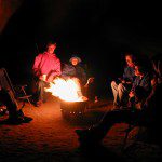
fireboulders

Interstate 8 EAST from SD / exit Ocotillo. SD county road # S2, the south end near the State Park boundary. Gorgeous every season but summer. Great winter camping close to SoCal.

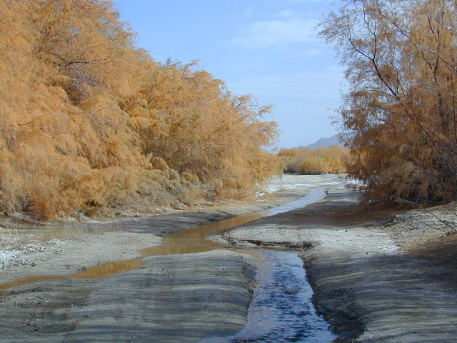
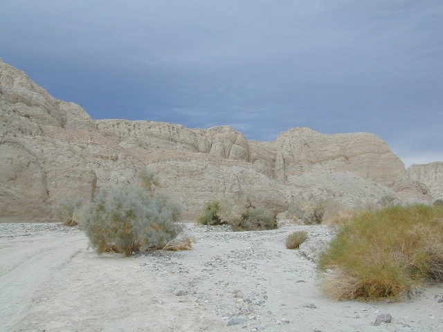
This  dirt road is located in a desert wash area, which starts west – off the paved road S2. The signed white desert wash is a suitable drive for passenger cars (most years). But you best have 4×4 if the rain gets going good. Low riders should watch for the ridge lines – as they are naturally rockier places and could take out an oil pan of a mini SUV (at a high rate of speed).
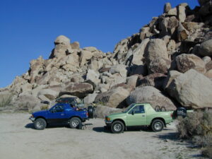
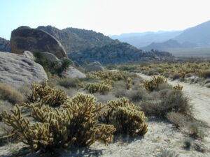
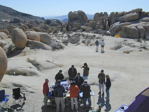
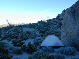
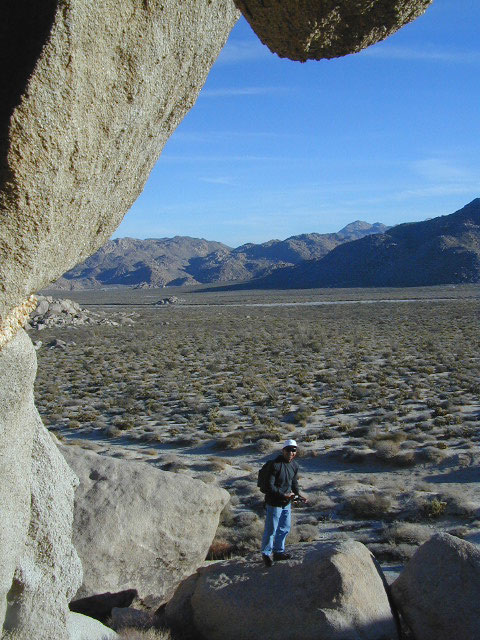
mortero campsThe giant boulders garden at the far end of this route have nice views of the Imperial desert floor. Better from the top of the boulders too; numerous primitive camp sites are tucked into the coves, surrounding the big boulders.

No toilets; no shade; no water; minimal vegetation. At night the stars are heavenly, but you can see city lights from Calexico and Mexicali.

train

GOAT TRESTLE?

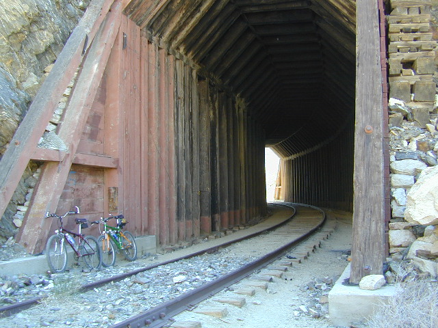
From this area you can hike or mountain bike up to the “old goat trestle” and numerous historic train tunnels @ Carrizo Gorge Goat Trestle (not to be confused w/ the wildflower destination called Carizo Plains in Kern Co). BRING A HARD COPY topographic MAP of this area, if you wish to explore past camp. Moderate hike, an all day adventure. Bring lunch and water!
bike on railroad

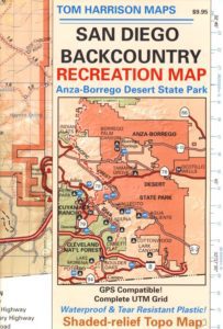
Tom Harrison Anza MAPSAN DIEGO Backcountry Map
this waterproof map has the entire State Park covered with all back roads, trailheads, campgrounds and railroad tracks
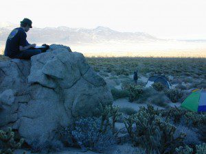
artistsview

bouldertents

When you decide to stop the car, look around for the best spot. Park off the road way and preferably in a turn out or camp spot. Turn off the engine, get out of the automobile, stretch your legs, breathe, look, close your eyes – tight and breathe deeply, then open and look around you again. This particular place is special, you can just feel it. Walking around the boulder area, be cautious of snakes.

On the boulders – closely examine them, climb on them, get to the top; you will find (Native American) Indian grinding holes called mortars or morteros.
gethigher

great side trip option: Across the paved road (SD County Road S2) on the opposite side of the valley is a nice hike to Sand Dollar Hill. (I’m sure this isn’t the real name). Dirt road leads up to a dirt parking area for hikers. Busy lil place sometimes. These desert dirt hills have wind caves and chunks of sand dollars scattered all over them. The real ocean floor way out here, east in the Anza SD desert… how cool is that?

great side trip option: Canon Sin Nombre is just up the road a piece, N on S2, on the EAST side of the road. Amazing viewpoint turn out, right on the highway, overlooking the impressive topography and badlands. If you have a high clearance SUV or any truck you can drive down into the sandy tight, rocky wash. It meets back up with another main wash way back there.

Tons to explore back here. Off roader should think Tread Lightly on this turf and primitive car campers should use a Leave No Trace approach. White sand, deep sand, caves, smoke trees, and the best slot canyon climbing & hiking this side of the Anza Borrego State Park.
desert views

Trinity Alps Wilderness

NorCal Mountains – Trinity Alps Wilderness

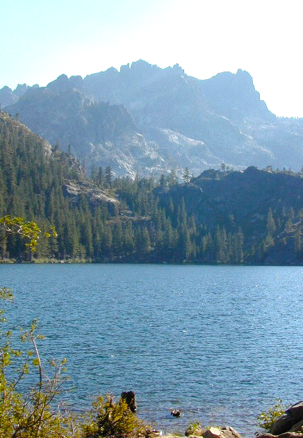
Sapphire Lake -- Suicide Ridge -- Trinity Alps

525,627 acres

North of Weaverville & Lewiston, about 10 miles
West of Trinity Lake & Redding, CA
Headwaters of the Trinity River & the Salmon River

Shasta-Trinity National Forest

Thompson Peak – 9002′ elevation
Trinity Mountain – 6094′
Granite Peak – 8091′

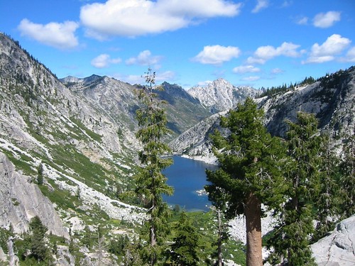
Trinity is NorCal’s jewel of alpine lakes and granite peaks – many above 8000′ elevation, about 40 miles inland from the ocean. Trinity is located in between the infamous redwood coast and the I-5 corridor. Rivers, creeks, lakes, and trails into the high elevations regions, bqckpackers and equestrian campers alike.

trinityalps_lgHiking trailheads are accessed from all sides -On the east side you have Trinity Lake & Trinity River w/ Highway 3 running lengthwise in a north-south direction. Hwy 299 runs east-west along the south side of the wilderness. Klamath River Hwy 96 lies on the west side of the wilderness. Salmon River, Scott Mountains and Cecilville are north of the alps.

Both the small Russian Wilderness & the larger Marble Mountain Wilderness are located to the north of Trinity Alps, along with rural towns near the Scott Mountains and the Salmon River. Castle Crags Wilderness is to the eastern side, near Interstate 5.

towns nearby –

camp

Campgrounds near Trinity Alps Wilderness

hike

Trinity Alps Trailheads

lake

Waterfalls & Lakes near Trinity

NFS


View Larger Map

The mountainous area is quite unique, as exposed granite mountain peaks and alpine lakes are pretty rare in the coastal Cascade ranges. The only other spot in California that has an 8000′ peak nearing the coast is just north of Los Angeles – Los Padres’s Mount Abel & Mount Pinos peaks, both over 8000′ in elevation.

TRINITY ALPS TOPO MAP

camp

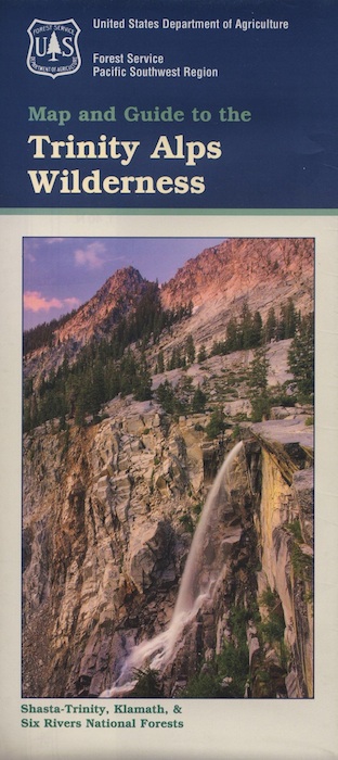
The USDA map for Trinity Alps Wilderness was outta print for nearly 2 years and it has recently been updated and reprinted. New edition released in 2013 and now available at the Total Escape map store. Printed on waterproof map paper and updated in 2012.

California Aspens

AspenGroves

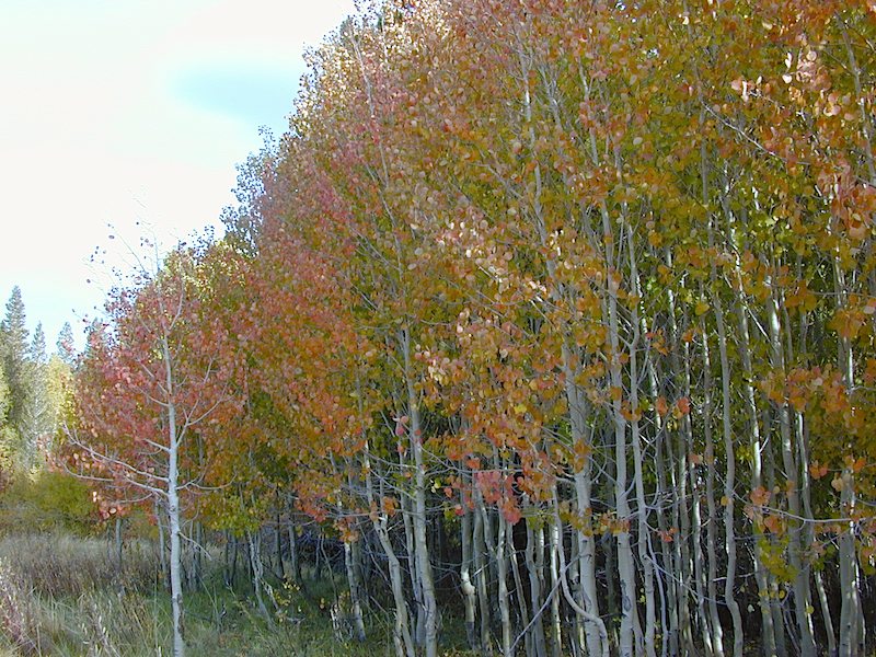
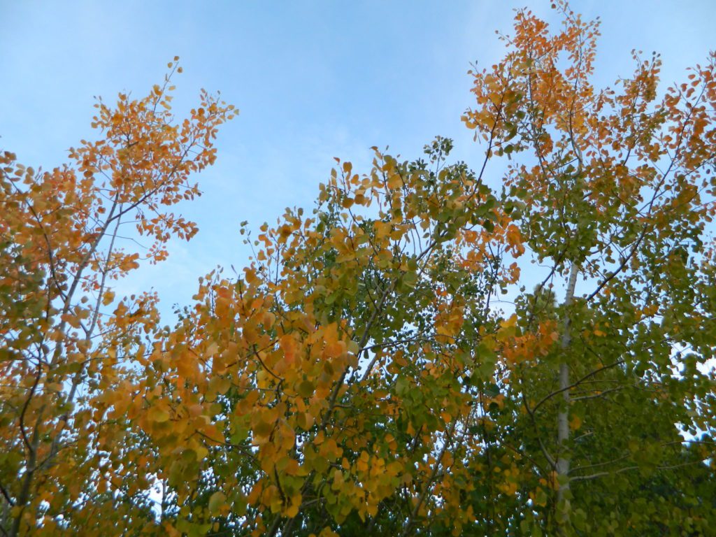
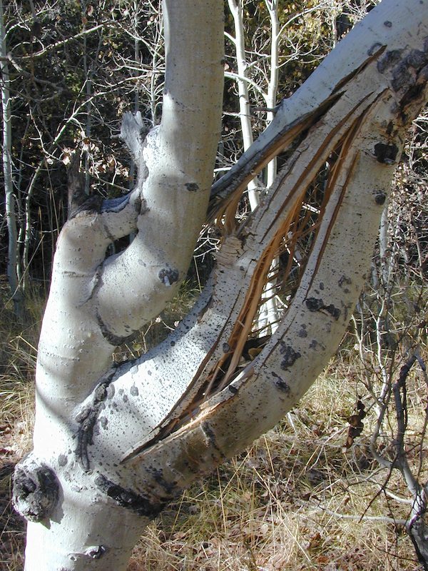
Aspen Groves are easy to recognize with their thick stands. White trunks with dark knots, slender, with oval shaped leaves. Growing in a network of roots, which are found lining creeks, alpine lakes, or spilling out from higher elevations, along  scenic canyons.

The unique round leaves which can turn spectacular colors in the fall season. The fluttering and flapping of the oval-shaped, thick, green leaf is a sure sign of summer. When breezes get cooler, Autumn is only a few weeks away and as quick as the cold comes in, what a short and special show they put on.

autumncabin
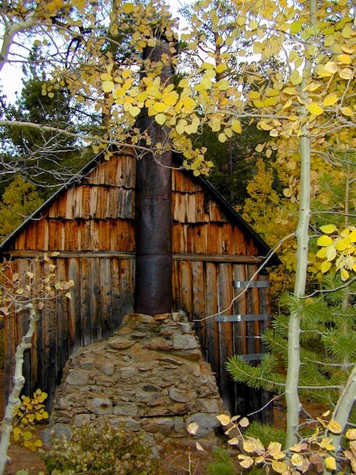
Green Creek historic cabin, on the Eastern Sierra

California Fall Colors

Aspen trees can be found at higher mountain elevations in California, usually above 4000′ – all the way up to about 10,000′ or higher, depending on the mountain range and local water flows. Groves have an extensive root systems underground, so they often withstand wildfires and can come back after the rest of the forest is gone.

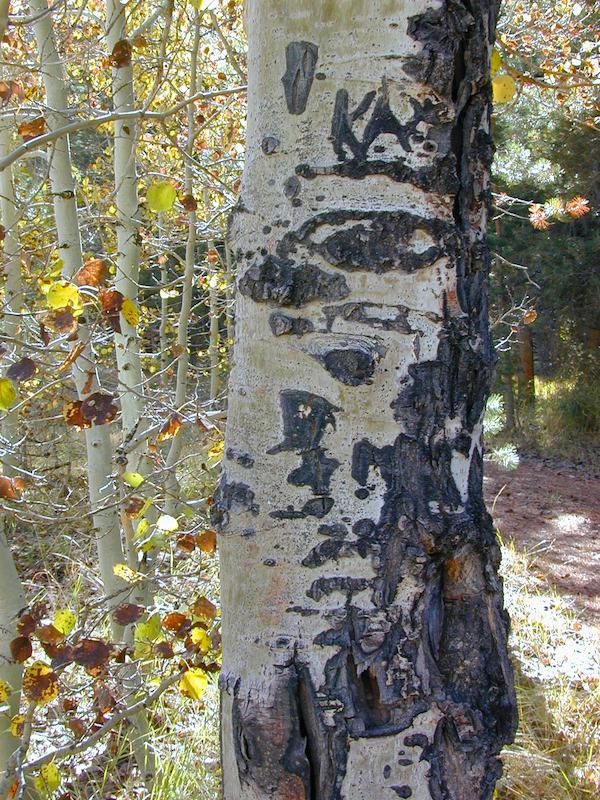
Beavers build dams in creeks around aspen trees, fishermen and campers love to camp next to aspens, and lovers carve their initials into their white bark. These trees do indeed take a beating, from all angles, winter weather included… so stop from cutting them!

carvings

fishing creeks mountain biking stargaze Picnic Camp Hiking horseback back roads mountains

  • BIKE
  • CAMP
  • FISH
  • HIKE
  • KAYAK
  • PICNIC

summer and autumn

These deciduous trees are naked half the year, typically from November to April, as winter buries them in snow and ice. Time is of the essence, limited to Summer and Autumn – to enjoy their shade and the beauty of the groves. Scenic meadows and fishing creeks are just an added bonus for searching out the aspen.

Aspens can be found in hidden canyons, primarily along the Eastern Sierra US Hwy 395 and surrounding mountain lakes. Some Sierra Passes have decent displays of color as well – like Carson Pass Hwy 88 and Yosemite’s Tioga Pass Hwy 120.

Below is a list of Total Escape’s favorite aspen areas of California

ASPENDELL
BAKER CREEK (4×4)
BIG PINE CANYON – NORTH FORK TRAIL

BISHOP CREEK
BLUE LAKES, CARSON PASS
BLUE LAKE, MODOC

CONVICT LAKE, US 395
COTTONWOOD CREEK @ ANCIENT BRISTLECONES
COYOTE FLAT (4×4)

CROCKER @ LAKE DAVIS
CROWLEY LAKE, US 395

DUNDERBERG MEADOW

EAGLE LAKE @
ASPEN GROVE CAMPGROUND

GREEN CREEK ROAD, US 395
HASKINS VALLEY @ BUCKS LAKE
HILTON CREEK, US 395
HOPE VALLEY
JUNE LAKE LOOP

LAKE SABRINA
LAKE TAHOE
LAUREL LAKES ROAD, US 395
LEE VINING CANYON
LUNDY LAKE, US 395

MAMMOTH LAKES, US 395

MCCLOUD CREEK @ ALGOMA
MCGEE CREEK, US 395

MILL CREEK to MINERAL, CA
HWY 172 LOOP aspensofmineral1000

MODOC NF @ BLUE LAKE
NORTH LAKE, ASPENDELL @ BISHOP

ONION VALLEY @ INDEPENDENCE
PARKER LAKE RD @ JUNE LAKE LOOP
PINE CREEK ROAD, BISHOP

PLUMAS-EUREKA STATE PARK
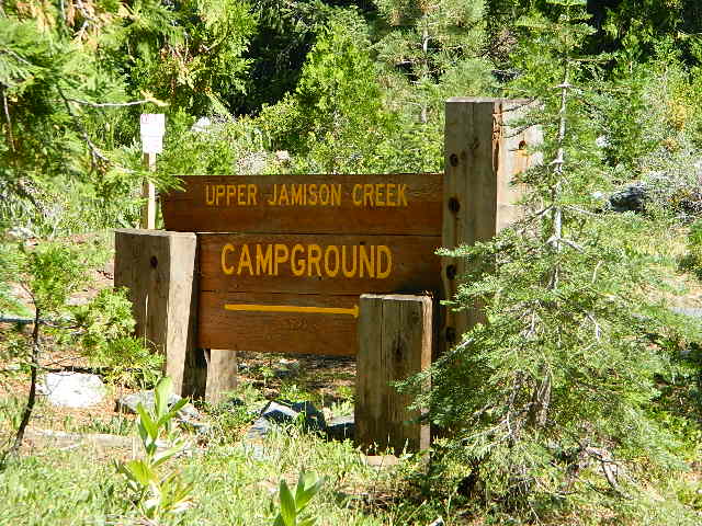
@ UPPER JAMISON CREEK CAMPGROUND

PLUMAS EUREKA

QUAKING ASPEN CAMP, GIANT SEQUOIA

RED’S MEADOW, MAMMOTH
ROCK CREEK ROAD @ US HWY 395

ROSS CAMPGROUND, PLUMAS NF

SPALDING, CA @ EAGLE LAKE

TOM’S PLACE, US 395
TWIN LAKES @ BRIDGEPORT
VIRGINIA LAKES, US 395

WISHON RESERVOIR

aspentips
Aspen Tips @ Eagle Lake California


aspenwall
Green Creek Camping

Autumn Camping in California


amigoaspens
Laurel Lake Road @ 9000′ – Eastern Sierra, California


aspensplit

Gold Rush Days

gold country grange

Gold Rush Days
California Gold Country

Numerous locations hold historic themed street fairs, parades and festivals in the foothills of the Sierra Nevada.

Gold Country Events

this list is only a partial list, and more will be added soon

Amador County Fair

Arnold Independence Day Parade

Calaveras County Fair

Calaveras Grape Stomp

Coloma Gold Rush Live

Coloma Lotus Celebration

Gold Country Fair

Grass Valley Cornish Christmas

Mark Twain Wild West Fest

Mariposa County Fair

Murphys Homecoming & Duck Races

Nevada City Constitution Day Parade

Old Auburn Country Christmas

Wagon Train Hangtown Days

NOTE: The Gold Rush Days in Old Town Sacramento is now called “Waterfront Days Old Sacramento

califrepublic

Gold Country Historic Parks

bluewagon

Gold Country Cities & Towns

58 counties
58 Counties in Calif

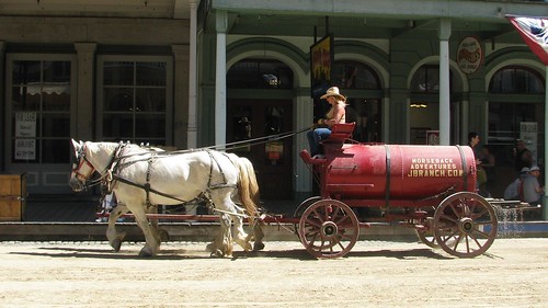
JB Ranch Water Wagon 1

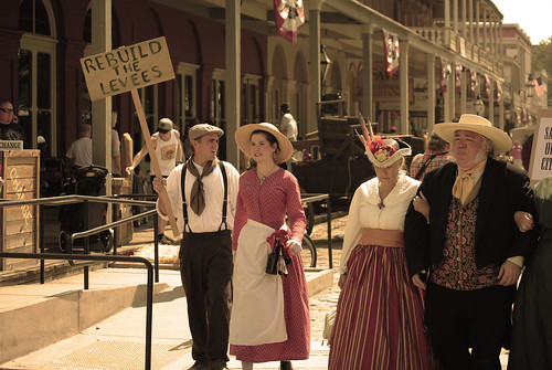
Gold Rush Daze 6

Gold Country Rivers

listed alphabetically

Gold Country Forests

listed from north to south

Plumas National Forest
Tahoe National Forest
Eldorado National Forest
Stanislaus National Forest
Calaveras Big Trees State Park
Sierra National Forest

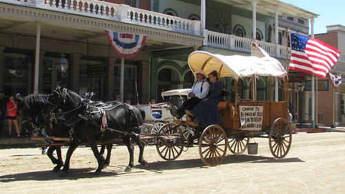
Covered Wagon with 2 Horses 1

Vallecito – Anza Borrego

Vallecito Park, San Diego Desert

Anza Borrego Desert

Great Overland Stagecoach Route of 1849

East San Diego County Road S2 winds thru the lower passes & washes of Anza Borrego Desert State Park. On the edge of the State Park boundary Vallecito is a small campground & park, but it was a stage coach route in the 1800’s.

California Historic Marker #304

Vallecito

VALLECITO STAGE STOP – A 1934 reconstruction of Vallecito Stage Station (originally built in 1852) on the eastern slopes of the mountains in the high desert. A super important stop on the first official transcontinental route, serving ‘The Jackass Mail‘, the Butterfield Overland Stage Line, and the southern emigrant caravans.

backpacking, birdwatching, camping, cycling, hiking, mountain biking, off roading, stargazing, wildflowers

camp


Vallecito Campground
elev. 1555′
camp sites: 44
overnight fee
first come, first serve
reservations accepted
Campfire pits, picnic tables, bathrooms, & historic buildings; 22 sites are tents only. RV 40′ limit; Additional 8 equestrian campsites w/ corrals. No RV hookups, no dump station. No piped water. No gasoline, no store, no amenities. No firewood, no collecting of firewood. No shade trees, just tall desert brush. Arrive adequately prepared for real desert roughin it.

RV

Vallecito Stage Station County Park
760-765-1188
37349 Great Southern Overland Stage Route
County Road S2 @ mile marker 34.7
About 3.5 mi NW of Agua Caliente Hot Springs

Closed during the hottest months of summer: JUNE-AUG. Open seasonally: Labor Day weekend through the fall, winter and spring, up until the last week in May. 

camptruck

see also – Oriflamme Canyon / Mason Valley Truck Trail

muck to stagecoachA neighboring and very rural stage coach stop is further down a long wash, to the south east. Getting there usually requires 4×4, since you must ford a muddy desert wash w/ creek & deep holes. There are no signs out in this sandy desert wash, so you best have a good map and a compass.

The Old Carrizo Stage Station site is accessible by 4 different dirt roads (desert washes) way off the paved highway. None of these are well signed at the highway: Vallecito Creek, Willow Creek near Mountain Palm Springs, Carrizo Creek near Bow Willow, and Canyon sin Nombre.

Agua Caliente, Bow Willow Campground, Canebrake, Sweeney Pass,  the badlands overlook, mud caves and slot canyons are all located south of Vallecito. California SR 78 and Blair Valley are north of Vallecito.

Vallecito Creek

San Diego Desert MapVallecito is located at the apex of the gap in the Carrizo Badlands created by Carrizo Creek and its wash in its lower reach, to which Vallecito Creek is a tributary. Once a seasonal village of the native Kumeyaay people, on a trail across the desert from the Colorado River, this oasis, became a crucial stopping place for Spanish and then Mexican travelers to recover from the desert crossing between Sonora and New Mexico to California. The non native settlement of the site began in 1850, as a camp with a one room sod warehouse as the U.S. Army Depot Vallecito for the supply of Fort Yuma. It was later increased in size and became a store, a stage station, and a ranch house. read more on wiki

find maps for this desert region –

Anza Borrego Desert Map

San Diego Backcountry Map

Cleveland National Forest Atlas

dark skies anza

califrepublic

Another Vallecito, California?

Yep! Small community of about 400 folks in the western Sierra Nevada  foothills. Gold Rush Country, mining region. Up off the Historic 49 and it used to be called Murphy’s Old Diggings.

see Gold Country Maps

Samuel P Taylor Campground

San Francisco Redwoods Camping

Samuel P Taylor State Park
Samuel P Taylor Campground

San Francisco Redwood State Park

SamP is one of the large redwood parks north of San Francisco, CA. Coastal redwoods can be found in the mountains above Santa Cruz, as well as on the Point Reyes peninsula in Marin County. Hiking in the region is amazing w/ enchanted forests, dramatic fog, waterfalls, numerous trails in every direction.

califrepublic

One of the best developed campgrounds in the region for car camping and RV campers.

Consisting of several camp loops, a group camp site, a horse camp and hike-in or bike-in camp sites. There are even cabin rentals in the park. This park has several camp sites that can accommodate visitors with disabilities. Reservations are highly recommended, especially during summer months. Be prepared to pay hefty fees for overnight use.

RVMax RV Camper Length: 31′
Max Trailer Length: 27′

  • Creekside Loop
  • Orchard Hill Loop
  • Madrone Group Site
  • Madrone Cabins
  • Horse Camp
  • Hike & Bike in Sites
    (8 person max)

Marin Redwoods
CA State Park

Samuel P Taylor State Park
59 developed campsites
+ cabin rentals
Sir Francis Drake Boulevard
415-488-9897

15 miles W of San Rafael, CA

Samuel P Taylor

camp

hiker

nearby towns:

State Park link

nearby parks:

  • Mount Tamalpais State Park
  • Point Reyes National Seashore
  • Tomales Bay State Park

Bridge

Los Coyotes

los coyotes SD

Los Coyotes Camping
Los Coyotes Reservation Campground

North County San Diego
Camping SD

Way out there, on your way to the Borrego desert, past Warner Springs somewhere is this little gem of a location. Near the southern slopes of Palomar Mountain, on the edge of Cleveland National Forest.

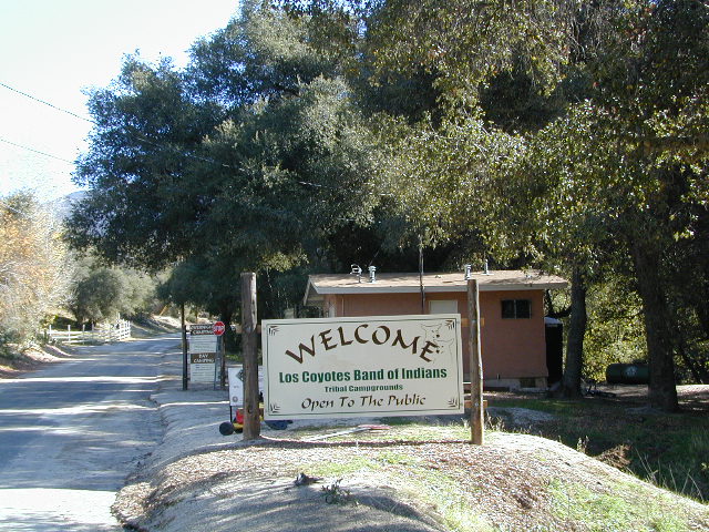
Los Coyotes Band of Indians Tribal Campground

open to the public

Great rural location, in-route to many destinations in Southern Cal. Temecula wine country, Warner Springs, Culp Valley, Anza Borrego Desert State Park, Borrego Springs.

Campground is a popular spot with locals, so note that some weekends can get rowdy. Ask about a more secluded camp site option if needed. There is plenty of primitive land out here.

Oak trees and boulder hills, dirt roads, near Hot Springs Mountain. North San Diego County.

Los Coyotes Band of Cahuilla & Cupeño Indians

Warner Springs, CA 92086
RECREATIONAL# 760-782-0712
ADMIN# 760-782-0711

payherebooth

snowx
Hot Springs Mountain SD

Silver Lake @ Lassen

Lassen Camp Site

AUG 2021

both lakes listed below CLOSED, due to wildfire 

Lassen Volcanic National Park is CLOSED also.

Silver Lake @ Lassen

(Lassen Co)

6400′ elev. inside Lassen National Forest
East of Lassen National Park

Silver Lake Road #10
20 miles off Highway 89. Northbound, outside of Westwood @ Lake Almanor, take County Road A21 to County Road 110 (Silver Lake Rd)

a21sign

Dirt road boat ramp @ southern end of lake. Winter weather & snow closes this area annually, so this lake is mainly a summertime destination. Mid-week tends to be less popular for those seeking seclusion.

  • backpacking
  • fishing
  • camping
  • canoe
  • hiking
  • kayaking

Hiking trails lead to Caribou Lake, Emerald Lake, Betty Lake, Trail Lake, Shotoverin Lake & Caribou Wilderness.

campground

Silver Bowl Campground NFS

• Elevation: 6400′
• Number of Sites: 18
• Vehicle Accessibility: small RV
• Campsites Reservation: No
• Camp Fee: Yes
• Toilet: Vault
• Water: piped/potable
• Length of Stay: 14 Days
• Season: May – October
• Trailheads: Caribou Wilderness

Lassen National Forest
Almanor Ranger District
900 East Highway 36
Chester, CA 96020
530-258-2141

silverlassen

2 Silver Lake in East Lassen? Surely.

Only 12 miles apart. As the crow flies.

Largest is Silver Lake, south of Caribou Lake, Lassen National Forest. East of the National Park, accessible by vehicle. The popular one that is mentioned above.

camp

Small Silver Lake at 6600′ elevation, is a hike-in only lake. Inside Lassen National Park, west of Snag Lake and the Fantastic Lava Beds.

hiker

See all Silver Lakes in California

Oak Bottom Campground

Oakbottom Campground

Whiskeytown Recreation Area:
Oak Bottom Campground

Carr Fire 2018: some portions of this lake, shore, roads and trails may be closed due to the recent wildfire

The large, level, paved campground is right on the north shore of Whiskeytown Lake, on Hwy 299 – E of Redding CA

hiker

101 walk-in campsites
22 RV sites
elevation 1200′

  • boating
  • camping
  • hiking trails
  • kayaking
  • marina
  • mountain biking trails

Campground Reservation on NRA

Camp Sites near Water

Group Camping can be reserved at
Whiskey Creek Group Picnic Area
3 group camping sites with excellent views of the lake and mountains, on the northeastern shore of Whiskeytown Lake.

nearby towns:

Views Westward

canoe

Lake Sunset Whiskeytown

And by golly, there is another

OAK BOTTOM CAMP in Northern California,
way over west near Marble Mountain Wilderness

camp

Salmon River @ Somes Bar:
Oak Bottom Campground NFS

elevation 700′
26 sites
No electricity, water or sewer hookups

Six Rivers National Forest – Oak Bottom Campground loops around a forested hillside with large trees providing ample shading for multiple sites within the campground. A variety of wildlife makes its home in the area.

Located off the main highway, on a side road, with the epic Salmon River! This NFS campground is popular with whitewater enthusiasts in the spring. Rafters, kayakers. Many challenging rapids ranging from Class 3 to 5 are available. Swimming is also popular in the summer and numerous river access areas are a short drive or walk from the campground.

Footed Rock

Footed Rock @ Bald Rock
Berry Creek, California

Before and After Photo

Wildfire: Bear Fire / North Complex 2020

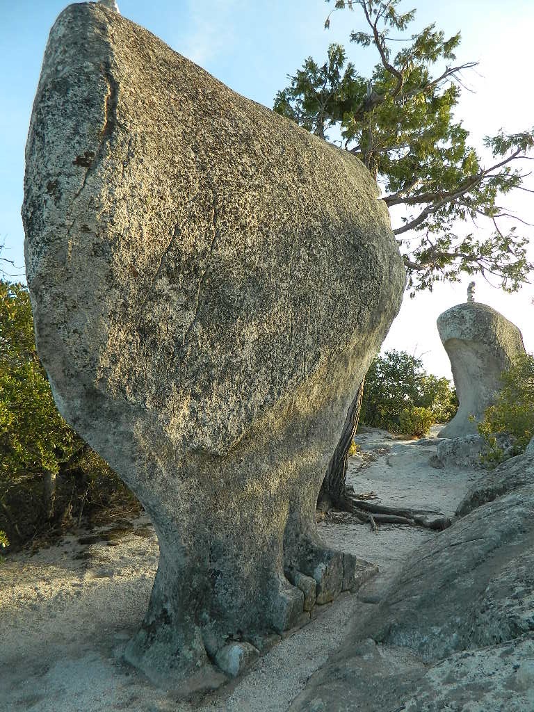
The Skinny Lone Cedar hangs on with Footed Rock. Bushes on the right side, had the flames licking at this tiny tree.

Footed Swipe

Berry Creek, CAfooted rock 95916

Many thanks to whoever cut/broke the mistletoe off in recent years. I never seem to hike with my loppers.

Bald Rock California

Footed Rock is a part of the popular Bald Rock hike. summer 2021 CURRENTLY CLOSED hiking trail in Berry Creek, CA

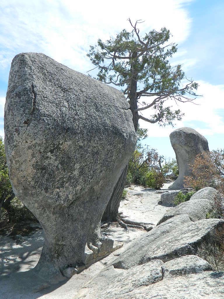
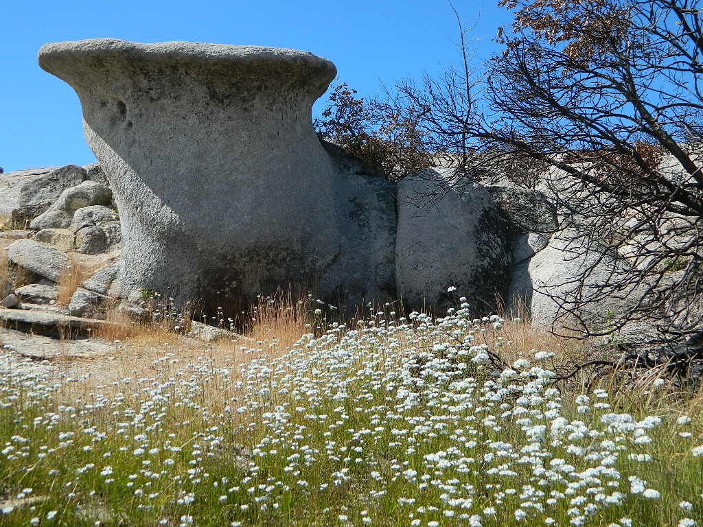
Mushroom Rock
Mushroom Rock @ Bald Rock


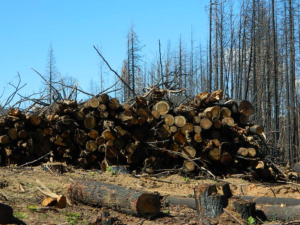
Lumber for Market
Lumber for Market, just sitting on the side of the road.

Log Truck Drivers make over $100/hour – yet there is still a job shortage in 2021. Go figure!

mountains

see more swipe photos –

Wildrose Campground

Wildrose Campground – Death Valley

wildrose3

Wildrose is an all-season campground in Wildrose Canyon, on the western edges of Death Valley National Park. This canyon gets very windy, so bring your guy lines, stakes & ropes for securing your tent. Motorhome RVs can make it in here, since the narrow road is a paved route – but be warned it can be curvy and slow going with the climb in elevation. This camp stays cooler than anything on the desert valley floor, so in summer months it can fill up quickly. Further up the hill are both ThorndikeMahogany Flat Campgrounds (both close in winter, due to snow)

• Elevation: 4,100′
• Number of Sites: 30
• Vehicle Accessibility: Open to all
• Campsites Reservation: No
• Length of Stay: 30 Days
• Season: year round

wildrosecamp

Directions:

From Stovepipe Wells, follow Highway 190 W to Emigrant Canyon. Turn left on Wildrose Road and follow it thru the tight rocky canyon, climbing in elevation the whole way. Wildrose Campground is obvious and near the charcoal kilns turn off.

From Panamint Valley, take Wildrose Road up.


View Larger Map

Death Valley MAPS –

Death Valley Park – NatGeo
Death Valley Topo Map – Tom Harrison

Nearby attractions:

Death Valley National Park
Panamint Valley
Ballarat Ghost Town
Skidoo Town Site
Charcoal Kilns
Telescope Peak
Tuber Canyon
Tucki Mine

New Bullards Bar Reservoir

Bullards Bar California

Bullards Bar Boat-in Camps

BULLARDS BAR Dark Day is a lakeside walk-in campground on a small reservoir, located deep in the Gold Country foothills. Flush toilets and hiking trails, kayak rentals and fishing.

fish

West of Highway 49. Huge dam for hydro-electric power. Minimal roadways along the lake and steep canyons make for optimum hiking and boating. Floating and fishing. Relaxing in the mountains, with fresh water!

On most maps the official name of this lake may read New Bullards Bar Reservoir, or Lake Bullards Bar, but locals just call it simply – Bullards Bar!

Sierra Nevada Foothills. Yuba River, California.

Northern Gold Country, California

Near Camptonville, West off Hwy 49
in between Oroville and Nevada City, CA

Located not far from historic Downieville, Bullard’s Bar is an excellent base camp location for exploring the upper reaches of the Gold Country region. Old mining locations, museums, a covered bridge, various parks, Yuba River, Sierra Buttes, Lakes Basin. Grass Valley & Nevada City are also nearby. Mountain bike trails, river rafting and hiking all around.

New Bullards Bar

lake surface area: 969,600 acrespaddle sports

lake elevation: 2000′ above sea level

lake county: Yuba County California

roads around lake: Marysville Road (south of lake and east side w/ Hwy 49), Moonshine Road (south of lake), Oregon Hill Road (west side), Pendola Road (north side), and Forest Route #47 (dirt road on north side)

boatramp

nearest towns:

Bullards Bar
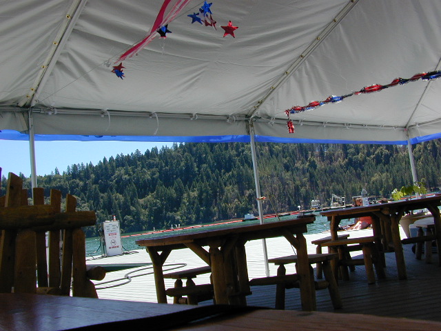
Shade @ the marina, just when you needed it most

Yuba River Recreation

camp

Bullards Bar water is a beautiful teal color of greenish-blue – due to heavy mineral content in the local soil (red dirt) and the dense forest above.

This water comes down the north fork of the Yuba River, as snowmelt from Lakes Basin Recreation Area, the Sierra Buttes, and the Yuba Pass on Highway 49. Northern Gold Country, California.

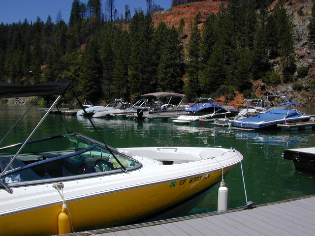
Bullards Bar Lake – Emerald Cove Marina
New Bullards Bar Reservoir
877-692-3201

boating boating gasoline marina

New Bullards Bar Reservoir

boat in camping

One of the few lakes in the Sierra Nevada that offer boat in camping at developed camp sites, and also to allow boaters primitive camping along the shoreline. No drinking water is available. No pit toilets, so a portable chemical toilet is always required. Plus, pack out all garbage.

No charge for DAY USE areas: parking or boat launch ramps

NOTE: Dark Day & Schoolhouse Campgrounds are the only car camping & RV accessible camping on this lake. These both have flush toilets and drinking water piped in. Hiking trails & boat launch nearby. Wheelchair accessible campsites are available.

CAMPS OPEN: APRIL – OCTOBER
Campgrounds @ BullardsBar are usually open from April to October annually and all are closed for winter months.

camping walkin camps hiking camping boating camping RV camping mountains

Bullards Bar Campgrounds

camp information 530-692-3200

  • GardenPoint: 17 boat-in sites
  • Madrone Cove: 10 boat-in sites
  • Shoreline Camp: 2 boat-in sites
  • Dark Day Walk-In Camp: 30 sites
  • Schoolhouse Campground: 56 sites
  • Hornswoggle Group Camp

Frenchy Point Campground USDA

Located 5 miles northwest of Dark Day Boat Ramp on the west side of the reservoir. Boat in only access. It is used as an over flow campground. There are campsites, but no bathrooms. Portable chemical toilet required. More info call Emerald Cove Marina at (530) 692-3200

National ForestsBullards Bar Lake located on the Yuba River, bordering
between Tahoe National Forest & 
Plumas National Forest


bullards bar California

lake recreation 

  • boat in camps
  • canoe
  • fish
  • houseboat rentals
  • kayak
  • picnic sites
  • sail
  • watercraft rentals

land recreation

  • backpack
  • campgrounds
  • hike
  • mountain bike
  • walk-in camps

bikingbullardsdam

also in the area


View Larger Map

califrepublic

Second Spillway – in the works?
Yuba Water Agency has just committed to building a $160 million second spillway at the New Bullards Bar Dam; beginning in 2021, with a completion date of 2025.

check

https://en.wikipedia.org/wiki/New_Bullards_Bar_Reservoir
https://en.wikipedia.org/wiki/New_Bullards_Bar_Dam

Camping for Thanksgiving

Turkey Casserole
Turkey Leftovers?

California Camping on Thanksgiving

If you’ve had it with the traditions, the big meal prep, or just sick of the family. Maybe you are a solo traveler, or a new transplant to California and need to explore more. Take a holiday away – for once this time.

Camping for turkey day? What a concept.

VWBus Death Valley
California is the perfect place for camping, all year long!


Stick to the lower elevations, look for canyons, and seek seclusion

California mountains often have snow during November. Avoid camping in snow @ 4000-5000′ elevation and above; Freezing temps above 3000-4000′ elevation.

Deserts, coastal regions and foothills are top choices for late Autumn car camping. Always check the weather ahead of departure, and have a plan B as an alternative. NorCal will be much wetter than the rest of the state.

MEALS: Prepare dinner meals ahead of trip departure. Bake turkey days before your trip and create meals based around that. Make mash potatoes at home and don’t forget to bring the butter. Pack pre-baked turkey for sandwiches, plus other quick snacks & meals for on-the-go travel.

seafood
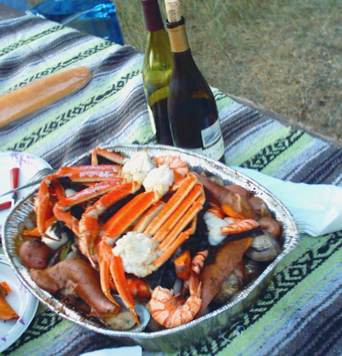
Non Traditional: Seafood Feast

Desert Camping is premium at this time of year. Luckily the eastern half of Southern Cal is desert. The lower the elevation, the better the temps will be overnight. Be prepared for wind when the ‘storm fronts’ approach, the winds do get a cranking! Dirt roads can become flowing washes during a good rainstorm, so know the weather forecast.

Coastal campgrounds may need advanced reservations. Be prepared for wet weather, especially up north. The redwoods groves are gorgeous anytime of year.

Gold County Reservoirs are prime areas for relaxing in nature, while everyone else is out shopping. Oak hills, rivers and canyons. RV campers love these large lakes; boating, fishing, mountain biking trails, kayak rentals, hiking near historic Gold Rush towns.

River Canyons of California are always beautiful destinations in the autumn months with fall leaves changing color. Many campgrounds can be found at lower elevation, river access areas.

California’s abundant Hot Springs are also top picks for holiday weekends.

Joshua Tree Campout

Joshua Tree National Park may be busy during this weekend. Instead try nearby Mecca: Box Canyon and Mecca Hills Wilderness, BLM desert lands near Interstate 10.

Anza Borrego Desert State Park is always a nice, easy and relatively close get-away for any holiday. Open camping on the backroads (for free) makes it one of the most attractive camping options in all of SoCal. Many dirt roads are accessible for passenger cars, if extreme caution is used. Don’t plan on driving more than a few miles on dirt.

froaders

Masses of off roaders love to camp out, especially on Thanksgiving weekend. Wheel all day, eat, drink, bon fires every night and rumor has it ‘they roast their big bird outdoors – deep in a dirt pit’. Really?

El Centro, Glamis, Imperial Dunes, Ocotillo Wells, Truckhaven Hills, Johnson Valley. All popular off roading areas in Southern California, so consider yourself warned.

Imperial Dunes

Mojave Desert, near US Hwy 395
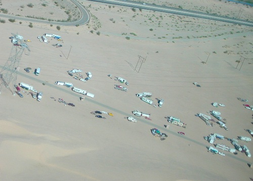
Jawbone Canyon expect to see RVs, toy-boxes and families outside enjoying the weekend. OHV style. Often the group tries to create a round corral with their huge convoy of vehicles, to keep thru traffic to a minimum around “their camp”. Just stay well away from those gear-heads. In general, it is a very busy area around Mojave up to Hwy 178 during the holidays. Try high desert Horse Canyon instead.

Bodie State Park
Bodie State Park

Tent Camping

Death Valley National Park is one of the best destinations for Thanksgiving, cuz Panamint Springs serves their free turkey dinner.

Did someone say FREE?

Leon at Mahogany

Sierra Buttes California

sierra buttes

The Sierra Buttes

elevation: 8591′

Northern Gold Country California at the headwaters to the Yuba River

Lakes Basin Recreation Area
Tahoe National Forest
near Plumas Eureka State Park

Gold Lake, Sardine Lake, Upper Sardine, Smith Lake, Packer Lake, Grass Lake, Sand Pond, Goose Lake, Snag Lake, Long Lake, Jamison Lake, Round Lake, Deer Lake, Tamarack Lakes, Young America Lake, Frazier Falls

Sierra Buttes

California is the land of granite peaks. Rocky, exposed mountains that stick up out of the landscape for all to see. Southern Cal has a few of them, but most granite peaks in California are found in the Sierra Nevada.

US 395 Eastern Sierra impressive ridge lines are the highest and most photographed and Lake Tahoe has plenty of big granite surrounding it. The farther you go north, the less granite you will see – not because it isn’t there, mostly cuz it is just buried with tall dense forests.

lakesbasinhikers
lakes basin day hikers

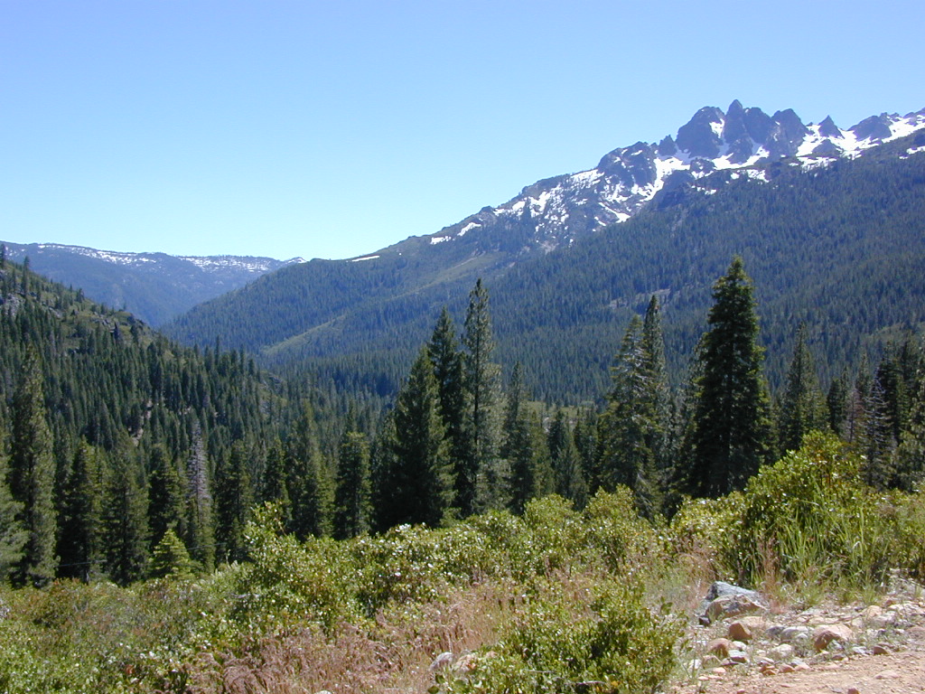
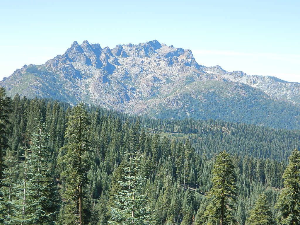
NORTH SIERRA – The Sierra Buttes are the impressive granite peaks located in between the North fork of Yuba River and Sardine Lake.

SE of Mount Lassen and NW of Lake Tahoe, at the tippy top of the historic gold country. Gold Lake Road #24 connects Gold Country Highway 49 to North of Tahoe Highway 89. Road #24 is often closed for winter snow, so most visitors enjoy this region in the summer months.hiker

Sierra Buttes Fire Lookout Hike

The infamous PCT (aka. Pacific Crest Trail) passes the peak and goes north through this basin of alpine lakes, so backpackers are often seen. Tent camping is very popular, as well as RV camping w/ numerous developed campgrounds and open camping as well.  Some of the hard to reach primitive camp sites (next to lakes) can be accessed via 4×4 vehicle. Gotta have a good topo map.

Downieville is well known for the mountain biking trails, so this whole region is covered with amazing trails. Snowmobilers and cross country skiers love the area during a good winter snow and they can access this area from the north off Hwy 89.


View Larger Map

Sardine Lake

hiking, biking, backpacking, camping, fishing, kayaking, cross country, & snowmobiling

campsite snag lake
Snag Lake (free) Camping on Gold Lake Highway

lakes basin views

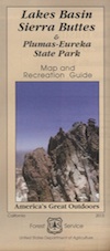
Sierra Buttes Map Tahoe National Forest

Silver Lake @ Bucks

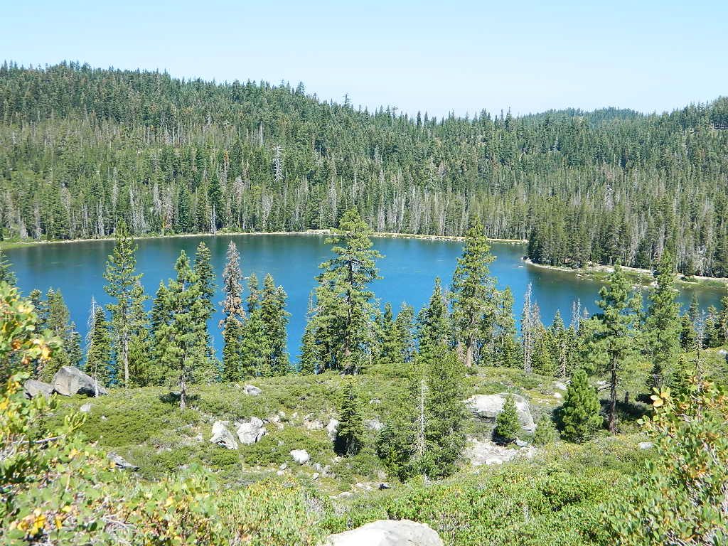
Silver Lake from Above

Silver Lake @ Bucks Lake Wilderness

(Plumas Co)

Plumas Road #24N29, off Bucks Lake Road
East of Bucks Lake, California.
a six mile, one lane, dirt road is the only vehicle access into this high elevation, dammed reservoir, tucked back against the wilderness. Secluded lake campsites await, you’ll just need to get a little dusty first. The turn off, at a small brown sign reading “Silver Lake”, one which is very easy to miss – due to the amount of homes, cabins, fencing and driveways in the vicinity.

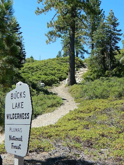
bucks trailhead

Bucks Lake Wilderness
Plumas National Forest

All Bucks Lake Campgrounds

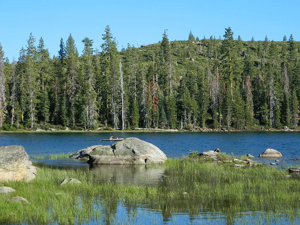
Kayaker @ Silver Lake

hiker

No swimming allowed at this Silver Lake, as it serves as a drinking water source for the neighborhoods below. Canoe & kayaking are allowed. Fishing is also popular at this location. Hiking trailheads at Silver Lake lead to the PCT (Pacific Crest Trail), Mount Pleasant, Spanish Peak and a small gem of a swimming hole, we call mini Gold Lake.

Bucks Lake Wilderness Map

NFS Campground @ Silver Lake, near Quincy, CA

This small campground is actually set downhill from the rock earthen dam, which is something to ponder before/during a big earthquake. With sites 1-5 in a shady forest area and the others a bit closer to the lake, no campsite is too close to another. These are all well-spaced-out sites, providing decent privacy and minimal noise from neighboring campers. No campsites are located at the lake edge, as the rocky dam is a long structure and quite complex with water control measures.

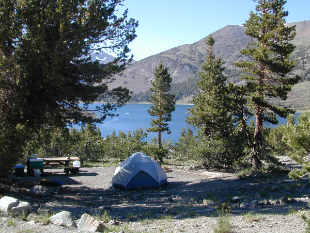
All the campsites have new bear boxes for food storage, cuz ‘wilderness’ usually means black bears are roaming about. Deer tend to frequent campsites 1 & 2.

2020 update:
overnight camping fees now charged at this campground

silver camp 5

Silver Lake Campground NFS

campground

• Elevation: 5800′
• Number of Sites: 9
• Vehicle Accessibility: RV 22′
• Campsite Reservations: No
• Camp Fee: Yes
• Toilet: Vault
• Water: No piped/potable
• Length of Stay: 14 Days
• Season: May – October
• Trailheads: PCT, Gold Lake, Rock Lake, Granite Gap, Bucks Lake Wilderness

silverbackdrop

As with most of the high elevation lakes in California, winter months can mean deep snow and dirt road closures. This campground is usually open through the end of October, but call head to the local rangers if in doubt.

Plumas National Forest
Mt. Hough Ranger District
39696 State Highway 70
Quincy, CA 95971
530-283-0555

ranger

See all Silver Lakes in California

Your Public Lands

west coast public land

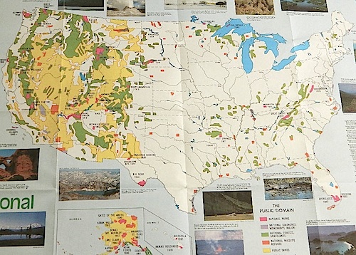
Access to wild land, open spaces, parks, forests, lakes, mountain peaks, public land – USDA National Forests, National Parks, State Parks, BLM. There is more public land available in the west half of the U.S., than anywhere else in the nation. This is one of the top reasons people relocate to the West Coast.

California’s Public Lands for Recreation

Federal lands, government managed parks, USDA National Forests, National Parks, National Wildlife Refuge, BLM, State Parks, State Forests, County Parks, Regional Open Spaces

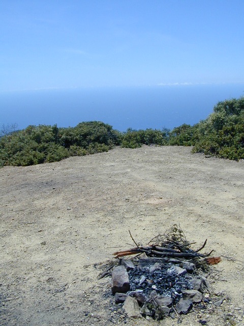
containfire

Campfire Restrictions in California

Sierra Rivers

State Park / National Park / National Forest / BLM / SHP / SVRA / OHV
what’s the difference?
a simple explanation of your public lands & what you can expect to do on them

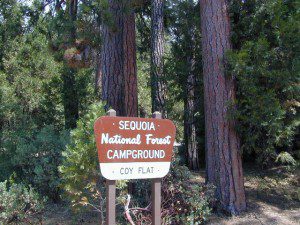
National Forest Campground
NPS

California National Parks – most National Parks are so crowded you can’t even enjoy the experience in the summer time. Try the off-season times for your best stay. Neighboring National Forests are a much better bet for abundant space, privacy & less taxing on the wallet for fees. These popular (NPS) parks are subject to federal budget cuts and closures.

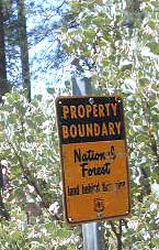
NF boundary

NFS

California National Forests – protected wilderness areas throughout state are surrounded by National Forests (NFS), and most National Parks (NPS) are surrounded by National Forests. Tons of small campgrounds & primitive spots for real seclusion. Get a free fire permit & camp almost anywhere you want. Use that SUV exploring the many dirt backroads & find that perfect camp spot (for free).

California State Parks

California State Parks – local California parks with a lot to offer the day hikers, picnicking family, tent camper or RV camper. From warm dry deserts soaking in a hot springs to the foggy coastal redwoods, these state run parks encompass a large section of California terrain. These parks are subject to state budget cuts and closures.

BLMBLM: Bureau of Land Management – mostly desert regions on the east side of California. A few coastal redwoods, some river canyons in the Sierra Nevada, many off road areas (OHV) in various mountain ranges. These federal lands are open spaces, generally a free for all on recreation.  Allowable = off roading, target shooting, open camping, campfires, bonfires. Geared toward OHV use, RVs and hunting.

Fire Safe Spot

All California Parks & Forests

hikes

California Lakes List

lake

California Topo Maps

topo maps

rangers

California Terrain & Destinations

  • Coastal California – Southern California beach camping is crowded & sparse, because of developed cities. Central Coast & Northern California offer many more choices in this category.
  • California Mountains – pine forest, mixed oaks & a variety of vegetation. Water sources such as lakes, stream & waterfalls make this choice the perfect camping spots. Granite peaks, high elevations wilderness areas throughout state & surrounded National Parks. Plenty backpacking options & dirt road primitive spots for the ultimate in privacy.
  • Countryside in California – coastal hills or mountain foothills. These rolling hillsides offer small creeks, oak trees & plenty of wide open spaces. Lakes & Reservoirs are located within these regions. Most campgrounds are fairly close driving distance to towns or cities. Wine country or gold country, California has it.
  • California Deserts – perfect for every season except summer, these vast spaces will humble just about anyone. Primitive camping galore & designated areas for real off-roading.
  • City CA / Urban Villages – not the best for really getting away from crowds, but can be an excellent opportunity to visit a city without spending big bucks on lodging. Or could just be a perfect one-nighter for getting familiar with camping. Most campsites are located in the foothill area behind suburbs, in county parks or even coastal.
  • California A to Z: Small Towns – 700 and counting; extensive list of destinations, focusing primarily on the back roads and outdoor recreation hubs
  • California by County – Find every county on Cali, and which towns are located inside of them

Yosemite Lake View Camp Sites

Bear in California

black bear

California Black Bears

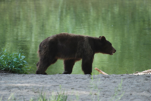
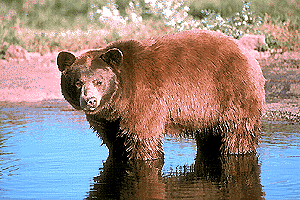
califrepublicAlthough the grizzly bear image graces the state flag, grizzlies were killed off during the gold rush days. Black bears are found in California mountains and foothills, down to lowest elevations in NorCal. California black bears come in more than one color –  light brown, cinnamon, dark brown, and of course, black. For the most part, bears usually stay away from people.

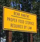
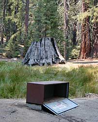
Some areas are more prone to bear problems due in large part to the overpopulation of tourists and abundance of food Bear Habitatprovided by them. Certain California National Parks are particularly notorious for their brazen bear populations. Concentrated bear problems are sometimes posted so be very aware and read signs. If you see steel bear boxes, leave no food or drink in your vehicle. Use the boxes to keep bears from breaking into your car!

California Black Bears

Follow some simple rules:

  • Keep a very clean campsite
  • Clean up all dirty dishes & beverage containers (especially before bedtime)
  • Keep clothing & sleeping bags free from food odors or heavy scents
  • Never leave any type of food garbage ‘bagged up’, sitting outside of a cabin rental, motorhome, trailer, or mountain home
  • Store garbage properly inside a locked, sturdy container inside garage or a shed
  • Stay away from bear cubs, there is sure to be a protective (aggressive) mother in close proximity
  • Try not to hike alone. Make noise & sing on trails to scare away any unwanted animals.
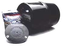
  • Bear storage canisters are available at sporting good stores & at stores in most National Parks.

Proper Food Storage Outdoors:

Bear Boxes @ Campground

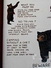
Store food in closed up automobile, not visible. Store food correctly: in trunk of your car, or hidden from sight; in campground food lockers when available.

Lock all food, beverages and coolers in the provided metal bear boxes or bear lockers where available.

Toothpaste, deodorant & anything that has a scent should be thought of as food and stored accordingly.

Bears are so strong they can rip your car door open (in places like Yosemite, where bears are problem and you can get cited for not storing food items properly)

Bears are so strong they can break open a garage door to get to the smelly trash inside, so make sure you utilize the curbside pickup service available in some mountain communities or take a trip to the dump once per week.

carcampers

DO NOT LEAVE FOOD OUT, UNATTENDED, outdoors…
during a picnic lunch, a quick snack, maybe a barbeque, or dinner around the campfire.

Birds, dogs, squirrels and wild animals can move in quickly.

hiker

Backpackers should hang food in nylon bag & drape over weak branch in high in tree: hang your food using the counterbalance method. Ranger who issues your wilderness permit can explain the hanging procedure;

2 stuff sacks (with drawstrings) for your food items, and 60 feet of medium weight cord. 2 carabiners make hanging much easier.

Bear Canisters

Bear Canisters

for your food when exploring the wilderness

hikers tent campers mountains rivers picnic lakes

Bear Repellent / Bear Mace
Bear Pepper Spray


camp  4x4 campfire fish

Additional Storage Tip

As for storing food inside cars:

When primitive car camping on a dirt road, which does not have campgrounds, nor bear lockers, it is possible to store food in the vehicle. BEST location is on the front floorboards with towel over it. With the car alarm set at bedtime, any ruckus should trigger a decent alarm. Any large animal trying to break in will get blasted with alarm siren & most likely will run away. The noise will wake you up as well, to deal with the intruder, if need be.

If a bear does get into your camp area:

  • At night, bring bear repellent can into tent, storing it close to the door. Bring a weapon for added protection.
  • Make as much noise as possible: yell, bang pots/pans, whistle, air horn and get your bear mace or pepper spray ready in hand
  • Raise your hands up to appear larger; lift clothing, increase appearance of size and yell aggressively toward bear.
  • Get your entire camp group together, join hands and spread out; Everyone at the camp should be outside the tents in order to be as effective as possible
  • Throw rocks & small objects; pots, pans, chairs
  • If possible, try to get to your car for protection
  • Sound the alarm on a vehicle &/or honk the horn

If you encounter a bear on a hiking trail:

  • Make as much noise as possible while walking solo. Hum, sing, talk to the birds. Sing or talk to yourself – out loud. Bear bells can be worn on hiking boots. Do not hike w/ headphones on listening to music/radio.
  • Carry bear spray (mace or pepper) in a belt holster, or easy to reach pack.
  • If a bear approaches: stand still, slowly retreat, say a few calming words in a friendly voice and calmly retreat, keep eyes on the bear

encountering a bear  – see more on this topic 

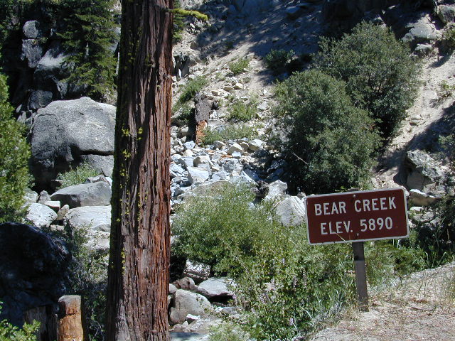
bearcreek

camptruck pinetree  ranger

Bear Meadow
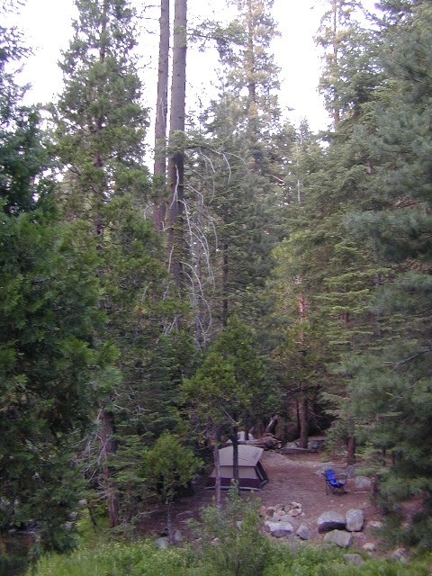
Camp Site at Bear Meadow, Sequoia NF

dirtbikes

Bear Box in Mineral King

driftwood

California Parks List

California Parks and Recreation

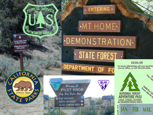
State Parks, State Forests, State Recreation Area, National Parks, National Monuments, National Forests – What is the Difference?

public lands

Forest, Park, Reserve, Monument, Recreation Area, BLM, Nature Preserve… arghh!

Don’t let all the park and forest names confuse you. It is all California and it is your public land! No bikes on trails, No gathering wood, No dogs here, No camping there; Now what?

Below is our overview graph for all California parks and forests – the basic concepts & the rules broken down for anyone to understand. Permits may be needed in certain areas. Only the government officials understand the true nature of all the ridiculous red tape.

CA Wilderness Areas California Wilderness Back country lands very protected from roads and human impact. Off limits to vehicles & mountain bikes. Only accessible by backpacking, hiking or horseback. Endangered species; Hard to reach terrains in the High Sierra. Overnight visits may require a wilderness permit.
CA National Parks California
National Parks – NPS: National Park Service
Federal lands are national parks, preserves & monuments; highly regarded as some of the most scenic in world & protected.  Very popular places and crowds often in summer. Limited use areas for camping & recreation. No mountain biking on trails. No dogs on trails. Try off-season. Drive thru entrance fees.
NM: California
National Monument
Located within the National Park System & more specific to a region. Historic buildings, geological features and deserts ruins qualify. Some National Monuments become National Parks. Many locations have entrance fees.
NRA: National Recreation Area Located within the National Park System & somewhat specific to a waterways, coastlines, lakes and reservoirs. Some locations have entrance fees.
NSA:
National Scenic Area National Seashore
Located within the National Park System & is basically scenic area worth preserving. Usually no entrance fees.
California National Parks
California USFS:
CA National Forests
USDA Forest Service
Areas of forest lands throughout state; some surround the National Parks. 18 national forests make up 20 million acres of federal land. Multiple use areas: snow skiing, mining, grazing, off-roading. OHV & SVRA Tons of small campgrounds, recreation & primitive spots for real seclusion. Best bet for finding a spot away from the crowds. Get a free fire permit & camp on back roads. No entrance fees, some parking or day use fees; SoCal requires an Adventure Pass.
California State Parks
California SP:
California State Parks
California Department of Parks & Recreation manages more than 260 parks. These smaller parks are located near cities with historical parks, as well as remote wild state land & coastal beaches. Entrance fees, day use, picnic and some have campgrounds. State Parks charge fees for day use, parking and overnight camping.
California SF: California State Forest California Demonstration Forests, areas to be protected. Redwoods & Sequoia Groves; fragile eco-systems. Handle with care. May charge entrance fee or day use fee.
California SRA:
State Recreation Areas
California Department of Parks and Recreation. Lakes, Reservoirs, Rivers. Many have boat rentals and active marina. Recreation lakes charge entrance, day use, parking or boat launch fees.
California OHV & SVRA: Off Hwy Vehicle Area and State Vehicle Recreation Areas Off Roading folks and dirt bikes can have their fun wheelin. Lands set aside for OHV use; dune buggies, quads & 4×4 enthusiasts. Most in desert regions; forest lands. Developed campgrounds large enough to accommodate RVs and trailers. Fees may apply in these off-road areas for day use or camping.
California County Parks Desert hot springs, oak foothills and campgrounds, local hills w/ hikes, parks close to urban regions. Back roads & rural land protected from freeways & development. May require parking or entrance fees. Find these listed on the California A-Z town pages
City Parks in California Urban Parks & Recreation, inside the city limits. Usually no entrance fees. Find these on California A-Z town pages
blm camps
BLM: public lands Bureau of Land Management All public lands that do not fall into the above categories. Little to no fees for day use, recreation or overnight camping. Plenty of desert & off roading areas. Some forest lands, certain lakes. Small campgrounds or open camping allowed. Fees may apply in developed campgrounds. Camp overnight almost anywhere out here for free, with a ranger issued camp fire permit.

califrepublic


Sequoia – which one?
Sequoia National Park
Sequoia National Forest
Giant Sequoia National Monument

Imagine that the Southern Sierra mountains is home to 3 different public parks named Sequoia. Yep, it’s true. Sequoia National Park, Sequoia National Forest, and Giant Sequoia National Monument. Other parks that have Sequoia groves are – Mountain Home State Forest, Calaveras Big Trees State Park, as well as Yosemite National Park.

As far as the Coastal Redwoods, most are included under State Parks. Find these parks on the Central Coast Big Sur and Santa Cruz mountains, plus Marin County, and all along the north coast US Hwy 101 from Mendocino to the Oregon border. Numerous redwoods parks are located along rivers.

we break it all down here on
Big, Tall, Old Trees

The super scenic Big Sur coastline is home to Julia Pfieffer Burns State Park and to the similarly named Pfieffer Big Sur State Park. Leave it to park personnel, state officials or the non-locals to create such a confusing naming system within our most-visited state.
hiker

Park Maps & Topos  topo maps

National Forest Atlas
National Forest Maps
National Park Maps
State Park Maps
BLM Maps

Lava Blue Lake
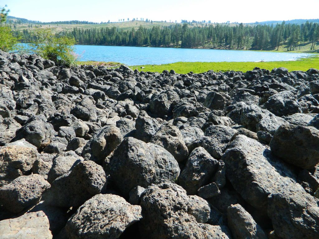
Lava Rock @ Blue Lake in Modoc County
holcombcamp
Holcomb Valley Camp, Big Bear Lake, CA
Wilderness with Horses Sierra Ski Maps Camping California Wilderness Rangers Snow Ski Topo Maps Mountain Biking Maps
Wilderness Hikes Wilderness Hiking Maps Wilderness Topo Maps Sierra Fishing Maps Sierra Topo Maps California Hiking Maps
holeinthegroundsign
Lassen Camping near a creek in Northern California

California Outdoor Recreation:
All parks, forests, preserves, monuments, public lands, lakes, rivers, wilderness, historical sites and museums can be found listed separately on our super duper local A-Z town pages

fout springs
Fout Springs, near Stonyford, Northern California

dirtbikes

California Yuba

Yuba River

Yuba California

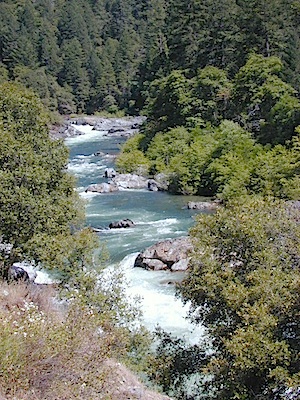
Yuba county, city and river are located in the upper Sierra Nevada, north Gold Country. Only a few small towns around here, but lotsa National Forest land and gorgeous granite rock. Yuba City is well known for its orchards, agriculture and diverse population. Yuba River is a recreation hot spot most of the year – spanning from the foothill canyons up to higher elevation alpine lakes. Camping, kayaking, fishing, camping, hiking, swimming holes & waterfalls.

Yuba River Downieville

California Yuba County

Yuba River, Sierra Nevada 

towns near the Yuba River:
Yuba City, California
Marysville, CA
North San Juan
Nevada City, California
Downieville, California
Sierra City, California
Truckee, California
Washington, CA
North Bloomfield
Bassetts

mountains

SUMMER = River Recreation

Most of us want to dunk ourselves in a cool mountain stream when the temperatures get beyond 100 degrees, which is summer months in Central California. Big rivers, like the Yuba are popular spots for all kinds of outdoor recreation and they really draw the crowds. Find your own piece of solitude by getting a good topo map of the region and exploring well away from the main road.

pinetree

This Yuba River gold country region of the Sierra Nevada mountains, is only about an hour drive up the hill from Sacramento; obviously, the further you drive the better it gets. Tons of one lane and dirt roads to explore. Fishing and camping almost everywhere.

Tahoe National Forest

California’s Yuba River headwaters start high in the mountains of the North Sierra. Northern Gold Rush Country.

NORTH FORK of the YUBA

Lakes Basin Recreation Area
Sierra Buttes
Gold Lake
Bassetts
Sierra City, CA
Downieville, CA

New Bullards Bar Reservoir
Nevada City, CA

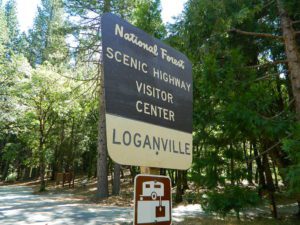
Loganville
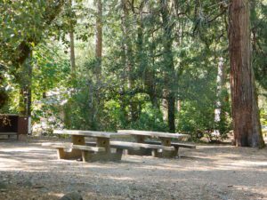
Loganville Campground
Indian Valley Campground
Indian Valley Campground, Tahoe National Forest

Several NFS Campgrounds, line the North Yuba River right along the Highway 49, between Bassetts and North San Juan, CA

  • Wild Plum Campground
  • Loganville Campground
  • Union Flat Campground
  • Cannon Point Campground
  • Ramshorn Campground
  • Rock Rest Campground
  • Indian Valley Campground
  • Fiddle Creek Campground

fish

MIDDLE FORK of the YUBA

This water comes from the rugged and remote Henness Pass area. The long, dirt, historic route Road 293 which connects  Reno, NV to the old mining camps along Highway 49 @ Camptonville, south of Downieville.

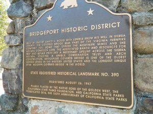
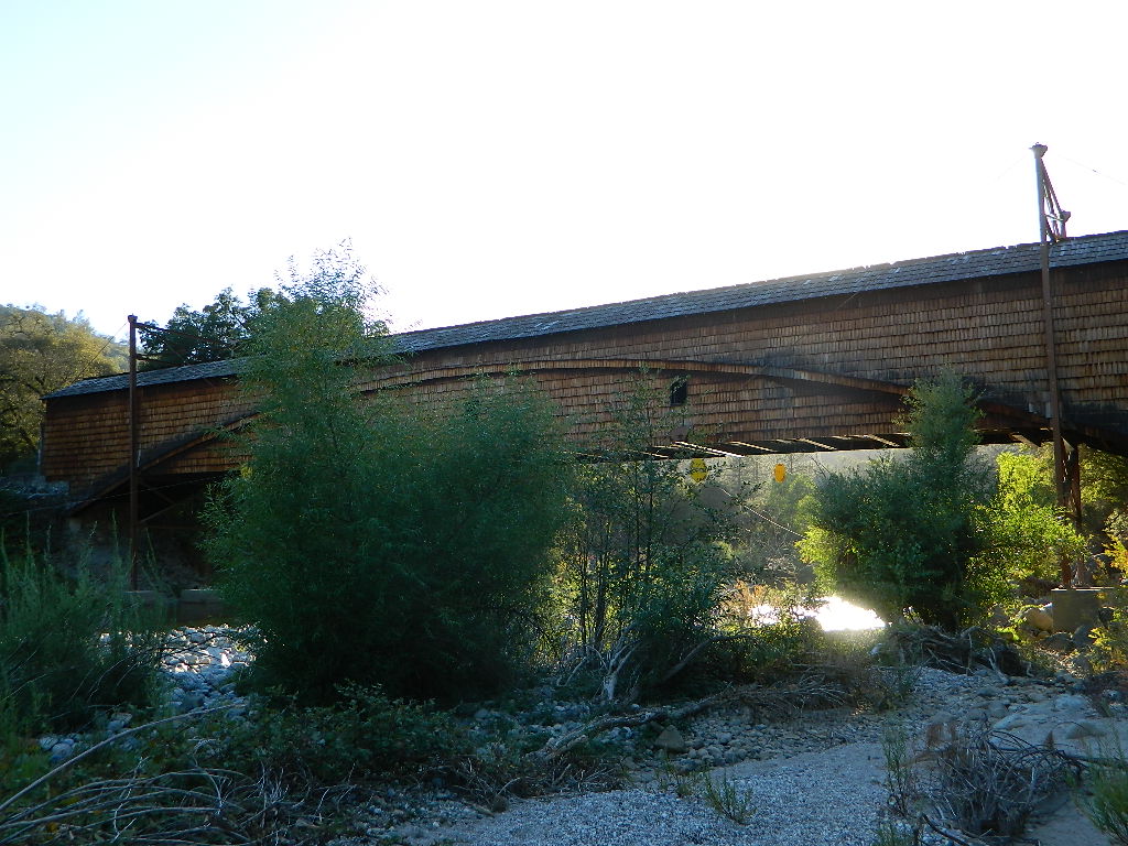
The Oregon covered bridge and the Bridgeport covered bridge run along this fork of the river. There is another State Park down @ Bridgeport; although bridge may be in reconstruction 2020.

A nice place to dip into the this fork of the river – is right off main Highway 49 on Moonshine Road, a secondary road that leads over to Bullards Bar Lake. Minimal parking spots and a steep hike down to the river; and you may have the whole place to yourself (on a weekday morning.)

Bridgeport Sign

middle yuba

hiker

SOUTH FORK of the YUBA

Donner Pass in the Truckee region, North side of Interstate 80. Snowmelt becomes creeks, around alpine lakes like Spaulding, Bowman, which all flow west. Graniteville & Washington, CA

edwards crossing
Edwards Crossing  from 1898

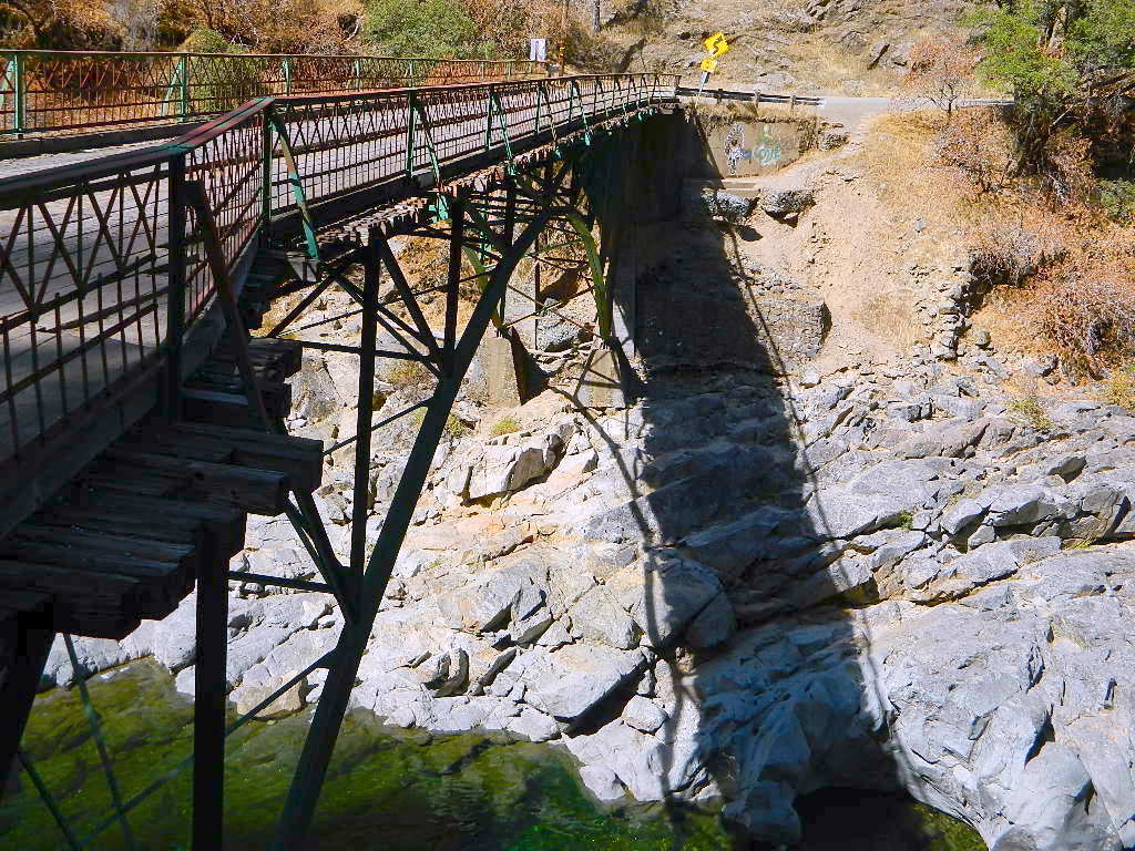
A very popular State Park for South Yuba is located along Hwy 49, north of Nevada City, CA. Many backpacking trails, mountain biking trails and day hiking trails, plus several old bridges (crossings), built before 1900 still exist and in use. Bureau of Land Management has the quietest and cheapest developed campground around these parts, accessible only by dirt road (North Bloomfield Road).

South Yuba River Map

yuba river map
Northern Gold Country: Yuba River Recreation Map

camp

NFS

Few National Forest Campgrounds are located on the South Fork. Many scenic, small lakes exist up in these higher altitudes, where the best camping is. Granite peaks, numerous creeks, forests and gravel roads.

bowmanbig
Big Bowman Lake

BEAR RIVER, Lake Faucherie, Sawmill Lake and Bowman Lake are all part of this Yuba watershed, along with about a dozen other lakes. Rugged granite gravel rock rocks will lead deep into these areas. 4WD or high clearance vehicle may be needed to reach these destinations.

The whole region gets buried DEEP feet in snow, so access is usually limited to summer and autumn only.

snow

faucherie

Snag Lake California

Snag Lake California


Lakes Basin Recreation Area
Snag Lake

A free lake camp in between Truckee & Quincy, CA

This is one of many small lakes situated within the Lakes Basin Recreation Area , in the Northern Sierra Nevada mountains. Just north of Downieville & Historic Gold Country. Snag Lake is nothing special compared to the rest of the scenic lakes close by, but it is worth a mention due to a few fun facts.

Sierra Nevada Lake

One thing this small lake campground does have is convenience, located right on the Gold Lake Highway – next to Goose Lake, plus hiking distance to the largest of the lakes, Gold Lake. The second feature is the campground is small, 16 primitive sites, picnic tables & one vault toilet. The third thing is that this is a FREE campground; no charge.

campsite snag lake

Snag Lake Campground

• Elevation: 6600′
• Number of Sites: 16
• Vehicle Accessibility: Small RVs
• Campsites Reservation: No
• Camp Fee: No
• Length of Stay: 14 Days
• Season: June – October
• Trailheads: Gold Lake

Boulder Hopping

dirt drive (no pavement)

No motorized boats allowed. No paved boat ramps. Kayaks & canoes can hand launch from several spots. The dirt driveway is easily missed, especially at night. The old wooden, forest service sign is not reflective. The vault toilet is close to the highway and the camp sites are along the lake edge. No pavement anywhere!

Upon arrival, camper trailers will want to get out and select the best route to a camp site. The small boulders, dead trees, root and rock obstacles are abundant on the dirt road entry, all around the campground, and at each camp site. High clearance vehicles would fair best at this camp, but some passenger cars may be able to manage the rocky entrance. Get out and look at the road, before scraping across the biggest rock. Slowly, carefully, maybe… and preferably an arrival before dark.
LOCALS TIP: The wind tends to pick up at night around these lakes, so brace your tent well and position your vehicle appropriately.
NFS lake camping lake fishin hiking lakes lakes

fishing lake?

rainbow trout

Obviously with a name like SNAG, you can imagine that the fishing here is not the best, since roots and old tree stumps make up a good portion of the shoreline. Luckily there are a dozen alpine lakes within a 20 mile radius to choose from for another fishing spot. Some lakes are hike-in only, some require 4×4 to reach and others have cabin resorts.

towns nearby –

sierra snow

SEASONAL SNOW CLOSURES

snowmobile
Gold Lake Hwy (or Gold Lake Road) closes in the winter months (NOV-APRIL) due to snow and the region is used as a winter recreation area. Cross-country skiing and snow-mobiling are both popular activities.

driftwood

Lassen – Snag Lake

ANOTHER SNAG LAKE in NorCal, can be found by foot, hiking into the Lassen Volcanic Wilderness. Backpacking the lake loop is approx 17 miles RT and includes 3 lakes – Snag Lake, Widow Lake, and Jakey Lake. Trailhead is located at Juniper Lake, at the north shore.

read more about this hike

hiker

SIERRA LAKES

4×4 lakes
backpacking lake
camping lakes
canoeing lake
fishing lakes
hiking lake
kayaking lakes
waterfalls