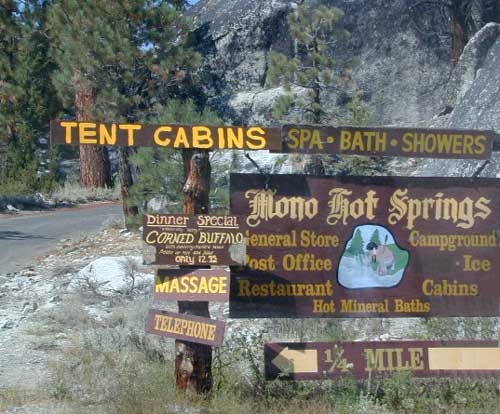
Tag Archives: resort

Mono Hot Springs

High Sierra Nevada
Mono Hot Springs

Sierra Snowmobile Destination

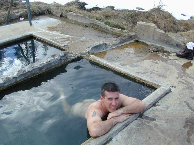
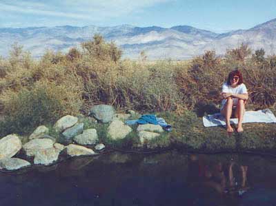
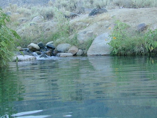
Mono Hot Pools @ San Joaquin River
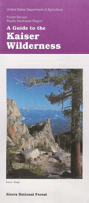
Sierra National Forest

Best of both worlds, way back in the boonies – two primitive tubs soaking perched on a soggy hill next to a big river, developed campground below, and a small resort w/ cabins, camping, restaurant and private soaking areas on the other side of the river.

Sierra hot springs15 mi. NE of Huntington Lake off Kaiser Pass Rd. Huntington Lake & Hwy. 168

Two squared cement tubs overlooking the San Joaquin River, deep in the Sierra Nevada Mountains.

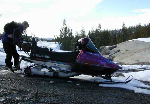
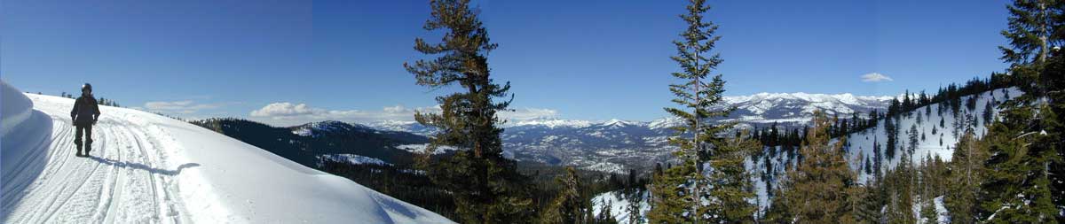
The coolest thing about this primitive hot springs is that it is a great destination for a one day snowmobile adventure. Rentals are in the nearby community of Lakeshore & the plowed paths are fairly easy to follow. If you plan on visiting the springs, you must not play around in the meadow much, there is plenty great Sierra scenery to be had. The snomo trip is a good 5 hours round trip with a lunch break & dip at mineral spring tubs.

  • backpacking
  • boating
  • camping
  • cross country skiing
  • fishing
  • hiking
  • horseback
  • kayaking
  • mountain biking
  • mountaineering
  • snow mobiling
  • stargazing
  • swimming
Sierra Snow-Mobiling
Sierra Snow-Mobilin’

snomo sierra hot springs

Kasier Pass WildernessWinter: road is closed half the year due to heavy snow. Summer: snow is gone and the road is open.

KAISER PASS ROAD
Large motorhomes, RVs are not allowed on this long, steep, narrow paved route.

Max vehicle length: 25 feet

Take Hwy.168, turn right on Kaiser Pass Rd, just past the big ski resort. Pass the large meadow & follow signs to Mono Springs & Lake Edison. Make sure not to miss the left turn or you may end up at Florence Lake.

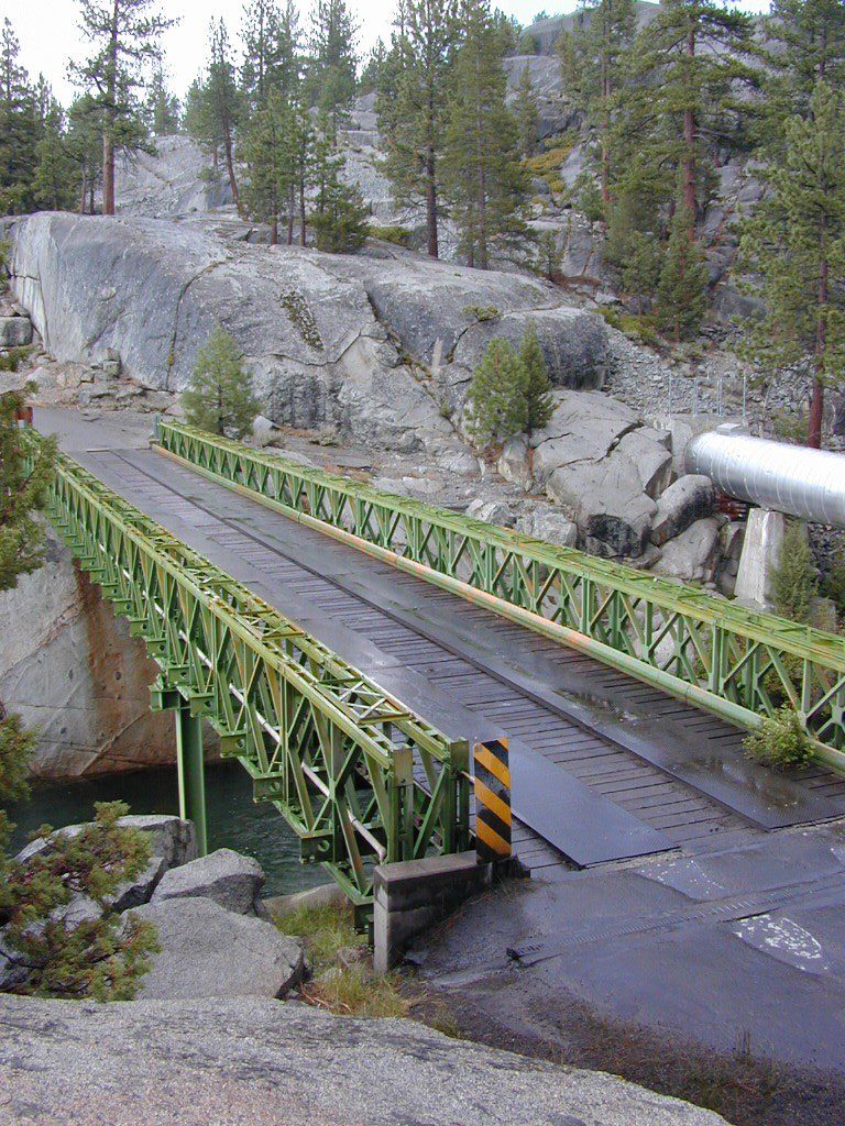
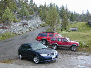
Parking near the green bridge over the San Joaquin River & hike over to the tubs on the hillsides. If there are other vehicles parked here, expect to see naked people nearby; Soaking should never be rushed. Clothing is optional – in California.

Green Bridge at San Joaquin Headwaters
camp

Mono Hot Springs Campground NFS

• Elevation: 6700′
• Number of Sites: 30
• Vehicle Accessibility: RV 25′
• Camp Fee: Yes
• Campsite Reservation: Yes
• Toilet: Vault
• Length of Stay: 14 Days
• Season: June – September
• Trailheads: Ansel Adams & John Muir Wilderness

NOTE: This USFS Campground, should not to be confused with the neighboring business, a privately run camp called –

Mono Hot Springs Cafe w/ Cabin Resort

Mono Springs Sign

closest forest, lakes, & destinations:NFS

topo maps for this region:

Parking Spot

Bucks Lake Wilderness

DSCN0237

Bucks Lake Wilderness Area

Bucks Lake, California
Plumas National Forest

topo mapIn the hills and canyons above Chico many wonders can be found. North Sierra Nevada mountains, medium sized recreation lake surrounded by lush forest; N of Lake Oroville and S of Lake Almanor. North Fork Feather River canyon forms the northern boundary to this designated Wilderness Area. The area is popular with backpackers and PCT hikers, as well as equestrian and the region has over a dozen campgrounds. Backcountry terrain includes an impressive 6 mile long canyon wall.

camp Bucks Lake Campgrounds

hotels Bucks Lake Lodging

The popular boating destination, Bucks Lake reservoir, is just outside the wilderness boundary, which makes for an excellent destination for day hikes. Boating, fishing, backpacking, hiking, camping, canoeing, kayaking, rock climbing, snowmobiling and mountain biking are just some of the outdoor recreation in the area. This Wilderness region features a Silver Lake and Gold Lake, as well as numerous other small, unheard-of lakes. A few can be accessed by vehicle, but more than half are hike-in only lakes.

  • backpacking
  • boating
  • cabin rentals
  • camping
  • canoeing
  • fishing
  • floating
  • hiking
  • kayaking
  • sailing
  • swimming
  • Bucks Lake Wilderness
    23,958 acres
    5200′ elevation at Bucks Lake

    Alpine wilderness, mountain peaks, hiking trails, PCT trailheads, numerous small lakes, plus large recreational fishing lake

    Bald Eagle Mountain – 7183′
    Bucks Mountain Peak – 6819′
    Mount Pleasant – 7067′

    Small lakes around the Bucks Lake Wilderness Area

    Bald Eagle Lake
    Blue Lake
    Cape Lake
    Gold Lake
    Grassy Lakes
    Jacks Meadow Pond
    Kellogg Lake
    Lost Lake
    Mud Lake
    Rock Lake
    Silver Lake
    Snake Lake
    Smith Lake
    Thompson Lake
    Three Lakes
    Upper Mud Lake

    regional maps –

    nearby towns –
    Berry Creek, CA
    Meadow Valley, CA
    Quincy, CA
    Chico, CA
    Oroville, CA

    lodge and cabins
    historic lodge burnt down, but they rebuilt and are re-opened again

    DSCN0242

    more info –

    Bucks Lake Trailheads (PDF)
    BucksLake.net
    Bucks Lake Fire Dept
    Bucks Lake Wilderness Wiki


    View Larger Map

    Keough Hot Springs

    Keough Hot Ditch
    HWY 395. Bishop. First Keough visit w/ Ted, 1990

    Keough Hot Springs

    Keough Hot Tubs, Eastern Sierra

    Keough Hot Ditch

    7 miles North of Big Pine & 7 miles South of Bishop;
    on the west side of Hwy. 395

    Keough California is comprised of two soaking spots – a small resort and the primitive tubs below. An Eastern Sierra rustic Hot Springs Resort w/ campground, tent cabins rentals and nice landscaping. Big, clean hot pools at the top of the road. Entrance fees, trees and vegetation, next to the mountains. Seniors and families frequent this place. Swimsuits are required.

    Keough’s Hot Springs Resort
    800 Keough Hot Springs Road
    Bishop, CA 93514
    760-872-4670

    Keough Hot Springs

    The Ditch

    Below the resort and above the highway, are some primitive, free hot pools that require dirt road driving. Public nudity is common. Open 24/7 w/ several brush lined pools on the eastern slopes of the Sierra Nevada Mountains overlooking the high desert of the Owens Valley. Quite impressive for being just off the highway. Buzzing, huge powerlines overhead are one of the only drawbacks of this soak spot. This place can get crowded at certain times.

    Posted: No overnight camping allowed at these lower hot springs.

    Soaking at Sunrise

    US Highway 395:
    Look for the turn off in between Bishop and Big Pine, California. Take the Keough Hot Springs Road up hill until the second dirt road, turn right and the primitive hot springs will be on the left, just beyond the cold stream crossing. Sometimes a high clearance might be needed. Cars should park and walk the if unsure of the terrain. Do not park right next to the soaking tub, as the ground is too weak and vehicles have been known to slide in, unexpectedly. No kidding!

    Plenty great camping all around the Eastern Sierra region. For campsites with cooler temps, higher elevation, pine trees & creeks: Head for the Glacier Lodge Rd – Inyo Road #9S21, West outta Big Pine.

    Adventurous 4x4s can try super remote Coyote Flat, a super high elevation pinyon plateau that overlooks Bishop. Also Highway 168 W outta Bishop will lead to primitive camping areas like The Buttermilks, a rock climbing area. Further up the hill is alpine lake and creek camping in aspen groves.

    Many developed Campgrounds in the region.


    View Keough Hot Springs in a larger map
    also nearby:

    Inyo Forest Maps