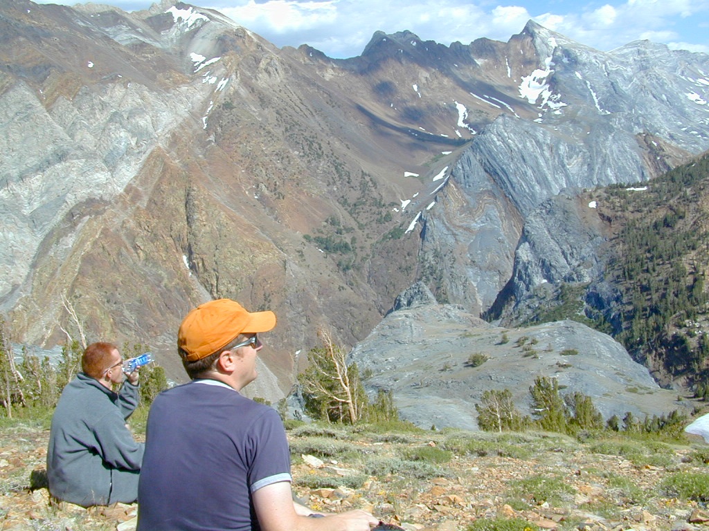
California has so much land and sheer beauty, it’s hard to wrap your mind around the vastness, much less the amazing and awe inspiring scenery. Snow skiing, kayaking, horseback, snowmobile, sleigh rides, dinner cruises, beer trains, wine tasting and so much more.
Drive California top to bottom (from Shasta to Baja) and you could be looking at months of prime vacation time. If you have that kinda luxury free time. If not, you might be looking for a local weekend of adventure, cave history or sightseeing. Total Escape has been featuring California tours for decades. We have something perfect just for you!
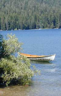
California Sierra Lakes Sierra Lake Destinations Sierra Lake Campgrounds
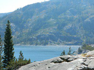
One of the best physical features about California is the amount of lakes and reservoirs it holds – in the mountains, foothills and the canyons, throughout the state.
recreational lakes – Huge, dammed reservoirs to the secluded, alpine lakes in the high country and all the variations in between.
There are literally thousands of lakes located within the Sierra Nevada mountains and it would be ridiculous to try to list them all here. Many of them can only be reached by hiking into Wilderness.
Most California lakes are popular and well known recreation spots, but others are secluded – if you drive far and long enough back on the dirt road. Some do not allow motorized boats and most do allow fishing and swimming. Some have campsites on the waters edge, while other camps are up on a hill over looking the lake.
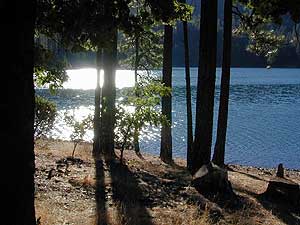
Below listed are some Sierra lakes that allow camping on the lakeshore or nearby. Most campgrounds are suitable for RVs, tent camping, and some may require 4 wheel drive to reach them.
In the hills and canyons above Chico many wonders can be found. North Sierra Nevada mountains, medium sized recreation lake surrounded by lush forest; N of Lake Oroville and S of Lake Almanor. North Fork Feather River canyon forms the northern boundary to this designated Wilderness Area. The area is popular with backpackers and PCT hikers, as well as equestrian and the region has over a dozen campgrounds. Backcountry terrain includes an impressive 6 mile long canyon wall.
The popular boating destination, Bucks Lake reservoir, is just outside the wilderness boundary, which makes for an excellent destination for day hikes. Boating, fishing, backpacking, hiking, camping, canoeing, kayaking, rock climbing, snowmobiling and mountain biking are just some of the outdoor recreation in the area. This Wilderness region features a Silver Lake and Gold Lake, as well as numerous other small, unheard-of lakes. A few can be accessed by vehicle, but more than half are hike-in only lakes.
backpacking
boating
cabin rentals
camping
canoeing
fishing
floating
hiking
kayaking
sailing
swimming
Bucks Lake Wilderness
23,958 acres
5200′ elevation at Bucks Lake
Alpine wilderness, mountain peaks, hiking trails, PCT trailheads, numerous small lakes, plus large recreational fishing lake
Bald Eagle Mountain – 7183′
Bucks Mountain Peak – 6819′
Mount Pleasant – 7067′
Small lakes around the Bucks Lake Wilderness Area
Bald Eagle Lake
Blue Lake
Cape Lake Gold Lake
Grassy Lakes
Jacks Meadow Pond
Kellogg Lake
Lost Lake
Mud Lake
Rock Lake Silver Lake Snake Lake
Smith Lake
Thompson Lake
Three Lakes
Upper Mud Lake
Located in the South Sierra Nevada mountains alongside the Southern Sierra Wilderness. Inside the remote rugged peaks of a deep, granite crevasse known as the Upper Kern River with ancient Sequoia forest to the west and to the eats, some of the tallest peaks in the Sierra range. This wild land area is home to the California golden trout and is the main water flow southward from the tallest peak in the lower 48 – Mount Whitney on the Eastern Sierra front.
Roads, campgrounds and trailheads surrounding Golden Trout Wilderness
Eastern Sierra –
Horseshoe Meadows Road (paved) leads up to high elevation meadows from the high deserts of Lone Pine, CA. Pacific Crest Trail (PCT) access; Mount Whitney and John Muir Wilderness are to the north. Equestrian corrals and horse trails. Camping is limited to a one night stay at any of the 3 campgrounds up here.
Fork of the Kern / Loyds Meadow Road #22S82 – This main paved road connects the Kern River (Sierra Hwy Road #99) to the lower elevation, granite slopes of the Western Divide, and the route dead ends at Jerky Meadow parking lot. Camp 1-6 are primitive camp areas located on dirt side roads and 4×4 might be required on some of them. Obtain a campfire permit from rangers in Kernville. Fishing, camping, waterfalls and swimming holes are popular in this region. The big developed camp along this road, is located 10 miles up, in a pine filled valley on Peppermint Creek on the west side of the street and is within the Giant Sequoia National Monument.
Lower Peppermint Campground: elevation 5300′ / 17 camp sites / open year round
Lloyd Meadows @ Sequoia Forest Road# 20S67 – is the Forks of the Kern Trailhead & the dirt road that accesses it, is very popular among equestrian campers.
Western Divide Highway –
Road #20S79 leads from Western Divide Hwy to Lewis trailhead.
Road #20S50 leads from Western Divide Hwy to 2 hiking trailheads.
Sequoia National Park, Three Rivers, CA –
South Fork Road leads up Kaweah River at Southfork trailhead.
Mineral King Road is only open seasonally, access to high country lakes and trailheads.
east side –
Cottonwood Trailhead (near Lone Pine)
Blackrock Trailhead (Monache Mdws)
south side –
Jerky Trailhead
Forks of the Kern Trailhead
Lewis Camp Trailhead (Western Divide)
Summit Trailhead (Western Divide)
Clicks Creek Trailhead (Western Divide)
Camp Wishon Trailhead (Western Divide)
west side –
South Fork Trailhead (Three Rivers) Atwell Mill Trailhead (Silver City)
Franklin Pass Trailhead (Mineral King)