Oak foothills of the Historic Gold Country, at the edge of the Sierra Nevada mountains.
boating
canoe
camping
fishing
hiking
houseboats
kayaking
wildflowers
Most Central Valley Reservoirs have blooming wildflowers in early springtime. Summer heat can measure triple digits for months as most of these lakes are located below 1000′ elevation.
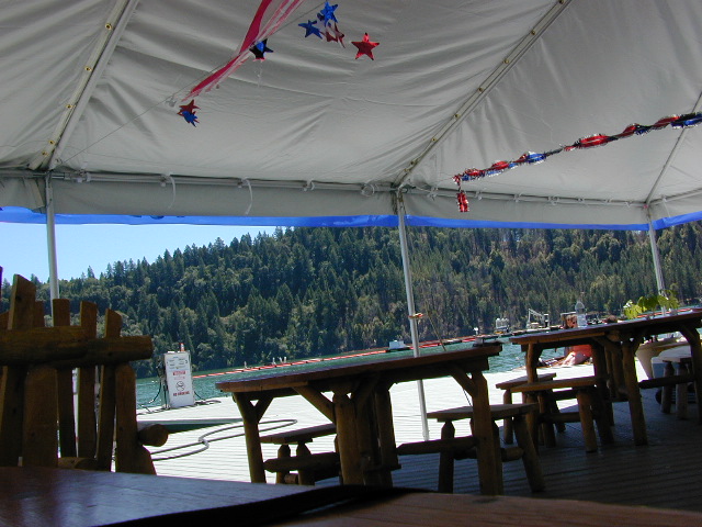
BULLARDS BAR Dark Day is a lakeside walk-in campground on a small reservoir, located deep in the Gold Country foothills. Flush toilets and hiking trails, kayak rentals and fishing.
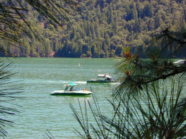
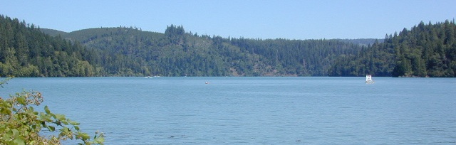
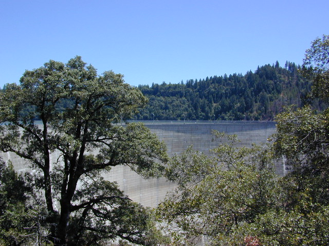
West of Highway 49. Huge dam for hydro-electric power. Minimal roadways along the lake and steep canyons make for optimum hiking and boating. Floating and fishing. Relaxing in the mountains, with fresh water!
On most maps the official name of this lake may read New Bullards Bar Reservoir, or Lake Bullards Bar, but locals just call it simply – Bullards Bar!
Sierra Nevada Foothills. Yuba River, California.
Northern Gold Country, California
Near Camptonville, West off Hwy 49
in between Oroville and Nevada City, CA
Located not far from historic Downieville, Bullard’s Bar is an excellent base camp location for exploring the upper reaches of the Gold Country region. Old mining locations, museums, a covered bridge, various parks, Yuba River, Sierra Buttes, Lakes Basin. Grass Valley & Nevada City are also nearby. Mountain bike trails, river rafting and hiking all around.
roads around lake: Marysville Road (south of lake and east side w/ Hwy 49), Moonshine Road (south of lake), Oregon Hill Road (west side), Pendola Road (north side), and Forest Route #47 (dirt road on north side)
One of the few lakes in the Sierra Nevada that offer boat in camping at developed camp sites, and also to allow boaters primitive camping along the shoreline. No drinking water is available. No pit toilets, so a portable chemical toilet is always required. Plus, pack out all garbage.
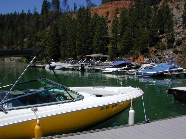
No charge for DAY USE areas: parking or boat launch ramps
NOTE: Dark Day & Schoolhouse Campgrounds are the only car camping & RV accessible camping on this lake. These both have flush toilets and drinking water piped in. Hiking trails & boat launch nearby. Wheelchair accessible campsites are available.
CAMPS OPEN: APRIL – OCTOBER Campgrounds @ BullardsBar are usually open from April to October annually and all are closed for winter months.
Located 5 miles northwest of Dark Day Boat Ramp on the west side of the reservoir. Boat in only access. It is used as an over flow campground. There are campsites, but no bathrooms. Portable chemical toilet required. More info call Emerald Cove Marina at (530) 692-3200
Second Spillway – in the works?
Yuba Water Agency has just committed to building a $160 million second spillway at the New Bullards Bar Dam; beginning in 2021, with a completion date of 2025.
In the hills and canyons above Chico many wonders can be found. North Sierra Nevada mountains, medium sized recreation lake surrounded by lush forest; N of Lake Oroville and S of Lake Almanor. North Fork Feather River canyon forms the northern boundary to this designated Wilderness Area. The area is popular with backpackers and PCT hikers, as well as equestrian and the region has over a dozen campgrounds. Backcountry terrain includes an impressive 6 mile long canyon wall.
The popular boating destination, Bucks Lake reservoir, is just outside the wilderness boundary, which makes for an excellent destination for day hikes. Boating, fishing, backpacking, hiking, camping, canoeing, kayaking, rock climbing, snowmobiling and mountain biking are just some of the outdoor recreation in the area. This Wilderness region features a Silver Lake and Gold Lake, as well as numerous other small, unheard-of lakes. A few can be accessed by vehicle, but more than half are hike-in only lakes.
backpacking
boating
cabin rentals
camping
canoeing
fishing
floating
hiking
kayaking
sailing
swimming
Bucks Lake Wilderness
23,958 acres
5200′ elevation at Bucks Lake
Alpine wilderness, mountain peaks, hiking trails, PCT trailheads, numerous small lakes, plus large recreational fishing lake
Bald Eagle Mountain – 7183′
Bucks Mountain Peak – 6819′
Mount Pleasant – 7067′
Small lakes around the Bucks Lake Wilderness Area
Bald Eagle Lake
Blue Lake
Cape Lake Gold Lake
Grassy Lakes
Jacks Meadow Pond
Kellogg Lake
Lost Lake
Mud Lake
Rock Lake Silver Lake Snake Lake
Smith Lake
Thompson Lake
Three Lakes
Upper Mud Lake


 Oak foothills of the Historic Gold Country, at the edge of the Sierra Nevada mountains.