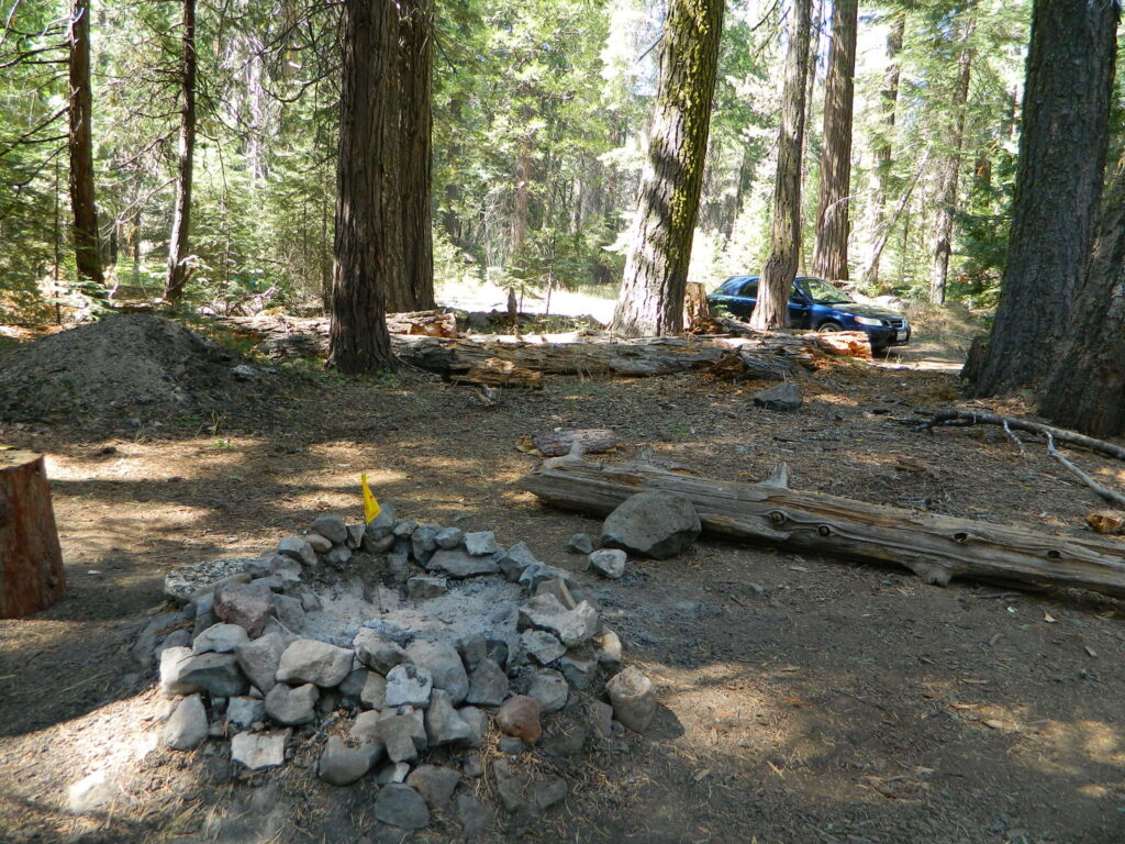
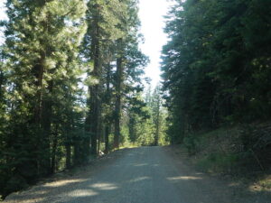
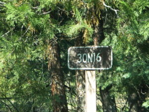
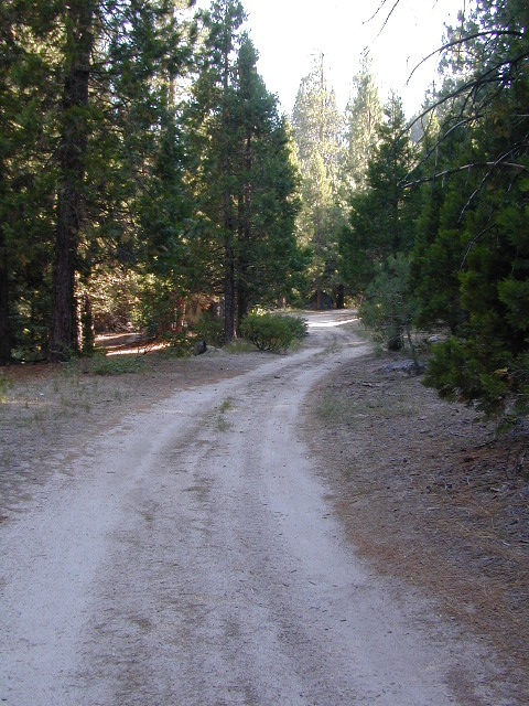
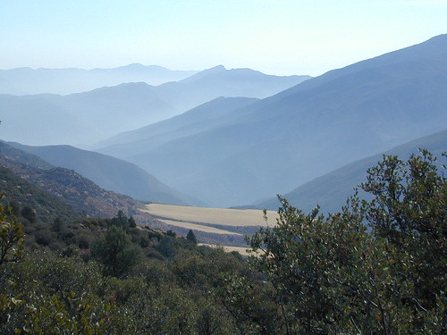
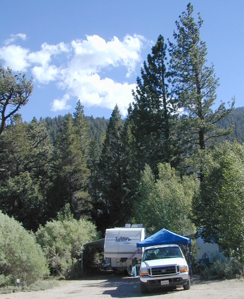
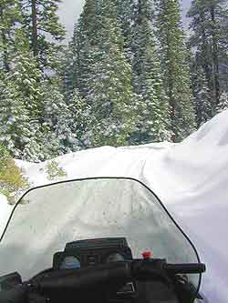
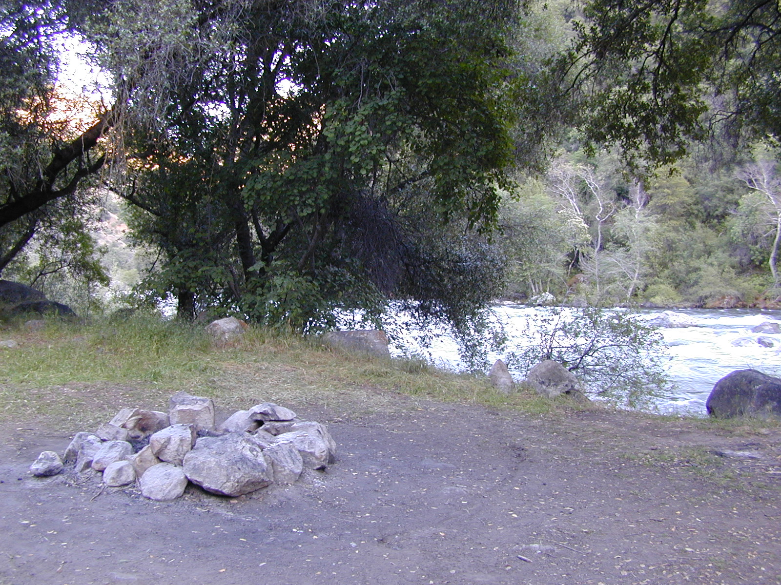
Lassen Back Roads
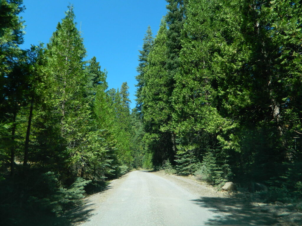
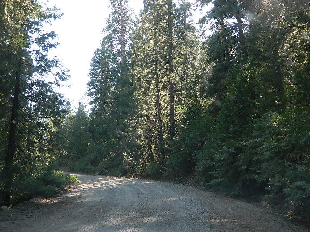
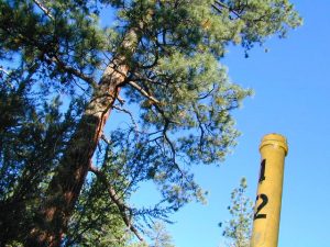
Lassen Rd #30N16 – Lassen National Forest
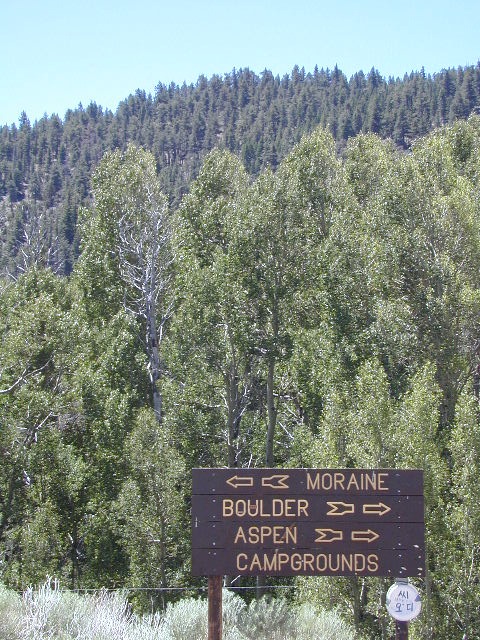
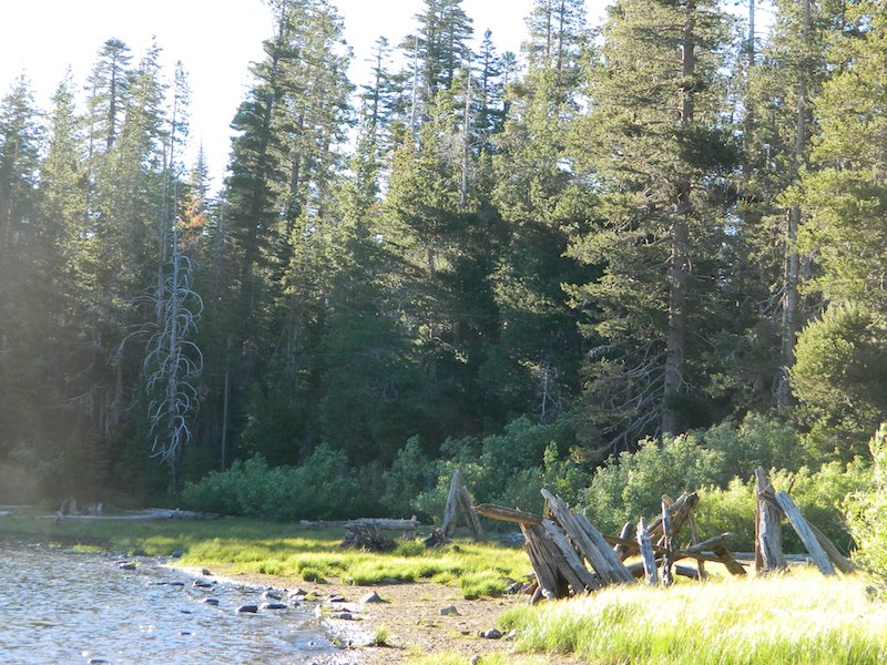
Nanny Creek / McGowan XC
E of Mineral, CA
Narrow dirt road thru dense forest, connects Highway 36 to Lassen Route #29N22 (Dry Lake Trail) and then heads west to meet with Lassen Road 17 (aka #31N45)
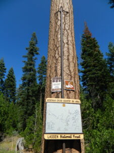
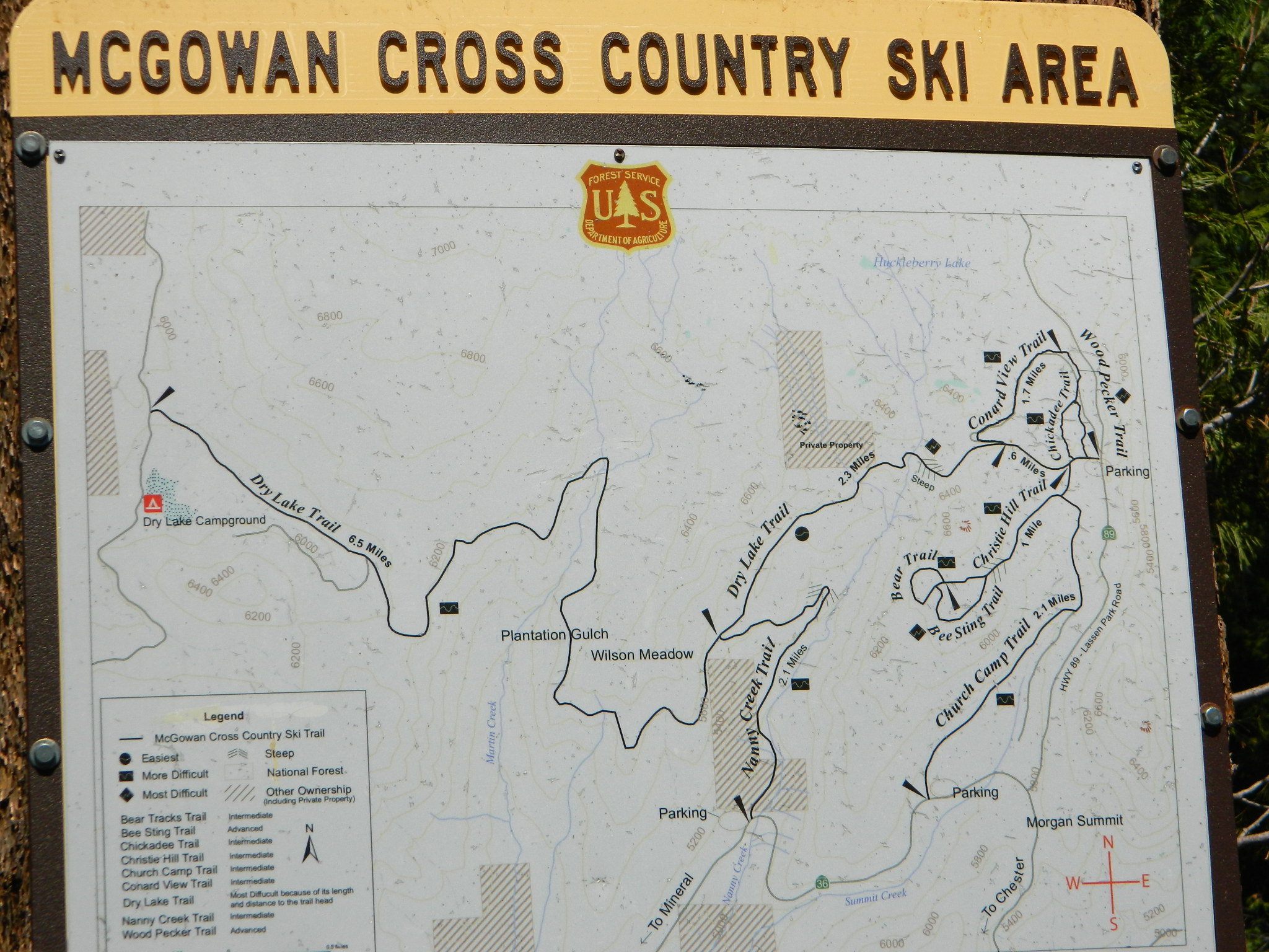
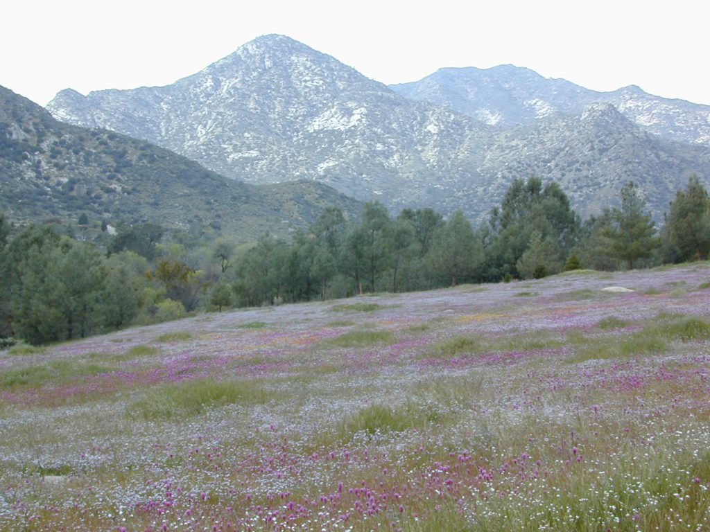
The McGowan Lake Cross-Country Ski Area has been in existence since 1982 and offers 10 miles of trails, 5 miles of which are periodically groomed.
Literally in the shadow of Lassen Peak, McGowan area trails wander through mixed conifer forest and are popular with beginning to advanced skiers. Elevations range from 5,020 to 6,200 feet. McGowan cross-country ski trails are closed to all motorized vehicles.
click to enlarge map
NOTE: No OHV riding, nor snowmobiling on this route!
WINTER – snow fall begins as early as November and lasts thru May. Road can be muddy in late spring.
SUMMER – this dirt road is accessible by automobiles during warmer months only and is not gated.
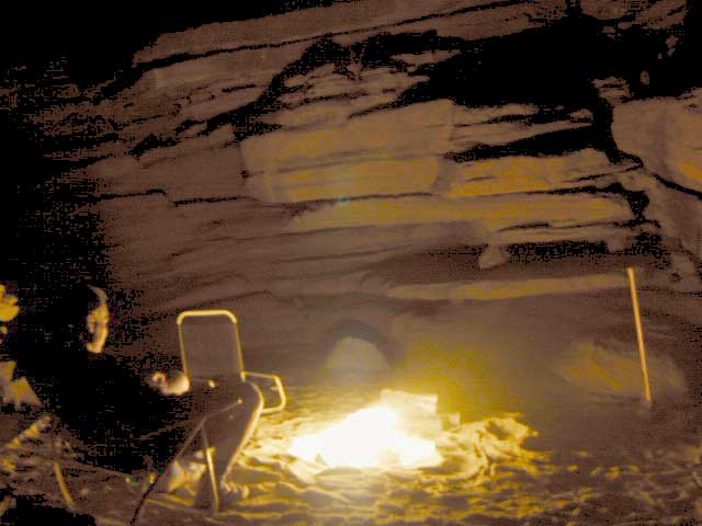
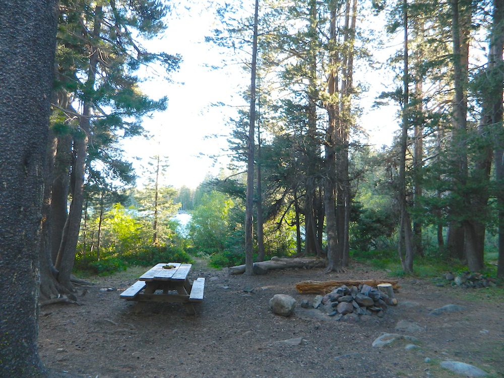
A few dispersed campsites along route 30N16, within the first mile from the pavement (Hwy 32). These precious few camps are usually in high demand during summer months! Head up hill a few more miles, deeper into the forest and find a real secluded site, dispersed style. Campfire Permits are always required for back country fires; found at nearest ranger station USFS in Mineral, CA
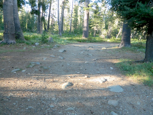
The first portion is a 2.1 mile long dirt road follows Nanny Creek about a mile, then it banks left, uphill to meet with 29N22. Sugar Pine Trailhead is located on this upper section of 30N16; a small wooden sign in a dense thicket can be seen on right side of road.
Junction with 29N22 #30N16 @ wide intersection w/ #29N22 – right turn for McGowan Lake, Christie Hill and the Volcanic National Park.
Road 30N16 continues westbound – Left turn for Heart Lake Trailhead, secluded boondock campsites and eventually, this dirt road ends @ Lassen Road 17 (#31N45) which is also a dirt road (and locally known as the Viola-Mineral Road), connecting Hwy 44 to Hwy 36.
DEEP SNOW can keep these dirt roads closed well into summer months, depending on the snow year. Keep this in mind when planning any early season recreation.
Broke Off Trail Lane intersects this 30N16 road right at the highway (36). It is the hard left that heads steeply up the rocky incline and skirts the highway headed west; Connects to the White Fir Lane road system above the small town of Mineral, CA.
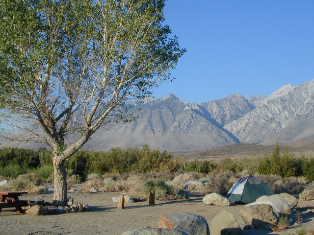
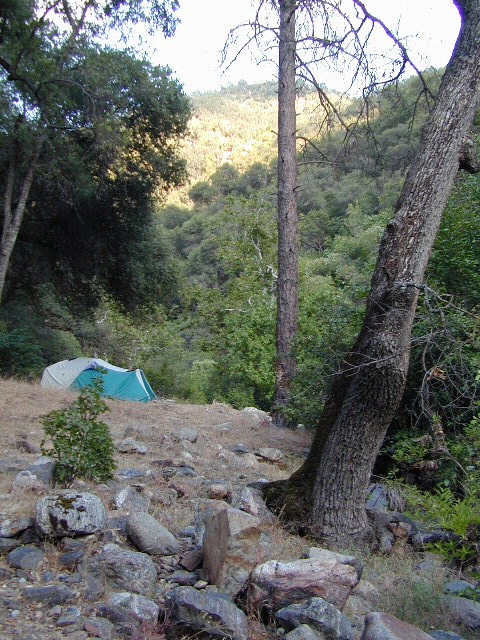
An overnight stay out-of-doors. Sleeping out under the stars.
Air bed, camping cot, tent… or just a tarp on the ground.
Perhaps a luxury Cabin Rental in the mountains or on the coast. Your choice.
From a luxurious cabin in the mountains, to a small clearing in near a meadow with a stream nearby – with just a backpack, the idea of “camping” is always a bit different for each person. Roughin’ it for free – in the wilderness, or on the back roads; Or pay dearly for the price of real amenities, while on vacation.
camp sites that require you to physically haul your camp gear from a parking area to the camp spot, ranging from 1/8 mi. walk to a 1-3 mile hike
backpacking
free w/ wilderness permit
ultimate in seclusion, bring it all on your back, on foot into the wilderness & enjoy trail camps
Trinity River Camping, Douglas City, CA
SO CAL CAMP FIRES – Yellow Post Campsites are remote camping spots in secluded areas, in a designated fire safe clearing. No facilities such as toilets or showers. Maybe a picnic table & fire rings, if you’re lucky. Southern California forests have these kinda spots. Required campfire permit & you must double check on local fire restrictions.
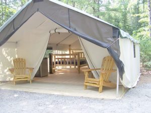
These structures are half way between ‘roughing it in a tent on the ground’ & having a ‘mountain cabin’. Tent cabins have wooden floors w/ canvas walls and roof; Dismantled annually for winter rain/snow, they are usually only available in mild, coastal climates or during summer months in the mountains.
Rentals typically include sleeping cots, but you’ll need to bring your own bedding (sleeping bags, sheets, pillows). Some rentals include shaded porches, wooden decks, minimal furniture, kitchenettes and/or wood burning stoves. Electricity may be available, or maybe not. Ask ahead of time, if you really must have that particular luxury when on vacation.
Yurts are a ’round version’ of this canvas cabin – which need to be aired out, often (to prevent mold). Yurt rentals are very popular and in high demand in California.
Find these type of rentals at yoga retreats, hot springs, beach canyons, remote lakes, redwood forests, high sierra camps, fishing camps and at certain RV parks.
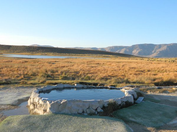
May also be known as Pulky’s Pool in hot springs books.
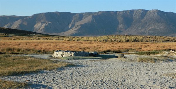
Hilltop is a new found favorite and one of the more scenic spots for a soaking tub in this region. Sitting out in the middle of a clearing, surrounded by marsh lands, this remote hot springs is a hike-in destination. No paved road, nor paved trail. The mountain and sky views from this tub are splendid, and if you time it perfect, you may have the place to yourself.
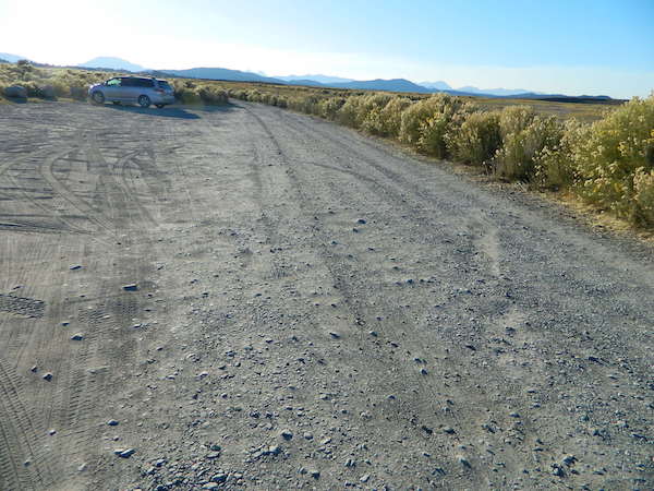
From US Highway 395 @ Benton Crossing Road – drive approximately 3 miles (passing dirt road Whitmore Tubs). Once you’ve crested a small hill, look for a gated dirt road on left, which leads a short ways, back through the sagebrush, to the parking area.
GPS coordinates: 37.6455, -118.8001
The dirt parking lot is adequate enough to handle a dozen vehicles, and this place is so well known, that it gets a fair amount of traffic at any time of year.
Rumor has it that Hilltop is one of the most visited hot springs near Mammoth Mountain; probably due to the proximity to the paved road. Cars and trucks, camper vans and RVs will be coming and going at all hours of the day and night. So consider yourself warned!
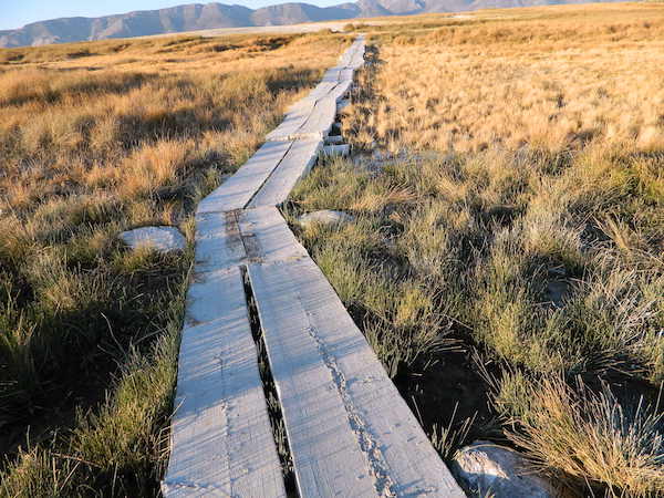
Gate and fence separate the parking from the trail, which leads a quarter mile (often over wooden plank boards) through alkali fields – out to the cement tub.
Only one, small makeshift bench next to the pool – and no tables, no seating, no facilities; Bring tarps, towels, ice chest and camp chairs (if you plan to stay a while).
Plastic PVC pipes and control valve adjust water flow and temperature. If the valve is left ON (wide open) overnight, the small tub will be too hot to soak in the following morning.
Camping options are pretty limited here. A small clearing for a tent, next to the parking lot; and one decent parking spot, large and private enough to call a camp site (at the dead end, past the parking).
The Eastern Sierra corridor of US Hwy 395 is far enough away that it cannot be heard from this spot.
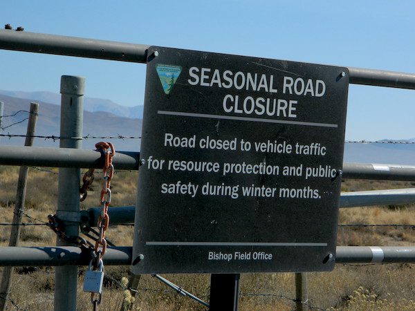
BLM gate at the paved road entrance reads: road is closed seasonally – assuming you can walk in during snowy winter months.
Hilltop is one of several primitive hot springs in this immediate region. See Mammoth Hot Springs for more choices.
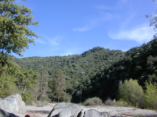
Sugarloaf Ridge, Greenhorn Mts
Alta Sierra, Kern River Canyon
Sugarloaf Road, above Kern River Canyon
SOUTH SIERRA: This route is located in between the Western Divide Highway and the cedar community of Alta Sierra, CA
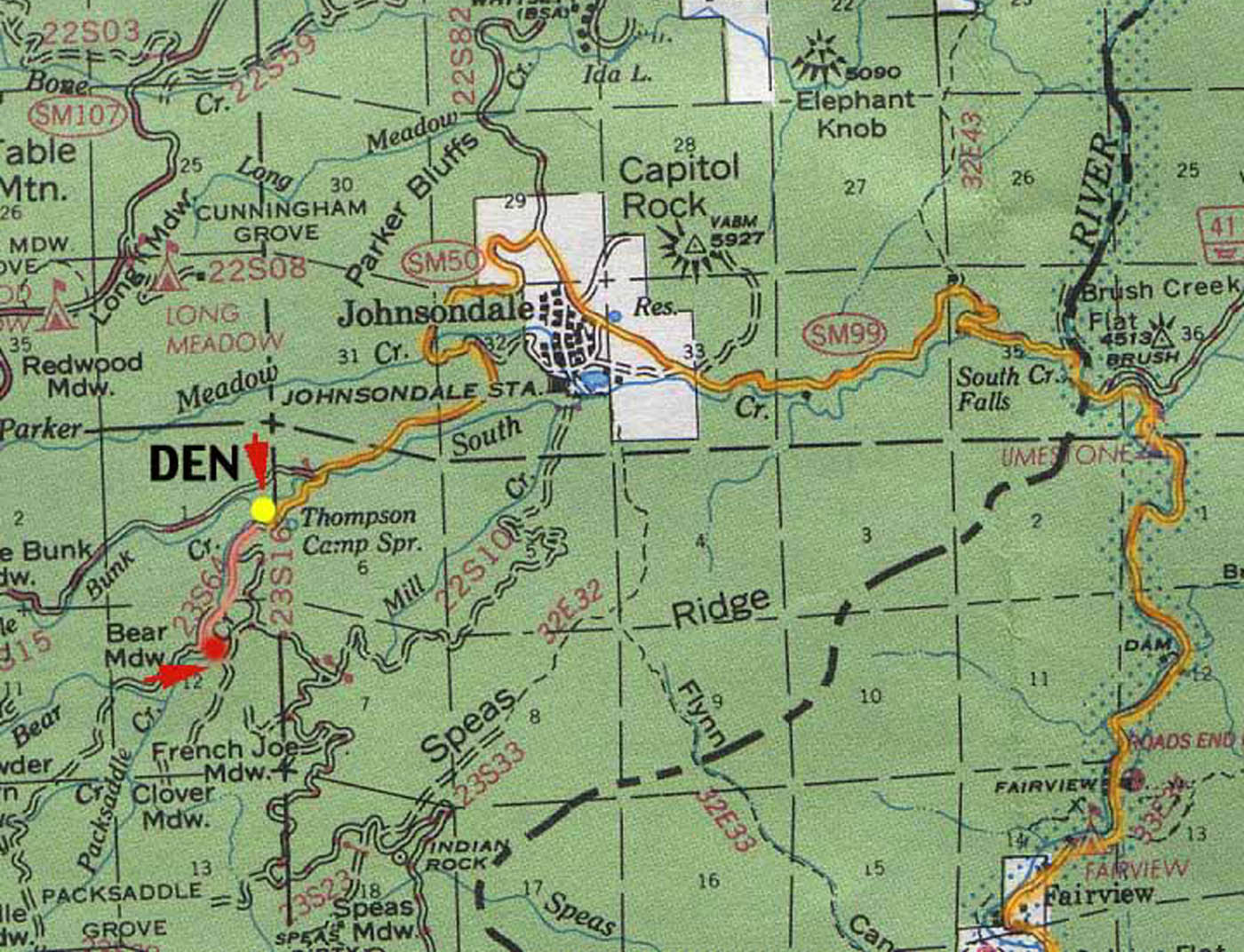
Sugarloaf Ridge: Forest Rd# 23S16 – Thompson Camp Spring, The Den @ Sequoia National Forest
Driving north on Sierra Hwy N of Kernville, California; Passing Fairview & the Johnsondale bridge; After the R Ranch @ Johnsondale, take the left fork on the main highway; After you climb in elevation, look for brown signs on right side of road & turn left on Forest Service Rd# 23S16. Primitive camp sites are located throughout this area along Packsaddle Creek. Do not turn left up Sugarloaf Rd. There are no good camp sites up that way (unless you wanna make one).
RV campers are very common at Thompson Camp Spring, as this road is paved up to this point. The paved road is windy & narrows after this point. It is not advised for trailers or long motorhomes past Thompson.
For the more adventurous, Bear Meadow & Packsaddle Mdw are located up the dirt road a bit on #23S64.
Paved Sequoia route# 23S16 continues to climb, which leads to the Speas Meadow, the Greenhorn Mountains & you best have a real good map if you are heading up this way. 20 miles of awesome open meadows, small streams, dense forest, wildflowers, some primitive camp sites & great viewpoints overlooking the Kern Canyon. All passenger car accessible! Elevations between 6000-7000′. Sugarloaf Peak has cross country skiing.
Side route #23S05 will take you to White River Campground w/ 12 spots. The paved road winds west down the mountain to Posey & eventually Glennville on Hwy 155.
Instead, to easily reach Hwy 155 – you’ll need to get on dirt for a few miles. While on 23S16, look for the Panorama Campground (@ 7400′ elevation w/ 10 sites). Take dirt road #24S15 to get back to civilization @ Alta Sierra, California.
Car campers in Southern California dream of the perfect setting: an uncrowded campsite, in a lush forest, with tall trees & flowing stream of crystal clear water. A swimming hole nearby, plus a place for the hammock. They also want it less than a 2 hours drive from their home. Unlikely.
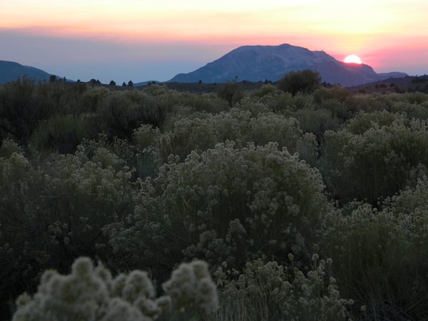
The real California rivers & mountains are in the northern half of the state, while the lower is more like a desert. You will need to drive hours to reach these kinda spots. The Sierra Nevada mountains are the closest bet for finding a creek side camp. Lassen is next, for exploring numerous dirt roads that lead to secluded spots. Northern California, above Redding usually has water flowing and decent fishing, even in the driest years.
Read more on specific California camping techniques:
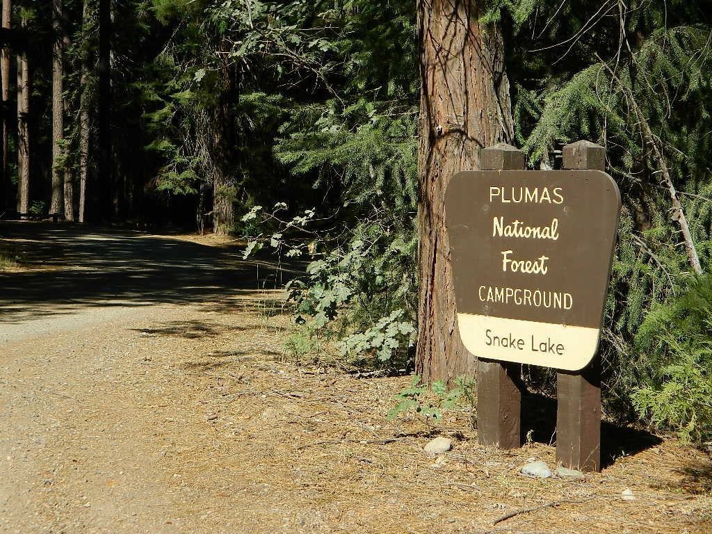
Developed campgrounds located next to rivers, creeks, or streams can be found on the back roads of California. Below is just a sample of small towns that have creek campgrounds nearby:
Many of the best creek camp spots are located outside of developed Campgrounds. Most we suggest on this site are located on dirt roads. Some routes may require a 4×4 vehicle, or high clearance 2WD.
thin blue lines – You’ll know a decent road when you see it. But when you are starting out at home, you need to concentrate of what dirt roads are along what water sources. And will these streams be flowing at this time of year? Many are seasonal creeks & can dry up in late summer. The most likely place to find great water flow is to look for the streams flowing directly into a major river or Lake/ Reservoir.
And if you are really not into to roughing it, but wanna find a CABIN on RIVER or CREEK, check out our extensive list of all vacation cabins here, California Cabin Rentals
Lassen Camping near a creek in Northern CaliforniaUpper Baker Creek, Inyo NF – 4×4 CampVan Life, on McCloud Creek @ Algoma
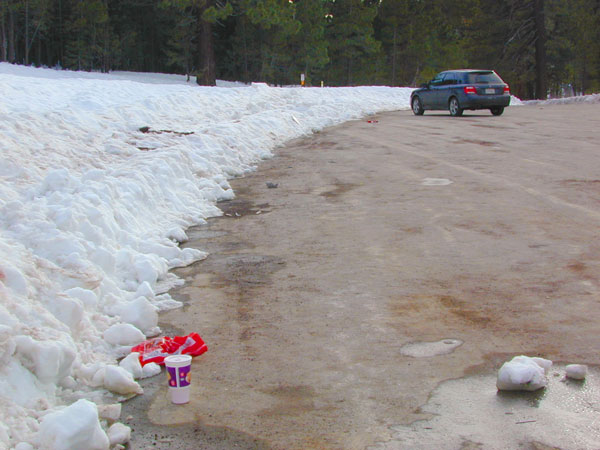
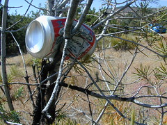
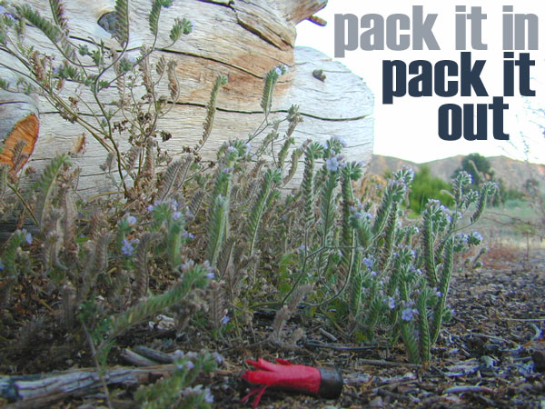
Microtrash is all that small stuff that seems to miss the trash bag.
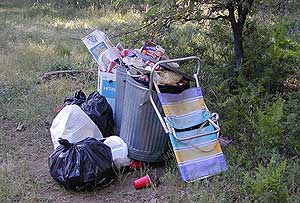
You manage to drag yourself off the couch, congratulations! You’ve packed up your ride and are heading out to your favorite “secret” spot. Anticipation builds as you arrive and pull into the empty lot. Your heart sinks however when you discover that your once pristine camp spot has been transformed into the new town dump. An old lawn chair, candy wrappers and beer cans litter the area that you once loved. Impromptu fire rings are strewn about and armies of weekend warriors have trampled your favorite meadow into a dust bowl.
DON’T BRING THE CITY TO THE WILDERNESS. The noise, the food containers, the beer bottles, the fast food wrappers, the broken plastic crap and the balled up baby diapers. The disposable society we have created now makes us all too LAZY. Getting off your ass and outdoors means you need to take some responsibility.
You get much needed exercise, outdoors breathing fresh air, and enjoying life, while discovering new destinations and awesome terrain. The least you can do is clean up a little, and encourage others to do the same.
thinking about that plastic water bottle you dropped on the trail?
Trash isn’t specific to just campers and target shooters. Hunters are notorious pigs, especially when gathering in groups. Day hikers ‘accidentally’ loose stuff all the time – from sunglasses to bottle caps. Picnickers often forget something at the site.
Family day in the snow sounds great. Sledders leave massive amounts of trash – from broken sleds to food trash.
unaware
Litterbugs include many types of folks: disruptive teens, toothless alcoholic contractors, local yolkels, urban mishaps, gangster wanna-bes, home boys, totally oblivious yuppies & even uneducated families…
keep the trash & tagging to the city!
EDUCATION is key on this matter & it starts with you. Please pass along good outdoor ethics.
Seems you can’t go deep enough. The further into the forest you go, you still seem to see it – evidence of neglect for our land. In every outing these days, we constantly notice tons of litter and graffiti. Deliberate disrespect for the open spaces and valued wilderness lands. What is going on here?
Please report graffiti in action to the local law enforcement or nearest rangers office! Or better yet, get them on video and post it on YouTube.com
What’s the worst that can happen?
Small fragments of plastics are being found inside birds, wildlife and marine life, due to the vast amounts of micro-trash that is found outdoors. Ingested plastics often kill the animals.
Our secluded swimming holes and creek trails are now littered so badly, that the smaller trash is making it into major rivers and into the bellies of fish and the near-extinct California condors.
Misuse and sheer disregard is how OUR lands get closed (by OUR OWN government). Closed off forever, turned into ‘off limit’ roads and more totally closed wildernesses, that only can be explored on foot. OHVs, dirt bikes, 4x4s need to realize their overall impact on natural habitats could have a detrimental effect on these lands. There is a balance. Play wisely. This includes all the red necks with guns too.
Graffiti, Soda Cans, and Cigarette Butts are a nuisance to nature.
As more and more office drones venture from their cubicles and out onto the unbeaten path, they leave behind the remnants of their bold treks for all to see. Refuse, human waste, smoldering campfires and crushed flora from selfish tent placements and trail blazing destroy our fragile eco-system and pollute the environment for years to come.
Be cautious walking around to avoid destroying the fragile ecosystems, such as meadows, seedlings, wildlife & wildflowers.
Pick up all your trash & even some left behind by previous campers. Leaving the camp or picnic site in better condition than you found it.
Below are some simple tips that, coupled with common sense, will enable you to stop being part of the problem and start being part of the solution!
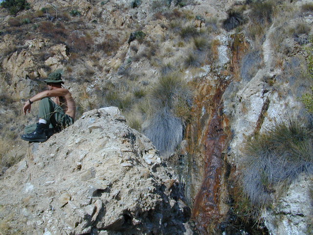
Sespe Hot Springs is one of the hottest thermal springs in the California coastal region. The unique springs, leaking from a cliff high above, leaves a red mark down the white rock wall and it is too hot to touch near the source. Scalding is possible in Sespe Gorge!
Several clearings and tent spots are located in the sandy canyon, between the cottonwood grove and the springs source. Stack river rocks and boulders to create your own soaking tub and relax. Do bring your backpack and plan on spending the night, cuz if not it’s an 18 mile RT hike (done as a day hike – it can be very long and rough). Weekdays are best for seclusion and having the whole place to yourself. Weekends are the prime time for SoCal trekkers to arrive.
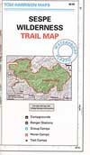
Grade Valley Road – The access to Sespe Hot Springs trailhead is via Lockwood Valley Road; west of Frazier Park about 12 miles. Take the backroad #7N03 (Grade Valley / Mutau Road) southbound into the forest and traverses 13 miles of rough dirt road to reach the small dirt parking lot. Deep inside this route, you are now totally surrounded by Sespe Wilderness. Both Thorn Meadows Campground and Half Moon Campground are located back here on the main dirt road. A dead end dirt road is the trailhead for Sespe Hot Springs.
Via Johnston Ridge – The access trail is LONG, with a lot of up and downs, changing in elevation, thru pinyon pine forest and oaks, along dry dusty ridges, very exposed. Cottonwood trees line the large canyon at the Hot Springs.
locking down the forests, before they burn (again)
Outside of developed campgrounds and permitted facilities, igniting, building, maintaining or using a fire on national forests in California will be prohibited.
List of Current Fire Restriction Orders for all USFS National Forests in California w/ links.
Fire Restrictions are now in effect for most all public lands in California. Data and news change weekly, so follow links for most up-to-date restrictions, before you make your drive.
These are the earliest and most restrictive campfire orders ever. No? Maybe the long drought years would be equivalent. Below is a brand new list broken down by federal land regions – forest and deserts, including BLM camping areas.
Looks like we are already into Stage II Restrictions for the begining of summer 2020.
NOTE: BBQ grills, all stoves, smoking, firecrackers, welding, chainsaws, off roading, dirt biking, hunting and target shooting are restricted within these orders. A few of these fire restrictions are dated to extend until DEC 31, 2025
More details and specifics can be found on each forests .gov web site, so please use THESE LINKS BELOW (before they break).
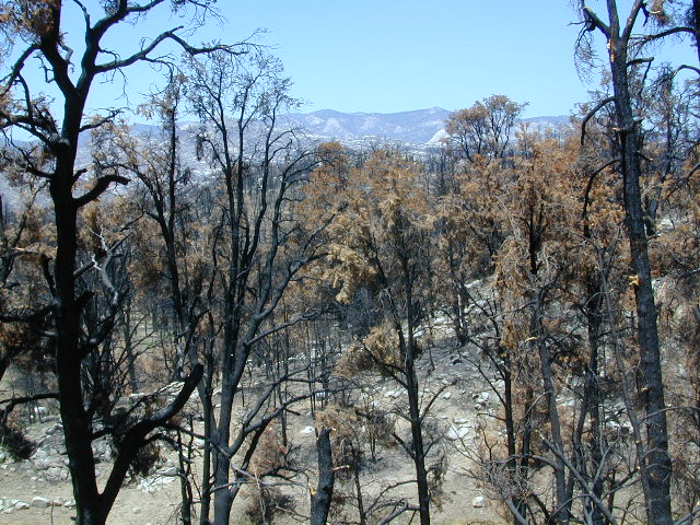
The land is dry and wildfire threat is an ongoing battle in California.
FOREST-WIDE FIRE RESTRICTIONS IN PLACE
Wildfires ravage California wild lands every year. Severity, longevity, most deadly. Let this year be different.
Northern California
BLM (Bureau of Land Management)
no campfires outside of developed campgrounds (statewide) (APR 29, 2020 – DEC 31, 2025)
see the current 2020 BLM Campfire Map
USDA PDF map shows only 26 places that you have have a campfire inside Modoc. The far drive could be worth it – for minimal crowds, darkest skies and maximum fishing. Best for week long road trips, super lazy summer style.
Persons with a valid California Campfire Permit are not exempt from the prohibitions.
However, persons with a valid California Campfire Permit may use a portable campfire ring/pit, stove, or lantern ( 5+ feet from flammable materials) IF THE UNIT burns gas, kerosene, jellied petroleum or pressurized liquid fuel, and is EQUIPPED w/ a shut-off valve.
Wow, what a mouthful. Guess the propane campfire is okay?
SUSANVILLE, Calif. May 29, 2020 – Lassen National Forest is enacting campfire restrictions… effective immediately and until further notice. Outside of developed campgrounds and certain permitted facilities, igniting, building, maintaining or using a fire on national forests in California will be prohibited.
Lassen Camping near a creek in Northern California
BLM Eagle Lake
no campfires outside of developed campgrounds (APR 29, 2020 – DEC 31, 2025)
see the current 2020 BLM Campfire Map
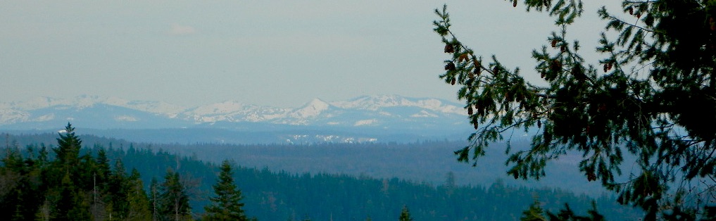
North Sierra where the granite meets the volcanic rock of Lassen. Feather River Watershed, Lake Oroville SRA, Bucks Lake Wilderness, Bald Rock, Quincy, Lakes Basin Recreation Area
Deane’s Valley Campground, way off the main road, between Quincy and Bucks Lake.
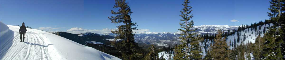
Donner Summit and Lake Tahoe get a majority of the Sierra Nevada snowfall and traffic. Deepest snowpacks are measured way up here, with dozens of small lakes surrounded by granite. Less snow means drier forests for 2020, and more tourists means more campfires. One spark is all it takes!
Tahoe National Forest (snowy mountains) April 2020, taken from Oro-Quincy Hwy looking southeast to Donner.
Yosemite’s west side w/ Bass Lake, Mammoth Pool, Granite Creek, Dinkey Creek, McKinley Grove, Shaver Lake, Huntington Lake, San Joaquin River, Mono Hot Springs, Edison Lake, Florence, Ward, Courtright, Wishon, Blackrock, and the Kings River. Biggest water reservoirs draws the largest crowds. Be fire safe and camp inside of a developed campground this summer.
Sonora Pass and the Gold Country have been hit hard by recent wildfires in the past decade, so now we pay the price w/ much tighter campfire restrictions. Popular mid Sierra region, easy access w/ many lakes and reservoirs; highways of CA 108 & CA 44
Campfires banned throughout the Eastern Sierra region until the end of 2022, within both the USFS and BLM campgrounds. US Highway 395, Mount Whitney, Mammoth, June Lake Loop & Mono Lake
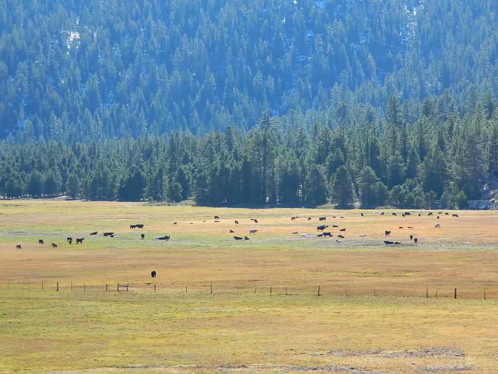
Tighter than normal campfire rules for the drier Southern Sierra. Kern River Canyon, Kennedy Meadows, Chimney Peak and beyond. Drive up hill, gaining levation to Sherman’s Pass or the Western Divide Highway and find a cooler campground in the dense trees. Forget the triple digit heat, brushy river and the masses, and climb to a higher altitude for the Big Trees and Big Meadows. Breckenridge, Horse Meadow, Long Valley, Mountain Home.
The possession or use of any steel jacketed or steel core ammunition of any caliber. This would include handgun, rifle and shotgun ammunition unless a person is in possession of a valid State of California hunting license and is actively engaged in the legal take/pursuit of game and non-game species in accordance with current California hunting regulations, and
During the issuance of Red Flag Warnings and Fire Weather Watches, as determined by the National Weather Service (NWS), all recreational shooting and use of campfires, is temporarily suspended to reduce the potential of unintended wildland fire ignitions for the period of the event.
Stage II Restriction:
All the restriction in Stage I above, and
Setting, building, maintaining, attending, or using open fire of any kind is prohibited, except campfires within approved fire pits and grills provided for in developed recreation sites; or campfires within the Imperial County Special Recreation Management Areas with a valid California Campfire Permit. Controlled flame devices such as portable stoves and lanterns with shut-off valves,using gas, jellied petroleum, or pressurized liquid fuel are allowed and require a valid California Campfire Permit, and
Smoking, except within an enclosed vehicle or camp trailer or while stopped or standing in a three-foot diameter area barren or cleared of all flammable materials and away from federal facility doors, windows and air ducts.
Stage III Restriction:
All the restrictions in Stage I above, and
Setting, building, maintaining, attending, or using open fire of any kind is prohibited. Controlled flame devices such as portable stoves and lanterns with shut-off valves,using gas, jellied petroleum, or pressurized liquid fuel are allowed with a valid California Campfire Permit, and
Smoking, except within an enclosed vehicle or camp trailer unless prohibited by State or local laws.
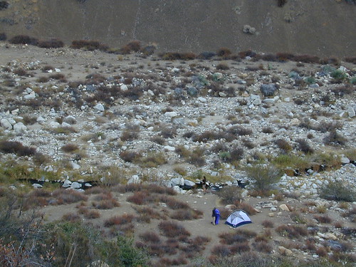
Free camping outside of a developed campground, for a self-contained camper who wants seclusion and privacy. Real relaxation in total peace and quiet. More nature, less people and minimal vehicles.
Free Campsites • Dispersed Camps • Open Camping • Boondocking
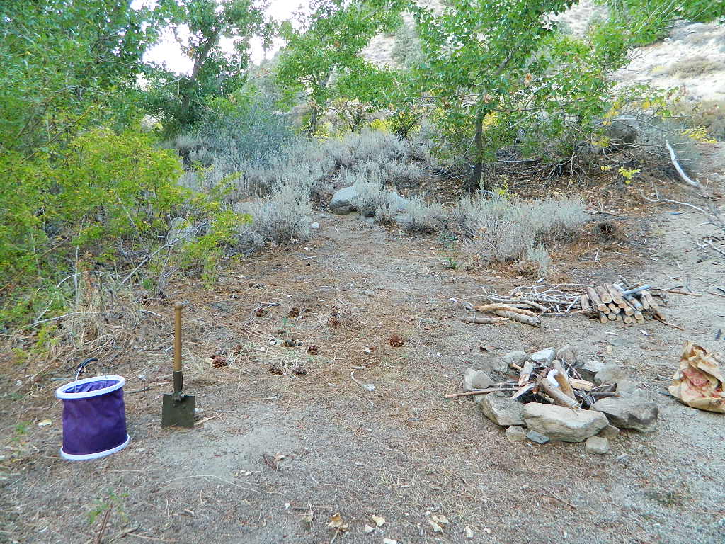
primitive camp sites –the bare minimum. a clearing for a tent, maybe a fire ring. no toilet, no fees; dirt road access.
campfire permits required. And it is up to you to know the current fire restrictions in the area you seek to camp overnight.
The further out you are willing to drive, the more remote you can be. Good topo maps of the region help you to find these ultimate, secret camping spots. National Forests & BLM Lands require a free camp fire permit to have a campfire.
Fire safety is always a big concern in wildfire prone areas like California. Additional Permits & Passes may be needed in some forests or parks; each location is different. Check with the local ranger station for up to date restrictions.
Many dirt roads lead avid campers to the best out-of-the-way camp sites. Camps may have picnic tables or just a fire ring, but usually NO toilets. Have the “No Bathroom Blues”? Don’t sweat it. check out the page onCamp Potty
Some camp sites are as bare as a small clearing, a rock fire ring if you’re lucky. A detailed backcountry map is always advised. If you count on your digital mobile device and online access for mapping, you could find yourself very lost. GoogleMaps is known for mislabeling the smallest of back roads – and they do not feature dirt roads either.
Turtle Mountain Road, SoCal
A high clearance vehicle may be needed to reach certain camp spots, but many can be accessed with a standard passenger car. Low riders will likely bottom out and motorcycle riders will get dusty.
Know your vehicles limitations for any off-road use and don’t get stuck in a bad situation. Soft sand is quite common in deserts and 4×4 might be needed. There aren’t any tow trucks out in the boonies and if you do find one, it’ll cost you something fierce. Watch for large rocks, deep ruts or tree limbs in the road (at any time) and watch low overhanging branches when driving a motorhome in to such spots. Some dedicated, hard-core RV campers prefer to camp in remote locations.
Southern California has something called yellow post camps, but we’ve really ONLY seen them inside San Bernardino National Forest areas, which includes Idyllwild and Mount San Jacinto, plus all the Big Bear Lake Mountains.
YELLOW STICK? These are fire safe spots w/ picnic table; secluded in the forest, some accessible by passenger cars, while other camps require a 4×4 to reach. Yellow post sites campfires are often off limits during fire restrictions, when only fires are allowed inside the larger developed campgrounds.
dirt road and trailheads
Backpackers trailheads often have a few camp sites near the parking lot, but these may be busy during summer months. Dirt roads leading to trailheads can have primitive camp sites along them as well. Long, big creeks in the forests are notorious for having awesome camp sites. Big river camp sites are sometimes free, if you know where to look. Sometimes the smallest of California campgrounds have no charge, first come, first serve (BLM, National Forest, or State run).
Before it got labeled BOONDOCKING: Primitive Camping in remote spots was what we lived for. Camp outside of developed campgrounds, for free. Campfires will usually be banned on these back roads during the driest part of the year. Check with local ranger stations for current fire restrictions.
Inyo High Country RoadsMcCloud #39N06 – Grizzly Peak Lookout Rd
pros and cons
possible dirt road access, seclusion, privacy, darker skies, no fees, no crowds, real peace & quiet
no toilet, no picnic tables, no pavement, no hospital, a long hike out, no cell phone service?
always be prepared to hike out (if need be).a giant tree can come down and block your exit road. landslides often happen on dirt back roads. the vehicle could break down or become disabled. get a topographic map and know how to read the terrain, without your device/phone.
PAY extra close attention when driving in (visually with terrain and your eyes and your map). You never know when you may need to back track – or turn around to find a PLAN B campsite.
Avid camper people are indeed known to GPS waypoint their favorite pick campsites (way on the back roads), so they can arrive after work, in the dark, on a Thursday night. Now that’s planning ahead!
California has many different National Forest districts and each region has their own fire restrictions. State Parks & BLM also manages recreation areas & camping in the Golden State. Each agency & region has different rules, so blanket answers cannot apply to general questions on campfires.
CAMPFIRE PERMITS
Campfire permits are required for fires outside of designated recreation sites. During fire restrictions, campfires could be banned. Campfire Permit are available from Forest Service, CalFire or BLM offices or online, http://www.preventwildfireca.org/
Manter Fire [2000], Dome Land Wilderness, Southern Sierra Nevada
the new abnormal
California suffers more from wildfires now than ever before. Native tribes let lightning strike wild fires burn and they did not suppress wildfire. Residential development creeping ever higher and denser into the foothills, an abundance of roadways, with the overgrown forest make fire danger ever more real.
Closed off wilderness areas, impassable dirt roads, landslides, fallen trees everywhere. Utility services (power lines), plus high winds and overgrown forest also play a huge part in the current wildfire catastrophes. Drought conditions or record winter rains, the huge population on the west coast -along with many other factors – means more fire danger. Educate yourself and others on fire safety, forests and weather patterns. Heed the wind, while in the wild. Wind spreads fire easily!
By mid summer we have usually have several wild land fires burning, which means campfire restrictions are usually in place before JULY 4th weekend. When this happens – No open campfires are allowed in the backcountry or on the back roads.
Often in the driest of years, no campfires are allowed (even inside the campgrounds).
If you love to primitive camp outside of developed campgrounds, you need to plan more road trips for spring time & autumn. Or head further north, well above Redding – where the forest are moist and snow graces Mount Shasta year round. Or perhaps, go desert camping during winter months. Checking the National Forest web sites can be confusing and their online information could be outdated.
Each forest and area is individually managed. No concise, easy-to-read list or online map exist on which forests are allowing backcountry campfires – and which ones are not. Conditions seem to change so often and they aren’t great about updating those .gov web sites. Best to call a local ranger station and ask about any current fire restrictions. You know, actually “talk on a phone” to a USFS, BLM or CalFire official. If you can speak to a field ranger, they can tell you more on dispersed camping. Or you can navigate the USDA web site to find current ALERTS & RESTRICTIONS. Cryptic lingo may be encountered, and many clicks maybe needed; possibly forcing you to download a PDF of current fire rules.
Sherman’s Pass, Sequoia National Forest
Big Meadow borders Dome Land Wilderness
in the Southern Sierra Nevada mountains
There are many large and gorgeous meadows inside Sequoia National Forest, but none compare in ‘grandeur’ to this southern Sierra public pasture. BIG MEADOW KERN
Find your way north of Kernville and the river really comes into view. Up close, right there! Stop, get out of the vehicle for a stretch break and breathe; take it all in. This is only the start of the adventure. Gorgeous Big Meadow is located up on the Kern Plateau, 3000′ above the river on the eastern ridges. Only accessible half the year due to snow, this meadow is a must see for those exploring the eastern side of the Kern River.
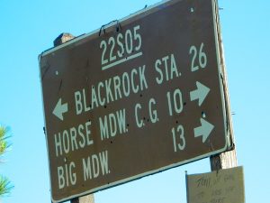
Sherman’s Pass Road #22S05 is a hard right turn after the Johnsondale Bridge. It is well signed and still easy to miss. Climb out of the dryness and into the dense forests and meadows of higher altitudes. Driving this southern Sierra-crossing route, Sherman’s Pass Rd. will require all of your concentration. Steep, curvy road without guard rails. Plus epic, scenic views (NOT to die for).
At this point – Rock slides, snow gates and road closure are typical in winter months. Check w/ rangers in Kernville about road conditions (before you head up this way).
The partially paved road will lead south a few miles, then becomes GRADED DIRT and ventures another 15+ miles – way, way out into dead-end territories. Not one road connects down to Lake Isabella!
Spur roads (all one lane, dirt roads) lead out to various places like – Cherry Hill, Big Meadow, Horse Meadow Campground, Dome Land Wilderness Trailheads, Manter Meadow, Salmon Creek Falls, Cannel Meadows, dozens of trails and spurs. Plenty of primitive camping back in these forest areas. A high clearance rig may be required the further back you go. Mud and snow are quite common in spring and fall.
Extra Large Camp Sites
BIG MEADOW is a favorite camp area among –
backpackers (trailheads)
equestrian (horse campers)
hunters
mountain bikers
off-road campers
westside drive: ample parking and camping for horse trailers
no ‘froading on meadows
Back Loop Road, around the Big Meadow. Narrow & muddy
Or perhaps this is not the Big Meadow near Sequoia that you are seeking. The scenic, giant, public horse pasture listed above is not to be confused with #14S11 Big Meadows Road, also in National Forest land, located in between popular Sequoia National Park and Kings Canyon. (100 miles north of here)
Yosemite is a top destination, all year long. California masses converge on the sacred valley each summer, so expect more as the buses keep rolling in. Plan a Yosemite trip before Memorial Day weekend – or after Labor Day weekend, for less people.
Camping close to Yosemite National Park without being inside the park boundaries. The scenery and wildness doesn’t stop in the back country. There are numerous National Forests surrounding the popular National Park, so much public land has been set aside for these recreation purposes. Granite-lined mountain meadows, dense forests, raging creeks, wildlife and real seclusion. Plenty of great paved back roads, dirt roads and camping options in the Sierra Nevada.
No campground reservations needed, cheaper fees (or free), less crowds, less noise. More freedom, more privacy, more nature.
Hundreds of developed, small campgrounds can be found around Yosemite. A few private RV resorts, cabin rentals, lodging on the main highways. Primitive style camping is considered “camping outside of developed campgrounds”. USDA National Forests usually allows open-camping within the forest boundary – with a required camp fire permit. Sometimes wildfire danger is too extreme, so they often ban campfires in dry conditions.
Gold Country Foothills – listed below are valley reservoirs. Oaks, dry hills, which can can be super hot in summer. Boating, camping and water recreation can be found at most Reservoirs, out in these parts.
Tioga Pass on Hwy 120 (elevation 9410′) is only open during summer months. Generally June through October. Always check road conditions before your trip.
Camping Hiking Lakes @ Tioga Very high elevation meadows, aspen groves, snowmelt lakes. Just east of Yosemite National Park border, near the EAST GATE, inside Inyo National Forest
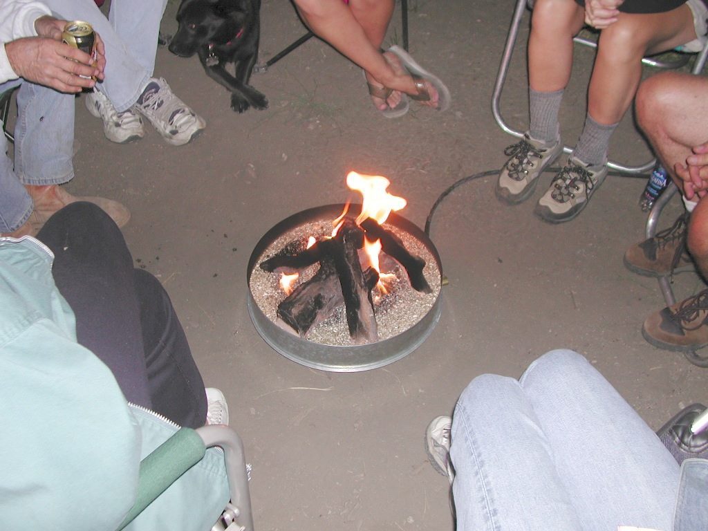
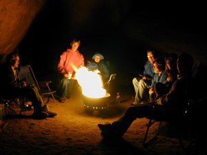
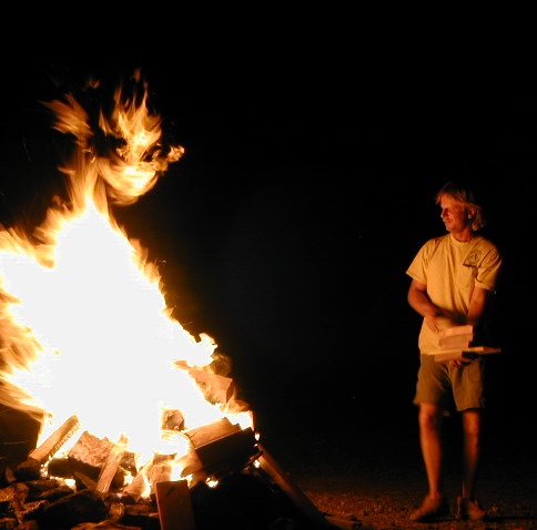
Deserts & beaches are the only places for bonfires.
kill your television
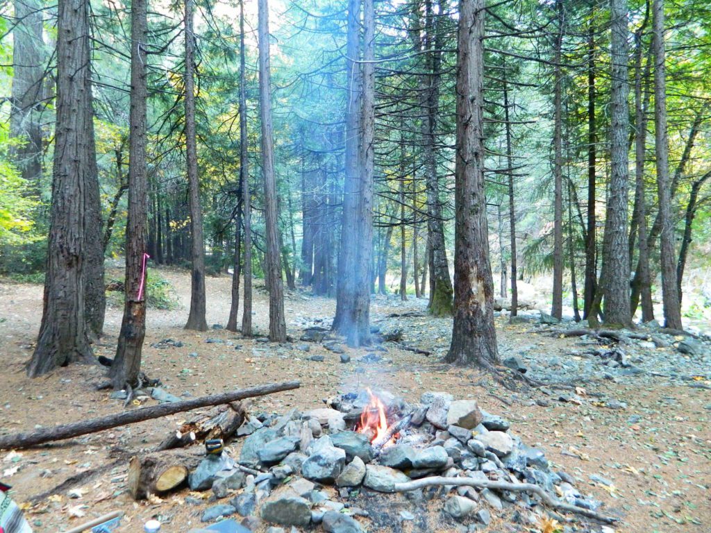
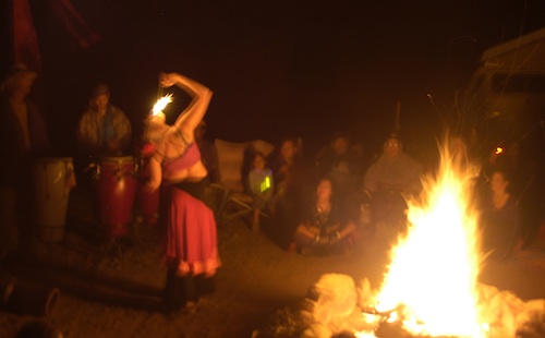
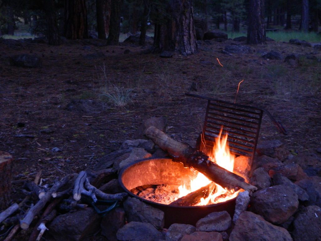
The heat source, the light source, the cook source, the sock drier, the night supplier, the outdoor LIVING ROOM. The campfire is the center stage for all entertainment, dining, drinking, music, true tales and ghost stories alike.
Since the beginning of time humans have gathered around the campfire at dark. This nightly ritual is built into us on the deepest level. We miss this today. We miss the real conversations, the community, the bonding, the stories, the soul searching. We miss the connection with nature, the fresh air and the great outdoors. The night sky filled with stars and maybe a meteor shower, a hot drink and the glow of the campfire coals. Enjoying the wilderness requires certain skills. FIRE is only ONE skill – for survival, for cooking, for warmth, for safety.
Total Escape is dedicated to those who yearn to camp, often.
photo – Charlie Sweeney 2010
Some folks cannot imagine camping without a campfire, but we better get used to it here on the West Coast. Weather patterns swing from years of super-dry drought to deluge and drenching – as we’ve seen of recent in California. Dry conditions means high wildfire dangers, tight camp stove and strict campfire restrictions.
Each California region, National Forests and State Parks have their own fire restrictions, so call ahead to rangers for current fire conditions on the place you wish to visit. Certain mountain locations will ban fires in the back country, fires on the back roads and sometimes in extreme conditions, no fires allowed even inside a developed campground.
Sagebrush could be cleared back another few feet, at least.
Campfire Restrictions
California is well known for its unforgiving drought conditions and its seasonal wildfire danger. Always know the fire conditions in the area you plan to camp. Most Southern California regions have banned ‘open campfires’ in forested areas, due to wildfire threat and population density. Call ahead to get an update on road closures and current campfire restrictions. Find California BLM offices & NFS ranger stations
Campfire Permits
If you plan on camping outside of a developed campground, you will need to get a free “camp fire permit”, which can be obtained at the local rangers office.
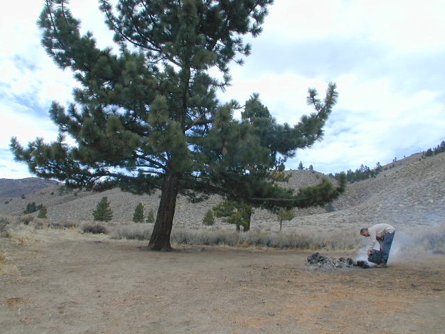
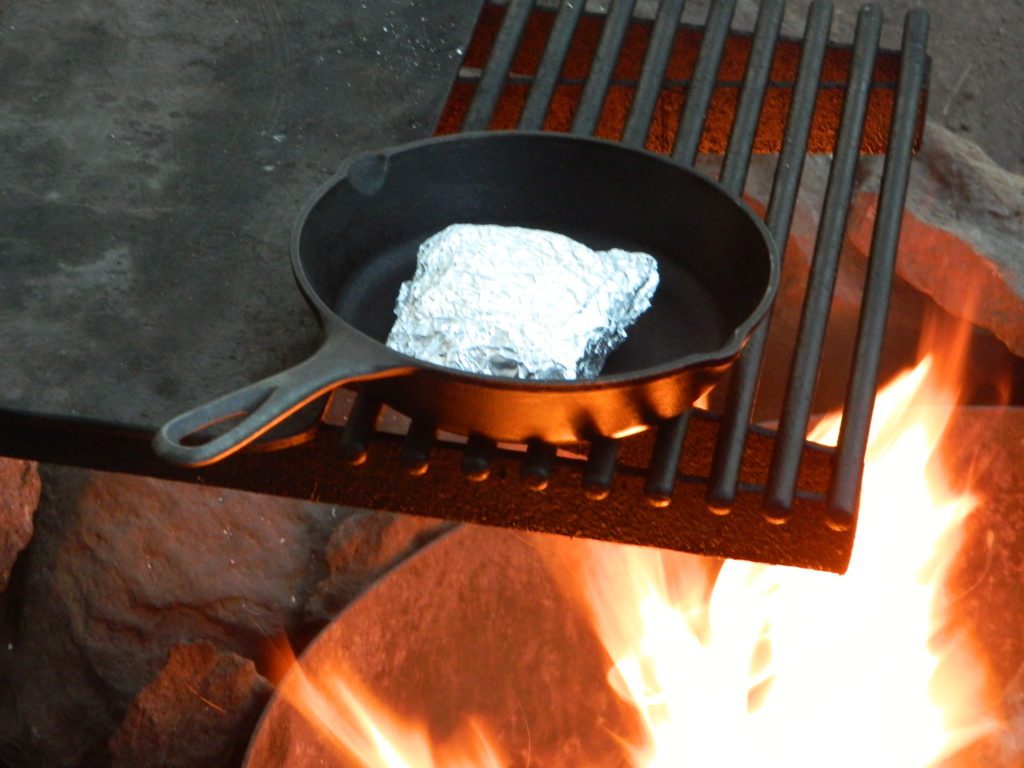
Build campfires in designated rings. Always try to use an existing ring when possible. If you must build a new rock fire ring, follow the guide on FireSafe
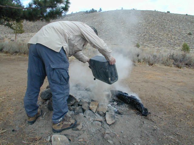
You will need water source & bucket, plus a decent shovel for building, maintaining and controlling a campfire. BRING enough water & tools with you to control a fire.
A ten foot clearance – all around, down to the bare dirt is the best practice. No brush close to the ring, no bushes, no leaves or pine needles. No dry over-hanging tree branches.
You might need to clean trash out of the fire pit, so bring heavy duty trash bags, or a spare old box. Shovel comes in handy here.
Kindling is key to getting a good fire going fast, so gather more of the small stuff. Wood gathering away from camp is usually better pickens.
Use environmentally friendly fire starters (with damp wood, if you must); not the BBQ lighter fluid or gasoline
Building fires up against a big boulder scars them w/ black soot, and although it can reflect heat back to you, it is seldom worth the unsightly damage
Bring chainsaws or hand saws for cutting your own campfire wood in the forest
Gathering wood for fuel — use only dead and down wood
A ranger issued “wood cutting permit” is required if you plan on cutting a full cord
Never burn plastics, batteries or other toxic materials in campfires
Tossing beer bottle caps into a campfire only litters site for future campers
While glass bottle smelting is a real treat among boys at night, which one is actually gonna get their hands dirty & clean up broken glass out of the campfire the following morning?
Do not leave any hot coals during the day (if you are away from camp). Winds could pick up.
Always douse campfire with water completely when breaking camp. Stir it, feel for heat, and drown it more if you hear sizzling or see bubbling.
Read more wild fire / campfire info on our FireSafe page
The Final Step of Breaking Camp
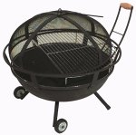
Campfire Pits & Fire Containers
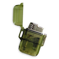
Stormproof Lighters
Developed Campgrounds offer sturdy, permanent, metal campfire pits. Many have adjustable grills built in.Primitive Camping is allowed in National Forests throughout California. Campfire permits are required. This style of camping is more peaceful and secluded, without neighbors, without fees and without amenities (no table, no fire ring, no toilet)
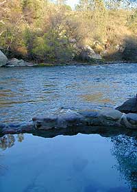
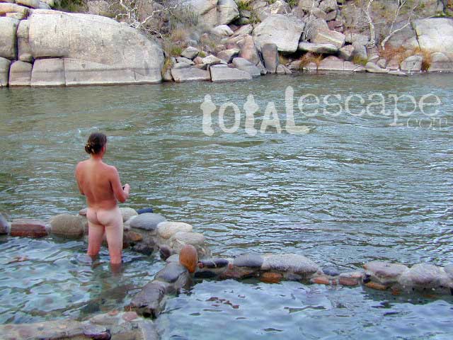
This place was the alternate choice to Miracle Hot Springs, but since that one is now closed – this is the main attraction out here, along the lower stretch of the Kern River.
USFS Forest Hobo Campground is about a mile away and it may be closed due to landslide repairs. There is also plenty primitive style camping options if you so choose.
Remington is by far, one of the nicest primitive hot tubs in the whole region and easy to access. If you can find it, the rewards are great!! Can be crowded on weekends. If the dirt parking lot is totally full, come back later or wait it out. You can find travelers, mountain bikers, dirt bikers, hikers, backpackers, campers, off-roaders, RVers, burners, desert rats, military boys, local kids, LA couples, techno DJs from Russia – a wide variety of people soaking at this not-so-secret spot.
These unique hand-crafted stone tubs are located on the Lower Kern, overlooking the big river and the fish. 3 volunteer built cement & river rock hot spring pools sit adjacent to the Kern River. There is also another small cooler tub on the trail perched above the thick brush.
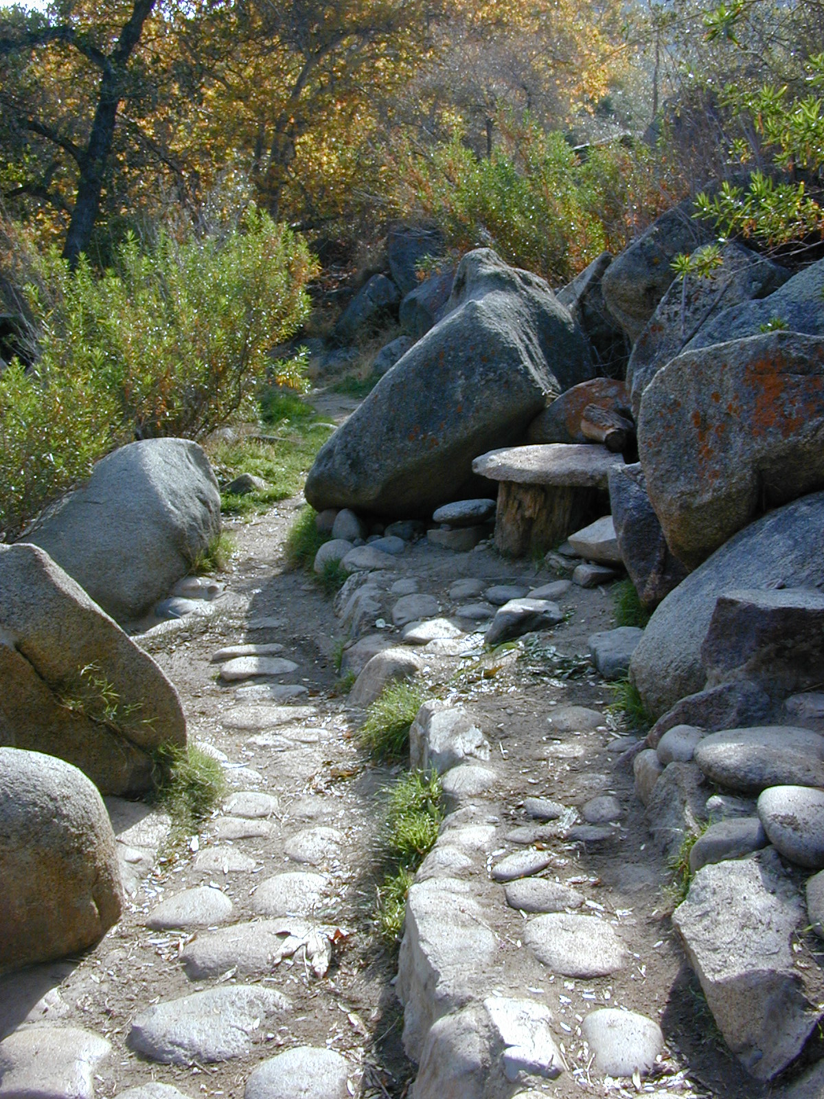
This prime recreation spot is located a few miles west of Hobo Campground (old Miracle Hot Springs) is sometimes busy: dirt parking lot, minimal sign & the tubs are not viewable from the road. From parking area you must hike down a steep grassy trail for about a mile.
Bring towels, beverages & everything you will need from the vehicle, as turning around to go back & get everything half way down will prove to be a challenging trail up. Boulders & oaks on steep hillsides. A few campsites down along main trail. Wildflowers here are wonderful in Spring (April-May). Please pick up litter & keep this place beautiful.
West of Kernville & Lake Isabella, CA
along Kern River in the Lower Kern Canyon Gorge, Southern Sierra Nevada mountains
Remington primitive hot springs are located inside the lower Kern Canyon, southwestern part of Sequoia National Forest. Take Highway 178 east to the 4 lane portion, look for Borel Road right turn which climbs a steep hill up to Old Kern Canyon Road. At this stop sign you will see a sign for Remington Trail (3.5 miles) pointing to the right.
Remington Trailhead (signed) & dirt parking lot across from trail, is located on Old Kern Canyon Rd, which runs parallel to the 4-laner Hwy. 178 on the opposite side of the Kern River. The well known Kern Canyon Road is also labeled as “Cort 214” on GoogleMaps.
Remington Ridge Trail #32E51 – Mountain bike, hike and horseback trail
Breckenridge Road #28S06, access via Havilah, CA. Breckenridge has pine forest at higher elevation, and is the tallest mountain to the south of Kern River.
Minimal camping spots with very little privacy at the main dirt parking lot at Remington Hot Springs. The best tent camping is located down on the trails, so you may choose to hike-in to the secluded oaks to the sandy beach camps below. No facilities at Remington, no tables, no toilets, no electricity, so come very prepared to “rough it”.
USFS Sandy Flat Campground and Hobo Campground are a few miles away (to the east), on the same Kern Cyn Road; Breckenridge Campground is on a tall pine forested ridge just to the south, but requires a long drive around the mountain, or a super rugged 4WD vehicle for a steep dirt road.
Folks seeking more seclusion can choose to primitive camp along the narrow paved road leading to the west. Motorhome campers like the option of road side boondocking with great views; several level pullouts can accommodate most any camper. 4×4 camping is closer to Lake Isabella @ Keyesville or BLM River Camping. Primitive camp spots on numerous dirt roads are located in this Lower Kern River area, but you will need to check with Sequoia National Forest ranger for gate closures, fire permit & fire current restrictions.
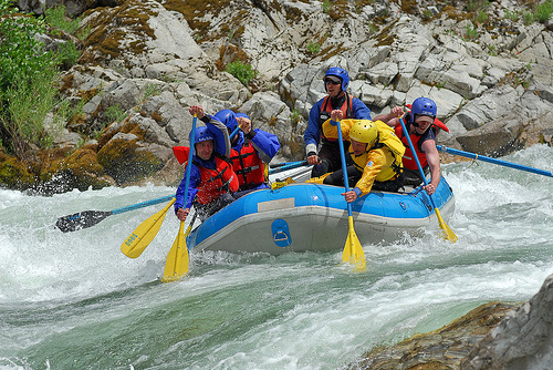
One of the most remote & biologically intact watersheds left inside California. The headwaters of the Salmon River flow from the Trinity Alps, Marble Mountains, and the Russian Wilderness Areas. 850,000 acres of Wilderness surrounding the Salmon River watershed.
You gotta know how to read a map if you wanna find this hidden gem. For those who love seclusion! This NorCal river region is a prime destination for true nature lovers: campers, hikers, fishermen, river rafters, river kayakers, mountain bikers, backpackers, birdwatchers and horse enthusiasts. Summer is the busiest time and of course, the best weather. The remainder of the year, you’ll basically have the place all to yourself. Winters can be wet and sloppy, so don’t get stuck in the mud. Cell phone reception is minimal in these densely forested backwoods.
Rafting, river beaches, kayak spots. Campground camping, RV camping, tent camping, primitive and wilderness too.
A significant part of the Klamath River’s watershed is in the Karuk Tribe’s Ancestral Territory. Karuk Indians have carefully managed their lands through an integrated continuum with the aquatic and terrestrial ecosystem functions for thousands of years. Salmon, or “Ama” in the Karuk language, was a major source of food and spiritual renewal.
This is one of many small lakes situated within the Lakes Basin Recreation Area , in the Northern Sierra Nevada mountains. Just north of Downieville & Historic Gold Country. Snag Lake is nothing special compared to the rest of the scenic lakes close by, but it is worth a mention due to a few fun facts.
One thing this small lake campground does have is convenience, located right on the Gold Lake Highway – next to Goose Lake, plus hiking distance to the largest of the lakes, Gold Lake. The second feature is the campground is small, 16 primitive sites, picnic tables & one vault toilet. The third thing is that this is a FREE campground; no charge.
Snag Lake Campground
• Elevation: 6600′
• Number of Sites: 16
• Vehicle Accessibility: Small RVs
• Campsites Reservation: No
• Camp Fee: No
• Length of Stay: 14 Days
• Season: June – October
• Trailheads: Gold Lake
dirt drive (no pavement)
No motorized boats allowed. No paved boat ramps. Kayaks & canoes can hand launch from several spots. The dirt driveway is easily missed, especially at night. The old wooden, forest service sign is not reflective. The vault toilet is close to the highway and the camp sites are along the lake edge. No pavement anywhere!
Upon arrival, camper trailers will want to get out and select the best route to a camp site. The small boulders, dead trees, root and rock obstacles are abundant on the dirt road entry, all around the campground, and at each camp site. High clearance vehicles would fair best at this camp, but some passenger cars may be able to manage the rocky entrance. Get out and look at the road, before scraping across the biggest rock. Slowly, carefully, maybe… and preferably an arrival before dark.
LOCALS TIP: The wind tends to pick up at night around these lakes, so brace your tent well and position your vehicle appropriately.
fishing lake?
Obviously with a name like SNAG, you can imagine that the fishing here is not the best, since roots and old tree stumps make up a good portion of the shoreline. Luckily there are a dozen alpine lakes within a 20 mile radius to choose from for another fishing spot. Some lakes are hike-in only, some require 4×4 to reach and others have cabin resorts.
Gold Lake Hwy (or Gold Lake Road) closes in the winter months (NOV-APRIL) due to snow and the region is used as a winter recreation area. Cross-country skiing and snow-mobiling are both popular activities.
Lassen – Snag Lake
ANOTHER SNAG LAKE in NorCal, can be found by foot, hiking into the Lassen Volcanic Wilderness. Backpacking the lake loop is approx 17 miles RT and includes 3 lakes – Snag Lake, Widow Lake, and Jakey Lake. Trailhead is located at Juniper Lake, at the north shore.
Best of both worlds, way back in the boonies – two primitive tubs soaking perched on a soggy hill next to a big river, developed campground below, and a small resort w/ cabins, camping, restaurant and private soaking areas on the other side of the river.
15 mi. NE of Huntington Lake off Kaiser Pass Rd. Huntington Lake & Hwy. 168
Two squared cement tubs overlooking the San Joaquin River, deep in the Sierra Nevada Mountains.
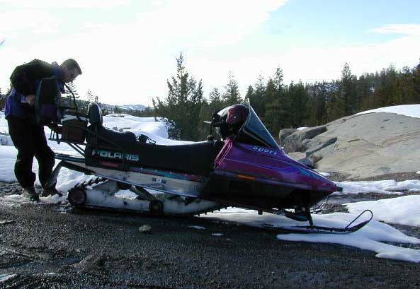
The coolest thing about this primitive hot springs is that it is a great destination for a one day snowmobile adventure. Rentals are in the nearby community of Lakeshore & the plowed paths are fairly easy to follow. If you plan on visiting the springs, you must not play around in the meadow much, there is plenty great Sierra scenery to be had. The snomo trip is a good 5 hours round trip with a lunch break & dip at mineral spring tubs.
backpacking
boating
camping
cross country skiing
fishing
hiking
horseback
kayaking
mountain biking
mountaineering
snow mobiling
stargazing
swimming
Sierra Snow-Mobilin’
Winter: road is closed half the year due to heavy snow. Summer: snow is gone and the road is open.
KAISER PASS ROAD Large motorhomes, RVs are not allowed on this long, steep, narrow paved route.
Max vehicle length: 25 feet
Take Hwy.168, turn right on Kaiser Pass Rd, just past the big ski resort. Pass the large meadow & follow signs to Mono Springs & Lake Edison. Make sure not to miss the left turn or you may end up at Florence Lake.
Parking near the green bridge over the San Joaquin River & hike over to the tubs on the hillsides. If there are other vehicles parked here, expect to see naked people nearby; Soaking should never be rushed. Clothing is optional – in California.
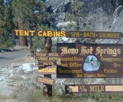
Mono Hot Springs Campground NFS
• Elevation: 6700′
• Number of Sites: 30
• Vehicle Accessibility: RV 25′
• Camp Fee: Yes
• Campsite Reservation: Yes
• Toilet: Vault
• Length of Stay: 14 Days
• Season: June – September
• Trailheads: Ansel Adams & John Muir Wilderness
NOTE: This USFS Campground, should not to be confused with the neighboring business, a privately run camp called –
Winter wet weather doesn’t need to put a damper on your outdoor exploring, if you can get your hands on a 4×4 vehicle. Almost any SUV or truck with 4 wheel drive is capable of driving through some snow or mud. Just how deep is the mud (underneath the snow) is usually the big question. Many National Forests and State Parks close certain dirt roads due to over-use, or to control soil erosion and prevent the deep muddy ruts which are costly to re-grade come springtime. Call ahead to the rangers to find which back road routes are indeed open, or bring your printed topo map and wing it.
The California destinations listed below are popular winter spots for off roading enthusiasts. Some places may be busier than others. The dirt roads surrounding these spots are real treasures, so try to plan an all-day loop trip if possible. Camping w/ a campfire permit is an option on many back roads. Plenty lodging in nearby small towns if winter camping is not your thing.
Tribal lands are mostly located in rural regions which always have plenty of dirt roads to explore. Get a good back roads map for the public lands nearby, parks, BLM, National Forest. If the overnight camping is dropping into the twenties or teens, then know the forecast. A good rule of thumb for California hotel stays: If the low temps overnight are below the cost of a hotel room at the nearby casino, the comfy lodge might be well worth considering.
Avi Casino
@ California – Arizona border.
The Laughlin casino in the middle of nowhere, right on the Colorado River. Jet ski rentals, swimming pools and spas, restaurants, RV park. The historic Mojave Trail, aka Mojave Road, starts next to the property.
Gold Country Casino
@ Lake Oroville, California
Sierra Nevada mountains Northern California. Conveniently located near Feather River (all 4 forks) and Plumas National Forest, with Berry Creek and Bucks Lake Wilderness to explore. Snow often closes the highest elevations.
Viejas Casino
@ Pine Valley, East County San Diego
Great bouldered mountains with back road exploring, hiking, mountain biking trails, all easy access from Southern California. Get a Cleveland National Forest map and expect some road closures near Laguna Mountain Sunrise Highway, especially when it snows.
Diamond Mountain Casino
Susanville, Northern California
Located in between US Highway 395 and Mount Lassen, the scenic Susan River region has lots to offer for the outdoor enthusiasts. Plenty of roads to explore, some big lakes too. Many Forest roads could be closed due to snow, so be warned and call ahead to the ranger.
The whole Carson City area in Nevada has some excellent dirt roads to explore. Old mines, caves, many miles of pinyon forests. Lake Tahoe is nearby with luxury resorts, casinos and snow skiing.
If you just can’t stand the cold and snow, then warmer climates lie to the south. Baja California is a tourist/traveler and off-roader haven in the wintertime.
Holiday Wheeling
Jawbone Canyon for Thanksgiving weekend will get dirt bikes by the thousands and big families. Christmas is busy around the Palm Spring desert destinations – like Joshua Tree. Easter weekend is popular w/ wildflowers and campers in Anza Borrego Desert.
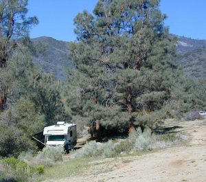
RV camping
Occasionally, wide graded dirt roads lead to secondary routes, so overnighting it with a motorhome on the back roads is very possible (if deep mud is not present). RV camping is quite the tradition for Southern Californians. Desert off roaders in tow, all over the Mojave. Steer clear of busy family groups. Pick a lesser known area to camp and explore. Get your real topo maps out and choose easy access from pavement, but wide graded dirt roads are best. Plenty roads like this in the Eastern Sierra, on the east side of US Hwy 395. RV campers that follow Total Escape might very well be interested in testing the limits of their recreational vehicle, slowly.
AWD Sportwagons
Before AWD got marketed as 4WD, Total Escape was way out there exploring in a 2 wheel drive and posting it online for you. All wheel drive station wagons should stick to the paved and plowed roads. If you plan to do a lotta dirt road driving in the old Subaru, keep the rock crawling to a minimum. If not, you may want to invest in a skid plate for the oil pan. Nothing beats first hand experience and learning ahead of time how your car will behave before you loose control on icy dark steep roads. Go practice with the emergency break and get the vehicle in a wide open snow plowed area if possible, just avoid the temptations to get wild. Don’t get the doughnut urge and plant yourself in a tree. Remember, it’s not like the commercial showed us, those are closed roads they are filming on.
Snow Chains
If you plan to be off roading in snow or mud at all you might want to consider some important safety items: tire chains for snow, a tow strap and tire plugs for flats. If you own a high clearance 2WD SUV, you could benefit from running chains on all four tires when snow is present. How deep the snow gets and how steep the hills are, determines how far you can go without a real 4 wheel drive. Some choose to rent a 4WD for the weekend road trip.
Snow Plow First Pass
Carry these items when traveling in winter conditions:
tools, jumper cables, tow strap, emergency gear, first aid kit, real boots, extra clothes, blankets, flashlights, food, drinking water, cell phone, maps
Eastern Sierra Nevada – Inyo Mountains
Inyo Forest Back Roads – Mammoth Off Road
Off Road near US Highway 395. Yep, Olancha has some OHV (off-road) areas near the dunes, but this web site is dedicated to the real deal, the scenery, the trail heads, the hot springs, great secluded camping & of course, back road exploring.
You will need a Inyo National Forest map to discover these back roads. These are minimally traveled routes, un-maintained, sometimes washed out, eroded & maybe even creek crossings (without a bridge). Some gravel two-lane routes, some one lane roads leading deep into dead end canyons.
A few popular routes are paved, but most of these listed are indeed dirt roads. Some may require high clearance vehicle, or even 4×4. Know your vehicles limitations & be prepared to turn back when the road worsens. Cuz more often than not, it’s a sign of what more difficult terrain is to come.
Watch out for live stock – they are dumber than they look.
Owenyo Rd – Wanna parallel the highway (395) on dirt; Sure, it’s a long bumpy route – from Hwy 136 @ Dolomite to Bend City @ Mazourka Cyn.
Road# 13S05 – Mazourka Canyon Rd – leads up to some old mining camps & way behind Mazourka Peak (9410′) deep into the Inyo mountains. It’s all desert on this side, but these canyons have pinyons & more vegetation than you would imagine. Road# 9S15 & 9S14 circle Andrews Mountain (9460′) then join back up w/ Death Valley Rd (the North Pass into Saline Valley).
Ancient Bristlecone Pine Forest has some great dirt roads surrounding it. After you are finished with all the touristy sights & you don’t wanna spend the rest of the day in the visitors center or back at camp, try Cottonwood Canyon – full of aspens, camp sites & fishing, not cottonwood trees. 4×4 is required. Crooked Creek has boulders, boulders & more boulders. Plus some amazing camp sites with open sky views. Silver Canyon is for high clearance only, 2WD okay. This will lead you down to Laws Railroad Museum on Hwy 6, on the back side of Bishop, CA
Benton Crossing Rd (green church @ 395)
This wide road leads out to multiple dirt roads that peel off in every direction. Many Eastern Sierra Hot Springs can be found out here – on the east side of the highway. No hot spring resorts, no facilities, no clothing & very primitive.
Bishop 4×4 route Coyote Flat
Coyote Wash leads up to Coyote Flat & out to Coyote Lake. This a a spectacular high altitude plateau overlooks the Owens Valley & requires 4 wheel drive just to get up there. Pinyons, junipers, aspens, wildflower meadows, old mines, & yes, lakes at 11,000′ elevation. Views of the High Sierra & South Lake.
Buttermilk Road – This dirt road is north turn off of Hwy 168, W of Bishop, CA. “The Buttermilks” are a popular spot among rock climbers. A great place for indian petroglyphs too!
Road# 9S21 – Glacier Lodge Road – Paved road. Creek exploring & fishing. Plenty Campgrounds. W of Big Pine CA
Horseshoe Meadows Rd – Paved route with great views over Owens dry lake bed; access via Lone Pine CA; A nice day trip to meadows & High Sierra scenery. Picnic & day hike!
McMurray Meadows Rd – south off of Glacier Lodge Rd (#9S21) just W of Big Pine CA. You can find ancient cinder cone volcanoes & cave-like lava tubes in between this long dirt road & the highway.
Monache Meadows is a high elevation meadow that takes some time & determination to get to. This area is part of the Inyo National Forest, but can be accessed by either: backpacking thru the high Sierra’s or driving a high clearance vehicle thru Sequoia NF # 22S05 Sherman Pass Road, behind the Black Rock Ranger Station & Troy Meadows Campground. High clearance is needed, 4×4 maybe. Great camping sites near Olancha Peak trailhead. The area is surrounded by Golden Trout Wilderness & South Sierra Wilderness. From US Highway 395 to Kennedy Mdws & then Monache is a full day of exploring, so you may as well stay the night up there. But bring warm gear, a campfire permit & a capable vehicle.
Manzanar Routes – Back behind Manzanar Camp there are miles of dirt roads to explore. Many creeks side camp sites can be found even with a passenger car. Small trees & sage brush. Secluded camping (for free) is possible in the Eastern Sierra.
Mono Craters (Rd# 1N11) – the youngest mountain range on the continent. Just south of Mono Lake, this route skirts the pumice cones & climbs over the Aeolian Buttes, before it meets back up with Hwy 395.
Walker Creek Rd #19S01 – Oaks & creek. South of Olancha CA, look for turn off & follow dirt road up into the tight canyon.
Inyo Road# 6S16 – Pine Creek Road – Creek exploring & fishing. NW of Bishop behind Rovana, also known as Round Valley, CA
Road# 4S02 – Owens Gorge Road – N of Bishop behind Lake Crowley. Camping w/ boulders & pines. Good open sky views for stargazing.
Road# 4S86 (Inyo Rd #28E201) – Laurel Lakes Road – Camp in aspens @ Laurel lakes, high elevation; access to alpine lake trailheads; SE of Mammoth Lakes, CA
Road# 2S05 – Deadman Creek – Creek fishing in forest. N of Mammoth
Road# 2S07 – Owens River Road – Pine forest, near hot springs; no facilities. N of Mammoth
Road# 1S63 – June Lake Loop is CA SR 158 (Hwy 158) paved main route, which is often closed for winter months, due to deep snow.
Road# 1N17North of June Lake Loop; dirt road access to Parker Lakes & Walker Lake trailheads; Side canyon routes offer (unmarked) picnic areas and fishing spots; few primitive camping options.
Road# 1S25A Parker Lakes Road– Aspen & pine forest, near creeks; E of Grant Lake / N of June Lake
Road# 1S23 Walker Lake Road – Pine forest route to Walker Lake; E of Grant Lake / N of June Lake
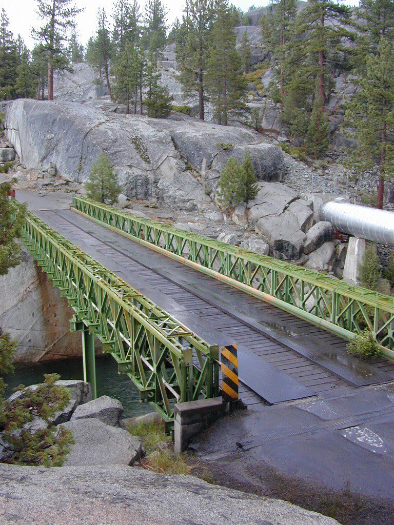
Kings River, Sierra National Forest Road #12S01 – Lower Kings
Located in between Kings Canyon National Park and Pine Flat Reservoir. Graded dirt road w/ trailhead parking & camping; Primitive car camping, vault toilets, some areas accessible by small RV. Campfire permits are required.
Long, (sometimes rough) dirt road, that parallels the north side of the Kings River. Dirt road used by families, fishermen, kayakers, campers, mountain bikers, rafters and rafting shuttle buses, seasonally. May be gated and closed off to the public in wetter months of the year.
Bear Wallow Trailhead
Kings River Trailhead
click to enlarge
Forest Route 12S01 crosses the river and leads to the south side of the river, near Green Cabin Flat. Mill Flat Campground is back this way.
Road 12S01 gains in elevation, turns to high-clearance, continuing up McKenzie Ridge thru a small slice Sequoia National Forest to the highway Kings Canyon National Park. 4×4 may be needed in wet/snowy weather.


 No facilities such as toilets or showers. Maybe a picnic table & fire rings, if you’re lucky. Southern California
 Rentals typically include sleeping cots, but you’ll need to bring your own bedding (sleeping bags, sheets, pillows). Some rentals include shaded porches, wooden decks, minimal furniture, kitchenettes and/or wood burning stoves. Electricity may be available, or maybe not. Ask ahead of time, if you really must have that particular luxury when on vacation.
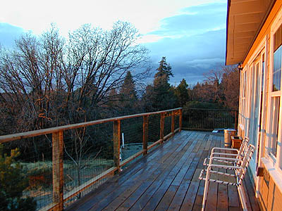


 Gold Country Foothills – listed below are valley reservoirs. Oaks, dry hills, which can can be super hot in summer. Boating, camping and water recreation can be found at most Reservoirs, out in these parts.


 Inyo Road# 6S16 – Pine Creek Road – Creek exploring & fishing. NW of Bishop behind Rovana, also known as Round Valley, CA