Tag Archives: high desert

Camping for Thanksgiving

Turkey Casserole
Turkey Leftovers?

California Camping on Thanksgiving

If you’ve had it with the traditions, the big meal prep, or just sick of the family. Maybe you are a solo traveler, or a new transplant to California and need to explore more. Take a holiday away – for once this time.

Camping for turkey day? What a concept.

VWBus Death Valley
California is the perfect place for camping, all year long!


Stick to the lower elevations, look for canyons, and seek seclusion

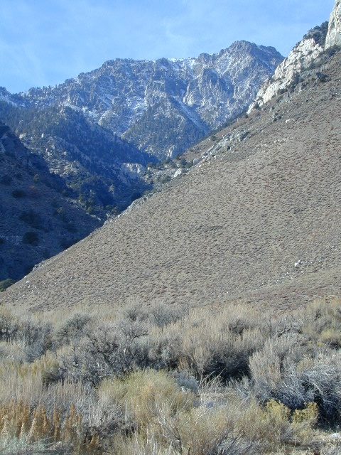
California mountains often have snow during November. Avoid camping in snow @ 4000-5000′ elevation and above; Freezing temps above 3000-4000′ elevation.

Deserts, coastal regions and foothills are top choices for late Autumn car camping. Always check the weather ahead of departure, and have a plan B as an alternative. NorCal will be much wetter than the rest of the state.

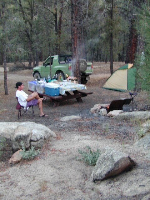
MEALS: Prepare dinner meals ahead of trip departure. Bake turkey days before your trip and create meals based around that. Make mash potatoes at home and don’t forget to bring the butter. Pack pre-baked turkey for sandwiches, plus other quick snacks & meals for on-the-go travel.

seafood
Non Traditional: Seafood Feast

Desert Camping is premium at this time of year. Luckily the eastern half of Southern Cal is desert. The lower the elevation, the better the temps will be overnight. Be prepared for wind when the ‘storm fronts’ approach, the winds do get a cranking! Dirt roads can become flowing washes during a good rainstorm, so know the weather forecast.

Coastal campgrounds may need advanced reservations. Be prepared for wet weather, especially up north. The redwoods groves are gorgeous anytime of year.

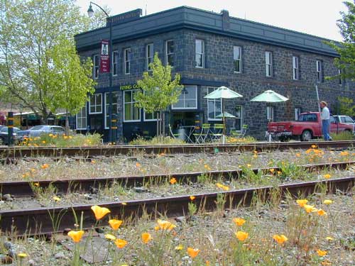
Gold County Reservoirs are prime areas for relaxing in nature, while everyone else is out shopping. Oak hills, rivers and canyons. RV campers love these large lakes; boating, fishing, mountain biking trails, kayak rentals, hiking near historic Gold Rush towns.

River Canyons of California are always beautiful destinations in the autumn months with fall leaves changing color. Many campgrounds can be found at lower elevation, river access areas.

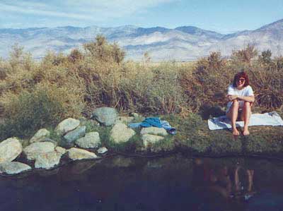
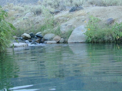
California’s abundant Hot Springs are also top picks for holiday weekends.

Joshua Tree Campout

Joshua Tree National Park may be busy during this weekend. Instead try nearby Mecca: Box Canyon and Mecca Hills Wilderness, BLM desert lands near Interstate 10.

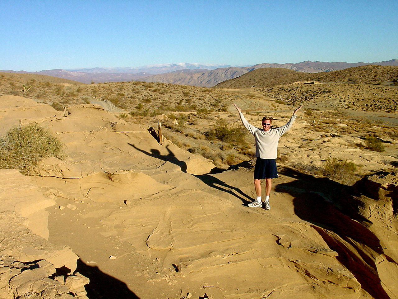
Anza Borrego Desert State Park is always a nice, easy and relatively close get-away for any holiday. Open camping on the backroads (for free) makes it one of the most attractive camping options in all of SoCal. Many dirt roads are accessible for passenger cars, if extreme caution is used. Don’t plan on driving more than a few miles on dirt.

froaders

Masses of off roaders love to camp out, especially on Thanksgiving weekend. Wheel all day, eat, drink, bon fires every night and rumor has it ‘they roast their big bird outdoors – deep in a dirt pit’. Really?

El Centro, Glamis, Imperial Dunes, Ocotillo Wells, Truckhaven Hills, Johnson Valley. All popular off roading areas in Southern California, so consider yourself warned.

Imperial Dunes

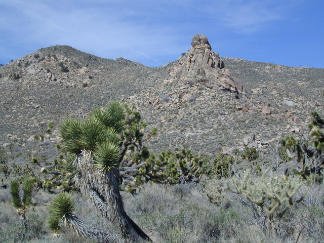
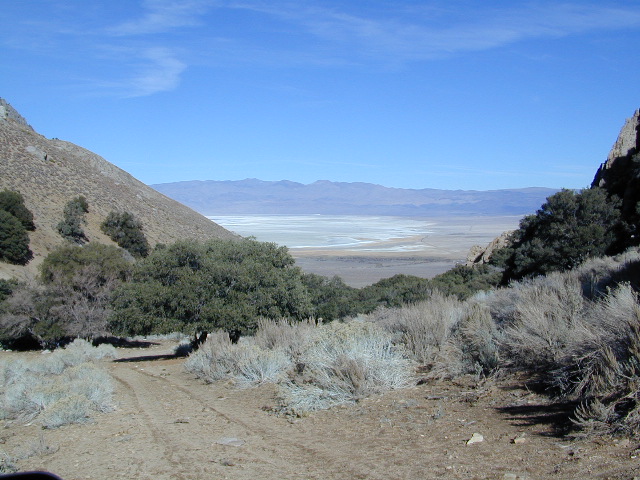
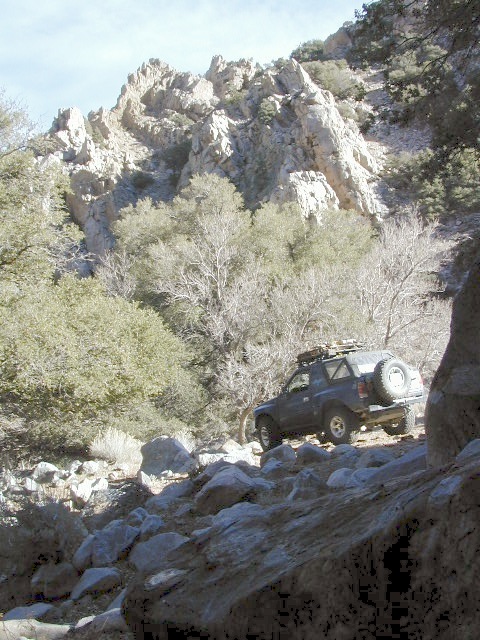
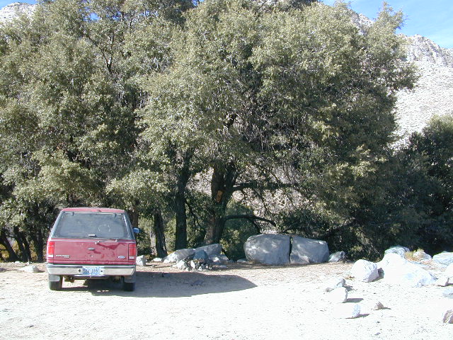
Mojave Desert, near US Hwy 395
Jawbone Canyon expect to see RVs, toy-boxes and families outside enjoying the weekend. OHV style. Often the group tries to create a round corral with their huge convoy of vehicles, to keep thru traffic to a minimum around “their camp”. Just stay well away from those gear-heads. In general, it is a very busy area around Mojave up to Hwy 178 during the holidays. Try high desert Horse Canyon instead.

Bodie State Park
Bodie State Park

Tent Camping

Death Valley National Park is one of the best destinations for Thanksgiving, cuz Panamint Springs serves their free turkey dinner.

Did someone say FREE?

Leon at Mahogany

Eastern Sierra Camping

tallpeaktower

Inyo Forest Campgrounds – Eastern Sierra Campgrounds

areas include: Lone Pine, Mount Whitney, Independence, Onion Valley, Ancient Bristlecone Pines, Big Pine, Bishop [Hwy 168], High Sierra, Owens River, Lake Crowley, Rock Creek, Mammoth Lakes [Hwy 203], June Lake Loop [Hwy 158], Lee Vining & East Yosemite National Park [Hwy 120]. Camping on Eastern Sierra Highway 395

Eastern Sierra recreation – backpacking, horse packing, day hiking, creek fishing, mountain biking, mountaineering, rock climbing

Listed below are Inyo National Forest campgrounds, County Parks, BLM public camps for outdoor recreation. Many campgrounds are closed for winter months. Blue links lead to more camp information. Boldface links to detailed information & photos on campground.

campground elev spots veg toilet water notes
Agnew Meadows 8400′ 21 pines chem piped Mammoth; Jun-Sept
Baker Creek Campground 4100′ 40 cottn vault no Big Pine, BLM; RV 30′
Big Bend Campground 7800′ 17 pines vault piped Lee Vining, April-Oct
Big Meadow 8600′ 11 pines flush piped Rock Creek; May-Oct
Big Pine Creek 9000′ 30 pines vault piped W of Big Pine; May-Oct
Big Trees Campground 7500′ 9 pines flush piped W of Bishop ; April-Sept
Bishop Park Group Camp 8400′ 20 pines flush piped No RVs;
Bishop Creek
Crowley Lake Camp 6800′ 47 sage vault piped BLM Camp; Apr-Oct
East Fork Campground 9000′ 133 aspens flush piped fishing camp Rock Creek
Ellery Lake Campground 9500′ 12 pines flush piped E Yosemite; June-Oct
Forks Campground 7800′ 8 pines flush piped W of Bishop,; April-Oct
Four Jefferey 8100′ 106 pines vault piped W of Bishop; April-Oct
Glacier View Campground 4000′ 40 cttnwd flush piped Big Pine, CA; open all yr
Goodale Creek 4000′ 43 cttnwd vault no BLM Camp; April-Nov
Grandview Campground 8600′ 26 pinyon vault no Ancient Bristlecone Pines
Grays Meadow 6000′ 52 pines flush piped W of Independence
Gull Lake Campground 7600′ 11 aspens flush piped June Loop; April-Nov
Hartley Springs 8400′ 20 pines vault no Glass Creek, June-Oct
Horseshoe Meadow 10,000′ 10 pines vault piped 1 day limit; horses; More
Horton Creek 4975′ 49 pines vault piped BLM Bishop; May-Oct
Independence Creek 4000′ 25 cottn vault no Independence, BLM; RV 30′
Intake Campground 7500′ 8 pines flush piped W of Bishop; April-Oct
Iris Meadow Campgr 8300′ 14 pines flush piped W of Bishop; May-Oct
June Lake Campground 7600′ 22 pines flush piped fishing/hiking
Junction Campground 9600′ 13 pines vault lake E Yosemite; June-Oct
Lake George Campground 9000 16 pines flush piped fish, June-Sept
Lone Pine Campground 5500′ 43 pinyon vault piped W of Hwy 395
McGee Creek 7600′ 26 aspen flush piped Tom’s Place, Hwy 395
New Shady Rest 7800′ 94 pines flush piped Mammoth, in town
North Lake Campground 9500′ 11 pines vault piped W of Bishop; June-Oct
Oh Ridge Campground 6000′ 148 pines flush piped June Lake
Old Shady Rest Camp 7800′ 51 pines flush piped Hwy 203, Mammoth
Onion Valley Campground 9000′ 15 aspen vault piped High Sierra access
Palisade Campground 8600′ 5 aspen flush piped Rock Creek; May-Oct
Pine City Campground 8900′ 10 pines flush piped Lake Mary, June-Sept
Pine Grove Campgr 9300′ 11 pines flush piped May-Oct
Pleasant Valley Res. 4500′ 75 sage vault piped BLM, US 395; open all yr
Pumice Flat 7700′ 17 flush piped June-Sept
Reversed Creek Campground 7600′ 17 aspen flush piped June Loop; May-Oct
Rock Creek Lake 7600′ 25 aspen flush piped Tom’s Place; May-Oct
Sabrina Campground 9000′ 18 pines vault piped W of Bishop; May-Oct
Saddlebag Lake 10,000′ 20 pines vault piped highest camp; June-Oct
Sherwin Creek Camp 7600′ 87 pines flush piped Mammoth Lakes
Taboose Creek 3900′ 55 shade vault stream Big Pine;
open all yr
Tinemaha Creek 4400′ 55 shade vault stream Independence, Inyo Co Park
Tioga Lake Campgr 9700′ 13 pines vault piped fish Yosemite, June-Oct
Tuff Campground 7000′ 34 pines flush piped Rock Creek; RV 22′
Tuttle Creek 5120′ 83 sage vault seasonal Lone Pine; open all yr
Upper Pine Grove 9400′ 8 pines piped May-Oct
Upper Sage Flat 7600′ 21 pines vault piped W Big Pine; April-Oct
Whitney Portal Camp 9000′ 44 pines flush piped Trailhead; May-Oct
Whitney Trailhead 9000′ 10 pines vault piped Trailhead; May-Oct

sunsetgrandview

see Group Campgrounds in Inyo National Forest, Eastern Sierra

8

Eastern Sierra Vacation, see also –

Topo maps, wilderness hiking maps, fishing maps
Equestrian trails, 4×4 routes, OHV maps –

Twin Lakes
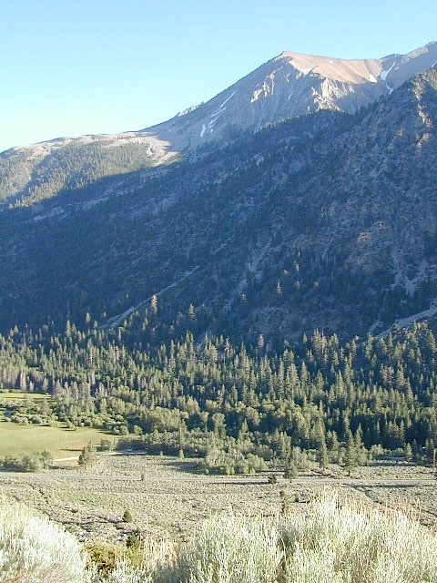
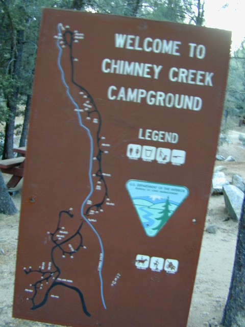
Eastern Sierra communities include:

Dogs in Lake

Poppy Stompers

California Golden Poppy

The official state flower of California is the POPPY

Spring usually means it’s warming up, to a great wildflower season in California. Time to get outdoors more! Hike, bike and picnic near the wildflowers and see some poppies.

poppy fields

California Golden Poppies can be found throughout the state, in small patches near the roadways, rolling hills behind vineyards, in high desert flats (where wind gets whipping) or even out near a ranch, with oak hills and fields of golden orange.

POPPIES can blanket hillsides, resulting in a show stopping event – which can be deadly on freeways? N of L.A. interstate 5 (the Grapevine) TEJON PASS (Lebec, Gorman, Junction 138) >> Please pull to nearest exit and stop the car. (It will be safest and well worth the 10 minute stretch break.)

Golden poppies can be found all over California. Flowers like lupine and owls clover can often be found nearby. Wildflowers may only last a few weeks, so go enjoy them while they last.

Bright yellow, gold, deep orange – or any shade in between!

best places to find poppies

NORTHERN CALIFORNIA

Table Mountain @ Cherokee Road
North of Oroville, CA

wine country

Wine Country NorCal

Alexander Valley Road

Railroad Tracks @ Santa Rosa, CA
Napa County
Sonoma County

Santa Rosa Tracks

CENTRAL CALIFORNIA

Kern County

Fort Tejon State Historic Park @ I-5
Cerro Noroeste Road & Klipstein Canyon
Carrizo Plain National Monument BLM
Kern River Canyon
S of Walker Basin @ Caliente Bodfish Rd
North of Tehachapi, CA

Santa Lucia Mountains
Rock Front Ranch
Schoolhouse Canyon
Cottonwood
Hwy 166, West of New Cuyama, CA

Figueroa Mountain Road
Los Padres National Forest
East of Santa Ynez, CA

Pine Flat Reservoir
@ Kings River, Sierra National Forest
East of Fresno, CA

East Bay San Francisco
The rural hills out east are the best places to find poppies in the Bay Area.

Mojave Desert Preserve
Providence Mountain SRA
Interstate 40
East of Barstow, CA

Central Coast California

Gold Country Hiking

Gold Country California

Auburn, CA
Central California Reservoirs
Located all around most rivers w/ dams (reservoirs) poppies can easily be found along highways, rural roads and on oak hillsides.


SOUTHERN CALIFORNIA

Boulder Creek Road (dirt)
Descanso to Julian, CA
San Diego Mountain Foothills

SoCal poppies

Lancaster Poppy: Antelope Valley Poppy Reserve

Poppy Hotline (661) 724-1180

Remember, stay on the trail!  Getting a picture of that one really nice poppy will crush all the plants along the way, and compact the ground leaving lifeless bare dirt for the next year or longer.  If someone else has started a trail, do not add to the damage.  Please be a responsible park visitor and leave the park as nice as you found it.

Or you can avoid the crowds & tour buses at the Poppy Park to head off on your own adventure. All along both sides of high desert Hwy 138 you can find fields of California Poppies, from the small town of Neenach, CA east to Hwy 14. Plus the hills of Gorman are usually full of color.

Gorman @ I-5
Gorman CA – Interstate 5 @ jct Hwy 138

Borrego Camping

Anza Borrego Park / Anza Borrego Campgrounds

DSCN0034

California Highway 78 cuts across Southern California and right thru the middle of the largest State Park in the lower 48. Anza Borrego Desert State Park is a place that must be visited more than once to really take in all the beauty it has to offer. Free camping in Southern California is abundant here, if you are willing to follow the primitive camp fire rules of the park and you are comfortable camping away from developed campgrounds.

North-South: San Diego County Road S2 skirts the western border with Laguna Mountain towering above. It starts at Ocotillo @ Interstate 8 and heads Northwest to Lake Henshaw at Warner Springs.

East-West: a major route S22, connects Ranchita /Montezuma Valley to the Borrego Valley, and continues East to the Salton Seawhataview. The center of the parks is pretty much the town of Borrego Springs, where the State Parks visitors center is located. San Diego County Road S3 leads from Hwy 78 down the the town of Borrego Springs Valley.

developed campgrounds:

free camping: While the camping facilities listed above provide picnic tables and toilets, or more luxury camping… Total Escape thinks the best part of camping in Anza Borrego Desert is the vast amount of free, open camping available on most back roads. Hundreds of dirt roads lead off in all directions, so you can find the peace and solitude that few inside busy campgrounds ever experience.

  • Anza Borrego Desert Map
  • San Diego Backcountry Map
  • Many Anza desert routes are sandy washes, dirt roads, some for high clearance vehicles only, or 4WD in several canyons. Often there is no signs telling you need 4×4 to proceed. May only find out when its too late and you’re stuck.

    Have a good dirt road map with you and know your vehicles limitations. Passenger cars should be very cautious off road. Cell phone coverage is spotty out here in the most remote wilderness areas. oystercamp

    Mojave Road Map

    Mojave Road Trail

    The Mojave Road

    Mojave Desert Back Roads

    The historic Mojave Road spans the high desert region of east California – crossing the Colorado River westward to roughly Los Angeles. Now a network of dirt and paved routes follow the original overland trade route. Click the plaque photo below to read more.

    The Mojave Road

    The rugged, dirt road cuts right through the middle of the Mojave National Preserve. Mid Hills, Kelso Depot, Cima.

    mojave topo maps

    Joshua Trees, mountains, boulders, sand dunes, railroad history. The high desert is abundant with wildlife, plant life, lava tubes, caverns, camping, and dirt roads. Plus wild windy weather.

    Mojave Loop

    MOJAVE PARK
    Located on the way to Vegas, NV – or the Grand Canyon in Arizona. Mojave NP is in the triangle space in between Interstate 15 and Interstate 40, on the eastern side of southern California. Freeway close, free camping in the Mojave does indeed exist, if you know where to look.

    Mojave Map by Trails Illustrated NatGeo 

    NatGeo Map Mojave California

    National Geographic acquired Trails Illustrated Maps more than a dozen years ago. Ever since these plastic topo maps have gone 2 sided, full-color w/ more details featured than ever before. Updated regularly. Waterproof plastic, perfect for outdoor desert travels.

    Mitchell Cavern, called Providence Mountains SRA, has camping, but it is situated up on an exposed bluff overlooking the freeway. Location gets windy as hell. Better campground is at Hole in the Wall, or even better, Mid Hills Camp.

    Mojave Peaks

    Primitive, free camping can be found off of Kelbaker Road, but be warned: dirt roads can get deeply rutted and impassible during extreme wet weather. 4WD may be required sometimes.

    • CAMPGROUND CAMPING
    • FREE CAMPING
    • GROUP CAMPING
    • HIKING TRAILS
    • HISTORIC MONUMENTS
    • HORSE CAMPING
    • HORSEBACK TRAILS
    • JOSHUA TREES
    • LAVA TUBES
    • MINING HISTORY
    • MOUNTAIN BIKE TRAILS
    • OFF ROAD CAMPING
    • RAILROAD HISTORY
    • RANCHES
    • RV CAMPING
    • SAND DUNES
    • VOLCANIC TERRAIN

    Mojave Desert Map by Tom Harrison

    Mojave Road Map

    One of the first readily available topographic style maps of the Mojave desert. Waterproof plastic, Tom Harrison brand maps are perfect for any type of backcountry travel, on foot, on horse, or off-road.

    Campsites

    AAA & NPS: one-page freebie; excellent overview map created by the Automobile Association of Southern California w/ the National Park Service. Handed out at Visitors Center and ranger stations (1990s)

    BLM Maps of Mojave: OHV (off highway vehicle) maps can be found at the local Bureau of Land Management ranger stations:

    Benchmark California Atlas

    California Atlas
    Best map for statewide coverage!

    This premium full state atlas has the whole, massive Mojave desert covered, which extends north into Death Valley National Park and south to Joshua Tree National Park.

    Mojave Desert Books


    Horse Canyon

    Horse Canyon Mojave

    Horse Canyon California

    Southern Sierra / Mojave Road SC 65

    Mojave Desert meets the Sierra Nevada Mountains
    North Highway 14

    North of Mojave, CA
    North of Red Rock State Park
    North of Jawbone Canyon

    South of south of US Hwy 395, south of jct Hwy 178

    backroads BLM camping desert roads hiking PCT mountain bike jeep roads primitive camp

    elevation: 3000′-7000′

    Horse Canyon is a dirt road up a high desert canyon, with joshua trees and wash outs. 7000′ elevation pinyon pine ridges above w/ PCT.

    Most would say the see a whole-lotta-nothingness out here in these deserts…. when they zoom by at 70 mph on the blacktop highway.

    at Total Escape, we beg to differ.

    Solo Driver SUV

    Intersection on Hwy 14 @ SC 65, dirt route will travel west into the mountains. Initial desert road follows Little Dixie Wash, but veers north up to Horse Canyon and the higher forested ridges.

    Horse Cyn is a scenic, desert, dirt road that becomes a rugged 4×4 trail the higher it climbs in the canyon. The route traverses a ridge line and dead ends at the old cabin; No through route, no loop. The PCT continues on to the Walker Pass @ the 178.

    The lower Horse Canyon is area quite accessible by standard truck or SUV. High clearance is recommended out on these kinda roads. Vegetation is quite sparse at first, but improves with the miles traveled. Wildflowers can be awesome, usually April-June. Picnic spots everywhere; primitive camping sites can be found out here, off the main dirt road. Please reuse existing camp sites when possible.

    wheelin pals

    Passenger cars may attempt this, but should watch for unexpected deep dips and rocks, washed out in the road. (No tow service in the middle of nowhere). Road conditions do change with the seasons out in the boonies. Cell phone reception could be spotty back in the deepest of canyons.

    PCT
    PCT trail access: Pacific Crest Trail follows this ridge road for miles. They call this range the SCODIE Mountains; Old cabin at the end of the road.

    cabin mcivers

    Sage Canyon and Cow Heaven Canyon are both to the north, along with Freeman Canyon (CA SR 178). Bird Spring and Dove Spring Canyons are both to the south, along with the most popular regions of Red Rock State Park and the Jawbone OHV area.

    nearby towns:

    INYOKERN, CA
    LAKE ISABELLA, CA
    MOJAVE, CA
    RANDSBURG, CA
    RIDGECREST, CA

    joshuacanyons

    19S01 – Inyo NF

    south sierra ridges

    Walker Creek Road #19S01
    – Inyo National Forest

    Southern Slopes, Eastern Sierra Nevada

    Just south of Olancha, off US Hwy 395 is a dirt road that takes you 5 miles up to an oak canyon lined with rocks. There are several primitive camp sites along the Walker Creek. A high clearance vehicle may be needed in some sections, but 4×4 is not required. Small RVs might attempt this, but if the first mile frightens you, turn around while you’re ahead.

    Dirt Road near 395

    This private, shaded, creek area is perfect for those traveling Highway 395, looking for a quick and free camp spot near Olancha, CA

    nice shady spots
    Shady picnic or camp spots above 4000′ elevation.

    some granite
    Hiking trails at the end of the road lead deep into the mountains. One on the right takes you to waterfalls. The trail on the left will take you to meet up with the Sage Flat Trail, which leads up to Olancha Pass, Summit Meadows & a small lake, in the South Sierra Wilderness. The Pacific Crest Trail runs the ridges here, just west of Monache Meadows, which is at 8000′ elevation, way above here – up on top. 

    First Camp

    US 395 highway – the dirt road turn off is very close to a gas station, and it maybe be signed, or not. The gas stop may be in business, or perhaps not. This is rural California, wide open desert and things come and go quickly.

    On a good topo map, located Olancha Creek and Summit Creek to the south. Walker Creek is the canyon in between those two, just so know where you are going and can visualize. This one is an easy-to-miss dirt road turn off – especially if you are going over 50 mph.

    Chimney Creek Campground

    campmap

    Chimney Creek Campground
    BLM Kern / Mojave

    High mountain desert camp is mislabeled on some maps as “Chimney Peak Campground” or “Chimney Rock Campground”. Pinyon pine forest on Chimney Creek, near hiking trailheads, wildflowers and Chimney Peak Wilderness. Southern Sierra ridge near Mojave Desert and California SR 178.

    peakpinyons

    Canebrake Road is a graded dirt road that makes up part of Chimney Peak Back Country Byway. This rural route is a major graded dirt road located north of Highway 178 – which connects Canebrake to Long Valley up near Kennedy Meadows. Pacific Crest Trail passes next to this campground in the Southern Sierra mountains. The campground turn off is way east of Lake Isabella Hwy 178 is (near Walker Pass & PCT) and follow dirt road north to Kennedy Meadows in the far eastern reaches of Sequoia National Forest

    Chimney Peak BLM
    • Elevation: 5,700′
    • Number of Sites: 32
    • Camping Reservations: No
    • Sites Available: First come, First serve
    • Vehicle Accessibility: RV limit 28′ max
    • Length of Stay: 14 Days
    • Water: Piped (April – Sept)
    • Toilet: Vault
    • Season: Open all year
    • Fee: No
    • Operated By: BLM
    • Closest Town: Lake Isabella, CA

    Bureau of Land Management
    BLM Bakersfield Ranger Station
    661-391-6000

    Lamont Peak
    Lamont Peak – elev 7510′

    nearby destinations –
    Camp Kern Backroads

    Chimney Peak Wilderness
    Lamont Peak
    Long Valley Campground
    Dome Land Wilderness
    Owens Peak Wilderness
    Jawbone Canyon
    Sequoia National Forest
    Sacatar Trail Wilderness
    Kiavah Wilderness
    Kennedy Meadows
    Lake Isabella
    Kern River
    Monache Meadows


    View Chimney Creek Campground in a larger map

    Keough Hot Springs

    Keough Hot Ditch
    HWY 395. Bishop. First Keough visit w/ Ted, 1990

    Keough Hot Springs

    Keough Hot Tubs, Eastern Sierra

    Keough Hot Ditch

    7 miles North of Big Pine & 7 miles South of Bishop;
    on the west side of Hwy. 395

    Keough California is comprised of two soaking spots – a small resort and the primitive tubs below. An Eastern Sierra rustic Hot Springs Resort w/ campground, tent cabins rentals and nice landscaping. Big, clean hot pools at the top of the road. Entrance fees, trees and vegetation, next to the mountains. Seniors and families frequent this place. Swimsuits are required.

    Keough’s Hot Springs Resort
    800 Keough Hot Springs Road
    Bishop, CA 93514
    760-872-4670

    Keough Hot Springs

    The Ditch

    Below the resort and above the highway, are some primitive, free hot pools that require dirt road driving. Public nudity is common. Open 24/7 w/ several brush lined pools on the eastern slopes of the Sierra Nevada Mountains overlooking the high desert of the Owens Valley. Quite impressive for being just off the highway. Buzzing, huge powerlines overhead are one of the only drawbacks of this soak spot. This place can get crowded at certain times.

    Posted: No overnight camping allowed at these lower hot springs.

    Soaking at Sunrise

    US Highway 395:
    Look for the turn off in between Bishop and Big Pine, California. Take the Keough Hot Springs Road up hill until the second dirt road, turn right and the primitive hot springs will be on the left, just beyond the cold stream crossing. Sometimes a high clearance might be needed. Cars should park and walk the if unsure of the terrain. Do not park right next to the soaking tub, as the ground is too weak and vehicles have been known to slide in, unexpectedly. No kidding!

    Plenty great camping all around the Eastern Sierra region. For campsites with cooler temps, higher elevation, pine trees & creeks: Head for the Glacier Lodge Rd – Inyo Road #9S21, West outta Big Pine.

    Adventurous 4x4s can try super remote Coyote Flat, a super high elevation pinyon plateau that overlooks Bishop. Also Highway 168 W outta Bishop will lead to primitive camping areas like The Buttermilks, a rock climbing area. Further up the hill is alpine lake and creek camping in aspen groves.

    Many developed Campgrounds in the region.


    View Keough Hot Springs in a larger map
    also nearby:

    Inyo Forest Maps

    Old West Days in Randsburg CA

    bands

    Old West Days in Randsburg

    Many old west towns are still in existence in California, but few are as unique as the Randsburg Mining Camp in the Northern Mojave desert, where Hwy 395 meets the 14. The sleepy desert town is a hub of activity ( on weekends) for car clubs, dirt bikers, of-roaders & travelers passing through. Mid week you’ll see the locals and fewer tourists.Green Shack


    This high desert annual event is on the third Saturday in September every year, music street fair is the biggest day of the year for local residents & tourists alike. Historic sights, donkeys, horses, cowboys, live music, food & all the fun you can imagine in the middle of nowhere. One day only!

    Sponsored by the Rand Desert Museum

    Annual event: September
    760-793-3147

    Randsburg, CA

    JLRansb14


    Post Office Cat


    Night Time Entertaining Ourselves