Tag Archives: day hikes

Carrizo Gorge Goat Trestle

,Carizzo Gorge

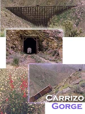
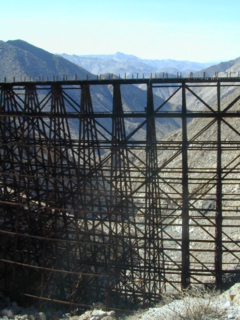
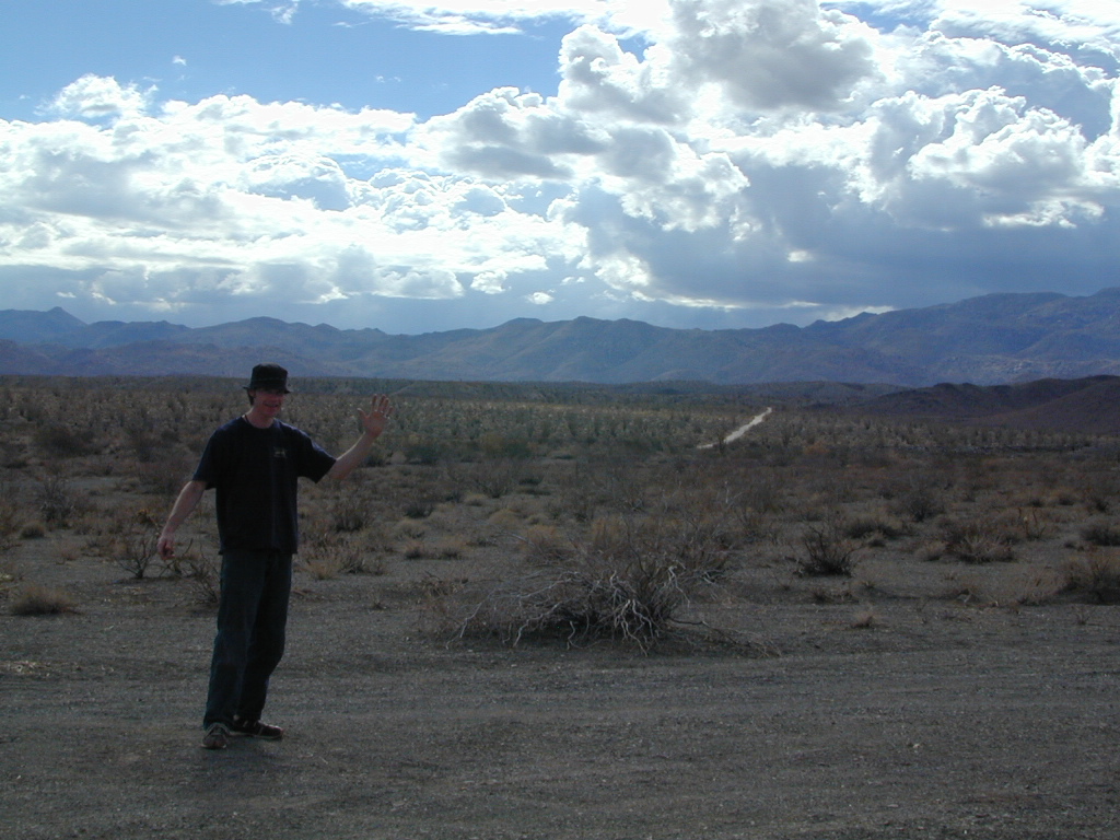
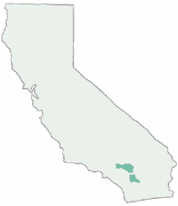
Carrizo Gorge Goat Trestle – via Mortero Wash. Near the south end of Anza Borrego State Park is the infamous ‘goat trestle’, one of the largest wooden rail road trestles in the US.

giant trestle desert

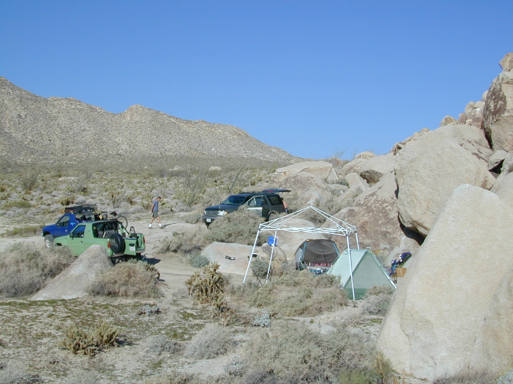
This hike can be reached by driving N on San Diego County Road S2 (from I-8) into Anza Borrego Desert State Park. Near the park boundary keep your eyes peeled for Mortero Canyon Rd (signed) on the left side. This is a sandy, one-lane, dirt road, accessible by passenger car, that leads out to the train tracks & then past to the Mortero Big Boulder campsites. Park at rail road tracks near water tank & start hike from here.

NOTE: Do not be alarmed if you happen to see NUDE hikers coming from the opposite end of this railway, where a nudist resort is located along Interstate 8, called De Anza Springs.

hike bike primitive camp sites

Carrizo Gorge Trestle
Railroad Tunnels, near Anza Borrego Desert

rail road history

San Diego & Arizona Eastern Railroad ­ SD&A/SD&AE

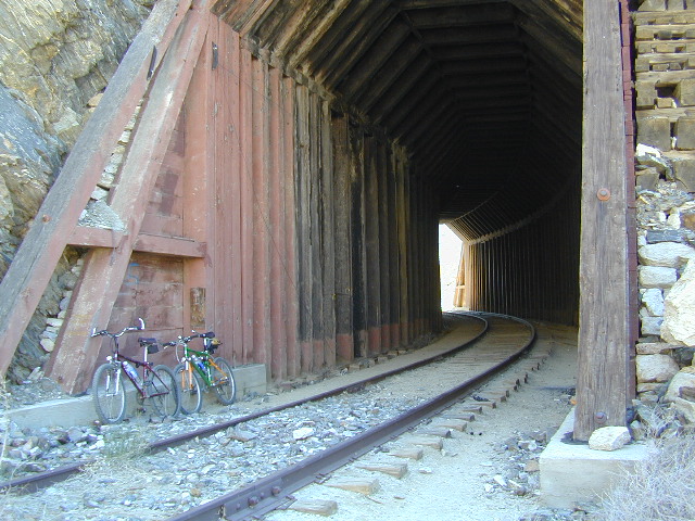
Ground was broken on September 7, 1907 by San Diego’s Mayor, John Forward and the construction of the 140 mile route was completed on November 15, 1919. The first through train was the called the “Golden Spike Limited”, named after the $286 golden spike, which John D Speckels drove into the ground near tunnel #8.

  • The Goat Canyon Trestle was built in 1932 to re-route tracks due to a landslide.
  • Passenger Cars Ran until 1951.
  • The route through Carriso Gorge was closed temporarily by Tropical Storm Kathleen in September of 1976.
  • And was reopened 1981, and then closed again by recurring storms.
  • Kyle Railways ran freight cars until mid 1984.

train

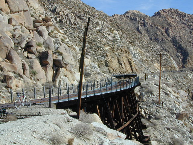
The Carriso Gorge section has fallen into disrepair with two trestles being burned and the collapse of two tunnels as the result of fires. The trestles have been rebuilt and one of the tunnels has been repaired – however,  this scenic section of track is used mostly by hikers and mountain bikers.

Goat Trestle Anza Borrego Desert

Other Facts: Derailed cars are from 1984 and were filled with bags of cement. Laborers were brought in to unload the cement but the cars were left. The Goat Canyon Trestle is 185″ tall and 600″ long. During its use it was the tallest wooden structure in daily use. Hence, this trestle was designated a Historic Civil Engineering Landmark in 1986. Carrizo means “reed grass” in Spanish. Total cost of construction was $18 million.

In 1979 the SD & AE west of Plaster City was sold to the Metropolitan Transit Development Board for $18.1 million. SD&A was said to stand for “Slow, Dirty and Aggravating” generally because of the high temperatures, smoke and open windowed trains cars.

South end of Anza Borrego State Park
Dispersed camping
Dispersed camping (for free) in the Boulders

califrepublic

see more
RailRoads & Historic Train Towns in California

7S02 – San Berdu NF

Fire Safe Trees

Toro Peak
Forest Road# 7S02

Santa Rosa Truck Trail
San Bernardino National Forest

South of Palm Desert, CA
Southeast of Idyllwild, CA
SE of Lake Hemet
Graded dirt road – southbound, off Palms to Pines Hwy 74

7S02 up hill

Road conditions on dirt roads change with the weather and the seasons. This route can be rocky and uneven in spots. One lane road, on a big hill w/ minimal pullouts. Snow is possible, during winter & springtime. This route often closed during winter months – or for rock slides. Trailers and RVs are not recommended on this dirt road, although small motorhome campers can try.

ROUTE CURRENTLY CLOSED? find out on USDA web site link

Elevation approx 6000′ @ HWY
w / route continuing up to Toro Peak @ 8740′NFS

NFS local camp sites: 

  • Santa Rosa Campground
  • Santa Rosa Springs Campground
  • Toro Campground

Bare bones, primitive camp sites. Tables, fire rings. Must have a campfire permit for this region. Vault toilets? None.

toro_campsite

Did I mention the wind yet? Tall trees do block a majority of the wind, but some areas get whipping – so choose your tent site wisely. And stake it down well, before that quick day hike. Since this is a mountain ridge line, expect thunderstorms, wind and possibly light snow.

The big, famous Palm Canyon in Palm Springs starts below. The impressive desert canyon trails lead up to highway 74. Continue on foot uphill, southbound, cross the pavement, and end up in this Toro Peak region. Small campgrounds, few people, great views over the desert. Pick a smog free weekend (with wind) for best Coachella Valley views.

San Berdu Idyllwild SoCal

Santa Rosa Wilderness

Trailhead CA

bike  mountain biking
hike  hiking trailhead
bkrd  4×4 trailheads
horse equestrian trails

Rock climbing, backpacking, fly fishing creeks, snowmobiling, you name it. No matter what kind of trail you seek in California, we have the maps to get you out there, this weekend. If you seek a week long adventure in the Sierra high country, or a weekend getaway destination you’ve never heard of, or a quick after work hike near your home town, we just might have it listed. And we probably have the waterproof, topographical map too.

tentcabinyosemite

DOGS & BIKES on TRAILS:

Dog friendly trails include almost anything within the CA National Forests. Remember that most National Parks & State Parks literally forbid dogs on hiking trails. Mountain bikes can access only certain trails in parks, but in the National Forests nearly every trail or dirt road is up for grabs.

OHV ROUTES:

snomoiMotorized vehicles, such as quads, ATVs, dirt bikes, Jeeps & 4x4s must stick to designated routes signed specifically for OHV (off highway vehicle) & you won’t be finding many of those inside National Parks & State Parks, so it’s best to look for BLM or NF lands. Many regular, forest, back roads close in winter due to heavy snow pack & thus become cross country ski, snowshoe or even snowmobiling trails. The best ones can be found in the Sierra Nevada mountains.

Explore a decent selection of random trail heads within Cali.

hiking in Forest

And if you ever get bored with “reading” text about trails, you can always search the visual database of amazing Cali scenery over at DanaMite’s flickr site

California Fire Road

Silver Lake @ Bucks

Silver Lake from Above

Silver Lake @ Bucks Lake Wilderness

(Plumas Co)

Plumas Road #24N29, off Bucks Lake Road
East of Bucks Lake, California.
a six mile, one lane, dirt road is the only vehicle access into this high elevation, dammed reservoir, tucked back against the wilderness. Secluded lake campsites await, you’ll just need to get a little dusty first. The turn off, at a small brown sign reading “Silver Lake”, one which is very easy to miss – due to the amount of homes, cabins, fencing and driveways in the vicinity.

bucks trailhead

Bucks Lake Wilderness
Plumas National Forest

All Bucks Lake Campgrounds

Kayaker @ Silver Lake

hiker

No swimming allowed at this Silver Lake, as it serves as a drinking water source for the neighborhoods below. Canoe & kayaking are allowed. Fishing is also popular at this location. Hiking trailheads at Silver Lake lead to the PCT (Pacific Crest Trail), Mount Pleasant, Spanish Peak and a small gem of a swimming hole, we call mini Gold Lake.

Bucks Lake Wilderness Map

NFS Campground @ Silver Lake, near Quincy, CA

This small campground is actually set downhill from the rock earthen dam, which is something to ponder before/during a big earthquake. With sites 1-5 in a shady forest area and the others a bit closer to the lake, no campsite is too close to another. These are all well-spaced-out sites, providing decent privacy and minimal noise from neighboring campers. No campsites are located at the lake edge, as the rocky dam is a long structure and quite complex with water control measures.

All the campsites have new bear boxes for food storage, cuz ‘wilderness’ usually means black bears are roaming about. Deer tend to frequent campsites 1 & 2.

2020 update:
overnight camping fees now charged at this campground

silver camp 5

Silver Lake Campground NFS

campground

• Elevation: 5800′
• Number of Sites: 9
• Vehicle Accessibility: RV 22′
• Campsite Reservations: No
• Camp Fee: Yes
• Toilet: Vault
• Water: No piped/potable
• Length of Stay: 14 Days
• Season: May – October
• Trailheads: PCT, Gold Lake, Rock Lake, Granite Gap, Bucks Lake Wilderness

silverbackdrop

As with most of the high elevation lakes in California, winter months can mean deep snow and dirt road closures. This campground is usually open through the end of October, but call head to the local rangers if in doubt.

Plumas National Forest
Mt. Hough Ranger District
39696 State Highway 70
Quincy, CA 95971
530-283-0555

ranger

See all Silver Lakes in California

Los Padres Topo

Los Padres Monterey

Los Padres National Forest Maps

Los Padres atlas
Los Padres National Forest USDA Topographic Atlas

7 minute QUADS (topo maps) inside a spiral bound book. Covers both north & south part of Los Padres National Forest. This map book can be found at ranger station – Los Padres USFS or click the book above to take you to the Total Escape Map Shop!

Los Padres Monterey Los Padres Ojai

Waterproof plastic map; USDA National Forest Service Maps

Additional topo maps for Los Padres region –

Forests

see more about Los Padres National Forest

Big Sur Coast

dirtbikeshiker

Links for Los Padres National Forest destinations

hwy33overlook
North of Ojai, CA – Highway 33 winds up to Los Padres NF

Hiking Trails Los Angeles

Los Angeles Hikes, Angeles National Forest, Angeles Crest, Baldy, Wrightwood, Palmdale, Tujunga, Frazier, and Malibu Coast

DSCN0048
You relocated to California for college or your career – and to enjoy the outdoors more, but you ended up in the Los Angeles Basin instead, breathing smog daily. You will need to escape – soon, for sanity sake.

check

Total Escape – this is your new favorite web site on California outdoors. Bookmark it dude. And be proud to love nature!

PCT hikes – Pacific Crest Trail
The world renowned  hiking trail that runs the entire length of the entire West Coast US. Canada to Baja, by way of Washington, Oregon and California – all on foot.

More PCT MAPS: Pacific Crest Trail Maps

Mount Pinos Recreation Area

Los Angeles Hiking Maps

th_angeles_d

Angeles Front Country
Angeles High Country
Angeles National Forest
Channel Islands Map
Cucamonga Wilderness
Dick Smith Wilderness
Joshua Tree Park Map
Los Padres National Forest Map
Malibu Creek Map
Mojave Preserve Map
Mount Baldy Map
Mount Wilson Trail Map
Pacific Crest Trail Maps
Point Mugu Map
San Bernardino National Forest Map
San Berdoo Mountains Maps
San Diego Backcountry Map
San Gorgonio Wilderness Map
San Jacinto Wilderness Map
Sespe Wilderness Map
Topanga Trail Map
Verdugo Mountains Trail Map
Zuma / Trancas Canyons Map

pinetree

And when you finally get bored with hiking only in Southern California, there’s a whole lot more California to explore – up state!

NORCAL – Well beyond San Francisco and Yosemite, there are meadows to be found. Seclusion and tranquility in nature, without the crowds. Too many dirt roads to drive and dozens of rivers to see. Waterfalls abound, with wildflowers and amazing scenery all around. Small towns to discover!

Fly fishing rivers, kayaking lakes, wineries, organic farms, geysers, volcanoes, caves, old bridges and so much more to find in NorCal.

DanaMite loves to cover the real nooks and crannies of California, just for you – right here on Total Escape.

hiker

San Rafael Wilderness

Sierra Madre Mountains
Cachuma Lake to Cuyama Valley

Sierra Madre Mountains

197,380 acres
Central Coast Foothills
Los Padres National Forest

NFSlogo
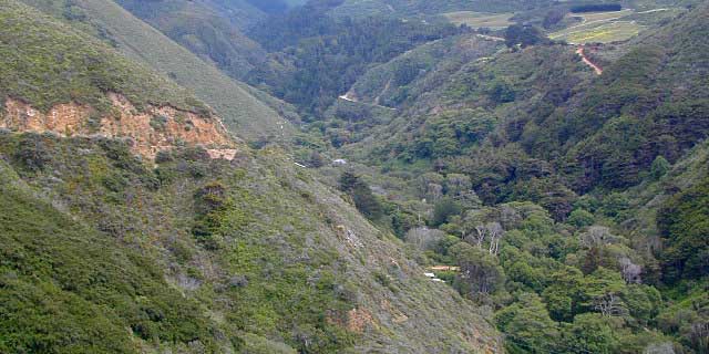
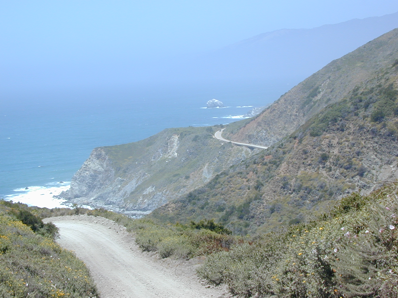
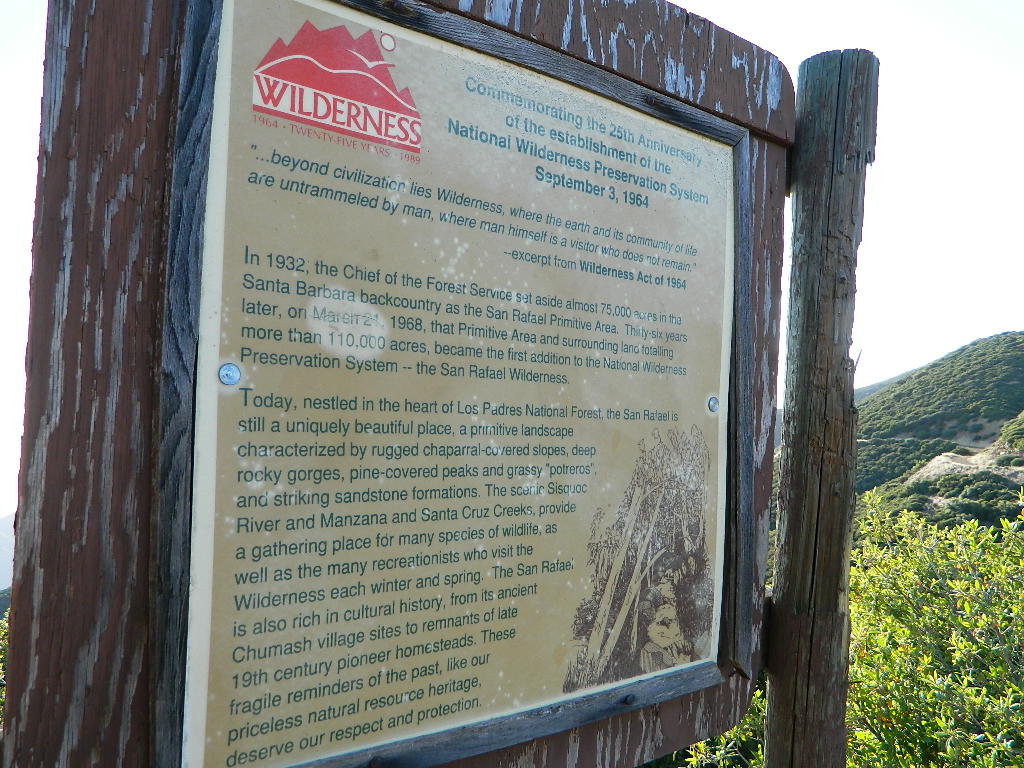
North of Santa Barbara, CA
East of Santa Maria, CA
South of New Cuyama, CA
West of Ventucopa, CA

San Rafael Wilderness is otherwise known as the Santa Barbara backcountry. The Sierra Madre mountains and San Rafael mountains make up the this chunk of wilderness, a vast open space near the coast – which extends from Lake Cachuma to the Cuyama River Valley. This is the southern ridge line along Highway 166, with few pine trees, mostly oaks, leading west to Santa Maria River.

hikerFigueroa Mountain and Lake Cachuma are to the south near Santa Barbara. Vineyards and wineries skirt the western hills of Santa Maria, cattle grazing, oil fields and agriculture line the northern borders near Cuyama Valley. Dick Smith Wilderness is just to the east a little bit, spanning over toward Hwy 33.

OHV: better known as off-roading and dirt biking is common in the foothills behind Santa Barbara, as well as on the west side of the San Rafael Wilderness, near Miranda Pine and Tepusquet Road. Numerous small campgrounds on dirt roads are positioned around the perimeter, but no OHV trails lead into the wilderness areas.

McPherson Peak – 5749′ elevation
Peak Mountain – 5843′DSCN5759
Timber Peak – 4764′
Miranda Pine Mountain – 4120′
Wheat Peak – 2436′

trailheads –

  • via Figueroa Road #8N09
  • Cachuma Saddle
  • Davy Brown
  • McPherson Peak, on Sierra Madre Ridge
  • Painted Rock, on Sierra Madre Ridge
  • Santa Barbara Canyon, off Hwy 166

developed campgrounds surrounding the wilderness

  • Davy Brown Campground
  • Nira Campground
  • Cachuma Campground
  • Figueroa Campground
  • Manzana Schoolhouse
  • Colson Canyon (OHV) #11N04
  • Brookshire Springs
  • Miranda Pine #11N03
  • Horseshoe Springs
  • Lazy Campground
  • Wagon Flat Campground
  • Barrel Springs #10N06
  • Alesandro Campground

back road access –

  • Figueroa Mountain Road #8N09
  • Tepusquet Road, off Hwy 166
  • Miranda Pine Road #11N03
  • Sierra Madre Ridge Road #32S13
  • Cottonwood Canyon Rd @ Hwy 166
  • Santa Barbara Canyon Rd, off Hwy 166

indian rock art

Native American petroglyphs can be found in this remote region of Central California, but may require topographic skills, detective work, trekking and at least a full day of physical action.

PigPen Trailhead

Access to ”Painted Rock” on Sierra Madre ridge is hike/bike in only. The dirt road that access these trailheads are rough road and not maintained. High clearance may be needed. This day trip is an all-day adventure and you might want to consider bringing the mountain bike. Just stay on the road, as rangers will ticket for riding in the designated Wilderness Areas.

from the west – If you plan to visit the rock art from the west side, take Cottonwood Canyon (small sign) turn off of Hwy 166. Pay attention to private property signs, cuz the locals are serious about their lands. Keep on driving up the mountain. Above Bates Canyon Campground up on the ridge, turn left, east on dirt road #32S13 – proceed several miles to the dirt parking area at the pig pen w/ locked gated and signed trailhead.

from the east – dirt road hike is about 10 miles (one way) and it starts at the Santa Barbara Canyon trailhead @ locked gated. Rural back road access requires a good topo map. Find Cuyama River @ Hwy 166, take the route on west side of bridge. East of New Cuyama, CA

nearby towns –

6N06 – Stanislaus NF

graded road

Forest Rd #6N06 – County Line Road, Fence Creek, Stanislaus National Forest

Central Sierra Nevada Mountains, California
N of Hwy 108; W of Sonora Pass

On the very edge of wilderness
Stanislaus National Forest
County Line Road
Fence Creek Campground (NFS)

Graded dirt road near Clarks Fork junction @ SR 108. Dirt road travels up into forest, hiking trails and meadows; South side of the volcanic Dardanelles @ Tuolumne Co. & Alpine Co. boundary

Carson Iceberg Map

County Line Trailhead
Wheats Meadow Trailhead
Carson Iceberg Wilderness Area
The Dardanelles (9524′ elev)

Clark Fork, Middle Stanislaus River

Topo Maps of this Region:

Stanislaus National Forest Map USDA
Carson Iceberg Wilderness Map USDA
Carson, Emigrant, Mokelumne Map NatGeo
Sierra Nevada Topo Map

hiker

  • backpacker access
  • day hiking
  • horse camping
  • primitive camping
  • trailhead camping

winter road closure, annually
check with local rangers on road access and conditions.

Rd# 6N06, climbs to mountain scenery at upper elevations, well of the main highway. Route is a 2-lane wide road at times, narrower and private towards the end of roads; several dirt roads, overgrown 2 tracks w/ many camp sites to choose from. Dispersed primitive camping requires a camp fire permit.

6N06rd

OHV off-roaders will only find dead ends on dirt route 6N06. NO motorized access in nearby wilderness. Wheelers should try south of Highway 108 @ Niagra Campgrounds; Niagra Off Road #5N01 for all the noise-makers, gear heads, dirt bikes, and toy boxes. Niagra Creek, Niagra OHV, Niagra 4×4.

dirtbikes

nearest towns:

Dardanelle
Pinecrest Lake
Twain Harte

volcano mdws

Lakes Basin Recreation Area

Lakes Basin Area, California

Golden gems of California, a collection of alpine lakes on the north end of Historic Gold Country, North Yuba River, Northern Sierra Nevada

lake dunk
EAST of Downieville, CA

California’s Gold Lake and surrounding lakes; the granite spires of the Sierra Buttes and the creeks, waterfalls, headwaters of the Yuba River — total wild beauty. Steep, granite, river canyon from Downieville drive east on Highway 49 from Sierra City to Bassetts, a gasoline and market stop; they have a small hotel there too.

Historic Lodges

Take the left turn, north on to the Gold Lake Highway. The alpine and extremely scenic Lakes Basin Area consist of all small lakes in between Hwy 49 to Hwy 89, along GOLD LAKE HWY [Road S620] some maps read Road #24 or call this Gold Lake “Road” instead of highway. Snow closes in this route during winter months.

The impressive Lakes Basin Gold Lake Region is in the north part of Tahoe National Forest, on the border of Plumas National Forest. Plumas Eureka State Park is also nearby.

Hiking, Camping, Backpacking, Picnicking, Wildflowers, Stargazing, Fishing, Kayaking, XC Skiing, Snowmobiling

Lakes Basin Map

Lakes Basin Campground

California best lake destinations

lakes basin views

Lakes Basin Recreation Area

Sierra Buttes Map


Yosemite Topo

merceddownriver

Yosemite Topo Maps

ti_yosemiteYosemite National Park, in California’s Sierra Nevada mountains, is the most visited of all the National Parks. Tourists, visitors and campers fill the main valley all year long, with the crowds peeking in mid summer. Autumn is gorgeous, winter is snowy, spring is glorious and summer is grand.

The park has numerous alpine lakes, granite domes, meadows, Sequoia groves and a snow ski resort. Backpacking is popular here, hiking all over, bike rentals w/ miles of paved trails. Plus, the best in big wall climbing. Waterfalls and granite cathedrals tower above the lush, glacier- carved valley. Mighty MERCED RIVER, right through the middle of granite and forests.

Storms of recent have rearranged the landscape inside the valley with a number camping facilities wiped out by the river. Yosemite lost half of the campsites, which dramatically reduced the amount of camping available inside the main valley. Older cabins at Yosemite Lodge are gone. Less camping, but more people means you should make camp reservations early as possible; or search for camping just outside the National Park boundary.

Sightseeing and hiking should be part of your visit to Yosemite Valley. Bring your raft for a float down the river. Stay away from the crowds and take the back roads, with our great selection of Yosemite backcountry maps.

We now have links to digital maps for download!

Topographic maps for Yosemite National Park – and the outlying regions:

Teneja Lake, Hwy 120. Yosemite National Park
Eastern Sierra Camping

Inyo National Forest

Sierra National Forest

Stanislaus National Forest

Yosemite Lakes

Yosemite Lodging

Yosemite National Park

Mariposa County CA
Ahwahnee
Bass Lake
Coarsegold
El Portal
Fish Camp
Groveland
Lee Vining
Mariposa
Midpines
Nipinnawasee
Oakhurst
Wawona
Vogelsang: High Sierra Camp

th_half_dome_d

Backpacking
Day Hikes
GRANITE TERRAIN
Topographic
Yosemite Trail Maps

TuolumneMdws

Sunrise Lakes
Sunrise Lakes, Yosemite HSC Loop Hike


Hiking California Coast

California Coast Trails

Big Sur Coast Coastal hikes are the mildest trails California has to offer, ranging from scenic strolls along the base of beach cliffs to steep redwood forested canyons. From Torrey Pines in San Diego to the multiple redwood parks along the North Coast, there is no shortage of hiking near the coastline. Southern California has more beaches than parks, with tide pool areas being a favorite destination for many. Central Coast has lush, fern canyons with year-round flowing creeks and numerous bluffs and rugged beaches. Bay Area has hiking trails nearly everywhere – along the bay, in the woods or on the coast. NorCal has all the wilderness, parks and remote beaches one could ever hope for. What are you waiting for? Get out there.

Pacific Valley Hiking

San Francisco Bay Area Hiking

Limekiln Hikes

hiking trail maps

NorthMarin
Channel Island National Park Map
Los Angeles Hiking Maps
Los Padres NF South (Ojai, Santa Barbara, Frazier)
Los Padres NF North (San Luis Obispo, Big Sur)
Marin Hiking Maps
Mendocino National Forest Map
Six Rivers National Forest Map
Redwoods Map
Ventana Wilderness Map w/ Silver Peak

Sand Dollar Beach

Green Creek Road

Mono County Wildlife Area
Mono County Wildlife Area, Green Creek Road- off Hwy 395, near Bodie

Green Creek California

Eastern Sierra

S of Bridgeport, CA
MONO – Road #142NFS

Toiyabe National Forest
Bridgeport Ranger District

If you are thinking about fishing or camping the Eastern Sierra, North of Bishop & you are not up for the crowds at Mammoth or June Lakes, then try the Bridgeport area, north on Hwy 395. Rural ranch lands along main road, Bodie ghost town turn off across the highway and Virginia Creek Settlement are also nearby

Green Creek is a 11 mile long dirt road in the lush Eastern Sierra the northern portion. The wide, graded dirt road is signed and dead ends at a Toiyabe National Forest campground called Green Creek Campground. The drive up can be washboard bumpy in some parts, but that doesn’t stop the hundreds of adventurous motorhomes that make this trek annually. This place features some of the best prime Sierra back roads camping options for RVs.

Another dirt route, Dunderberg Meadow Road peels off to the left. Dunderberg departs  off Green Creek a couple of miles from the highway and well maintained. This route leads to meadows, aspens, picture perfect scenery and much more seclusion. Passenger car accessible, wide graded dirt roads to wilderness edges. Two-track one lane trails lead to meadow edges and more creeks. Very impressive views of the Sierra peaks over here on this side. Meadows are sensitive areas, wonderful for picnics and you should always minimize impact.

State Park California

Green Creek Wildlife Area
Mono County, California

Aspen Grove Camping for RVs

  • alpine lakes
  • backpacking
  • bird watching
  • camping
  • creeks
  • day hikes
  • fishing
  • hiking
  • horseback
  • hunting
  • mountain biking
  • wildlife
  • wilderness

Plain old passenger cars can easily make this route deep into the Eastern Sierra aspen canyon. Graded dirt and4x4 could be needed winter months. Backpackers can enjoy easy access to the Hoover Wilderness trailheads. There is plenty semi-primitive camping spots along the way, right on the creek, for free…. so no need to sleep in your vehicle upon arrival.

Autumn Aspen Groves: fall colors peak in October, which is usually when the first snows for the winter season start. November – usually the freeze gets them and lifeless brown leaves dangle, until the Sierra Nevada wind gust blow real good.

camp

Green Creek Camping

DIRT ROAD CAMPING

  • alpine lakes
  • backpacking
  • car camping
  • day hikes
  • fishing camping
  • meadows
  • RV camping
  • tent camping

Hoover Wilderness

Dispersed, primitive camp spots along this main dirt road are on a first come basis. You’ll need a fire permit. Many flat camps are set along the creek in aspen groves, some pines, others have  cubby hole privacy. Large granite valley, big creek, bird, scenery and nature everywhere.  Some folks spend weeks camping out here in the warm weather months. Fishing is a big attraction.

Old Cabin in autumn leaves, up near the top of the dirt road deep in the aspen grovesNFS

Green Creek Campground USFS
7500 elevation
11 camp sites
fee, open May – October
trailhead parking nearby

hiking trails lead to

hikes

TOPOGRAPHIC MAPS:

Aspen Camp

28E201 – Inyo NF

trailsdown

Road #28E201 – Inyo National Forest
also known as Inyo Road #4S86

Laurel Lakes Road
Inyo National Forest
Eastern Sierra, California

Southeast of Mammoth Lakes, CA
West of Crowley Lake, CA

Steep, rocky, gravel road, way up above (and behind) Convict Lake. 4WD may be needed during wet or snowy weather. High clearance is always advised. Locked GATE at the bottom means the NFS rangers have closed the route (seasonally) for deep snow, rock slides, avalanches, or other erosion hazards.

Laurel Canyon, US Hwy 395
Laurel Creek
Laurel Lakes

amigoaspens
Laurel Lake Road, Eastern Sierra

Find more INYO BACK ROADS

  • backpacking
  • camping
  • fishing
  • hiking
  • horseback
  • lakes
  • mountaineering

GenevieveLake

Trailhead to Lake Genevieve (pictured above), hike lake loop, snowy peaks.
NOTE: No easy access to the PCT (Pacific Crest Trail)

Laurel Mountain (elev 11,818′)
Bloody Mtn. (12,544′)

oldestrocks

gnarlyrocks
CLICK TO ENLARGE

Geologic:

Oldest, exposed rock in the Sierra Nevada mountains range. Buckling granite w/ volcanic rocks. Evidence of glacial activity including, terminal, lateral, and recessional moraines, glacial striations and polish, erratic boulders, and of course the numerous lakes. see more

Volcanic Eastern Sierra
Volcanic hikes in the Eastern Sierra

4S12 – Inyo NF

rockcreekroad

Rock Creek Road

Rock Creek Lake, Eastern Sierra, California

Inyo Forest Road #4S12
also known as Inyo Road 12, and also Rock Creek Rd.

Majestic mountain scenery. Popular paved route that leads from US 395 up to Rock Creek Lake, on the edge of granite wild lands; lake is situated above 9000′ elevation and the hiker trailheads are further up, beyond the lake at over 10,000 feet. Steep canyon, large canyon, rocky granite canyon, high elevation.

Super scenic drive, but open less than half the year, due to deep snow. Eastern Sierra Nevada mountains. Inyo National Forest

North of Bishop, CA
South of Mammoth, CA
SW of US Highway 395

hikes horse camp bike

backpacking
camping
fishing
hiking
horseback
trailheads
wilderness

A popular and favorite place for summer camping, fishing and hiking. Backpacking, horse trails, high elevation lakes, mountain passes, peaks, wilderness areas. RV campgrounds, tent camping, car camping. Mountain biking in vast canyon, near campgrounds and creek. No bikes in the Wilderness (up and above Rock Creek)

Autumn colors, aspen groves usually best in early October. Snow closure in winter months (Nov-May).

snowyautumn

elevation 7072′ @ Tom’s Place, CA (US Hwy 395)
elevation 9682′ @ Rock Creek Lake
elevation 10,272′ @ Trailhead Parking (end of road)

UP, UP, HIGHER & AROUND LAKE
One lane, paved route gets narrow, but keeps on climbing. Road #6S05 continues up – past Rock Creek Lake and ends at hiking trailheads, paved parking lot and a few picnic spots.

iris meadow
Iris Meadow Campground NFS

12 NFS Campgrounds in this region, starting with one at the highway, several along the way and the campgrounds at Rock Creek Lake.

No campfires are allowed in this canyon – outside of a developed campground. Not much in the way of primitive car camping options either, except for strapping on a backpack and heading into high elevation wilderness.

rockcreeklake

Rock Creek Lake

Rock Creek Campgrounds

Inyo National Forest
John Muir Wilderness

Trailheads along Rock Creek Road #4S12

  • Upper Hilton Lakes
  • Tamarack
  • Lakes Valley (Little Lakes)
  • JMT – John Muir Trail

Rock Creek NFS Hiking Trailheads (download PDF)

Eastern Sierra Maps:
Inyo National Forest Map USDA
John Muir Wilderness Maps
Mammoth Lakes Map by NatGeo
Mono Divide High Country Map


rock creek lake
Rock Creek Lake, first snowfall (Autumn)


looking for another place called ROCK CREEK in California? (we are working on that)

Spicer Reservoir

spicer terrain


Spicer Meadow Reservoir

Spicer Meadows, Spicer Reservoir, Rd #7N01
Spicer Lake, Stanislaus National Forest

lake elevation 6418′
227 surface acres

public boat ramp
hiking trail around lake
more lakes nearby

Ebbetts Pass Sierra Hwy 4

Ancient volcanic peaks mix with Sierra Nevada granite rock, pine forests and fresh, clear, clean mountain water! California, of course.

Stanislaus Forest Road #7N01 leads down from Highway 4 to this popular series of alpine lakes and reservoirs. Camping, fishing, hiking and mountain biking. Sailing, canoeing, kayaking, swimming, floating and fishing are also popular water activities.

Rules of the Reservoir:
10 mph speed limit on Western Arm.
No motorized boating in Eastern Arm.
Camp only in developed Campgrounds.

NFS
2 NFS Campgrounds at west end of lake:

  • Spicer Campground (60 sites)
  • Spicer Group Camp (75 people max)
  • Campgrounds only open June-September. Some campsites at the campground are wheelchair accessible.

    Additionally, Stanislaus River Campground w/ only 8 sites, is located just off the main access road #7N01, right near the river.

    spicer lake shore

    Spicer #7N01

    Numerous smaller lakes in the region make this a hot spot for summer vacations. Union and Utica Reservoirs (both with dirt road access) are good for kayaking and canoes, while power or sail boats prefer the larger Spicer Lake. Summit Lake and Elephant Rock Lake are perfect for quite picnics and day hikes. Trails (many unmarked) connect the lakes to each other. Area gets buried with snow in winter, so these roads are generally only open half the year.

    More reservoirs and lakes nearby:
    Highland Lakes
    Mosquito Lakes
    Lake Alpine, CA
    (all along Hwy 4)

    Stanislaus National Forest Map USDA
    Stanislaus National Forest Map USDA

    Nearby mountain towns:
    ARNOLD, CA
    BEAR VALLEY, CA
    Lake Alpine, CA

    John Muir Wilderness

    John Muir Hiking / John Muir Map

    High Sierra Hiking

    California Wilderness Area Acres Topographical Maps
    John Muir Wilderness

    elevations: 4000′-14,496′

    584,000 John Muir Wilderness Maps
    Inyo National Forest

    JMT

    High Sierra Nevada / Eastern Sierra

    Rugged Sierra Nevada high country. The highest peaks in the Sierra Nevada mountains can be found inside this Wilderness. Many peaks are well above 13,000 feet. Granite, glaciated basins, big snow, alpine lakes, meadows, wildflowers, streams, creeks, cliffs, jagged peaks. Mount Whitney stands as the tallest mountain in the lower 48 states.

    John Muir Trail Maps
    – JMT Topo Map

    lacontedivide
    Le Conte Divide, Sierra Nevada California – 12,000′ elevation peaks

    Eastern access via steep granite hiking, off US Hwy 395 (Bishop, Independence, Lone Pine)
    Western access backpacking thru Kings Canyon National Park, Hwy 180
    or Sequoia National Park, Hwy 198 (Mineral King, Three Rivers)
    or Sierra National Forest, Hwy 168 (Lake Edison, Florence Lake, Courtright Reservoir)
    North access via backcountry Yosemite National Park, Hwy 120
    or Mammoth Area towns (Lee Vining, June Lake, Mammoth Lakes)

    Hundreds of miles of hiking trails, some of the highest peaks in the nation. Trails open to equestrian and foot traffic only. Trailhead quotas limit the amount of day hikers and backpackers that an access the Wilderness daily. Wilderness permit required: Inyo National Forest Permits

    Eastern Sierra Visitor Center
    Inyo Visitors Office

    JM Topo Trails

    USDA National Forest
    USFS, NPS, BLM

    NFS NPS

    Eastern Sierra Interagency Office
    US Hwy 395 @ SR 136
    Lone Pine, CA 93545
    760-876-6200

    JMT
    JOHN MUIR TRAIL- John Muir Wilderness

    nearby towns, parks & resorts:

    Aspendell
    Big Pine
    Bishop, CA
    Courtright Reservoir
    Florence Lake
    Independence, CA
    Kings Canyon National Park
    Lake Edison
    Lone Pine, CA
    Mammoth Lakes
    Olancha, CA
    Tom’s Place
    Wishon Reservoir
    Yosemite National Park

    www.flickr.com

    Horse Meadow Campground

    Kern Meadows Camping

    Horse Meadow Campground

    Salmon Creek, Kern Plateau –
    Sequoia National Forest

    horse camping National Forest Camps Mountain Biking Kern Hikes fish Trailer access camping
    Looking to stay away from the masses camping at the Kern River?

    Horse Meadow Campground can be found on the east side of the Kern River, up on the Kern Plateau. Up the infamous, steep and rugged Shermans Pass Road. How exciting!

    Steep Grades

    Climb the hill slowly and cautiously, no guardrails. Up the grade, Shermans eastbound – out of the dryness of the Kern canyon. Find Cherry Hill Road, that is also the Big Meadow turn off: Forest Road# 22S12, a long, narrow dirt road leads from paved Shermans Pass Road, 10 miles out to this ideal campground. Far enough off the main road, so you won’t see much of a crowd out here.

    22s05 sherman pass

    Hunters, horse campers and hikers really like this spot. Mountain bikers are known to frequent the region as well. Forest, meadows, trails, creeks, nature, all around. Dome Land Wilderness is close by; Waterfalls hikes, swimming holes, viewpoints. Fishing, hunting, horseback trails. Dirt roads and single track trails all over – all within the vicinity of Big Meadow.

    Kern Meadows Camping

    From the main Rd #22S12, the camp access road #23S08 will lead out to the NFS Campground – HORSE MEADOW. Located at higher elevation forests – 3000′ feet higher than the Kern River!

    Nice forested, high country camp spots in a developed campground. The long, access road is worth it for all the scenery and seclusion. Vault toilets, piped water, maybe a small fee. Open summer into autumn, closes for winter months.

    Horse Meadow Campground

    • Elevation: 7600′
    • Number of Sites: 41
    • Vehicle Access: RV 23′ max
    • Campsites Reservation: No
    • Camp Fee: Yes
    • Length of Stay: 14 Days
    • Season: June – November
    • Trailheads: Salmon Creek

    33e36trailhead
    Developed Campground @ Salmon Creek Trail #33E36. Hiking trailheads lead off to various destinations like, Salmon Creek Falls, Big Meadow, Cannel Meadows and Dome Lands.

    Sequoia Kern Map

    Sunny Campsite

    SUMMERTIME: If you are coming in from Kennedy Meadows on the EAST (or the Mojave desert US 395) – first verify that the Sherman Pass is OPEN for through traffic. Ask road conditions with local rangers ahead of time. ANY amount of snow will close this whole paved route for the winter season, up until June sometimes.

    Over 30 miles (one way) to the nearest general store for supplies. Pack ‘block ice’ in the cooler, instead of cubes.

    nearby towns:
    Fairview
    Kennedy Meadows
    Kernville
    Lake Isabella
    Mojave

    Big Meadow is closeby. Check it out!

    Big Meadow Kern

    Long Valley Campground

    Secluded Camp Sites

    Long Valley Campground BLM

    Southern Sierra Nevada
    secluded camp, fishing & hiking trails
    (free campground, open all year long)

    South Fork of Kern River & DomeLand Wilderness

    20+ miles from the nearest paved road; a remote camp on Long Valley Loop Road, off Canebrake Road. Both are dirt roads: high clearance vehicle recommended!

    High Desert meets the Sierra Mountains

    Back in the dry pinyon hills east of Kernville, beyond Sherman’s Pass; high above the Mojave desert and north of Canebrake & Highway 178. Long dirt roads, remote campground w/ fishing & hiking trails. Wilderness access.

    hiking fishing trails horse trails back roads back roads sierra mountains

    Chimney Peak Back Country Byway
    Canebrake, California

    These dirt back roads listed above skirt the edge of Dome Land Wilderness & Sequoia National Forest winding through BLM Land bordering the Mojave. The byway networks recreation areas between Kennedy Meadows and Canebrake, east of Lake Isabella. Eastern Kern County, California.

    backpacking
    camping
    fishing
    hiking
    horseback trails
    mountain biking
    rock climbing
    stargazing
    wildflowers

    Trailheads Domeland

    People come way out here for the seclusion – the peace & the quiet. Mid-week you can have the whole place to yourself. Abundant hiking trails & fishing access. Into the Dome Land Wilderness you will find incredible scenery and diverse terrain – giant granite domes, waterfall canyons, and the South Fork of the Kern River (3 mi hike to river). PCT
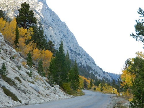
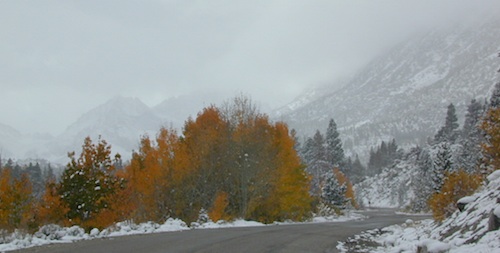
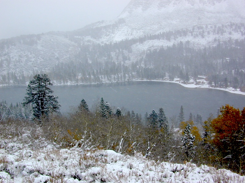
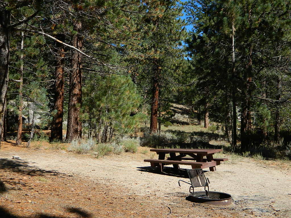
The infamous Pacific Crest Trail passes close to Long Valley Campground, but Chimney Creek Campground is much closer to the PCT.

    BLM Camping

    Long Valley Campground

    • Elevation: 5200′
    • Number of Sites: 13
    • Vehicle Accessibility: High Clearance Vehicle
    • Facilities: picnic tables, fire rings, vault toilet
    • Campsites Reservation: No
    • Camp Fee: None
    • Length of Stay: 14 Days
    • Season: Open all year
    • Operated by: BLM
    • Trailheads: S. Fork Kern River & Domeland Wilderness

    Bureau of Land Management
    BLM Bakersfield Field Office
    661-391-6000
    Find a BLM page w/ map & info

    Recent Domeland Wild Fires:
    Manter Fire (2000)
    McNally Fire (2002)

    Long Valley Loop
    Long Valley Loop Road (2001)

    2016 NOTE: The part of the LOOP of Long Valley Loop Road that connects this campground to Kennedy Meadows (to the north) is CLOSED due to a huge washout. The Long Valley campground is accessible from the south side, from Hwy 178 @ Canebrake – and requires many miles of dirt road driving. High clearance vehicles are recommended; 4×4 needed in wet weather or snow.

    towns nearby:

    CANEBRAKE
    KENNEDY MEADOWS
    KERNVILLE
    LAKE ISABELLA
    MOJAVE

    High Desert Sagebrush
    High Desert Sagebrush & Dirt Roads
    Wildfire Burn
    Manter Wildfire Burn Area (2001)

    Bucks Lake Wilderness

    DSCN0237

    Bucks Lake Wilderness Area

    Bucks Lake, California
    Plumas National Forest

    topo mapIn the hills and canyons above Chico many wonders can be found. North Sierra Nevada mountains, medium sized recreation lake surrounded by lush forest; N of Lake Oroville and S of Lake Almanor. North Fork Feather River canyon forms the northern boundary to this designated Wilderness Area. The area is popular with backpackers and PCT hikers, as well as equestrian and the region has over a dozen campgrounds. Backcountry terrain includes an impressive 6 mile long canyon wall.

    camp Bucks Lake Campgrounds

    hotels Bucks Lake Lodging

    The popular boating destination, Bucks Lake reservoir, is just outside the wilderness boundary, which makes for an excellent destination for day hikes. Boating, fishing, backpacking, hiking, camping, canoeing, kayaking, rock climbing, snowmobiling and mountain biking are just some of the outdoor recreation in the area. This Wilderness region features a Silver Lake and Gold Lake, as well as numerous other small, unheard-of lakes. A few can be accessed by vehicle, but more than half are hike-in only lakes.

  • backpacking
  • boating
  • cabin rentals
  • camping
  • canoeing
  • fishing
  • floating
  • hiking
  • kayaking
  • sailing
  • swimming
  • Bucks Lake Wilderness
    23,958 acres
    5200′ elevation at Bucks Lake

    Alpine wilderness, mountain peaks, hiking trails, PCT trailheads, numerous small lakes, plus large recreational fishing lake

    Bald Eagle Mountain – 7183′
    Bucks Mountain Peak – 6819′
    Mount Pleasant – 7067′

    Small lakes around the Bucks Lake Wilderness Area

    Bald Eagle Lake
    Blue Lake
    Cape Lake
    Gold Lake
    Grassy Lakes
    Jacks Meadow Pond
    Kellogg Lake
    Lost Lake
    Mud Lake
    Rock Lake
    Silver Lake
    Snake Lake
    Smith Lake
    Thompson Lake
    Three Lakes
    Upper Mud Lake

    regional maps –

    nearby towns –
    Berry Creek, CA
    Meadow Valley, CA
    Quincy, CA
    Chico, CA
    Oroville, CA

    lodge and cabins
    historic lodge burnt down, but they rebuilt and are re-opened again

    DSCN0242

    more info –

    Bucks Lake Trailheads (PDF)
    BucksLake.net
    Bucks Lake Fire Dept
    Bucks Lake Wilderness Wiki


    View Larger Map

    Trinity Alps Camping

    Trinity Alps Wilderness Campgrounds

    Northern California Camping
    Shasta Trinity National Forest

    Trinity Alps Wilderness

    camp


    • backpacking
    • camping
    • fishing spots
    • floating
    • hiking
    • hunting
    • kayaking
    • mountain biking
    • off-roading
    • soaking
    • swimming holes
    • tubing
    • stargazing

    trinitydetail

    campgrounds near Trinity trailheads –

    camping Highway 3
    (California State Route 3):

    • Horse Flat Campground, near Eagle Creek trailhead
    • Eagle Creek Campground @ Hwy, near Stoddard Lake & Eagle Creek trailhead
    • Goldfield Campground, near Boulder Creek trailhead
    • Big Flat Campground (via Coffee Creek Road #104)
    • Preacher Meadow Campground @ Hwy, near Swift Creek trailhead

    camping Highway 299
    (California State Route 299):

    • Ripstein Campground, near Canyon Creek trailhead
    • Hobo Gulch Campground, on Road #34N07
    • Hayden Flat Campground, near Big French Creek & Green Mountain
    • Denny Campground, near Jim Jam Ridge, East Fork & New River; Way out west
    • Groves Prairie Campground, near Grizzly Camp trailheadtrinityalps_lg
    • Happy Camp Campground, near Grizzly Camp trailhead

    camping Highway 96
    (California State Route 96):

    • Tish Tang Campground, near Tish Tang trailhead
    • Box Campground, near Red Cap Lake, Bear Hole & Mill Creek Lake
    • Klamath Riverside Campground @ Hwy, near Salmon Summit

    camping Salmon River (Cecilville Road #1C02):

    trinitysign
    Trinity Scenic Byway (CA SR 3)

    NorCal Topographic Maps – Trinity Map

    Shasta Trinity National Forest Map

    Pacific Crest Trail Map #6 (Shasta Cascades)

    Trinity Alps Wilderness Map

    outdoor destinations also nearby –


    View Larger Map