Tag Archives: forest

Calaveras Big Trees

BigTreeMatt

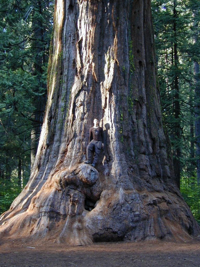
California State Park system manages this Gold Country Sequoia grove, called Calaveras Big Trees

Calaveras State Park
1170 Highway 4
Arnold, CA 95223

4 miles northeast of Arnold on California Highway 4, Ebbetts Pass

elevation: 4800′
6073 acres

Park Hours
Day Use: Sunrise to Sunset

Stanislaus River and Sequoia Groves
+ 2 developed campgrounds

Park Headquarters
209-795-2334

Visitors Center
209-795-3840

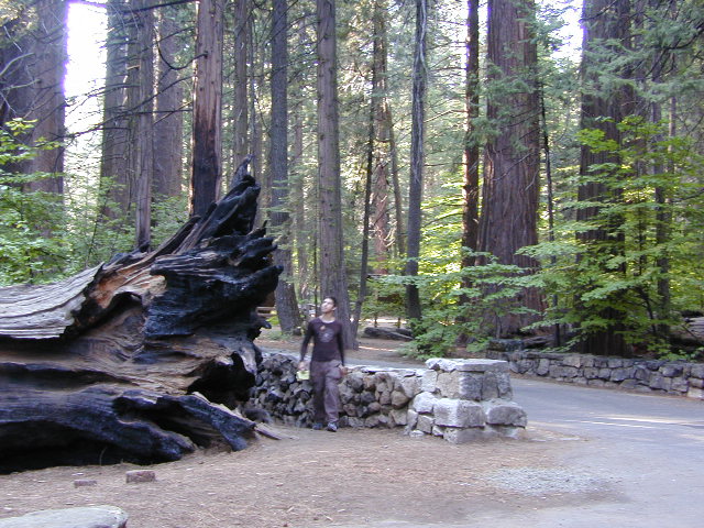
Calaveras is a small but popular Sequoia Park in the Gold Rush foothill country of the western Sierra Nevada Mountains. Large Sequoia redwood trees, Visitors Center, nature trails, 2 large campgrounds, Stanislaus River access, hiking trailheads and picnic spots. Summer and weekends are usually busy. Plan your visit on weekdays or off-season for less crowds.

Park is open during the winter, but expect rain or snow. Sledding is allowed in the State Park during decent snowfall. Snow chains or 4WD may be needed to reach this location during winter months.
fenceline

toddlers
Photo Credit © Mike Rother

Calaveras Recreation 

Cabin Rentals & Campgrounds
Calaveras has rustic cabin rentals

Fishing
Stanisalus River
Beaver Creek

Hiking
Nature trails near Sequoia groves; Day  hiking throughout park
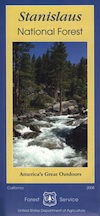
stanislaus
Stanislaus NF Map

Horses
May-October
Horseback tours
& stagecoach rides

Mountain Biking
on bike routes and roads only

Winter Skiing
Cottage Springs
nearby

Calaveras Backpacking

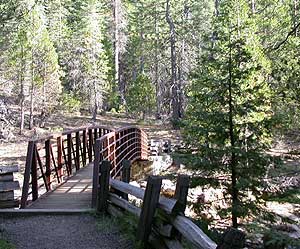
footbridge
Photo Credit © Mike Rother

This park has nature trails, hiking trails , dirt roads and bike routes.

No trails in the State Park connect to outer wilderness areas or forest.

For backcountry camping on foot, you’ll need to drive into the National Forest and locate a trailhead. Obtain wilderness permit ahead of time at the USFS ranger station in Hathaway Pines, CA

NFS

Stanislaus National Forest
Calaveras Ranger Station USFS
ranger
5519 Highway 4
Hathaway Pines, CA 95233
Phone: 209-795-1381

Closest wilderness areas to Calaveras SP:
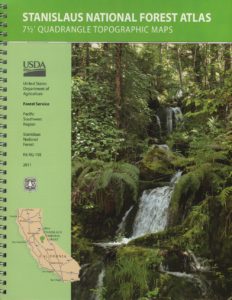
StanislausTopoAtlas
Stanislaus Topo Atlas

Calaveras CampgroundsRV camping Sonora

2 large developed campgrounds with  flush toilets.camp
Campgrounds open March- November. Max RV or trailer = 30′
(camp reservations  accepted)

walk-in camp sites for tents only:
North Grove Environmental
Oak Hollow Environmental North
Oak Hollow Environmental South
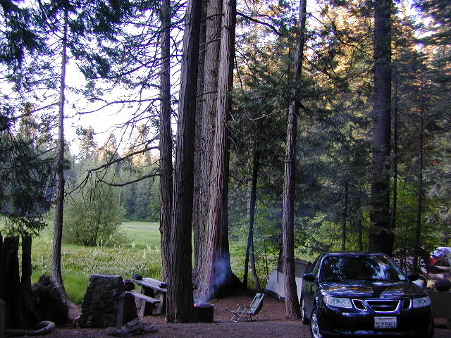
Calaveras Car Camping
Calaveras Car Camping @ North Grove

NFS Camp Sites Nearby

Beaver Creek Campground is located on Beaver Creek, on a dirt back road, way back in there. Past the big river. Just beyond the South Grove trailhead. USDA web site states that this camp is currently closed due to tree hazards. Google Maps has it listed, but the gov web site does not. Call local rangers to find out!

Sourgrass Recreation Area is just north of the State Park. Forest Road #52 will lead to numerous river destinations, camp sites, fishing spots and swimming holes.

Wakalu Hep Yo Campground: Primitive camp; 49 camp sites w/ fee. Pack it in, Pack it out. No garbage services. No reservations. First-come, first-serve. aka Wild River Campground

Big Meadow Campground is a large NFS camp, located right on Highway 4, about 20 miles from Arnold, CA; Large forested camp w/ shade, hiking and fishing closely; North fork of Stanislaus River; Autumn colors in the aspen grove; 68 camp sites, some of which can accommodate RVs. Max length = 27′
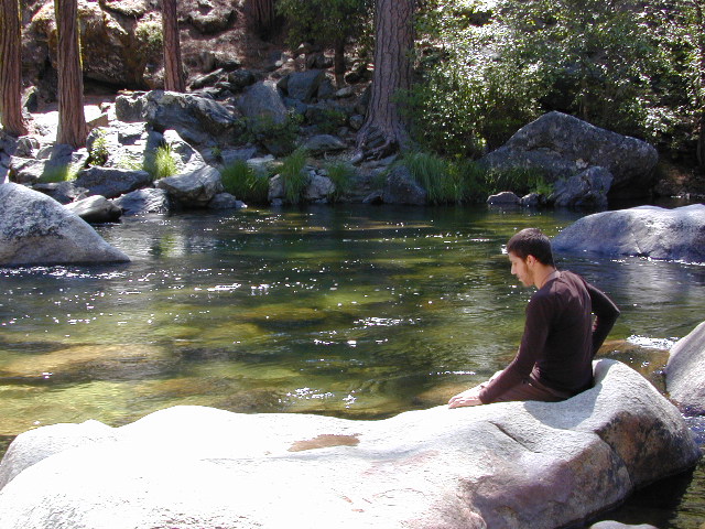
Stanislaus River

Primitive Camp Sites

No primitive camping inside this state park; Campfires are only permitted inside the 2 developed campgrounds.

WALK-IN environmental campsites are available at both of the State Park campgrounds – North Grove & Oak Hollow.

campfireFor car camping and free of charge camping spots, you’ll need to exit the park and start your searching on the back roads, in the neighboring Stanislaus National Forest. First, get a good topo map and try to pick several spots worth exploring. Obtain a campfire permit from the USFS ranger station (Arnold, CA)

Driving dirt roads and looking for a primitive camp site should be accomplished during daylight hours. Arriving at night could pose serious problems, like getting lost, encountering wildlife, settling on a poor place to camp or worst, sleep in your car. Always plan for plenty of time and daylight to find a good (free) camp.

camptruckAcross the Highway (SR 4) from Calaveras State Park a long dirt road ridge line will lead to Railroad Flat –  Forest Service Rd#5N23, Summit Level Road

Just north of Calaveras State Park is a paved road worth checking out – Board Crossing Road #52 becomes Forest Service Rd #5N02
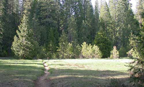
bigtreesmdw

Calaveras Hiking

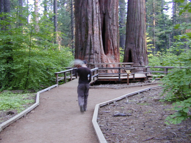
State Park has nature trail around Sequoia grove & guided tours in hikersummer. Day hiking trails throughout the park and fishing trails along the river.

swat
Did we mention that you should always bring the mosquito repellant?

Grove Hike
Hiking around the North Grove

more public lands nearby –
BLM Gold Country
USDA Stanislaus National Forest

Nearby towns w/ lodging:

Angels Camp, CA
Arnold, CA
Dorrington, CA
Murphys, CA
Sonora, CA
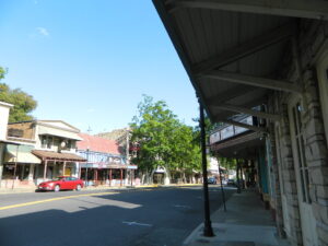
mainstreet2021
Main Street in Angels Camp, CA

Snow Towns in California

snow towns

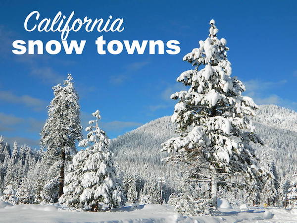
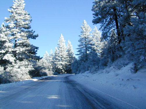
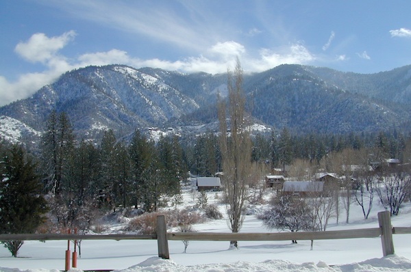
People visit higher elevation towns & parks just to hang out in the snow. Ski resorts are plentiful, but not every snowy town has a ski lift. They may just have a great sledding hill or a big meadow to cross country ski.

Elevations range from 4000′-9000′ above sea level.

Most California snow locations have a wide variety of outdoor recreation, lodging, restaurants, shops. Cute cabins to rent for that upcoming weekend get-away. Or that week-long fishing trip. But with millions people in the state you better make overnight reservations in advance.
snow
California WINTERS:
When does winter actually ‘set in’ for California?

eastern sierra: OCT- APR
western sierra: NOV- APR
high sierra: OCT- MAY
northern coast: OCT- MAY
northeast: OCT- APR

snow

Winter Recreation in California

winter road conditions
California Road Conditions

CALIFORNIA SNO-PARKS: Locations listed below with California State Snow Parks nearby, are listed in bold.

sledding

SoCal Snow

While Southern California doesn’t receive nearly the amount of snow that the rest of the state gets, it does on occasion get some winter storm precipitation. Perhaps just a winter dusting, or maybe a few inches, but sledding families usually enjoy it. For real snow skiing opportunities, head to the Sierras!

Angeles National Forest
Angelus Oaks
Big Bear City
Big Bear Lake
Cleveland National Forest
Fawnskin
Frazier Park
Idyllwild
Julian
Laguna Mountain
Lake Arrowhead
Los Padres National Forest
Palomar Mountain
Pine Cove
Pine Mountain
Ramona
Running Springs
San Bernardino National Forest
Sky Forest
Twin Peaks
Wrightwood

huntington lake

Sierra Nevada Snow

Arnold
Aspendell
Avery
Bear Valley
Blairsden
Blue Lakes
Bridgeport
Calaveras Big Trees State Park
Camp Nelson
Convict Lake
Dorrington
Downieville
El Dorado National Forest
Fish Camp
Hume Lake
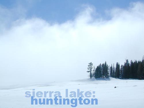
Huntington Lake
Inyo National Forest
Kirkwood
June Lake
Lakeshore
Lake Tahoe
Mammoth Lakes
Markleeville
Norden
Pinecrest
Plumas National Forest
Ponderosa
Rock Creek Canyon
Sequoia National Park
Shaver Lake
Sierra City
Sierra National Forest
Sierra Nevada Mountains
Stanislaus National Forest
Tahoe National Forest
Tahoe City
Tahoe Vista
Tahoma
Toiyabe National Forest
Tom’s Place
Truckee
Twain Harte
Twin Lakes
Yosemite
Yosemite National Park

sierrasnowbelt
Sierra Snowbelt

snowmo

NorCal Snow

Blairsden
Bucks Lake
Burney
Butte Meadows
Cedarville
Chester
Childs Meadow
Etna
Fall River Mills
Fort Jones
Gold Lake
Graeagle
Greenville
Happy Camp
Inskip
Klamath National Forest
Lake Almanor
Lassen National Forest
Lassen Volcanic National Park
McCloud
Mill Creek
Mineral
Mount Shasta
Portola
Quincy
Shasta Trinity National Forest
Shingletown
Six Rivers National Forest
Soda Springs
South Lake Tahoe
Trinity Center
Trinity Lake
Westwood

snow towns california

List of Rural Counties in California

Rural California
forests, mountains, rivers, canyons, orchards, farms, wilderness 

The states with the largest amount of land classified as rural are:
1. Alaska, 2. Texas, 3. California, 4. Montana

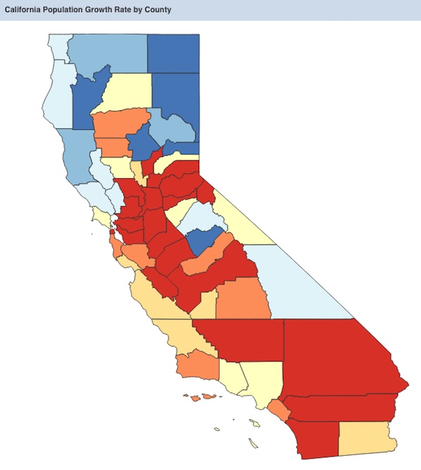
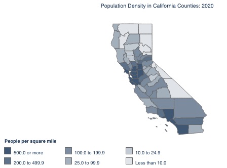
The state of California has the highest population in the nation, but residents are highly concentrated and unevenly distributed.

California’s population has declined for the first time in its history.  Population increased from 1800 up until 2017, but most recently has seen a decline, referred to as ‘CalExodus’

NOTE: Half the population resides in just 4 counties:
Los Angeles, Orange, San Diego, San Bernardino

chickens

58 counties in California

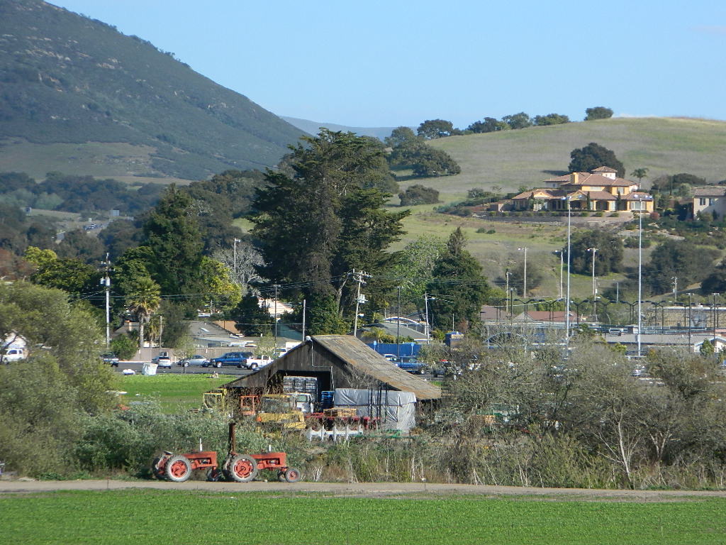
In California the majority of the population live in urban (city) areas, while just a small percentage live in rural areas. California’s rural population is not highly concentrated, but distributed throughout many of the 58 counties.

Rural Relocation inside of California

bycounty

Rural Northern California

California counties defined as rural:

California counties considered mostly rural:

horseback

The California counties listed below may have growing populations, yet most still have available land for small farms, orchards and livestock. Home prices will be higher in areas in close proximity to cities. When planning to relocate outside of a city, abundant water should be a top priority. Wells can dry up during drought years, so check this 2015 map for prior affected regions.

More California  Counties w/ Rural Residential Areas:

centralfarmland

checkRural areas can still be found in Southern California, in places like East County San Diego and maybe Riverside County, but the cost of real estate is high in many parts of the state and not easily affordable.
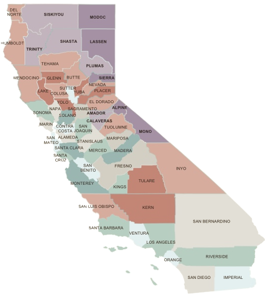
Anything near the coast is way more expensive than sunny, hot inland locations, with desert lands being the least expensive. Food grows well in sunshine and heat, just make sure you have lots of water. Be prepared to build shade structures.

Total Escape is here to show you the rest of the state.

rural california

purples are rural
oranges semi-rural

RELOCATING TO RURAL COUNTRY

Many older homes may be in dire need of complete renovation, so be ready to work, or hire out to have it done. Moldy foundations, collapsing basements, leaky roofs, retaining walls. Home inspection should be learned (in advance) of home ownership.

Rural ranches and mountain homes may be located on dirt roads. Snow and rain make unpaved access messy or impossible, so vehicle choice (4×4) could be an issue when relocating to wilder lands.

Larger properties could be totally undeveloped. Land excavation is quite expensive, so you might need to consider buying your own earth moving machine.

Looking for a rural property with a well and/or a creek will ensure a good water source for years to come, but only if you maintain the system. Upgrades may be needed and water filters are always a reoccurring cost. Water testing is recommended for your home. Well tests are usually offered by local well companies. To drill a new well on raw land, expect to pay thousands of dollars. Especially if no road or drive way exists.

CA population density 2020


pinetree

WILD FIRES in California 

wildfire aftermath
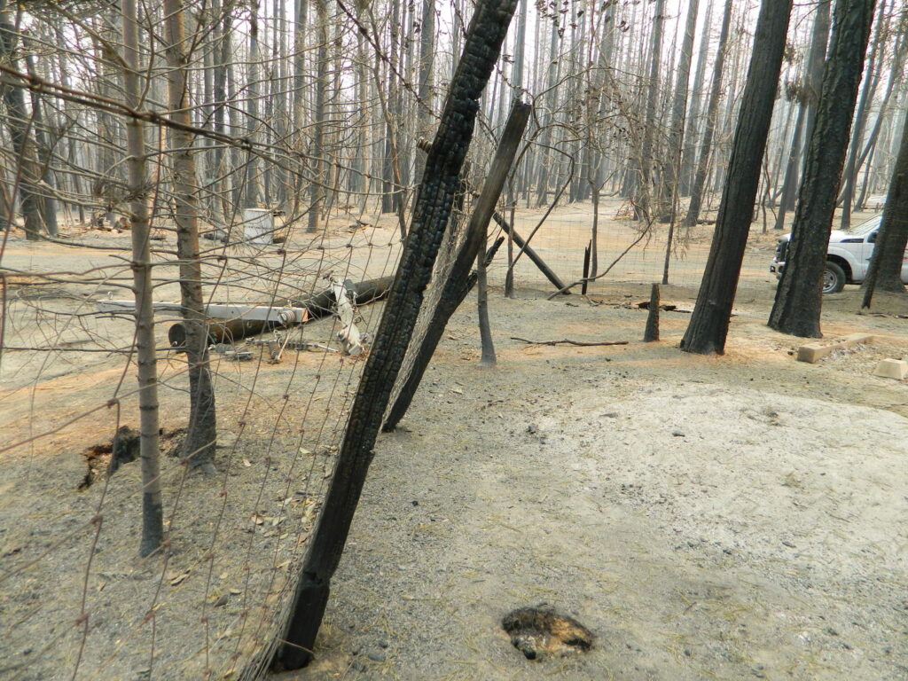
Aftermath of Wildfire 2020

Wildfire is a common threat in rural areas, due to the amount of vegetation and the remote location. Preparation (years in advance), can go a long way to saving your structures from catching fire.

Harden your home to stand alone, without any expectations of firefighters coming to fight the fire or save your house.

Be physically fit, disciplined and capable of ‘brush clearance’ on your own land, every year. What used to be a 30 foot perimeter clearance around structures, has turned into a 100 foot requirement.

But with recent erratic fire seasons, more aggressive and  lasting longer – authorities are now considering a 300 foot clearance mandatory, allowing for tree removal well into neighboring properties.

Be prepared to pay for tree removal and brush clearance, if you cannot do it yourself. Your life and property LITERALLY rely on proper brush clearance around your home.

TREE REMOVAL + BRUSH CLEARING

Since many wildland fires are spread with the dramatic wind events, originating from the east, special consideration should be paid to the east side of buildings.

Geography plays a big part on this. Sometimes winds come from the northeast. Know the unique landscape, hazard potentials and the pattern of weather for the region you reside in.

California Population Growth Rate by County


snow

WEATHER

California has it’s own share of weather related crises’ – from seasonal flooding to landslides, rock slides to avalanches, heatwaves to snow storms, winds events (up to 70 mph) and of course, dry lightning strikes with abundant wild land fires.

Too cold, too hot, too much snow. Research historical weather records for any place you plan to live, and expect those normals to change (maybe drastically) with future predictions.

Over the decades, Total Escape has found the NWS, which is the National Weather Service, forecasts to be more accurate than most of the other weather related web sites. Be ready for any type of weather, from serious downpours to droughts.

pinetree

ELEVATION

California has extreme elevation, with below-sea-level desert basins to the tallest granite, mountain peaks. It is much easier to grow food crops at lower elevations in California, than in the mountains or foothills. Livestock and apple & citrus orchards prefer the sunny mountain foothills, while rice and grains will typically grow only in the low lands. Know what terrain is best for the type of farm or homestead you want to create. Snow is possible, but not very common, down to 1000′ elevation. Snow depth can be an issue for any type of year-round growing above 4000′ elevation.

DOWN THE HILL

Shopping and groceries could be many miles away, so you’ll need to see how far you are willing to drive (and how often) for food staples. Hardware stores, big box stores and most conveniences of city life are now hours away.

rural_living

As Americans, our ancestors come from the natives, the rebels, the adventurers – and the dreamers, many of who migrated westward to create a better life. 

snow

Now is a time that we could re-create ourselves, as a nation – and individually.

During the Great Depression of 1930’s – nearly half the US population worked in agriculture – and most households had a backyard vegetable garden. That lifestyle continued through the 1950’s, but then commercialism and pesticides took over our food; and we became less interested in food production over the decades.

grow a food garden

DISTRACTED

Today, farm workers have decreased to less than 10% of our population. Now we rely on corporations to feed us. If you yearn for a new life – outdoors, out in the country, with less city, less noise and more nature – this site can help you find a new rural location to explore, even in Crowded California.

ruralhuasna

Total Escape has been focusing on rural California since 1996

AtoZsmalltowns

California towns & cities by Elevation

California towns listed by Population

California towns & cities by Zip Code

California Regional Map


oaktree

recreate

ideas

forestmaps


dogJess Valley

canoe

colusalevee

growingonions

pinetree