All posts by DanaMite

Gen-X Camp diva DanaMite, founder of Total Escape. California, off the Beaten Path [est. 1996]

Mortero Wash

Anza Borrego Desert State Park / Mortero Wash

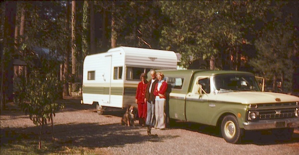
San Diego Desert Camping

south anzaxterrayellow

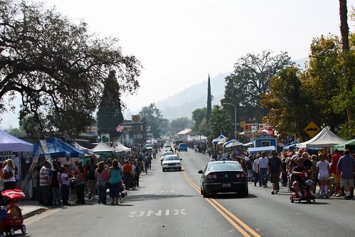
Primitive desert car camping close to SD

fireboulders

Interstate 8 EAST from SD / exit Ocotillo. SD county road # S2, the south end near the State Park boundary. Gorgeous every season but summer. Great winter camping close to SoCal.

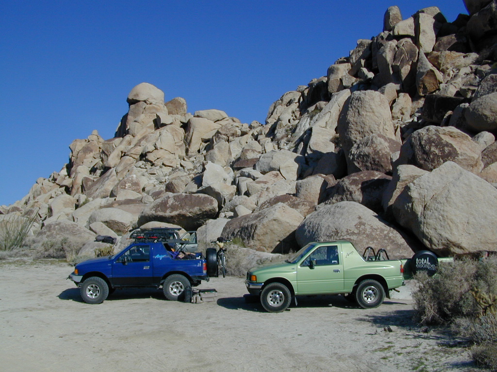
This  dirt road is located in a desert wash area, which starts west – off the paved road S2. The signed white desert wash is a suitable drive for passenger cars (most years). But you best have 4×4 if the rain gets going good. Low riders should watch for the ridge lines – as they are naturally rockier places and could take out an oil pan of a mini SUV (at a high rate of speed).

mortero camps
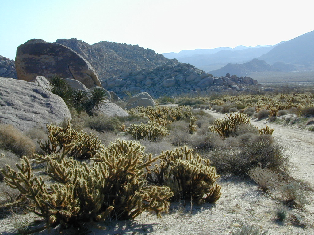
The giant boulders garden at the far end of this route have nice views of the Imperial desert floor. Better from the top of the boulders too; numerous primitive camp sites are tucked into the coves, surrounding the big boulders.

No toilets; no shade; no water; minimal vegetation. At night the stars are heavenly, but you can see city lights from Calexico and Mexicali.
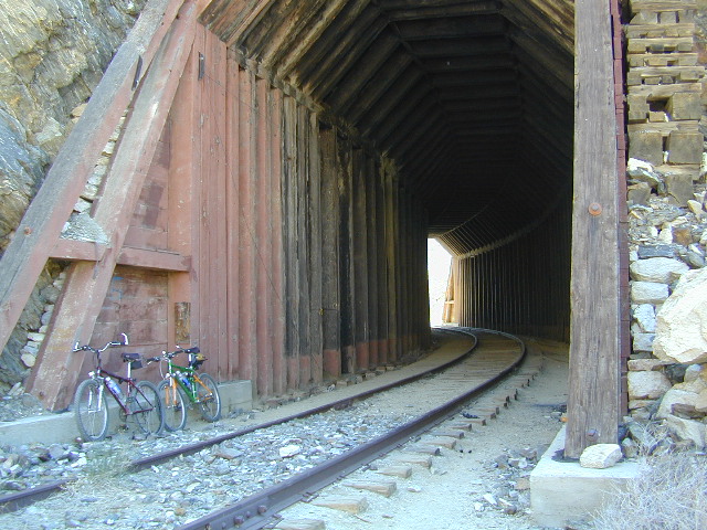
train

GOAT TRESTLE?

From this area you can hike or mountain bike up to the “old goat trestle” and numerous historic train tunnels @ Carrizo Gorge Goat Trestle (not to be confused w/ the wildflower destination called Carizo Plains in Kern Co). BRING A HARD COPY topographic MAP of this area, if you wish to explore past camp. Moderate hike, an all day adventure. Bring lunch and water!

bike on railroad

Tom Harrison Anza MAP
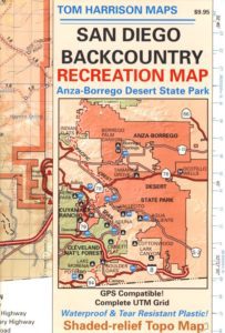
SAN DIEGO Backcountry Map
this waterproof map has the entire State Park covered with all back roads, trailheads, campgrounds and railroad tracks

artistsview

bouldertents

When you decide to stop the car, look around for the best spot. Park off the road way and preferably in a turn out or camp spot. Turn off the engine, get out of the automobile, stretch your legs, breathe, look, close your eyes – tight and breathe deeply, then open and look around you again. This particular place is special, you can just feel it. Walking around the boulder area, be cautious of snakes.

On the boulders – closely examine them, climb on them, get to the top; you will find (Native American) Indian grinding holes called mortars or morteros.

gethigher

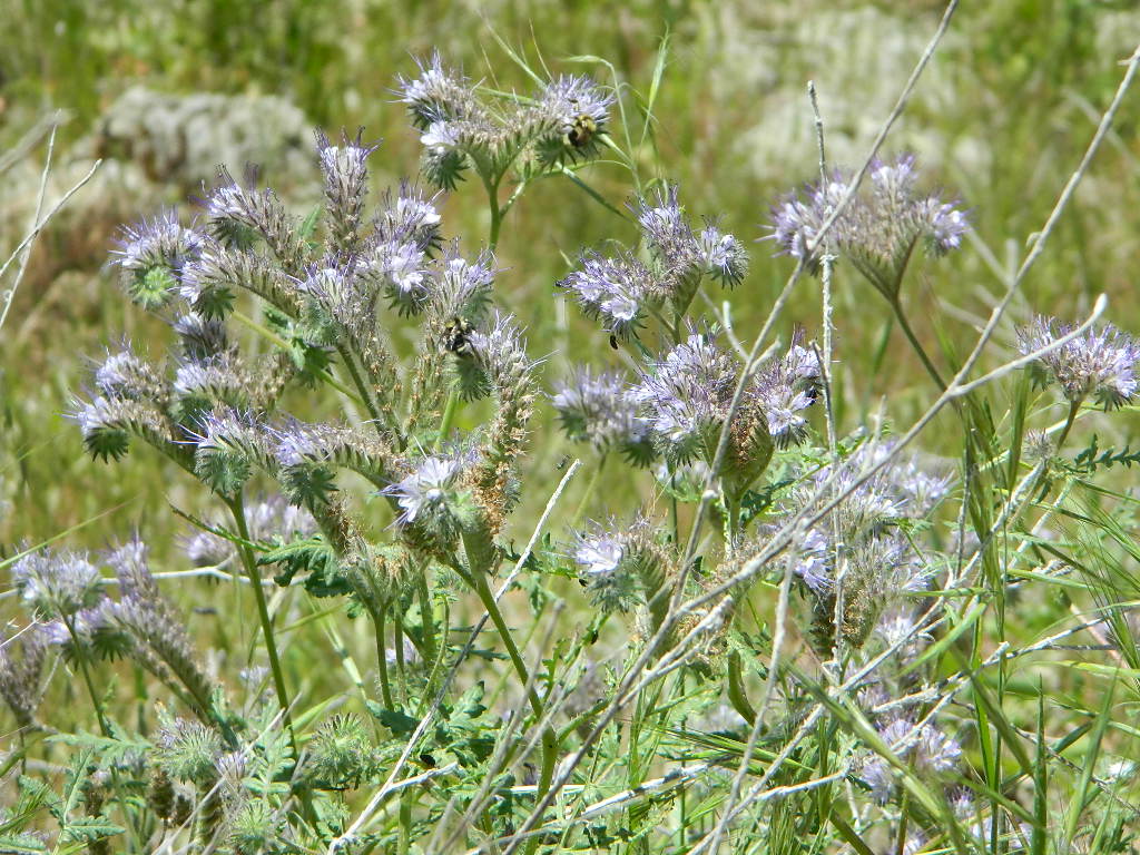
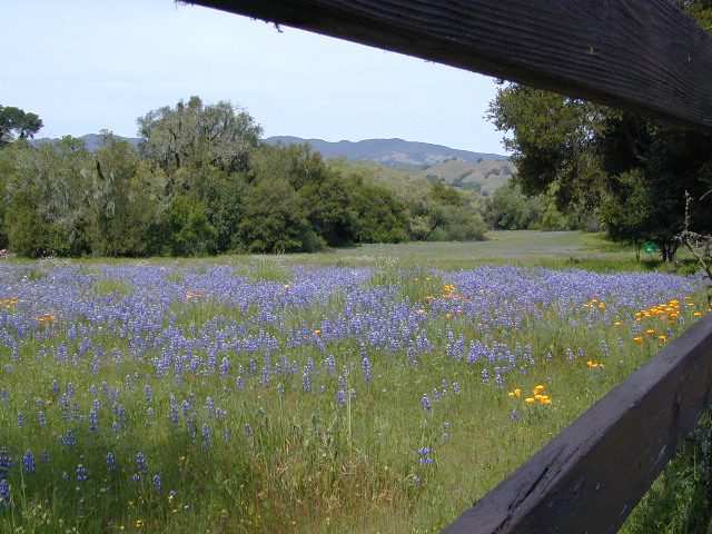
great side trip option: Across the paved road (SD County Road S2) on the opposite side of the valley is a nice hike to Sand Dollar Hill. (I’m sure this isn’t the real name). Dirt road leads up to a dirt parking area for hikers. Busy lil place sometimes. These desert dirt hills have wind caves and chunks of sand dollars scattered all over them. The real ocean floor way out here, east in the Anza SD desert… how cool is that?

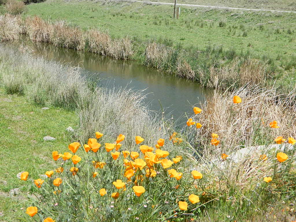
great side trip option: Canon Sin Nombre is just up the road a piece, N on S2, on the EAST side of the road. Amazing viewpoint turn out, right on the highway, overlooking the impressive topography and badlands. If you have a high clearance SUV or any truck you can drive down into the sandy tight, rocky wash. It meets back up with another main wash way back there.

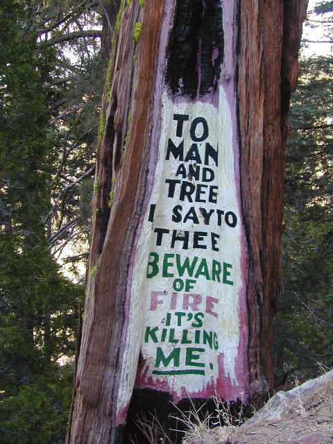
Tons to explore back here. Off roader should think Tread Lightly on this turf and primitive car campers should use a Leave No Trace approach. White sand, deep sand, caves, smoke trees, and the best slot canyon climbing & hiking this side of the Anza Borrego State Park.

desert views

Sierra Snowmobile Rentals

California Snow Mobiling

It was another one of those long and tiring days in the office and all I wanted to do was find myself on a open highway heading out of town. So right after the time clock struck five, I raced home, picked up my bags which were packed with my clothing and gear the night before, stopped at my girlfriends home to rescue her from the mundane existence of the apartment, we found ourselves finally on our way into snow country of the Sierra-Nevadas.

snowmo

Our destination was a small resort community called Lakeshore CA, situated on the shore of Lake Huntington between the Ansel Adams and John Muir Wildernesses in the Sierra National Forest. The drive up the mountain at dark was breath taking and clear, a night in March with a full moon out and a fresh blanket of snow gracing our presence all around us as we drove our truck through the winding mountain road. The temperature must of been in the teens that night but that didn’t faze us as we looked out of our car windows at the spectacular sight Mother Nature had in store for us. Soft snow pillows hung on tree limbs everywhere, glistening moonlight bounced off the gentle lake as we drove along side and huge snow drifts towered on the road shoulder as we traveled to our resort lodge destination.

califrepublic

lakeshore
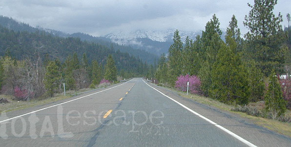
At first we thought it would require more map insight in finding the lodge under such wintery conditions. But to our surprise, the road we had been traveling on, Highway 168, just dead ended at our weekend getaway. The check into the lodge was fast and simple, soon we found ourselves settling into a decent rustic cabin with drifts of snow twelve feet high all around. Thanks to the constant plowing of roads, everything was accessible within reason due to El Ninos erratic behavior.

The next day we became captivated by the raw beauty of waking in a wintery wonderland, hardly hours away from the hustle and bustle of the big cities of Los Angeles and San Francisco. After a bit of exploring around the frozen lake, we took off on a rented snowmobile for the back country where we became amazed by gorgeous mountain lookouts.

Untouched wilderness full of snow-capped mountains, lost tranquil valleys, and frozen pools and streams locked in a time zone of raw beauty.

I wanted to stay gazing for hours but our destination was deep in the wilderness valley about twenty miles away. There after passing through woodsy trails and snowy spectaculars we arrived at our place of relaxation, the Mono Hot Springs. This out of the way spot has been frequented over the years by naturalists like ourselves who have pulled off the trail to dip into the eighty degree plus waters that caress the body with mineral rich fluids.

Never have I been so relaxed in an environment with no one around for miles, white snow all around with a trickling stream close by for awe and amazement. If it wasn’t for the deadline for the snowmobile return, we could of stayed at this place til sundown. The ride home on the machine, my body seemed to be thanking my mind for bringing it to such an inspiring place. My mood was calm and invigorated by the mountain waters & scenery.

epic views over snowy sierra
epic views over snowy Sierra

Back at the lodge after freshening up, my girlfriend and I discussed how lucky we were to be able to experience activities like these that really don’t require throngs of urbanites to complicate and mettle up our space. That night we enjoyed and excellent meal inside the lodge dining room which didn’t weight us down. Then over to the saloon we went to indulge in spirits, a small wedding party was happening were participates graced our presence with drunken humor. Even though they looked like the stereo typical yuppies, this didn’t bother us as we knew that they had come to the same spot to be enveloped by the sheer beauty and splendor of Lakeshore, California.

Spring 1998, by Chris DiNenna

snow

check

Large portions of the Sierra Nevada were greatly affected by recent wildland fires. This area was burnt by forest fire 2020 Creek Fire

From Mammoth Pool to Edison Lake, huge, old growth forests ignited in a major wildfire along the upper San Joaquin River, inside Sierra National Forest. Military helicopters rescued stranded campers by the hundreds, as seen on the nightly news.

BEWARE: this land may not look anything like the photos

Trinity Alps Wilderness

NorCal Mountains – Trinity Alps Wilderness

Sapphire Lake -- Suicide Ridge -- Trinity Alps

525,627 acres

North of Weaverville & Lewiston, about 10 miles
West of Trinity Lake & Redding, CA
Headwaters of the Trinity River & the Salmon River

Shasta-Trinity National Forest

Thompson Peak – 9002′ elevation
Trinity Mountain – 6094′
Granite Peak – 8091′

Trinity is NorCal’s jewel of alpine lakes and granite peaks – many above 8000′ elevation, about 40 miles inland from the ocean. Trinity is located in between the infamous redwood coast and the I-5 corridor. Rivers, creeks, lakes, and trails into the high elevations regions, bqckpackers and equestrian campers alike.

trinityalps_lgHiking trailheads are accessed from all sides -On the east side you have Trinity Lake & Trinity River w/ Highway 3 running lengthwise in a north-south direction. Hwy 299 runs east-west along the south side of the wilderness. Klamath River Hwy 96 lies on the west side of the wilderness. Salmon River, Scott Mountains and Cecilville are north of the alps.

Both the small Russian Wilderness & the larger Marble Mountain Wilderness are located to the north of Trinity Alps, along with rural towns near the Scott Mountains and the Salmon River. Castle Crags Wilderness is to the eastern side, near Interstate 5.

towns nearby –

camp

Campgrounds near Trinity Alps Wilderness

hike

Trinity Alps Trailheads

lake

Waterfalls & Lakes near Trinity

NFS


View Larger Map

The mountainous area is quite unique, as exposed granite mountain peaks and alpine lakes are pretty rare in the coastal Cascade ranges. The only other spot in California that has an 8000′ peak nearing the coast is just north of Los Angeles – Los Padres’s Mount Abel & Mount Pinos peaks, both over 8000′ in elevation.

TRINITY ALPS TOPO MAP

camp

The USDA map for Trinity Alps Wilderness was outta print for nearly 2 years and it has recently been updated and reprinted. New edition released in 2013 and now available at the Total Escape map store. Printed on waterproof map paper and updated in 2012.

7S02 – San Berdu NF

Fire Safe Trees

Toro Peak
Forest Road# 7S02

Santa Rosa Truck Trail
San Bernardino National Forest

South of Palm Desert, CA
Southeast of Idyllwild, CA
SE of Lake Hemet
Graded dirt road – southbound, off Palms to Pines Hwy 74

7S02 up hill

Road conditions on dirt roads change with the weather and the seasons. This route can be rocky and uneven in spots. One lane road, on a big hill w/ minimal pullouts. Snow is possible, during winter & springtime. This route often closed during winter months – or for rock slides. Trailers and RVs are not recommended on this dirt road, although small motorhome campers can try.

ROUTE CURRENTLY CLOSED? find out on USDA web site link

Elevation approx 6000′ @ HWY
w / route continuing up to Toro Peak @ 8740′NFS

NFS local camp sites: 

  • Santa Rosa Campground
  • Santa Rosa Springs Campground
  • Toro Campground

Bare bones, primitive camp sites. Tables, fire rings. Must have a campfire permit for this region. Vault toilets? None.

toro_campsite

Did I mention the wind yet? Tall trees do block a majority of the wind, but some areas get whipping – so choose your tent site wisely. And stake it down well, before that quick day hike. Since this is a mountain ridge line, expect thunderstorms, wind and possibly light snow.

The big, famous Palm Canyon in Palm Springs starts below. The impressive desert canyon trails lead up to highway 74. Continue on foot uphill, southbound, cross the pavement, and end up in this Toro Peak region. Small campgrounds, few people, great views over the desert. Pick a smog free weekend (with wind) for best Coachella Valley views.

San Berdu Idyllwild SoCal

Santa Rosa Wilderness

California Motorcycle Roads

CA motorcycle roads

These are the roads that drivers love. More room to roam, more space, more pavement, more scenery to love and less people, less drivers and less distractions. California has endless roadways that wind through every part of the entire state. If you enjoy real driving in California, you like the curvy roads & scenery. Total Escape  has dedicated numerous hours to the collection of back roads in California. Some paved, some not.

4000 RPMs or higher / Cerro Noroeste Road to Hwy 166

CALIFORNIA driving WAYS & ROADS

CALIFORNIA SCENIC HIGHWAYS & MAIN ROADS

free stickers
get your free sticker

singlelanerd

MAPS, PARKS & LINKS

see also

scenic drives
Some random road east of Trinity River

Parks and Recreation Magazine

California Parks and Wreck

tv the big distraction

step 1. kill your television
step 2. get outside, everyday
step 3. sleep overnight, under the stars

For those who may be still trapped in TV-Land, welcome to Total Escape, a dedicated web site all about the “real world” of wilderness and non-fiction, California style.

parksrectv

Before I started my web business people would suggest to me that I need to write a book. So I naturally chose the world wide web. Now decades later, they are still asking the same question. “Why don’t you write a book on this stuff?”

I say “I did, it’s online. On the internet already. Go look.”
Puzzled, they would turn away to gaze at their device.

Total Escape was created in the web 1.0 days (1996), so I could easily keep track of my many travels, the awesome destinations, my recommendations, my travel logs, zillons of photographs, camping trips, the back roads, signs, maps, GPS, all of it. I worked my day job doing 3D & then moonlighted starting this small web biz. My biggest draw to the internet format at first was being able to update outdoor info instantly. Secondly, it was the ability to work from anywhere with a phone line. (56k anyone?)

No toxic inks, no newspaper. No glossy mag. No waste. Just free digital energy about outdoor destinations, transferred across the cyber waves, just for you the avid Escaper.

park magazine

Then came the buy-out offers and seasonal magazine ideas from sources in San Diego. By late 2003, none had solidified. Several print magazines did however mention totalescape.com in a few articles, which resulted in some nice traffic spikes. Eternally grateful for the early on-lookers and participants!

Quite personally, I had already had my share of smelly inks, papers & paints in art college. Working in a computer career field, I was fully aware of the web in the early 1990’s. I was ready for the computer age & the internet. Eager in fact! Ready to make that leap from graphics & print concepts over to web windows was all I thought about for years.

I did not want to print anything; waste anything. I wanted my biz to be state of the art, futuristic – so here I am, 26 years later. WOW!

Thousands of photos, hundreds of destinations, all local to California. All by itself, Total Escape is a Parks and Recreation Magazine online – and always updating.

DanaMite
Total Escape – California, Off the Beaten Path
totalescape.com

California Outside Blog

California A to Z

AtoZsmalltowns

California Photos
flickr.com/photos/danamite/sets/

propanecampfire
Stupid idea #544967 – the propane campfire
Shouldn’t we be looking up at the stars?

secluded camps

ranger

Parks & Forests

Wilderness List

califrepublic

California Google Maps

Gurnsey Campground

bestcampgurnsey

Gurnsey Creek, Lassen Forests & Fishing

NFS Gurnsey Creek Campground: W of Chester, CA

CLOSED 2020-2022: Campground is undergoing some serious work with removal of hazardous trees and forest clean up. NOTE: DixieFire 2021 did not damage this portion of the forest highway (CA 36)

A developed USDA campground along forested Highway 36, near the junction of Chico’s Hwy 32. This stretch of 36  overlaps with north-south Lassen Hwy 89. Awesome fishing creek, meadows, hiking trails and mountain biking trails nearby. Paved, level camp sites w/ easy access to Lassen Volcanic Park and the National Forest.NFSlogo

This is a popular camp just south of the Lassen National Park boundary and 5 miles east of Child’s Meadow Resort. Car camp, tent camping, some spaces for large motorhomes. Plenty fishing, hiking and mountain biking trails.

Gurnsey Creek begins in Childs Meadows, north on Hwy 36 – just outside of Lassen National Park 

gurnseycreek

Gurnsey Creek Campground, California

on Gurnsey Creek; Campground open May-October
(depending on snow)
gurnseysign

Lassen Creek Camping

52 camp sites on Gurnsey Creek @ 4700′ elevation; vault toilets, creek and piped water, bear boxes; first come, first serve camping – and reservations are also accepted

GURNSEY CREEK CAMPGROUND

Max Camper Length: no limitations
Shady forest camp sites w/ creek. Numerous fishing spots. Close to Lassen Volcanic National Park, Chester and Lake Almanor. Backpackers, day hikers and horseback riders will enjoy the PCT nearby. Pacific Crest Hiking Trail runs to the east side of this campround.pct

CHESTER, CA ranger
Rangers Office: 530-265-4531
Almanor Ranger DIstrict, Lassen NF

GROUP CAMP RESERVATIONS NFS

2 reservable Group Camps are available at this campground. Group Site 1 can accommodate up to 56 people; Group Site 2 can accommodate up to 112 people.

Free Camping nearby.
If you are seeking primitive camping in this Lassen area, look for dirt roads in the USDA National Forest lands, which surround the National Park boundary.

to the west – Lassen Road #14 – the Blue Ridge, north off of Hwy 89 @ Mineral.

to the south – Yellow Jacket Road #29N48 around Turner Mountain, which is south-southwest of Mill Creek.

to the east – Lassen Road #10 – head north off of Highway 89 in between Chester & Westwood.

see also – Lassen Lakes

lassen park mapHighly advised: a real map, a printed ‘hard copy’ shows both the National Park and the National Forest of Lassen on one map – with topographic features, all mountain peaks, creeks, lakes, trailheads, plus all dirt and paved roads.

Trailheads near Gurnsey Campground lead out to –

NEARBY TOWNS:


View Larger Map

Gurnsey overview
Mature forested, creek campground, close to the highway

California Aspens

AspenGroves

Aspen Groves are easy to recognize with their thick stands. White trunks with dark knots, slender, with oval shaped leaves. Growing in a network of roots, which are found lining creeks, alpine lakes, or spilling out from higher elevations, along  scenic canyons.

The unique round leaves which can turn spectacular colors in the fall season. The fluttering and flapping of the oval-shaped, thick, green leaf is a sure sign of summer. When breezes get cooler, Autumn is only a few weeks away and as quick as the cold comes in, what a short and special show they put on.

autumncabin
Green Creek historic cabin, on the Eastern Sierra

California Fall Colors

Aspen trees can be found at higher mountain elevations in California, usually above 4000′ – all the way up to about 10,000′ or higher, depending on the mountain range and local water flows. Groves have an extensive root systems underground, so they often withstand wildfires and can come back after the rest of the forest is gone.

Beavers build dams in creeks around aspen trees, fishermen and campers love to camp next to aspens, and lovers carve their initials into their white bark. These trees do indeed take a beating, from all angles, winter weather included… so stop from cutting them!

carvings

fishing creeks mountain biking stargaze Picnic Camp Hiking horseback back roads mountains

  • BIKE
  • CAMP
  • FISH
  • HIKE
  • KAYAK
  • PICNIC

summer and autumn

These deciduous trees are naked half the year, typically from November to April, as winter buries them in snow and ice. Time is of the essence, limited to Summer and Autumn – to enjoy their shade and the beauty of the groves. Scenic meadows and fishing creeks are just an added bonus for searching out the aspen.

Aspens can be found in hidden canyons, primarily along the Eastern Sierra US Hwy 395 and surrounding mountain lakes. Some Sierra Passes have decent displays of color as well – like Carson Pass Hwy 88 and Yosemite’s Tioga Pass Hwy 120.

Below is a list of Total Escape’s favorite aspen areas of California

ASPENDELL
BAKER CREEK (4×4)
BIG PINE CANYON – NORTH FORK TRAIL

BISHOP CREEK
BLUE LAKES, CARSON PASS
BLUE LAKE, MODOC

CONVICT LAKE, US 395
COTTONWOOD CREEK @ ANCIENT BRISTLECONES
COYOTE FLAT (4×4)

CROCKER @ LAKE DAVIS
CROWLEY LAKE, US 395

DUNDERBERG MEADOW

EAGLE LAKE @
ASPEN GROVE CAMPGROUND

GREEN CREEK ROAD, US 395
HASKINS VALLEY @ BUCKS LAKE
HILTON CREEK, US 395
HOPE VALLEY
JUNE LAKE LOOP

LAKE SABRINA
LAKE TAHOE
LAUREL LAKES ROAD, US 395
LEE VINING CANYON
LUNDY LAKE, US 395

MAMMOTH LAKES, US 395

MCCLOUD CREEK @ ALGOMA
MCGEE CREEK, US 395

MILL CREEK to MINERAL, CA
HWY 172 LOOP aspensofmineral1000

MODOC NF @ BLUE LAKE
NORTH LAKE, ASPENDELL @ BISHOP

ONION VALLEY @ INDEPENDENCE
PARKER LAKE RD @ JUNE LAKE LOOP
PINE CREEK ROAD, BISHOP

PLUMAS-EUREKA STATE PARK
@ UPPER JAMISON CREEK CAMPGROUND

PLUMAS EUREKA

QUAKING ASPEN CAMP, GIANT SEQUOIA

RED’S MEADOW, MAMMOTH
ROCK CREEK ROAD @ US HWY 395

ROSS CAMPGROUND, PLUMAS NF

SPALDING, CA @ EAGLE LAKE

TOM’S PLACE, US 395
TWIN LAKES @ BRIDGEPORT
VIRGINIA LAKES, US 395

WISHON RESERVOIR

aspentips
Aspen Tips @ Eagle Lake California


aspenwall
Green Creek Camping

Autumn Camping in California


amigoaspens
Laurel Lake Road @ 9000′ – Eastern Sierra, California


aspensplit

Lassen Camping

NFS ELAM
Elam Creek Campground, Hwy 32

Camping near Lassen Park

Lassen River Camp
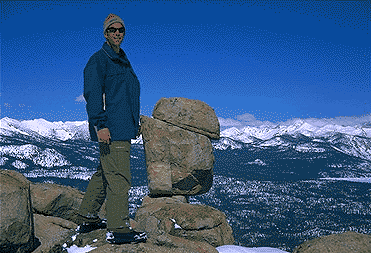
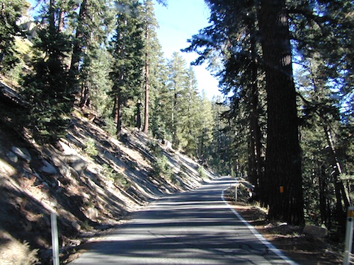
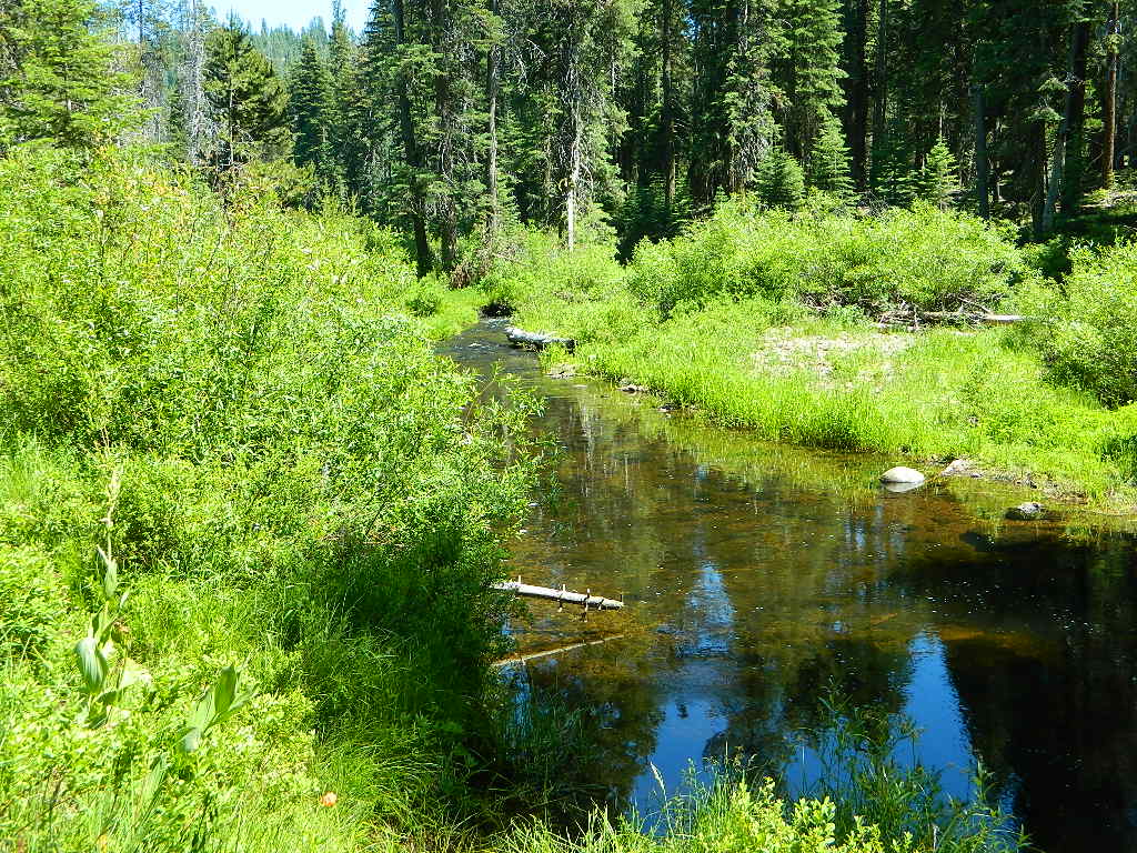
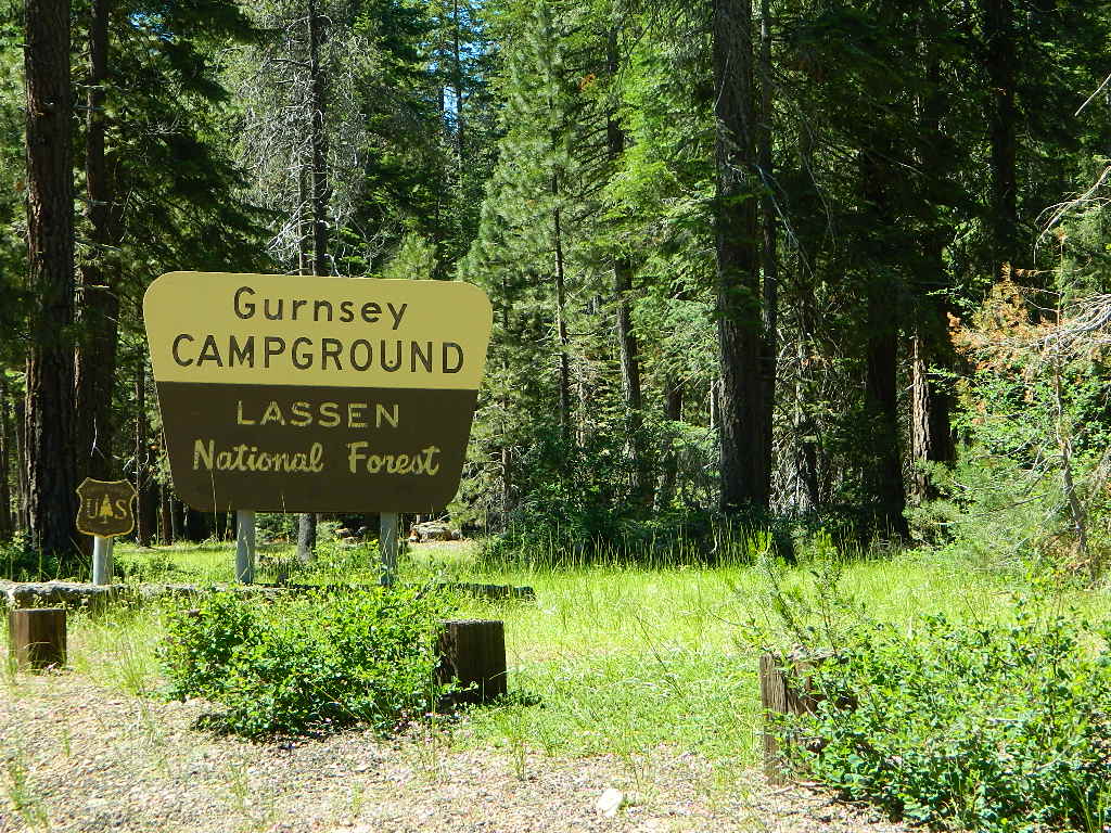
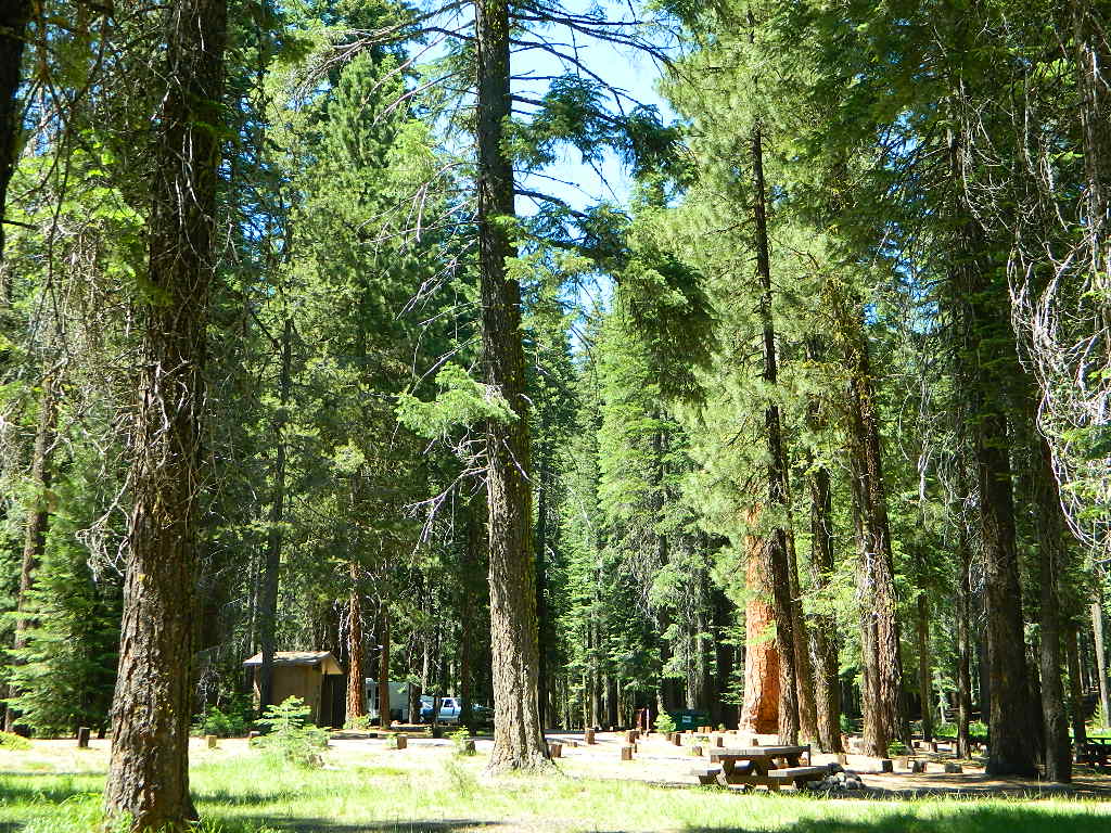
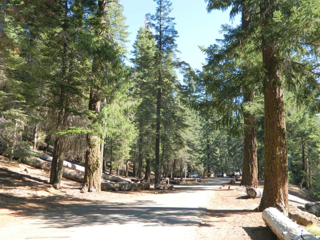
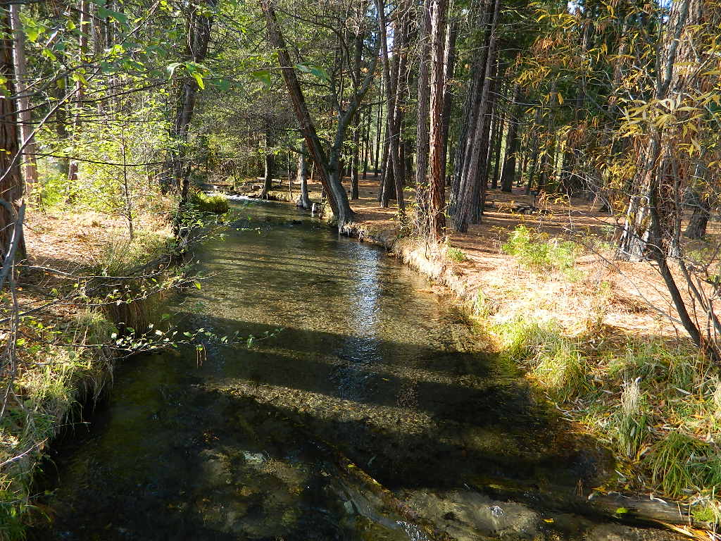
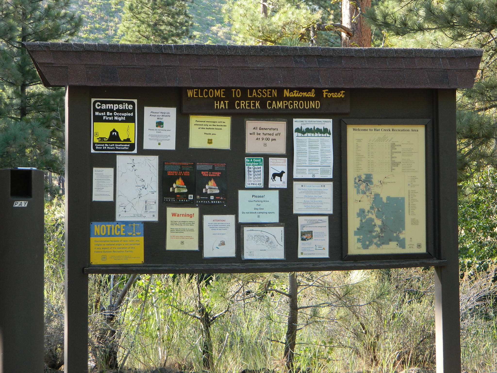
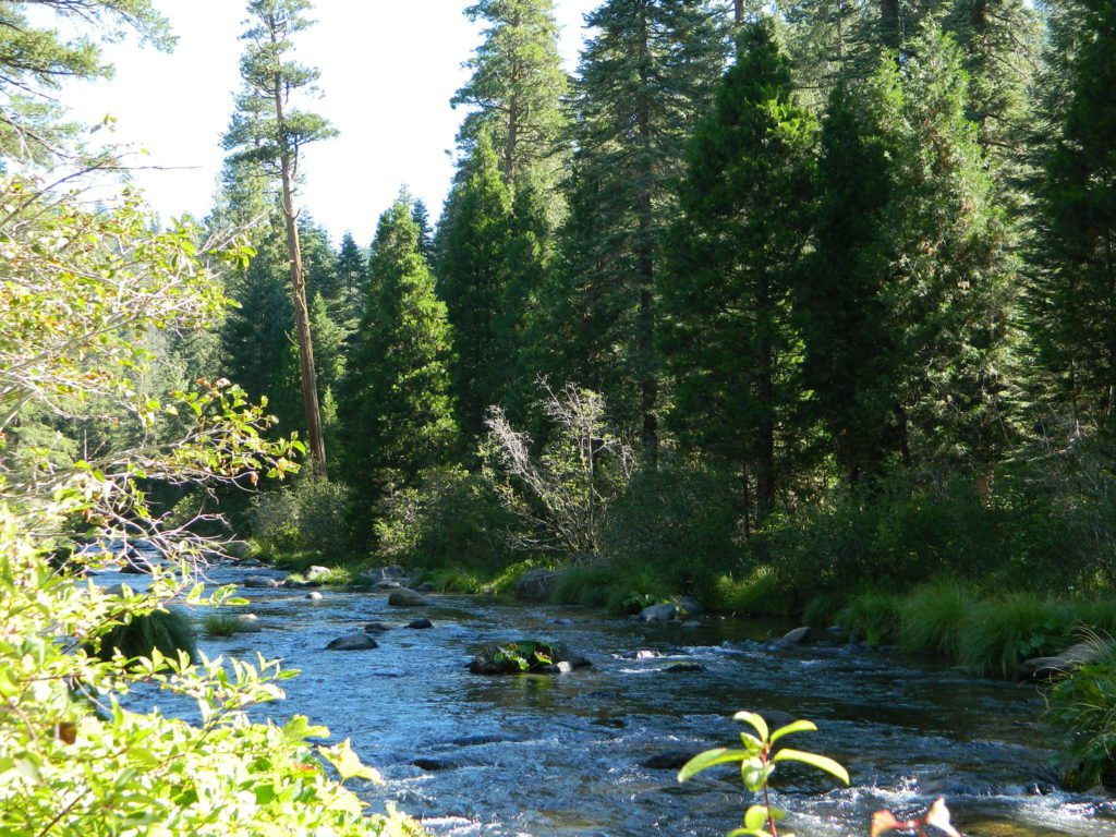
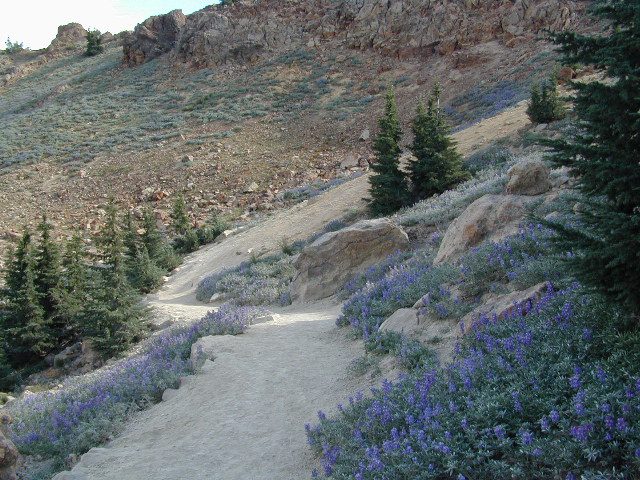
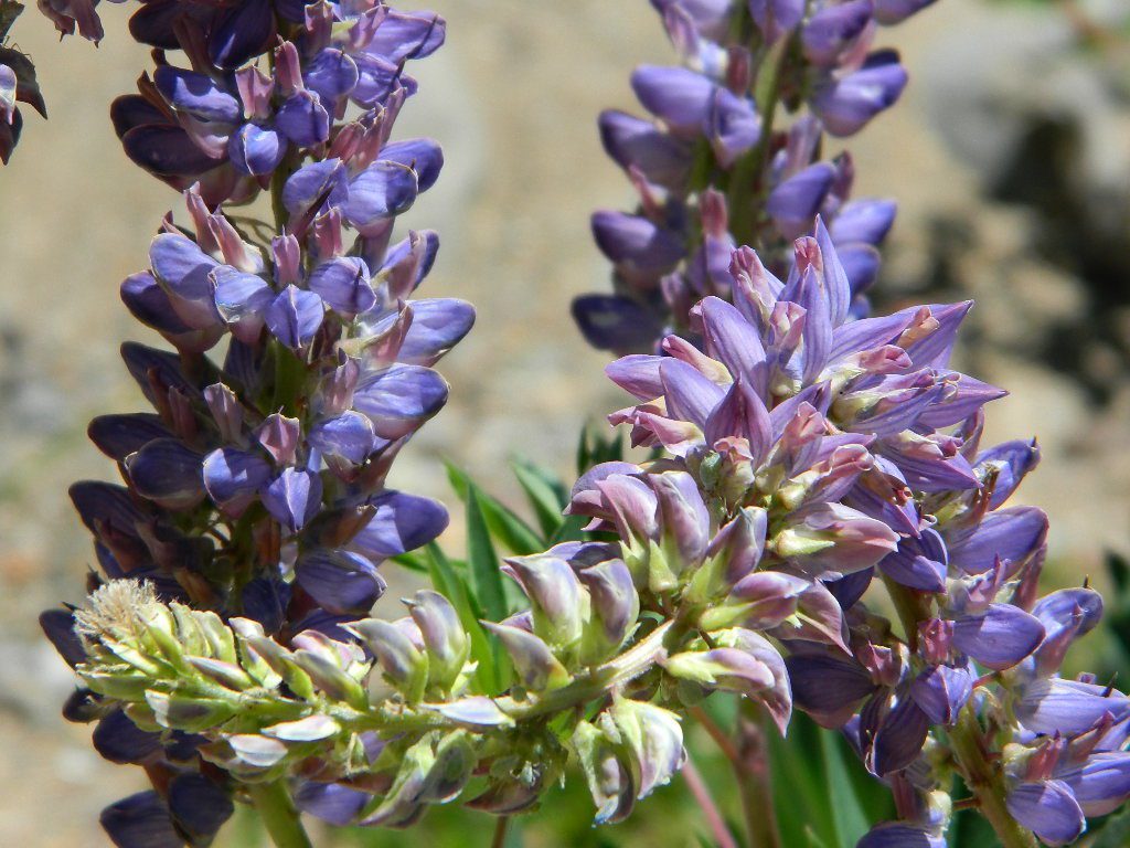
Mount Lassen is part of the Cascade Mountain Range, located north of the Sierra Nevada. The Lassen forest encompasses a large area of wilderness land, snowmelt creeks and an abundant dirt road system. Most of which is covered in deep snow about half the year, so plan accordingly.

Plenty of great dispersed camping along the old logging roads in this Lassen Forest area, surrounding the Volcanic National Park; in Northern California. Many dirt roads are graded annually to allow for passenger car access. You can make it way back there in a car – just watch for the mud and some boulders!

lassen maps

Camp fire permits required (see below). Pease try to choose a camp that has been used before and pack out your garbage.

HINT: a USDA Lassen National Forest Map is very helpful when camping these remote, Lassen back roads. Stay away from the crowds, avoid camp fees & really enjoy your vacation.

Camp right on a rushing river, alone. With no one in sight or sound. Have that secluded camping experience you’ve always dreamed about. Fishing, relaxing, maybe some hiking too. Or better, your mountain bike. Plenty forest roads to explore.mountains

Numerous waterfalls to discover, water flowing everywhere. Mount Lassen @ 10,457′ elevation, is often snow-capped year round. This Northern California region is covered with pine forests and volcanic history.

Cool Springs PGE
Cool Springs @ Butt Lake, California
(PG&E Campground)

CAMP LASSEN
is our guide to all camping and campgrounds
in Lassen Forest, Parks and nearby towns

camp

NFS

If you wanna find the nearest biker bar, head over to the rustic and forested Bambi Inn @ Butte Meadows. The place is popular all the time, especially on weekends. Scenic day drive from Chico, located near a nice river and bridge, plus they have cabin rentals too. Sometimes they have big events and it can get pretty crowded and loud w/ drinking and outdoor music.

BSA Camp Lassen is a boy scout camp located E of Chico, off Highway 32 near Butte Meadows, CA

Dispersed Camp sites in Lassen in Lake Almanor Area

campground elev. spots veg toilet water notes
Alder Creek Campground 3900′ 6 pines vault creek March-Nov
Benner Creek Campground 5562′ 9 pines vault creek May-Nov
Black Rock Campground 2100′ 6 pines vault creek year round, fish
Echo Lake Campground 6440′ hike pines none lake May-Nov, no tables
Soldier Creek Campground 4890′ disp pines vault creek May-Nov, fall hunters
South Antelope Campground 2700′ 4 pines vault creek year round
Willow Lake Campground disp pines lake May-Nov, no tables

NORTH LASSEN

Free North Lassen
Free Camping Lassen

Northside of Mount LassenNFSlogo

Excellent back roads camping w/ dense forest and free firewood all over the place (bring hand saw). Dispersed, primitive, free camping, near creek, and highway close. Many forest dirt roads turn offs, all along Highway 44 (California SR 44) near junction w/ Hwy 89 @ Lassen National Park.

Big creeks, dense forests, graded dirt roads, dark night skies. PCT access, trailheads, camping, fishing, hiking, hunting, all along Upper Hat Creek.

Campfire permits (shovel, bucket & water) are required when camping outside of a developed campground. Always check on current fire restrictions. Washed out bridges and landslides are common, which means road closed signs can be found on these remote backroads.

campfire

see also –

Hat Creek Campground
Honn Campground on Hat Creek, Hwy 89
Large Lupine Lassen
Large Lupine on Mill Creek

HatCreekCampgr

Lassen Area Maps –

Lassen Towns –

Creeks along Highway 32 - N of Chico, CA
Creeks along Highway 32 – N of Chico, CA
Lake Almanor, California
USFS Chester Ranger Station

Lassen National Forest
Almanor Ranger District
900 E. Hwy 36 | PO Box 767
Chester, CA 96020
530-258-2141


What is Camping?

Old Timers Berry Creek

Basically, what is Camping?

4x4 camping RV camping car camping primitive camping backpacking cabin camping

BLM camping State Park camping National Forest campgrounds National Park camping


An overnight stay out-of-doors. Sleeping out under the stars.
Air bed, camping cot, tent… or just a tarp on the ground.
Perhaps a luxury Cabin Rental in the mountains or on the coast. Your choice.

stars camptruck campfire

campFrom a luxurious cabin in the mountains, to a small clearing in near a meadow with a stream nearby – with just a backpack, the idea of “camping” is always a bit different for each person. Roughin’ it for free – in the wilderness, or on the back roads; Or pay dearly for the price of real amenities, while on vacation.

car camping

Various types of Camping in California:

type of
camping
average
cost per night
brief description – what to expect
modern cabin $300 – $600 better than a hotel room, full kitchen, phone, internet, TV, real furniture and maybe a hot tub
rustic cabin $90 – $299 bare minimum, beds, kitchen sink, electricity. maybe a bathroom
tent cabins / yurts $60- $150 wood floors, canvas walls, sleeping cots. reservations accepted. (very popular) may be open seasonally
camper vans, motorhome,
recreational vehicle
rentals, or own it all creature comforts on wheels, lots of luxury. camp the back roads.
camper shell own it mini motorhome on the back end of a pickup truck. smaller than RV
RV campground $35- $80 50+ sites, lots of facilities & families w/ RVs. reservations accepted
developed campground $20- $50 usually 30 – 100 sites, paved loop, facilities. toilets, piped water. plenty in our camping section (most popular)
small campground $12- $27 less than 25 camp sites, pit/vault toilets. plenty small campgrounds listed in our camping section
primitive car camping free way-out-there camp spots w/ dispersed camp sites, for the rugged self-contained, self-sufficient camper; access usually via dirt back roads.
SUV/ 4×4 camping free remote spots on long, steep, bumpy dirt roads; dispersed camp sites in secluded areas. 4 wheel drive may be needed
walk-in campsites
bike-in campsites
low cost or free camp sites that require you to physically haul your camp gear from a parking area to the camp spot, ranging from 1/8 mi. walk to a 1-3 mile hike
backpacking free w/ wilderness permit ultimate in seclusion, bring it all on your back, on foot into the wilderness & enjoy trail camps

  pinetree    fish

River Beach Campground
Trinity River Camping, Douglas City, CA

yellowpost

SO CAL CAMP FIRES – Yellow Post Campsites are remote camping spots in secluded areas, in a designated fire safe clearing. Camp Fires
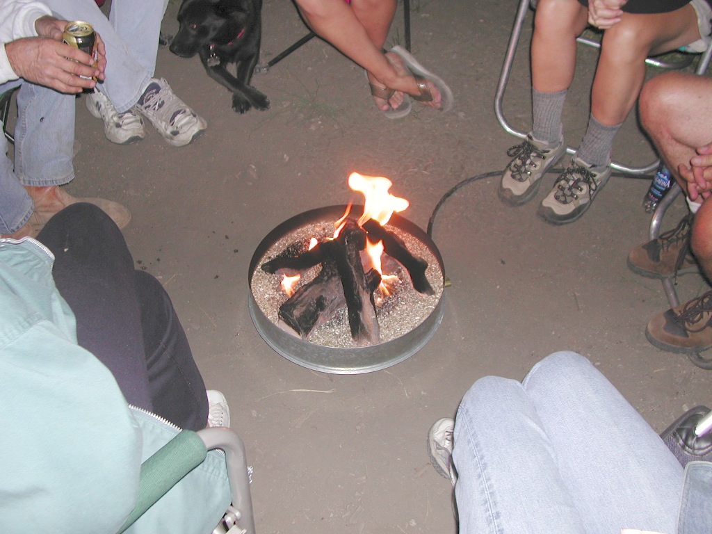
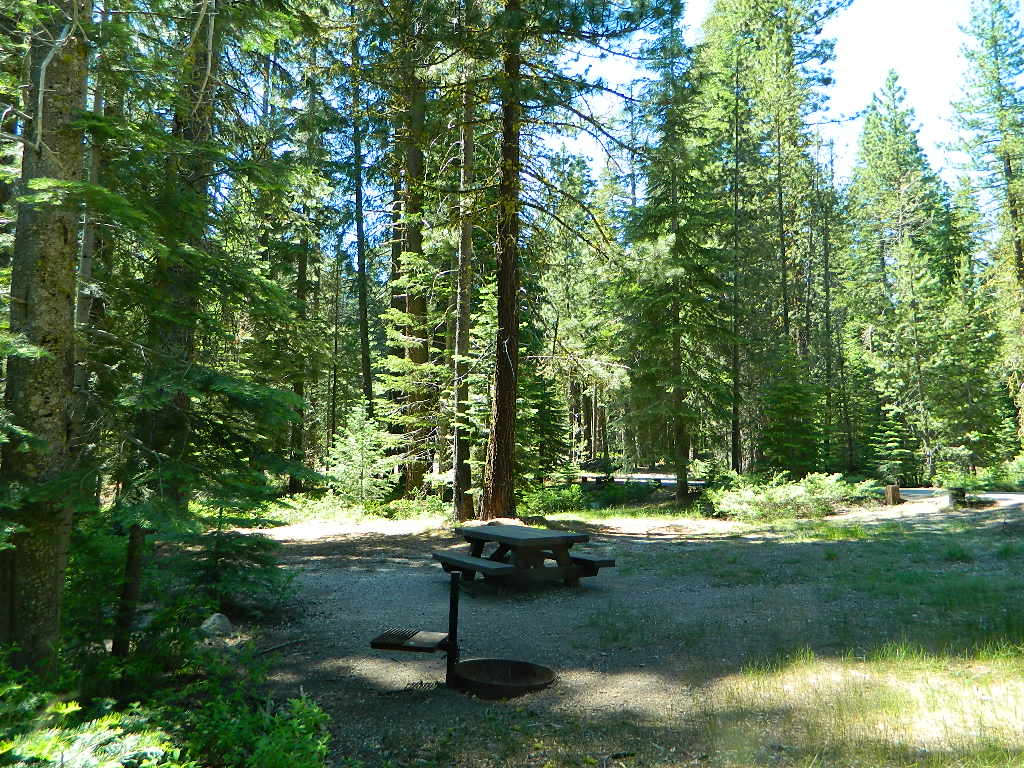
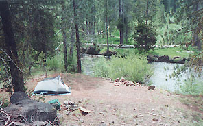
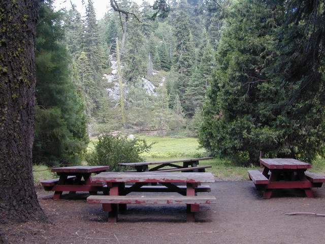
No facilities such as toilets or showers. Maybe a picnic table & fire rings, if you’re lucky. Southern California forests have these kinda spots. Required campfire permit & you must double check on local fire restrictions.

Tent Cabin Rentals

Canvas Tent Cabins & Yurts

These structures are half way between ‘roughing it in a tent on the ground’ & having a ‘mountain cabin’. Tent cabins have wooden floors w/ canvas walls and roof; Dismantled annually for winter rain/snow, they are usually only available in mild, coastal climates or during summer months in the mountains.

deluxe-tent-cabin
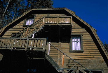
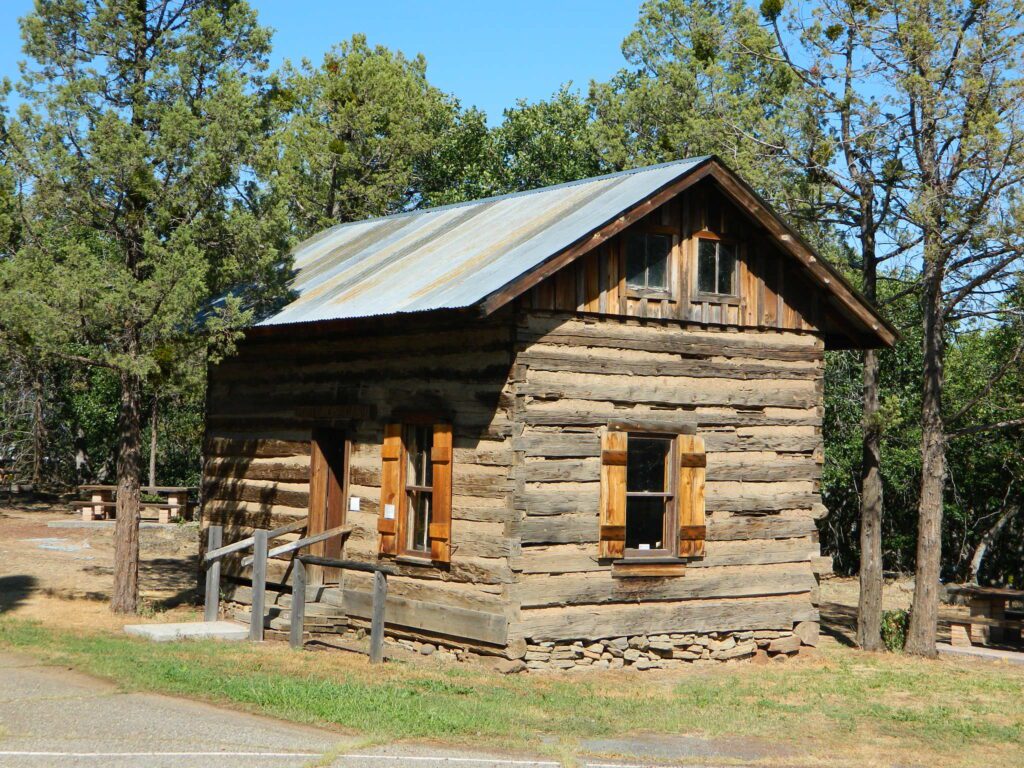
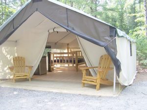
Rentals typically include sleeping cots, but you’ll need to bring your own bedding (sleeping bags, sheets, pillows). Some rentals include shaded porches, wooden decks, minimal furniture, kitchenettes and/or wood burning stoves. Electricity may be available, or maybe not. Ask ahead of time, if you really must have that particular luxury when on vacation.
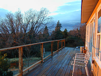
Yurts are a ’round version’ of this canvas cabin – which need to be aired out, often (to prevent mold). Yurt rentals are very popular and in high demand in California.

Find these type of rentals at yoga retreats, hot springs, beach canyons, remote lakes, redwood forests, high sierra camps, fishing camps and at certain RV parks.

National Forest Service Rangers wildlife

Deck w/ View

National Forest Fire Lookouts
& Historic Cabins

hiker

Tent Camp Yosemite Valley

Camping California Back Roads


Snow Mountain Wilderness

Snow Mtn Wilderness

Mendocino Forest, Lake Pillsbury

North of Wine Country, east of US Hwy 101

2018 (Mendo Complex Wildfire) Ranch Fire
burnt most of this area

Located in the coastal mountain range north of Clear Lake and west of Stonyford, California; in between I-5 and US 101
On the southern half of the Mendocino National Forest.

snow mountains

60,076 acres
East Snow Mountain Peak – 7056′ elevation
West Snow Mountain Peak – 7038′ elevation
Lake Pillsbury – 1818′ elevation
Mendocino National Forest
Eel River
Elk Creek
Cold Creek
Anderson Creek
Corbin Creek
Sheet Iron State Game Refuge

  • backpacking
  • camping
  • hang gliding
  • horseback trails
  • off roading
  • paragliding
  • snowboarding
  • snow shoeing

Snow Mountains MapWilderness permits and campfire permits are required. Check local rangers for up to date weather conditions, road closures, parking and trail conditions.

Dirt Roads M10 and M3 are the major routes around this mountain area. Route M10 is also known as 43A on some older maps. Several 4×4 trails skirt the wilderness boundary near the tallest peaks, so you may see some OHV use in this region when hiking.

ranger stations
NFS

EAST SIDE

National Forest Office
Grindstone Ranger District
Willows, CA
530-934-3316

Stonyford Work Center
530-963-3128

WEST SIDE

Upper Lake Ranger
707-275-2361

Covelo Ranger District
707-983-6118

NFS campgrounds nearby
camping

EAST SIDE

    • North Fork Campground (Road# 18N03)
    • South Fork Campground (Road M10)
    • Fouts Campground (M10)

4x4 trails

  • Grey Pine Campground (M10)
  • Mill Creek Campground (M10)
  • Dixie Glade Campground (M10)

WEST SIDE

  • Lower Nye Campground (Road M3)
  • West Crockett Campground (M3)
  • Upper Nye Camp (M3)
  • Windy Point Campground (M3)

hiking trailheads
hiking

  • Bloody Rock (Road M6)
  • Crooked Tree (Road M3)
  • North Ridge (M3)
  • Windy Point (M3)
  • Upper Nye (M3)
  • Bear Wallow (Road# 18N06)
  • Trout Creek (@ Fouts Springs)
  • Dixie Glade (Road M10)
  • Summit Spring (M10)

2017: a large landslide has closed the dirt road route in between Lake Pillsbury & Alder Springs, CA. Road M6 closed indefinitely.

off road routes nearby


View Larger Map

Camp Lassen

Lassen Campgrounds

Mill Creek w/ Lassen Peak
Mill Creek w/ Lassen Peaks (July 2011)

Feather River Camping, Lake Almanor Campgrounds, Hat Creek, River Fishing NorCal, Topo Maps, California Campground  Reservations, Lassen National Forest camp sites and all the outdoor recreation you can imagine.

Volcanic lands of Lassen National Park are surrounded by Lassen National Forest, which means if you cannot find camping inside the National Park – you can surely find it in the outlying regions – with rivers . The National Park Lassen Hwy 89 is often closed during winter months due to snow, as Diamond Peak & Reading Peak are around 8000′ elevation. In 2011 the south entrance did not open until late summer due to heavy snows.

Lassen Camping

A few Lassen campground sites may be reservable, more info with links below; the rest of the campgrounds in the green lists are on a first come, first serve basis.

  • BUTTE LAKE CAMPING
  • JUNIPER LAKE GROUP CAMP
  • MANZANITA LAKE CAMPRGOUND
  • SUMMIT LAKE CAMPGROUND
  • GURNSEY CREEK – CLOSED 2022
  • HAT CREEK CAMPGROUND
  • HOLE IN THE GROUNDCLOSED 2022

Lassen National Park Campgrounds NPS

Camp Lassen / Lassen Lakes

campground elevation spots veg toilet water info
Lake Fork Campground 6792′ 18 pines vault piped June-Oct
Southwest Walk-In 6700′ 21 pines flush piped CLOSED
Warner Valley 5650′ several pines vault piped CLOSED

Lassen National Forest Campgrounds NFS

HOLE IN THE GROUND CAMPGROUND – Mill Creek, CA
CLOSED due to DixieFire

Eagle Lake District

campground elev. spots veg toilet water notes
Bogard Campground 5600′ 22 aspen, pines vault pump May-Oct
Butte Creek Campground 5600′ 20 oak, pines vault creek CLOSED
Crater Lake Campground 6800′ 17 mixed conifer vault pump dirt road, June-Oct
Goumaz Campground 5200′ 5 ponderosa vault creek dirt road
Roxie Peconom Campground 4800′ 10 ponderosa flush pump dirt road

Roxie Peconom

Hat Creek District

campground elev. spots veg toilet water notes
Big Pine Campground 4500′ 19 pines vault pump April-Oct
Bridge Campground 4000′ 25 pines vault piped April-Oct, fish
Honn Campground 3400′ 6 pines vault no CLOSED
Rocky Campground 4000′ 8 pines vault creek CLOSED
Honn Campground
Hat Creek @ Honn Campground

Lake Almanor District

campground elev. spots veg toilet water notes
Alder Creek Campground 3900′ 6 pines vault creek CLOSED
Benner Creek Campground 5562′ 9 pines vault creek May-Nov
Black Rock Campground 2100′ 6 pines vault creek year round, fish
Butte Meadows Campground 4600′ 13 pines vault piped June-Nov
Domingo Springs Campground 5060′ 18 pines vault piped CLOSED
Echo Lake Campground 6440′ disp pines lake CLOSED
Elam Campground 4400′ 15 pines vault piped CLOSED
High Bridge Campground 5200′ 12 pines vault piped CLOSED
Rocky Knoll Campground 6000′ 18 pines vault piped CLOSED
Silver Bowl Campground 6000′ 18 pines vault piped CLOSED
Soldier Meadows 4890′ 15 pines vault creek CLOSED
South Antelope Campground 2700′ 4 pines vault creek CLOSED
Warner Creek Campground 5040′ 13 pines vault creek CLOSED
West Branch Campground 5000′ 15 pines vault piped May-Nov
Willow Springs Campground 5100′ 14 pines vault creek May-Nov, fall hunters
Willow Lake Campground disp pines lake CLOSED

A few PG&E Campgrounds can be found near Lake Alamanor, which are managed by the utility company and not listed on National Forest or National Park web sites.

MOST ALL CAMPGROUNDS CLOSED, due to Dixie Fire damages

LAKE ALMANOR – PG&E Campgrounds
Southshore @ Canyondam, CA

LAST CHANCE CREEK – PG&E Camp, North of Lake Almanor

BUTT VALLEY Reservoir – PG&E Campgrounds
West of Lake Almanor, CA

Juniper Lake Table
Juniper Lake – Lassen NPS

Lassen National Park

Lassen National Forest

Northern California Topographic Maps

Lassen Area Maps & Books –

Lassen Towns –

Northern California Wildflowers

Wildflowers of Northern California

flora blooms first in lower elevations; summer for high elevations

Lupine Oroville
Lupine of Table Mountain, Oroville, CA

Chico Area

North Table Mountain via Cherokee Road – N of Oroville, CA
the epic volcanic tablelands of Butte County.

Upper Bidwell Park, Chico, CA

Black Butte Lake, West of Chico, CA
On the west side of Interstate 5. Campgrounds, boating, wildflowers and hiking trails.

Clear Lake Area

Bear Valley Road (long dirt road) which connects Hwy 20 to Stonyford. Look for small dirt road turn off (north) off of Highway 20. NE of Clear Lake, CA

BLM Glen Eden Trail
Lakeport @ Clear Lake, CA
w/ California Fawn Lilies and camping

    • Mayacamas Campground
    • Goat Rock Campground

Highway 20 – West of Interstate 5 @ Williams, CA

West of Winters, CA

Lake Berryessa

Valley Vista Regional Park
Rumsey on Hwy 16

fiddlenecks
Fiddlenecks
Wilbur Hot Springs Area

NPS

Lassen Peak Trail
in Lassen Volcanic National Park 
(opens in June, after snow melts and highway is cleared)

Lassen Peak Trail

Mill Creek, California
Giant, curly lupine on a big creek, just south of Lassen National Park. Park along Hwy 172 on the east side, about a mile before the Mill Creek Resort and hike along creek to find large lupine. Great picnic area.

Curly Lupine
Curly Lupine @ Mill Creek, CA

wildfire note:
burn scars are excellent spots to find wild flowers

North Sierra Nevada Mountains

Bald Rock Road Loop, Berry Creek, CA
Granite dome above Lake Oroville SRA
Hiking trailhead, Scenic drive loop. Lupine, poppies, monkey flower, dogwoods. Wildflower drive through a recently burnt forest (2020) #BearFire

Buttermilk Bend in South Yuba River State Park
southyubariverstatepark.org

Green Suspension Bridge (Bidwell Bar)
Lake Oroville SRA @ Hwy 162
April 2021 photo

Windy Point
East of Colfax, CA
off of Iowa Hill Road @ American River
April 2021 photo

wildflower

Sacramento Area

Folsom Point @ Folsom Lake
east of Sacramento
May 2021 photo

Marshall Gold Discovery
State Historic Park
Highway 49
Coloma, CA

Stebbins Cold Canyon Natural Reserve
UC Davis

58 counties
58 Counties in Calif

San Francisco Bay Area

Black Diamond Mines Regional Preserve
Somerville Road, Antioch, CA

Briones Regional Park, Bear Creek Staging Area
Lafayette, CA

Coyote Hills Regional Park
Fremont, CA

Jepson Prairie Preserve
Dixon, CA

Mix Canyon Road, Vacaville, CA
Solano County

Mount Diablo State Park
(925) 837-2525

Rancho San Antonio County Park
Cupertino, CA

Rockville Hills Regional Park
Fairfield, CA

Stevens Creek County Park
Cupertino, CA

Las Trampas Regional Wilderness
San Ramon, CA

Tassajara Ridge Trail
San Ramon, CA

Wilder Ranch
Santa Cruz, CA

butterfly

The North State

Castle Crags Wilderness
Interstate 5, North of Lake Shasta

Ferry Point, Klamath River Highway 96
Happy Camp, CA

Hiking Trails @ Greenhorn Park
Yreka, CA

Garden Gulch Hiking Trails
Weaverville, CA

Lava Beds National Monument

Marble Mountain Wilderness
PDF brochure on wildflowers USFS

Smith River National Recreation Area
Gasquet, CA

South Gate Meadow, Mount Shasta

alex valley

North Redwoods Coast

Humboldt Lagoons State Park
Trinidad, CA

Mendocino Headlands State Park
Mendocino, CA

Wine Country, Northern California

Alexander Valley Road
Healdsburg @ Napa County, CA

Highway 128 Scenic Drive
Yolo County @ Lake Berryessa, CA
westward drive to Napa & Sonoma
ending at US Hwy 101 (or continue to coast)

Moore Creek Park
St Helena @ Napa County, CA

Poppy Field with Oaks
Alexander Valley Rd, Napa County

Santa Rosa

Santa Rosa Downtown Poppies @ Rail Road

Sequoia National Forest Camping

Sequoia National Forest Campgrounds
Giant Sequoia National Monument

Sequoia National Forest Campgrounds
Sequoia NF Camping

Sequoia Campground Reservations – Giant Sequoia Campgrounds, Western Divide, Kern Canyon

areas include: Kernville, Kern River, Lake Isabella, Sherman’s Pass, Kennedy Meadows, Forks of the Kern, Western Divide Highway, Camp Nelson, Kings River, Hume Lake & Sequoia National Park

Sequoia Group CampgroundSequoia campgroundsListed below are all the Sequoia National Forest campgrounds, public lands for outdoor recreation. USFS
NFSlogo

Sequoia Campgrounds

campground elev spots veg toilet water notes
Alder Creek Campground 3900′ 13 alder vault creek W of Alta Sierra
Auxiliary Dam Campgr 2650′ dsp flush piped Lake Isabella
Belknap Campground 4800′ 15 pines vault piped April – Oct
Big Meadows Campground 7600′ 25 pines vault creek CLOSED
Boulder Gulch Camp 2650′ 78 oaks flush piped fishing Lake Isabella; RV max 45′
Breckenridge Campground 6600′ 8 pines vault no South of Kern River; no RVs
Buck Rock Campground 7600′ 5 pines vault no Kings Canyon NP
Camp 3 Campground 2800′ 52 oaks vault creek Kings River rafting; RV max 30′
Camp 4 Campground 1000′ 5 oaks vault creek no RVs, Kings River rafting
Camp 4 1/2 Cabin 1000′ 5 oaks vault creek no RVs, Kings River rafting
Camp 9 Camp Area RV 2600′ 109 none flush piped Lake Isabella
Cedar Creek Campground 4800′ 11 pines vault piped W Alta Sierra; no RVs; May-Oct
Coy Flat Campground 5000′ 20 pines vault piped May – Oct
Eshom Creek Campground 4800′ 23 pines vault piped CLOSED
Evans Flat Campground 6100′ 20 pines vault spring equestrian, pasture; RV 20′
Fairview Campground 3500′ 55 mixed vault river upper Kern River; RV 45′
Fish Creek Campground 7400′ 40 pines vault E of Sherman; RV max 27′
Frog Meadow Campground 7500′ 10 pines vault no Sugarloaf Ridge; June-Oct
Frog Guard Station Cabin 7500′ 10 pines vault no Sugarloaf Ridge; 2 nite min
Gold Ledge Campground 3200′ 37 mixed vault Kern River; RV max 30′
Green Cabin Flat Camp 1000′ dsp oaks Kings River; primitive
Hanning Flat Campground 2650′ dsp chem fishing Kern River
Headquarters Campground 2800′ 44 alder vault Kern River; RV max 27′
Hobo Campground 2300′ 35 oaks chem lower Kern River; RV 22′
Horse Camp 7600′ 5 pines vault equestrian campsites
Horse Meadow Campground 7400′ 41 pines vault Sherman’s Pass; RV 22′
Hospital Flat Campground 3000′ 40 alder vault Kern River; RV max 30′
Hume Lake Campground 5200′ 74 pines flush CLOSED
Hungry Gulch Campground 2700′ 78 oaks flush piped Lake Isabella; May-Oct
Kennedy Meadows Camp 6100′ 39 pines vault piped E of Shermans; RV max 30′
Landslide Campground 5800′ 9 pines vault creek CLOSED
Leavis Flat Campground 3000′ 9 pines vault piped California Hot Springs; RV 16′
Limestone Campground 3800′ 22 mixed vault creek Kern River rafting; RV 30′
Live Oak North Campground 2700′ 60 oaks flush piped Lake Isabella; RV max 30′
Live Oak South Campground 2700′ 90 oaks flush piped Lake Isabella; RV max 30′
Long Meadow Group Camp 6500′ 23 pines vault piped CLOSED
Lower Peppermint Campground 5300′ 17 pines vault piped CLOSED
Main Dam Campground 2500′ 82 oaks vault piped Lake Isabella; RV max 45′
Mill Flat Campground 1100′ 5 pines vault creek Kings River rafting; no trailers
Panorama Campground 7400′ 10 pines vault no Sugarloaf Ridge; June-Sept
Paradise Cove Campground 2600′ 138 oaks flush piped Lake Isabella; RV max 30′
Peppermint Dispersed 7100′ 19 vault creek CLOSED
Pioneer Point Campground 2650′ 78 oaks flush piped Lake Isabella; RV max 30′
Princess Campground 5900′ 90 pines vault CLOSED
Quaking Aspen Campgr 7000′ 32 aspen vault creek CLOSED
Redwood Meadow Campgr 6100′ 15 pines vault piped CLOSED
Sandy Flat Campground 2300′ 35 oaks vault Lower Kern River
South Fork Recreation 2650 dsp flush piped some walk-in camp sites
Stine Cove Campground 2650′ dsp oaks vault Lake Isabella
Stoney Creek Campgr 6400′ 49 pines flush piped CLOSED
Tenmile Campground 5800′ 13 pines vault piped CLOSED
Tillie Creek Campground 2650′ 159 oaks flush piped fishing; RV max 45′
Troy Meadow Campground 7800′ 73 pines vault OHV; E Sherman’s; RV 20′
Upper Stony Creek Camp 6400′ 19 pines vault piped Sequoia NP; May-Oct
White River Campground 4000′ 12 oaks vault piped Sugarloaf; May-Oct; RV 16′
Wishon Campground 4000′ 31 oaks vault piped open all year
Hume Lake Camping
Hume Lake, California
Western Divide Wishon Campground
Wishon Campground on the Western Divide

Giant Sequoia Campground

Sequoia Camping & Kernville Vacations, see also –

Topo maps, wilderness hiking maps
Equestrian trails, OHV maps –

Sequoia National Forest Campgrounds

Recent Wildfires:

Castle Fire + Shotgun Fire:
SQF Complex Fire 2020

Colony Fire + Paradise Fire:
KNP Complex Fire 2021

Giant Sequoia Fires
Windy Fire 2021

Sequoia National Forest Campgrounds

Sequoia mountain communities include:

Plumas Campgrounds

Plumas Campsites

Snake Lake Campground near Quincy, California

hikerPlumas National Forest has excellent outdoor recreation and developed campgrounds, as well as secluded, primitive back roads camping sites. If you prefer a camp with table, toilet and a campfire ring, then expect to pay a fee. There are several small, remote campgrounds listed below, but most are located on paved roads. Venture down dirt roads to find a premium camp sites for free. Scroll the map links below to explore the back roads of Plumas, and discover hidden fishing holes.

SOME CAMPGROUNDS are closed due to  wildfire damage in the Plumas region.

#BearFire #NorthComplex wildland fires 2020
#DixieFire wildfire 2021

fish  4x4  camp

Plumas Camping; Sierra Nevada Campgrounds; Feather River, Fishing Lakes, Reservoirs, PCT

campground elev spots toilet water notes
Black Rock Campground 5046′ 20 vault piped Little Grass Valley Res.
Boulder Creek Campground 5000′ 70 vault piped reservations
Antelope Lake
Brady’s Campground 7200′ 4 vault creek Greenhorn
Pine Creek
Cottonwood Springs Group Camp 5700′ 20 vault creek reservations
Conklin Park Campground 5900′ 9 vault creek US Hwy 395
Crocker Campground 5800′ 10 vault creek Eagle Lake
Deanes Valley Campground 4400′ 7 vault creek dirt road
#24N20

Feather Falls Campground 2500′ 5 vault piped CLOSED
Gansner Bar Campground 2300′ 14 flush piped Caribou Road,
North Feather
Gold Lake Campground 6400′ 6 vault lake 4WD camp site, LBRA
Grizzly Creek Campground 5000′ 8 vault piped reservations
Bucks Lake
Hallsted Campground 2800′ 20 flush piped reservations
North Feather
Horse Camp 5046′ 10 vault lake Little Grass Valley Res.
Hutchins Campground 5200′ 10 flush piped Bucks Lake
Lake Almanor Campground 4500′ 53 vault piped reservations
Lakes Basin Campground 6400′ 24 vault piped Lakes Basin Rec.
Laufman Campground 5100′ 6 vault creek US Hwy 395
Little North Fork 4000′ 8 vault creek CLOSED
Lone Rock Campground 5000′ 87 vault creek reservations
Antelope Lake
Long Point Campground 5000′ 38 vault creek reservations
Antelope Lake
Meadow  Campground 6100′ 6 vault no dirt road
#24N29
Mill Creek Campground 5000′ 10 vault piped Bucks Lake
Milsap Bar Campground 1600′ 20 vault creek CLOSED
North Fork Campground 2600′ 20 vault piped reservations
North Feather
Peninsula Campground 5046′ 25 flush piped Little Grass Valley Res.
Queen Lily Campground 2600′ 12 flush piped reservations
North Feather
Red Feather Campground 5100′ 60 flush piped Little Grass Valley Res.
Rock Creek Campground 4000′ 6 vault no dirt road
#24N20
Rogers Cow Camp 4000′ 5 vault no CLOSED
Ross Camp 6070′ 5 vault no high clearance
Silver Lake Campground 5800′ 8 vault lake CLOSED
Snake Lake Campground 4200′ 9 vault lake horse corrals
RV + trailers
Sundew Campground 5000′ 19 vault piped Bucks Lake
Tooms Vehicle Campground 5046′ 20 vault piped Little Grass Valley Res.
Whitehorse Campground 5000′ 20 vault creek reservations
Plumas National Forest Map


ceremony site
This particular camp spot is shady and has bench seats. A perfect little ceremonial set up.


  • backpackingboatramp
  • boating
  • camping
  • fishing
  • forests
  • hiking
  • hunting
  • kayakingcanoe
  • lakes
  • mountain biking
  • off-roading
  • swimming holes
  • wildlife

see also – Plumas Camping

primitive camp sites hikes camp NFSlogo

FIRE LOOKOUTS & NFS CABINS for rent

RogersCowCamp
Rogers Cow Camp on Oro-Quincy Highway, North Sierra Nevada
secludedcamp
Dense forest @ Deane’s Valley Camp, in between Quincy & Meadow Valley, CA

Plumas Forest Maps

goldshore
Mini Gold Lake, near Silver Lake @ Bucks

Plumas Forest Regions

  • Beckworth Ranger District

Lake Davis, Conklin, Crocker, Gold Lake, Lakes Basin

  • Feather River Ranger District

Little Grass Valley Res., Sly Creek, Feather River

  • Mount Hough Ranger District

Antelope Lake, Bucks Lake, Feather River Canyon, Indian Valley

Bike Trail Lake Almanor

Paved bike path along the west shore of Lake Almanor, a very developed lakeshore community, south of Mount Lassen peak.

Apple Days in Springville

Springville Apple Festival Images

Springville Apple Festival

Western Sierra. The sleepy foothills town on Hwy 190, Springville California, holds their annual Apple Festival near the Tule River & the Sierra Nevada mountains. Enjoy apple burritos, apple pies, apple tamales and apple cobblers!

Craft and food vendors, costume contest. 5k & 10k runs (Apple Run) Celebrating 40 years on this local event.

Annual event; October
One day event
559-202-6904

SPRINGVILLE CA

springvilleapplefestival.com


CONSUMERISM #3 of 100 Stranger Critters

Wildflower Century Ride

Butte County Bicycle Ride
Chico Wildflower Century Ride

Bike riders can enjoy the hilly Wildcat 100 & 125, the traditional Wildflower 100 & 65, the Flatflower 60 & 30, and the Childflower 12. Wildfest pre-ride party.

Annual event: April

Chico, CA

wildflowercentury.org

IMG_1625L Chico Velo cycling club

California Central Coast Bike Event:
San Luis Obispo County also has a cycling race / ride called the Wildflower Century SLOBC held in March

wildflower

califrepublic

Kings River Camping

Camping areas along Kings River, Sierra Nevada California

dirtroadskings

Kings is the longest river in the Sierra Nevada and very rugged and remote in most of the length. The Upper Kings is situated in the Wilderness and National Park at the highest of elevation. Granite alpine back country, with abundant small lakes, the Pacific Crest Trail and numerous Wilderness areas.

pct

The tallest peak, Mount Whitney, drains this way – down waterfalls and whitewater, westward to the San Joaquin Valley. Agriculture, farmlands and orchards of fruit.

The mid section of this mighty Kings River runs close to Hwy 180 inside the Kings Canyon National Park

fish

The Lower Kings is popular among campers, fishermen, kayakers and rafters, accessible most of the year. Upper Kings River is located inside the National Park boundaries.

hiker

Upper Kings River Headwaters

8000-10,000′ elevation
PCT trail camping, hiking trails lead 20+ miles from Cedar Grove, skirting the Joh Muir Wilderness

camp

NPS Campgrounds @ National Park
South Fork Kings River

Inside Kings Canyon National Park:
Cedar Grove Village @ end of Highway 180

elevation 4600′

may be closed during winter months.
reservations recommended.
NPS

roaring falls

Roaring River Falls

Sentinel Dome (9115′ elev)

hikes
Roads End Trailhead
Backpacking trails lead up river from the paved parking area.
NPS – wilderness permits required for overnight stays.
Camping, day hikes and horseback trails. Wildlife and wildflowers abundant in this Cedar Grove / South Fork canyon.

Kings Highcountry Topo Map

bridge kings

Camping near Lower Kings River

Open all year round. Outside the National Park boundary, westward in lower elevations, many more camping options are available.

NFS

NOTE: Sierra National Forest is located  on the north side, along the river shore in between Pine Flat Lake & Kings Canyon National Park. But Sequoia National Forest is located on the south side, so you may need more maps. Cell phone service is spotty or non-existent in this deep canyon.

Lower Kings is best accessed via the paved roads, up behind Pine Flat Lake, California

river
Trimmer Springs Road #11S12: a paved access road, that wraps around the northern shore of Pine Flat Reservoir. Very curvy and long, with 25 mph curves; this main route continues east into the massive Kings River Canyon.

Google Maps may have this road crossing the river, towards the end. Proper signage is questionable in the area, since local rednecks love to shoot up signs. Trimmer route quickly peters out to narrow dirt roads, anywhere past the Mill Flat Campground area.

Lower Kings is NOT easily reached via the National Park, nor Kings Canyon Highway 180. Dirt road travel is required on Road #12S01, which can be steep and rocky at best. The drive is a steep climb up to the highway, which may require 4 wheel drive in some sections, depending on weather and land slides. This road is rough, so you will need at least a high clearance rig and a good forest map. Winter brings some snow and abundant rains (NOV – APRIL).

LANDSLIDES and ROCK SLIDES are common with ROAD CLOSURES not always posted on the Sierra National Forest, NFS web site.

big river kings


poppy

Wildflowers are abundant in this region for springtime. (MARCH-MAY)

camp

(north shore)
Lower Kings River
elevation 1100′

Sierra National Forest fish

Kirch Flat Campground NFS (17 sites)

tables & toilets

both above camps are free camp spots: boondocking, dispersed camps, primitive car camping, tent camping, RV camping, river fishing, kayaking, rafting

Sierra Road #12S01 – primitive camping, few pit toilets; fishing access, some trailhead camps and RV spots along river. The northern most arm of this road is also referred to as Road# 12S001 Garnet Dike, on the NFS web site.

newbridge
Along paved routes, near bridges, some dispersed camping is also allowed. Campfire permits are required.

Sierra Road #9 is Big Creek Canyon a side route, graded dirt road worth exploring for primitive camping options. The farther you drive up, the more vegetation you will find. Campfire permits are required.

BlackRock Reservoir Road #11S12, another side route (paved) climbs steeply in elevation, along a cliff edge. This spot offers a small NFS campground near a lake, and is located along the North Fork of the river.

kingsflow2010
click to enlarge

(south shore)
Lower Kings River

elevation 1000′

Sierra National Forest

NFS

Lake View

boatramp

Pine Flat Reservoir

elevation 952′

rafterskings

Avocado Lake Park is down river and a perfect spot for a picnic or BBQ. A 210 acre day use park providing recreation that includes swimming, fishing and picnicking. The park has picnic tables, a group picnic area, BBQs, boat launching ramp and a playground. West of Pine Flat Reservoir, this grassy county park is only open during daylight and no overnight camping is allowed.

picnic

Next park down river is
Kings River Green Belt Park, which seems to be popular with joggers and dog walkers. Also run by the county, this place closes at sundown and no camping facility is offered.

RV

@ Highway 180

Riverbend RV Park
17604 E Kings Canyon Rd
Sanger, CA 93657
with seasoned organic firewood