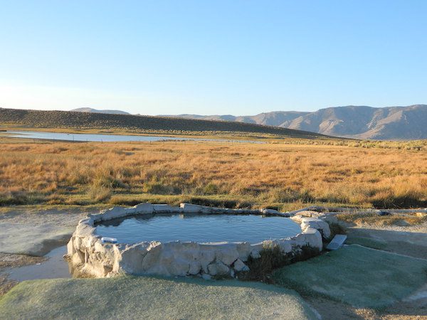
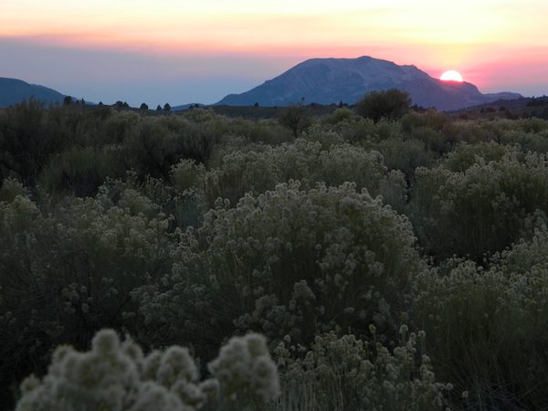
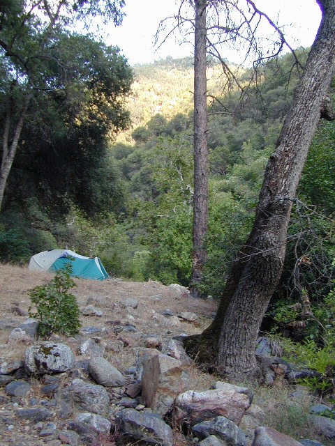
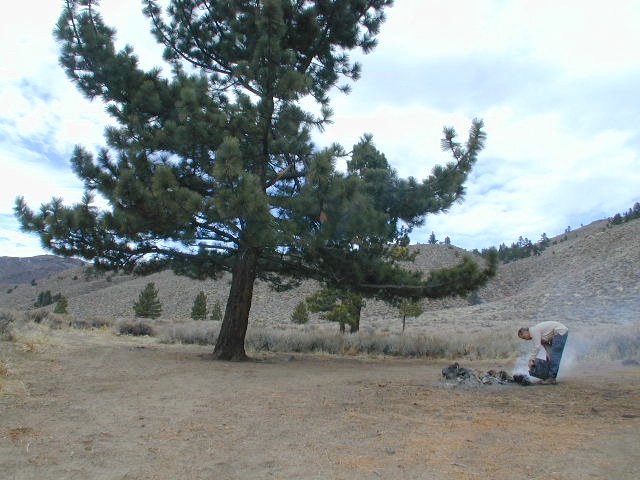
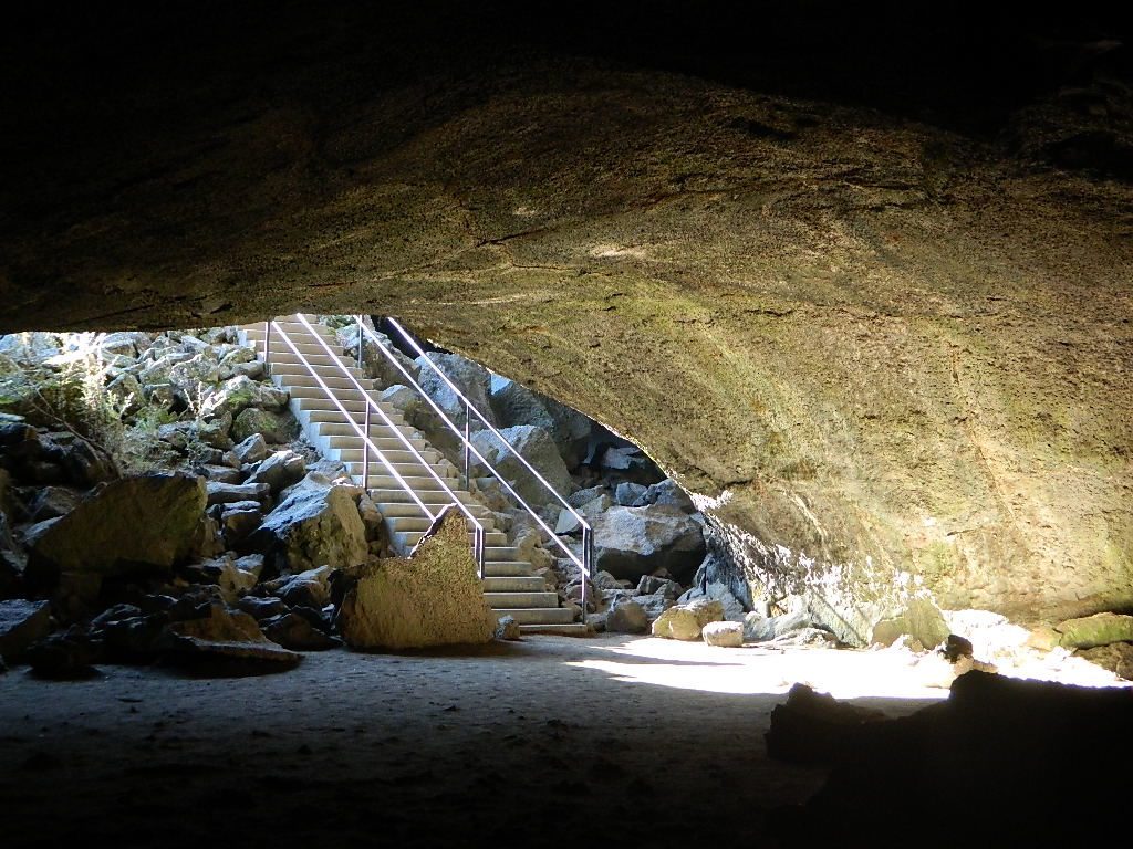
May also be known as Pulky’s Pool in hot springs books.
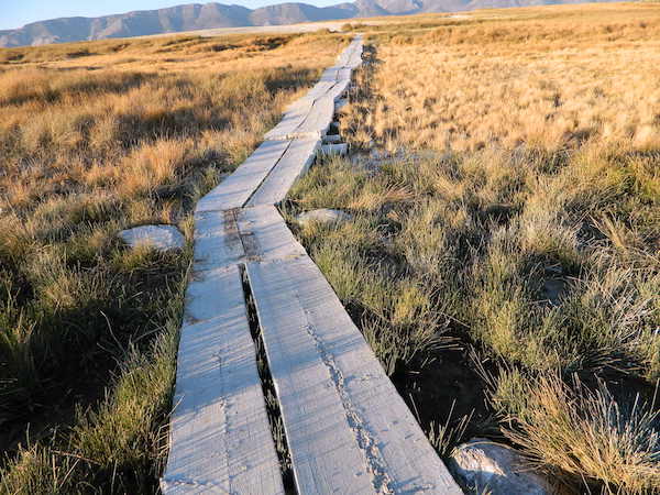
Hilltop is a new found favorite and one of the more scenic spots for a soaking tub in this region. Sitting out in the middle of a clearing, surrounded by marsh lands, this remote hot springs is a hike-in destination. No paved road, nor paved trail. The mountain and sky views from this tub are splendid, and if you time it perfect, you may have the place to yourself.
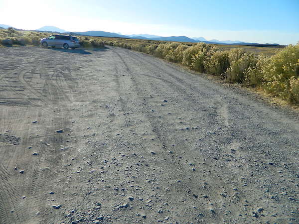
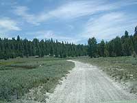
From US Highway 395 @ Benton Crossing Road – drive approximately 3 miles (passing dirt road Whitmore Tubs). Once you’ve crested a small hill, look for a gated dirt road on left, which leads a short ways, back through the sagebrush, to the parking area.
GPS coordinates: 37.6455, -118.8001
The dirt parking lot is adequate enough to handle a dozen vehicles, and this place is so well known, that it gets a fair amount of traffic at any time of year.
Rumor has it that Hilltop is one of the most visited hot springs near Mammoth Mountain; probably due to the proximity to the paved road. Cars and trucks, camper vans and RVs will be coming and going at all hours of the day and night. So consider yourself warned!
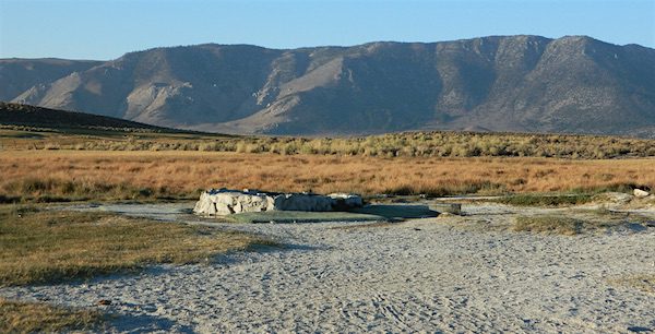
Gate and fence separate the parking from the trail, which leads a quarter mile (often over wooden plank boards) through alkali fields – out to the cement tub.
Only one, small makeshift bench next to the pool – and no tables, no seating, no facilities; Bring tarps, towels, ice chest and camp chairs (if you plan to stay a while).
Plastic PVC pipes and control valve adjust water flow and temperature. If the valve is left ON (wide open) overnight, the small tub will be too hot to soak in the following morning.
Camping options are pretty limited here. A small clearing for a tent, next to the parking lot; and one decent parking spot, large and private enough to call a camp site (at the dead end, past the parking).
The Eastern Sierra corridor of US Hwy 395 is far enough away that it cannot be heard from this spot.
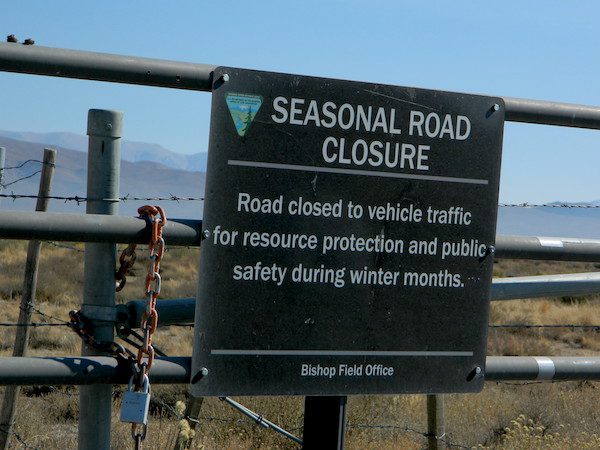
BLM gate at the paved road entrance reads: road is closed seasonally – assuming you can walk in during snowy winter months.
Hilltop is one of several primitive hot springs in this immediate region. See Mammoth Hot Springs for more choices.
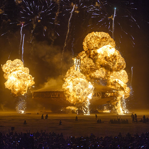
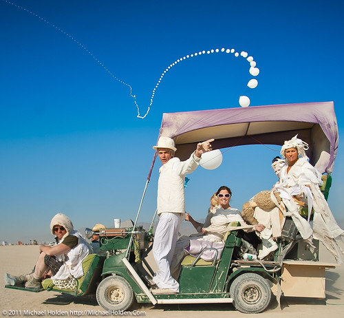
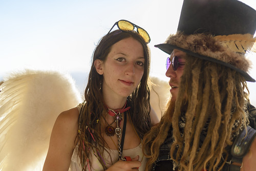
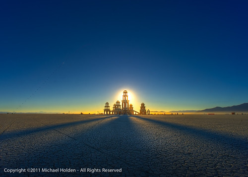
Everyone (who is anyone) has heard of this massive annual desert party by now. The historic bon fire event that started in Santa Cruz in 1986 and then moved out to the deserts of Nevada. Way north of Reno!
The event is getting bigger by the decades, so expect a mind altering experience with tens of thousands of well-decorated lost souls. Advanced tickets are required.
Art cars, construction, costumes, pyrotechnics, live bands, music DJs, the playa dust & summer desert camping w/ 70,000 other freaks in the temporary set up of Black Rock City.
BRC = Black Rock City
NPR said about Burning Man, “Once considered an underground gathering for bohemians and free spirits of all stripes, Burning Man has since evolved into a destination for social media influencers, celebrities and the Silicon Valley elite.”
If you’ve had it with the traditions, the big meal prep, or just sick of the family. Maybe you are a solo traveler, or a new transplant to California and need to explore more. Take a holiday away – for once this time.
Camping for turkey day? What a concept.
California is the perfect place for camping, all year long!
Stick to the lower elevations, look for canyons, and seek seclusion
California mountains often have snow during November. Avoid camping in snow @ 4000-5000′ elevation and above; Freezing temps above 3000-4000′ elevation.
Deserts, coastal regions and foothills are top choices for late Autumn car camping. Always check the weather ahead of departure, and have a plan B as an alternative. NorCal will be much wetter than the rest of the state.
MEALS: Prepare dinner meals ahead of trip departure. Bake turkey days before your trip and create meals based around that. Make mash potatoes at home and don’t forget to bring the butter. Pack pre-baked turkey for sandwiches, plus other quick snacks & meals for on-the-go travel.
Non Traditional: Seafood Feast
Desert Camping is premium at this time of year. Luckily the eastern half of Southern Cal is desert. The lower the elevation, the better the temps will be overnight. Be prepared for wind when the ‘storm fronts’ approach, the winds do get a cranking! Dirt roads can become flowing washes during a good rainstorm, so know the weather forecast.
Coastal campgrounds may need advanced reservations. Be prepared for wet weather, especially up north. The redwoods groves are gorgeous anytime of year.
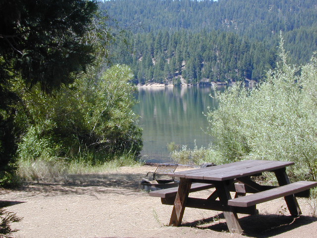
Gold County Reservoirs are prime areas for relaxing in nature, while everyone else is out shopping. Oak hills, rivers and canyons. RV campers love these large lakes; boating, fishing, mountain biking trails, kayak rentals, hiking near historic Gold Rush towns.
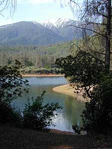
River Canyons of California are always beautiful destinations in the autumn months with fall leaves changing color. Many campgrounds can be found at lower elevation, river access areas.
California’s abundant Hot Springs are also top picks for holiday weekends.
Anza Borrego Desert State Park is always a nice, easy and relatively close get-away for any holiday. Open camping on the backroads (for free) makes it one of the most attractive camping options in all of SoCal. Many dirt roads are accessible for passenger cars, if extreme caution is used. Don’t plan on driving more than a few miles on dirt.
froaders
Masses of off roaders love to camp out, especially on Thanksgiving weekend. Wheel all day, eat, drink, bon fires every night and rumor has it ‘they roast their big bird outdoors – deep in a dirt pit’. Really?
El Centro, Glamis, Imperial Dunes, Ocotillo Wells, Truckhaven Hills, Johnson Valley. All popular off roading areas in Southern California, so consider yourself warned.
Mojave Desert, near US Hwy 395 Jawbone Canyon expect to see RVs, toy-boxes and families outside enjoying the weekend. OHV style. Often the group tries to create a round corral with their huge convoy of vehicles, to keep thru traffic to a minimum around “their camp”. Just stay well away from those gear-heads. In general, it is a very busy area around Mojave up to Hwy 178 during the holidays. Try high desert Horse Canyon instead.
locking down the forests, before they burn (again)
Outside of developed campgrounds and permitted facilities, igniting, building, maintaining or using a fire on national forests in California will be prohibited.
List of Current Fire Restriction Orders for all USFS National Forests in California w/ links.
Fire Restrictions are now in effect for most all public lands in California. Data and news change weekly, so follow links for most up-to-date restrictions, before you make your drive.
These are the earliest and most restrictive campfire orders ever. No? Maybe the long drought years would be equivalent. Below is a brand new list broken down by federal land regions – forest and deserts, including BLM camping areas.
Looks like we are already into Stage II Restrictions for the begining of summer 2020.
NOTE: BBQ grills, all stoves, smoking, firecrackers, welding, chainsaws, off roading, dirt biking, hunting and target shooting are restricted within these orders. A few of these fire restrictions are dated to extend until DEC 31, 2025
More details and specifics can be found on each forests .gov web site, so please use THESE LINKS BELOW (before they break).
The land is dry and wildfire threat is an ongoing battle in California.
FOREST-WIDE FIRE RESTRICTIONS IN PLACE
Wildfires ravage California wild lands every year. Severity, longevity, most deadly. Let this year be different.
Northern California
BLM (Bureau of Land Management)
no campfires outside of developed campgrounds (statewide) (APR 29, 2020 – DEC 31, 2025)
see the current 2020 BLM Campfire Map
USDA PDF map shows only 26 places that you have have a campfire inside Modoc. The far drive could be worth it – for minimal crowds, darkest skies and maximum fishing. Best for week long road trips, super lazy summer style.
Persons with a valid California Campfire Permit are not exempt from the prohibitions.
However, persons with a valid California Campfire Permit may use a portable campfire ring/pit, stove, or lantern ( 5+ feet from flammable materials) IF THE UNIT burns gas, kerosene, jellied petroleum or pressurized liquid fuel, and is EQUIPPED w/ a shut-off valve.
Wow, what a mouthful. Guess the propane campfire is okay?
SUSANVILLE, Calif. May 29, 2020 – Lassen National Forest is enacting campfire restrictions… effective immediately and until further notice. Outside of developed campgrounds and certain permitted facilities, igniting, building, maintaining or using a fire on national forests in California will be prohibited.
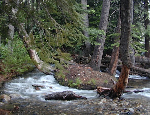
Lassen Camping near a creek in Northern California
BLM Eagle Lake
no campfires outside of developed campgrounds (APR 29, 2020 – DEC 31, 2025)
see the current 2020 BLM Campfire Map
North Sierra where the granite meets the volcanic rock of Lassen. Feather River Watershed, Lake Oroville SRA, Bucks Lake Wilderness, Bald Rock, Quincy, Lakes Basin Recreation Area
Deane’s Valley Campground, way off the main road, between Quincy and Bucks Lake.
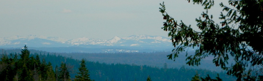
Donner Summit and Lake Tahoe get a majority of the Sierra Nevada snowfall and traffic. Deepest snowpacks are measured way up here, with dozens of small lakes surrounded by granite. Less snow means drier forests for 2020, and more tourists means more campfires. One spark is all it takes!
Tahoe National Forest (snowy mountains) April 2020, taken from Oro-Quincy Hwy looking southeast to Donner.
Yosemite’s west side w/ Bass Lake, Mammoth Pool, Granite Creek, Dinkey Creek, McKinley Grove, Shaver Lake, Huntington Lake, San Joaquin River, Mono Hot Springs, Edison Lake, Florence, Ward, Courtright, Wishon, Blackrock, and the Kings River. Biggest water reservoirs draws the largest crowds. Be fire safe and camp inside of a developed campground this summer.
Sonora Pass and the Gold Country have been hit hard by recent wildfires in the past decade, so now we pay the price w/ much tighter campfire restrictions. Popular mid Sierra region, easy access w/ many lakes and reservoirs; highways of CA 108 & CA 44
Campfires banned throughout the Eastern Sierra region until the end of 2022, within both the USFS and BLM campgrounds. US Highway 395, Mount Whitney, Mammoth, June Lake Loop & Mono Lake
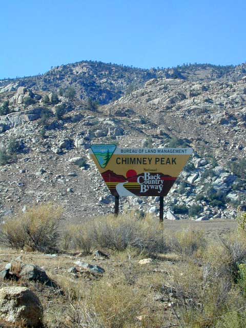
Tighter than normal campfire rules for the drier Southern Sierra. Kern River Canyon, Kennedy Meadows, Chimney Peak and beyond. Drive up hill, gaining levation to Sherman’s Pass or the Western Divide Highway and find a cooler campground in the dense trees. Forget the triple digit heat, brushy river and the masses, and climb to a higher altitude for the Big Trees and Big Meadows. Breckenridge, Horse Meadow, Long Valley, Mountain Home.
The possession or use of any steel jacketed or steel core ammunition of any caliber. This would include handgun, rifle and shotgun ammunition unless a person is in possession of a valid State of California hunting license and is actively engaged in the legal take/pursuit of game and non-game species in accordance with current California hunting regulations, and
During the issuance of Red Flag Warnings and Fire Weather Watches, as determined by the National Weather Service (NWS), all recreational shooting and use of campfires, is temporarily suspended to reduce the potential of unintended wildland fire ignitions for the period of the event.
Stage II Restriction:
All the restriction in Stage I above, and
Setting, building, maintaining, attending, or using open fire of any kind is prohibited, except campfires within approved fire pits and grills provided for in developed recreation sites; or campfires within the Imperial County Special Recreation Management Areas with a valid California Campfire Permit. Controlled flame devices such as portable stoves and lanterns with shut-off valves,using gas, jellied petroleum, or pressurized liquid fuel are allowed and require a valid California Campfire Permit, and
Smoking, except within an enclosed vehicle or camp trailer or while stopped or standing in a three-foot diameter area barren or cleared of all flammable materials and away from federal facility doors, windows and air ducts.
Stage III Restriction:
All the restrictions in Stage I above, and
Setting, building, maintaining, attending, or using open fire of any kind is prohibited. Controlled flame devices such as portable stoves and lanterns with shut-off valves,using gas, jellied petroleum, or pressurized liquid fuel are allowed with a valid California Campfire Permit, and
Smoking, except within an enclosed vehicle or camp trailer unless prohibited by State or local laws.
Free camping outside of a developed campground, for a self-contained camper who wants seclusion and privacy. Real relaxation in total peace and quiet. More nature, less people and minimal vehicles.
Free Campsites • Dispersed Camps • Open Camping • Boondocking
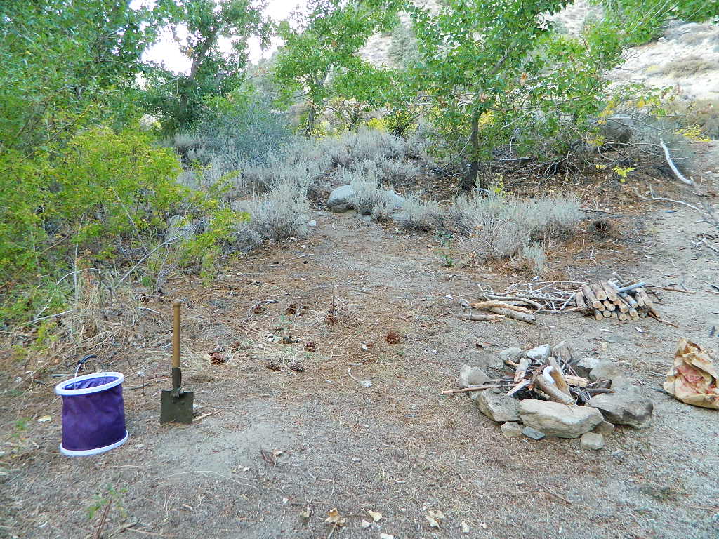
primitive camp sites –the bare minimum. a clearing for a tent, maybe a fire ring. no toilet, no fees; dirt road access.
campfire permits required. And it is up to you to know the current fire restrictions in the area you seek to camp overnight.
The further out you are willing to drive, the more remote you can be. Good topo maps of the region help you to find these ultimate, secret camping spots. National Forests & BLM Lands require a free camp fire permit to have a campfire.
Fire safety is always a big concern in wildfire prone areas like California. Additional Permits & Passes may be needed in some forests or parks; each location is different. Check with the local ranger station for up to date restrictions.
Many dirt roads lead avid campers to the best out-of-the-way camp sites. Camps may have picnic tables or just a fire ring, but usually NO toilets. Have the “No Bathroom Blues”? Don’t sweat it. check out the page onCamp Potty
Some camp sites are as bare as a small clearing, a rock fire ring if you’re lucky. A detailed backcountry map is always advised. If you count on your digital mobile device and online access for mapping, you could find yourself very lost. GoogleMaps is known for mislabeling the smallest of back roads – and they do not feature dirt roads either.
Turtle Mountain Road, SoCal
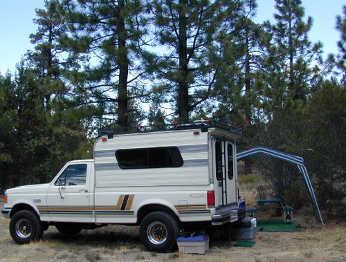
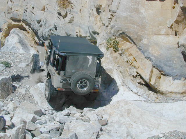
A high clearance vehicle may be needed to reach certain camp spots, but many can be accessed with a standard passenger car. Low riders will likely bottom out and motorcycle riders will get dusty.
Know your vehicles limitations for any off-road use and don’t get stuck in a bad situation. Soft sand is quite common in deserts and 4×4 might be needed. There aren’t any tow trucks out in the boonies and if you do find one, it’ll cost you something fierce. Watch for large rocks, deep ruts or tree limbs in the road (at any time) and watch low overhanging branches when driving a motorhome in to such spots. Some dedicated, hard-core RV campers prefer to camp in remote locations.
Southern California has something called yellow post camps, but we’ve really ONLY seen them inside San Bernardino National Forest areas, which includes Idyllwild and Mount San Jacinto, plus all the Big Bear Lake Mountains.
YELLOW STICK? These are fire safe spots w/ picnic table; secluded in the forest, some accessible by passenger cars, while other camps require a 4×4 to reach. Yellow post sites campfires are often off limits during fire restrictions, when only fires are allowed inside the larger developed campgrounds.
dirt road and trailheads
Backpackers trailheads often have a few camp sites near the parking lot, but these may be busy during summer months. Dirt roads leading to trailheads can have primitive camp sites along them as well. Long, big creeks in the forests are notorious for having awesome camp sites. Big river camp sites are sometimes free, if you know where to look. Sometimes the smallest of California campgrounds have no charge, first come, first serve (BLM, National Forest, or State run).
Before it got labeled BOONDOCKING: Primitive Camping in remote spots was what we lived for. Camp outside of developed campgrounds, for free. Campfires will usually be banned on these back roads during the driest part of the year. Check with local ranger stations for current fire restrictions.
Inyo High Country RoadsMcCloud #39N06 – Grizzly Peak Lookout Rd
pros and cons
possible dirt road access, seclusion, privacy, darker skies, no fees, no crowds, real peace & quiet
no toilet, no picnic tables, no pavement, no hospital, a long hike out, no cell phone service?
always be prepared to hike out (if need be).a giant tree can come down and block your exit road. landslides often happen on dirt back roads. the vehicle could break down or become disabled. get a topographic map and know how to read the terrain, without your device/phone.
PAY extra close attention when driving in (visually with terrain and your eyes and your map). You never know when you may need to back track – or turn around to find a PLAN B campsite.
Avid camper people are indeed known to GPS waypoint their favorite pick campsites (way on the back roads), so they can arrive after work, in the dark, on a Thursday night. Now that’s planning ahead!
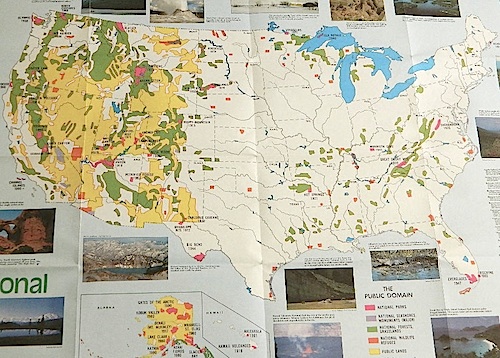
Access to wild land, open spaces, parks, forests, lakes, mountain peaks, public land – USDA National Forests, National Parks, State Parks, BLM. There is more public land available in the west half of the U.S., than anywhere else in the nation. This is one of the top reasons people relocate to the West Coast.
California’s Public Lands for Recreation
Federal lands, government managed parks, USDA National Forests, National Parks, National Wildlife Refuge, BLM, State Parks, State Forests, County Parks, Regional Open Spaces
California National Parks– most National Parks are so crowded you can’t even enjoy the experience in the summer time. Try the off-season times for your best stay. Neighboring National Forests are a much better bet for abundant space, privacy & less taxing on the wallet for fees. These popular (NPS) parks are subject to federal budget cuts and closures.
California National Forests– protected wilderness areas throughout state are surrounded by National Forests (NFS), and most National Parks (NPS) are surrounded by National Forests. Tons of small campgrounds & primitive spots for real seclusion. Get a free fire permit & camp almost anywhere you want. Use that SUV exploring the many dirt backroads & find that perfect camp spot (for free).
California State Parks – local California parks with a lot to offer the day hikers, picnicking family, tent camper or RV camper. From warm dry deserts soaking in a hot springs to the foggy coastal redwoods, these state run parks encompass a large section of California terrain. These parks are subject to state budget cuts and closures.
BLM: Bureau of Land Management – mostly desert regions on the east side of California. A few coastal redwoods, some river canyons in the Sierra Nevada, many off road areas (OHV) in various mountain ranges. These federal lands are open spaces, generally a free for all on recreation. Allowable = off roading, target shooting, open camping, campfires, bonfires. Geared toward OHV use, RVs and hunting.
Coastal California – Southern California beach camping is crowded & sparse, because of developed cities. Central Coast & Northern California offer many more choices in this category.
California Mountains – pine forest, mixed oaks & a variety of vegetation. Water sources such as lakes, stream & waterfalls make this choice the perfect camping spots. Granite peaks, high elevations wilderness areas throughout state & surrounded National Parks. Plenty backpacking options & dirt road primitive spots for the ultimate in privacy.
Countryside in California – coastal hills or mountain foothills. These rolling hillsides offer small creeks, oak trees & plenty of wide open spaces. Lakes & Reservoirs are located within these regions. Most campgrounds are fairly close driving distance to towns or cities. Wine country or gold country, California has it.
California Deserts – perfect for every season except summer, these vast spaces will humble just about anyone. Primitive camping galore & designated areas for real off-roading.
City CA / Urban Villages – not the best for really getting away from crowds, but can be an excellent opportunity to visit a city without spending big bucks on lodging. Or could just be a perfect one-nighter for getting familiar with camping. Most campsites are located in the foothill area behind suburbs, in county parks or even coastal.
California A to Z: Small Towns – 700 and counting; extensive list of destinations, focusing primarily on the back roads and outdoor recreation hubs
California by County – Find every county on Cali, and which towns are located inside of them
Deserts & beaches are the only places for bonfires.
kill your television
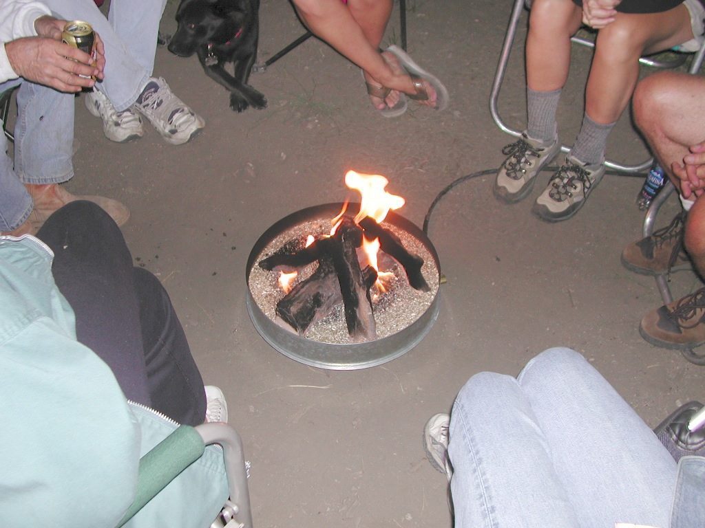
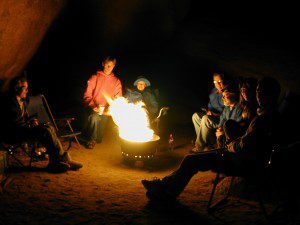
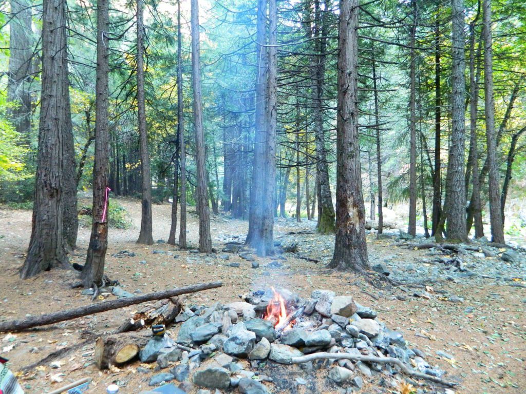
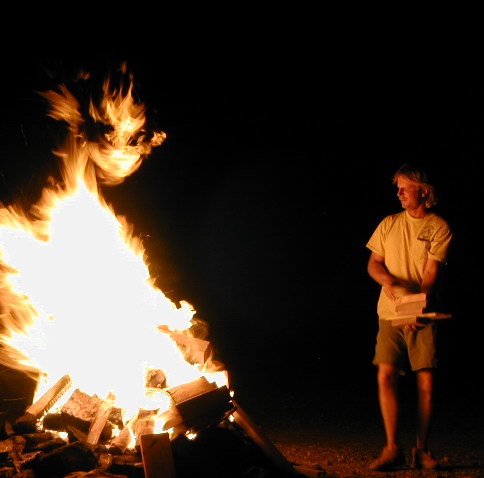
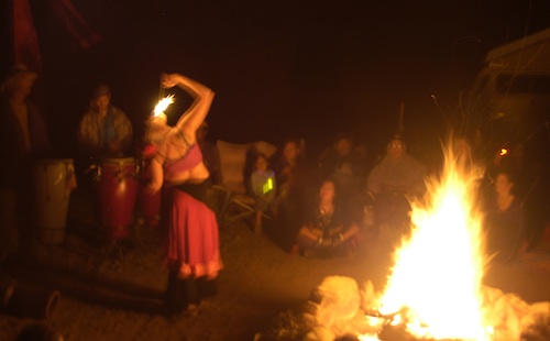
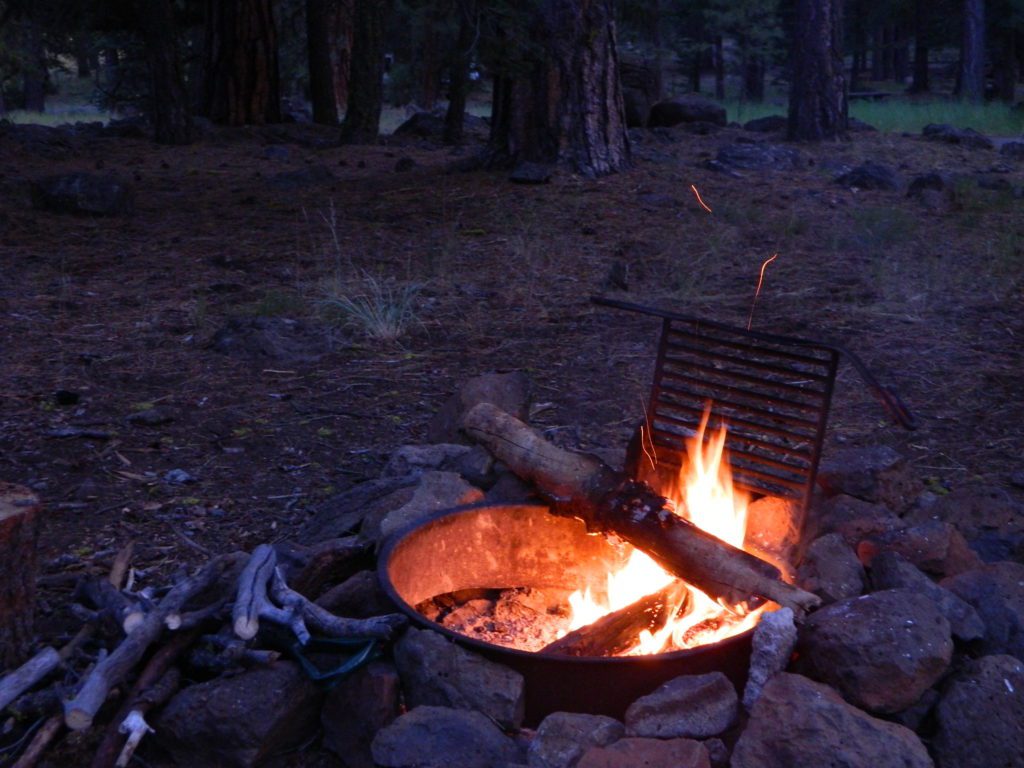
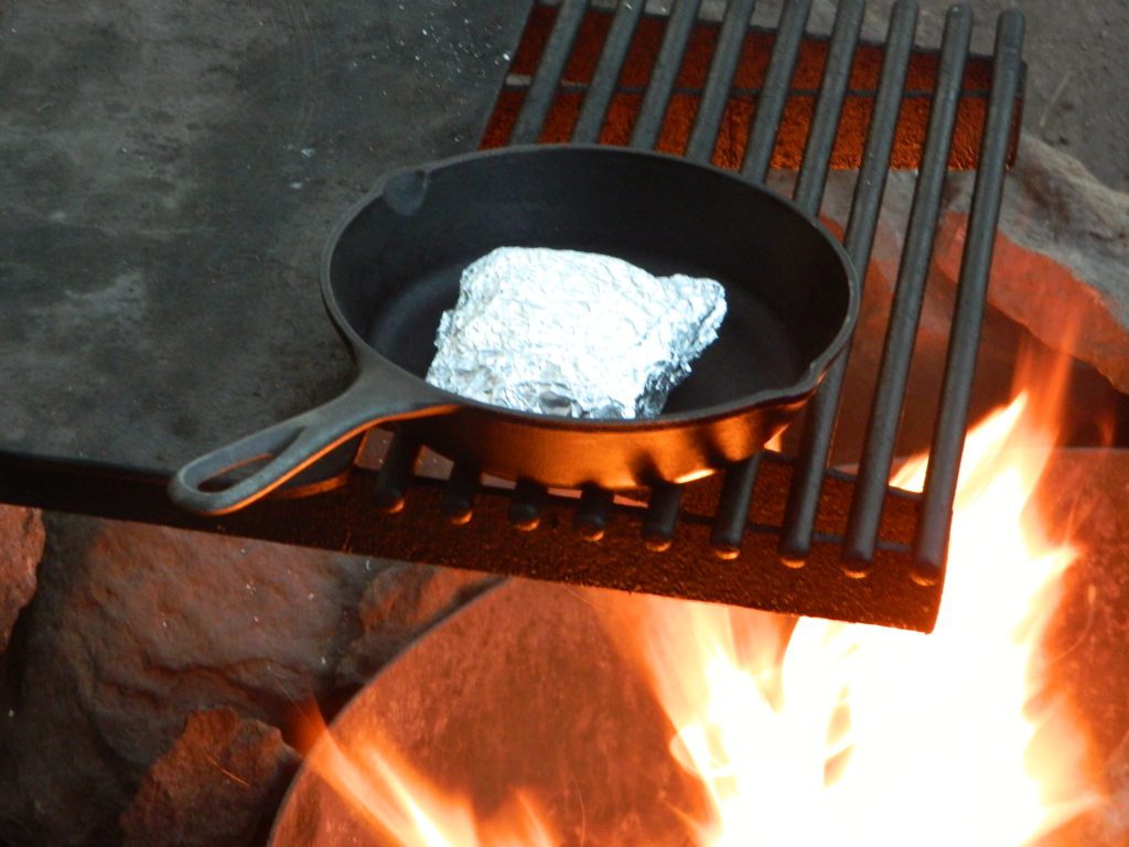
The heat source, the light source, the cook source, the sock drier, the night supplier, the outdoor LIVING ROOM. The campfire is the center stage for all entertainment, dining, drinking, music, true tales and ghost stories alike.
Since the beginning of time humans have gathered around the campfire at dark. This nightly ritual is built into us on the deepest level. We miss this today. We miss the real conversations, the community, the bonding, the stories, the soul searching. We miss the connection with nature, the fresh air and the great outdoors. The night sky filled with stars and maybe a meteor shower, a hot drink and the glow of the campfire coals. Enjoying the wilderness requires certain skills. FIRE is only ONE skill – for survival, for cooking, for warmth, for safety.
Total Escape is dedicated to those who yearn to camp, often.
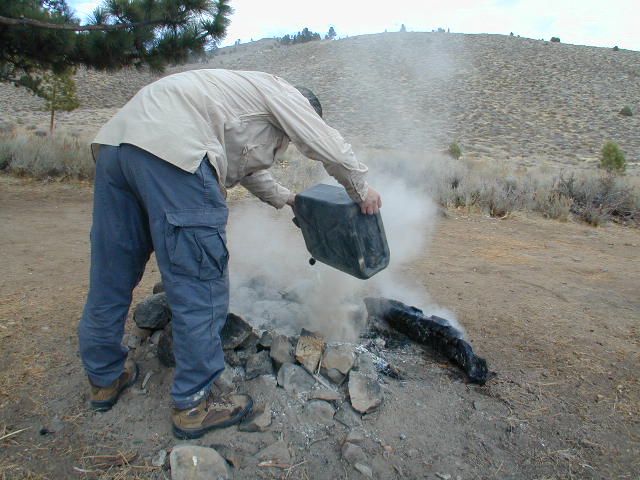
photo – Charlie Sweeney 2010
Some folks cannot imagine camping without a campfire, but we better get used to it here on the West Coast. Weather patterns swing from years of super-dry drought to deluge and drenching – as we’ve seen of recent in California. Dry conditions means high wildfire dangers, tight camp stove and strict campfire restrictions.
Each California region, National Forests and State Parks have their own fire restrictions, so call ahead to rangers for current fire conditions on the place you wish to visit. Certain mountain locations will ban fires in the back country, fires on the back roads and sometimes in extreme conditions, no fires allowed even inside a developed campground.
Sagebrush could be cleared back another few feet, at least.
Campfire Restrictions
California is well known for its unforgiving drought conditions and its seasonal wildfire danger. Always know the fire conditions in the area you plan to camp. Most Southern California regions have banned ‘open campfires’ in forested areas, due to wildfire threat and population density. Call ahead to get an update on road closures and current campfire restrictions. Find California BLM offices & NFS ranger stations
Campfire Permits
If you plan on camping outside of a developed campground, you will need to get a free “camp fire permit”, which can be obtained at the local rangers office.
Build campfires in designated rings. Always try to use an existing ring when possible. If you must build a new rock fire ring, follow the guide on FireSafe
You will need water source & bucket, plus a decent shovel for building, maintaining and controlling a campfire. BRING enough water & tools with you to control a fire.
A ten foot clearance – all around, down to the bare dirt is the best practice. No brush close to the ring, no bushes, no leaves or pine needles. No dry over-hanging tree branches.
You might need to clean trash out of the fire pit, so bring heavy duty trash bags, or a spare old box. Shovel comes in handy here.
Kindling is key to getting a good fire going fast, so gather more of the small stuff. Wood gathering away from camp is usually better pickens.
Use environmentally friendly fire starters (with damp wood, if you must); not the BBQ lighter fluid or gasoline
Building fires up against a big boulder scars them w/ black soot, and although it can reflect heat back to you, it is seldom worth the unsightly damage
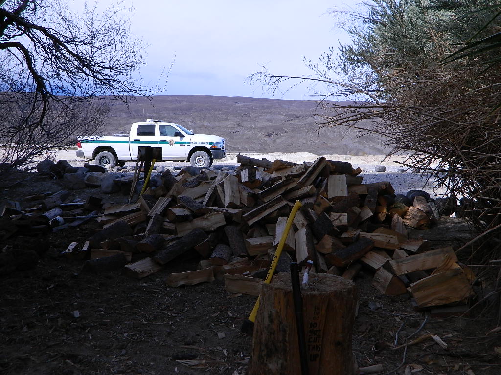
Bring chainsaws or hand saws for cutting your own campfire wood in the forest
Gathering wood for fuel — use only dead and down wood
A ranger issued “wood cutting permit” is required if you plan on cutting a full cord
Never burn plastics, batteries or other toxic materials in campfires
Tossing beer bottle caps into a campfire only litters site for future campers
While glass bottle smelting is a real treat among boys at night, which one is actually gonna get their hands dirty & clean up broken glass out of the campfire the following morning?
Do not leave any hot coals during the day (if you are away from camp). Winds could pick up.
Always douse campfire with water completely when breaking camp. Stir it, feel for heat, and drown it more if you hear sizzling or see bubbling.
Read more wild fire / campfire info on our FireSafe page
The Final Step of Breaking Camp
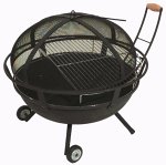
Campfire Pits & Fire Containers
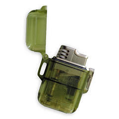
Stormproof Lighters
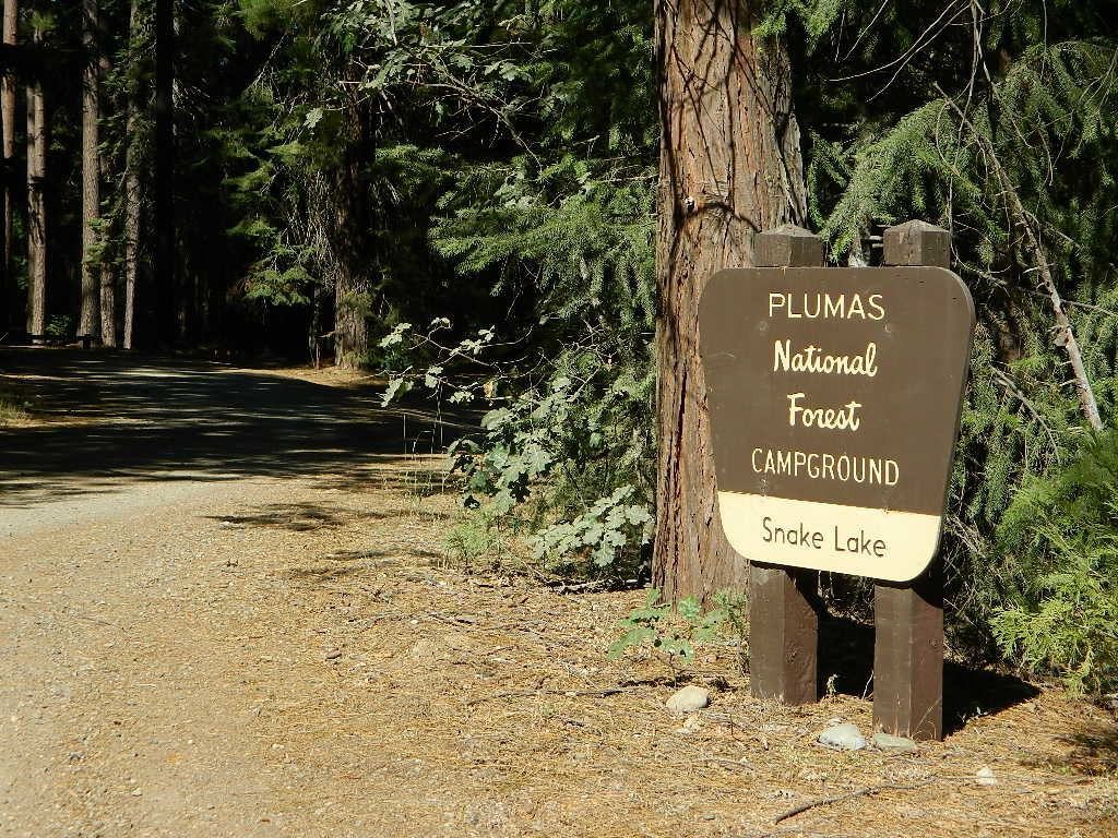
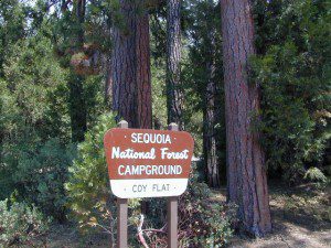
Developed Campgrounds offer sturdy, permanent, metal campfire pits. Many have adjustable grills built in.Primitive Camping is allowed in National Forests throughout California. Campfire permits are required. This style of camping is more peaceful and secluded, without neighbors, without fees and without amenities (no table, no fire ring, no toilet)
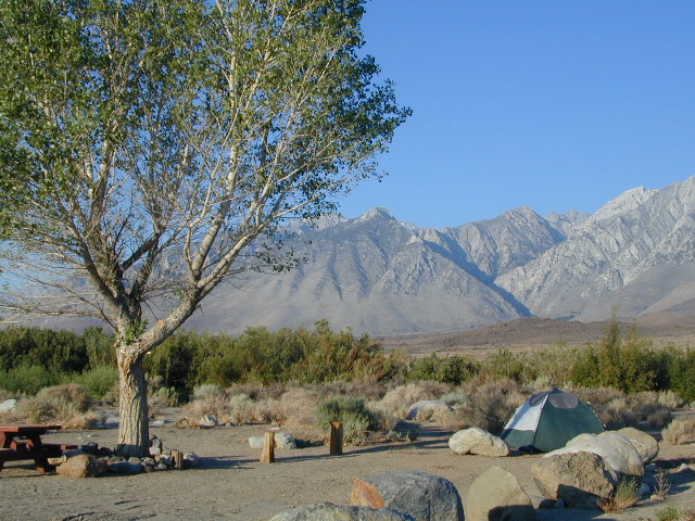
Inyo Forest Campgrounds – Eastern Sierra Campgrounds
areas include: Lone Pine, Mount Whitney, Independence, Onion Valley, Ancient Bristlecone Pines, Big Pine, Bishop [Hwy 168], High Sierra, Owens River, Lake Crowley, Rock Creek, Mammoth Lakes [Hwy 203], June Lake Loop [Hwy 158], Lee Vining & East Yosemite National Park [Hwy 120]. Camping on Eastern Sierra Highway 395
Eastern Sierra recreation – backpacking, horse packing, day hiking, creek fishing, mountain biking, mountaineering, rock climbing
Listed below are Inyo National Forest campgrounds, County Parks, BLM public camps for outdoor recreation. Many campgrounds are closed for winter months. Blue links lead to more camp information. Boldface links to detailed information & photos on campground.
State Parks, State Forests, State Recreation Area, National Parks, National Monuments, National Forests – What is the Difference?
Forest, Park, Reserve, Monument, Recreation Area, BLM, Nature Preserve… arghh!
Don’t let all the park and forest names confuse you. It is all California and it is your public land! No bikes on trails, No gathering wood, No dogs here, No camping there; Now what?
Below is our overview graph for all California parks and forests – the basic concepts & the rules broken down for anyone to understand. Permits may be needed in certain areas. Only the government officials understand the true nature of all the ridiculous red tape.
Back country lands very protected from roads and human impact. Off limits to vehicles & mountain bikes. Only accessible by backpacking, hiking or horseback. Endangered species; Hard to reach terrains in the High Sierra. Overnight visits may require a wilderness permit.
Federal lands are national parks, preserves & monuments; highly regarded as some of the most scenic in world & protected. Very popular places and crowds often in summer. Limited use areas for camping & recreation. No mountain biking on trails. No dogs on trails. Try off-season. Drive thru entrance fees.
NM: California
National Monument
Located within the National Park System & more specific to a region. Historic buildings, geological features and deserts ruins qualify. Some National Monuments become National Parks. Many locations have entrance fees.
NRA: National Recreation Area
Located within the National Park System & somewhat specific to a waterways, coastlines, lakes and reservoirs. Some locations have entrance fees.
NSA:
National Scenic Area National Seashore
Located within the National Park System & is basically scenic area worth preserving. Usually no entrance fees.
Areas of forest lands throughout state; some surround the National Parks. 18 national forests make up 20 million acres of federal land. Multiple use areas: snow skiing, mining, grazing, off-roading. OHV & SVRA Tons of small campgrounds, recreation & primitive spots for real seclusion. Best bet for finding a spot away from the crowds. Get a free fire permit & camp on back roads. No entrance fees, some parking or day use fees; SoCal requires an Adventure Pass.
California Department of Parks & Recreation manages more than 260 parks. These smaller parks are located near cities with historical parks, as well as remote wild state land & coastal beaches. Entrance fees, day use, picnic and some have campgrounds. State Parks charge fees for day use, parking and overnight camping.
California SF: California State Forest
California Demonstration Forests, areas to be protected. Redwoods & Sequoia Groves; fragile eco-systems. Handle with care. May charge entrance fee or day use fee.
California SRA:
State Recreation Areas
California Department of Parks and Recreation. Lakes, Reservoirs, Rivers. Many have boat rentals and active marina. Recreation lakes charge entrance, day use, parking or boat launch fees.
Off Roading folks and dirt bikes can have their fun wheelin. Lands set aside for OHV use; dune buggies, quads & 4×4 enthusiasts. Most in desert regions; forest lands. Developed campgrounds large enough to accommodate RVs and trailers. Fees may apply in these off-road areas for day use or camping.
California County Parks
Desert hot springs, oak foothills and campgrounds, local hills w/ hikes, parks close to urban regions. Back roads & rural land protected from freeways & development. May require parking or entrance fees. Find these listed on the California A-Z town pages
City Parks in California
Urban Parks & Recreation, inside the city limits. Usually no entrance fees. Find these on California A-Z town pages
All public lands that do not fall into the above categories. Little to no fees for day use, recreation or overnight camping. Plenty of desert & off roading areas. Some forest lands, certain lakes. Small campgrounds or open camping allowed. Fees may apply in developed campgrounds. Camp overnight almost anywhere out here for free, with a ranger issuedcamp fire permit.
Sequoia – which one?
Sequoia National Park
Sequoia National Forest
Giant Sequoia National Monument
Imagine that the Southern Sierra mountains is home to 3 different public parks named Sequoia. Yep, it’s true. Sequoia National Park, Sequoia National Forest, and Giant Sequoia National Monument. Other parks that have Sequoia groves are – Mountain Home State Forest, Calaveras Big Trees State Park, as well as Yosemite National Park.
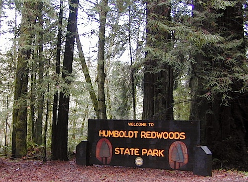
As far as the Coastal Redwoods, most are included under State Parks. Find these parks on the Central Coast Big Sur and Santa Cruz mountains, plus Marin County, and all along the north coast US Hwy 101 from Mendocino to the Oregon border. Numerous redwoods parks are located along rivers.
The super scenic Big Sur coastline is home to Julia Pfieffer Burns State Park and to the similarly named Pfieffer Big Sur State Park. Leave it to park personnel, state officials or the non-locals to create such a confusing naming system within our most-visited state.
Lava Rock @ Blue Lake in Modoc CountyHolcomb Valley Camp, Big Bear Lake, CA
Lassen Camping near a creek in Northern California
California Outdoor Recreation:
All parks, forests, preserves, monuments, public lands, lakes, rivers, wilderness, historical sites and museums can be found listed separately on our super duper local A-Z town pages
Mountain biking has become a popular sport especially in California. We’ve got so much great terrain, so close to home (the urban sprawl), that this outdoor hobby is bound to get you back in shape, fast. Start slow to avoid burnout and injury. The weather is awesome, just go. Plan a camping weekend & bring your bike!
Obvious (but humorous) information on bike riding or mountain biking in Sequoia NP. Upon doing research for this page, noticed a heck of a lotta folks typing in the phrase
Sequoia National Park Bike Trail
I laugh…. but plenty people are searching for bike trails near Sequoia groves, inside the most protected of lands, the National Parks.
Firstly, most National Parks in California do not allow bikes on hiking trails. The Sierra Nevada has NO National Parks that allow mountain biking on their trails. (official words are: Biking is allowed on the main roads in the parks but is prohibited on park trails.)
Yuk. Who wants to ride on asphalt in the wild?
Yosemite & Lake Almanor both have nice paved bike paths. But you may want dirt trails for biking. Be it mellow mountain biking on forest roads, or the hard core Downie-droppers.
California Wilderness Areas are the same rules, but even tighter. So that brings us to Sequoia National Forest. Yes, indeed California National Forests allow mountain bikes on most trails, in most cases. The popular trails might even get small brown signs showing bikes that are allowed.
Second, there are no bike rentals inside Sequoia National Park (or Kings), so you must bring yours in, or better yet ride in. I dare you. Although you cannot take said bike on a dirt trail, so you’ll need to stick to pavement only. The main highway (Hwy 198) has got to be one of the curviest, narrow, fern lined ridge routes of the region. You would be a fool to ride this area, as a senior citizen w/ a 40 foot motorhome or a speeding SUV may take you out on a curve. Seriously! You better be in great shape if you plan to descend into Kings Cyn. That route is just as dangerous if not more so. These 2 National Parks – Sequoia & kings, both get a lotta traffic. Year round.
Thirdly – here is the biggest tip of the whole topic. In between Kings Canyon & Sequoia National Parks is a slice of Sequoia National Forest land. (Meaning you can ride bikes or mountain bikes here) Most call it Big Meadows Road # 14S11 & there is plenty camping all down this road – 12 miles with spur roads in every direction. A nice chunk of forest with rocks, meadows, camps & dirt roads. Granite & great scenery. What more could you ask for? More forest roads than single track trails tho and please watch for equestrian traffic. The dead end of this road leads out to 2 Wilderness areas, so be prepared to navigate with a good map in hand. No bikes are allowed in the Wilderness, remember?
Total Escape loves camping so much that this web site literally has hundreds of pages on the topic, but we won’t overwhelm you with the list on this page. Below is a good cross section of what camping pages we have & what to expect.
Camping in California is a blast! Enjoy nature, sleep under the stars, exercise & save money while vacationing. We show you road trips geared around nature, all local, all outdoors, all California. Exploring dirt roads for secluded spots and small campgrounds, learning new survival skills in the back country and enjoy the wilderness without the tourist crowds. The average weekend trip can run you as little as $100.00. This includes fuel, groceries, firewood and maybe camp or park fees. Once purchased your basic camping gear – tent, sleeping bag and stove can last you decades if properly cared for.
Anza Borrego Desert State Park & Borrego Springs Campgrounds
Anza Borrego Desert is the largest of the California State Parks. Borrego Palm Canyon Campground is the official name of this popular palm oasis & developed campground located very close to Borrego Springs CA. Hike or bike to town. There is also a private RV Park named Palm Canyon Resort in town, just to confuse you.
Desert wildflowers blooms, popular hiking & biking trails, plus mud caves & slot canyons draw plenty visitors here, mostly in the winter months. Summer high temps exceed 90 degrees for months at a time.
There are hundreds of miles of dirt roads to explore, and one could easily spend every weekend for a full year, checking out all there is to see in this vast desert, where elevations range from near sea level to 5000′ peaks.
BORREGO PALM CANYON CAMPGROUND
main campground near Visitors Center, in town Borrego Springs, CA
120 camp sites for tents & RVs, flush toilets, overnight / day use fees reservations accepted
TAMARISK GROVE CAMPGROUND
27 camp sites, flush toilets, fee
on S-3 @ Highway 78 jct (closed June – Sept) reservations accepted (Oct-May)
Vern Whitaker Horse Camp
equestrian campground w/ corrals, 10 camp sites, flush toilets
elev, 960′, located N of Borrego Springs, near scenic and rugged Coyote Canyon. reservations accepted
Backcountry Campgrounds Anza
Arroyo Salado
16 miles east of Borrego Springs on County Road S-22
Blair Valley Camping Area
open car camping & RV spots, vault toilets
on SAN DIEGO County Rd S-2 near Highway 78 jct
Bow Willow Campground
elev, 950′, hwy access, 16 camp sites, pit toilets, overnight fee
near Sweeney Pass & badlands overlook; located on S-2, 9 miles N of Interstate 8
Canon Sin Nombre
off S-2 near Sweeney Pass; entrance near Badlands Overlook; slot canyon hikes
Coyote Canyon Camping
N of Borrego Springs via Di Giorgio Road
rugged backcountry dirt road, tent camping only
car camping near ocotillo gardens; 4×4 needed @ creek crossing & Sheep Canyon
Culp Valley Campgound
elev, 3400′, hwy access, 8 camp sites, pit toilets, free camp
located on S-22, atop Montezuma Grade
Culp Valley Boulders
elev, 3700′, dirt road access, primitive camp sites, free
located off S-22, 4×4 near Montezuma Grade
Fish Creek Campground
Hwy 78 near Ocotillo Wells & Split Mountain
elev, 280′, dirt road access, 8 camp sites, pit toilets, free camp
from hwy, go 12 milies south on Split Mountain Road
Yaqui Well
5 mi. south of Borrego Springs on County Road S-3 & right on Yaqui Pass Road, go 6 miles to camping area on right side
Yaqui Pass
5 mi. south of Borrego Springs on County Road S-3 & right on Yaqui Pass Road, go 4 miles to camping area on left side
Culp Valley trails, North Anza Borrego SP, SoCal Deserts
All Desert Campgrounds Nearby
AGUA CALIENTE HOT SPRINGS
(San Diego County Park)
88 camp sites for tents & RVs, flush toilets, overnight / day use fees, 760-765-1188
located on Co. Rd S-2, 22 miles N of Interstate 8 (closed June-Aug)
BOX CANYON RDMecca, CA – in between Joshua Tree NP and Anza Borrego Desert
BLM camping in Box Canyon & Mecca Hills Wilderness Park
LEAPIN LIZARD RV RANCH
(Private Campground Resort)
85 acres, 60 camp sites
located on Split Mountain Road, Ocotillo Wells, CA
OCOTILLO WELLS SVRA
(State Vehicular Recreation Area)
elev. 160′, 4×4 and off road camp sites for trailers & RVs
no water, no hook-ups, pit toilets, no fees, 760-767-5391
located on Highway 78 (closed June-Sept)
PALM CANYON RV RESORT
(Private Campground Resort)
located in town, Borrego Springs, CA
SALTON SEA SRA
(State Recreation Area & Campground)
Mecca Beach, Corvina Beach, Salt Creek Campgrounds
located on Highway 111 on east side of inland sea
SLAB CITY @ SALTON SEA
old Camp Dunlap in California desert badlands
free & open RV camping near Salton Sea
located off Highway 111 on east side of inland sea
TRUCKHAVEN HILLS
(OHV trails & camp spots)
elev. 300′, 4×4 and off road camp sites for car camping, touy hauler trailers & RVs
no water, no hook-ups, no fees,
located on S-22, East of Borrego Springs, CA
VALLECITO PARK
(San Diego County Park)
44 camp sites for tents & RVs, no hook-ups, toilets, overnight / day use fees, 760-765-1188
located on S-2, 22 miles N of Interstate 8 (closed June-Aug)
FREE CAMPING ANZA– Let us also remind you that this is the best place to camp in California for primitive car camping (camping outside of a developed campground). Open all year long – always! Super secluded, darkest skies, free and always located on the back roads. 4×4 is not required in all areas, so there are plenty of options. Blair Valley or Coyote Canyon Gardens are popular camp spots, but there are thousands of hidden canyons and washes in this giant State Park, just awaiting your tent. You’ll need a decent topographic map. For more info on free camping click here.
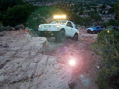
When people hear the phrase “off road” a hundred things can come to mind. Granola types envision rednecks, guns & beer cans tearing up the wilderness; while teen boys may like dirt bikes or motocross races; your co-worker digs the rock crawling rigs (on TV); your lesbian pals like to do desert & ghost town exploring in their Jeep & a million families like to camp out with RV & toys in tow. The quads, the sand rails, the rock crawling machines, the custom built buggies. Trophy trucks, rally racing Subies, 4WD camper vans, dirt bikes, the standard stock SUV, some w/ 4-wheel drive and who can forget the ever-freaking-popular jeaps. Sunday drivers sightseeing or hard core dare devil racers can be found in the realm of off-road: Off pavement.
They are ALL off roaders! And they are all unique, custom & no two created equal. There is certainty of it & the passionate fans will tell you. The off roading interest has gained popularity as more & more recreation vehicles become available to the main stream market. And TV shows promote these awesome rigs, the sport of dirt racing, rock crawling & the fantastic terrain. (And if you still watch television, that will soon change!)
Baby boomers seek retirement vacations: compact 4WD camper vans, or smaller RVs capable of trailering an off-road machine; Fathers look for ways to entertain family out of doors, or escape on solo trips (for sanity sake). The off-road sport and interest has literally exploded over the past 20 years w/ media, hobby, competitions & after market products – along with the rising gas & tire prices.
Plan better trips, learn to really read a topographic map, depart for your trip over-prepared and find new, amazing destinations all over California. Use Total Escape often and get a bumper sticker for your rig!
Many folks drive dirt roads just to get to a trailhead and go hiking, mountain biking or rock climbing. Many backpackers trailheads are indeed located miles off pavement on forest dirt roads.
Some outdoor enthusiasts crave seclusion: peace and quite, away from city life, city folks, all noise… well away from the crowds. Preferring to camp outside of developed campgrounds, which means free camping (mostly on dirt roads). Campfire permits are always required. Many excellent, hidden camp sites can be found on rugged, unpaved back roads – some requiring 4 wheel drive, others not.
Gear Heads: those who value ‘vehicle time’ over ‘real nature’ will literally SIT inside their rigs (almost all day) – enjoying scenery from a safe distance. Picnic spot, viewpoint, yes, but rarely ever seeking out a hike, or a waterfall. Should a break-down occur, these dedicated guys will have their heads under the hoods or crawling underneath, for hours if needbe. Always be prepared with food in the cooler.
And believe it or not, some off-roaders will not even tent camp! They do not sleep on the ground. They prefer a local lodge in the nearest small town or they could own a luxury RV (towing a trailer w/ the overbuilt Jeep). Talk about gas guzlers.
Backcountry routes may be signed – high clearance needed, or not. Black diamond, double diamond trail. Yikes 4×4 required, what! Did we miss a sign or take a wrong turn?
SIGNS are not always reliable on the back roads.
Small Signs: get shot at, run over, blown over and washed away with erosion… so best have a hard copy map (at all times).
In Trinity, locals have been known to remove forest road signs to confuse tourists and prevent traffic in certain directions. I can’t imagine why. Cough, cough, Hyampom!
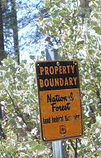
PVT – private property
This brings us to private ROADS & LAND. Just because a dirt road is located in a forest or rural region doesn’t mean it is open to the public. Generally private lands are well marked w/ ‘No Trespassing’ notices, some fenced and gated. In Baja and in ranching areas in general, public access may be allowed to pass through. Inquire at a local ranger stations for the area you wish to explore.
Litter removal 101 should be the norm; Don’t Trash California! Teach your children well. Respect the land and always Tread Lightly! Find more about ECO – CAMPING
East of Lake Isabella and west of Walker Pass, there is a small community called Canebrake along Highway 178 Canebrake Road, a graded dirt road climbs up into pinyon pine forests. Lamont Peak (aka Lamont Pinnacles) is a decent hike & rock climbers dig it too.
Chimney Creek Campground is along the main road and has RV access (28′ max), for the motorhomes who do not mind a little dirt road driving. Easy trail access to numerous area hikes. The PCT is routed close by.
Long Valley Campground is tucked way back in the boonies with trailhead leading into the granite Dome Lands; Fishing and river access to the South Fork of the Kern.
Long Valley Loop Road (2001)
Long Valley Loop Road circles the Chimney Peak Wilderness, which skirts the Domeland Wilderness. THE LOOP is washed out and ROAD is NOW CLOSED in one portion. See BLM web site for up to date info.
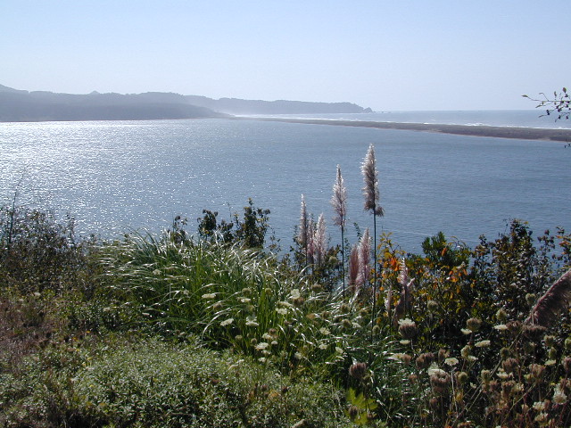
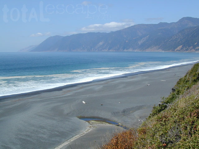
The sheer beauty of real weather, the clashing storms and ocean with the land. Cold and wet half the year (or more), Northern Cal has less people and more scenery. More nature, more land, more forests, more view points, more wild beauty – than the rest of the California coast.
Maybe more hippies too!
The fantastic coastlines of Northern California are forested, rugged, rocky and they receive a lot more rain than the rest of California. Coastal fog or deep cloud layers are common, even in warmer months.
Tall cliffs, large lagoons, rural towns, and foggy beaches. Beaches filled with small rocks. No sand? Minimal access to the coast in some areas.
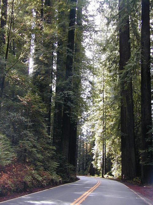
Super tall, coastal redwood trees thrive along this oceanfront wildness. They are located just a skip away from the sea. Most groves located miles inland, near US 101 highway. Close enough, but not out there on the windy beach, exposed with the elements.
NorCal Coast Campgrounds are located generally along river ways, near redwood forests and near paved roads. Redwood Campgrounds are all over up here. Literally, everywhere. Some camps are better suited for RV campers than others. A few parks have walk-in or hike-in access to camp sites.
Several redwood parks are 20 miles from the coast, so know the exact location before you book a campsite online. Driving “over to coast for a quick day trip” is no easy task, since routes can be narrow backroads with many curves. Pavement, if you’re lucky.
listed below:
campgrounds actually located at the coastline are labeled in bold text
When the weather is warm and sunny, people – flock to the hidden coves, rugged beaches, or they float, kayak, fish or raft on the rivers, or the enjoy long day hikes.
blue links lead to State Park pages with camp reservations.
Some redwoods parks are open year round, others only in summer months. Reservations for campgrounds is common along this desired vacation region of California. River kayakers, mountain bikers, tent campers, avid hikers, road trippers and RV campers.
camps actually located at the coastline are labeled in bold text
California Redwood forests are found along the NorthCoast; coastal redwoods. And in the Sierra Nevada mountains; those big redwoods are called Sequoias.
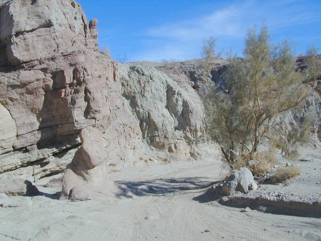
Lost Coast: Drive Dirt Roads – USAL ROAD# 431, this road is the hard left off HWY 1, just as it peels away from coast and heads into redwoods and US 101. Follow this dirt and gravel scenic wonder drive out to Usal Beach Campground, Sinkyone Wilderness and Shelter Cove. The pavement picks up again near Honeydew, a rugged 30-something miles north. Real 4×4 may be needed in wet weather.
Eastern Sierra Nevada – Inyo Mountains
Inyo Forest Back Roads – Mammoth Off Road
Off Road near US Highway 395. Yep, Olancha has some OHV (off-road) areas near the dunes, but this web site is dedicated to the real deal, the scenery, the trail heads, the hot springs, great secluded camping & of course, back road exploring.
You will need a Inyo National Forest map to discover these back roads. These are minimally traveled routes, un-maintained, sometimes washed out, eroded & maybe even creek crossings (without a bridge). Some gravel two-lane routes, some one lane roads leading deep into dead end canyons.
A few popular routes are paved, but most of these listed are indeed dirt roads. Some may require high clearance vehicle, or even 4×4. Know your vehicles limitations & be prepared to turn back when the road worsens. Cuz more often than not, it’s a sign of what more difficult terrain is to come.
Watch out for live stock – they are dumber than they look.
Owenyo Rd – Wanna parallel the highway (395) on dirt; Sure, it’s a long bumpy route – from Hwy 136 @ Dolomite to Bend City @ Mazourka Cyn.
Road# 13S05 – Mazourka Canyon Rd – leads up to some old mining camps & way behind Mazourka Peak (9410′) deep into the Inyo mountains. It’s all desert on this side, but these canyons have pinyons & more vegetation than you would imagine. Road# 9S15 & 9S14 circle Andrews Mountain (9460′) then join back up w/ Death Valley Rd (the North Pass into Saline Valley).
Ancient Bristlecone Pine Forest has some great dirt roads surrounding it. After you are finished with all the touristy sights & you don’t wanna spend the rest of the day in the visitors center or back at camp, try Cottonwood Canyon – full of aspens, camp sites & fishing, not cottonwood trees. 4×4 is required. Crooked Creek has boulders, boulders & more boulders. Plus some amazing camp sites with open sky views. Silver Canyon is for high clearance only, 2WD okay. This will lead you down to Laws Railroad Museum on Hwy 6, on the back side of Bishop, CA
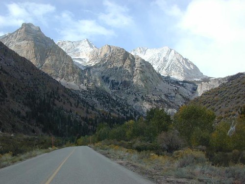
Benton Crossing Rd (green church @ 395)
This wide road leads out to multiple dirt roads that peel off in every direction. Many Eastern Sierra Hot Springs can be found out here – on the east side of the highway. No hot spring resorts, no facilities, no clothing & very primitive.
Bishop 4×4 route Coyote Flat
Coyote Wash leads up to Coyote Flat & out to Coyote Lake. This a a spectacular high altitude plateau overlooks the Owens Valley & requires 4 wheel drive just to get up there. Pinyons, junipers, aspens, wildflower meadows, old mines, & yes, lakes at 11,000′ elevation. Views of the High Sierra & South Lake.
Buttermilk Road – This dirt road is north turn off of Hwy 168, W of Bishop, CA. “The Buttermilks” are a popular spot among rock climbers. A great place for indian petroglyphs too!
Road# 9S21 – Glacier Lodge Road – Paved road. Creek exploring & fishing. Plenty Campgrounds. W of Big Pine CA
Horseshoe Meadows Rd – Paved route with great views over Owens dry lake bed; access via Lone Pine CA; A nice day trip to meadows & High Sierra scenery. Picnic & day hike!
McMurray Meadows Rd – south off of Glacier Lodge Rd (#9S21) just W of Big Pine CA. You can find ancient cinder cone volcanoes & cave-like lava tubes in between this long dirt road & the highway.
Monache Meadows is a high elevation meadow that takes some time & determination to get to. This area is part of the Inyo National Forest, but can be accessed by either: backpacking thru the high Sierra’s or driving a high clearance vehicle thru Sequoia NF # 22S05 Sherman Pass Road, behind the Black Rock Ranger Station & Troy Meadows Campground. High clearance is needed, 4×4 maybe. Great camping sites near Olancha Peak trailhead. The area is surrounded by Golden Trout Wilderness & South Sierra Wilderness. From US Highway 395 to Kennedy Mdws & then Monache is a full day of exploring, so you may as well stay the night up there. But bring warm gear, a campfire permit & a capable vehicle.
Manzanar Routes – Back behind Manzanar Camp there are miles of dirt roads to explore. Many creeks side camp sites can be found even with a passenger car. Small trees & sage brush. Secluded camping (for free) is possible in the Eastern Sierra.
Mono Craters (Rd# 1N11) – the youngest mountain range on the continent. Just south of Mono Lake, this route skirts the pumice cones & climbs over the Aeolian Buttes, before it meets back up with Hwy 395.
Walker Creek Rd #19S01 – Oaks & creek. South of Olancha CA, look for turn off & follow dirt road up into the tight canyon.
Inyo Road# 6S16 – Pine Creek Road – Creek exploring & fishing. NW of Bishop behind Rovana, also known as Round Valley, CA
Road# 4S02 – Owens Gorge Road – N of Bishop behind Lake Crowley. Camping w/ boulders & pines. Good open sky views for stargazing.
Road# 4S86 (Inyo Rd #28E201) – Laurel Lakes Road – Camp in aspens @ Laurel lakes, high elevation; access to alpine lake trailheads; SE of Mammoth Lakes, CA
Road# 2S05 – Deadman Creek – Creek fishing in forest. N of Mammoth
Road# 2S07 – Owens River Road – Pine forest, near hot springs; no facilities. N of Mammoth
Road# 1S63 – June Lake Loop is CA SR 158 (Hwy 158) paved main route, which is often closed for winter months, due to deep snow.
Road# 1N17North of June Lake Loop; dirt road access to Parker Lakes & Walker Lake trailheads; Side canyon routes offer (unmarked) picnic areas and fishing spots; few primitive camping options.
Road# 1S25A Parker Lakes Road– Aspen & pine forest, near creeks; E of Grant Lake / N of June Lake
Road# 1S23 Walker Lake Road – Pine forest route to Walker Lake; E of Grant Lake / N of June Lake
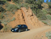
Dirt roads, backroads, desert trails, OHV routes, single tracks, dunes, fire roads, gravel roads, 4×4 roads
When you wanna explore a new area, California has plenty of public land to offer. Off Road Maps can get you away from the crowds & the main staging areas. Maps can show you prime areas to ride & camp that you may not have ever imagined. Secluded, wide open, or freeway close. Terrain – the endless deserts, the mountain foothills, the higher hills , way above the city. The choice is yours.
Whether you seek secluded stream side camp sites, with some fishing or a dusty, long, desert trail that spans the entire Mojave desert, you can find these secret spots with good old fashioned topographic maps. Hard copies! The real deal. No cell signal? No problem.
4×4 Panamint Valley has numerous canyons & ridges to conquer
The most trusted full-state book-atlas that Total Escape recommends. When you must have a (hard copy) map for local road trips – Benchmark Atlas is the best one by far.
NFS, USDA
Forest Atlas: National Forest Topo Atlas
Spiral bound book of all topographic quads, of select National Forests in California.
Awesome California locations w/ off-road trails nearby. DanaMite has compiled a list of first-hand knowledge information, links, photos, campsites, maps, all revolving around rural California. Check out the ever growing list and get ready to explore the back roads, like never before.
OHV area, motor vehicle use, 4×4 camps, dirt trails, forest routes; Download maps for various off-roading areas in California.
What the heck is it ???
4WD = 4 wheel drive
4×4 = (same as above)
2WD = 2 wheel drive
4×2 = (same as above)
AWD = All wheel drive
SUV = Sport Utility Vehicle
MTB = Mountain Bike
MX = Motocross (dirt bike motorcycle)
SNOMO = Snow Mobile (sled machine)
GAS-POWERED RECREATION: The past two decades have emerged with vehicle redesigns from well known brands, creating a number of new “utility vehicles” for the sport of off-roading (otherwise known as, burning gasoline while recreating in the outdoors). Here is a breakdown on the acronyms, but they all basically refer to much of the same “off road type vehicles”.
ATV = All Terrain Vehicle (quad)
MOHUV = Multipurpose Off-Highway Utility Vehicle
ROPS = Roll Over Protection System
ROV = Recreational Off-Highway Vehicle
RUV = Recreational Utility Vehicle
SxS = Side by Side Vehicle (2 seated)
SSV = (same as above)
UTV = Utility Task Vehicle
Common abbreviations for off-road on public lands:
OHV – Off Highway Vehicle SVRA – State Vehicular Recreation Areas BLM – Bureau of Land Management NFS – National Forest (USDA) MVUM – motor vehicle use map (NFS)
PVT – private land / keep out
MTR – motorized
RD – road
CO – county
RTE – route
SR – state route
FR – forest route / road
EXT – exit
CK – creek
EL – elevation
MT – mountain
STA – station (ranger/fire station)
PO – post office
Around 2012 the National Forest Service printed up a bunch of nice off-road maps for various popular regions of California. Oddly, they told me not to sell them and I never heard anything about them again after that. Not even sure if these above are available to the public, but if you dig around you might find ’em. Call the rangers, they might know.
If interested, you could call the ranger station and ask about any local off-road maps, and availability. Mostly they have freebie one page print-outs, black & white — to keep the crowds where they want them. Other times they might have real color, printed maps for sale at the station. Maps that can get you deeper into the terrain, with wild edges of reality nearby. 4×4 maps, OHV map, MVUM
BLM Maps (Bureau of Land Management)
Government agency that manages large amounts of California land. Public lands that do not fall into the National Forest or National Park or State Park realm. BLM oversees some mountain areas, river canyons and primarily, desert regions within California. Visit a local BLM office to see the selection of area maps.
Turtle Mountain Road
Decent & FREE: dirt road maps can be found at BLM ranger station, south of NEEDLES, on US Hwy 95. Explore Turtle Mountain and find free camping IN ROUTE; Eastern California Desert.
This dirt road is a side canyon route; access to a whole mess of aspens @ Parker Creek. Fish the creek. Day hikes and backpackers trails; Picnic in the aspen groves.
Parker Lake Rd turn off is signed @ Road #1N17. All this is north of Highway 158 @ Grant Lake, on the June Lake Loop #1S63.
Primitive camping options only. No facilities, No developed campgrounds back here. Minimal camp sites and clearings, so have a backup plan B in case these few canyons are already occupied.
MUD NOTE: Dirt roads here can turn to mud, especially near creek beds – anytime in between October and May. Region is also prone to summer thunderstorms; Maybe even flash floods. Weather changes for June Lake and Lee Vining can be sudden so keep tabs on the current forecast.


 NOTE: BBQ grills, all stoves, smoking, firecrackers, welding, chainsaws, off roading, dirt biking, hunting and target shooting are restricted within these orders. A few of these fire restrictions are dated to extend until DEC 31, 2025


 A high clearance vehicle may be needed to reach certain camp spots, but many can be accessed with a standard passenger car. Low riders will likely bottom out and motorcycle riders will get dusty.


 Eastern Sierra communities include:


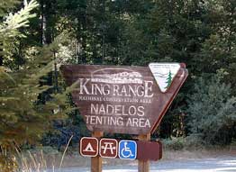 Lost Coast Camping BLM
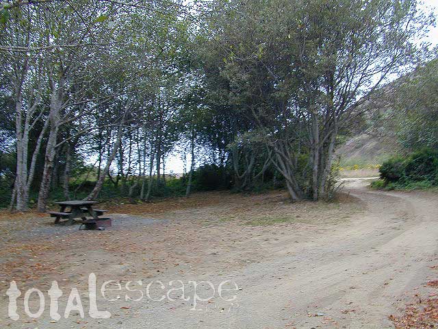


 Inyo Road# 6S16 – Pine Creek Road – Creek exploring & fishing. NW of Bishop behind Rovana, also known as Round Valley, CA