Tag Archives: highway

Roxie Peconom Campground

Lassen Forest Road #29N03
Roxie Peconom Camp

Roxie Peconom

MAIDU INDIANS: Roxie was a native medicine woman and lived over 100 years in these parts. Read more here

AUG 2021: Closed due to the Dixie Fire

Wild onions were found along the top of Thompson, Diamond, Eagle Lake, Willard, and Mountain Meadows.

Lassen National Forest – W of Susanville, CA

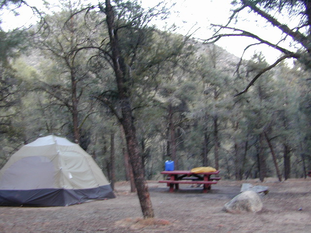
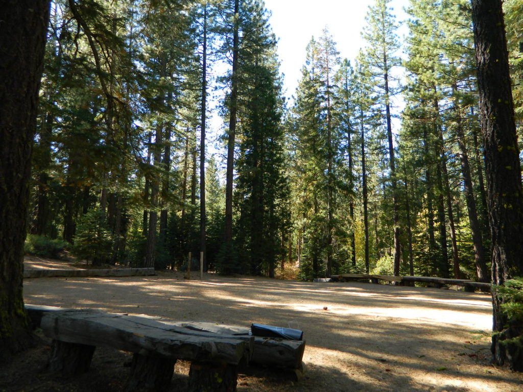
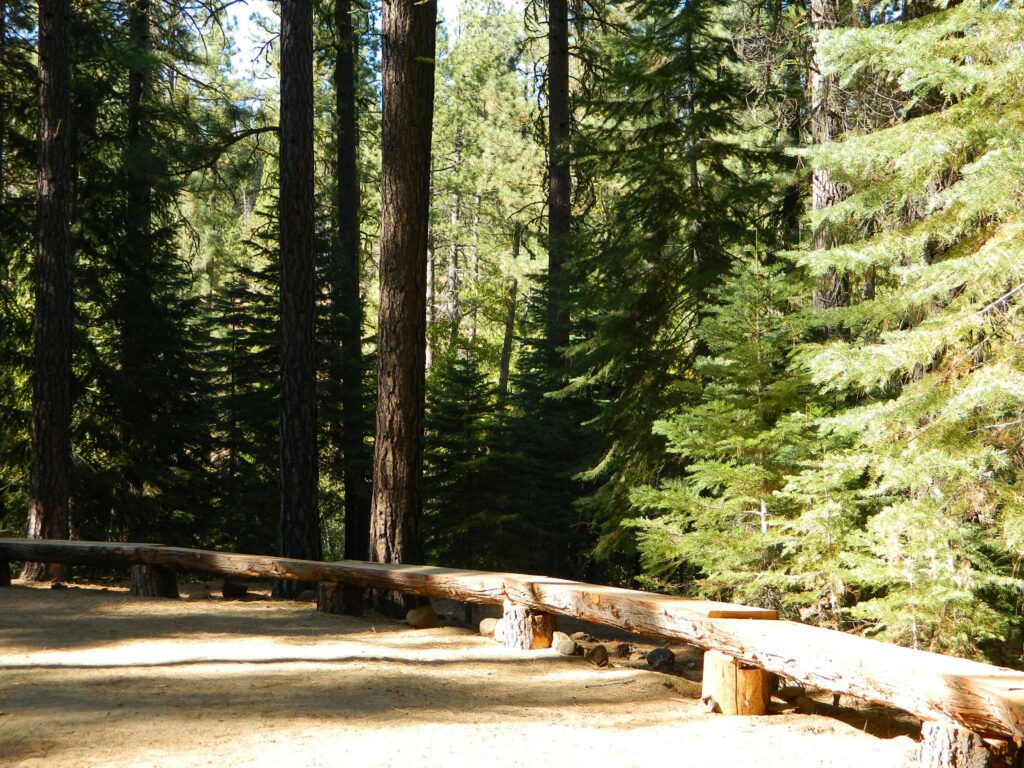
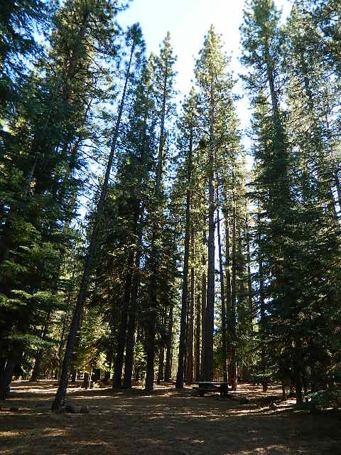
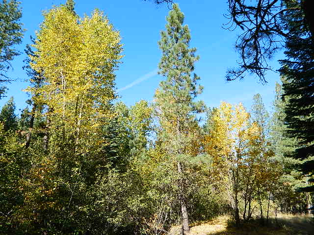
This pine forest is home to the developed NFS campground – which has been named after the tribal elder. The camp location is a sacred spot to the local native tribes. Just above Susanville, CA on the west side, south of the highway; forested w/ creeks and aspen groves. Autumn colors can be found in the creek beds.

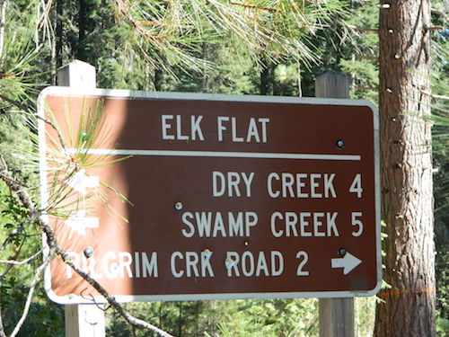
Dirt roads all over the place, leading to far away destinations like Diamond Mountain, Antelope Lake and Taylorsville. The backcountry region was recently damaged by wildfires: 2020 Sheep Fire and now the Dixie Fire 

pinetree

FREE CAMPING – W Susanville, CA
en route camp

Less than 3 miles of dirt road #29N03 driving will get you back off the highway and into this forest, Hwy 36 W of Susanville. Bring the mountain bike for abundant usage and a week of exploring.

Only 13 miles to downtown Susanville, via the back road. Chaney Creek Road is a main dirt road near Highway 36, which parallels the river, the red rock bluff and the road, downhill into town.

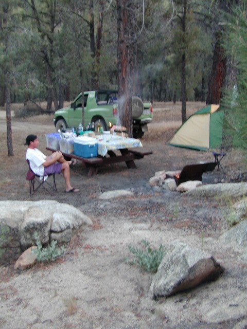
This FREE campground is popular with the hipcampers and pediums – and gets rave reviews; small RV campers do like to use this camp spot, if they don’t mind a little dirt road driving; they’ll need to park in the dirt parking lot, 40+ feet away (not adjacent to the picnic tables or fire rings).

  • camping

  • ceremony

  • drum circle

  • fishing

  • hiking

  • horseback trails

  • hunting

  • mountain bike

  • off road trails

Roxie Circle
Bear Dance Circle @ Roxie

roxie seating

walk in campground, and close to town

hiker

Shady Campground

Walk-In Campsites @ Roxie

AUG 2021 – CLOSED due to the Dixie Fire

Roxie P Campground
Susanville, CA – Lassen NFNFSlogo

• Elevation: 4,800′
• Number of Sites: 10 (walk-in only)
• Vehicle Accessibility: any
• Campsites Reservation: No
• Campsite Fee: No
• Length of Stay: 14 Days
• Season: open all year
• Trailheads: Diamond Peak


shadycamp

Flat forest and easy to walk. Shade and pine needles, picnic tables and group fire pits. All facilities are encompassed with a  sturdy wooden, fence line. No RV or trailer access to camp sites. Mountain bikers like this spot and so do horseback riders. Travelers passing through eastern California will welcome the convenient location, plus the ease of dirt road.

The Roxie Camp is situated near Willard Creek on the south side of the Highway 36, close to Susanville. Willard is a feeder stream into the Susan River, which flows into town.  Quiet camp, most of the time. If a big family is camping here w/ children, or there is a tribal gathering, it could get loud.

PLAN B –  head over to Goumaz Campground NFS, due north. Located in between, near the junction of Hwy 38 & 44. Near the railroad tracks and the Susan River. Smaller camp near the NRT (National Recreation Trail), the  Biz Johnson Trail (BLM).
2021, this camp is CLOSED!

so find someplace else: PLAN C
(make sure any camp is open by calling rangers before traveling).

Fire Lookout hike near Milford Grade

Susanville Hiking Trails PDF
BLM Southside Trails
mountain bike, hike, horseback

aspenroxie
Aspen trees at Roxie in Autumn

dirtbikes

off road Susanville

OHV activity may be passing the developed campground, but are discouraged – due to the layout of camp. Plenty spots for ‘froaders further out – at the end of the road. Way back there!

Jeeps, 4×4 trucks, quads, dirt bikes, anglers and hunters travel these dirt back roads, as well as rangers, campers, horses, mountain bikes, and big logging trucks. 25 mph slow is always best. Daytime headlights help you get seen in the shadows. Forest is dense and road conditions are ever changing.

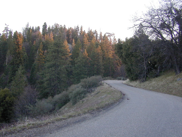
Forest Road #29N03 is Gold Run Road, the bumpy dirt road – that skirts around Diamond Mountain on the south side. Lots of one single track or one-lane dirt roads, which will require a National Forest map or a decent topo map to navigate properly.

OHV is common in these areas, but not so busy at this camp. If you seek peace and quiet and solitude, know how to read a map and where the noise is expected to be. Avoid the OHV areas, if you want to nap in the hammock and read a book.

Wild red necks with guns live in NorCal, so pay close attention to property lines and trespassing signs.

ranger

USFS Ranger Station is located on the west side, just outside of town, on the wide downhill grade on the highway @ the Eagle Lake turnoff. Cal Fire station is also located along this stretch of road.

Lassen National Forest
Ranger Station USFS

CA-36 @ Eagle Lake Rd
Susanville, CA 96130
530-257-4188

Cal Fire Station
697 CA-36, Susanville, CA 96130
530-257-4171

fish

NEARBY TOWNS:

Chester, CA
Lake Almanor, CA
Susanville, CA
Westwood, CA

Susan River is nearby, but not really walking distance from Roxie Camp

eagleclouds
Large Eagle Lake, N of Susanville, CA

California Reference

shasta back roads

California Information Centers w/ Helpful Links, Tips, Weather & Road Advice


SIERRA HWYS / Sierra Passes:
Annual Highway Closures in the snowy Sierra Nevada Mountains

snow

California Road Conditions

 caltrans
Cal-Trans Road Conditions
800-427-7623
All CHP Offices
Web cams on California freeways

Nevada Road Conditions
702-793-1313

Oregon Road Conditions
503-588-2941

California Travel Timelines

California Back Roads Info

L.A. Road Closures
Department of Public Works Los Angeles

North State Road Conditions & Web Cams
Siskiyou County California

Weather Bureau
530-221-5613

California Mountain Roads –
Snow Chain Requirements

R1 – Chains are required on all vehicles except passenger vehicles and light-duty trucks under 6,000 pounds gross weight and equipped with snow tires on at least two drive wheels. Chains must be carried by vehicles using snow tires. All vehicles towing trailers must have chains on one drive axle. Trailers with brakes must have chains on at least one axle.

R2 – Chains or traction devices are required on all vehicles except four-wheel/all-wheel drive vehicles with snow-tread tires on all four wheels. NOTE: four-wheel/all-wheel drive vehicles must carry traction devices in chain control areas.

R3 – Chains required. Chains or traction devices are required on all vehicles, no exceptions.

The most common chain controls are R-1 and R-2. Highways will often be closed before an R-3 control is imposed, but winter weather conditions can change any road condition, hour by hour.

California Information Centers

check

California Office Of Tourism
1121 L St., Suite 103, Sacramento, CA 95814

California Welcome Centers
various locations, usually near freeway & factory outlet malls

California Bureau of Land Management
BLM

California Department of Fish and Game
916-445-0411

California National Forests NFS
USFS

CaliforniaNational Parks NPS
NPS

California State Parks calsp
SP, SHP, SRA

Eastern Sierra Interagency Center 
US Highway 395 @ Death Valley turn off
760-876-6200
2 miles south of Lone Pine CA
@ junction of Hwy 395 & SR 136

Kelso Depot Visitors Center
Mojave National Preserve
760 252-6108
Kelbaker Road, Kelso, CA

Old Station Visitor Information Center
13435 Brian’s Way
Highway 44/89, Old Station, CA 96071
530-335-7517
Hat Creek, East Lassen NF

California State Transportation

CA Trains – Amtrak, MetroLink, Coaster, BART, Skunk

California Statewide Bus Lines – Amtrak bus, Greyhound & FlixBus

train

California off road links

California 4×4 Groups
Cal 4-Wheel

Total Escape Back Roads

dirtbikes

California Travel Tours

California by Bicycle
California 4×4 Tours
California by Helicopter
California by Horseback
California by Llama
Lake Tahoe Tours
Palm Springs Tram
Vegas Outdoor Tours

hiker

California Maps: Parks, Wilderness, OHV trails

longwayup
Breckenridge Mountain, eastern, paved access from Breckenridge Road #28S06, Sequoia National Forest, Kern County California
gorgeview
Sierra National Forest Road #11S12 – Big Creek, granite gorge view. Dirt road connecting Wishon Reservoir to the Kings River, on the Western side of the Sierra Nevada
Road 64 South Warner
Exploring Modoc Road 64 (aka South Warner Rd) located back behind Blue Lake Campground. Excellent horse camping opportunities next to South Warner Wilderness.

California Roads

observatorio
Observatory @ San Pedro Martir, Baja California Norte – Pine Forest Camping Laguna Hanson, Parque Nacional Constitution de 1857; located off Hwy 3 east of Ensenada
signage
Kelbaker Road, Mojave Desert – paved connector and main route between Interstate 15 and Interstate 40. Mojave Desert National Preserve
newarmypass
Backpacking, Equestrian and Hiking Trailheads to the High Country Eastern Sierra. Cottonwood Lakes, Inyo National Forest @ US Highway 395

California Elevations

conradkid
High Sierra hiking @ 12,000 feet above sea level

elevation

high altitude towns    well above sea level

The majority of California cities are located near sea level, with low lying farmlands and populated coastlines common throughout world geography. California has super diversity w/ the population, as well as the elevation and the terrain. Vast rugged deserts bordering Nevada, from high deserts (8000′ @ Bodie ghost town) to low deserts (below sea level for Mecca) near the Salton Sea. Towering granite peaks with minimal vegetation, to fern canyons and redwood groves at the coast, California has quite the unique landscape.

The beautiful golden state is also home to the highest and lowest point within the lower 48 states; and those points are only about 100 miles apart – Death Valley  (-282′ elev) and  Mount Whitney  (14,494′ elev).

I-80 Donner PassMTN TOWN: upper elevation mountain towns w/ forests and flowing water, are primarily located in the Sierra Nevada range which runs the backbone of California in a north-south direction,  separating the Pacific Ocean from the Great Basin. High altitudes are abundant in California, especially in the Eastern Sierra – but most are only accessible by foot.

Mountain communities in Southern California includes places like Mount Laguna, Palomar, Big Bear, Arrowhead, Idyllwild and Mount Pinos.

The coastal mountain range and the Sierra Nevada  encompasses most of Central California. The rest of the space is dedicated to large cities, farmlands and farming towns – which are most lower elevation. Orchards and vineyards can be found in the foothills (200′-2000′ elevation)

Northern California has more mountains and rivers, generally higher elevations and plenty more space to explore. Secluded forests, rivers, creeks, lakes, and reservoirs can be found above 2000′ elevation, north of Sacramento. The bigger mountains in the far north part of the state are part of the Cacade Range, which is volcanic in nature. (Mt. Lassen & Mt. Shasta). More water, more trees and more land – NorCal is very different than the lower half of the golden state.

hwy33overlook
North of Ojai, CA – Highway 33 winds up to Los Padres NF

California Elevation Breakdown

  • Alpine lakes, streams, forests, mountain peaks, granite scenery is abundant above 6000′ elev.
  • Pine forests, junipers, sage chaparral, manzanita, joshua trees can be found between 3000-6000′
  • Hot Springs, creek canyons and cottonwoods are usually discovered above 2000′ elev.
  • Oak hills, ghost pines, creek beds, river canyons  and most agriculture range from 1000-3000′
  • Under 1000′ elevation is the majority of the populated cities and towns within California; coastline, urban areas, foothills, farmland and a few reservoirs
Mecca Hills
Mecca Hills, below sea level

GoogleMaps – groundbreaking tool for trip planning and checking out trailheads, camps and dirt roads from overhead

USGS Viewer – topographic overlays for altitude estimates, and various imagery

California Elevations Map

shaverMS

snowflake
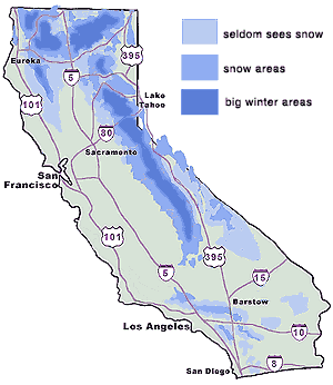
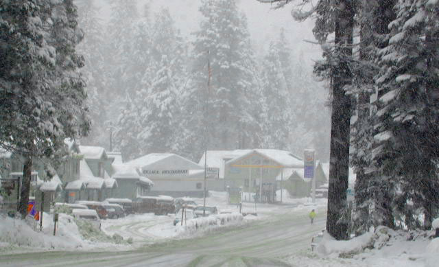
Snow is always a factor in mid to high altitude towns with road conditions being unpredictable with each mountain range and each micro-climate. Winter months range from late October to May, so be warned. Above 3000′ elevation usually gets some snow. Serious snow above 5000′. Some High Sierra Passesdon’t open until JULY (Yosemite Hwy 120 & Sonora Hwy 108). Carry tire chains or have 4×4 to travel safely on snowy roads. Guard rails are seldom around every curve.
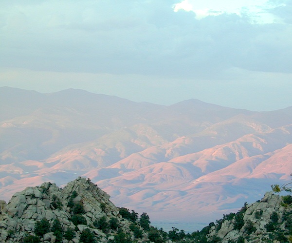
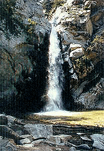
list of California towns
by elevation


Rainbow Lodge California

bishopbelow
Above Owens Valley (US 395) at sunset, as seen from the Sierra side (8000′ elev)

Green Creek Road

Mono County Wildlife Area
Mono County Wildlife Area, Green Creek Road- off Hwy 395, near Bodie

Green Creek California

Eastern Sierra

S of Bridgeport, CA
MONO – Road #142NFS

Toiyabe National Forest
Bridgeport Ranger District

If you are thinking about fishing or camping the Eastern Sierra, North of Bishop & you are not up for the crowds at Mammoth or June Lakes, then try the Bridgeport area, north on Hwy 395. Rural ranch lands along main road, Bodie ghost town turn off across the highway and Virginia Creek Settlement are also nearby

Green Creek is a 11 mile long dirt road in the lush Eastern Sierra the northern portion. The wide, graded dirt road is signed and dead ends at a Toiyabe National Forest campground called Green Creek Campground. The drive up can be washboard bumpy in some parts, but that doesn’t stop the hundreds of adventurous motorhomes that make this trek annually. This place features some of the best prime Sierra back roads camping options for RVs.

Another dirt route, Dunderberg Meadow Road peels off to the left. Dunderberg departs  off Green Creek a couple of miles from the highway and well maintained. This route leads to meadows, aspens, picture perfect scenery and much more seclusion. Passenger car accessible, wide graded dirt roads to wilderness edges. Two-track one lane trails lead to meadow edges and more creeks. Very impressive views of the Sierra peaks over here on this side. Meadows are sensitive areas, wonderful for picnics and you should always minimize impact.

State Park California

Green Creek Wildlife Area
Mono County, California

Aspen Grove Camping for RVs

  • alpine lakes
  • backpacking
  • bird watching
  • camping
  • creeks
  • day hikes
  • fishing
  • hiking
  • horseback
  • hunting
  • mountain biking
  • wildlife
  • wilderness

Plain old passenger cars can easily make this route deep into the Eastern Sierra aspen canyon. Graded dirt and4x4 could be needed winter months. Backpackers can enjoy easy access to the Hoover Wilderness trailheads. There is plenty semi-primitive camping spots along the way, right on the creek, for free…. so no need to sleep in your vehicle upon arrival.

Autumn Aspen Groves: fall colors peak in October, which is usually when the first snows for the winter season start. November – usually the freeze gets them and lifeless brown leaves dangle, until the Sierra Nevada wind gust blow real good.

camp

Green Creek Camping

DIRT ROAD CAMPING

  • alpine lakes
  • backpacking
  • car camping
  • day hikes
  • fishing camping
  • meadows
  • RV camping
  • tent camping

Hoover Wilderness

Dispersed, primitive camp spots along this main dirt road are on a first come basis. You’ll need a fire permit. Many flat camps are set along the creek in aspen groves, some pines, others have  cubby hole privacy. Large granite valley, big creek, bird, scenery and nature everywhere.  Some folks spend weeks camping out here in the warm weather months. Fishing is a big attraction.

Old Cabin in autumn leaves, up near the top of the dirt road deep in the aspen grovesNFS

Green Creek Campground USFS
7500 elevation
11 camp sites
fee, open May – October
trailhead parking nearby

hiking trails lead to

hikes

TOPOGRAPHIC MAPS:

Aspen Camp

Cuyama Valley

Cuyama River Valley, California

Ventucopa WineriesNorth of Ojai, Highway 33 meets Highway 166: Ozena, Ventucopa, & New Cuyama make up the 3 small communities inside the Cuyama River Valley, located in south of the San Joaquin (California’s Central) Valley.

On the outter edge of Santa Barbara County, where Kern, San Luis Obispo & Ventura counties all meet, you can find great solitude, a large red dirt, high desert wash & plenty rural trails. Off-roading, backcountry camping, hiking, mountain biking all over this region.

Ozena Ranger Station sits at the south end of Cuyama, at the intersection of Lockwood Valley Rd & Hwy 33. Ozena Campground with 10 spots @ 3660′ elevation, is to the east off Lockwood.

Nettle Springs Campground (8 spots @ 4400′ elevation) can be accessed via Apache Canyon, a 10 mile long dirt road# 8N06, off Hwy 33

2 smaller campgrounds – Tinta and Ranch Nuevo are on the west side of Hwy 33 & may require a high clearance vehicle to reach. Trails out of these campgrounds lead to the Dick Smith Wilderness.

Chumash Wilderness is just east of Ventucopa, as Los Padres National Forest surround this agricultural valley. Quatal Canyon and Quatal Wash reach from the upper elevations of pinyon pines near Mount Able to Cuyama river bed below, as Cerro Noroeste Road skirts the northern rim of the impressive red rock canyon. Toad Spring Campground is at the top. Apache Saddle and Pine Mountain Club are just east of Quatal Cyn.

Cuyama riverbed follows Highway 33 and then turns west, following Highway 166, past the ranch lands, the volcano hills and notorious Rock Front Ranch.

All the pavement around Cuyama is very popular amongst motorcyclists. Scenic touring kinda roads. A very nice 100 mile loop trip is from Pine Mountain Club – W on Mil Potrero Hwy, W on Cerro Noroeste Rd, W on Hwy 166, S on Hwy 33, East on Lockwood Valley Road – back to Frazier Park & I-5 Lebec.

Mahutasan, the indian sweat lodge and the extremely rustic Sage Brush Annies Restaurant w/ winery are the highlights of this rural agriculture valley called Ventucopa CA. Cuyama Peak and fire lookout tower overlooks the whole Cuayama Valley & can be accessed via Santa Barbara Canyon Rd. 4×4 may be required in certain spots. This lovely oak and manzanita lined canyon was scorched by the Zaca Wildfire in mid 2007.

  • Cuyama Wineries
  • Pistacio Orchards
  • Quatal Canyon
  • Ballinger OHV Park

helpful maps of the region –

towns in the valley –

towns close by –


View Larger Map

Hwy 166 Wildflowers, School House Canyon


Angeles Crest Hiking

Hiking Trails Los Angeles

another two bite the dust

localhikes.com – GONE
latrails.com – GONE

Millard Falls
2 mi RT; 1200′ elevation; oaks.
Arroyo Seco District –
of Angeles National Forest
818-790-1151
Altadena CA
From Interstate 210 in San Gabriel Valley, exit Lake Ave., go N & turn left/west onto Loma Alta Dr. & to Chaney Trail & follow signed dirt road

LA waterfalls

Sturtevant Falls
5 mi RT; 4600′ elevation; oaks, creek-crossings.
Santa Anita District –
of Angeles National Forest
818-899-1900
inside Big Santa Anita Canyon
From Interstate 210 in San Gabriel Valley, exit Santa Anita Ave.Go North/East, through neighborhood & up mountain to paved parking lot.

More hikes on Angeles Forest

  • Big Tujunga Wash
  • Circle X Ranch
  • Mendenhall Ridge
  • Mount Lukens
  • Newhall Pass
  • Strawberry Peak
  • Towsley Canyon
  • Verdugo Mountains

Hiking Los Angeles Area

Angeles Forest – Los Angeles California

nearby towns –

Angeles Maps – hiking, OHV & mountain biking –

Chimney Creek Campground

campmap

Chimney Creek Campground
BLM Kern / Mojave

High mountain desert camp is mislabeled on some maps as “Chimney Peak Campground” or “Chimney Rock Campground”. Pinyon pine forest on Chimney Creek, near hiking trailheads, wildflowers and Chimney Peak Wilderness. Southern Sierra ridge near Mojave Desert and California SR 178.

peakpinyons

Canebrake Road is a graded dirt road that makes up part of Chimney Peak Back Country Byway. This rural route is a major graded dirt road located north of Highway 178 – which connects Canebrake to Long Valley up near Kennedy Meadows. Pacific Crest Trail passes next to this campground in the Southern Sierra mountains. The campground turn off is way east of Lake Isabella Hwy 178 is (near Walker Pass & PCT) and follow dirt road north to Kennedy Meadows in the far eastern reaches of Sequoia National Forest

Chimney Peak BLM
• Elevation: 5,700′
• Number of Sites: 32
• Camping Reservations: No
• Sites Available: First come, First serve
• Vehicle Accessibility: RV limit 28′ max
• Length of Stay: 14 Days
• Water: Piped (April – Sept)
• Toilet: Vault
• Season: Open all year
• Fee: No
• Operated By: BLM
• Closest Town: Lake Isabella, CA

Bureau of Land Management
BLM Bakersfield Ranger Station
661-391-6000

Lamont Peak
Lamont Peak – elev 7510′

nearby destinations –
Camp Kern Backroads

Chimney Peak Wilderness
Lamont Peak
Long Valley Campground
Dome Land Wilderness
Owens Peak Wilderness
Jawbone Canyon
Sequoia National Forest
Sacatar Trail Wilderness
Kiavah Wilderness
Kennedy Meadows
Lake Isabella
Kern River
Monache Meadows


View Chimney Creek Campground in a larger map

Sierra Road Conditions

Sierra Nevada Road Conditions – Highway California

Snowy RoadsWinter Snow/ Winter Roads Sierra Nevada:

On rare occasions the Golden State freeway – Interstate 5 can be closed due to snow; N of Valencia on the Grapevine (near Lebec) or more likely up in NorCal (near Shasta).

Interstate 80 (aka Donner Pass) is often closed during big storms. Luckily there are hotels in Auburn or Truckee.

Highway conditions on mountain passes higher than 4000′ elevation can be unpredictable in winter months (Oct-May). It may be fine & just sprinkling @ 2000′, but a few miles up can be a white out. Ask anyone who’s ever driven the infamous Donner Pass in winter time. (more on Donner Party)

Annual Sierra Highway Closures

Ski mountains

shaver lakeWhere does it Snow in California ?
Okay, okay ….so it’s nothing like those dreaded East Coast winters, but hey, some parts of California do get some serious snow. (see elevations) And the newbies who don’t prepare for it will be sorry. On the winter vacation travels, be prepared for almost anything, especially in the Sierra’s & Northern California.
Snowy towns in California

See California Weather & Road Conditions

California Winter: When does winter actually ‘set in’ for California?

Eastern Sierra CA: OCT- MAY
Western Sierra CA: NOV- APR
High Sierra CA: SEPT- MAY
North Coast CA: OCT- MAY
Northeast CA: OCT- APR

The following mountain roads are partially closed or totally closed during winter months. Please check road conditions before you leave for your trip. Chains may be required in most mountain areas of California.

CALTRANS web site

Highway CA County Region Connecting Towns
Hwy 155 Kern Southern Sierra Alta SierraWofford Heights
Hwy 190 Tulare Western Divide Hwy Camp NelsonPonderosa CA
M 375 Tulare Sequoia NP Hammond – Mineral King
Hwy 180 Tulare Kings Canyon NP Hume Lake – Cedar Grove
Whitney Portal Rd Inyo Eastern Sierra Lone Pine – Mount Whitney
Onion Valley Road Inyo Eastern Sierra Independence – Onion Valley
Glacier Lodge Rd Inyo Eastern Sierra Big Pine – Glacier Lodge
Lake Rd Hwy 168 Inyo Bishop Area Hwy 168 – South Lake
Hwy 120 Mariposa Yosemite NP Yosemite Lee Vining CA
Hwy 120 Mono Mono Lake Lee ViningBenton Hot Springs
Hwy 108 Mono Eastern Sierra DardenelleSonora Jct. Hwy.395
Hwy 89 Alpine Eastern Sierra MarkleevilleLake Topaz
Hwy 4 Alpine South Lake Tahoe Lake Alpine – Hwy 89
Hwy 44 Shasta Lassen Volcanic NP Manzanita Lake – Mineral CA

Tuttle Creek Campground

Tuttle Way

There she sits, above Lone Pine California, right next to the High Sierra. Above the Alabama Hills….. at the base of Whitney, on an alluvial fan overlooking the Owens Valley & US Hwy 395.

Tuttle Creek Campground is perfect stop for RVers traveling the Eastern Sierra, beginner mountain bikers needing to explore & test their skills, or the avid backpackers waiting to acclimate & get a good nights rest in reasonable temperatures, before attempting the tallest Mount Whitney.

Tuttle Creek is a BLM Campground w/ picnic tables, fire rings or BBQs. Awesome creek camping at the base of Mount Whitney. Hear the water rushing over the boulders; soothing for bedtime or stargazing. The fishing is decent. Wildflowers like indian paintbrush & lupine can be found here in spring and summer, in the high desert sage lands of the Eastern Sierra.

• Elevation: 5120′
• Number of Sites: 85
• Vehicle Accessibility: RVs okay
• Camp Fee: No
• Campsites Reservation: No
• Length of Stay: 14 Days
• Season: March – October
• Trailheads: John Muir Wilderness

From Lone Pine CA, head West 3 miles on Whitney Portal Rd, turn LEFT on Horseshoe Meadow Road, within 2 miles, turn right on a dirt road that leads to the campground.

Tuttle Creek flows past campground; No drinking water.
Pit toilets; Some shade.

BLM Lone Pine
760-872-4881

LONE PINE CA

HINT: On the dirt back roads, on the slopes of the Eastern Sierra, between Lone Pine & Bishop, you can find & fishing holes & primitive camps (free camping) on any numerous of creeks; some you can park so close that you don’t have to leave your vehicle to fish. You may need a high clearance vehicle to reach some.