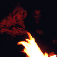
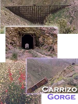
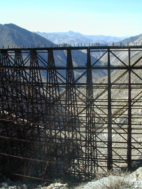
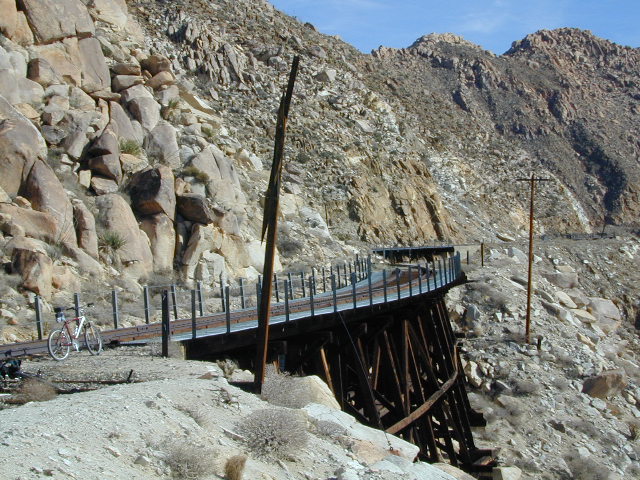
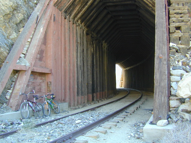
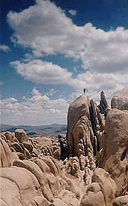
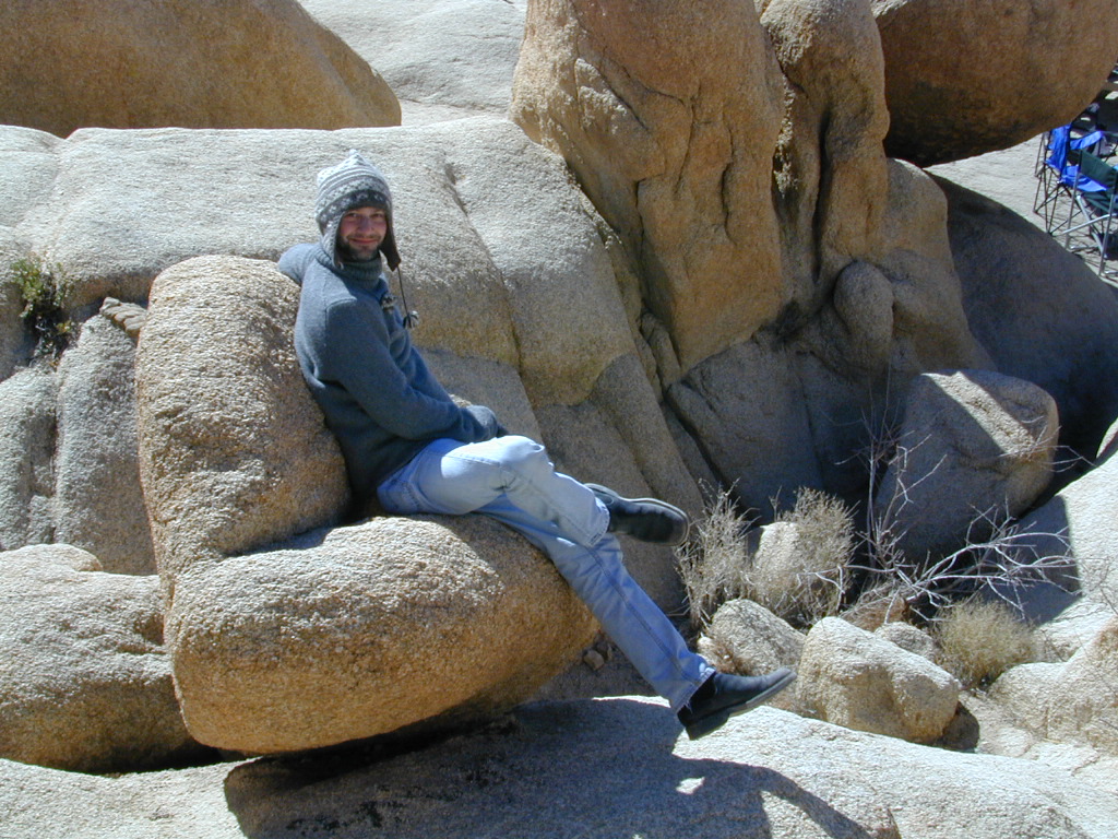
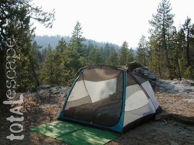
Carrizo Gorge Goat Trestle – via Mortero Wash. Near the south end of Anza Borrego State Park is the infamous ‘goat trestle’, one of the largest wooden rail road trestles in the US.
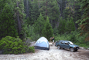
This hike can be reached by driving N on San Diego County Road S2 (from I-8) into Anza Borrego Desert State Park. Near the park boundary keep your eyes peeled for Mortero Canyon Rd (signed) on the left side. This is a sandy, one-lane, dirt road, accessible by passenger car, that leads out to the train tracks & then past to the Mortero Big Boulder campsites. Park at rail road tracks near water tank & start hike from here.
Ground was broken on September 7, 1907 by San Diego’s Mayor, John Forward and the construction of the 140 mile route was completed on November 15, 1919. The first through train was the called the “Golden Spike Limited”, named after the $286 golden spike, which John D Speckels drove into the ground near tunnel #8.
The Goat Canyon Trestle was built in 1932 to re-route tracks due to a landslide.
Passenger Cars Ran until 1951.
The route through Carriso Gorge was closed temporarily by Tropical Storm Kathleen in September of 1976.
And was reopened 1981, and then closed again by recurring storms.
Kyle Railways ran freight cars until mid 1984.
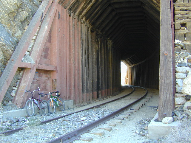
The Carriso Gorge section has fallen into disrepair with two trestles being burned and the collapse of two tunnels as the result of fires. The trestles have been rebuilt and one of the tunnels has been repaired – however, this scenic section of track is used mostly by hikers and mountain bikers.
Other Facts: Derailed cars are from 1984 and were filled with bags of cement. Laborers were brought in to unload the cement but the cars were left. The Goat Canyon Trestle is 185″ tall and 600″ long. During its use it was the tallest wooden structure in daily use. Hence, this trestle was designated a Historic Civil Engineering Landmark in 1986. Carrizo means “reed grass” in Spanish. Total cost of construction was $18 million.
In 1979 the SD & AE west of Plaster City was sold to the Metropolitan Transit Development Board for $18.1 million. SD&A was said to stand for “Slow, Dirty and Aggravating” generally because of the high temperatures, smoke and open windowed trains cars.
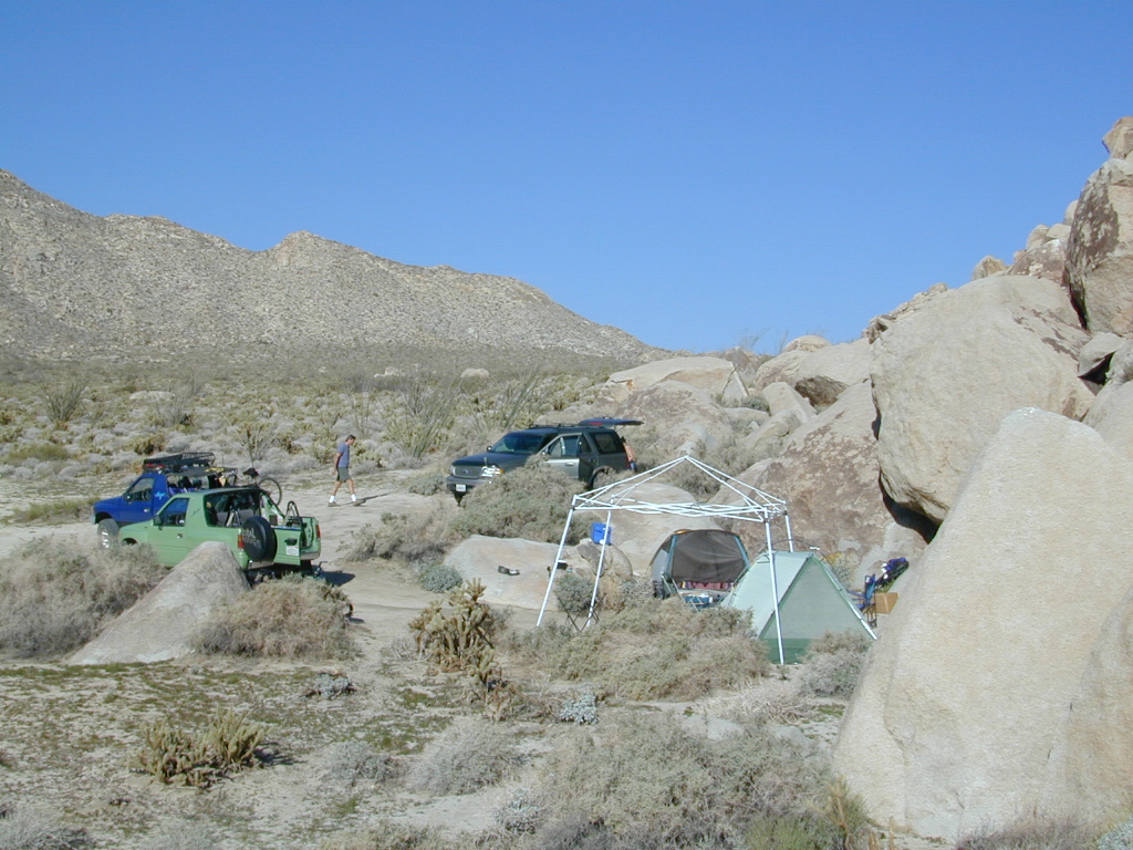
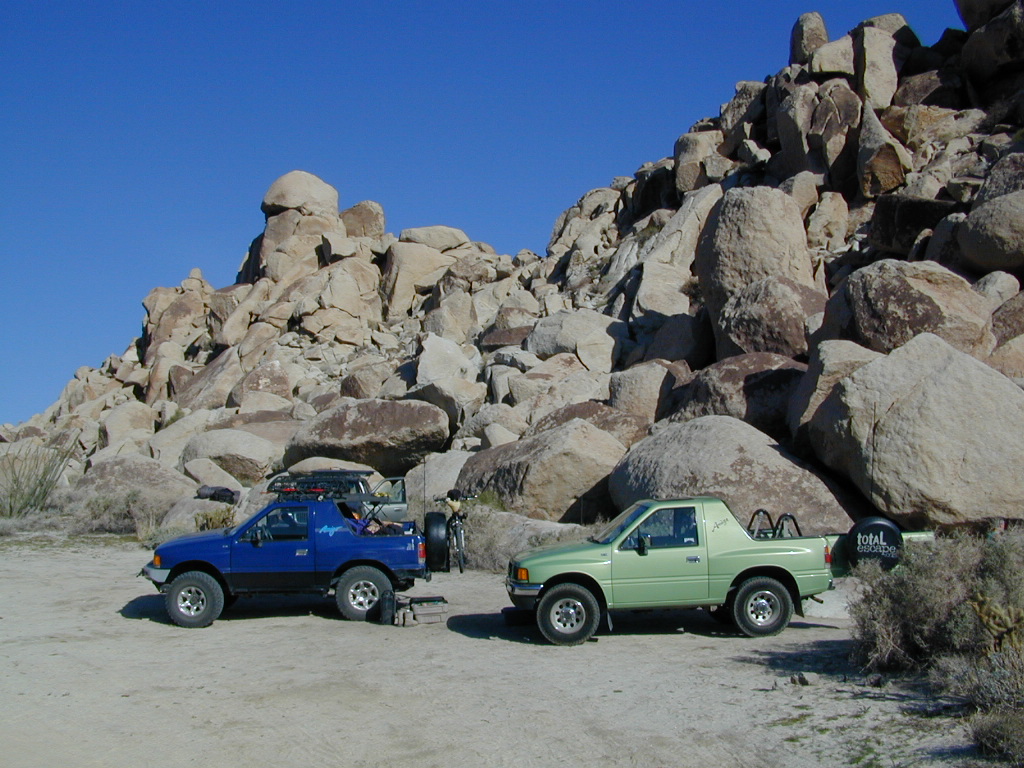
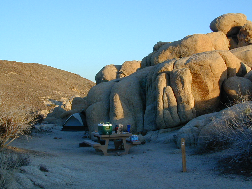
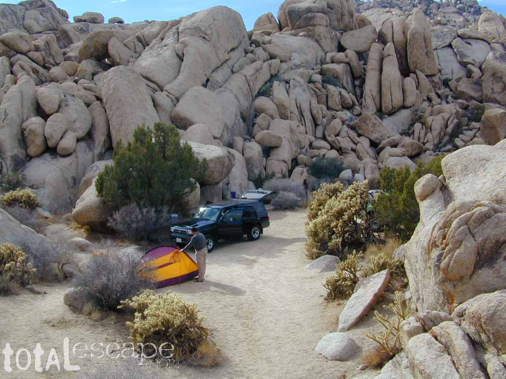
South end of Anza Borrego State ParkDispersed camping (for free) in the Boulders
California Fire Lookouts for Rent
US Forest Service Cabins
Rent a secluded cabin with an amazing view, a historic tower for wildfire spotting, or a USFS guard station – hidden deep inside USDA California National Forests. Several of these NFS lookouts have been closed recently, so the ones listed below have links to status and reservation information.
Dirt road access is common to reach these remote locations. Some require stair climbing, or steep access hikes. Winter months are usually snowy, inaccessible and sometimes dangerous for these high country locations. Access roads suffer from closures due to rock slides or landslides. Check with the locals ranger station for current conditions.
A few of these rentals are open all year long – in the southern part of the golden state.
El Dorado National Forest
Harvey West Cabin
4,720′ elev. on Silverfork American River, Gold Rush
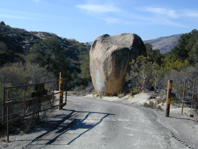
Interstate 8 EAST from SD / exit Ocotillo. SD county road # S2, the south end near the State Park boundary. Gorgeous every season but summer. Great winter camping close to SoCal.
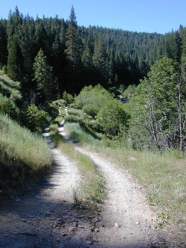
This dirt road is located in a desert wash area, which starts west – off the paved road S2. The signed white desert wash is a suitable drive for passenger cars (most years). But you best have 4×4 if the rain gets going good. Low riders should watch for the ridge lines – as they are naturally rockier places and could take out an oil pan of a mini SUV (at a high rate of speed).
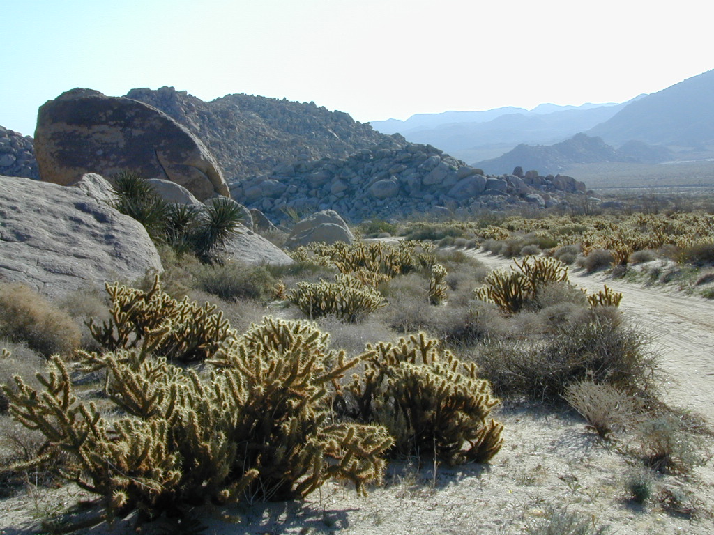
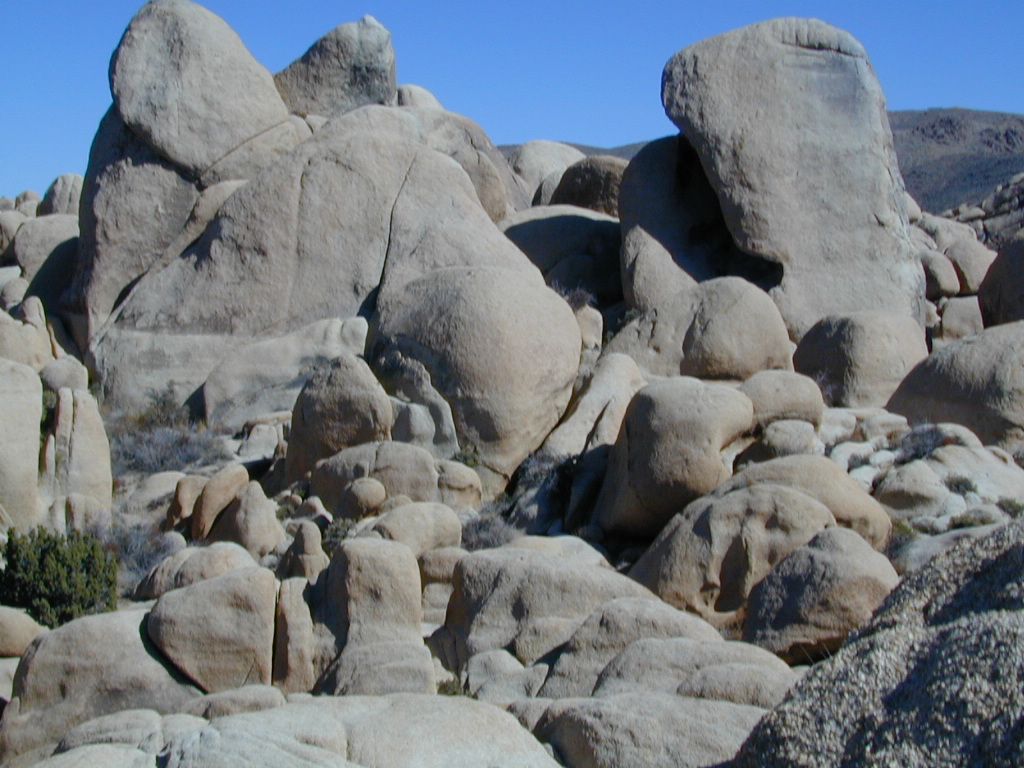
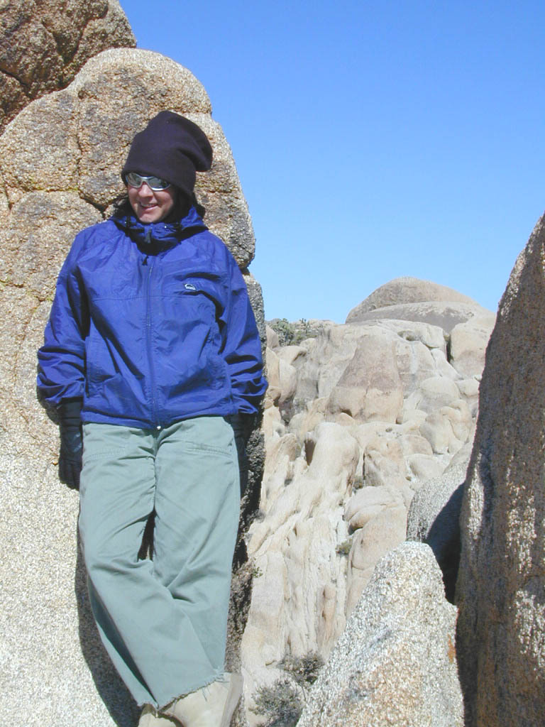
The giant boulders garden at the far end of this route have nice views of the Imperial desert floor. Better from the top of the boulders too; numerous primitive camp sites are tucked into the coves, surrounding the big boulders.
No toilets; no shade; no water; minimal vegetation. At night the stars are heavenly, but you can see city lights from Calexico and Mexicali.
GOAT TRESTLE?
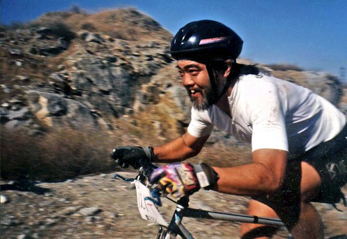
From this area you can hike or mountain bike up to the “old goat trestle” and numerous historic train tunnels @ Carrizo Gorge Goat Trestle (not to be confused w/ the wildflower destination called Carizo Plains in Kern Co). BRING A HARD COPY topographic MAP of this area, if you wish to explore past camp. Moderate hike, an all day adventure. Bring lunch and water!
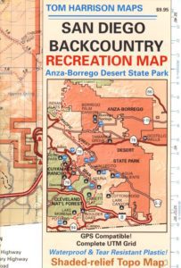
SAN DIEGO Backcountry Map
this waterproof map has the entire State Park covered with all back roads, trailheads, campgrounds and railroad tracks
When you decide to stop the car, look around for the best spot. Park off the road way and preferably in a turn out or camp spot. Turn off the engine, get out of the automobile, stretch your legs, breathe, look, close your eyes – tight and breathe deeply, then open and look around you again. This particular place is special, you can just feel it. Walking around the boulder area, be cautious of snakes.
On the boulders – closely examine them, climb on them, get to the top; you will find (Native American) Indian grinding holes called mortars or morteros.
great side trip option: Across the paved road (SD County Road S2) on the opposite side of the valley is a nice hike to Sand Dollar Hill. (I’m sure this isn’t the real name). Dirt road leads up to a dirt parking area for hikers. Busy lil place sometimes. These desert dirt hills have wind caves and chunks of sand dollars scattered all over them. The real ocean floor way out here, east in the Anza SD desert… how cool is that?
great side trip option:Canon Sin Nombre is just up the road a piece, N on S2, on the EAST side of the road. Amazing viewpoint turn out, right on the highway, overlooking the impressive topography and badlands. If you have a high clearance SUV or any truck you can drive down into the sandy tight, rocky wash. It meets back up with another main wash way back there.
Tons to explore back here. Off roader should think Tread Lightly on this turf and primitive car campers should use a Leave No Trace approach. White sand, deep sand, caves, smoke trees, and the best slot canyon climbing & hiking this side of the Anza Borrego State Park.
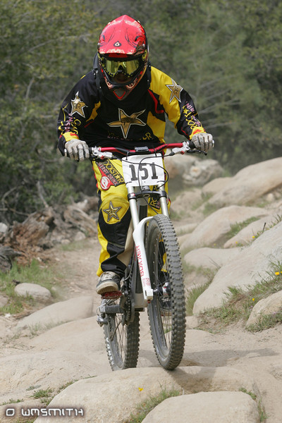
Mountain bike races are few & far in between, so Total Escape is here to promote them. This is one of the longest running races, near Lake Isabella, along the Kern River.
The All Mountain, Down country, Gravel, Vintage, XC, Downhill, Enduro Event or the year.
Up to 500+ bikes in competition w/ various classes. Downhill, cross country & short track. Presented by the Southern Sierra Fat Tire Association. 30+ years running, so we know it’s very popular. Annual event held in the Springtime.
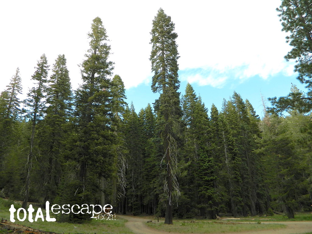
Jamison Creek Canyon: the small stream flows all year long
Small Sierra Nevada camp on Upper Jamison Creek in a granite canyon, within a gorgeous red fir forests, wildflowers and fresh mountain air.
high clearance vehicle recommended
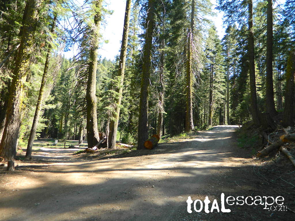
Gravel (rocky) road access, and here we use the word “road” loosely: Plumas County Road #507
Plumas Forest Route 507
also known as Johnsville Road; Johnsville McRea Road (misspelled McCrea on Google Maps)
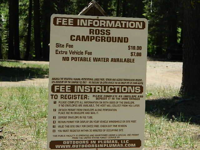
Ross Campground NFS
• Elevation: 6,070′
• Number of Sites: 5
• Vehicle Accessibility: High clearance; No RVs or trailers
• Camp Fee: Yes
• Campsite Reservation: No
• Toilet: Vault
• Water: Creek only
• Length of Stay: 14 Days
• Season: May–October
• Trailhead: McRea Ridge & PCT
camping
dirt roads
hiking
mountain biking
off-roading
swimming holes
stargazing
wildflowers
RUSTIC CAMP: No Picnic Tables!
4 camp sites are located at this turnoff @ driveway. Another single camp spot is located half mile up road, next to 2 nice swimming holes. Although the National Forest web site states that this place has 3 sites, it does indeed have 5 camp fire rings. All are available on a first come basis.
No OHV off-road riding in camp.
Snow is possible at this elevation, between October-April. Thunderstorms are common in summer in the Sierra Nevada mountains. 4×4 will be needed to access this area, if winter weather sets in.
Across Jamison Creek from Ross Camp
is Mount Fillmore @ 7715′ elev. Up canyon is Mc Rae Ridge PCT trailhead Mt Etna @ 7063′ Blue Nose Mtn @ 7290′
USFS just started charging a fee for this remote creekside camp. It used to be free, but no more.
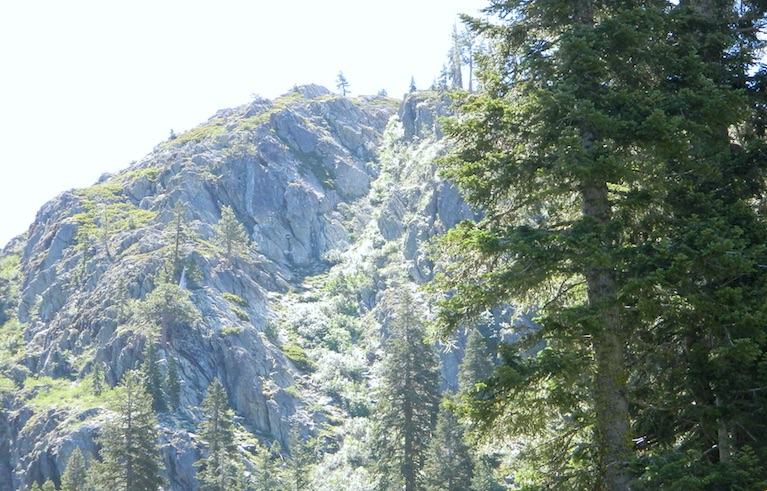
Tucked way back in the granite high elevations, near Donner Pass is a wilderness water flow called Canyon Creek. Connecting small lakes and big reservoir, this creek is part of the Nevada District water supply. The Sierra Nevada region is Tahoe National Forest and the terrain is abundant rock.
Campground is perched on the edge of rock overlooking the impressive whitewater; sounds of crashing water at certain campsites is deafening. Half of the campsites are located in a forest loop and the rest are out in the open, with much granite and fewer trees, perfect for star watchers.
Canyon Creek California
Lake Faucherie is a mile up the creek and Sawmill Lake is a mile down stream, so it’s a great fishing location, as well as hiking, kayaking and canoeing destination. The Pacific Crest Trail (PCT) is also routed close by. A hiking trailhead at the north end of Sawmill Lake leads to a loop hike of small lakes.
roughest roads in the region
Campground loop is paved, but the 12+ mile access road is NOT.
Twenty plus miles of paved & gravel backroads in boulder-hopping bliss, leads to granite lined lakes and forested campsites. Two different driving routes into this canyon:
One is the longer way Road 18 – paved access off of Gold Country Highway 20, which becomes an 8 mile long, rocky, rough, one-lane road around Bowman Lake.
The other is slightly shorter, county road #843 that comes in the back way from Jackson Meadow Reservoir (off Hwy 89, N of Truckee).
Both of these primitive roads join at Jackson Creek Campground, a favorite among off-roaders.
Canyon Creek Campground is another few miles up Road ##843-037, a rugged canyon route towards Lake Faucherie, where the road comes to a dead end.
Don’t let the old maps fool you: these National Forest Roads are labeled as gravel roads, but boulders and rock slides are quite common. 4×4 would be nice, but high clearance is recommended.
Minimal signs designate trails, roads and lake access; What signs that do exist are old, faded and broken. No warning signage reading ‘high clearance’ or ‘4WD recommended’ – so obviously Tahoe NF won’t be installing new signs anytime soon.
backpacking
camping
canoeing
fishing
hiking
kayaking
stargazing
Faucherie, Sawmill and Bowman Lakes are all along this waterway called Canyon Creek.
National Forest Campground Latitude: 39.436863 Longitude: -120.579564
Canyon Creek Campground
• Elevation: 6600′
• Number of Sites: 20
• Toilet: Vault
• Vehicle Access: High Clearance Vehicle, no trailers
• Campsites Reservation: No
• Camp Fee: No
• Length of Stay: 14 Days
• Season: June – October
• Trailheads: Faucherie & Sawmill Lakes
• Managing agency: Nevada Irrigation District
530-265-5302
Canyon Creek Campground is an excellent campground for staying away from the crowds, which seem to focus more around Bowman Lake & Jackson Meadows Reservoir.
All campsites at this campground have steel bear boxes – for proper food storage in black bear country.
Prefer camping outside of developed campgrounds? then the primitive camp sites that line Canyon Creek will be a welcomed surprise. Most are clearly marked with small signs and some may require 4×4 to access. When fire restrictions are tight, campfires are only allowed in the developed campgrounds.
desert hikers and rock climbers love this small camp
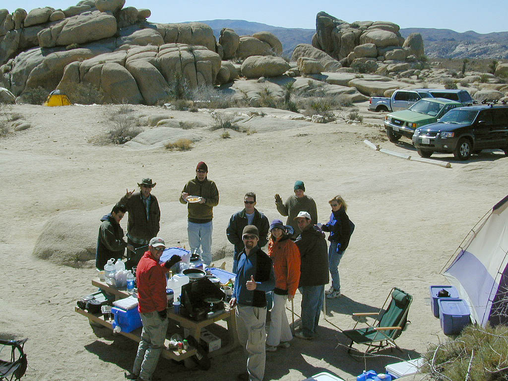
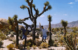
White Tank & Belle campgrounds are the smallest camps Joshua Tree National Park has to offer. On the east side of park both campgrounds are located half a mile from one another.
This Southern California desert lunar-scape National Park is more popular & crowded because of the proximity to major urban areas. The south east side of the park entrance station, Cottonwood, is the least busiest gate.
bouldering
camping
hiking
stargazing
From the town of 29 Palms (on Highway 162) take National Park entrance South on Gold Park Rd. At intersection with Loop Rd. (do not turn right) Go straight through onto El Dorado Mine Rd. about two miles drive leads the 2 campgrounds.
In the years between 2000-2005 founder of Total Escape, DanaMite, lead several guided camping trips to Joshua Tree and liked this specific area the best.
Large, granite, alpine lake in the Central Sierra Nevada Mountains. Abundant trout fishing, swimming, camping, boating, hiking, floating, kayaking, picnic sites, and high altitude backpacking trailheads. Shoreline fishing is just as good as by boat. Fishing boats can be rented at Kit Carson Lodge.
The high altitude location makes this a winter wonderland half the year w/ snow ski resorts nearby! It is an awesome summertime family vacation destination as well. Fishing is excellent through Autumn months. Campgrounds close up shop in October, generally when the snow starts. High Sierra – Deep snow pack means they will not reopen until May (at the earliest).
Carson is major Sierra Pass highway, but it closes for big snows, so always check CalTrans before you make the drive up the mountain. Carson Pass is California State Route 88, which connects the Gold Country (on the western slopes) to the South Lake Tahoe region (on the eastern border), near Nevada.
Check Current Highway Conditions for HWY 88 roads.dot.ca.gov
Cal Trans 800-427-7623
Silver Lake Day Use Areas
These areas listed below are operated by El Dorado Irrigation District and they do charge a day-use fee for many of the amenities provided. Boat Launch fee? Yep. Parking fee? Maybe. Picnic stop! How much? Eat fast!
Ferguson Point is located on the north shore of Silver Lake: 10 picnic tables & vault toilets.
Sandy Cove is on NW shore of Silver Lake: Wheel-chair access to lake edge, 5 picnic tables, piped water & vault toilets.
Oyster Creek Rest Area, up along Highway 88, 1 mile NE of Silver Lake: 10 picnic tables & vault toilets.
Historic Memories: Camp Minkalo, Camp Silverado & Kays Silver Lake Resort are all closed now.
Many small businesses come and go in the rural mountains of California. Throughout the decades, some do survive, but many change hands, change names, or have a difficult time ‘making it all work’ in the off-season. Always call ahead (real phone w/ real person) before you make a big drive to a remote location.
National Forest Campgrounds in this lake vicinity:
East Silver Lake Campground – 62 sites
West Silver Lake Campground – 42 sites Kirkwood Lake Campground – 12 sites
Silver Lake Campground NFS
• Elevation: 7200′
• Number of Sites: 62
• Vehicle Accessibility: RV 30′
• Campsite Reservations: Yes
• Camp Fee: Yes
• Toilet: Vault
• Length of Stay: 14 Days
• Season: June – October
• Trailheads: Hidden Lake, Sandy Cove
El Dorado National Forest
Amador Ranger District
26820 Silver Drive
Pioneer, CA 95666
209-295-4251
Older lodges, resorts, camps and cabins at Silver Lake were mainly built in the 1920s, while the oldest resort dates back to the mid 1800s. Wow, how cool is that! Much history in this mountain region w/ Kit Carson Emigrant Trail, all stories totally worth exploring.
Plumas National Forest Camping – Primitive Camp Sites
Spanish Creek, Quincy, CA
Plumas Forest Camping
North Sierra Nevada, Northern California
Listed below are primitive campgrounds w/ minimal facilities or open camping areas in Plumas National Forest. Plumas has excellent fishing as the big rivers & numerous creeks run thru this northern Sierra Nevada landscape. Open camping is allowed on almost any dirt road w/ a current campfire permit
Brady’s Camp
[on Pine Creek near Argentine Rock]
near Quincy, CA – east on Squirrel Creek Rd. & go 8 mi. to the campground. Elevation 7200′ / Open May – October
Bucks Lakehas numerous NFS Campgrounds and PCT access; Overall elevation 5000′ w/ abundant boating, fishing and hiking. Snow in winter closes roads. Cabins, marina, lodge, restaurants. Bucks Lake Wilderness, Gold Lake, Silver Lake
Deanes Valley Campground
[along Rock Creek] Hwy.70 Quincy, go 3.5 mi. west on Buck Lake Rd. Head south & 7 mi. to the campground. Elevation 4400′ / Open April – October
Backpacking trails w/ dirt road access. Above Chico, beyond Cohassett; on the border of Tehema Co. and Butte Co. (Lassen NF & Plumas NF)
Inskip, CA – Way up beyond the Ridge, well past Magalia and Stirling City – find dense forests, dirt roads and camping. Philbrook Reservoir w/ West Branch Campground NFS. Elevation 5546′
Ohio Valley – Seneca Road
[off Hwy 89 to southside] Primitive forest camping near Lake Almanor. ATV trails, hunting. Creeks and river camping closer to Seneca. High clearance or 4WD may be needed on these dirt back roads – depending on snow and mud. There is plenty dirt roads back here to explore.
Snake Lake
[good fishing area] Hwy.70 Quincy, go 5 mi. west on Buck Lake Rd. Head north & 5 mi. to the campground at the lake. Elevation 4200′ / Open April – October
Anza Borrego Desert State Park & Borrego Springs Campgrounds
Anza Borrego Desert is the largest of the California State Parks. Borrego Palm Canyon Campground is the official name of this popular palm oasis & developed campground located very close to Borrego Springs CA. Hike or bike to town. There is also a private RV Park named Palm Canyon Resort in town, just to confuse you.
Desert wildflowers blooms, popular hiking & biking trails, plus mud caves & slot canyons draw plenty visitors here, mostly in the winter months. Summer high temps exceed 90 degrees for months at a time.
There are hundreds of miles of dirt roads to explore, and one could easily spend every weekend for a full year, checking out all there is to see in this vast desert, where elevations range from near sea level to 5000′ peaks.
BORREGO PALM CANYON CAMPGROUND
main campground near Visitors Center, in town Borrego Springs, CA
120 camp sites for tents & RVs, flush toilets, overnight / day use fees reservations accepted
TAMARISK GROVE CAMPGROUND
27 camp sites, flush toilets, fee
on S-3 @ Highway 78 jct (closed June – Sept) reservations accepted (Oct-May)
Vern Whitaker Horse Camp
equestrian campground w/ corrals, 10 camp sites, flush toilets
elev, 960′, located N of Borrego Springs, near scenic and rugged Coyote Canyon. reservations accepted
Backcountry Campgrounds Anza
Arroyo Salado
16 miles east of Borrego Springs on County Road S-22
Blair Valley Camping Area
open car camping & RV spots, vault toilets
on SAN DIEGO County Rd S-2 near Highway 78 jct
Bow Willow Campground
elev, 950′, hwy access, 16 camp sites, pit toilets, overnight fee
near Sweeney Pass & badlands overlook; located on S-2, 9 miles N of Interstate 8
Canon Sin Nombre
off S-2 near Sweeney Pass; entrance near Badlands Overlook; slot canyon hikes
Coyote Canyon Camping
N of Borrego Springs via Di Giorgio Road
rugged backcountry dirt road, tent camping only
car camping near ocotillo gardens; 4×4 needed @ creek crossing & Sheep Canyon
Culp Valley Campgound
elev, 3400′, hwy access, 8 camp sites, pit toilets, free camp
located on S-22, atop Montezuma Grade
Culp Valley Boulders
elev, 3700′, dirt road access, primitive camp sites, free
located off S-22, 4×4 near Montezuma Grade
Fish Creek Campground
Hwy 78 near Ocotillo Wells & Split Mountain
elev, 280′, dirt road access, 8 camp sites, pit toilets, free camp
from hwy, go 12 milies south on Split Mountain Road
Yaqui Well
5 mi. south of Borrego Springs on County Road S-3 & right on Yaqui Pass Road, go 6 miles to camping area on right side
Yaqui Pass
5 mi. south of Borrego Springs on County Road S-3 & right on Yaqui Pass Road, go 4 miles to camping area on left side
Culp Valley trails, North Anza Borrego SP, SoCal Deserts
All Desert Campgrounds Nearby
AGUA CALIENTE HOT SPRINGS
(San Diego County Park)
88 camp sites for tents & RVs, flush toilets, overnight / day use fees, 760-765-1188
located on Co. Rd S-2, 22 miles N of Interstate 8 (closed June-Aug)
BOX CANYON RDMecca, CA – in between Joshua Tree NP and Anza Borrego Desert
BLM camping in Box Canyon & Mecca Hills Wilderness Park
LEAPIN LIZARD RV RANCH
(Private Campground Resort)
85 acres, 60 camp sites
located on Split Mountain Road, Ocotillo Wells, CA
OCOTILLO WELLS SVRA
(State Vehicular Recreation Area)
elev. 160′, 4×4 and off road camp sites for trailers & RVs
no water, no hook-ups, pit toilets, no fees, 760-767-5391
located on Highway 78 (closed June-Sept)
PALM CANYON RV RESORT
(Private Campground Resort)
located in town, Borrego Springs, CA
SALTON SEA SRA
(State Recreation Area & Campground)
Mecca Beach, Corvina Beach, Salt Creek Campgrounds
located on Highway 111 on east side of inland sea
SLAB CITY @ SALTON SEA
old Camp Dunlap in California desert badlands
free & open RV camping near Salton Sea
located off Highway 111 on east side of inland sea
TRUCKHAVEN HILLS
(OHV trails & camp spots)
elev. 300′, 4×4 and off road camp sites for car camping, touy hauler trailers & RVs
no water, no hook-ups, no fees,
located on S-22, East of Borrego Springs, CA
VALLECITO PARK
(San Diego County Park)
44 camp sites for tents & RVs, no hook-ups, toilets, overnight / day use fees, 760-765-1188
located on S-2, 22 miles N of Interstate 8 (closed June-Aug)
FREE CAMPING ANZA– Let us also remind you that this is the best place to camp in California for primitive car camping (camping outside of a developed campground). Open all year long – always! Super secluded, darkest skies, free and always located on the back roads. 4×4 is not required in all areas, so there are plenty of options. Blair Valley or Coyote Canyon Gardens are popular camp spots, but there are thousands of hidden canyons and washes in this giant State Park, just awaiting your tent. You’ll need a decent topographic map. For more info on free camping click here.
Before you can choose the ultimate place for your tent, you must decide where it is you wanna sleep OUTDOORS. What ultimate location? Your destination can play a huge factor in you getting a peaceful nights rest. And do you really need a campground? Or, are you ready to try to rough it, without the amenities? Best camping is off-the-beaten-path, and usually on the back roads. Trailhead camps, 4×4 camps, best view camps, creek camps; Dispersed camping, often called primitive camping. Focusing here on car camping, tent camping and backpacking routes.
Just choosing a flat tent spot isn’t good enough anymore. You crave the best camping experience and seek real nature, with minimal crowds. No annoying neighbors, no parking hassles, no traffic or cars passing by. We at Total Escape are here to help you get to your wilderness goals and experience nature like never before. Right here, right now and it doesn’t hafta cost you a dime.
California Camping Destination:
Let’s start with a terrain overview. California has it all – mountains, deserts, coastal, rolling oaks with rivers in the countryside, plus the infamous wine country and developed campgrounds within city limits. Desert camping in summer months should only be attempted by the experienced camper who loves 90+ temperatures. Mountain camping in winter can be freezing, so make sure you have the proper gear. Good maps are a must have and the readily available National Forest maps are your best avenue for getting and staying away from the masses. Visit our Destinations page to decide what kinda place you wanna ‘call home for the weekend’.
If you are the “I don’t care where I sleep kinda guy, as long as I can do/see this many things” all crammed into a 3-day holiday weekend, then you best do your research ahead of time. Get a good map, measure the mileage, plan picnic stops and sightseeing. Plan to set camp in a central location close to the main highway to call home-base, so you can be off exploring as much as possible.
Schedule in some “down time” or a full day for relaxing. Calculate driving distances and pad it w/ an extra hour. Maybe make a campground reservation if you are visiting a National Park or busy State Park. If you plan to wing it without reservation, always have plan B or plan C options already picked out. With millions of residents and tourists on the west coast, chances are you won’t be the only person wanting to do Big Sur, Yosemite or Point Reyes that particular weekend.
Helpful Hints
for a Good Nights Sleep @ the Camp Site
Bring a decent Sleeping Pad. Air Mattress with the inflator pumps will be the most luxury, without sleeping directly on the hard ground. Therm A Rest sleeping pads are another fine option, for those who like to travel light and still have air underneath them. Extra blankets, always.
Flat & Soft ground is the goal in choosing the best tent spot. Park your vehicles over the rocky slanted ground and keep the best flat areas for your camp site.
Do not pitch a tent in a meadow, no matter how inviting it looks. Wetlands and meadows are fragile ecosystems, an area that should be protected.
Look at the big trees above your sleeping spot and examine them. Do not place your tent near or underneath a dead tree or a dead limb. Trees do break and fall, especially if winds pick up. This could be a life or death choice, so remember to look up.
Bring abundant good tent stakes and USE them. Yellow plastic stakes are for soft cedar and sand. Thin aluminum stakes are for backpackers. Large steel nail stakes (some w/ plastic tips) are best stakes for all-around terrain.
Bring a mallet to pound stakes or use big rocks to hammer them. Gloves are also a good idea!
Never underestimate the use of a big tarp and some rope.
Guy lines help hold a tent in place when windy weather turns to big storm. If wind is in the forecast, then do this task before you head out on your day hike away from camp.
Make sure selected tent site is flat. Lay on the ground to check it out.
Place head of bedding up hill (if any slant can be noticed)
Tents should be at least 10 feet away from your campfire. At least 100 feet away from a creek or lakeshore.
Beach camping at the ocean edge; Know the high tide mark; place tent accordingly.
Slot canyons are awesome, sandy, narrow washes, many with cliffs and caves. In the desert badlands these can become raging rivers w/ flash floods. When rain is heavy in the mountains many miles away, you could get flooded in the low lands. If you hear any thunder – RUN to high ground. Better off picking another camp site, than to die by a wall of water!
Shade in the Desert sounds like an oxymoron, unless you find a place with high cliffs, or slot canyons. Tamarisk trees and palm canyon locations are usually an oasis of RV tourists & travelers. Hot Springs are also busy spots. Pinyon pines, juniper and over-sized manzanita can be found in higher elevation deserts above 1000′. The prime desert camping season is generally October thru March, as April can easily soar close to 90 degrees high.
Some people swear by the open spaces and back road camping options, as they have more seclusion, plenty privacy and best off all, no campground fees. You might need a GPS and a high clearance SUV to reach some of these camp spots, but you will be blessed with a unique secret spot to call your own.
Campgrounds come in all styles these days: From small primitive camps on a creek to the luxurious RV resorts with laundry room and showers. And then there is everything in between. This web site Total Escape specializes in FREE camping on the back roads and the smallest of campgrounds.
Reservations are usually accepted at the most popular camp locations, many are wide open on weekdays and the majority of campsites overall are available on a first come, first serve basis.
Ancient volcanic peaks mix with Sierra Nevada granite rock, pine forests and fresh, clear, clean mountain water! California, of course.
Stanislaus Forest Road #7N01 leads down from Highway 4 to this popular series of alpine lakes and reservoirs. Camping, fishing, hiking and mountain biking. Sailing, canoeing, kayaking, swimming, floating and fishing are also popular water activities.
Rules of the Reservoir:
10 mph speed limit on Western Arm.
No motorized boating in Eastern Arm.
Camp only in developed Campgrounds.
2 NFS Campgrounds at west end of lake:
Spicer Campground (60 sites)
Spicer Group Camp (75 people max)
Campgrounds only open June-September. Some campsites at the campground are wheelchair accessible.
Additionally, Stanislaus River Campground w/ only 8 sites, is located just off the main access road #7N01, right near the river.
Numerous smaller lakes in the region make this a hot spot for summer vacations. Union and Utica Reservoirs (both with dirt road access) are good for kayaking and canoes, while power or sail boats prefer the larger Spicer Lake. Summit Lake and Elephant Rock Lake are perfect for quite picnics and day hikes. Trails (many unmarked) connect the lakes to each other. Area gets buried with snow in winter, so these roads are generally only open half the year.
Inside the granite maze of rock known as Caples Creek, you may find this small lake, just off the highway. Paved access camp ideal for quiet weekends – fish, hike, stargaze and relax. Snow is deep in these parts of the Sierra, so the campground closes annually for winter.
No motor boats
No RV or motorhomes
No horse trailers
Kirkwood Campground
• Elevation: 7,600′
• Number of Sites: 12
• Vehicle Accessibility: No RVs
• Campsites Reservation: No
• Campsite Fee: Yes
• Length of Stay: 14 Days
• Season: June – October
• hiking trailheads, fishing, swimming, kayaking, canoe, rock climbing
Bears are active in this region, so use the metal bear boxes provided to store all food items.
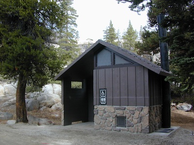
Extra precautions should be taken with human waste around fragile eco systems, like lakes and meadows. Use the new bathroom, instead of the bushes (or granite crack).
San Diego Backcountry
600,000 acres of SoCal desert
BLOOM: February thru May Anza Park elevations range from low to high. Lowest near eastern border of park (next to the Salton Sea) to the upper reaches of the western slopes @ 4000′ of the Laguna mountains. Lower elevations sprout up first; Micro flowers, Easter-egg-color splendor in the dry washes. Higher elevations bloom later (along w/ areas on San Diego County Rd S-2, the Great Overland Stage Route)
Drive from Temecula to Warner Springs, and then proceed east – out to the Salton Sea via Back Road Highway #S22 (Montezuma Grade). A great route to take thru the Borrego State Park – for the full gamut in vegetation & altitude. Grapevine Canyon is an alternate off road route down a scenic canyon. Culp Valley has a small campground, plus lots of boulders and decent views to the Borrego Valley. Off the highway, on dirt, one-lane side roads lead to many primitive spots. Perfect for private picnics, stargazing or overnight camping.
Indian Flat Campground is located on the seasonal San Luis Rey River in rural North San Diego County. From I-15 @ Temecula, CA travel eastbound on Highway 79. Look for the tiny turn off (on left side) for forest road #9N05, sorta near glider airport located west of Warner Springs. This poorly paved backcountry route (half dirt/mud at times) is also known as both Indian Flats Road or Lost Valley Road.
Graded dirt road (paved in some portions) travel is approximately 6.5 miles to campground, look for gate and turn off on the left side. When you see the giant boulder near the entrance, you’ll know you’ve made it to the right place.
Oak trees and a few pines, plenty shade, boulders and mountain scenery, this is a great small campground that is well away from everything in Southern California. Seasonal creek-sized river and boulder waterfall often dries up in late summer. This means a wet spring is the best time to visit this camp. Hiking, mountain biking trails and hammock spots. Pacific Crest Trail access.
• Elevation: 3,600′
• Number of Sites: 17
• Camping Reservations: None
• Sites Available: First come, First serve
• Vehicle Accessibility: Length 15′ max.
• Length of Stay: 14 Days
• Water: No Piped; Seasonal creek nearby
• Toilet: Vault
• Season: Closed for mud & snow during winter months
• Fee: Yes
• Operated By: National Forest Service
• Closest Town:Warner Springs, CA
There she sits, above Lone Pine California, right next to the High Sierra. Above the Alabama Hills….. at the base of Whitney, on an alluvial fan overlooking the Owens Valley & US Hwy 395.
Tuttle Creek Campground is perfect stop for RVers traveling the Eastern Sierra, beginner mountain bikers needing to explore & test their skills, or the avid backpackers waiting to acclimate & get a good nights rest in reasonable temperatures, before attempting the tallest Mount Whitney.
Tuttle Creek is a BLM Campground w/ picnic tables, fire rings or BBQs. Awesome creek camping at the base of Mount Whitney. Hear the water rushing over the boulders; soothing for bedtime or stargazing. The fishing is decent. Wildflowers like indian paintbrush & lupine can be found here in spring and summer, in the high desert sage lands of the Eastern Sierra.
• Elevation: 5120′
• Number of Sites: 85
• Vehicle Accessibility: RVs okay
• Camp Fee: No
• Campsites Reservation: No
• Length of Stay: 14 Days
• Season: March – October
• Trailheads: John Muir Wilderness
From Lone Pine CA, head West 3 miles on Whitney Portal Rd, turn LEFT on Horseshoe Meadow Road, within 2 miles, turn right on a dirt road that leads to the campground.
Tuttle Creek flows past campground; No drinking water.
Pit toilets; Some shade.
HINT: On the dirt back roads, on the slopes of the Eastern Sierra, between Lone Pine & Bishop, you can find & fishing holes & primitive camps (free camping) on any numerous of creeks; some you can park so close that you don’t have to leave your vehicle to fish. You may need a high clearance vehicle to reach some.


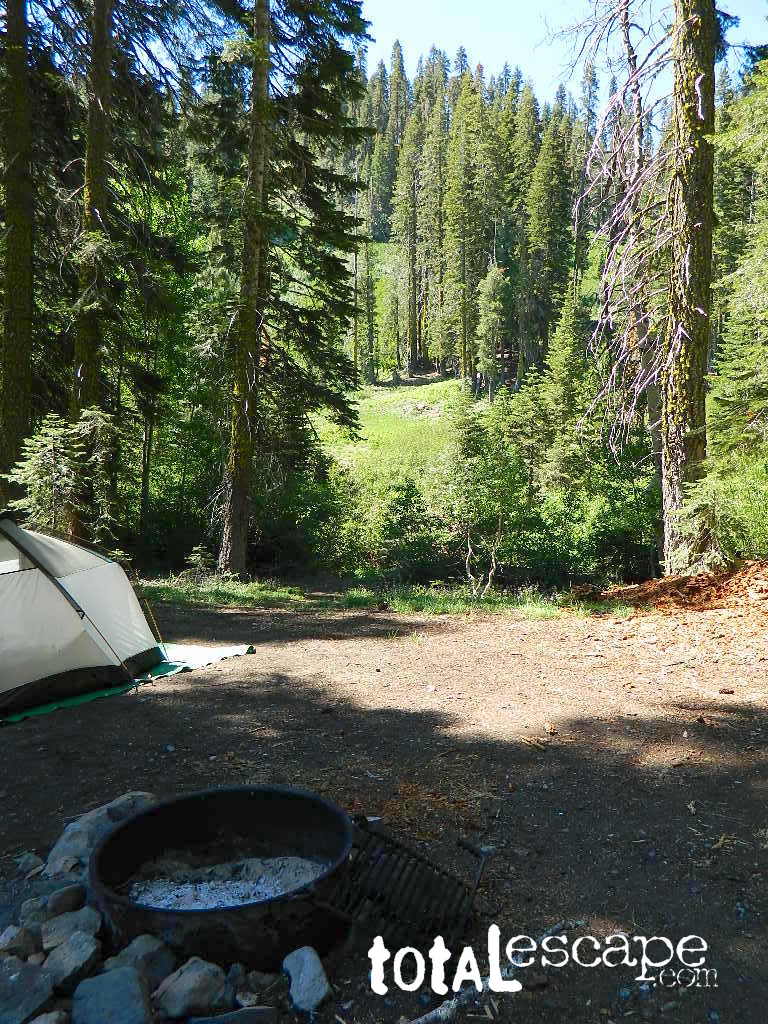
 Small Sierra Nevada camp on Upper Jamison Creek in a granite canyon, within a gorgeous red fir forests, wildflowers and fresh mountain air.
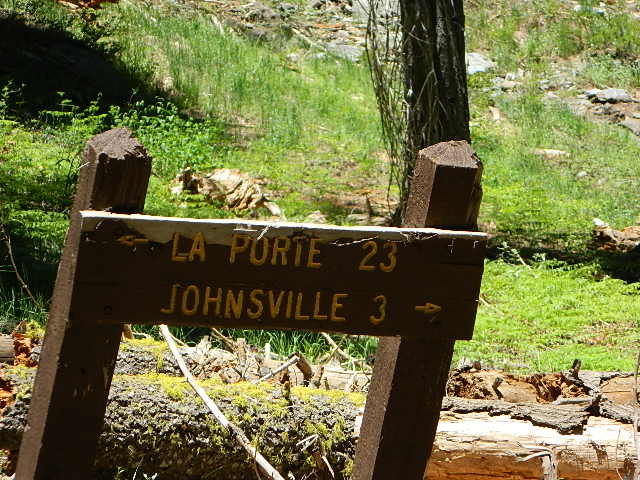


 If you are the “I don’t care where I sleep kinda guy, as long as I can do/see this many things” all crammed into a 3-day holiday weekend, then you best do your research ahead of time. Get a good map, measure the mileage, plan picnic stops and sightseeing. Plan to set camp in a central location close to the main highway to call home-base, so you can be off exploring as much as possible.