Sierra Madre Road
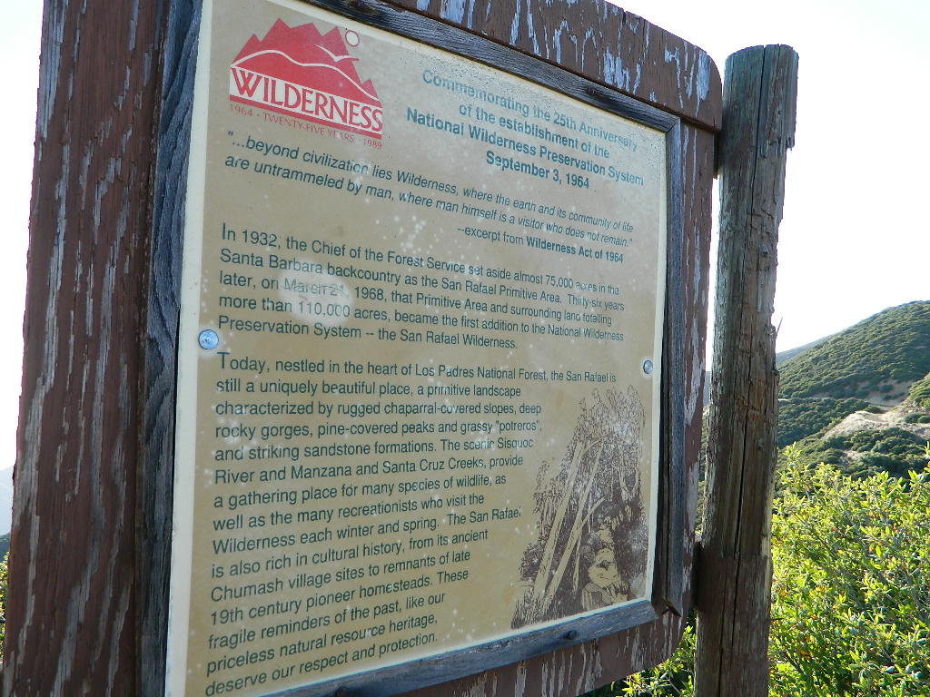
Sierra Madre Ridge, San Rafael Wilderness
Los Padres National Forest
Forest Road #32S13
off of Cuyama Valley Hwy 166

East of Santa Maria, CA – along Highway 166 (on the south side of the pavement) are several dirt roads that lead up to the main ridge road that access this part of Los Padres National Forest.
- backpacking
- camping
- dirt bike trails
- dirt roads
- hiking
- horse camping
- mountain biking
- off road routes
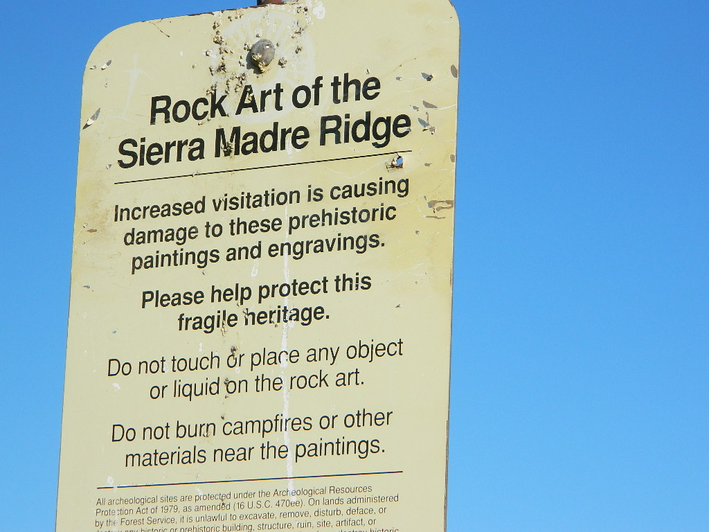
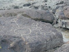
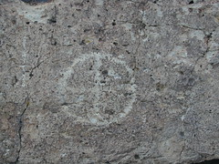
- petroglyhs
- wildflowers
4WD not required, but high clearance is helpful. Open almost all year. Rainy season gate closures (at hwy) during winter months.


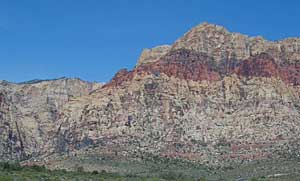
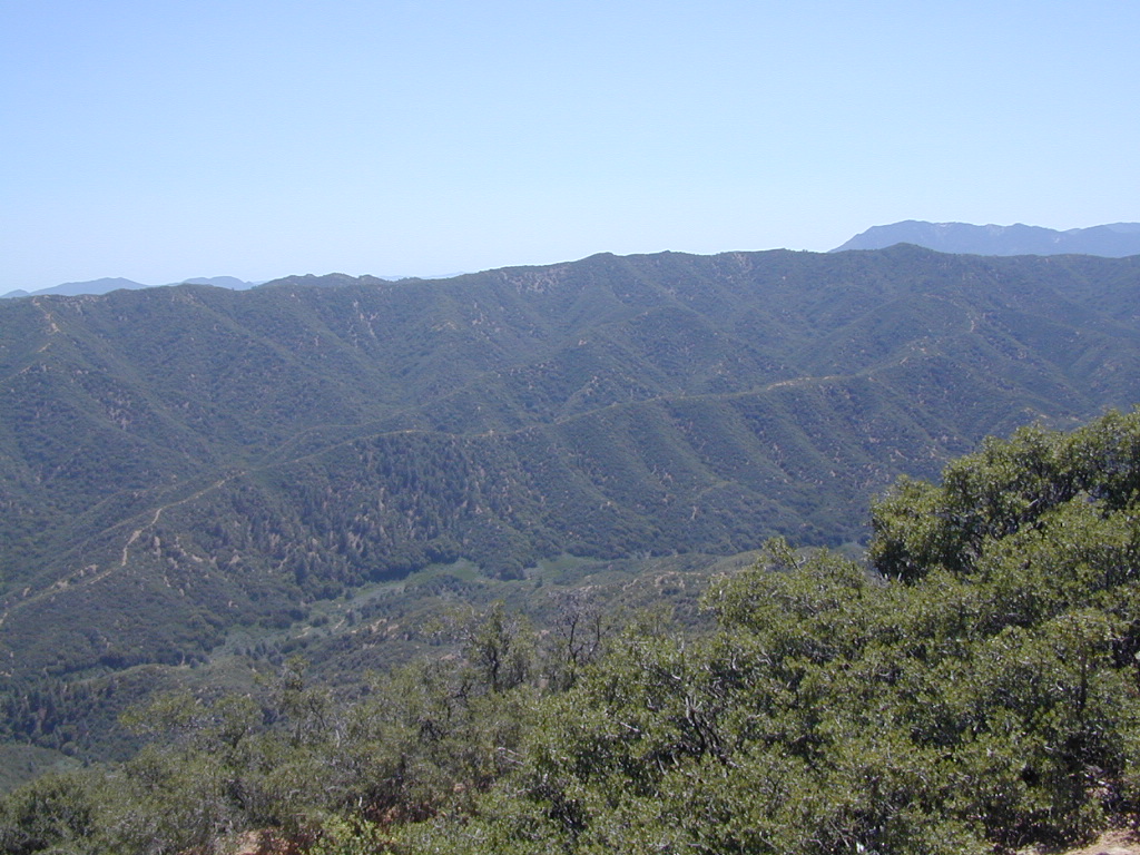
Sierra Madre Mountains
Miranda Pine Mountain (elev. 4120′)
Timber Peak (elev. 4754′)
Peak Mountain (elev. 5843′)
McPherson Peak (elev. 5749′)
Samon Peak (elev. 6221′)
Sierra Madre Ridge is forest road #32S13, which parallels Hwy 166 (Cuyama River) for over 50 miles on the Sierra Madre Ridge at approx. 5000 feet elevation.
NOTE: A good stretch of this dirt road is closed to vehicle traffic. Although it connects to Santa Barbara Canyon near Ventucopa, you cannot drive it. Only hike or mountain bike!

NFS Gate locked at the HOG PEN trailhead, and from there you can bike or walk all the way the other end at Santa Barbara Canyon near Cuayama Fire Lookout @ Dick Smith Wilderness


Small campgrounds in the region:
off Highway 166
Miranda Pine Campground (on 32S13 @ 11N03)
Bates Canyon Campground (via Cottonwood Canyon Rd)
also known as White Oaks Campground
Aliso Canyon Campground (via Aliso Canyon Road)
not accessible by vehicle, from dirt road 32S13; only by trail
in the backcountry
Painted Rock Camp (hike-in)
Sycamore Camp (hike-in)
high clearance, off road accessible
Horseshoe Springs (11N04)
Lazy Campground (11N04)
Wagon Flat Campground (11N03)
Barrel Springs (10N06)
Colson Canyon (11N04)


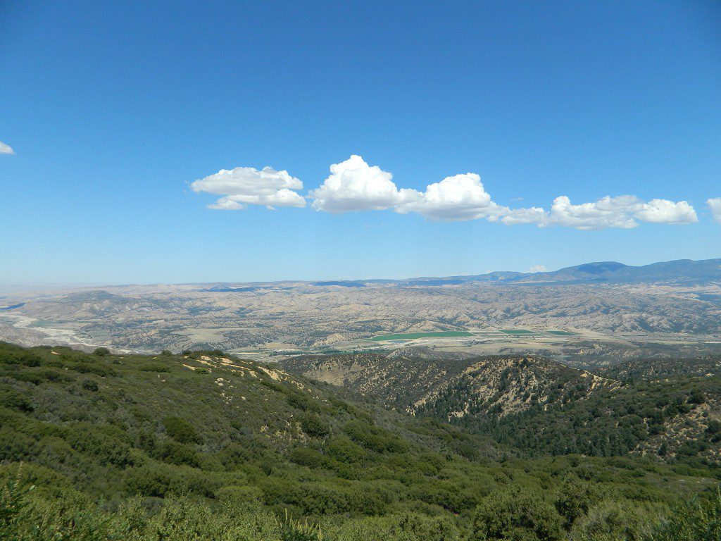
Highway 166 Cuyama River Valley
EAST San Luis Obispo County
Wildflowers Bloom: APRIL-MAY


San Rafael Wilderness
Sisquoc River
Native Rock Art
Sierra Madre Mountains

MAPS of the Area:

Los Padres USFS MAP
Los Padres Topo Atlas
Los Padres West NatGeo Map
Dick Smith Wilderness Map

 nearby destinations:
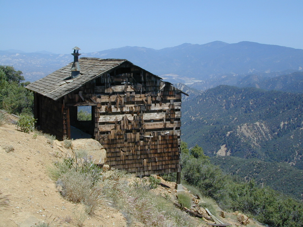
Cuyama Peak Fire Lookout
New Cuyama, CA
Rock Front Ranch 4×4
Santa Maria, CA
Ventucopa, CA

 North of Santa Barbara, CA