Tag Archives: Pine Mountain

Toad Spring Campground

Toadsprings

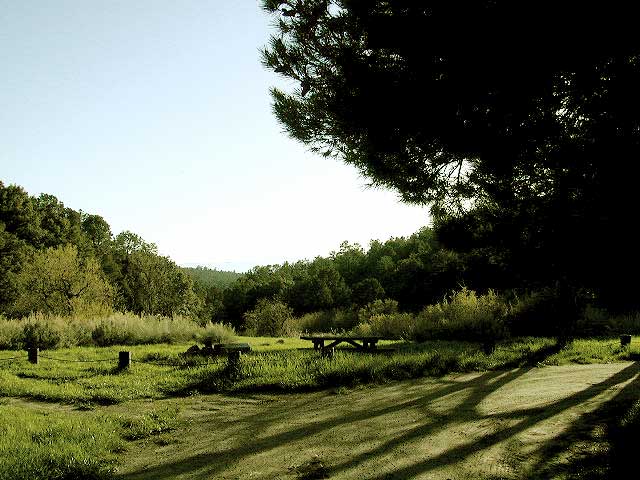
Los Padres National Forest; Toad Spring Campground

Atop Quatal Canyon on Forest Rd #9N09
– less than a mile off of Cerro Noroeste Road; just west of Apache Saddle. Cerro Noroeste Road name has changed to Harris Ranch Road (2015), so make sure to check on several maps before venturing out, just so you know.

5700′ elevation w/ 5 camp sites.
picnic tables, fire rings & no toilet. OHV trails nearby

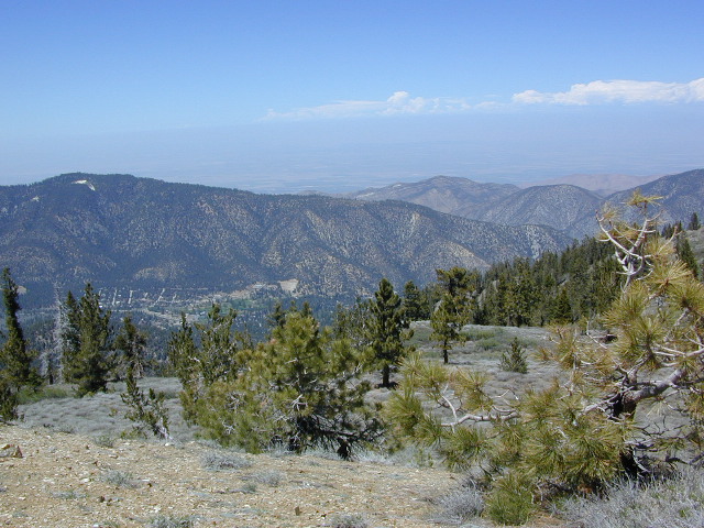
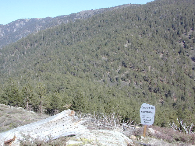
Red dirt Quatal Canyon, next to the Chumash Wilderness & the Apache Saddle, a small campground is an oasis for the wildlife. A year round drippy, soggy natural springs feeds the meadow & trickles down the dirt road. Great birdwatching, hiking, native wildflowers & hunting.

OHV use is quite common; Quatal Cyn trails,  a long desert wash to explore. Short side canyons to the right, off of main road (9N09). Many routes may require a high clearance vehicle, but not 4×4, unless it’s raining or wet or snowy. You’ll need a Los Padres Forest map to get the most enjoyment out of this confusing landscape.  The multi-colored, eroded badlands makes great day hikes. Chumash Cliffs & Mount Abel 8286′.

Ballinger Canyon OHV Park is about 20 miles away, via Quatal Cyn & then 5 miles N on Hwy 33


View Larger Map

LOS PADRES NATIONAL FOREST MAPS – USDA
LOS PADRES EAST MAP – NatGeo
LOS PADRES WEST MAP – NatGeo

towns nearby:

PINE MOUNTAIN CA

VENTUCOPA CA

West Kern

festivals kern

CA Kern / western Kern county

Kern County is known for its oil, its agriculture, and outdoor recreation. The Kern River is the highlight of the region with lush, green and grey granite canyons, a big reservoir & the Sequoia trees just up the road. On the western side of Kern County are small towns like Frazier Park, the golfing cabin community of Pine Mountain Club, plus the oil meccas of Maricopa and Taft. Expansive Lockwood Valley enters into Ventura County. Cuyama River borders Santa Barbara & SLO counties.

Much of the western Kern area is rural ranch land, desert or forest. Los Padres National Forest, Chumash Wilderness, Bittercreek Wildlife Refuge, Wind Wolves Preserve, Buena Vista Reservoir, Ballinger Canyon, Hungry Valley and Fort Tejon State Park all call this region home, right on the mighty tangent of the San Andreas fault line. The San Emigdio range and the surrounding mountains of Mt Pinos and Mount Able design a perpendicular range to the Central Cali coastline, connecting the huge Mojave desert to the ocean. Cerro Noroeste is a very scenic drive.

The 17 mile long Quatal Canyon, where the indian camp of Mahu Tasen hosts a Bear Dance every summer is also a wild place of bird watching, camping and hunting. The indian word for Mount Pinos is “Iwihinmu” – a sacred spot for Chumash Indians, as well as others; Chumash call it the ‘center of the world’. Locals respond regularly with music, hikes, star gazing, drum circles (seasonally) and local festivals (annually) .

PHOTOS: Los Padres Photos | Miller Jeep Trail Off Roading Photos

Drum Camp Pinos | Drumming Cerro Noroeste

Tecuya Ridge

Tecuya Ridge, Cuddy Valley 4×4 trails can keep you busy for a whole weekend of back road exploring.

boating, camping, dirt biking, fishing, hiking, horseback, hunting, mountain biking, off roading, skydiving, xc skiing

DSCN0029

Quatal Canyon

Chumash Wilderness

Chumash Wilderness
Los Padres National Forest

38,150 acres
Mount Pinos – 8831′ elevation
Cerro Noroeste – 8286′ elevation
Los Padres National Forest

Terrain consists of high mountain peaks, badlands of Quatal Canyon Wash & Lockwood Valley; Steep slopes of forests, rock outcroppings, sparse forest areas, on border of Kern County & Ventura County. This area is sacred to the native California Chumash tribe.

Quatal Canyon Rd #9N09

DSCN0042Mount Pinos, Mount Abel, Cerro Noroeste, Westside Park, Hudson Ranch Road, Mil Potrero Highway, Lockwood Valley Road, East Dry Canyon, Apache Canyon, Cuyama River

campgrounds nearby –

The Peak to Peak Hike is a 7 mile, high elevation, ridge line day hike that traversed 2 of the tallest peaks in Kern County – Mt Pinos (elevation 8831′) and Mt Abel (8286′). Day hikes, equestrian trails, backpacking, mountain biking areas nearby. Steep, granite, chaparral, lightly forested w/ ponderosa and Jeffrey pines. From this ridge trail you have a 360 degree view over the entire region. The cabin community of Pine Mountain Club is to the north side (and IF the skies are really clear, you can see the Sierra Nevada mountain range too); Lockwood Valley & Ozena Valley are located to the south; Cuyama Valley to the west and the Tejon Pass w/ Frazier Park to the east.

Off road use 4×4, dirt bikes, ATVs, and quads are common in Quatal Canyon, Apache Canyon, East Dry Canyon leading up to the wilderness edge. Rangers will ticket if they find you on the Chumash side of Quatal wash. The secluded yet inviting, wide, white sandy washes are just too tempting for some bad boys.

Chumash trailheads are located

  • about a mile before Camp-O-Alto Campground (Mount Abel)
  • along lower end of Quatal Canyon Wash (OHV areas parallel)

nearby towns –


DSCN0060


View Chumash Wilderness Area in a larger map