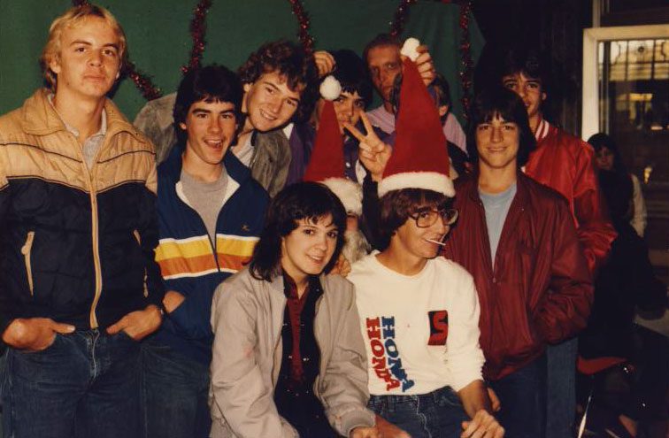
(before the dot com crash, before digital cameras, before GPS, before social media & way ahead of smartphones)
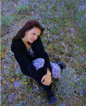
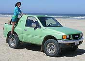
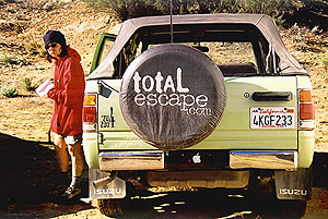
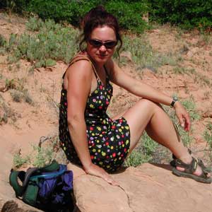
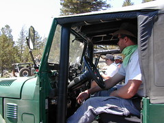
Sole creative force of Total Escape, Dana Williams left her 3D animation career to start living and working her dream job, online and off. Utilizing artistic talents, computer skills, a vast knowledge of the California landscape and a simple love of nature, to make it all come together for a killer web site called Total Escape.
27 years online means fresh content & updates every month; reworking web code every few years to keep up with various browsers, apps, maps, and wildfires.
“travel agent to the back woods”
Living close to the earth with organic gardening and rural living, DanaMite strives to offer California residents, new-comers and visitors unique, local destinations, concentrating on the outdoors – well away from overcrowded, busy, urban cities and tourist traps. Total Escape can show you how to discover the secret, hidden spots on your public lands that the gov web sites will not even dare to mention.
help keep
total escape
online
the independent source for California travel
NO CORPORATE sponsorship No venture capital No government subsidies No annoying pop-up ads
No scripts chugging bandwidth No membership needed
Decades without a television set lends plenty of time for studying terrain, topographic maps, GPS coordinates and thousands of photographs to compile more than 8000 pages on just California travel. Far from the daily grind of everyday life, DanaMite continues in educating the public about local travel, camping, family farms, organic cafes, outdoor recreation, respecting the land, responsible use of our resources & how to get more enjoyment out of weekend travels.
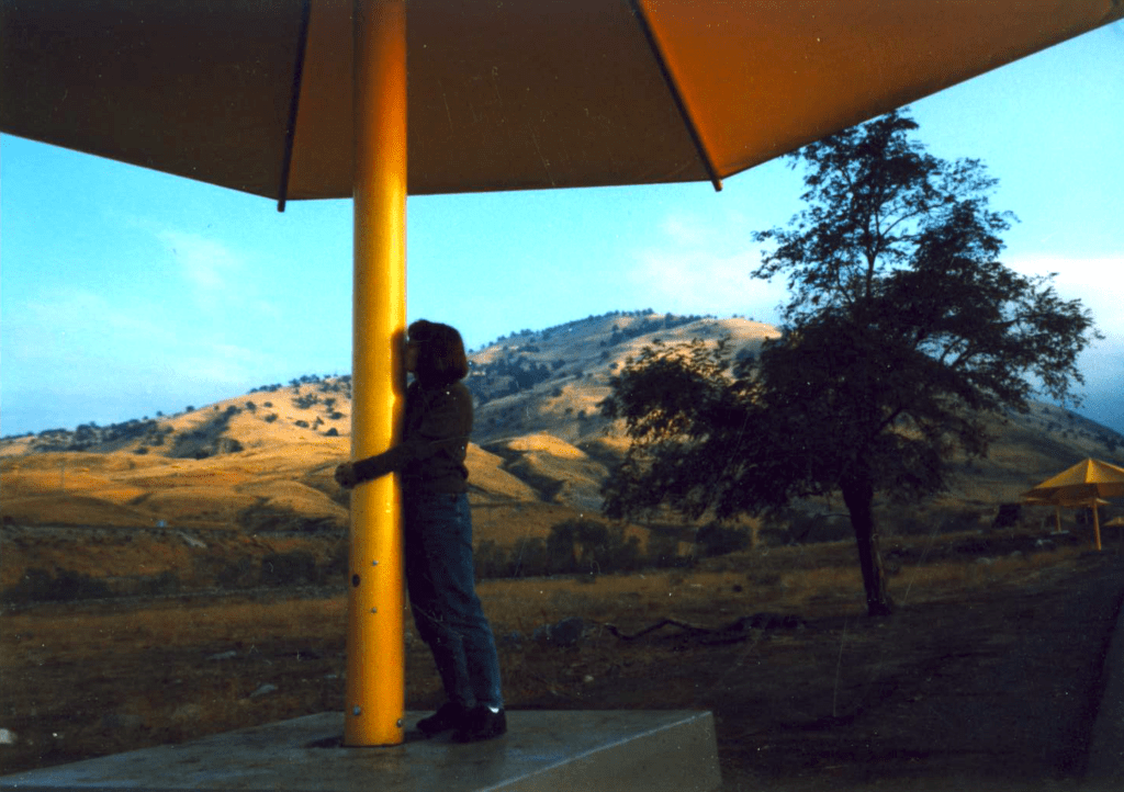
40+ years of documenting back roads of California, plus some Baja & Utah too!DanaMite loves Utah, almost as much as she loves California.Tejon Pass “Cristo’s Umbrellas” art installation 1991. Photo copyright – Kevin Robinson
Never married, No kids No wifi, No smartphone
No tattooed eyebrows
If you could care less about celebrity gossip or television, you are not alone. Many people seek more relaxing travel in their lives, but can barely afford a vacation, or a day off of work.
DanaMite is all about dirt – being outside and inspiring you to be outside as much as possible.
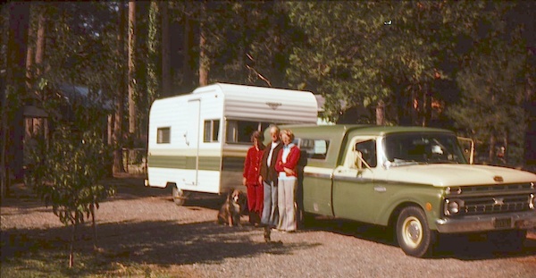
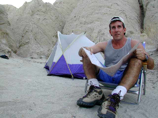
I began car camping in the Borrego desert while in college as an easy, inexpensive “weekend away from the city”. Cheap, literally dirt cheap outdoor vacations. Free camping, if you really know the good areas.
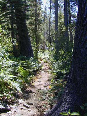
Whether you dig hiking or biking on dirt, sleeping in the dirt (tent camping) or wheelin in the dirt, we have the TOTAL DIRT on California. Back Roads, Hot Springs and tons of outdoor destinations inside the golden state. Nearly 3 decades online, we’ve been here from the start.
Dirt roads, dirt campsites, dirt trails. Desert dirt, mountain dirt, coastal cliffs to country canyons w/ huge reservoirs. All California dirt, terrain, forests and water too.
Trinity is NorCal’s jewel of alpine lakes and granite peaks – many above 8000′ elevation, about 40 miles inland from the ocean. Trinity is located in between the infamous redwood coast and the I-5 corridor. Rivers, creeks, lakes, and trails into the high elevations regions, bqckpackers and equestrian campers alike.
Hiking trailheads are accessed from all sides -On the east side you have Trinity Lake & Trinity River w/ Highway 3 running lengthwise in a north-south direction. Hwy 299 runs east-west along the south side of the wilderness. Klamath River Hwy 96 lies on the west side of the wilderness. Salmon River, Scott Mountains and Cecilville are north of the alps.
Both the small Russian Wilderness & the larger Marble Mountain Wilderness are located to the north of Trinity Alps, along with rural towns near the Scott Mountains and the Salmon River. Castle Crags Wilderness is to the eastern side, near Interstate 5.
The mountainous area is quite unique, as exposed granite mountain peaks and alpine lakes are pretty rare in the coastal Cascade ranges. The only other spot in California that has an 8000′ peak nearing the coast is just north of Los Angeles – Los Padres’s Mount Abel & Mount Pinos peaks, both over 8000′ in elevation.
TRINITY ALPS TOPO MAP
The USDA map for Trinity Alps Wilderness was outta print for nearly 2 years and it has recently been updated and reprinted. New edition released in 2013 and now available at the Total Escape map store. Printed on waterproof map paper and updated in 2012.
step 1. kill your television step 2. get outside, everyday step 3. sleep overnight, under the stars
For those who may be still trapped in TV-Land, welcome to Total Escape, a dedicated web site all about the “real world” of wilderness and non-fiction, California style.
Before I started my web business people would suggest to me that I need to write a book. So I naturally chose the world wide web. Now decades later, they are still asking the same question. “Why don’t you write a book on this stuff?”
I say “I did, it’s online. On the internet already. Go look.”
Puzzled, they would turn away to gaze at their device.
Total Escape was created in the web 1.0 days (1996), so I could easily keep track of my many travels, the awesome destinations, my recommendations, my travel logs, zillons of photographs, camping trips, the back roads, signs, maps, GPS, all of it. I worked my day job doing 3D & then moonlighted starting this small web biz. My biggest draw to the internet format at first was being able to update outdoor info instantly. Secondly, it was the ability to work from anywhere with a phone line. (56k anyone?)
No toxic inks, no newspaper. No glossy mag. No waste. Just free digital energy about outdoor destinations, transferred across the cyber waves, just for you the avid Escaper.
Then came the buy-out offers and seasonal magazine ideas from sources in San Diego. By late 2003, none had solidified. Several print magazines did however mention totalescape.com in a few articles, which resulted in some nice traffic spikes. Eternally grateful for the early on-lookers and participants!
Quite personally, I had already had my share of smelly inks, papers & paints in art college. Working in a computer career field, I was fully aware of the web in the early 1990’s. I was ready for the computer age & the internet. Eager in fact! Ready to make that leap from graphics & print concepts over to web windows was all I thought about for years.
I did not want to print anything; waste anything. I wanted my biz to be state of the art, futuristic – so here I am, 26 years later. WOW!
Thousands of photos, hundreds of destinations, all local to California. All by itself, Total Escape is a Parks and Recreation Magazine online – and always updating.
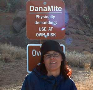
DanaMite
Total Escape – California, Off the Beaten Path totalescape.com
Aspen Groves are easy to recognize with their thick stands. White trunks with dark knots, slender, with oval shaped leaves. Growing in a network of roots, which are found lining creeks, alpine lakes, or spilling out from higher elevations, along scenic canyons.
The unique round leaves which can turn spectacular colors in the fall season. The fluttering and flapping of the oval-shaped, thick, green leaf is a sure sign of summer. When breezes get cooler, Autumn is only a few weeks away and as quick as the cold comes in, what a short and special show they put on.
Green Creek historic cabin, on the Eastern Sierra
California Fall Colors
Aspen trees can be found at higher mountain elevations in California, usually above 4000′ – all the way up to about 10,000′ or higher, depending on the mountain range and local water flows. Groves have an extensive root systems underground, so they often withstand wildfires and can come back after the rest of the forest is gone.
Beavers build dams in creeks around aspen trees, fishermen and campers love to camp next to aspens, and lovers carve their initials into their white bark. These trees do indeed take a beating, from all angles, winter weather included… so stop from cutting them!
BIKE
CAMP
FISH
HIKE
KAYAK
PICNIC
summer and autumn
These deciduous trees are naked half the year, typically from November to April, as winter buries them in snow and ice. Time is of the essence, limited to Summer and Autumn – to enjoy their shade and the beauty of the groves. Scenic meadows and fishing creeks are just an added bonus for searching out the aspen.
Aspens can be found in hidden canyons, primarily along the Eastern Sierra US Hwy 395 and surrounding mountain lakes. Some Sierra Passes have decent displays of color as well – like Carson Pass Hwy 88 and Yosemite’s Tioga Pass Hwy 120.
Below is a list of Total Escape’s favorite aspen areas of California
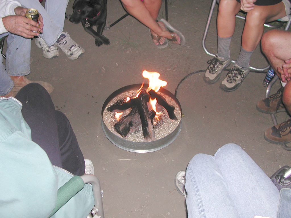
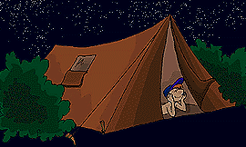
An overnight stay out-of-doors. Sleeping out under the stars.
Air bed, camping cot, tent… or just a tarp on the ground.
Perhaps a luxury Cabin Rental in the mountains or on the coast. Your choice.
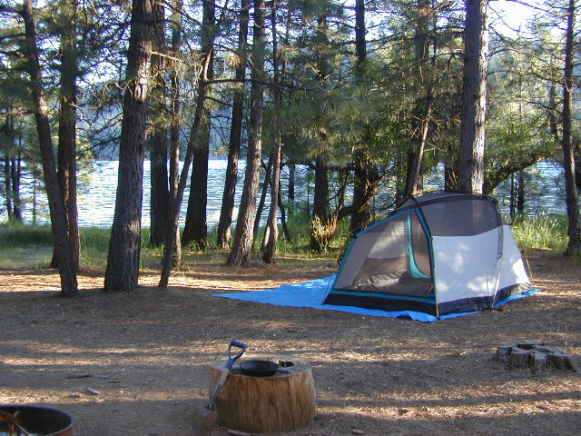
From a luxurious cabin in the mountains, to a small clearing in near a meadow with a stream nearby – with just a backpack, the idea of “camping” is always a bit different for each person. Roughin’ it for free – in the wilderness, or on the back roads; Or pay dearly for the price of real amenities, while on vacation.
camp sites that require you to physically haul your camp gear from a parking area to the camp spot, ranging from 1/8 mi. walk to a 1-3 mile hike
backpacking
free w/ wilderness permit
ultimate in seclusion, bring it all on your back, on foot into the wilderness & enjoy trail camps
Trinity River Camping, Douglas City, CA
SO CAL CAMP FIRES – Yellow Post Campsites are remote camping spots in secluded areas, in a designated fire safe clearing. No facilities such as toilets or showers. Maybe a picnic table & fire rings, if you’re lucky. Southern California forests have these kinda spots. Required campfire permit & you must double check on local fire restrictions.
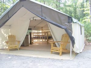
These structures are half way between ‘roughing it in a tent on the ground’ & having a ‘mountain cabin’. Tent cabins have wooden floors w/ canvas walls and roof; Dismantled annually for winter rain/snow, they are usually only available in mild, coastal climates or during summer months in the mountains.
Rentals typically include sleeping cots, but you’ll need to bring your own bedding (sleeping bags, sheets, pillows). Some rentals include shaded porches, wooden decks, minimal furniture, kitchenettes and/or wood burning stoves. Electricity may be available, or maybe not. Ask ahead of time, if you really must have that particular luxury when on vacation.
Yurts are a ’round version’ of this canvas cabin – which need to be aired out, often (to prevent mold). Yurt rentals are very popular and in high demand in California.
Find these type of rentals at yoga retreats, hot springs, beach canyons, remote lakes, redwood forests, high sierra camps, fishing camps and at certain RV parks.
California has no shortage of 4 wheel drive vehicles, but how many of them actually use them for what they were intended? If you’ve had your 4WD for a while and are itching to get to know the local trails, then grab yourself a few good OHV maps & head for the hills.
If you are a total novice and think you might want to get familiar with routes, what your vehicle can and cannot do, and learn the ropes from the pros, then you might want to discover the friendly folks in your local 4×4 club. Below we list as many legitimate groups we can find, with or without web sites. If your club is not listed, then please contact us & we might add it.
Anza Borrego Desert Washes
Off roaders (with running rigs) can enjoy pre-planned back road trips with various 4×4 Groups in California:
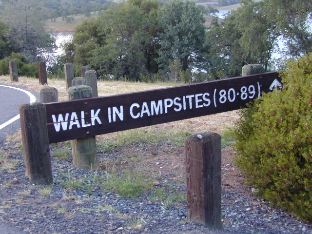
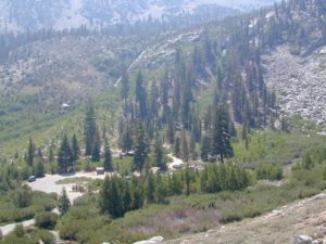
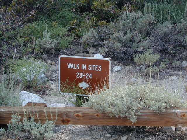
Below are developed campgrounds in California that have walk-in camp spots available. Vehicles are parked and you must carry your gear into the camp site (usually a short distance, but can be up to a half mile).
California Campgrounds with more than a 1-mile trek are not included in this list below. Areas such as – Catalina Island, Crystal Cove SP, Angel Island SP, Point Reyes National Seashore, indeed have many hike-to camps, but most are measured in miles (one way).
walk in campsites are perfect for –
people who wish not to see cars @ camp
people who prefer less noise while camping
physically fit folks, who want exercise
backpackers, who plan to hit the trails soon
avid hikers, who may be out day hiking
cyclists, just passing through
mountain bike campers
one nighters, travelers who only stay one night
late comers to the campground
(hint: these are usually the last campsites to fill up)
Walk in campsites are often located away from car campers & RVs. Some camp sites may have more privacy, tucked away in trees, while others have shared community area with fire pits and/or barbecues. All camp sites will have picnic tables and a some kinda toilet nearby. Bear boxes may be available for storing food properly. Sharing these food storage boxes with neighboring campers is common practice.
Campgrounds with walk-in sites range in elevation from sea level marshlands to high altitude alpine lakes. Most of these camps listed below are located inside developed campgrounds with overnight fees. Many are small campgrounds, while others are large hubs of activity. Some may be smaller campgrounds, with just a few camp sites. The most popular places can be reserved, with the links provided.
Many parks can also have day use fees, so know where you park and what time span is allowed. Ask the campground host if needing assistance. Some campgrounds lock their gates at sunset and do not permit entry at night. Others may not allow campers to check in anytime after sundown. Know their rules before you make reservations.
If you plan on not making camp reservations; make sure to have a plan B or C choice camp – in case your desired campground is already full. Many popular destinations can fill up fast (by noon in the summer).
Spacious Camp @ Aspen Grove Campground, Eagle Lake, CA
Niagra Creek Campground, OHV 4×4 trails, Stanislaus NF
North Battle Creek Reservoir, PG&E Camp, West of Lassen North Grove Campground, Calaveras Big Trees State Park
Southwest Walk-In Camp, 6700′ elev @ Lassen Volcanic NP Squaw Leap Campground, San Joaquin River, Auberry CA Stillwater Cove Regional Park, N of Fort Ross, Sonoma Coast
Table Mountain Group Camp, Bishop Creek Canyon, Inyo NF
Tahoe National Forest
Donner Area Camping Lakes
NFS 530-265-4531
Carr Lake Campground 10 miles north of Highway 20 6,700′ elev 5 walk-in campsites
Rucker Lake Campground 6 miles north of Highway 20 5,462′ elev 7 walk-in campsites
Sterling Lake Campground 9 miles north of Interstate 80 7,000′ elev 6 walk-in campsites
Toad Lake Walk In Camp, PCT @ Shasta National Forest Tuolumne Meadows Camp, Yosemite National Park
(reservations & wilderness permits required)
Walk in campgrounds are considered ‘tent camping‘, as opposed to ‘car camping‘, which is literally camping next to your vehicle. This type of hike-in camping may also be referred to as ‘trailhead camping‘, as many ideal hikes begin at these prime locations. Boat-in, bike-in or hike-in camp sites are also available at some of these locations.
This cycling event has now morphed into multiple events at various locations.
Green Fondo, California
Annual charity bike ride where folks ride a few hundred miles over days, learn about clean energy, support a great cause, and have fun cycling. Bike route changes every year.
July 4th marks the busiest summer week in California. It’s mid Summer for most school kids. The golden state has its biggest increase of visiting tourists during this month too, along with the local residents traveling on seasonal road trips. Plenty of traffic, be warned.
Camping July 4th means EVERYBODY and their GRANDMOTHER will be outside this weekend. The majority of big family camp-outs and social BBQ events take place — on this very summer holiday weekend. Backpackers and serious car campers are on the road well ahead of time – headed for wilderness destinations.
Stay away from the biggest campgrounds and tourist traps, unless you are into that. Head for the back country for optimal seclusion, flowing creeks and coolest lakes.
City Fireworks & Parade Events can be found on various city web sites or chamber of commerce sites, which you can easily access through Total Escape.
Fourth of July is also known as Independence Day, with celebrations in almost every major city & some notable small towns. City parades, firework displays, live music, streets fairs, BBQs, crafts, beach bon fires & in certain beach towns, total utter chaos. Below is only a sampling of popular July 4th events within California. Firework shows are so common that we are not listing most of them.
California is currently the #1 travel destination in the country. Travel and tourism totals $80 billion annually in California, support jobs for a million Californians and generate $5.3 billion in state and local tax revenues.
Total Escape is the independent travel site for the golden state. We also list some other resources below.
California Guide
locals prefer…. Total Escape, California, Off the Beaten Path
There are many gorgeous rivers in California that are perfect for camping and fishing, but none are located in Southern California. None! Yep, you read that right. If you think about it, the golden state is about half desert! The majority of our natural water in our state is coming from the north – so take this as a warning: you might need to drive a few hours to find your ideal river camp.
The easy-to-access waterways are found mostly along highways in the Sierra Nevada – or way up in NorCal. Deep granite gorges carved out by glaciers, surrounded by forested peaks is only half the appeal. High elevation lakes, waterfalls, big trees, abundant wildlife, and the alpine villages are all part of the Sierra Nevada experience. Raft, kayak, fly fish, hike, bike or just camp out next to a big, rushing, flowing river. Our selection of California maps will get you narrowed down to a specific region, so you can find that perfect river campground, or explore and discover the back roads – for the most seclusion.
KERN RIVER: The Kern River is one of the most popular of all the Sierra rivers due to its proximity to SoCal. Hurried, stressed-out, Angelinos (LA) can be at this destination in under 3 hours – which makes it a very busy place most months.
So, let it be told, that summer is not the best time to enjoy the Kern. If you do plan a summer outting, make sure you head for the Upper Kern (10+ mi N of Kernville & Lake Isabella) or the North Fork of the Kern (out in Monache Meadows) where 4×4 is often needed.
The Lower Kern River has only 2 developed campgrounds: Hobo (closed for damage 2019) andSandy Flat (open all year). Numerous primitive camp spots are available along Old Kern Canyon Rd, which parallels the Hwy 178 on the south side. None of which are located at the rivers edges. Remington Hot Springs is a popular spot for soaking. Fishing trails, mountain biking trails and hiking trails, all over. Fire danger is great in this area, so pay extra close attention to signs and fire restrictions.
Kern River above Lake Isabella and Kernville is a better choice for camping availability.
Everybody loves Yosemite! This is the most popular park in the whole state; maybe the whole nation.
The majority of campers want to stay “right on the river” when they visit Yosemite NP, but that is just plain old impossible, since reservations go fast and there is only so much room for everyone in this enclosed, narrow, precious valley.
This particular park has some major floods (1997 & 2005) that wiped out bridges, road ways; all the old wooden cabins (at Yosemite Lodge) are gone and only half of the campgrounds are still available. Yosemite has had 11 winter floods since 1916 that have caused substantial damage to property. That number is expected to increase, as winter precipitation is getting less predictable.
Reservations are taken for camping and cabins – far in advance; like one year. No joke!
3 Yosemite Campgrounds are located next to the Merced River (inside spectacular Yosemite Valley)
Way up in the Yosemite high country, which is only open a few months outta the year, the beautiful Tuolumne Meadows Campground is located next to lush meadows and the scenic Tuolumne River. All Yosemite campsites must be reserved well in advance, so visit links above – if you are serious about a Yosemite camping trip anytime soon.
MOKELUMNE RIVER: Way up the road, deep in the western Sierra, Gold Country. Small NFS campgrounds, right on the river; Access is long, narrow paved, switch-back road, not suitable for RVs or trailers.
STANISLAUS RIVER: The Sonora Pass, the fishing is very decent way back in this granite gorge. Highway 108 is only open a few months outta the year, due to deep snow & rock slides – so time is of the essence. Summer time is prime vacation weather up here. Several campgrounds are located right on the river, or on the major feeder streams. Or you can opt for secluded primitive camping on the back roads. Find Sonora camping in Stanislaus National Forest.
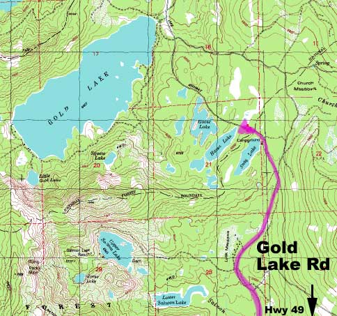
YUBA RIVER: The biggest play time river in the northern Gold Country, this runs along Hwy 49 near Downieville and also has a major South Fork for the best swimming holes and primitive camping in this region. Tubing, rafting, kayaking, fishing, camping, gold panning, you name it, Yuba has it. Look for more on the South Yuba Recreation Map, or the USDA issued Tahoe National Forest Map
FEATHER RIVER: Top fishing river in the Lassen to Oroville area. Chester and Lake Almanor in the upper reaches. High Bridge Campground is nice paved-camp-site camping; a forested spot where you can fish 2 rivers on the same day. A Plumas NF or Lassen NF map would be quite helpful for this region. Lower down the mountain, lower Feather Rivers which include all 4 forks which feed Lake Oroville – West Fork (Paradise, CA), North Fork, Middle Fork Feather, (Berry Creek, CA) and the South Fork (Lumpkin). Lots of waterways and creeks worth exploring in between Chico and the mountain town of Quincy.
KINGS RIVER: This one particular river is the longest in the Sierra Nevada mountain range, pulling snow melt from the upper reaches of the High Country and Mount Whitney. The river area just to the West of the National Park, over to Pine Flat Reservoir, is all prime for outdoor recreation. Several river rafting companies work this stretch of river.
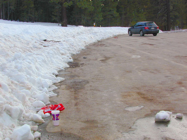
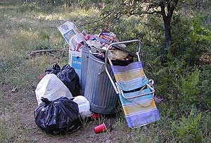
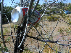
Microtrash is all that small stuff that seems to miss the trash bag.
You manage to drag yourself off the couch, congratulations! You’ve packed up your ride and are heading out to your favorite “secret” spot. Anticipation builds as you arrive and pull into the empty lot. Your heart sinks however when you discover that your once pristine camp spot has been transformed into the new town dump. An old lawn chair, candy wrappers and beer cans litter the area that you once loved. Impromptu fire rings are strewn about and armies of weekend warriors have trampled your favorite meadow into a dust bowl.
DON’T BRING THE CITY TO THE WILDERNESS. The noise, the food containers, the beer bottles, the fast food wrappers, the broken plastic crap and the balled up baby diapers. The disposable society we have created now makes us all too LAZY. Getting off your ass and outdoors means you need to take some responsibility.
You get much needed exercise, outdoors breathing fresh air, and enjoying life, while discovering new destinations and awesome terrain. The least you can do is clean up a little, and encourage others to do the same.
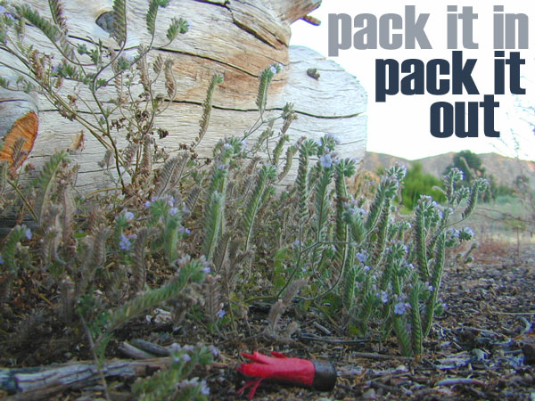
thinking about that plastic water bottle you dropped on the trail?
Trash isn’t specific to just campers and target shooters. Hunters are notorious pigs, especially when gathering in groups. Day hikers ‘accidentally’ loose stuff all the time – from sunglasses to bottle caps. Picnickers often forget something at the site.
Family day in the snow sounds great. Sledders leave massive amounts of trash – from broken sleds to food trash.
unaware
Litterbugs include many types of folks: disruptive teens, toothless alcoholic contractors, local yolkels, urban mishaps, gangster wanna-bes, home boys, totally oblivious yuppies & even uneducated families…
keep the trash & tagging to the city!
EDUCATION is key on this matter & it starts with you. Please pass along good outdoor ethics.
Seems you can’t go deep enough. The further into the forest you go, you still seem to see it – evidence of neglect for our land. In every outing these days, we constantly notice tons of litter and graffiti. Deliberate disrespect for the open spaces and valued wilderness lands. What is going on here?
Please report graffiti in action to the local law enforcement or nearest rangers office! Or better yet, get them on video and post it on YouTube.com
What’s the worst that can happen?
Small fragments of plastics are being found inside birds, wildlife and marine life, due to the vast amounts of micro-trash that is found outdoors. Ingested plastics often kill the animals.
Our secluded swimming holes and creek trails are now littered so badly, that the smaller trash is making it into major rivers and into the bellies of fish and the near-extinct California condors.
Misuse and sheer disregard is how OUR lands get closed (by OUR OWN government). Closed off forever, turned into ‘off limit’ roads and more totally closed wildernesses, that only can be explored on foot. OHVs, dirt bikes, 4x4s need to realize their overall impact on natural habitats could have a detrimental effect on these lands. There is a balance. Play wisely. This includes all the red necks with guns too.
Graffiti, Soda Cans, and Cigarette Butts are a nuisance to nature.
As more and more office drones venture from their cubicles and out onto the unbeaten path, they leave behind the remnants of their bold treks for all to see. Refuse, human waste, smoldering campfires and crushed flora from selfish tent placements and trail blazing destroy our fragile eco-system and pollute the environment for years to come.
Be cautious walking around to avoid destroying the fragile ecosystems, such as meadows, seedlings, wildlife & wildflowers.
Pick up all your trash & even some left behind by previous campers. Leaving the camp or picnic site in better condition than you found it.
Below are some simple tips that, coupled with common sense, will enable you to stop being part of the problem and start being part of the solution!
Oak foothills of the Historic Gold Country, at the edge of the Sierra Nevada mountains.
boating
canoe
camping
fishing
hiking
houseboats
kayaking
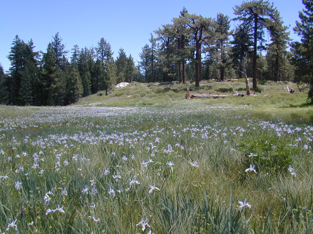
wildflowers
Most Central Valley Reservoirs have blooming wildflowers in early springtime. Summer heat can measure triple digits for months as most of these lakes are located below 1000′ elevation.
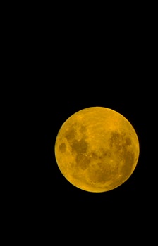
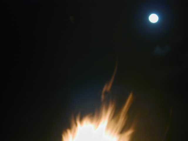
Make plans for your nights spent camping out, under the stars, watching the celestial events and meteor showers. Comfortable: Hat, blanket, radio. Hot cocoa and sugary treats will help keep you awake and alert.
Next Solar Eclipse, 2024
April 8, 2024 — Great North American Eclipse (see more info)
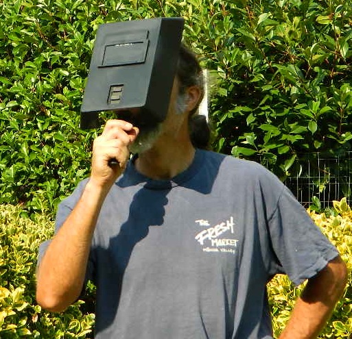
Never look directly at the sun, instead use eye protection such as welders face shield or makeshift shoe box viewer
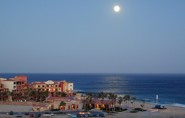
Upcoming Lunar Eclipse
2021 Lunar Eclipses
May 26: “Blood moon” total lunar eclipse
Across western North America you will be able to witness the moon blush red as it undergoes a total lunar eclipse. This dramatic astronomical event happens when the sun, Earth, and moon are precisely aligned so that our planet’s shadow completely blankets the moon’s face. (see more info)
orange, red or amber colored moon A total lunar eclipse is sometimes called a Blood Moon, because of the reddish tinge the Full Moon takes on when fully eclipsed.
November 19: Partial lunar eclipse
Last lunar eclipse of the year will greet sky watchers across North and South America. Technically a partial eclipse, up to 95 percent of the full moon will be cast within Earth’s dark shadow. During the maximum phase, it should briefly appear as a total eclipse, which means the lunar disk may show hints of orange or red. (see more info)
best places to watch the skies
The California Deserts are sometimes the best place to watch the nights sky, unless the winds are kicking up. Deserts are warmer than other locations and if you position yourself well you can be far from any city lights.
The California Foothills, both coastal foothills or mountain foothills – are the second best choice, if you can drive up canyons and get well away from the sprawling suburbs. Choice spots would be ridges above 2000′ elevation, with minimal trees. Oak foothills are choice spots. Higher than 4000′ and you will be chillin overnight.
The California Mountains are the prime choice for summertime recreation of all kinds. Primitive camping on the back roads will save you fees at a developed campground. The higher in altitude, the less atmosphere above you – the better night sky viewing is above. Choose a meadow or mountain ridge w/ minimal trees. Burn areas provide wide open spots, so you can seek old wildfire ridges. Nights can get pretty chilly most all year long, so go well prepared. Jackets, gloves, hats and all. Keep all campfires to a bare minimum after 9pm, so you can focus on the stars in the sky.
your pupils will welcome the dark skies
The California Coast is often covered with a thick layer of clouds and moisture, so star gazing along the ocean front is not always great. Central Coast and NorCal beaches have less less population, so these would be the ideal locations. Choose an inland valley w/ rolling oak hills and dirt roads, over the busy beaches. There might be clear days and nights, especially if forecast call for heat – check the local weather forecast for accurate up to date conditions.
Large urban areas, the cities and towns of California are the worst place you can sky watch, due to light pollution, traffic and smog. Drive to the outskirts of town – pick a dark location, a park, open space or forest lands nearby. Arrive before dark to get the best spots, well off the main road. Choose viewing spots without street lights and without passing traffic. Find a nice level spot to set chairs up and bring lots of snacks.
If you’ve had it with the traditions, the big meal prep, or just sick of the family. Maybe you are a solo traveler, or a new transplant to California and need to explore more. Take a holiday away – for once this time.
Camping for turkey day? What a concept.
California is the perfect place for camping, all year long!
Stick to the lower elevations, look for canyons, and seek seclusion
California mountains often have snow during November. Avoid camping in snow @ 4000-5000′ elevation and above; Freezing temps above 3000-4000′ elevation.
Deserts, coastal regions and foothills are top choices for late Autumn car camping. Always check the weather ahead of departure, and have a plan B as an alternative. NorCal will be much wetter than the rest of the state.
MEALS: Prepare dinner meals ahead of trip departure. Bake turkey days before your trip and create meals based around that. Make mash potatoes at home and don’t forget to bring the butter. Pack pre-baked turkey for sandwiches, plus other quick snacks & meals for on-the-go travel.
Non Traditional: Seafood Feast
Desert Camping is premium at this time of year. Luckily the eastern half of Southern Cal is desert. The lower the elevation, the better the temps will be overnight. Be prepared for wind when the ‘storm fronts’ approach, the winds do get a cranking! Dirt roads can become flowing washes during a good rainstorm, so know the weather forecast.
Coastal campgrounds may need advanced reservations. Be prepared for wet weather, especially up north. The redwoods groves are gorgeous anytime of year.
Gold County Reservoirs are prime areas for relaxing in nature, while everyone else is out shopping. Oak hills, rivers and canyons. RV campers love these large lakes; boating, fishing, mountain biking trails, kayak rentals, hiking near historic Gold Rush towns.
River Canyons of California are always beautiful destinations in the autumn months with fall leaves changing color. Many campgrounds can be found at lower elevation, river access areas.
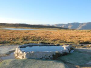
California’s abundant Hot Springs are also top picks for holiday weekends.
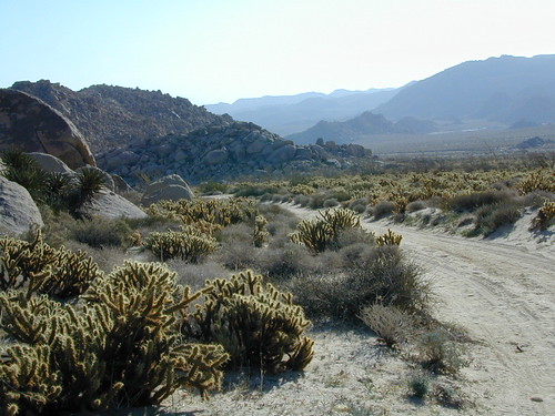
Anza Borrego Desert State Park is always a nice, easy and relatively close get-away for any holiday. Open camping on the backroads (for free) makes it one of the most attractive camping options in all of SoCal. Many dirt roads are accessible for passenger cars, if extreme caution is used. Don’t plan on driving more than a few miles on dirt.
froaders
Masses of off roaders love to camp out, especially on Thanksgiving weekend. Wheel all day, eat, drink, bon fires every night and rumor has it ‘they roast their big bird outdoors – deep in a dirt pit’. Really?
El Centro, Glamis, Imperial Dunes, Ocotillo Wells, Truckhaven Hills, Johnson Valley. All popular off roading areas in Southern California, so consider yourself warned.
Mojave Desert, near US Hwy 395 Jawbone Canyon expect to see RVs, toy-boxes and families outside enjoying the weekend. OHV style. Often the group tries to create a round corral with their huge convoy of vehicles, to keep thru traffic to a minimum around “their camp”. Just stay well away from those gear-heads. In general, it is a very busy area around Mojave up to Hwy 178 during the holidays. Try high desert Horse Canyon instead.
Cleveland National Forest Camping – San Diego Campgrounds – Desert Camping Anza Borrego – SD County Campgrounds – BLM Campgrounds – San Diego Beach Camping – San Diego Mountains
Indian Flats Campground is located on a dirt road off Hwy 79, near Warner Springs CA. Boulder ridges & manzanita surround this oak filled secluded canyon. Small seasonal creek & waterfall is a short walk from campsite.
Los Coyotes Campground is a tribal camp, located on Hot Spring Mountain in North San Diego County. High desert chaparral, oak groves and boulders.
Anza Borrego Desert by far has the best free camping options available near San Diego.
Maps Mountains / Desert Topo / San Diego Area Maps
Mountains of Northern California / NorCal Mountain
California sure has a lot of mountains. West Coast land is home to the tallest Sierra Nevada range, plus the Cascade range, which extends northwards to Canada. (Many of which have volcanic peaks.)
We break down all the mountainous regions in the north part of the state below w/ links, topo maps, lakes, rivers, wilderness, parks and forests. Small towns & cities are linked in red.
Sacramento River, above Lake Shasta
North Coast Mountains
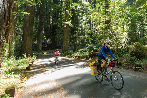
Redwood forests and rivers are what make up most of the Northwest part of California, just below the Oregon coast. Logging and fishing are the big industries up here. Lumber mill towns and camps still exists today. Wilderness areas, dirt back roads, river kayaking, stream fishing, camping and real wild indians. Oh yeah, and Big Foot!
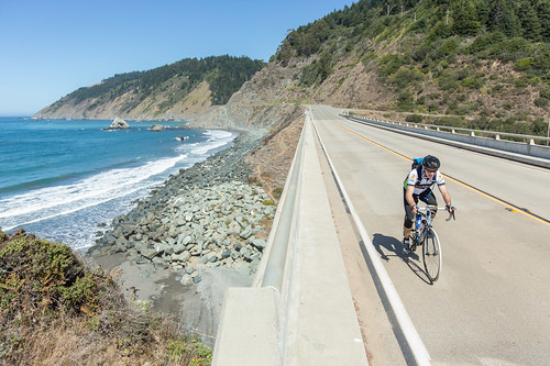
The landscape in more dramatic along the North Coast of California, as the steep rocky terrain tumbles into the sea w/ the San Andreas fault running parallel to the shore. Marine life, rocky shores w/ small towns. Del Norte County & Humboldt County. Wild rainy weather, at least half the year; fog and sun the other half.
The furthest north is Siskiyou County, which borders the state of Oregon. We have the Klamath River flowing south into California, with plenty of mountain peaks, forests and wilderness. Interstate 5, Highway 3 and Highway 96
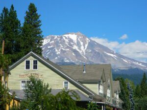
Pacific Crest Trail passes through the area and backpacking is common (all year long). Notable spots – Klamath Knot and The Eddy’s. Prominent Mount Shasta is actually situated inside Siskiyou County, not Shasta.
Giant Mount Shasta is located inside Siskiyou County, and Shasta County & Trinity is everything located to the south of it. Interstate 5, Highway 3 and Highway 299. Recreational lakes, rivers and streams, and off roading trails.
Waterfalls, hot springs, mountain biking and stream fishing can be found within this region. Mining history and museums are primarily situated around Weaverville. Houseboats and boat rentals can be found on the big reservoirs. Whiskeytown was totally toasted in wildfire of 2018. Alpine lakes, granite spires, campgrounds and cavern tours, all located along the Interstate 5 corridor.
Beautiful park setting @ Lee Fong Park, in historic Weaverville, CATrinity River Camping, Douglas City, CA
Mendocino Mountains
Coastal mountains located above the Napa & Sonoma wine country. US 101 & Highway 20. Rivers, forests, wilderness and redwoods is the key terrain that make up the Mendocino County mountains.
There is a fair amount of off road trails and dirt roads located in and around Mendocino, so you can expect to see 4x4s, dirt bikes and toy haulers on the east side of the mountain range. The coastal side of the Mendo National Forest will have the rivers and redwood parks.
Northern Sierra Nevada mountains is where the granite rock of the Sierra meets to volcanic rock of Lassen Volcano. Butte County and Plumas County is the Feather River drainage, all flowing south from Mount Lassen.
Pacific Crest Trail is routed through Bucks Lake Wilderness and the Feather River Canyon, so backpacking is popular. Highway 70
Technically speaking, the Susan River is the top waterway of the Sierra Nevada mountains. Lassen County spans the distance from the Nevada state line, west to Plumas forest and the Feather Rivers (all 4 forks).
Lassen Peak is the middle of the National Park and the National Forest totally surrounds that. Numerous lakes, hiking trails, wilderness areas and dirt roads make up this huge forested area. Snow-mobiling is popular in winter months around the town of Chester.
The far northeast corner of the golden state is the remote cattle range lands of Modoc Country inside Modoc County. Drier than the rest of NorCal, the high desert sage brush meadows, a few lakes and pine forest mountains. Highway 299 & US 395
enjoying quality time alone is not weird, wrong, or unnatural, no matter how many strange looks you get from friends & envious co-workers
Stop waiting for someone to do things with. Quit thinking that your best friend or partner will one day magically suggest an outdoorsy road trip, or day hike, or mountain bike ride. YOU are the one who craves the wildness of the earth, the unexplored, the secluded. The time is now for you to start living the life you want, outdoors, in California – today!
maybe it’s time to leave the city, for good
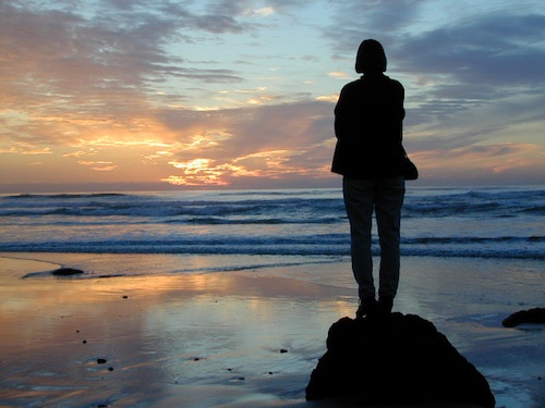
If you’ve just about had it with the pressures of everyday stresses, the wifi city life and the busy pace of civilized society is starting to get to you. Get a clue fast – before you loose your marbles. It’s time for much needed rest and relaxation. Nature is the best place to relax and reconnect with yourself and mother nature.
A change in scenery. A fresh perspective. A real break from the norm. No shopping, no errands, no phones, no television, no computers, nobody around. No one, except you.
Unplug yourself from the hectic rat race and go exploring. Give yourself time to fully unwind: time to think, time to enjoy the outdoors and really find that special place of peace that comes only from earth. Yes, all by yourself.
VISION QUEST
Call it an annual primal ritual, or a first time experiment, traveling solo can be a blessing in disguise. Learning to be alone outdoors, become more aware of the physical world and enjoying yourself is an important key to a balanced life. Whether you seek a quick refresher course for the weekend or a full blown month long road trip, seeking a new comfortable destination and the art of basic relaxing is the main focus for this trip.
slow going
When you travel alone, it’s easy to take your own sweet time. Going slow is something we don’t usually do in our busy city lives. Time is so precious, so you may as well stretch that vacation out as long as possible. Savor the moments.
Take as long as you like for – photography, picnicking, hiking, stretching, yoga, cooking and stargazing. Firewood collection becomes the biggest chore of the day, and it could take hours. Walking from camp, every direction will lead to a new adventure. Driving back roads at 20 mph is luxurious. No one to be your back seat driver. Sleep in every day if you want. No pressures, no schedules, no big worries. Sunlight, food, heat, weather, cooking and cleaning. Sit back and learn to really relax. Enjoy a secluded camp site for a full week, and get to know the wildlife on a first name basis.
Follow the back roads to seclusion, or reserve several days at a unique campground. Imagine night after night of peaceful rest, with the sounds of nature surrounding you & the stars of the heavens dancing across the darkest skies.
Explore new terrain every day & move to a new camp every night. Or make it a “stay put” week-long meditation, in one spot. Whatever fits your needs. Either way, you’ll enjoy the solitude & the healing powers of nature. Answering to no one but yourself, you may feel guilty or kinda selfish the first few days, but this will fade as you learn to embrace the solo journey.
And it doesn’t hafta be all about roughin it either. While backpacking into the almighty wilds of the true wilderness has its good points – along with life threatening dangers possible every day, a simple quick weekend trip to a nearby small inn, fishing lodge, or a bed & breakfast could work for the pampered types. Choose something different and unique, yet know your own limitations (on comfort & on a physical level). Make sure your destination choice is surrounded by some nature and preferably wilderness.
Good California Maps are a must have! Don’t rely on digital cell service or count on online maps being readily available. The hard-copy versions are always the best back up plan. Old paper maps are the very best, cuz they can often show more hidden waterfalls, trails and old mines than the newer maps.
National Forest maps are best for getting and staying away from the tourist crowds. Visit Destinations to decide what kinda place you wanna explore this season.
which is why the golden state population always seems to be increasing, right? Helping you get away from your normal routine and the masses is what we do best here at Total Escape. Discover thousands of pages, photos and links on this site to create your very own unique retreat.
The mountains, deserts, coastal, rolling oak countryside & even urban escape inside city villages, are perfect starting points for planning your little escape.
Desert camping in autumn, winter and springtime months is perfect timing for any kinda soul searching, catching up on a good book, or just gazing out at the vast vistas. Meteor showers fall within the latter part of the year, so stargazing and camping is excellent with the new moon. Temps start to drop come September, so be warned. Mountain cabins drop to their off season rates after summer, but be prepared for chilly temps and get proper outdoor gear.
SAFETY TIPS: Give your schedule to someone. Any bit of info is helpful. A map or written itinerary given to a neighbor or close friend will help ensure your safety and timely return. Bring your cell phone, plenty maps, bear mace, a firearm and emergency supplies for additional security.
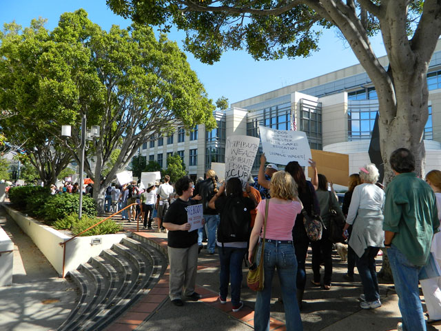
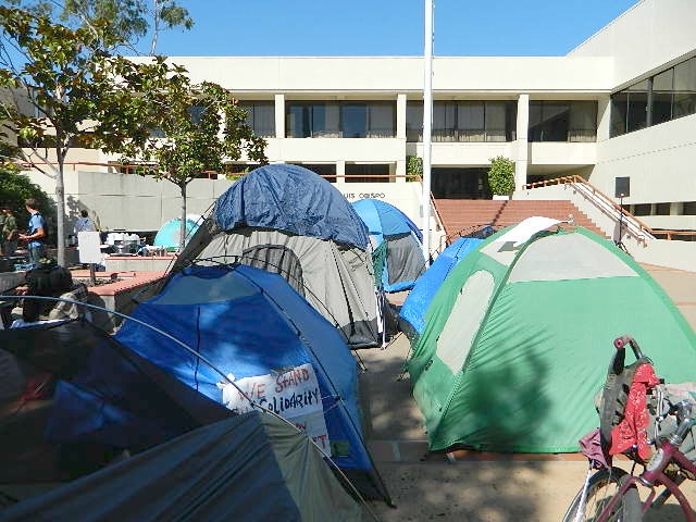
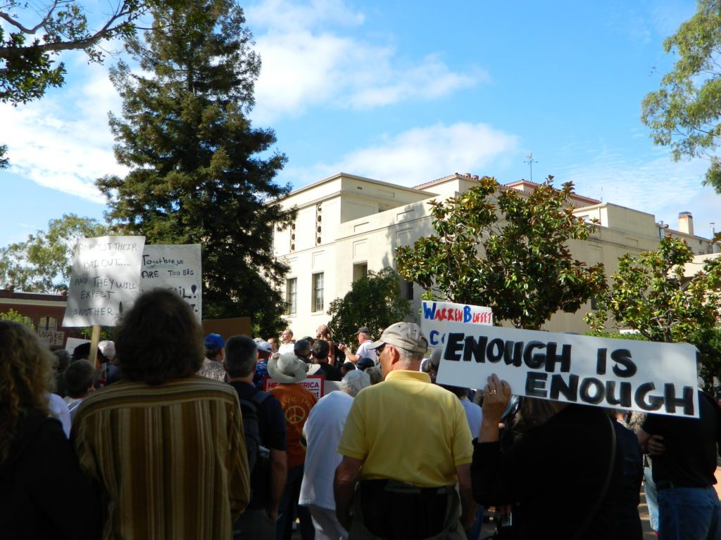
The past weekend makes the Occupy Wall Street protest look like a walk in the park w/ a picnic.
Only 8 and a half years ago (2011) – Americans were in the streets marching in mass. After 15 million people lost their home to foreclosure, 9 million lost their jobs and the banking system was teetering on the edge of financial collapse (2008), people woke up, joined together to demand a better system.
Banks got bailed out, We got sold out.
Mass Protest: Did things get better for everyone since then?
Ask around
are you ready to leave your comfort zone?
(manual labor may be involved)
a vast resource for rural California
58 Counties in Calif
plenty of space for everyone grow food, save seeds
Summer in the City = Uncertain
They want you – for your own safety – indoors, online, controlled and monitored. Wait, what? Do we really need to stay inside 24/7 – stir crazy, checking news and social media hourly.
Escape to the real Outdoors
Turn off the television and the computer and go outside. Plant a garden, grow some food, read a book, go for a long walk or a day hike. Find a new waterfall, dust off the old mountain bike or bring a picnic to the nearest open space.
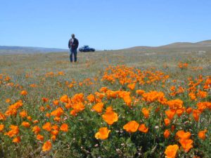
California Poppy ParkDesert Camping is best in Spring.
@ HOME, for how long?
Choose the outdoors, over the indoors. Solo and safe. Secluded, distant, remote. Total Escape specializes in these types of locations.


 Living close to the earth with organic gardening and rural living, DanaMite strives to offer California residents, new-comers and visitors unique, local destinations, concentrating on the outdoors – well away from overcrowded, busy, urban cities and tourist traps. Total Escape can show you how to discover the secret, hidden spots on your public lands that the gov web sites will not even dare to mention.

 If you could care less about celebrity gossip or television, you are not alone. Many people seek more relaxing travel in their lives, but can barely afford a vacation, or a day off of work.
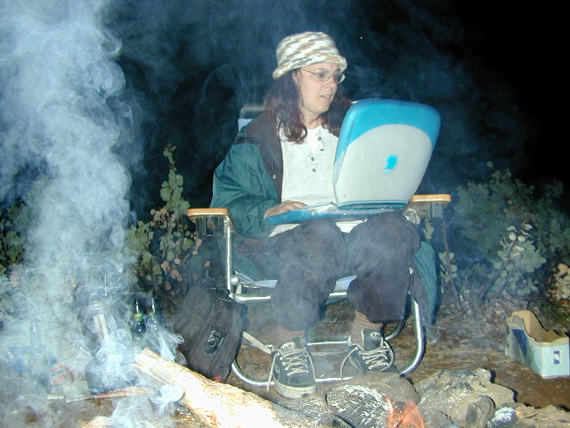


 From a luxurious cabin in the mountains, to a small clearing in near a meadow with a stream nearby – with just a backpack, the idea of “camping” is always a bit different for each person. Roughin’ it for free – in the wilderness, or on the back roads; Or pay dearly for the price of real amenities, while on vacation.
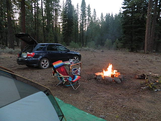


 No facilities such as toilets or showers. Maybe a picnic table & fire rings, if you’re lucky. Southern California
 Rentals typically include sleeping cots, but you’ll need to bring your own bedding (sleeping bags, sheets, pillows). Some rentals include shaded porches, wooden decks, minimal furniture, kitchenettes and/or wood burning stoves. Electricity may be available, or maybe not. Ask ahead of time, if you really must have that particular luxury when on vacation.


 Redwood forests and rivers are what make up most of the Northwest part of California, just below the Oregon coast. Logging and fishing are the big industries up here. Lumber mill towns and camps still exists today. Wilderness areas, dirt back roads, river kayaking, stream fishing, camping and real wild indians. Oh yeah, and Big Foot!


 Northern Sierra Nevada mountains is where the granite rock of the Sierra meets to volcanic rock of Lassen Volcano.
 Technically speaking, the Susan River is the top waterway of the Sierra Nevada mountains.


