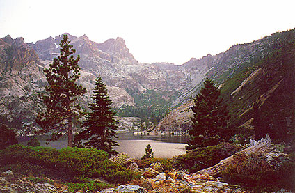
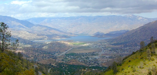
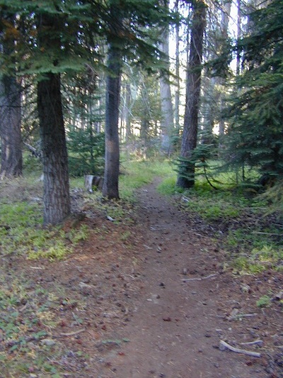
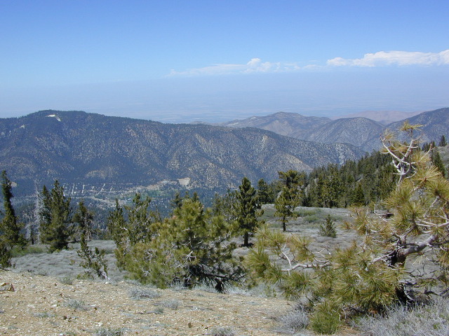
Lake Davis @ Plumas National Forest elevation 5886′
Three paved roads access Lake Davis which is located north of Highway 70. Residential areas exist on the south side of the lake, which is 7 miles north of Portola, CA
Grizzly Ridge (elev 7000′) is located on the westside of Lake Davis, East of Quincy, CA
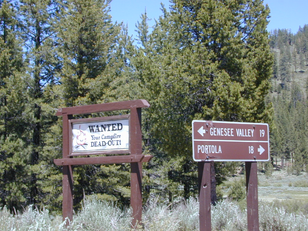
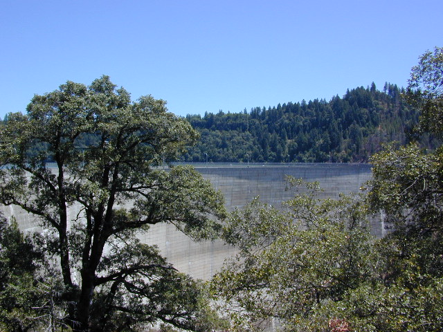
Beckwourth Taylorsville Road #112 (a dirt road) follows Little Grizzly Creek down from Genesee, and flows into this rural reservoir. Grizzly Valley Dam, also known as the Grizzly Creek Dam, reinforced the lake when it was built in 1967.
Crocker Mountain @ Lake Davis, California
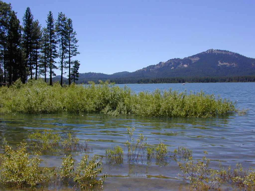
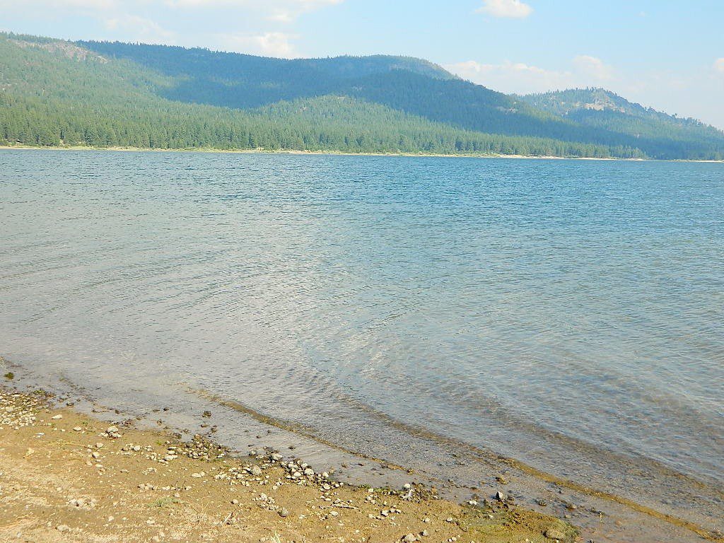
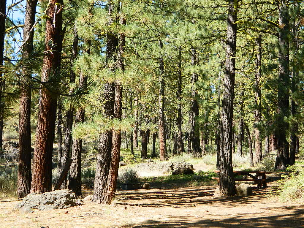
Quiet Lake Davis
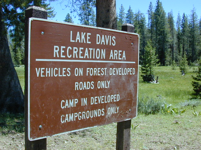
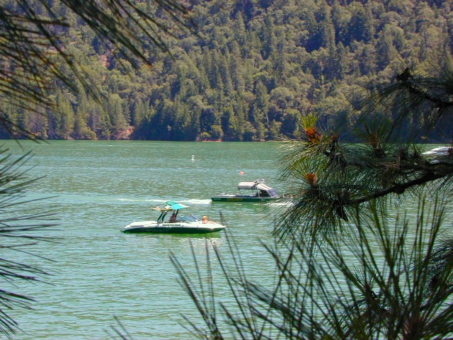
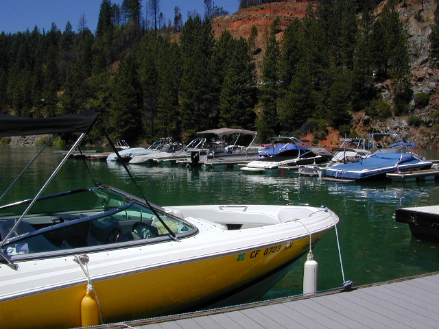
Lake Davis Recreation Area offers a wide variety of outdoor experiences for summer including: camping , picnicking, fishing, hunting, boating, mountain biking, swimming, and wildlife viewing. Waterskiing and jet skis are not permitted. In the winter, ice fishing, snowmobiling, and cross-country skiing are popular activities.
Frequent strong winds can cause the lake to become very hazardous for small craft. Boat Ramps at Camp Five, Honker Cove, Lightning Tree and Mallard Cove. Launching facilities have loading docks, paved ramps, parking and restrooms, and they all charge a fee.
Relatively uncrowded lake in the Northern Sierra, this location is often overlooked by travelers for more the popular, larger lakes. Locals use this location for outdoor recreation. Plumas National Forest
bird watching
boating
camping
cycling
fishing
forests
hiking
horseback
kayaking
meadows
mountain biking
stargazing
wildflowers
wildlife viewing
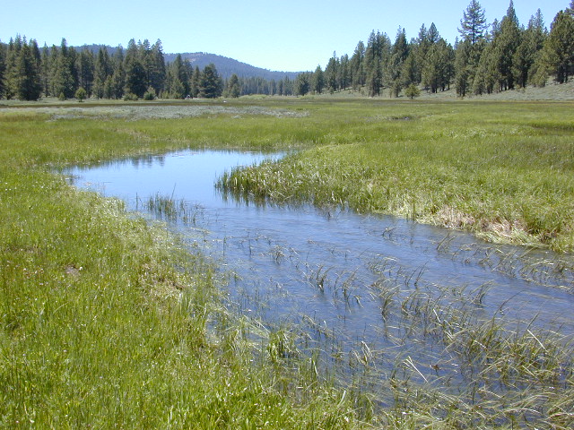
The developed campgrounds are located on the southern end of the lake. The backside of the lake is mostly made of up creeks, meadows, forests, dirt roads, wildflowers and abundant wild life.
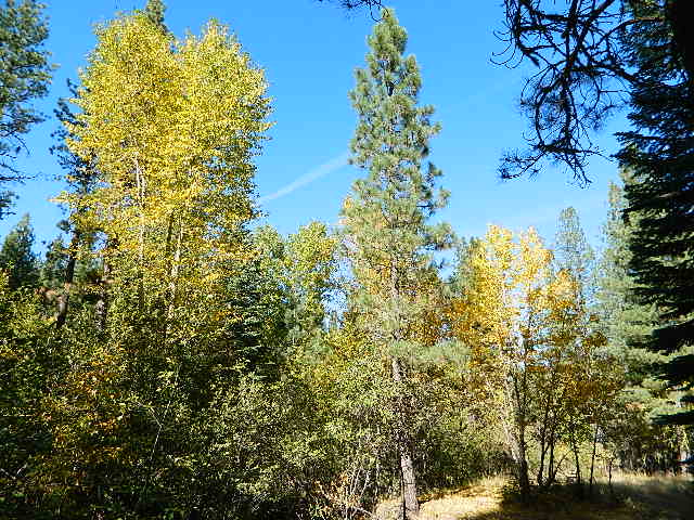
Aspen Groves are easy to recognize with their thick stands. White trunks with dark knots, slender, with oval shaped leaves. Growing in a network of roots, which are found lining creeks, alpine lakes, or spilling out from higher elevations, along scenic canyons.
The unique round leaves which can turn spectacular colors in the fall season. The fluttering and flapping of the oval-shaped, thick, green leaf is a sure sign of summer. When breezes get cooler, Autumn is only a few weeks away and as quick as the cold comes in, what a short and special show they put on.
Green Creek historic cabin, on the Eastern Sierra
California Fall Colors
Aspen trees can be found at higher mountain elevations in California, usually above 4000′ – all the way up to about 10,000′ or higher, depending on the mountain range and local water flows. Groves have an extensive root systems underground, so they often withstand wildfires and can come back after the rest of the forest is gone.
Beavers build dams in creeks around aspen trees, fishermen and campers love to camp next to aspens, and lovers carve their initials into their white bark. These trees do indeed take a beating, from all angles, winter weather included… so stop from cutting them!
BIKE
CAMP
FISH
HIKE
KAYAK
PICNIC
summer and autumn
These deciduous trees are naked half the year, typically from November to April, as winter buries them in snow and ice. Time is of the essence, limited to Summer and Autumn – to enjoy their shade and the beauty of the groves. Scenic meadows and fishing creeks are just an added bonus for searching out the aspen.
Aspens can be found in hidden canyons, primarily along the Eastern Sierra US Hwy 395 and surrounding mountain lakes. Some Sierra Passes have decent displays of color as well – like Carson Pass Hwy 88 and Yosemite’s Tioga Pass Hwy 120.
Below is a list of Total Escape’s favorite aspen areas of California
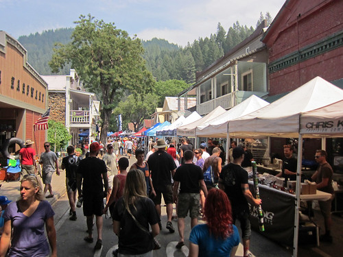
The very busiest weekend to visit the Downieville – Yuba River canyon region, so consider yourself warned.
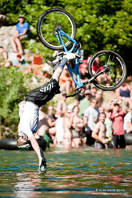
Bicycle Expo & Street Fair on Saturday and Sunday. Live music & dancing. Big Air River Jump, plus, race cross country style or the infamous Downieville Downhill. Shuttle service available.
One of the biggest mountain bike events on the west coast. Located deep in the heart of Northern Gold Country, along the Yuba River & historic Highway 49. Camping options available in every direction. The small historic hotels book up well in advance.
This pine forest is home to the developed NFS campground – which has been named after the tribal elder. The camp location is a sacred spot to the local native tribes. Just above Susanville, CA on the west side, south of the highway; forested w/ creeks and aspen groves. Autumn colors can be found in the creek beds.
Dirt roads all over the place, leading to far away destinations like Diamond Mountain, Antelope Lake and Taylorsville. The backcountry region was recently damaged by wildfires: 2020 Sheep Fire and now the Dixie Fire
FREE CAMPING – W Susanville, CA en route camp
Less than 3 miles of dirt road #29N03 driving will get you back off the highway and into this forest, Hwy 36 W of Susanville. Bring the mountain bike for abundant usage and a week of exploring.
Only 13 miles to downtown Susanville, via the back road. Chaney Creek Road is a main dirt road near Highway 36, which parallels the river, the red rock bluff and the road, downhill into town.
This FREE campground is popular with the hipcampers and pediums – and gets rave reviews; small RV campers do like to use this camp spot, if they don’t mind a little dirt road driving; they’ll need to park in the dirt parking lot, 40+ feet away (not adjacent to the picnic tables or fire rings).
camping
ceremony
drum circle
fishing
hiking
horseback trails
hunting
mountain bike
off road trails
Bear Dance Circle @ Roxie
walk in campground, and close to town
Walk-In Campsites @ Roxie
AUG 2021 – CLOSED due to the Dixie Fire
Roxie P Campground
Susanville, CA – Lassen NF
• Elevation: 4,800′
• Number of Sites: 10 (walk-in only)
• Vehicle Accessibility: any
• Campsites Reservation: No
• Campsite Fee: No
• Length of Stay: 14 Days
• Season: open all year
• Trailheads: Diamond Peak
Flat forest and easy to walk. Shade and pine needles, picnic tables and group fire pits. All facilities are encompassed with a sturdy wooden, fence line. No RV or trailer access to camp sites. Mountain bikers like this spot and so do horseback riders. Travelers passing through eastern California will welcome the convenient location, plus the ease of dirt road.
The Roxie Camp is situated near Willard Creek on the south side of the Highway 36, close to Susanville. Willard is a feeder stream into the Susan River, which flows into town. Quiet camp, most of the time. If a big family is camping here w/ children, or there is a tribal gathering, it could get loud.
PLAN B – head over to Goumaz Campground NFS, due north. Located in between, near the junction of Hwy 38 & 44. Near the railroad tracks and the Susan River. Smaller camp near the NRT (National Recreation Trail), the Biz Johnson Trail (BLM). 2021, this camp is CLOSED!
so find someplace else: PLAN C
(make sure any camp is open by calling rangers before traveling).
OHV activity may be passing the developed campground, but are discouraged – due to the layout of camp. Plenty spots for ‘froaders further out – at the end of the road. Way back there!
Jeeps, 4×4 trucks, quads, dirt bikes, anglers and hunters travel these dirt back roads, as well as rangers, campers, horses, mountain bikes, and big logging trucks. 25 mph slow is always best. Daytime headlights help you get seen in the shadows. Forest is dense and road conditions are ever changing.
Forest Road #29N03 is Gold Run Road, the bumpy dirt road – that skirts around Diamond Mountain on the south side. Lots of one single track or one-lane dirt roads, which will require a National Forest map or a decent topo map to navigate properly.
OHV is common in these areas, but not so busy at this camp. If you seek peace and quiet and solitude, know how to read a map and where the noise is expected to be. Avoid the OHV areas, if you want to nap in the hammock and read a book.
Wild red necks with guns live in NorCal, so pay close attention to property lines and trespassing signs.
USFS Ranger Station is located on the west side, just outside of town, on the wide downhill grade on the highway @ the Eagle Lake turnoff. Cal Fire station is also located along this stretch of road.
Lassen National Forest
Ranger Station USFS
CA-36 @ Eagle Lake Rd
Susanville, CA 96130
530-257-4188
Cal Fire Station
697 CA-36, Susanville, CA 96130
530-257-4171
BULLARDS BAR Dark Day is a lakeside walk-in campground on a small reservoir, located deep in the Gold Country foothills. Flush toilets and hiking trails, kayak rentals and fishing.
West of Highway 49. Huge dam for hydro-electric power. Minimal roadways along the lake and steep canyons make for optimum hiking and boating. Floating and fishing. Relaxing in the mountains, with fresh water!
On most maps the official name of this lake may read New Bullards Bar Reservoir, or Lake Bullards Bar, but locals just call it simply – Bullards Bar!
Sierra Nevada Foothills. Yuba River, California.
Northern Gold Country, California
Near Camptonville, West off Hwy 49
in between Oroville and Nevada City, CA
Located not far from historic Downieville, Bullard’s Bar is an excellent base camp location for exploring the upper reaches of the Gold Country region. Old mining locations, museums, a covered bridge, various parks, Yuba River, Sierra Buttes, Lakes Basin. Grass Valley & Nevada City are also nearby. Mountain bike trails, river rafting and hiking all around.
roads around lake: Marysville Road (south of lake and east side w/ Hwy 49), Moonshine Road (south of lake), Oregon Hill Road (west side), Pendola Road (north side), and Forest Route #47 (dirt road on north side)
One of the few lakes in the Sierra Nevada that offer boat in camping at developed camp sites, and also to allow boaters primitive camping along the shoreline. No drinking water is available. No pit toilets, so a portable chemical toilet is always required. Plus, pack out all garbage.
No charge for DAY USE areas: parking or boat launch ramps
NOTE: Dark Day & Schoolhouse Campgrounds are the only car camping & RV accessible camping on this lake. These both have flush toilets and drinking water piped in. Hiking trails & boat launch nearby. Wheelchair accessible campsites are available.
CAMPS OPEN: APRIL – OCTOBER Campgrounds @ BullardsBar are usually open from April to October annually and all are closed for winter months.
Located 5 miles northwest of Dark Day Boat Ramp on the west side of the reservoir. Boat in only access. It is used as an over flow campground. There are campsites, but no bathrooms. Portable chemical toilet required. More info call Emerald Cove Marina at (530) 692-3200
Second Spillway – in the works?
Yuba Water Agency has just committed to building a $160 million second spillway at the New Bullards Bar Dam; beginning in 2021, with a completion date of 2025.
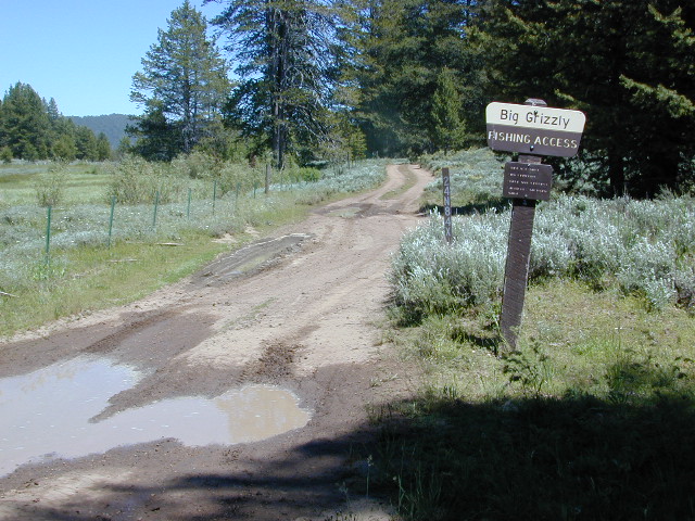
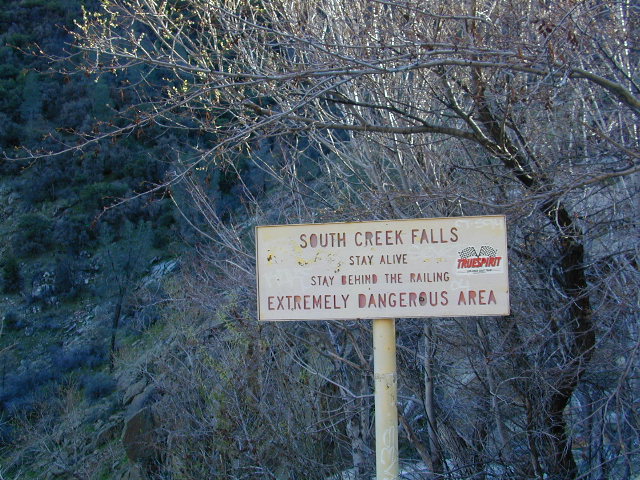
Seldom used, but often loved. This old camp used to be a California Conservation Corps (CCC) camp, during the construction of Lake Davis in 1966. Situated next to a big meadow w/ ancient lava flows up hill, the small campground hugs a wooded hillside above the freshly paved Beckwourth-Genesse Road #111
If choosing to enter camp from the lake side, take Crocker Mountain Rd. / Plumas Forest Rd #24N06, up from Grizzly Road #112.
The Lake Davis area is a north turn off Hwy 89, in between Beckwourth and Portola, CA
Access from the paved (east) side is via Beckwourth-Genesse Road #111. Adventurous camper trucks, or small RVs may attempt this dirt hillside campground, but roots and rocks and erosion are abundant in the upper portion of the camp, so be warned.
Off Roaders (dirt bikes, quads, 4x4s) like this rustic camp spot, cuz it’s not too far off the pavement – and they can drive their comfy campers w/ trailers en tow, and the big BBQ grill and easy-up shade.
Note: you cannot see Lake Davis from this side of the hill.
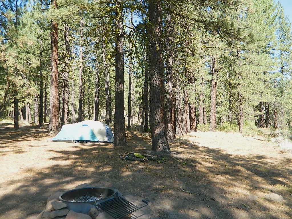
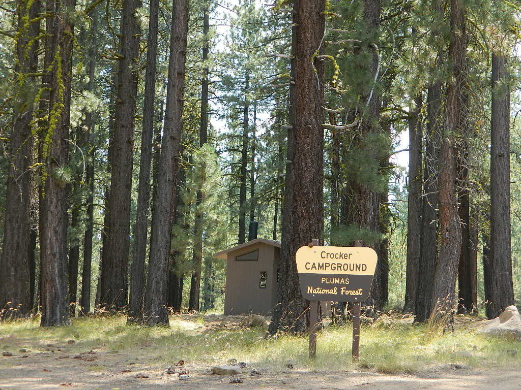
Autumn is nice here w/ aspen groves at nearby Crocker Guard Station. There are no aspen trees in the campground – only pines. This primitive campground is located on a forested, volcanic hillside facing east; Dirt road entry, vault toilet w/ minimal facilities. No paved campsite loop here!
Numerous unmarked foot trails lead out to the meadows edge, up lava ridges or into the forest behind the aspens. Crocker Guard Station is a very short walk; and available for rent from the NFS w/ reservation.
Crocker Campground NFS
• Elevation: 5600′
• Number of Sites: 10
• Vehicle Accessibility: Small RV
• Campsites Reservation: No
• Camp Fee: Yes
• Length of Stay: 14 Days
• Season: May – November
• Trailheads: Crocker Meadow Loop
Crocker Guard Station
aka Crocker CCC Camp
Set back nicely off the main road, this stylish, historic, two story cabin – with wood siding and front porch – has meadows and aspen groves surrounding it. Paved road access from Beckwourth Genesee Road
CCC = the Civilian Conservation Corps is often mentioned when reading about this specific location.
Crocker Guard Station was built in 1912 as a home for Forest Service personnel, and was later staffed as a fire station until the 1980s. Now the building serves as a USFS Cabin Rental; which could also make a nice (small) wedding location. Very scenic location w/ aspen groves.
Crocker Mountain (7444′ elev) is popular for deer hunting, mountain biking, as well as off-road travel. Trails can be dusty and steep in summer, then snowy, slippery and muddy in wetter months. This Plumas mountain region does get some snow, so check the weather forecast.
Lake Davis is about 5 miles away from this small campground, to the west. From Crocker Camp to Lake Davis (the most direct way) is a one lane, graded dirt road – Plumas Forest Rd #24N06
The paved driving to the lake will be triple the distance – and you’ll need to go back to the highway.
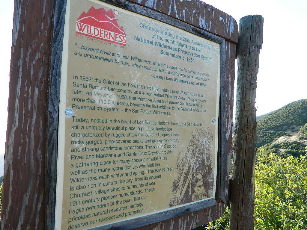
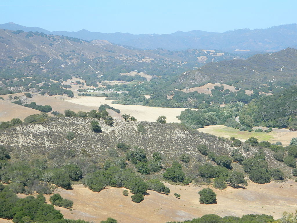
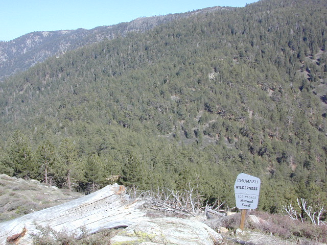
North of Santa Barbara, CA East of Santa Maria, CA South of New Cuyama, CA West of Ventucopa, CA
San Rafael Wilderness is otherwise known as the Santa Barbara backcountry. The Sierra Madre mountains and San Rafael mountains make up the this chunk of wilderness, a vast open space near the coast – which extends from Lake Cachuma to the Cuyama River Valley. This is the southern ridge line along Highway 166, with few pine trees, mostly oaks, leading west to Santa Maria River.
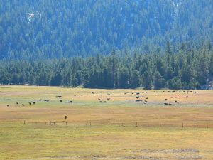
Figueroa Mountain and Lake Cachuma are to the south near Santa Barbara. Vineyards and wineries skirt the western hills of Santa Maria, cattle grazing, oil fields and agriculture line the northern borders near Cuyama Valley. Dick Smith Wilderness is just to the east a little bit, spanning over toward Hwy 33.
OHV: better known as off-roading and dirt biking is common in the foothills behind Santa Barbara, as well as on the west side of the San Rafael Wilderness, near Miranda Pine and Tepusquet Road. Numerous small campgrounds on dirt roads are positioned around the perimeter, but no OHV trails lead into the wilderness areas.
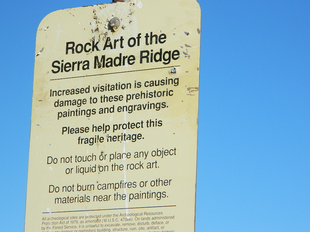
Native American petroglyphs can be found in this remote region of Central California, but may require topographic skills, detective work, trekking and at least a full day of physical action.
Access to ”Painted Rock” on Sierra Madre ridge is hike/bike in only. The dirt road that access these trailheads are rough road and not maintained. High clearance may be needed. This day trip is an all-day adventure and you might want to consider bringing the mountain bike. Just stay on the road, as rangers will ticket for riding in the designated Wilderness Areas.
from the west – If you plan to visit the rock art from the west side, take Cottonwood Canyon (small sign) turn off of Hwy 166. Pay attention to private property signs, cuz the locals are serious about their lands. Keep on driving up the mountain. Above Bates Canyon Campground up on the ridge, turn left, east on dirt road #32S13 – proceed several miles to the dirt parking area at the pig pen w/ locked gated and signed trailhead.
from the east – dirt road hike is about 10 miles (one way) and it starts at the Santa Barbara Canyon trailhead @ locked gated. Rural back road access requires a good topo map. Find Cuyama River @ Hwy 166, take the route on west side of bridge. East of New Cuyama, CA
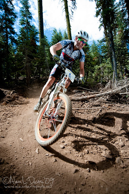
Mountain biking has become a popular sport especially in California. We’ve got so much great terrain, so close to home (the urban sprawl), that this outdoor hobby is bound to get you back in shape, fast. Start slow to avoid burnout and injury. The weather is awesome, just go. Plan a camping weekend & bring your bike!
Obvious (but humorous) information on bike riding or mountain biking in Sequoia NP. Upon doing research for this page, noticed a heck of a lotta folks typing in the phrase
Sequoia National Park Bike Trail
I laugh…. but plenty people are searching for bike trails near Sequoia groves, inside the most protected of lands, the National Parks.
Firstly, most National Parks in California do not allow bikes on hiking trails. The Sierra Nevada has NO National Parks that allow mountain biking on their trails. (official words are: Biking is allowed on the main roads in the parks but is prohibited on park trails.)
Yuk. Who wants to ride on asphalt in the wild?
Yosemite & Lake Almanor both have nice paved bike paths. But you may want dirt trails for biking. Be it mellow mountain biking on forest roads, or the hard core Downie-droppers.
California Wilderness Areas are the same rules, but even tighter. So that brings us to Sequoia National Forest. Yes, indeed California National Forests allow mountain bikes on most trails, in most cases. The popular trails might even get small brown signs showing bikes that are allowed.
Second, there are no bike rentals inside Sequoia National Park (or Kings), so you must bring yours in, or better yet ride in. I dare you. Although you cannot take said bike on a dirt trail, so you’ll need to stick to pavement only. The main highway (Hwy 198) has got to be one of the curviest, narrow, fern lined ridge routes of the region. You would be a fool to ride this area, as a senior citizen w/ a 40 foot motorhome or a speeding SUV may take you out on a curve. Seriously! You better be in great shape if you plan to descend into Kings Cyn. That route is just as dangerous if not more so. These 2 National Parks – Sequoia & kings, both get a lotta traffic. Year round.
Thirdly – here is the biggest tip of the whole topic. In between Kings Canyon & Sequoia National Parks is a slice of Sequoia National Forest land. (Meaning you can ride bikes or mountain bikes here) Most call it Big Meadows Road # 14S11 & there is plenty camping all down this road – 12 miles with spur roads in every direction. A nice chunk of forest with rocks, meadows, camps & dirt roads. Granite & great scenery. What more could you ask for? More forest roads than single track trails tho and please watch for equestrian traffic. The dead end of this road leads out to 2 Wilderness areas, so be prepared to navigate with a good map in hand. No bikes are allowed in the Wilderness, remember?
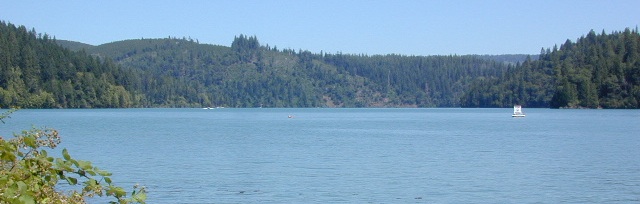
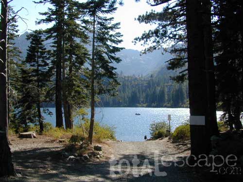
The granite spires of the Sierra Buttes (8591′) tower above both Upper & Lower Sardine, making for a glorious backdrop to these two lakes. This is a popular fishing lake with no swimming allowed. The water is so clear that at noon you can see to the bottom!
There are numerous, super-scenic, small lakes in this region and one trip here is not nearly enough. Total Escape rates this collection of small lakes up there w/ the ‘best hiking lakes’ in California. The Pacific Crest Trail runs through this awesome lakes area, which is located north of Truckee, east of Downieville.
backpacking
boating
camping
canoeing
fine dining
fishing
hiking
granite peaks
kayaking
mountain biking
off-roading
stargazing
waterfalls
wildflowers
high elevation means snow
Plumas Co Road #24 is the Gold Lake Road, also referred to as the Gold Lake Highway – which skirts the lakes, the buttes and connects Historic Gold Country Hwy 49 to Graeagle Golfing @ Hwy 89. SNOW CLOSES THIS ROAD, but the area remains open for winter recreation.
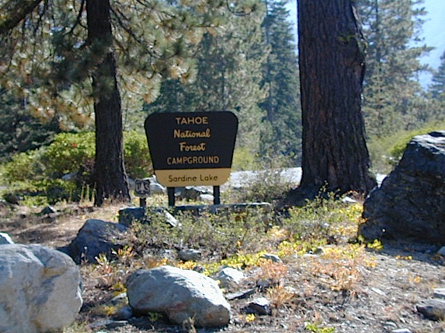
SARDINE LAKE ROAD, a paved turn off the main road. NFS Campground is located one mile from the shore at Lower Sardine. Sardine Lake Resort rents cabins and the restaurant serves dinners w/ lake view!
Sardine Lake Campground
• Elevation: 5800′
• Number of Sites: 29
• Vehicle Accessibility: RV 22′
• Campsites Reservation: Yes
• Camp Fee: Yes
• Facilities: piped water, vault toilet
• Length of Stay: 14 Days
• Season: June – October
• Trailheads: Sierra Buttes & PCT
Sardine Peak Lookout
SARDINE PEAK FIRE TOWER LOOKOUT (NFS)
Built in 1935, a three story enclosed tower with external stairs. 2019 – No longer available as an overnight rental. (elevation 8138′)
Upper Sardine Lake: Takes only a short hike to get to. This is a pure glacial bowl; the rock plunges straight into the water, no beach at all. Great fishing; ice-cold swimming.
Sequoia National Forest Campgrounds
Kern River, Southern Sierra Nevada
All the developed campgrounds listed below charge an overnight fee. Some are open year round, while others close for winter. Few are walking distance to the market, some may have piped running water, and garbage collection. Most have paved loop driveways and can accommodate large RVs. All campgrounds have bathroom facilities.
No day use parking lot inside the campgrounds. Park outside the camping grounds for recreation: fishing, hiking, mountain biking, rafting or wildflowers.
This entire canyon is dedicated to outdoor recreation w/ very few residential streets. Southern Sierra Nevada mountains – the whole Kern River area draws a lot of traffic from its proximity to Southern California.
Lake Davis Loop is a 20 mile circle around the lake. Drive or mountain bike route. Scenic drive on dirt roads, or an easy bike ride. Average ride time 2 hours for biking.
A flat, easy loop around Lake Davis is best in summer months, as snow usually closes this area in winter. The whole route is a mix of paved, dirt and gravel road. There are picnic areas along the way, lake views, bird and wildlife viewing, wildflowers.
Numerous primitive camp sites and secondary dirt roads fork in various directions, off of this main loop. Volcanic ridges line the west side of the lake, dense forest and seclusion can be found all around. Bald eagles fly overhead and wild life is abundant.
boat
camp
fish
hike
mountain bike
stargaze
wildlife
CROCKER GUARD STATION
Crocker Station is for rent and reservations are required. This wooden 2-story home was built in 1912 for Forest Service personnel, and later staffed as a fire station until the 1980s.
Situated at 5700′ elevation, its alpine beauty and cooler temps make it a much sought after, especially in summertime. Located a few miles from the lake and 10 miles northeast of Portola, California. There is a small campground next door called Crocker Campground. A dirt road access to Crocker Meadow is quickest from lake, but the paved route around is longer.
DIRECTIONS:
From California SR 70 (Highway 70) in Portola take West Street approximately 7 miles to the Lake Davis Dam. Park at the information kiosk and get acquainted with maps and the area info.
Drive or bike the lake loop. Travel 1.7 miles west to Forest Service Road 24N10, travel on that for 8.1 miles until you reach the junction with County Road 112. Then turn east and continue around the lake, past the Grizzly Campground a half mile, turn South on Country Road 126 and continue back to the dam.
Heart Bar Camp: Forest Road #1N02 – San Bernardino National Forest
Heartbar Campground, Heart Bar Horse Camps, RV Dispersed Sites, Coon Creek Cabin. SE of Big Bear Lake; Hiking & Equestrian Trails
Hwy 38 , the long way into Big Bear Lake, up thru Angelus Oaks CA. Heartbar Campground is a developed recreation area, right up front. 94 camp sites, plus the recreation all around. Big equestrian area.
HART BAR: Heart Bar is large pine valley w/ alpine meadows, great camping, San Gorgonio looms overhead with ridges of 10,000′ elevation.
free, dispersed, primitive camping
in Southern Cal
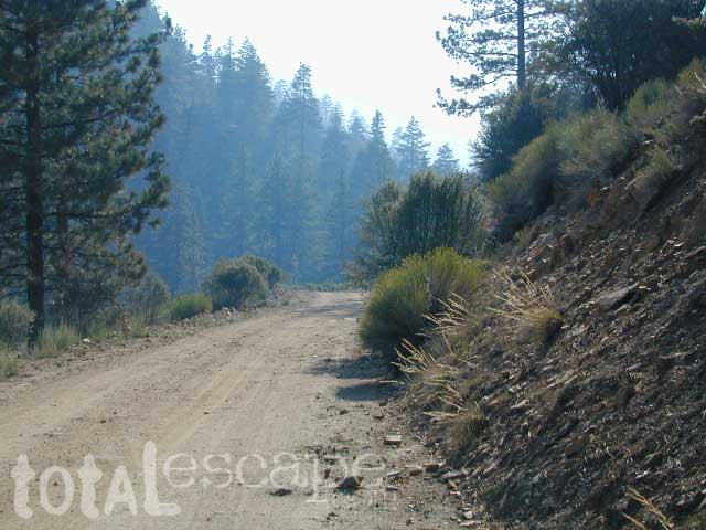
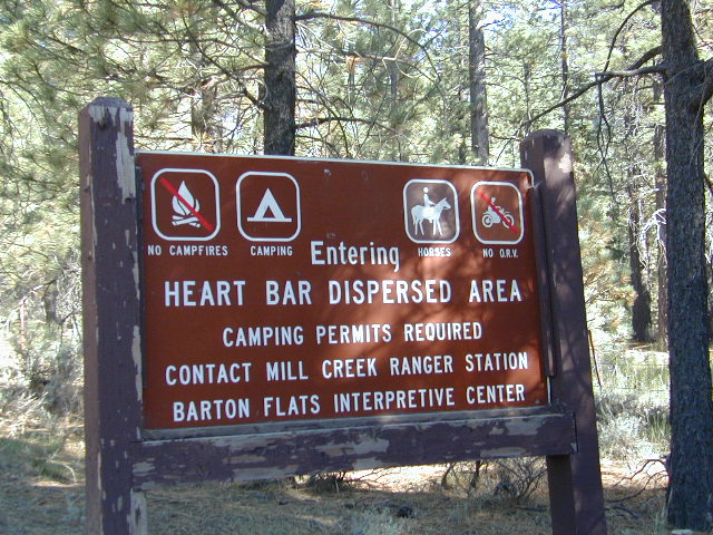
HEART BAR DISPERSED AREA
Forest Service Rd #1N02 – the dirt road is graded & maintained, about half the year. Primitive camp sites require permits; see local rangers. Many forest roads can close due to heavy snow, big rain or rock slides. Best traveled in the warmer months. Winter can be questionable with open gates and road access.
Large open sites, with tables & moderately level dirt access. Seen RV campers way back here. RV’s beyond 30′ are not recommended. At end of this 5 mile dirt route is a hiking trail to Big Morongo Canyon & a really neat historic place called the Coon Creek Cabin.
Totally worth a visit, if you plan on driving to the end of the road – just for the heck of it. Cabin area can be reserved for small group camping in summer months.
If you are thinking about fishing or camping the Eastern Sierra, North of Bishop & you are not up for the crowds at Mammoth or June Lakes, then try the Bridgeport area, north on Hwy 395. Rural ranch lands along main road, Bodie ghost town turn off across the highway and Virginia Creek Settlement are also nearby
Green Creek is a 11 mile long dirt road in the lush Eastern Sierra the northern portion. The wide, graded dirt road is signed and dead ends at a Toiyabe National Forest campground called Green Creek Campground. The drive up can be washboard bumpy in some parts, but that doesn’t stop the hundreds of adventurous motorhomes that make this trek annually. This place features some of the best prime Sierra back roads camping options for RVs.
Another dirt route, Dunderberg Meadow Road peels off to the left. Dunderberg departs off Green Creek a couple of miles from the highway and well maintained. This route leads to meadows, aspens, picture perfect scenery and much more seclusion. Passenger car accessible, wide graded dirt roads to wilderness edges. Two-track one lane trails lead to meadow edges and more creeks. Very impressive views of the Sierra peaks over here on this side. Meadows are sensitive areas, wonderful for picnics and you should always minimize impact.
Plain old passenger cars can easily make this route deep into the Eastern Sierra aspen canyon. Graded dirt and4x4 could be needed winter months. Backpackers can enjoy easy access to the Hoover Wilderness trailheads. There is plenty semi-primitive camping spots along the way, right on the creek, for free…. so no need to sleep in your vehicle upon arrival.
Autumn Aspen Groves: fall colors peak in October, which is usually when the first snows for the winter season start. November – usually the freeze gets them and lifeless brown leaves dangle, until the Sierra Nevada wind gust blow real good.
Green Creek Camping
DIRT ROAD CAMPING
alpine lakes
backpacking
car camping
day hikes
fishing camping
meadows
RV camping
tent camping
Dispersed, primitive camp spots along this main dirt road are on a first come basis. You’ll need a fire permit. Many flat camps are set along the creek in aspen groves, some pines, others have cubby hole privacy. Large granite valley, big creek, bird, scenery and nature everywhere. Some folks spend weeks camping out here in the warm weather months. Fishing is a big attraction.
Old Cabin in autumn leaves, up near the top of the dirt road deep in the aspen groves
Millard Falls
2 mi RT; 1200′ elevation; oaks.
Arroyo Seco District –
of Angeles National Forest
818-790-1151 Altadena CA
From Interstate 210 in San Gabriel Valley, exit Lake Ave., go N & turn left/west onto Loma Alta Dr. & to Chaney Trail & follow signed dirt road
Sturtevant Falls
5 mi RT; 4600′ elevation; oaks, creek-crossings.
Santa Anita District –
of Angeles National Forest
818-899-1900
inside Big Santa Anita Canyon
From Interstate 210 in San Gabriel Valley, exit Santa Anita Ave.Go North/East, through neighborhood & up mountain to paved parking lot.
Hundreds of trails meandering throughout this forest. Granite domes to huge Sequoia trees. Most secluded areas are found in the Eastern Section in the Dome Land Wilderness.
Sequoia National Forest & the Lower Sierra Nevada Mountains extend from the Tehachapi ranges to the Kings River Canyon; from the Great Central Valley to the Mojave desert.
Back a couple of decades ago, inspiration and research for creating this very web site began in the deserted hills behind San Diego. Escaping the city at every chance, some feel the rat race more than others. Luckily the desert is close and there is plenty of space for everyone. California boulders and badlands, hot springs, pine meadows, great views, oak forests creeks, coastal cliffs and lush canyons near downtown, SD does have some awesome hiking trails – even a few waterfalls too.
18, 679 acres
Central California Mountains
East of Arroyo Grande, CA
US Highway 101
exit #187A – Grand Ave
backpacking, camping, creek fishing, hiking, swimming holes, waterfalls
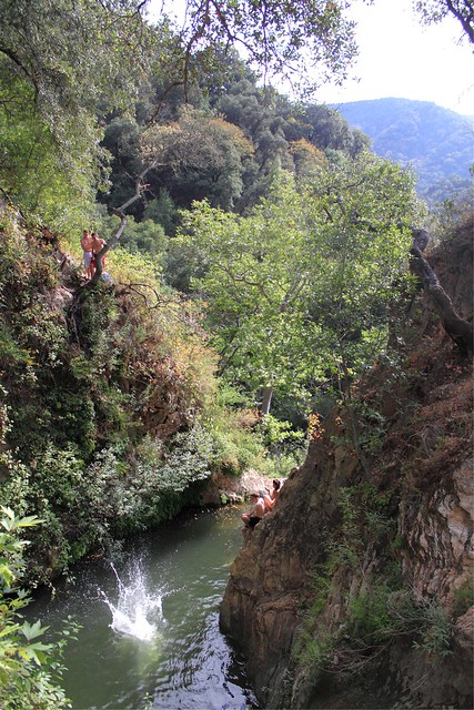
Santa Lucia Wilderness is the mountain range in between Santa Margarita Lake and Lake Lopez inside Los Padres National Forest, in a very remote and rugged portion of San Luis Obispo county. In the hills behind Arroyo Grande, past the Huasna turn off, above the local reservoir, beyond the big ranches – the waterfall trails of Santa Lucia can be found. Super steep canyons with only two dead end roads leading to trails. Waterfalls, swimming holes, way back there behind Piney Ridge.
tallest mountain peak elevations
Bald Mountain – 2834′
Lopez Mountain – 2868′
Black Butte – 2749′
Upper Lopez Canyon can be challenging drive with water in the creek, but it has 3 trailheads back in this canyon.
Pozo Road / Hi Mtn Road (#30S05 on the way to Pozo) will lead to a Santa Lucia trailhead @ Hi Mtn Campground and on to Big Falls trailhead. Locals call the whole route POZO, which leads from Lake Lopez to Pozo.
Road #15E11 Garcia Ridge OHV trail is off this same main route, Hi Mountain Road. The Rinconada trailhead can be found along the paved Pozo Road, west of the Pozo Saloon and east of the KOA Campground.
Terrain consists of high mountain peaks, badlands of Quatal Canyon Wash & Lockwood Valley; Steep slopes of forests, rock outcroppings, sparse forest areas, on border of Kern County & Ventura County. This area is sacred to the native California Chumash tribe.
Mount Pinos, Mount Abel, Cerro Noroeste, Westside Park, Hudson Ranch Road, Mil Potrero Highway, Lockwood Valley Road, East Dry Canyon, Apache Canyon, Cuyama River
The Peak to Peak Hike is a 7 mile, high elevation, ridge line day hike that traversed 2 of the tallest peaks in Kern County – Mt Pinos (elevation 8831′) and Mt Abel (8286′). Day hikes, equestrian trails, backpacking, mountain biking areas nearby. Steep, granite, chaparral, lightly forested w/ ponderosa and Jeffrey pines. From this ridge trail you have a 360 degree view over the entire region. The cabin community of Pine Mountain Club is to the north side (and IF the skies are really clear, you can see the Sierra Nevada mountain range too); Lockwood Valley & Ozena Valley are located to the south; Cuyama Valley to the west and the Tejon Pass w/ Frazier Park to the east.
Off road use 4×4, dirt bikes, ATVs, and quads are common in Quatal Canyon, Apache Canyon, East Dry Canyon leading up to the wilderness edge. Rangers will ticket if they find you on the Chumash side of Quatal wash. The secluded yet inviting, wide, white sandy washes are just too tempting for some bad boys.
Chumash trailheads are located –
about a mile before Camp-O-Alto Campground (Mount Abel)
along lower end of Quatal Canyon Wash (OHV areas parallel)
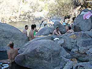
MIRACLE HOT SPRINGS on Lower Kern River is now closed!
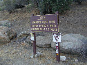
Hidden well by the dense vegetation, this multi-tub location provides a peaceful setting along the Kern River. Located on the Old Kern Canyon Road, (aka Old Kern Road) that parallels the main 4-laner Highway 178. The broken and dismantled tubs are inside a grouping of granite boulders, overlooking the Lower Kern River. NFS Campground is walking distance away. Week days you can have the place to yourself for picnics, river fishing and hiking. Mountain biking and hiking trails at Remington trailhead.
DanaMite’s Tip: This place has no operating hot pools unless you plan to physically dam up a tub with a few found rocks. Rangers do not like this practice. If you wanna camp at Hobo Campground you can walk over & hike around to check it out. Worth a look.
Camping available next door at Hobo Campground. A few primitive spots are located on the Old Kern Canyon Rd. Free car camping, and some sites big enough for level RV camping. See the rangers at the lake for Sequoia National Forest ranger and fire permit and check fire current restrictions.
Remington Hot Springs is only 2 miles down river, but it does require a short hike and it gets very busy on weekends!


