Sequoia National Forest Campgrounds
Sequoia NF Camping
Sequoia Campground Reservations – Giant Sequoia Campgrounds, Western Divide, Kern Canyon
areas include: Kernville, Kern River, Lake Isabella, Sherman’s Pass, Kennedy Meadows, Forks of the Kern, Western Divide Highway, Camp Nelson, Kings River, Hume Lake & Sequoia National Park
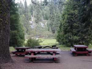
 Listed below are all the Sequoia National Forest campgrounds, public lands for outdoor recreation. USFS

Sequoia Campgrounds
| campground | elev | spots | veg | toilet | water | notes |
| Alder Creek Campground | 3900′ | 13 | alder | vault | creek | W of Alta Sierra |
| Auxiliary Dam Campgr | 2650′ | dsp | – | flush | piped | Lake Isabella |
| Belknap Campground | 4800′ | 15 | pines | vault | piped | April – Oct |
| Big Meadows Campground | 7600′ | 25 | pines | vault | creek | CLOSED |
| Boulder Gulch Camp | 2650′ | 78 | oaks | flush | piped | fishing Lake Isabella; RV max 45′ |
| Breckenridge Campground | 6600′ | 8 | pines | vault | no | South of Kern River; no RVs |
| Buck Rock Campground | 7600′ | 5 | pines | vault | no | Kings Canyon NP |
| Camp 3 Campground | 2800′ | 52 | oaks | vault | creek | Kings River rafting; RV max 30′ |
| Camp 4 Campground | 1000′ | 5 | oaks | vault | creek | no RVs, Kings River rafting |
| Camp 4 1/2 Cabin | 1000′ | 5 | oaks | vault | creek | no RVs, Kings River rafting |
| Camp 9 Camp Area RV | 2600′ | 109 | none | flush | piped | Lake Isabella |
| Cedar Creek Campground | 4800′ | 11 | pines | vault | piped | W Alta Sierra; no RVs; May-Oct |
| Coy Flat Campground | 5000′ | 20 | pines | vault | piped | May – Oct |
| Eshom Creek Campground | 4800′ | 23 | pines | vault | piped | CLOSED |
| Evans Flat Campground | 6100′ | 20 | pines | vault | spring | equestrian, pasture; RV 20′ |
| Fairview Campground | 3500′ | 55 | mixed | vault | river | upper Kern River; RV 45′ |
| Fish Creek Campground | 7400′ | 40 | pines | vault | – | E of Sherman; RV max 27′ |
| Frog Meadow Campground | 7500′ | 10 | pines | vault | no | Sugarloaf Ridge; June-Oct |
| Frog Guard Station Cabin | 7500′ | 10 | pines | vault | no | Sugarloaf Ridge; 2 nite min |
| Gold Ledge Campground | 3200′ | 37 | mixed | vault | – | Kern River; RV max 30′ |
| Green Cabin Flat Camp | 1000′ | dsp | oaks | – | – | Kings River; primitive |
| Hanning Flat Campground | 2650′ | dsp | – | chem | – | fishing Kern River |
| Headquarters Campground | 2800′ | 44 | alder | vault | – | Kern River; RV max 27′ |
| Hobo Campground | 2300′ | 35 | oaks | chem | – | lower Kern River; RV 22′ |
| Horse Camp | 7600′ | 5 | pines | vault | – | equestrian campsites |
| Horse Meadow Campground | 7400′ | 41 | pines | vault | – | Sherman’s Pass; RV 22′ |
| Hospital Flat Campground | 3000′ | 40 | alder | vault | – | Kern River; RV max 30′ |
| Hume Lake Campground | 5200′ | 74 | pines | flush | – | CLOSED |
| Hungry Gulch Campground | 2700′ | 78 | oaks | flush | piped | Lake Isabella; May-Oct |
| Kennedy Meadows Camp | 6100′ | 39 | pines | vault | piped | E of Shermans; RV max 30′ |
| Landslide Campground | 5800′ | 9 | pines | vault | creek | CLOSED |
| Leavis Flat Campground | 3000′ | 9 | pines | vault | piped | California Hot Springs; RV 16′ |
| Limestone Campground | 3800′ | 22 | mixed | vault | creek | Kern River rafting; RV 30′ |
| Live Oak North Campground | 2700′ | 60 | oaks | flush | piped | Lake Isabella; RV max 30′ |
| Live Oak South Campground | 2700′ | 90 | oaks | flush | piped | Lake Isabella; RV max 30′ |
| Long Meadow Group Camp | 6500′ | 23 | pines | vault | piped | CLOSED |
| Lower Peppermint Campground | 5300′ | 17 | pines | vault | piped | CLOSED |
| Main Dam Campground | 2500′ | 82 | oaks | vault | piped | Lake Isabella; RV max 45′ |
| Mill Flat Campground | 1100′ | 5 | pines | vault | creek | Kings River rafting; no trailers |
| Panorama Campground | 7400′ | 10 | pines | vault | no | Sugarloaf Ridge; June-Sept |
| Paradise Cove Campground | 2600′ | 138 | oaks | flush | piped | Lake Isabella; RV max 30′ |
| Peppermint Dispersed | 7100′ | 19 | – | vault | creek | CLOSED |
| Pioneer Point Campground | 2650′ | 78 | oaks | flush | piped | Lake Isabella; RV max 30′ |
| Princess Campground | 5900′ | 90 | pines | vault | – | CLOSED |
| Quaking Aspen Campgr | 7000′ | 32 | aspen | vault | creek | CLOSED |
| Redwood Meadow Campgr | 6100′ | 15 | pines | vault | piped | CLOSED |
| Sandy Flat Campground | 2300′ | 35 | oaks | vault | – | Lower Kern River |
| South Fork Recreation | 2650 | dsp | – | flush | piped | some walk-in camp sites |
| Stine Cove Campground | 2650′ | dsp | oaks | vault | – | Lake Isabella |
| Stoney Creek Campgr | 6400′ | 49 | pines | flush | piped | CLOSED |
| Tenmile Campground | 5800′ | 13 | pines | vault | piped | CLOSED |
| Tillie Creek Campground | 2650′ | 159 | oaks | flush | piped | fishing; RV max 45′ |
| Troy Meadow Campground | 7800′ | 73 | pines | vault | – | OHV; E Sherman’s; RV 20′ |
| Upper Stony Creek Camp | 6400′ | 19 | pines | vault | piped | Sequoia NP; May-Oct |
| White River Campground | 4000′ | 12 | oaks | vault | piped | Sugarloaf; May-Oct; RV 16′ |
| Wishon Campground | 4000′ | 31 | oaks | vault | piped | open all year |
Sequoia Camping & Kernville Vacations, see also –
- Sequoia National Forest Camping Primitive
- Sequoia National Park
- Mineral King
- Mountain Home State Forest
Topo maps, wilderness hiking maps
Equestrian trails, OHV maps –
- Sequoia National Forest MAP
- DOME LAND Wilderness MAP
- GOLDEN TROUT Wilderness MAP
- Jawbone Canyon OHV MAP

Recent Wildfires:
Castle Fire + Shotgun Fire:
SQF Complex Fire 2020
Colony Fire + Paradise Fire:
KNP Complex Fire 2021
Giant Sequoia Fires
Windy Fire 2021

Sequoia mountain communities include:

