Tag Archives: yuba river

New Bullards Bar Reservoir

Bullards Bar California

Bullards Bar Boat-in Camps

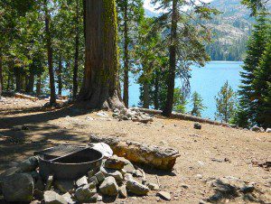
BULLARDS BAR Dark Day is a lakeside walk-in campground on a small reservoir, located deep in the Gold Country foothills. Flush toilets and hiking trails, kayak rentals and fishing.

fish

West of Highway 49. Huge dam for hydro-electric power. Minimal roadways along the lake and steep canyons make for optimum hiking and boating. Floating and fishing. Relaxing in the mountains, with fresh water!

On most maps the official name of this lake may read New Bullards Bar Reservoir, or Lake Bullards Bar, but locals just call it simply – Bullards Bar!

Sierra Nevada Foothills. Yuba River, California.

Northern Gold Country, California

Near Camptonville, West off Hwy 49
in between Oroville and Nevada City, CA

Located not far from historic Downieville, Bullard’s Bar is an excellent base camp location for exploring the upper reaches of the Gold Country region. Old mining locations, museums, a covered bridge, various parks, Yuba River, Sierra Buttes, Lakes Basin. Grass Valley & Nevada City are also nearby. Mountain bike trails, river rafting and hiking all around.

New Bullards Bar

lake surface area: 969,600 acrespaddle sports

lake elevation: 2000′ above sea level

lake county: Yuba County California

roads around lake: Marysville Road (south of lake and east side w/ Hwy 49), Moonshine Road (south of lake), Oregon Hill Road (west side), Pendola Road (north side), and Forest Route #47 (dirt road on north side)

boatramp

nearest towns:

Bullards Bar
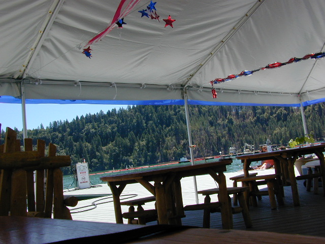
Shade @ the marina, just when you needed it most

Yuba River Recreation

camp

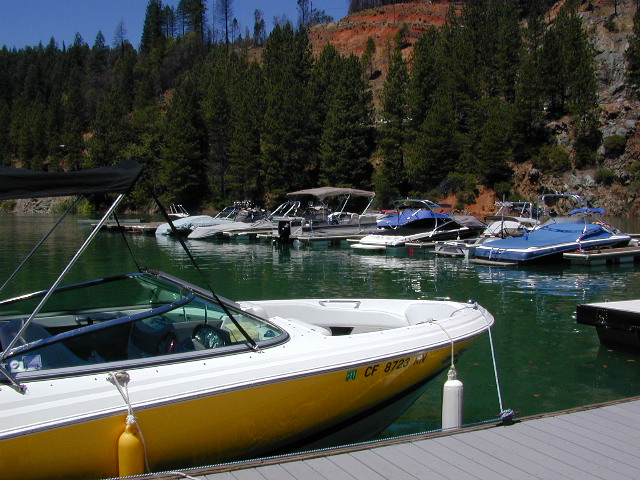
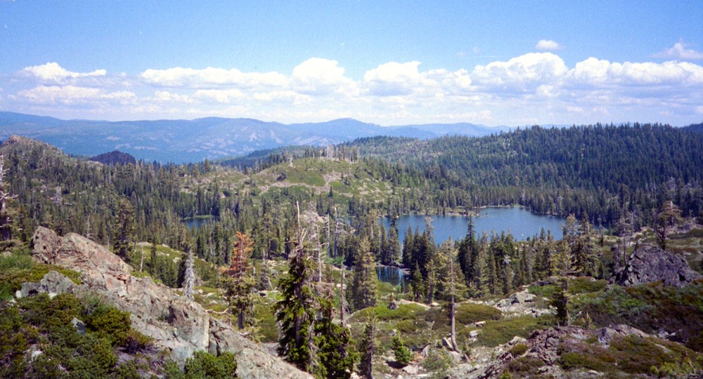
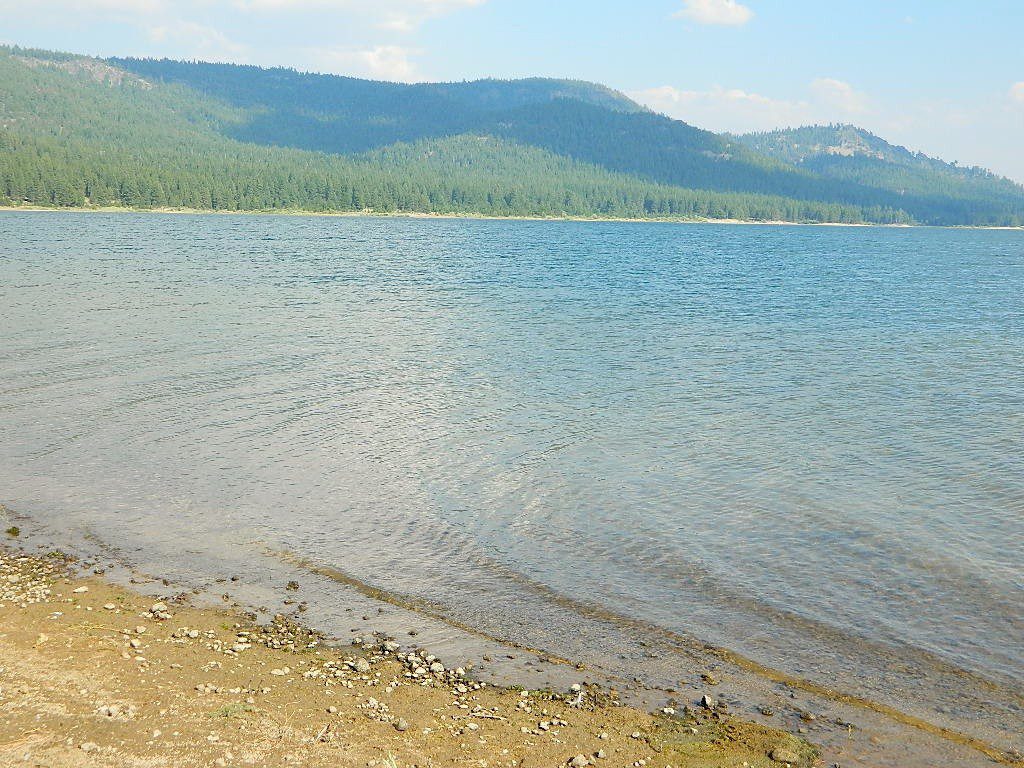
Bullards Bar water is a beautiful teal color of greenish-blue – due to heavy mineral content in the local soil (red dirt) and the dense forest above.

This water comes down the north fork of the Yuba River, as snowmelt from Lakes Basin Recreation Area, the Sierra Buttes, and the Yuba Pass on Highway 49. Northern Gold Country, California.

Bullards Bar Lake – Emerald Cove Marina
New Bullards Bar Reservoir
877-692-3201

boating boating gasoline marina

New Bullards Bar Reservoir

boat in camping

One of the few lakes in the Sierra Nevada that offer boat in camping at developed camp sites, and also to allow boaters primitive camping along the shoreline. No drinking water is available. No pit toilets, so a portable chemical toilet is always required. Plus, pack out all garbage.

No charge for DAY USE areas: parking or boat launch ramps

NOTE: Dark Day & Schoolhouse Campgrounds are the only car camping & RV accessible camping on this lake. These both have flush toilets and drinking water piped in. Hiking trails & boat launch nearby. Wheelchair accessible campsites are available.

CAMPS OPEN: APRIL – OCTOBER
Campgrounds @ BullardsBar are usually open from April to October annually and all are closed for winter months.

camping walkin camps hiking camping boating camping RV camping mountains

Bullards Bar Campgrounds

camp information 530-692-3200

  • GardenPoint: 17 boat-in sites
  • Madrone Cove: 10 boat-in sites
  • Shoreline Camp: 2 boat-in sites
  • Dark Day Walk-In Camp: 30 sites
  • Schoolhouse Campground: 56 sites
  • Hornswoggle Group Camp

Frenchy Point Campground USDA

Located 5 miles northwest of Dark Day Boat Ramp on the west side of the reservoir. Boat in only access. It is used as an over flow campground. There are campsites, but no bathrooms. Portable chemical toilet required. More info call Emerald Cove Marina at (530) 692-3200

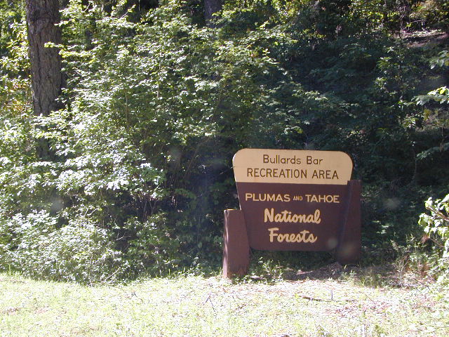
National ForestsBullards Bar Lake located on the Yuba River, bordering
between Tahoe National Forest & 
Plumas National Forest
 

bullards bar California

lake recreation 

  • boat in camps
  • canoe
  • fish
  • houseboat rentals
  • kayak
  • picnic sites
  • sail
  • watercraft rentals

land recreation

  • backpack
  • campgrounds
  • hike
  • mountain bike
  • walk-in camps

bikingbullardsdam

also in the area


View Larger Map

califrepublic

Second Spillway – in the works?
Yuba Water Agency has just committed to building a $160 million second spillway at the New Bullards Bar Dam; beginning in 2021, with a completion date of 2025.

check

https://en.wikipedia.org/wiki/New_Bullards_Bar_Reservoir
https://en.wikipedia.org/wiki/New_Bullards_Bar_Dam

Sierra Buttes California

sierra buttes

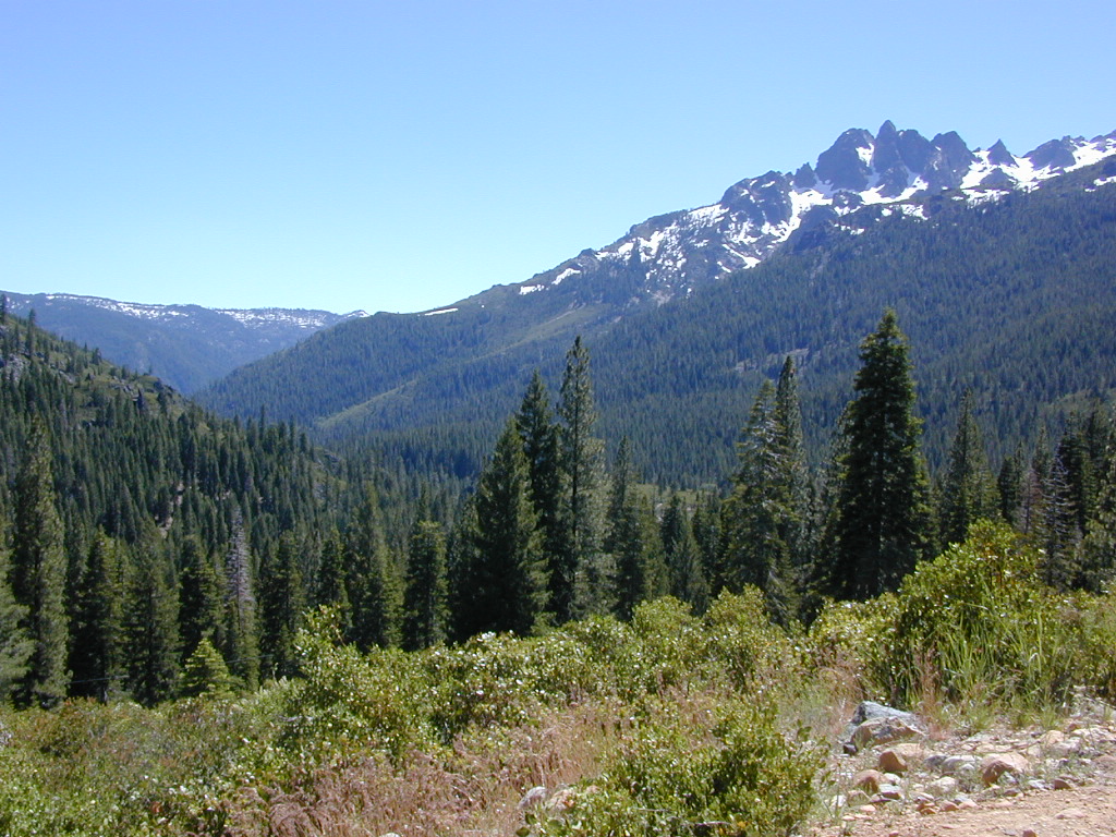
The Sierra Buttes

elevation: 8591′

Northern Gold Country California at the headwaters to the Yuba River

Lakes Basin Recreation Area
Tahoe National Forest
near Plumas Eureka State Park

Gold Lake, Sardine Lake, Upper Sardine, Smith Lake, Packer Lake, Grass Lake, Sand Pond, Goose Lake, Snag Lake, Long Lake, Jamison Lake, Round Lake, Deer Lake, Tamarack Lakes, Young America Lake, Frazier Falls

Sierra Buttes

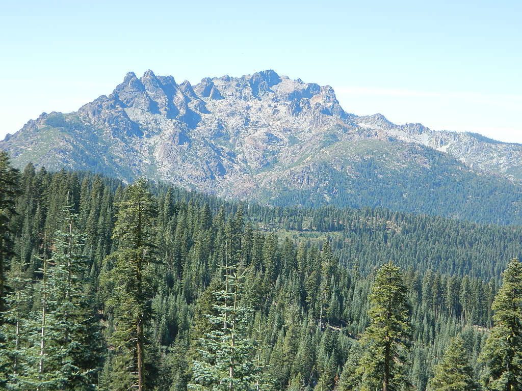
California is the land of granite peaks. Rocky, exposed mountains that stick up out of the landscape for all to see. Southern Cal has a few of them, but most granite peaks in California are found in the Sierra Nevada.

US 395 Eastern Sierra impressive ridge lines are the highest and most photographed and Lake Tahoe has plenty of big granite surrounding it. The farther you go north, the less granite you will see – not because it isn’t there, mostly cuz it is just buried with tall dense forests.

lakesbasinhikers
lakes basin day hikers

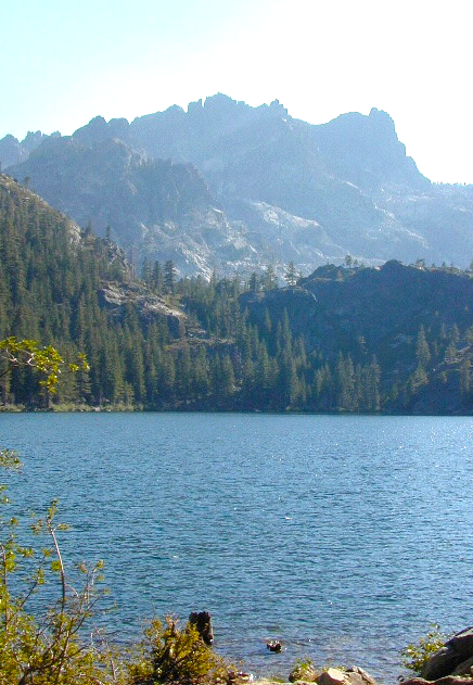
NORTH SIERRA – The Sierra Buttes are the impressive granite peaks located in between the North fork of Yuba River and Sardine Lake.

SE of Mount Lassen and NW of Lake Tahoe, at the tippy top of the historic gold country. Gold Lake Road #24 connects Gold Country Highway 49 to North of Tahoe Highway 89. Road #24 is often closed for winter snow, so most visitors enjoy this region in the summer months.hiker

Sierra Buttes Fire Lookout Hike

The infamous PCT (aka. Pacific Crest Trail) passes the peak and goes north through this basin of alpine lakes, so backpackers are often seen. Tent camping is very popular, as well as RV camping w/ numerous developed campgrounds and open camping as well.  Some of the hard to reach primitive camp sites (next to lakes) can be accessed via 4×4 vehicle. Gotta have a good topo map.

Downieville is well known for the mountain biking trails, so this whole region is covered with amazing trails. Snowmobilers and cross country skiers love the area during a good winter snow and they can access this area from the north off Hwy 89.


View Larger Map

Sardine Lake

hiking, biking, backpacking, camping, fishing, kayaking, cross country, & snowmobiling

campsite snag lake
Snag Lake (free) Camping on Gold Lake Highway

lakes basin views

Sierra Buttes Map Tahoe National Forest

Lakes Basin Recreation Area

Lakes Basin Area, California

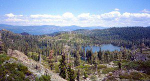
Golden gems of California, a collection of alpine lakes on the north end of Historic Gold Country, North Yuba River, Northern Sierra Nevada

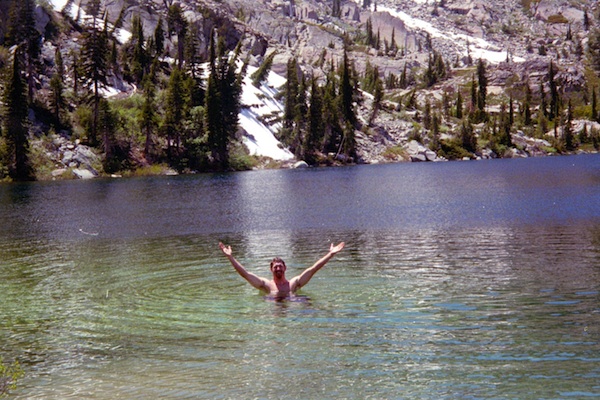
lake dunk
EAST of Downieville, CA

California’s Gold Lake and surrounding lakes; the granite spires of the Sierra Buttes and the creeks, waterfalls, headwaters of the Yuba River — total wild beauty. Steep, granite, river canyon from Downieville drive east on Highway 49 from Sierra City to Bassetts, a gasoline and market stop; they have a small hotel there too.

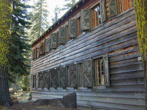
Historic Lodges

Take the left turn, north on to the Gold Lake Highway. The alpine and extremely scenic Lakes Basin Area consist of all small lakes in between Hwy 49 to Hwy 89, along GOLD LAKE HWY [Road S620] some maps read Road #24 or call this Gold Lake “Road” instead of highway. Snow closes in this route during winter months.

The impressive Lakes Basin Gold Lake Region is in the north part of Tahoe National Forest, on the border of Plumas National Forest. Plumas Eureka State Park is also nearby.

Hiking, Camping, Backpacking, Picnicking, Wildflowers, Stargazing, Fishing, Kayaking, XC Skiing, Snowmobiling

Lakes Basin Map

Lakes Basin Campground

California best lake destinations

lakes basin views

Lakes Basin Recreation Area

Sierra Buttes Map


Lake Tahoe Campground

Indian Valley Campground
Indian Valley Campground, Tahoe National Forest

Lake Tahoe Campgrounds

Cabins

Tahoe Forest Campgrounds

sierra buttes California

Lake Tahoe California

Listed below are developed camp grounds and RV camps around Lake Tahoe, run by various agencies. Most require reservations and are only open half the year (or less).

Lake Tahoe campgrounds: blue links lead to camp info.

campground elev spots veg toilet water notes
Bayview Campground 6000′ 10 pines vault Emerald Bay
Camp Richardson Tahoe 6500′ 330 pines flush piped South Lake Tahoe
Campground by the Lake 6000′ 157 pines flush piped South Lake Tahoe
D.L. Bliss State Park 6000′ 168 pines flush piped Westshore, Lake Tahoe
Eagle Point Tahoe 6100′ 100 pines flush piped California State Park
Emerald Bay State Park 6000′ 16 pines flush piped South Lake Tahoe CA
Fallen Leaf Lake Campground 6737′ 205 pines flush piped South Lake Tahoe CA
General Creek Campground 6000′ 175 pines flush piped Westshore, Lake Tahoe
Kaspian Campground 5800′ 20 pines flush piped Westshore, Homewood CA
Lake Forest Campground 6300′ 21 pines flush piped Northshore, Tahoe Vista CA
Meeks Bay Campground 6000′ 17 pines flush piped Westshore, Tahoma CA
Mount Rose Campground 8500′ 24 pines flush piped in Nevada @ Tahoe
Nevada Beach Campground 6200′ 54 pines flush piped Nevada Lake Tahoe
Pope Beach Campground 6000′ 49 pines flush piped South Lake Tahoe CA
Sandy Beach Campground 6300′ 44 pines flush piped Northshore, Tahoe Vista
Sugar Pine Point SP 6200′ 30 pines flush piped Westshore, Tahoma CA
Tahoe Pines Campground 6000′ 49 pines flush piped Meyers California
Tahoe Valley RV Campground 6000′ 413 pines flush piped South Lake Tahoe CA
Tahoe Campground SRA 6200′ 16 pines flush piped West shore, Tahoe City
William Kent Park 6300′ 95 pines flush piped Westshore, Tahoe City
Zephyr Cove Campground 6200′ 170 pines flush piped boat rentals Tahoe NV

rangerAll Tahoe Campgrounds will charge a fee for day use or overnight stays; Many require advanced reservations. Nightly rates vary per park, but tend to be expensive in this region. Most campgrounds are closed during the winter due to the big snow. Check with the ranger districts listed here.
primitive camp spots
Sawmill Lake 4×4 Camp

camp RV camps NFS hikes fishing mountain biking camps river fishing

NFSlogo

Tahoe National Forest encompasses a large region of the Sierra Nevada mountains surrounding the north portion of Lake Tahoe. areas included – Donner Pass, American River, Yuba River, Northern Gold Country; Lakes Basin Recreation Area; Small lakes and reservoirs with excellent fishing, all surrounded by lush forests.

15milesto20

Campgrounds with mid (5000′) to high-elevation (8000′) locations close annually for winter snow. Many are open for a few short summer months.

Listed below are Tahoe Campgrounds located away from the Lake Tahoe Basin; Inside Tahoe National Forest  Smaller camps are on a first come, first serve basis. blue links lead to camp info.

campground elev. spots veg toilet water notes
Ahart Campground 5300′ 12 pines vault American River
Alpine Meadows 5900′ 25 pines vault Martis Creek
Bear Valley Campground 6600 10 pines vault piped OHV trails, Sierraville
Berger Campground 5900 7 pines vault lake Packer Lake, Lakes Basin
Big Reservoir Campground 4000 18 pines vault piped non motor lake, Foresthill
Boca Campground 5605′ 26 pines vault boat launch
Boca Rest Campground 5605′ 25 pines vault piped on Boca Reservoir
Boca Spring Campground 5800′ 17 pines vault piped horses
Bowman Lake 5585 7 pines vault lake Donner area
Boyington Mill Campground 5680′ 12 pines vault Boca Reservoir
Cal-Ida Campground 2000′ 21 pines vault piped Yuba River, Downieville
Canyon Creek Campground 6000′ 20 pines vault creek Donner area
Carlton Flat Campground 2200′ 21 pines vault piped Yuba River, Downieville
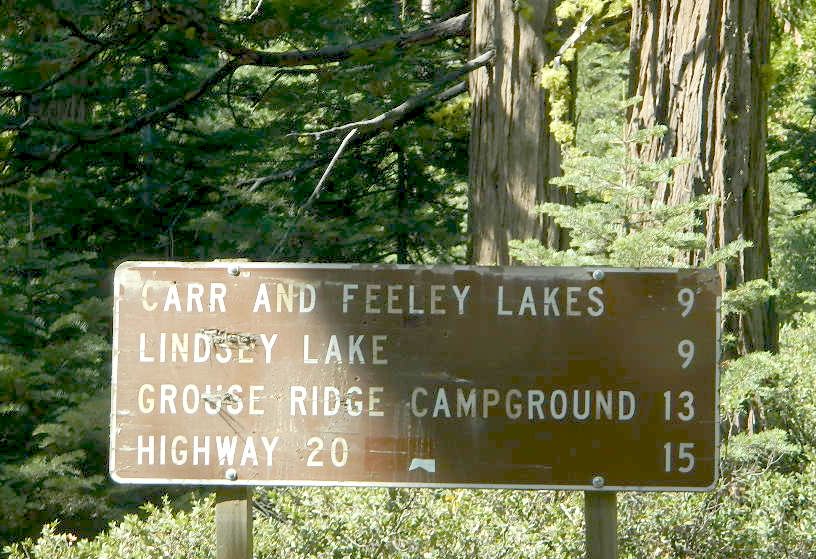
Carr Lake Campground 5900′ 5 pines vault lake Carr Feeley Lake
Chapman Creek Campground 6000′ 29 pines vault piped Yuba River
Chute Hill Campground 3400′ 30 pines flush piped Malakoff Diggins SP
Cold Creek Campground 5800′ 13 pines vault piped Sierraville
Cottonwood Campground 5600′ 24 pines vault piped Sierraville
Dark Day Campground 2200′ 16 oaks vault piped Bullards Bar Reservoir
Diablo Campground 5800′ 20 pines vault  Yuba River
Donner State Park Campground 5850′ 154 pines flush Donner Lake
East Meadow Campground 6100′ 46 pines flush piped Jackson Meadows Reservoir
Fiddle Creek Campground 2200′ 15 oaks vault piped Yuba River, Downieville
Findley Campground 6100′ 14 pines flush piped Jackson Mdws Res
Fir Top Campground 6100′ 12 pines vault flush Jackson Mdws Res
French Meadows Campground 5300′ 75 pines vault flush French Meadows Reservoir
Garden Point Campground 2000′ 19 variety vault fishing boats
Giant Gap Campground 3700′ 30 pines vault fishing boats
Goose Meadow Campground 5800′ 24 pines vault piped fish Donner
Grouse Ridge Campground 7400′ 9 pines vault Hwy 20
Hampshire Rocks Campground 5800′ 31 pines vault piped fishing camp
Independence Lake 6900′ 20 pines vault piped fishing
Indian Springs Campground 5600′ 35 pines vault piped fishing, Yuba River OHV
Indian Valley Campground 2200′ 17 pines vault piped Yuba River, Downieville
Jackson Creek Campground 5600′ 14 pines vault creek
Jackson Point Campground 6100′ 8 vault boat access Jackson Mdws Res
Lakeside Campground 5700′ 41 vault boat ramp Prosser Reservoir
Lake Spaulding Campground 5000′ 24 vault boat ramp PG&E Campground
Laiser Meadow Horse Camping 6200′ 11 vault piped High Sierra PCT access
Lewis Campground 5300′ 40 pines flush piped French Meadows Reservoir
Lindsey Lake Campground 5900′ 7 vault lake
Lodgepole Camping 5800′ 18 vault Lake Valley Reservoir
Loganville Campground 6000′ 29 vault piped Yuba River, Sierra City
Logger Campground 6000′ 252 pines flush piped Stampede Reservoir
Long Ravine Campground 2300′ 28 pines flush piped Rollins Reservoir
Lower Little Truckee 6000′ 15 vault piped Truckee River fishing
Madrone Cove Campground 2000′ 11 none Bullards Bar Reservoir
Meadow Lake Campground 7200′ 15 vault Sierra fishing camp
Meadow Lake Shoreline 7200′ 10 vault High Sierra Nevada
Mumford Bar Campground 5300′ 5 vault Foresthill Road
North Fork Campground 4400′ 17 vault piped American River
Onion Valley Campground 2300′ 5 oaks vault Sierra fishing camp
Orchard Springs Campground 2300′ 15 oaks flush piped Rollins Reservoir, Colfax
Pack Saddle Campground 6000′ 15 pines vault pump Packer Lake
Lakes Basin
Parker Flat OHV Camping 3900′ 7 pines vault off roading trails
Pass Creek Campground 6100′ 30 pines flush piped Jackson Mdws Res
Peninsula Campground 2300′ 58 pines flush piped Rollins Reservoir
Pine Aire Campground 2700′ 75 pines flush piped South Yuba River Camp
Poppy Campground 5300′ 12 pines vault French Meadows Reservoir
Prosser Campground 5800′ 29 pines vault Prosser Res.
Ramshorn Campground 2600′ 16 pines vault piped Yuba River, Downieville
River Rest Campground 2700′ 105 pines flush piped South Yuba River Camp
Robinson Flat Campground 6800′ 5 pines vault well
Rocky Rest Campground 2300′ pines vault Yuba River, Downieville
Rucker Campground 5800′ 10 pines vault Rucker Lake fishing
Sagenhen Campground 6480′ 10 pines vault
Salmon Creek Campground 5800′ 32 pines vault fishing
Lakes Basin
Sardine Campground 5800′ 29 pines vault Sardine Lake Lakes Basin
Schoolhouse Campground 2200′ 56 oaks flush piped Bullards Bar Reservoir
Scott’s Flat Campground 3200′ 86 oaks flush piped Scotts Flat Reservoir
Shirttail Creek Campground 3700′ 30 pines vault Sugar Pine Reservoir
Sierra Campground 5600′ 16 pines vault Yuba River, Sierra City
Silver Creek Campground 5800′ 27 pines vault Truckee River fishing
Snag Lake Campground 6000′ 12 pines vault Gold Lake Lakes Basin
South Yuba Campground 2700′ 16 pines vault South Yuba River Camp
Sterling Lake Campground 6500′ 6 pines vault lake
Talbot Campground 5600′ 5 pines vault American River
Union Flat Campground 3400′ 11 pines vault piped Yuba River, Downieville
Upper Little Truckee Camp 6100′ 26 pines vault Truckee River fishing
Webber Lake Campground 6800′ 60 pines vault lake Sierra fishing
White Cloud Campground 4200′ 46 pines flush piped biking, Nevada City
White Rock Lake Camp 7800′ 8 pines none High Sierra Nevada
Wild Plum Campground 4400′ 47 pines vault piped waterfalls, Sierra City
Woodcamp Campground 6100′ 20 pines flush piped
Woodchuck Campground 6300′ 8 pines vault creek
Yuba Pass Campground 6700′ 12 pines vault piped Yuba Pass, Hwy 49
Loganville Campground
Loganville Campground on Hwy 49
Union Flat Campground
North Yuba River @ Union Flat Campground

Tahoe National Forest

Tahoe Topo Maps


California Covered Bridge

Covered Bridges of California

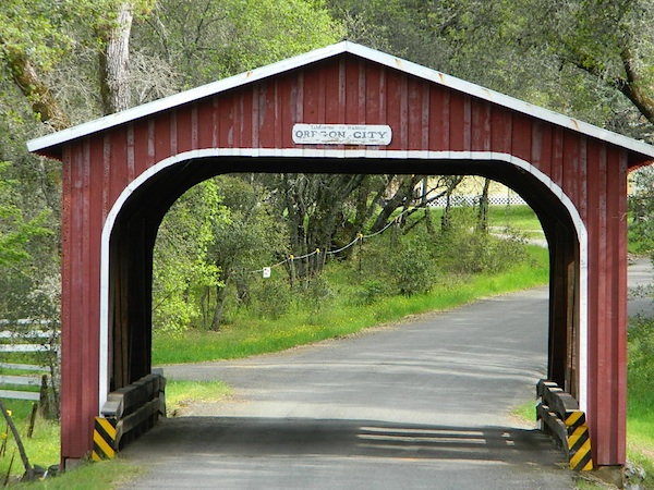
Oregon City Bridge
Oregon City Bridge, off Cherokee Rd, N Oroville, CA

Overland pioneers and miners flooded the Sierra Nevada mountains after 1848, when gold was discovered, transforming the natural landscape and native life of California – in horrendous ways. Industrius, eager and using the abundance of natural resources available to build homes, divert creeks, and construct a new way of life. Mining for precious metals was not a hobby, it was a ‘way of life’ for many who sought westward locales. Most traversed a continent on foot with covered wagons to get out here.

Many early bridges made of wood have disappeared in California. Historic places, such as these few wooden bridges of the West, need to be protected and preserved. So no carving your initials; spray paint (tagging), littering – nor bullet holes.

Felton Covered Bridge
Santa Cruz Mountains & Redwoods
Railway Train Rides
Felton, CA

Bridgeport Covered Bridge
(built in 1862)
South Fork of the Yuba River
Northern Gold Country Hwy 49
Nevada City & Downieville, CA

Honey Run Bridge
on Butte Creek @ Skyway
Historic Landmark from 1894
in between Chico & Paradise, CA

Knights Ferry BridgeState Park
State Historic Park

on Sacramento River
North of Sacramento, CA

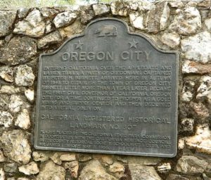
oregoncitymarker

Oregon City Bridge
(see photo at top of page)
Oregon Gulch, North Lake Oroville
via Table Mountain @ Cherokee Road
North of Oroville CA

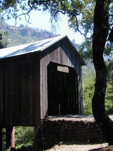
Oregon Covered Bridge
Middle Fork of the Yuba River
Northern Gold Country Hwy 49
in between Nevada City & Downieville, CA

Woodson Bridge SRAState Park
State Recreation Area

Woodson Bridge Campground Campgrounds
on Sacramento River, in betweenRV camping
Chico & Corning, CA

Honey Run Bridge
HoneyRun Bridge of Butte County, California

Volcanic Buttes of Chico
Volcanic Buttes of Chico California

Northern Sierra Nevada

Sierra Nevada North / Northern Sierra Nevada Mountains

lakes basin views

sierra buttes
the sierra buttes

Northern Gold Country, Yuba River

Sierra granite rock meets volcanic rock at Lakes Basin & Lassen NP

Some California maps consider Mount Lassen to be the top of the Sierra Nevada range, while other maps cut it off at Lakes Basin @ Sierra Buttes, much further south. Lassen Peak is actually part of the Cascade Range of mountains that go up the coast of the Pacific Northwest. Either way, we’ve included Lassen maps in this list.

Tahoe National Forest Map

South Yuba River Map

Lake Basin Recreation Area
Lake Basin Map
Sierra Buttes Map
Gold Lake, Graeagle, Sierra City

Plumas Eureka State Park
Plumas Eureka State Park Map
Middle Fork Feather River Map
Blairsden, Portola

View East from Davis
Crocker Mountain @ Lake Davis, California

Plumas National Forest
Plumas Forest Map
Almanor, Crescent Mills, Greenville, Inskip, Paradise, Quincy, Portola

Sierra Nevada

Lassen National Forest
Lassen Forest Map
Burney, Chester, Fall River Mills, Paynes Creek

lassen park

Lassen National Park
Lassen Park Maps
Mineral, Old Station, Westwood

laseen camps

Gold Country California

Gold Country Sierra Nevada

historic murphys hotel

1849:
California Gold Rush began

These foothill regions below are the rivers & mountains of the infamous California Gold Rush of the mid-1800’s. Many mountain dirt roads will lead to your secluded, private camp site, near a creek or river. Or plan on camping in a developed Campground near a recreation lake lined with amenities, pine trees & oaks. River rafting & kayaking can be found throughout this area, as well as backpacking, mountain biking and hiking trails. Fishing is very popular as well.

Waterfalls, back roads, granite features, historic mining camps, big fishing rivers all abound. Wilderness backpacking in the High Sierra can be accessed by Hwy 108 (Sonora Pass) Hwy 4 (Ebbetts Pass) Hwy 88 (Carson Pass), Sierra US Route Hwy 50 & Interstate 80. Numerous small towns populate Historic Highway 49 for every tourists need – meals, laundry, grocery, coffee, lodging & shopping.

waterfalls Sierra Nevada

Gold Country California forest & parks –

Hwy 4 Ebbetts Pass & Hwy 108 Sonora Pass

Stanislaus National Forest
Columbia State Park

Arnold, Columbia, Dardanelle, Jamestown, Long Barn, Mi-Wuk, Murphys, Pinecrest, Sonora, Strawberry, Twain Harte

Sierra Nevada

Hwy 4 Ebbetts Pass & Hwy 88 Carson Pass, US Hwy 50

El Dorado National Forest

Amador City, Bear Valley, Georgetown, Jackson, Kirkwood, Meyers, Placerville

Sierra Nevada

Interstate 80 Donner Pass

Tahoe National Forest

Alta, Colfax, Foresthill, Grass Valley, Norden, Sierraville, Soda Springs, Tahoe City, Tahoma, Truckee

Sierra Nevada

North Hwy 49 Yuba River

Malakoff Diggins State Park

Downieville, Nevada City

red brick alley

Oregon Hill Road

oregon hil lroad

Oregon Hill Road –
Sierra Nevada scenic drives

also known as Challenge Road, driving from the lake up

Oregon Peak & Little Oregon Creek
Bullards Bar & North Fork of the Yuba River

2800′ elevation

Oregon Hill Road connects the rural residential community of Challenge to the recreation lake called Bullards Bar Reservoir, which is bordering on the Tahoe National Forest and Plumas National Forest park boundaries.

This bumpy, little, back road route is kind of a “short cut” for those driving from Nevada City to Oroville, CA.

From the Sacramento Valley, N of Marysville, take Hwy 70 N to Honcut, exit freeway and find your way east to La Porte Rd. Take LaPorte Road past Brownsville and up to the next neighborhood called Challenge; Turn right at the small, one room post office in Challenge and continue 14 miles down to New Bullards Bar.

Or, if coming in to this lake from Gold Country Highway 49, take Moonshine Road or Marysville Road. Two developed campgrounds are located at the lake shore, on the east side. Boat in camping is most popular at Bullards Bar. The closed campground on the ridge (west side, above the lake) is called Burnt Bridge and has been non operational for years now, due to numerous wildfires.


View Larger Map

bullardsbarrecr

New Bullards Bar Reservoir is a prime water sports recreation and house-boating destination, nestled in between the Gold Country and the Sacramento Valley near Yuba City, CA.