Tag Archives: kings canyon

Sequoia National Forest Camping

Sequoia National Forest Campgrounds
Giant Sequoia National Monument

Sequoia National Forest Campgrounds
Sequoia NF Camping

Sequoia Campground Reservations – Giant Sequoia Campgrounds, Western Divide, Kern Canyon

areas include: Kernville, Kern River, Lake Isabella, Sherman’s Pass, Kennedy Meadows, Forks of the Kern, Western Divide Highway, Camp Nelson, Kings River, Hume Lake & Sequoia National Park
Sequoia Group CampgroundSequoia campgroundsListed below are all the Sequoia National Forest campgrounds, public lands for outdoor recreation. USFS
NFSlogo

Sequoia Campgrounds

campground elev spots veg toilet water notes
Alder Creek Campground 3900′ 13 alder vault creek W of Alta Sierra
Auxiliary Dam Campgr 2650′ dsp flush piped Lake Isabella
Belknap Campground 4800′ 15 pines vault piped April – Oct
Big Meadows Campground 7600′ 25 pines vault creek CLOSED
Boulder Gulch Camp 2650′ 78 oaks flush piped fishing Lake Isabella; RV max 45′
Breckenridge Campground 6600′ 8 pines vault no South of Kern River; no RVs
Buck Rock Campground 7600′ 5 pines vault no Kings Canyon NP
Camp 3 Campground 2800′ 52 oaks vault creek Kings River rafting; RV max 30′
Camp 4 Campground 1000′ 5 oaks vault creek no RVs, Kings River rafting
Camp 4 1/2 Cabin 1000′ 5 oaks vault creek no RVs, Kings River rafting
Camp 9 Camp Area RV 2600′ 109 none flush piped Lake Isabella
Cedar Creek Campground 4800′ 11 pines vault piped W Alta Sierra; no RVs; May-Oct
Coy Flat Campground 5000′ 20 pines vault piped May – Oct
Eshom Creek Campground 4800′ 23 pines vault piped CLOSED
Evans Flat Campground 6100′ 20 pines vault spring equestrian, pasture; RV 20′
Fairview Campground 3500′ 55 mixed vault river upper Kern River; RV 45′
Fish Creek Campground 7400′ 40 pines vault E of Sherman; RV max 27′
Frog Meadow Campground 7500′ 10 pines vault no Sugarloaf Ridge; June-Oct
Frog Guard Station Cabin 7500′ 10 pines vault no Sugarloaf Ridge; 2 nite min
Gold Ledge Campground 3200′ 37 mixed vault Kern River; RV max 30′
Green Cabin Flat Camp 1000′ dsp oaks Kings River; primitive
Hanning Flat Campground 2650′ dsp chem fishing Kern River
Headquarters Campground 2800′ 44 alder vault Kern River; RV max 27′
Hobo Campground 2300′ 35 oaks chem lower Kern River; RV 22′
Horse Camp 7600′ 5 pines vault equestrian campsites
Horse Meadow Campground 7400′ 41 pines vault Sherman’s Pass; RV 22′
Hospital Flat Campground 3000′ 40 alder vault Kern River; RV max 30′
Hume Lake Campground 5200′ 74 pines flush CLOSED
Hungry Gulch Campground 2700′ 78 oaks flush piped Lake Isabella; May-Oct
Kennedy Meadows Camp 6100′ 39 pines vault piped E of Shermans; RV max 30′
Landslide Campground 5800′ 9 pines vault creek CLOSED
Leavis Flat Campground 3000′ 9 pines vault piped California Hot Springs; RV 16′
Limestone Campground 3800′ 22 mixed vault creek Kern River rafting; RV 30′
Live Oak North Campground 2700′ 60 oaks flush piped Lake Isabella; RV max 30′
Live Oak South Campground 2700′ 90 oaks flush piped Lake Isabella; RV max 30′
Long Meadow Group Camp 6500′ 23 pines vault piped CLOSED
Lower Peppermint Campground 5300′ 17 pines vault piped CLOSED
Main Dam Campground 2500′ 82 oaks vault piped Lake Isabella; RV max 45′
Mill Flat Campground 1100′ 5 pines vault creek Kings River rafting; no trailers
Panorama Campground 7400′ 10 pines vault no Sugarloaf Ridge; June-Sept
Paradise Cove Campground 2600′ 138 oaks flush piped Lake Isabella; RV max 30′
Peppermint Dispersed 7100′ 19 vault creek CLOSED
Pioneer Point Campground 2650′ 78 oaks flush piped Lake Isabella; RV max 30′
Princess Campground 5900′ 90 pines vault CLOSED
Quaking Aspen Campgr 7000′ 32 aspen vault creek CLOSED
Redwood Meadow Campgr 6100′ 15 pines vault piped CLOSED
Sandy Flat Campground 2300′ 35 oaks vault Lower Kern River
South Fork Recreation 2650 dsp flush piped some walk-in camp sites
Stine Cove Campground 2650′ dsp oaks vault Lake Isabella
Stoney Creek Campgr 6400′ 49 pines flush piped CLOSED
Tenmile Campground 5800′ 13 pines vault piped CLOSED
Tillie Creek Campground 2650′ 159 oaks flush piped fishing; RV max 45′
Troy Meadow Campground 7800′ 73 pines vault OHV; E Sherman’s; RV 20′
Upper Stony Creek Camp 6400′ 19 pines vault piped Sequoia NP; May-Oct
White River Campground 4000′ 12 oaks vault piped Sugarloaf; May-Oct; RV 16′
Wishon Campground 4000′ 31 oaks vault piped open all year
Hume Lake Camping
Hume Lake, California
Western Divide Wishon Campground
Wishon Campground on the Western Divide

Giant Sequoia Campground

Sequoia Camping & Kernville Vacations, see also –

Topo maps, wilderness hiking maps
Equestrian trails, OHV maps –

Sequoia National Forest Campgrounds

Recent Wildfires:

Castle Fire + Shotgun Fire:
SQF Complex Fire 2020

Colony Fire + Paradise Fire:
KNP Complex Fire 2021

Giant Sequoia Fires
Windy Fire 2021

Sequoia National Forest Campgrounds

Sequoia mountain communities include:

14S11 – Sequoia NF

trails to meadow

Big Meadows Road: Sequoia Forest Rd# 14S11

SEPT 2021: Closed due to the KNP Complex Fire

GIANT SEQUOIA: in between Sequoia & Kings Canyon, inside Sequoia NF

Sequoia Meadows

This chunk of National Forest land is perfectly located in between 2 very popular National Parks – Kings Canyon and Sequoia. This primary paved road leads to some great camping, a perfect option for NOT camping inside the crowed National Parks.

Turn east off of Sequoia ‘Generals Highway’ 198, on to the well signed Big Meadow Rd. There is primitive camping all over this area & a few developed campgrounds along this route. Motorhomes be warned: the road narrows to one lane with no “turn outs” or U turn spots for the last 10 miles (on a steep cliff w/ large overhanging rocks)

SEE CAMPING PHOTOS

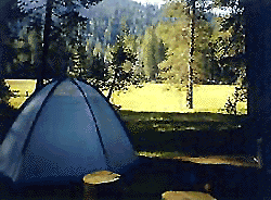
campIn the first few miles, the dispersed camp sites on the right side have great views & some situated on fairly flat granite slabs, perfect for astronomer campers or adventurous RVs. To the left side of the road is more primitive style campsites in wooded areas. The whole area is also a very popular cross country ski & snowmobiling spot for winter recreation. Hunters also like these camps during hunting season (in September).

horseback

There is a developed Horse Camp on the left side of the road for equestrian campers. This camp is located across from the biggest meadow and may be the first place you notice on this drive.


Buck Rock Campground
(7600′ elevation, 5 spots) & Big Meadows Campground (7600′ elevation, 25 spots) are both family style camps, perfect for those who want picnic tables, plus bathroom nearby. Sorry no flush toilets out here, only pit toilets.


Sequoia maps

Buck Rock Fire Lookout Tower @ 8500′ elevation – is located to the north on Forest Rd # 14S02. It’s a great spot for some impressive views – if you aren’t afraid of heights. To reach the tower you must climb several flights of steel steps. This place is worth a stop if planning a sightseeing day.

Big Meadows Guard Station @ 7500′ elevation (also known as Big Meadows Cabin), is located next to the BIG MEADOW and is available for rent on a weekend basis from the NFS. Hiking Jennie Lakes Wilderness and fly fishing Big Meadows Creek are favorite activities to be enjoyed.

Big Meadows Road is long & narrow – 12+ miles. RVs are not recommended beyond the Big Meadow Campground, as the road is one lane in some spots & it skirts a cliff edge. The views are incredible the farther you go & many creeks feed the region.

The narrow, long paved road eventually forks off into several smaller dirt roads back near Horse Corral Meadow. Way back here, the dirt roads lead out to trail heads for backpacking, horse packing or day hiking in Jennie Lakes & Monarch Wilderness. Backcountry access to either Sequoia or Kings Canyon National Park! Have a good map if you plan to venture out this far. Pay attention & don’t get lost.

GPS would be helpful in this area. Some of the smaller of the dirt roads are not even on the NFS maps. Make sure to GPS way-point your favorite camp site, so you can find in next time…. in the dark.

Sequoia National Forest

Sequoia National Forest MAP

nearby services:

Sequoia Groves

see all – Big Meadows in California 

Marvin Pass Trailhead

Mountain Biking Sequoia

Bald Mountain Lookout

Mountain Biking Kern & Biking Camps in Sequoia

Mountain biking has become a popular sport especially in California. We’ve got so much great terrain, so close to home (the urban sprawl), that this outdoor hobby is bound to get you back in shape, fast. Start slow to avoid burnout and injury. The weather is awesome, just go. Plan a camping weekend & bring your bike!

Remington

KERN RIVER AREA

Parks & Forests in Sequoia region of the Sierra Nevada –

Big Meadow Kern

SEQUOIA PARK BIKING

Obvious (but humorous) information on bike riding or mountain biking in Sequoia NP. Upon doing research for this page, noticed a heck of a lotta folks typing in the phrase

Sequoia National Park Bike Trail

I laugh…. but plenty people are searching for bike trails near Sequoia groves, inside the most protected of lands, the National Parks.

NPSFirstly, most National Parks in California do not allow bikes on hiking trails. The Sierra Nevada has NO National Parks that allow mountain biking on their trails. (official words are: Biking is allowed on the main roads in the parks but is prohibited on park trails.)

Yuk. Who wants to ride on asphalt in the wild?

Yosemite & Lake Almanor both have nice paved bike paths. But you may want dirt trails for biking. Be it mellow mountain biking on forest roads, or the hard core Downie-droppers.

California Wilderness Areas are the same rules, but even tighter. So that brings us to Sequoia National Forest. Yes, indeed California National Forests allow mountain bikes on most trails, in most cases. The popular trails might even get small brown signs showing bikes that are allowed.

Second, there are no bike rentals inside Sequoia National Park (or Kings), so you must bring yours in, or better yet ride in. I dare you. Although you cannot take said bike on a dirt trail, so you’ll need to stick to pavement only. The main highway (Hwy 198) has got to be one of the curviest, narrow, fern lined ridge routes of the region. You would be a fool to ride this area, as a senior citizen w/ a 40 foot motorhome or a speeding SUV may take you out on a curve. Seriously! You better be in great shape if you plan to descend into Kings Cyn. That route is just as dangerous if not more so. These 2 National Parks – Sequoia & kings, both get a lotta traffic. Year round.

Thirdly – here is the biggest tip of the whole topic. In between Kings Canyon & Sequoia National Parks is a slice of Sequoia National Forest land. (Meaning you can ride bikes or mountain bikes here) Most call it Big Meadows Road # 14S11 & there is plenty camping all down this road – 12 miles with spur roads in every direction. A nice chunk of forest with rocks, meadows, camps & dirt roads. Granite & great scenery. What more could you ask for? More forest roads than single track trails tho and please watch for equestrian traffic. The dead end of this road leads out to 2 Wilderness areas, so be prepared to navigate with a good map in hand. No bikes are allowed in the Wilderness, remember?

Maps for biking in the Sequoia –

For Sequoia/Redwood Parks with less people and more open biking trails, try these –

Wanna see some great riders & bikes in action?
California Mountain Bike Races

Bear Meadow
Camp Site at Bear Meadow, Sequoia National Forest  

Central Sierra Nevada Mountains

Small Camping Lake
Kirkwood Lake Campground

Central Sierra Nevada: Sequoia to Donner

Although Sequoia trees can be found in the southern Sierra, the National Park is located more in the mid-Sierra. From the Kern River to Kings River,  the southern stretch of Sierra Nevada is home to the southern most Sequoia groves, the longest river in California, and the granite dome wonderlands that overlook the Mojave Desert.

The Tehachapi range is on the tail end to the south w/ Hwy 58, while Kings Canyon Park borders more High Sierra Wilderness to the north end. If you are heading up from SoCal, this is the most accessible portion of the Sierra Nevada range.

While the Kern River Valley can get hot in the summer months, the rivers, streams & higher elevations surrounding it, make it a prime destination for folks seeking cooler mountain breezes, creeks and dark skies. Springtime is one of the best times of year to visit the Kern River. While summer is best for the high wilderness areas, since the snow usually doesn’t melt until May.

Mountain Home State Forest is a little known haven for campers & hikers seeking less-crowded Sequoia groves. With the Tule River, fishing ponds, waterfalls, swimming holes & meadows, this place provides a nice solitude to the busier parks to the north. Balch Park is a county park w/ large campground, that sits adjacent to Mountain Home Forest.

Both National Parks (Seqouia & Kings) are both busy in summer & tourists can be seen lining the main road, Highway 198. Crystal Cave & Boyden Cavern both offer daily tours during the warmer months. Sequoia National Park is open during winter months & is popular among winter sports enthusiasts. Kings Canyon National Park & Hwy 180 are also open during winter, with winter sports recreation.

Big Meadows Road (14S11) offers great camping options for those that wish to camp outside the National Park boundaries.

Sequoia groves

Sequoia forest & parks –

Sequoia National Forest
Mountain Home State Forest
Sequoia National Park
Kings Canyon National Park

Sequoia maps & trails –

Sequoia towns nearby –
Alta Sierra, Camp Nelson, Fairview, Kennedy Meadows, Kernville, Lake Isabella, Mineral King, Ponderosa, Springville, Three Rivers, Wofford Heights

Sierra Nevada

Central Sierra Nevada forest & parks –


Sierra National Forest

Yosemite National Park

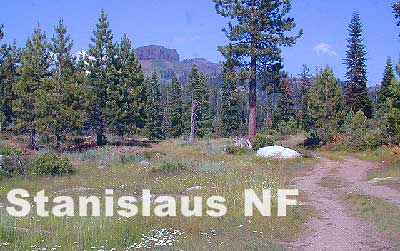
Stanislaus National Forest

Eldorado National Forest

Tahoe National Forest

Sierra Nevada

Central Sierra Highways –

Central Sierra Nevada maps & trails –

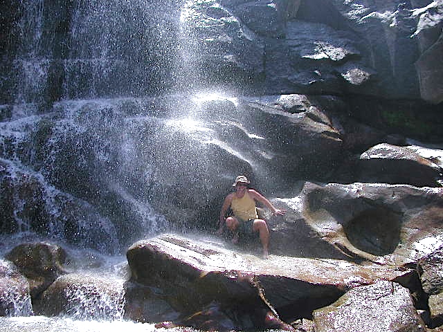
Rancheria Falls
Rancheria Falls, Huntington Lake, CA

Central Sierra Nevada towns nearby –
Bass Lake, Fish Camp, Huntington Lake, Pine Flat Reservoir, Shaver Lake

stanislaus sonora pass

Gold Country California

is located in the western foothills of the Central Sierra Mountains

Historic Highway 49 is the Gold Country Hwy, which begins down near Yosemite and leads north, thru the foothills, up to Sierra Buttes & ends out near Loyalton, CAgold miner

Redwood Hotels

Sierra Lodges, Sequoia Cabins & California Redwood Inns

alta sierra

Rent a cabin in the redwood forest of the north coast of California, or get a weekend retreat in the Sequoia, deep in the Sierra Nevada. Redwood inns, cottages & yurts can be found in the Central Coast region. Big Sur redwoods & Santa Cruz redwoods. Rustic hostels, historic Sierra lodges, or mountain cabins can be found in the Sierras, from Alta Sierra near Kernville, to Yosemite National Park.

Places to stay overnight in the Redwoods, or close by –

If you seek big lodges made from redwood timbers, those are the historic inns, located all over California. Redwood was harvested in California since 1850, right after gold was discovered and the masses flooded in. State officials have limited harvesting of ancient redwoods in Northern California in 1988. Logging and agricultural farms have already wiped out 96% of redwood forest that once covered California.

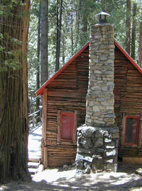
Sequoia Cabins

Sierra Cabins near Sequoia Groves

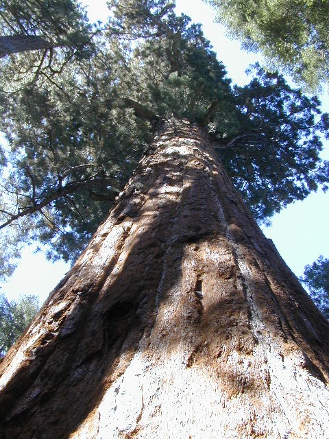
Sequoia trees naturally grow in the Sierra Nevada mountains, on the west side of the range. Several parks & forests make up what is known as “the Sequoias” – in the Southern Sierra, Sequoia National Forest; Giant Sequoia National Monument; Mountain Home State Forest; Central Sierra is home to Sequoia National Park & neighboring Kings Canyon NP; Sierra National Forest & Yosemite NP. Yep, all those areas have Sequoia groves!

See all the Sequoia & Redwood Groves in California!

California Cabin Rentals near to Sequoia groves –

Sequoia cabin rentals

TOPO MAPS of California Redwoods –

  • Sequoia Maps by NatGeo
  • Yosemite NP Maps
  • NorCal Redwoods Map
  • If you are searching for tallest species, the Coastal Redwoods located on the shores of Northern California, then you can find them over here – NorCal Redwoods

    Jennie Lakes Wilderness

    horse meadow trails

    Sequoia / Kings Canyon / Mitchell Peak

    outta print

    USDA MAP may be out of print 2017

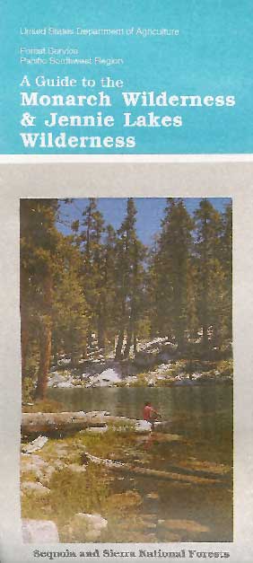
    Jennie Lakes Wilderness is located in between two popular National Parks, via the paved back roads off Sequoia Generals Highway 198. Monarch Wilderness is north of Jennie Lakes, bordering Kings Canyon.

    10,500 acres
    26 miles of trail

    Two lakes, Jennie Ellis Lake and Weaver Lake, set among granite outcroppings. Majority of the wWilderness is above 7,000 feet w/ red fir, lodgepole pine, and western white pine forest near treeline; abundance of spring wildflowers fill meadows. The two main lakes and Rowell Meadow are primary destinations for most backpackers wanting to camp overnight.


    Sequoia National Park

    Kings Canyon National Park

    Monarch Wilderness

    Impressive granite canyons, super steep. LOts of rugged rocky terrain, lower elevation to peaks of 11,000′. KINGS RIVER – Longest raging river in the Sierra, headwaters originating near Mount Whitney.

    Road#14S11 – Big Meadows Road

    National Forest & Wilderness Permits –

    USDA Sequoia NF

    More Wilderness Info & Links –

    sierrawild.gov/wilderness/jennie-lakes
    summitpost.org/jennie-lakes
    Jennie Lakes Wilderness Wiki

    Marvin Pass trailhead
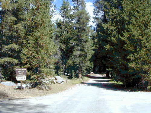
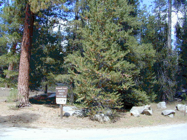
    Marvin Pass trailhead, 12 miles down Rd#14S11

    Another Big Meadows?
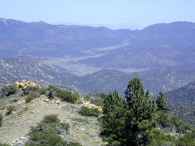
    Indeed, southern SEQ NF, on the East Kern Plateau.