Tag Archives: fishing lakes

Silver Lake @ June

June Lake Loop

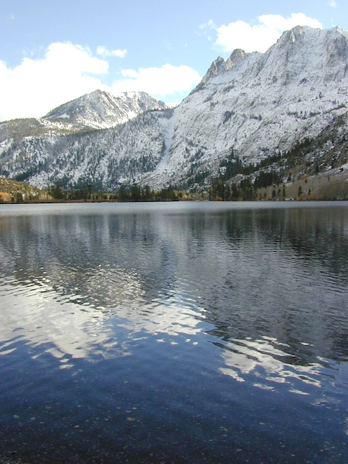
Silver Lake @ June Lake Loop

(Mono Co)

7700′ elev. Hwy 158, Backside of June Lake Loop, north of Mammoth.

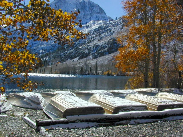
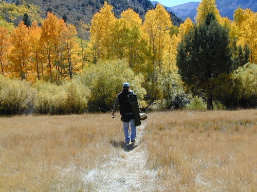
Prime hiking and fishing destination of the Eastern Sierra, California. With impressive Carson Peak (10,909′) towering as a granite backdrop for the lake, every day out here is super scenic. Unless, of course, blizzard white-out conditions occur – which is possible during winter.

fish
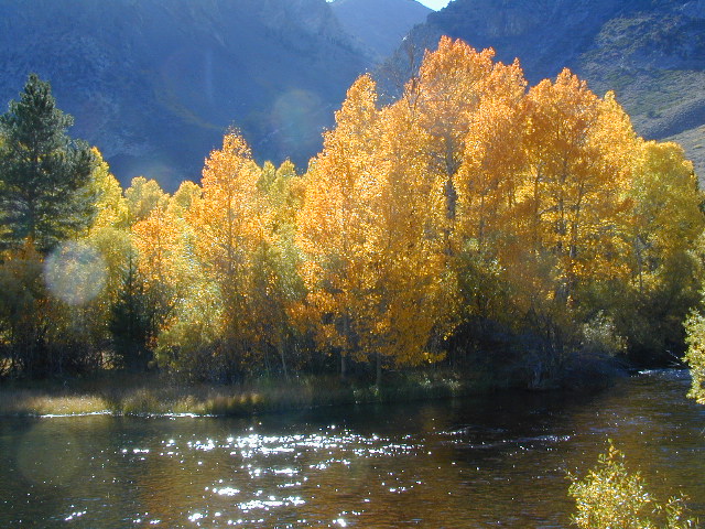
October-November, Autumn colors – at this particular location – tend to be fantastic, with aspen groves encompassing the lake, nearby streams and steep canyons.

fish: Reverse Creek, Rush Creek, Silver Lake, Grant Lake, Gem Lake, Gull Lake, June Lake

golden glow june

Winter weather & deep snow can close the paved highway loop, so know road conditions and weather forecast before you go. This beautiful Silver Lake is within walking distance of two lodges – Whispering Pines & Double Eagle Resort, so if rain or snow is predicted make your reservations.

  • aspen groves
  • autumn colors
  • backpacking
  • camping
  • canoeing
  • fishing lake
  • hiking trails
  • horseback trails
  • kayaking
  • mountaineering
  • picnic grounds
  • RV camp

Rental Boats

Ansel Adams Wildernesshiker
Inyo National Forest
June Lake, CA

This gorgeous, 80 acre alpine lake is a popular campground for fishing, picnicking, hiking, summer and autumn camping. Accommodates tent camping and RVs. Boat ramp, grocery store, coin-op laundry – all nearby. Camp closes for snow annually.

Silver Lake Campground NFS campground

• Elevation: 7600′
• Number of Sites: 28
• Vehicle Accessibility: RV 20′
• Campsites Reservation: Yes
• Camp Fee: Yes
• Toilets: Flush
• Water: Piped/Potable
• Length of Stay: 14 Days
• Season: April – October

NFS
Inyo National Forest
Mono Lake Ranger Station
North US Hwy 395
Lee Vining, CA 93541
760-647-3044

lets go fishing

stars

See all Silver Lakes in California

Faucherie Lake

Faucherie Kayak Camp

Faucherie Lake California

Lake Faucherie is set in spectacular scenery of granite mountains, with peaks and waterfalls all around. Many believe that you could only reach this kinda high elevation beauty by foot, with a backpack, but here it is – accessible by a very long, rough & rocky backroad.

No motorhomes, no camper trailers, no motorboats, no engine noises on the lake, no big families. Just well-deserved solitude, finally. Peace and quiet!

Perfect alpine lake for car-top boaters – those who carry their boats on top of a vehicle. But be warned very few ‘passenger cars’ make it back this far, due to the challenging roads.

BACKPACKING, CAMPING, CANOEING, FISHING, FLOATING, HIKING, KAYAKING, OFF-ROADING, SOAKING, STARGAZING, SWIMMING

No motorized boats or watercraft allowed. One public boat ramp; gravel parking area, vault toilets, gated entry for group campground. No more driving across dam (it is now gated).

NFS NFS NFS kayak camp hiking mountains NFS backroads snowmelt stars

Faucherie Lake Road – a spur road, off of the ‘843 Road’ leads up to both Sawmill & Faucherie Lakes, as well as the Canyon Creek Campground.

This primitive road forks off at Jackson Creek Campground, Tahoe NF, way, way back behind Bowman Lake. The rugged route is also known as Nevada County Rd #843-037. Conflicting numbers appear on USDA web site for this route, so don’t get confused.

The brown Forest Service signage is decent at Jackson Creek Campground – so if you get that far, you’re almost there. Sorta. Did I mention how crazy the road is? Any wet weather or snow will make this route “4×4 required”. This place is closed off about half the year, due to deep snow (NOV-MAY). Although on summer weekends, this area is busy for a remote high Sierra lakes region.

To reach this rugged Canyon Creek takes hours of driving with a good backcountry map and a reliable, high clearance rig. AWD Subies and mini SUVs beware, you’ll need a spotter on the bad sections of this road (or risk serious oil pan damage). Or perhaps maybe, we “shouldn’t be back on these kinda roads in that ‘lil sportwagon’ missy.”

See more details on driving directions for Canyon Creek Campground.

Crystal Clear Faucherie

Faucherie Lake Group Campground
(25 people maximum per site)

• Elevation: 6135′
• Number of Sites: 2
• Vehicle Access: High Clearance Vehicle, no trailers
• Campsites Reservation: Yes
• Camp Fee: Yes
• Season: June – October
• Trailheads: Faucherie Lake Falls, Five Lakes Basin, French Lake, Haystack Mountain

camp
Faucherie Group Camping

Campground Reservations:
Nevada Irrigation District
530-265-5302

incoming flow

Faucherie Falls – Six waterfalls above lake:
Upper Faucherie Lake Falls #1: 39.4257 N, 120.5616 W
Upper Faucherie Lake Falls #2: 39.4257 N, 120.5606 W
Upper Faucherie Lake Falls #3: 39.4262 N, 120.5568 W
Upper Faucherie Lake Falls #4: 39.4268 N, 120.5550 W
Upper Faucherie Lake Falls #5: 39.4270 N, 120.5544 W
Upper Faucherie Lake Falls #6: 39.4272 N, 120.5538 W
USGS Topo: English Mountain

Granite Faucherie