Mammoth Lakes area has several festivals throughout the year; a few ski and snowboard competitions, as well as mountain bike races. Mammoth is the outdoor recreation hub of the Eastern Sierra.
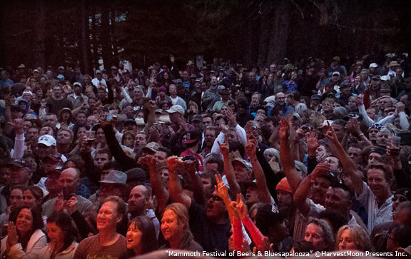
This summer mountain festival revolves around beer and live music, in the best spot to be in California’s 100+ degree hot weather – at 7000′ elevation, in the cool, pine forest (with refreshing lakes nearby).
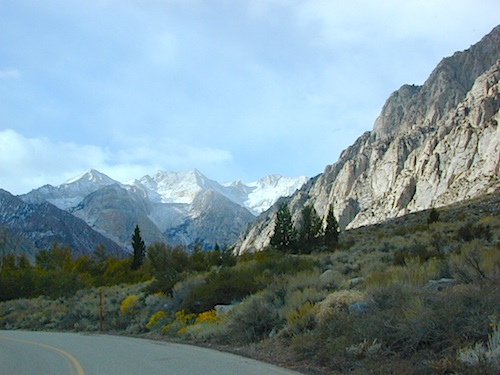
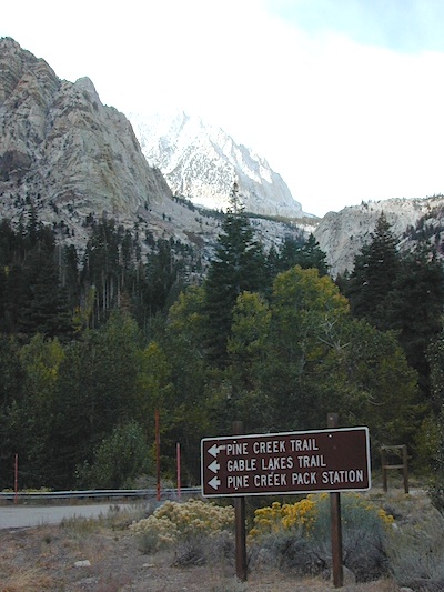
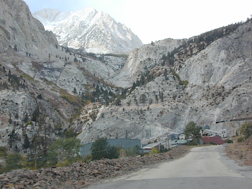
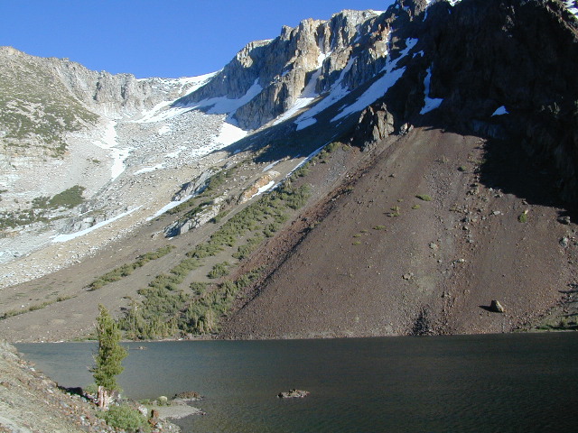
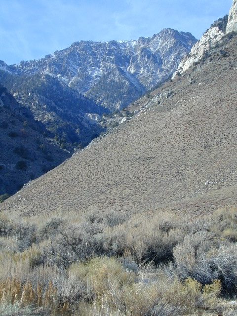
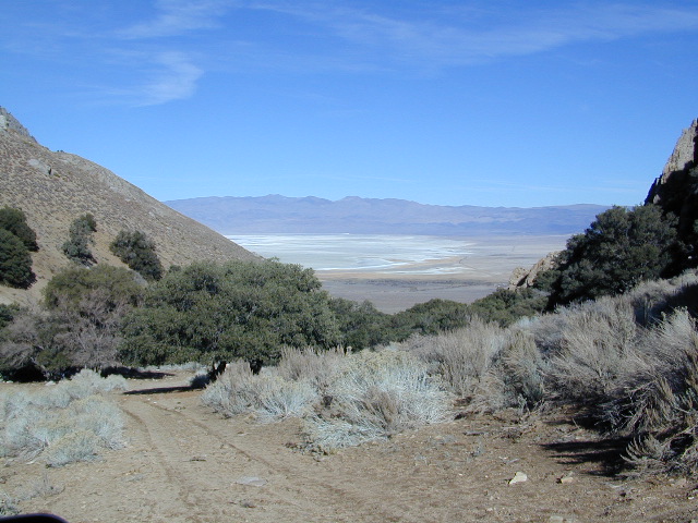
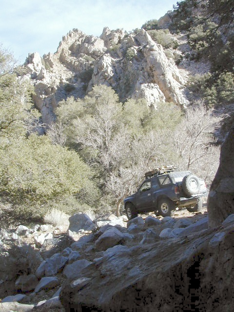
Paved route that dead ends at a huge, old tungsten mill. Impressive peaks and slopes, steep granite; spires and beehive shaped mountains. This region has a very ALPS FEELING, with an “Italy Pass” high above on the wilderness ridge lines.
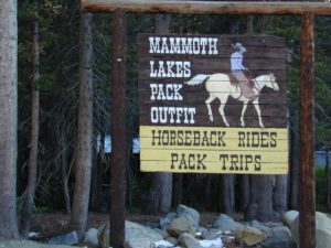
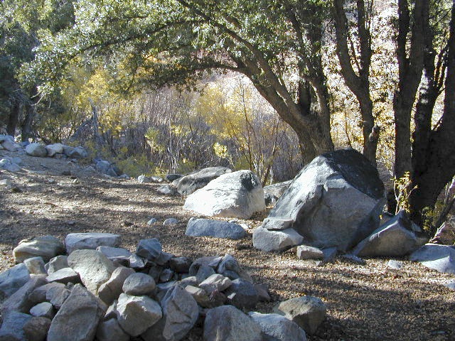
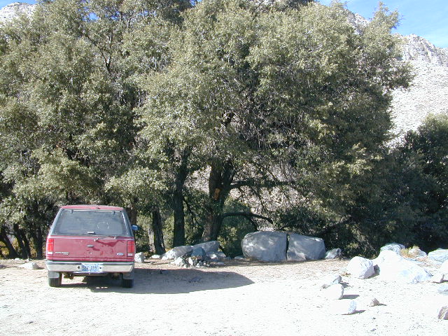
Pine Creek Road has minimal camping and maybe a half day worth of sightseeing (at most). A few creekside camp spots, only rock dirt road access. Campfire permits required. No facilities. No developed campgrounds. Hiking trails, wilderness access and a horse pack outfitter.
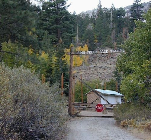
PINE CREEK PACK STATION
85 Pine Creek Road
Bishop, CA 93514
760-387-2797
NO developed NFS Campground exist up here, so don’t think about bringing that motorhome up this steep incline.
Mount Tom (elev 13,652′)
Gable Lakes
Pine Lake (9942′)
Bear Creek Spire (13,713′)
Spire Lake
Scheelite Canyon
Lower Morgan Lake (10,708′)
Round Valley Peak (11,943′) Round Valley
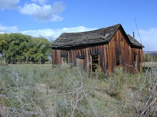
Rovana, CA
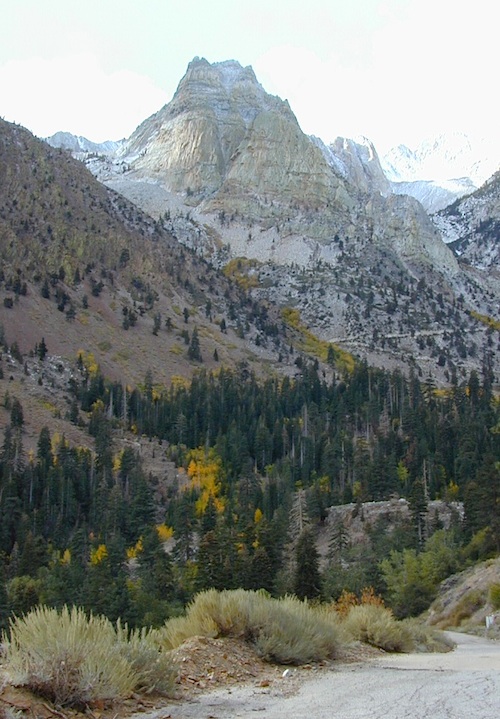
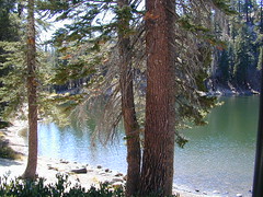
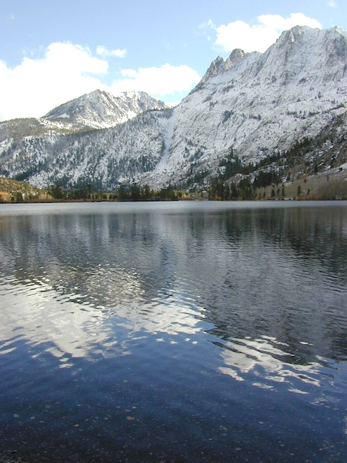
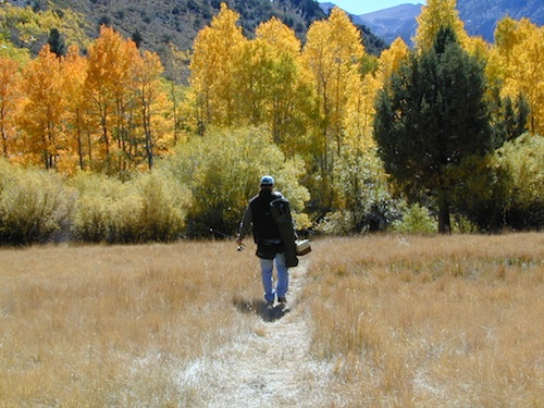
Sure splendor for fishing, most of the time. Lake fishing, stream fishing, river fishing. Fishing the Eastern Sierra area, near Mammoth Lakes, California can be very rewarding. You may have read about places like these in the sports magazines, seen them on a television program, or imagined them in a fishing vacation day dream. Summers can be crowded, so pick a lake and camp carefully. Weather can change quickly, so come prepared. Autumn fishing w/ the golden aspens and less crowds is preferred.
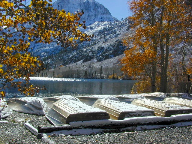
Most of these Eastern Sierra lakes listed below are accessible by car, others by foot. Look at the photos, pick a destination and get a good map of the area, so you can explore everything around too.
Inyo National Forest @ Yosemite East
Tioga Pass Hwy 120
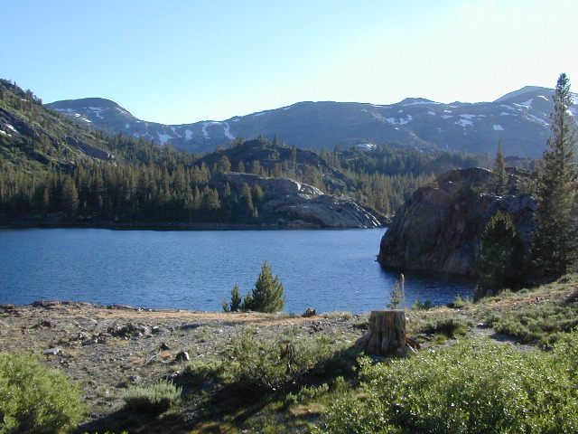
This spectacular setting has a top-of-the-world feeling to it. Gorgeous meadow area, right along the main highway, with a small lake next to giant rock slides and impressive granite mountains.
The air is thin, the sky is clearest blue, the snow is melting, the stream is trickling and the nights are chilly – even in summer. Bring a winter coat and extra blankets, if you plan to camp.
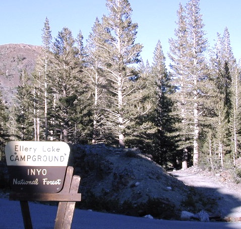
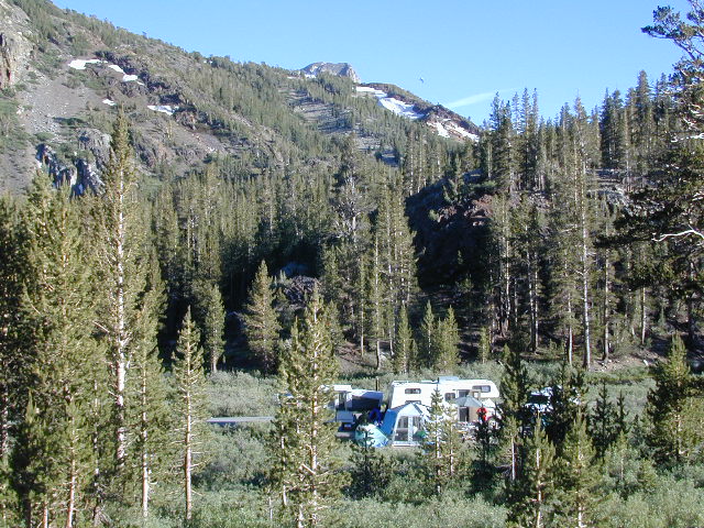
Ellery is small campground is located just outside the EAST GATE of Yosemite National Park, along Highway 120 Tioga Pass. Easily accessible and fully paved, this camp is only open half the year due to deep snowpack. The snow usually melts by June, and camp often closes early due to higher elevation weather, sometime in October or November.
Lee Vining Canyon is to the east and Mount Dana is to the west.
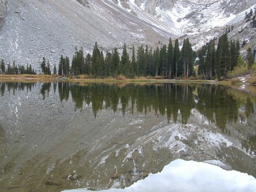
Ellery Lake is one of those magical places, where you can spend all day out in nature – without needing to drive anywhere. Gorgeous high country scenery surrounds you in every direction. Walk over to nearby meadows, creeks or neighboring lakes. Climb mountain peaks or enjoy extended day hikes. Watch wildlife from camp or fish in the lake. Stargaze at night w/ the darkest skies around.
Or how about, walk to dinner? This place is easy walking distance to the historic Tioga Pass Resort, where you can enjoy a real, sit-down meal at the cafe. (Hope they will re-open 2020)
Ellery Lake – camp, hike, fish or kayak. No motor boats allowed.
Travelers heading to or from the National Park, often stop at Ellery to take photos and walk around. There is always a flurry of activity around easily accessible lakes and this one is no different. The busy highway and constant traffic may be heard from camp, but the ideal location and epic lake makes up for the inconvenience.
This NFS campground is one of many small camps located along the highway, on the east side of Yosemite National Park. This special place is in high demand, can fill up fast and is quite busy most of the summer.
perfect for tent campers
Small parking areas, tight walkways, landscape and minimal campsites makes this a “no-turn-around” kinda campground, so don’t bring that huge RV (cuz it won’t fit).
Most sites do not have enough room to park a second vehicle at all. Each campsite has a locker for food storage. (bear country = store food properly)
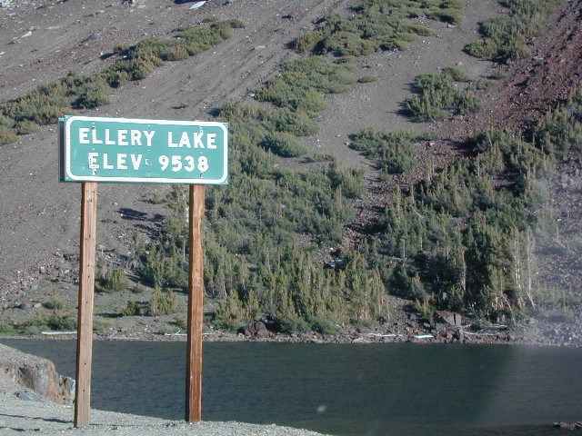
Ellery Lake Campground
• Elevation: 9,538′
• Number of Sites: 12
• Camping Reservations: No
• Sites Available: First come, First serve
• Vehicle Accessibility: Vehicle limit 28 ft.
• Length of Stay: 14 Days
• Water: Potable water
• Toilet: Vault
• Season: Closed during winter & spring
• Fee: Yes
• Operated By: National Forest Service
• Closest Town: Lee Vining, CA
7700′ elev. Hwy 158, Backside of June Lake Loop, north of Mammoth.
Prime hiking and fishing destination of the Eastern Sierra, California. With impressive Carson Peak (10,909′) towering as a granite backdrop for the lake, every day out here is super scenic. Unless, of course, blizzard white-out conditions occur – which is possible during winter.
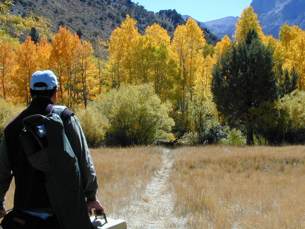
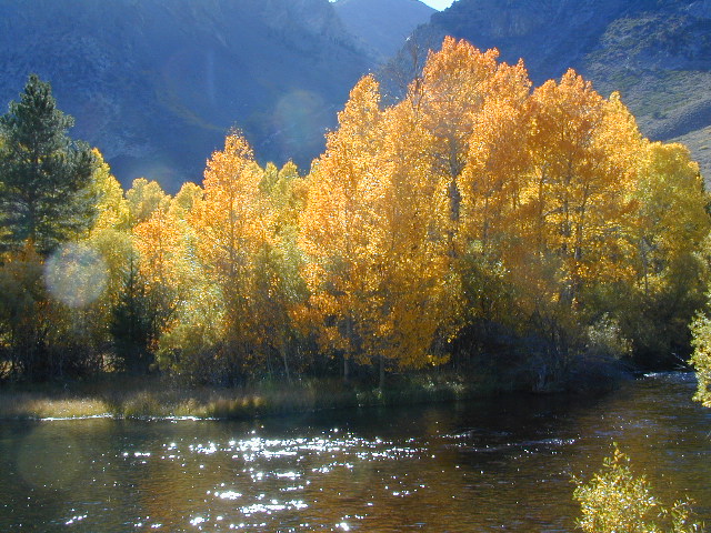
October-November, Autumn colors – at this particular location – tend to be fantastic, with aspen groves encompassing the lake, nearby streams and steep canyons.
fish: Reverse Creek, Rush Creek, Silver Lake, Grant Lake, Gem Lake, Gull Lake, June Lake
Winter weather & deep snow can close the paved highway loop, so know road conditions and weather forecast before you go. This beautiful Silver Lake is within walking distance of two lodges – Whispering Pines & Double Eagle Resort, so if rain or snow is predicted make your reservations.
This gorgeous, 80 acre alpine lake is a popular campground for fishing, picnicking, hiking, summer and autumn camping. Accommodates tent camping and RVs. Boat ramp, grocery store, coin-op laundry – all nearby. Camp closes for snow annually.
Silver Lake Campground NFS
• Elevation: 7600′
• Number of Sites: 28
• Vehicle Accessibility: RV 20′
• Campsites Reservation: Yes
• Camp Fee: Yes
• Toilets: Flush
• Water: Piped/Potable
• Length of Stay: 14 Days
• Season: April – October
Inyo National Forest
Mono Lake Ranger Station
North US Hwy 395
Lee Vining, CA 93541
760-647-3044
Rock Creek is a top destination for Autumn Colors in OCTOBER
NFS Campgrounds on Rock Creek Road listed below:
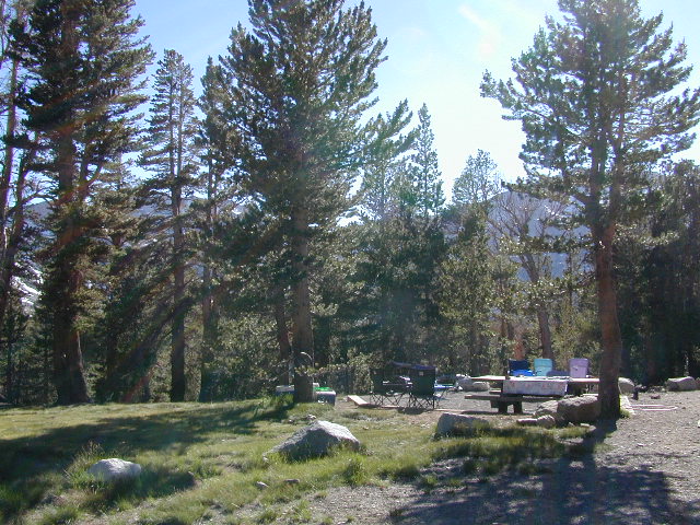
12 NFS Campgrounds are located around Eastern Sierra Rock Creek Canyon. Elevations range from 7000′ at the highway, to over 10,000′ at a trailhead parking lot at the road’s end. Most of these developed campgrounds listed are only open a few months outta the year, due to winter snow closures (NOV-APRIL). On occasion, snow can still be on the roads until MAY.
Mosquito Flat Walk-In Campground (trailhead camp) Some maps may have this one listed as Little Lakes Campground, but that is just the official trailhead name.
Backpackers and horseback riders frequent this Eastern Sierra canyon a lot of the year. Many high country trails lead out to Sierra peaks, alpine lakes and sheer wilderness. Download PDF Map of this canyons hiking trails.
Rock Creek Loop Road – Dinkey
Sierra Forest Road #9S09, off of paved Dinkey Creek Road. Excellent primitive camping along creek; 4×4 trailheads, as well as hiking & horseback trails. Small RVs okay. Dispersed camp sites, no facilities. Fire permits are required. Near Shaver Lake, CA inside the Sierra National Forest
Similarly named –
ROCK LAKE is located inside Lakes Basin Recreation Area, northern Gold Country @ Yuba River headwaters. Hike-in access only.
And if you want some Central Coast wheelin – 4×4 camping and trails, see the ROCK FRONT RANCH on California Hwy 166, on the way to New Cuyama, CA
Lower Rock Creek Road, off US hwy 395
We will continue to add any more Rock Creeks to this page (as we find and photograph them). Stay tuned for more of the very best camping in California.
Desert ghost towns to Sierra meadows & waterfalls, Inyo National Forest offers plenty of diversity for scenery. To list all the hikes in the Eastern Sierra would be obsurd, cuz there are so many trails. This side of the Sierra Nevada is all about hiking, fishing & camping.
No matter where you hike you will probably get a great view over the Owens Valley, Long Valley Caldera or Mono Lake. So that means most of those trails are hiking up a canyon, or a ridge line. Thousands of trails over this region require a good map to make the best decision for your hiking interest.
US HWY 395: The Eastern Sierra is one of the premier hiking destinations of California. Featuring the granite crags of the HIgh Sierra peaks. Mount Whitney, the tallest peak is closest to Lone Pine. Southern Californians love Eastern Sierra destinations, cuz they can avoid Los Angeles Basin and stay outta traffic.
Lone Pine Lake – Whitney Portal is a great, but crowded place for hiking. DO NOT ATTEMPT to hike to Mount Whitney in one day! Leave it to the seasoned pros. The first good stop up the Whitney Trail is gorgeous Lone Pine Lake, a great moderate day hike from there.
Alabama Hills – just below Mt. Whitney and has a totally different landscape than the backdrop granite Sierras behind. Try some boulder hopping & explore the dirt roads. Bring your mountain bike too.
Cottonwood Lakes (Pacific Crest Trail) – day hikes to alpine lakes. US 395 @ Lone Pine, W on Whitney Portal Rd. Left on Horseshoe Meadow Rd & continue up 19 mi. to the Horseshoe Meadow campground. Mostly a trail head camp, way, way up there. Open May – November
Kearsarge Pass – from 9000′ Onion Valley you can access the incredible High Sierra & numerous alpine lakes. The elevation gain makes this a full days hike; rated strenuous. Or continue on w/ backpack into Kings Canyon National Park.
Just south of Olancha, off US Hwy 395 is a dirt road that takes you 5 miles up to an oak canyon lined with rocks. There are several primitive camp sites along the Walker Creek. A high clearance vehicle may be needed in some sections, but 4×4 is not required. Small RVs might attempt this, but if the first mile frightens you, turn around while you’re ahead.
This private, shaded, creek area is perfect for those traveling Highway 395, looking for a quick and free camp spot near Olancha, CA
Shady picnic or camp spots above 4000′ elevation.
Hiking trails at the end of the road lead deep into the mountains. One on the right takes you to waterfalls. The trail on the left will take you to meet up with the Sage Flat Trail, which leads up to Olancha Pass, Summit Meadows & a small lake, in the South Sierra Wilderness. The Pacific Crest Trail runs the ridges here, just west of Monache Meadows, which is at 8000′ elevation, way above here – up on top.
US 395 highway – the dirt road turn off is very close to a gas station, and it maybe be signed, or not. The gas stop may be in business, or perhaps not. This is rural California, wide open desert and things come and go quickly.
On a good topo map, located Olancha Creek and Summit Creek to the south. Walker Creek is the canyon in between those two, just so know where you are going and can visualize. This one is an easy-to-miss dirt road turn off – especially if you are going over 50 mph.
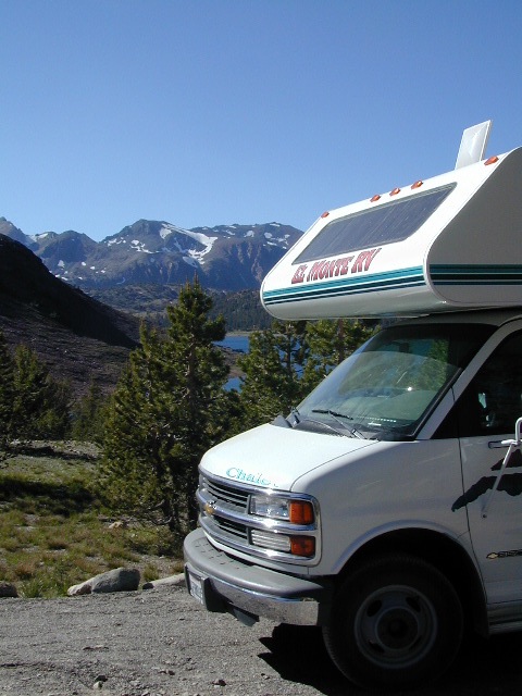
Tioga Pass camping on the eastern side of Yosemite National Park, just outside park boundaries is Inyo National Forest lands. Snow is usually epic up here and some of the deepest on the range of light.
Several prime campgrounds line this popular Sierra pass, highway 120. Most camps are located along the busy highway just outside the National Park gate. Behold, this prime choice destination is a few miles back off the highway, at the end of a graded dirt road. Smaller RVs okay.
High altitude, tree line, thin air, snow melt everywhere, spectacular elevations and dark skies make this an awesome stargazing spot. Summer is busy with trailers, boat rentals, horses and day hikers. Locals and fishermen use this small campground often, so tourists should feel lucky to find such a rare camp here. First come, First serve, when it is open (only half the year).
• Elevation: 10,000′
• Number of Sites: 19
• Camping Reservations: No
• Sites Available: First come, First serve
• Vehicle Accessibility: Vehicle limit 22 ft. max.
• Length of Stay: 14 Days
• Water: Piped; lake, creek nearby
• Toilet: Vault
• Season: Closed during winter & spring
• Fee: Yes
• Operated By: National Forest Service
• Closest Town: Lee Vining, CA
Inyo National Forest
Bishop Ranger Station
760-873-2400


