Tag Archives: waterfalls

14S11 – Sequoia NF

trails to meadow

Big Meadows Road: Sequoia Forest Rd# 14S11

SEPT 2021: Closed due to the KNP Complex Fire

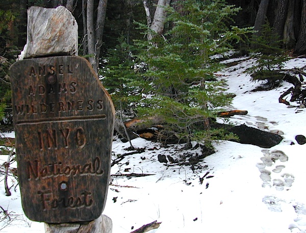
GIANT SEQUOIA: in between Sequoia & Kings Canyon, inside Sequoia NF

Sequoia Meadows

This chunk of National Forest land is perfectly located in between 2 very popular National Parks – Kings Canyon and Sequoia. This primary paved road leads to some great camping, a perfect option for NOT camping inside the crowed National Parks.

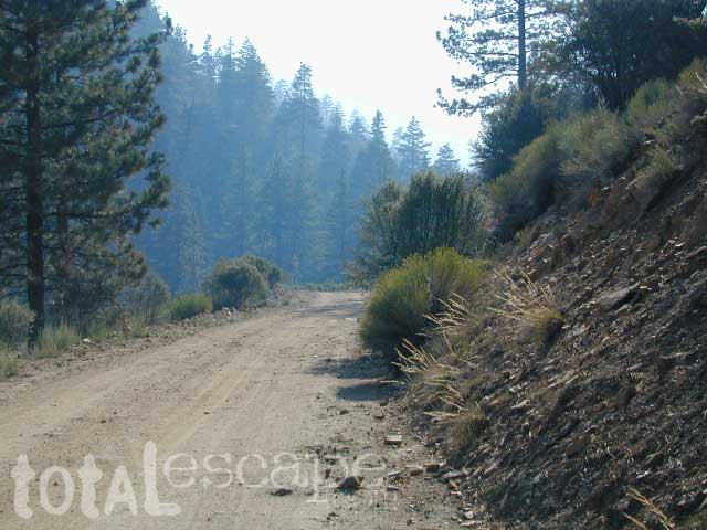
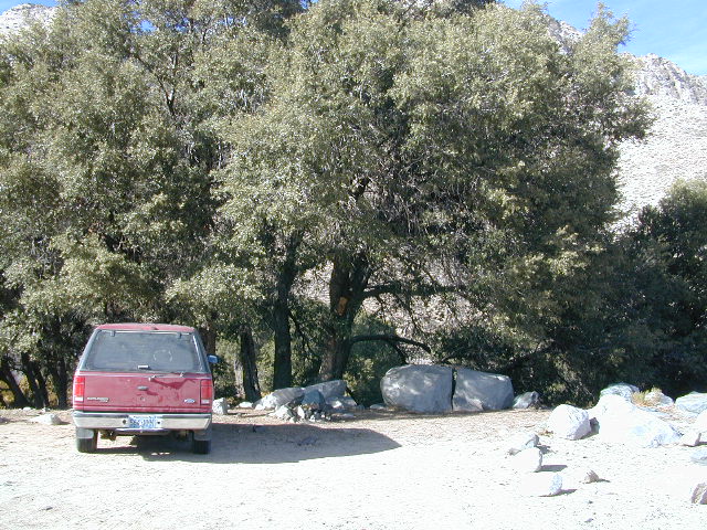
Turn east off of Sequoia ‘Generals Highway’ 198, on to the well signed Big Meadow Rd. There is primitive camping all over this area & a few developed campgrounds along this route. Motorhomes be warned: the road narrows to one lane with no “turn outs” or U turn spots for the last 10 miles (on a steep cliff w/ large overhanging rocks)

SEE CAMPING PHOTOS

camp
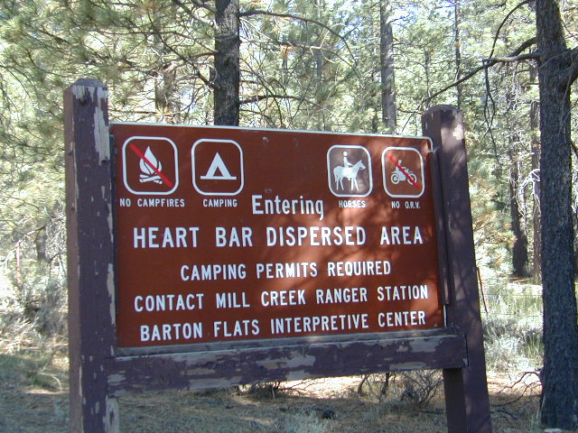
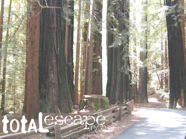
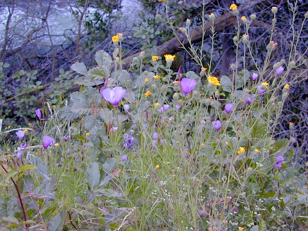
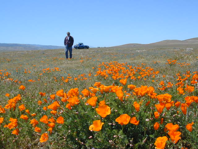
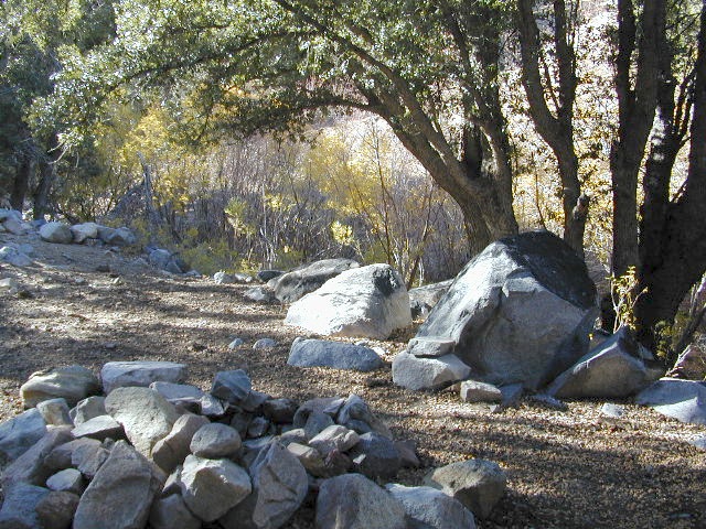
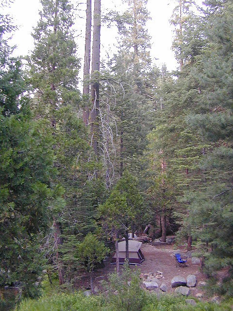
In the first few miles, the dispersed camp sites on the right side have great views & some situated on fairly flat granite slabs, perfect for astronomer campers or adventurous RVs. To the left side of the road is more primitive style campsites in wooded areas. The whole area is also a very popular cross country ski & snowmobiling spot for winter recreation. Hunters also like these camps during hunting season (in September).

horseback

There is a developed Horse Camp on the left side of the road for equestrian campers. This camp is located across from the biggest meadow and may be the first place you notice on this drive.


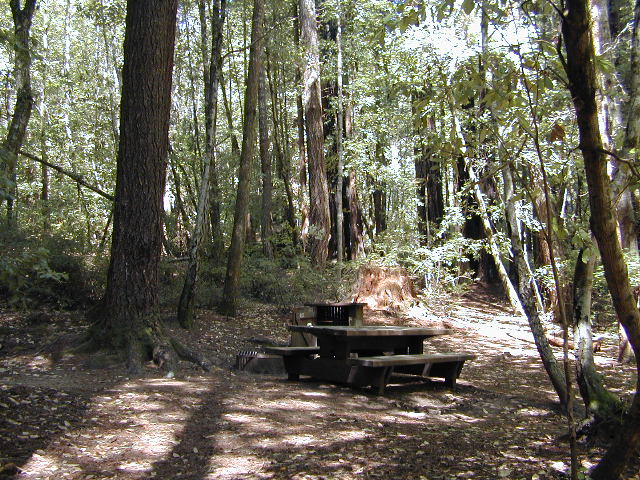
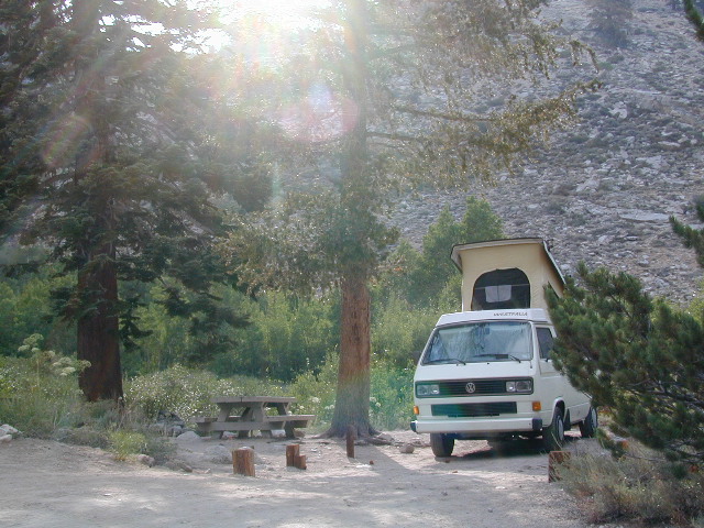
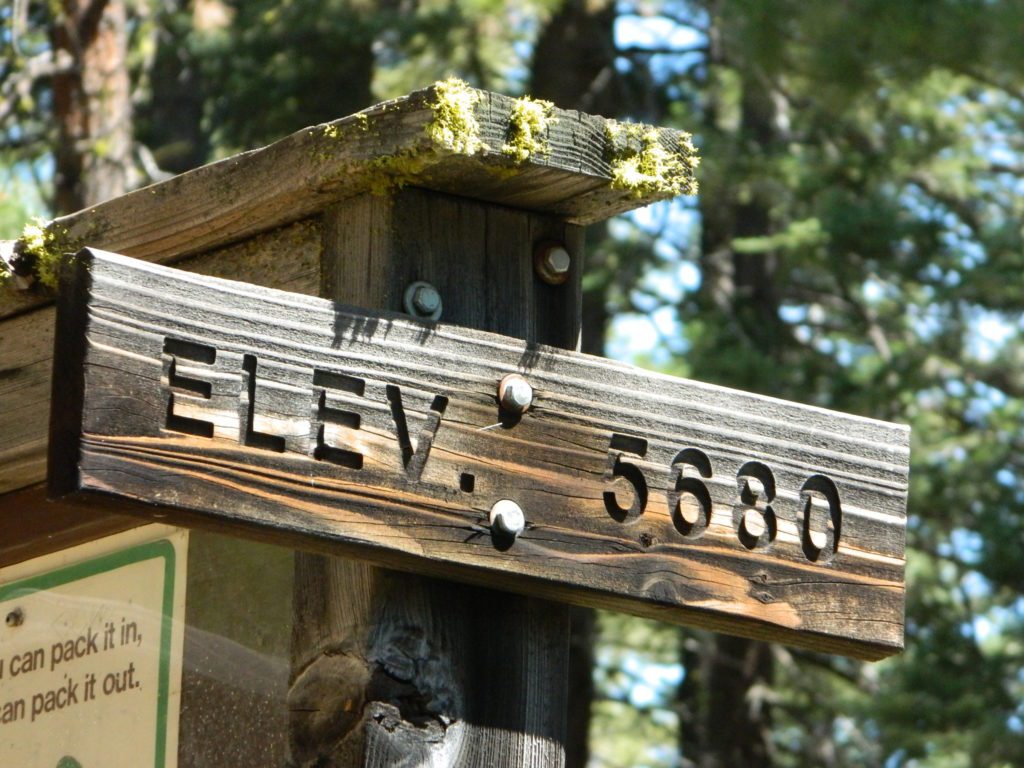
Buck Rock Campground
(7600′ elevation, 5 spots) & Big Meadows Campground (7600′ elevation, 25 spots) are both family style camps, perfect for those who want picnic tables, plus bathroom nearby. Sorry no flush toilets out here, only pit toilets.


Sequoia maps

Buck Rock Fire Lookout Tower @ 8500′ elevation – is located to the north on Forest Rd # 14S02. It’s a great spot for some impressive views – if you aren’t afraid of heights. To reach the tower you must climb several flights of steel steps. This place is worth a stop if planning a sightseeing day.

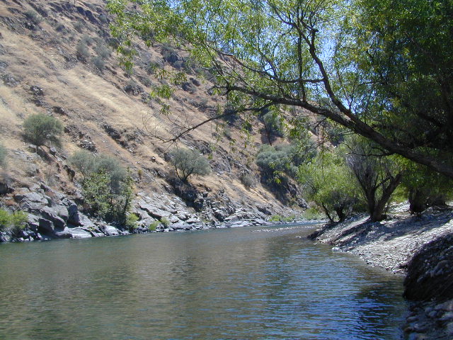
Big Meadows Guard Station @ 7500′ elevation (also known as Big Meadows Cabin), is located next to the BIG MEADOW and is available for rent on a weekend basis from the NFS. Hiking Jennie Lakes Wilderness and fly fishing Big Meadows Creek are favorite activities to be enjoyed.

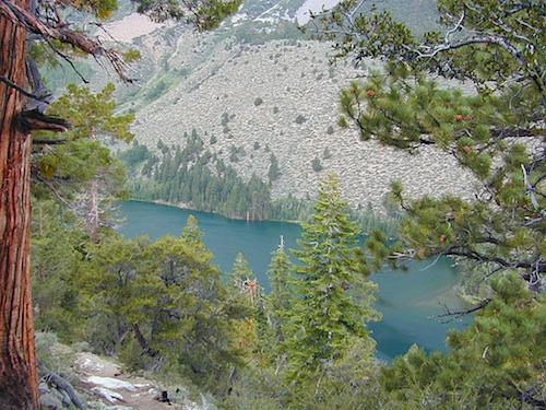
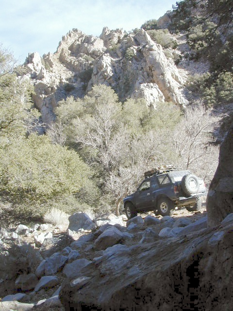
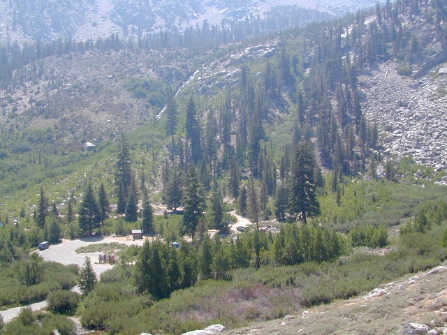
Big Meadows Road is long & narrow – 12+ miles. RVs are not recommended beyond the Big Meadow Campground, as the road is one lane in some spots & it skirts a cliff edge. The views are incredible the farther you go & many creeks feed the region.

The narrow, long paved road eventually forks off into several smaller dirt roads back near Horse Corral Meadow. Way back here, the dirt roads lead out to trail heads for backpacking, horse packing or day hiking in Jennie Lakes & Monarch Wilderness. Backcountry access to either Sequoia or Kings Canyon National Park! Have a good map if you plan to venture out this far. Pay attention & don’t get lost.

GPS would be helpful in this area. Some of the smaller of the dirt roads are not even on the NFS maps. Make sure to GPS way-point your favorite camp site, so you can find in next time…. in the dark.

Sequoia National Forest

Sequoia National Forest MAP

nearby services:

Sequoia Groves

see all – Big Meadows in California 

Marvin Pass Trailhead

Hiking Trails Los Angeles

Los Angeles Hikes, Angeles National Forest, Angeles Crest, Baldy, Wrightwood, Palmdale, Tujunga, Frazier, and Malibu Coast

DSCN0048
You relocated to California for college or your career – and to enjoy the outdoors more, but you ended up in the Los Angeles Basin instead, breathing smog daily. You will need to escape – soon, for sanity sake.

check

Total Escape – this is your new favorite web site on California outdoors. Bookmark it dude. And be proud to love nature!

PCT hikes – Pacific Crest Trail
The world renowned  hiking trail that runs the entire length of the entire West Coast US. Canada to Baja, by way of Washington, Oregon and California – all on foot.

More PCT MAPS: Pacific Crest Trail Maps

Mount Pinos Recreation Area

Los Angeles Hiking Maps

th_angeles_d

Angeles Front Country
Angeles High Country
Angeles National Forest
Channel Islands Map
Cucamonga Wilderness
Dick Smith Wilderness
Joshua Tree Park Map
Los Padres National Forest Map
Malibu Creek Map
Mojave Preserve Map
Mount Baldy Map
Mount Wilson Trail Map
Pacific Crest Trail Maps
Point Mugu Map
San Bernardino National Forest Map
San Berdoo Mountains Maps
San Diego Backcountry Map
San Gorgonio Wilderness Map
San Jacinto Wilderness Map
Sespe Wilderness Map
Topanga Trail Map
Verdugo Mountains Trail Map
Zuma / Trancas Canyons Map

pinetree

And when you finally get bored with hiking only in Southern California, there’s a whole lot more California to explore – up state!

NORCAL – Well beyond San Francisco and Yosemite, there are meadows to be found. Seclusion and tranquility in nature, without the crowds. Too many dirt roads to drive and dozens of rivers to see. Waterfalls abound, with wildflowers and amazing scenery all around. Small towns to discover!

Fly fishing rivers, kayaking lakes, wineries, organic farms, geysers, volcanoes, caves, old bridges and so much more to find in NorCal.

DanaMite loves to cover the real nooks and crannies of California, just for you – right here on Total Escape.

hiker

Onion Valley Campground

whiteVWcamper

Spectacular Small Campground located inside a granite bowl above 9000′ elevation, on the edge of the granite, near the John Muir Wilderness trails.camp

Inyo National Forest near Independence, CA
Eastern Sierra California

One of the best high elevation trailhead camp for backpackers in the Sierra.

High Sierra Lake Hikes

Onion Valley Campground

Onion Valley CA

  • Elevation: 9,200′
  • Number of Sites: 29
  • Vehicle Accessibility: no RVs
  • Camp Fee: Yes
  • Campsites Reservation: Yes
  • Toilet: Vault
  • Water: Piped
  • Length of Stay: 14 Days
  • Season: June – Sept
  • Trailhead Parking

Inyo National Forest hiker
Mount Whitney Ranger District
760-876-6200

Trailhead parking & camping for these High Sierra destinations –

onionsign

wild mountain onions?

High elevation NFS campground, located in a huge granite valley w/ waterfalls, wildflowers and aspen groves. The setting is breathtaking and the high altitude valley is nothing less than grand.

The views (east to the Owens valley) are from the paved road up, or from the hiking trails leading up outta camp. Gotta hike up (on foot) to see the views! Any visitor that does not hike, will be missing out on the best features of this destination. Plan to spend more than one day at Onion Valley.

ONLY OPEN for summer months! This small, developed campground closes annually.  Big winters and deep snow is the norm w/ elevation this high.

 walk-in camp sites

tent campas well as car camping sites.

  • picnic tables
  • fire rings
  • vault toilets
  • piped water
  • bear boxes

ONION VALLEY ROAD
access via Independence, CA

The paved road is long and very winding; sheer cliffs, steep drop offs, hairpin curves, minimal guard rails. RV motorhomes are not allowed on this route, due to the steepness of the terrain and the narrow roadway. conradkid2001

  • backpacking
  • camp
  • hiking
  • horse pack trips
  • lake fishing
  • mountaineering
  • rock climbing


horsepacks hiking Mountains

Rae Lakes Loop Map
Topo Hiking Map

HIKING LAKES in the Sierra

goldentroutlakecanyon
Golden Trout Lake Canyon

Gilbert Lake @ Kearsarge

see Onion Valley photos from –
Onion Valley Autumn 2008
Onion Valley Summer 2002

Mill Creek Falls Modoc

mill creek falls

Mill Creek Falls
Modoc National Forest

Just found another MILL CREEK in Northern California; a waterfall on the west side of the South Warner Wilderness. Located at the headwaters to the Pit River; about 6 miles east of Likely, CA

A small developed campground on a wooded slope; with new bathrooms, shady camp sites, a paved loop, and a short hike to the falls.Hiking trailhead leads into the wilderness area for fishing, hiking, lakes and backcountry access.

Open less than half the year, due to winter snow. Campground access off US Hwy 395, via Jess Valley Road #64

Mill Creek Falls Campground NFS

• Elevation: 5,680′
• Number of Sites: 20
• Vehicle Accessibility: RV 22′
• Camp Fee: Yes
• Campsites Reservation: No
• Piped Water: Yes
• Length of Stay: 14 Days
• Season: June – October
• Trailheads: South Warner Wilderness, Clear Lake

millcreek modoc

NFSlogo

Modoc National Forest
Warner Mountain Ranger District
530-279-6116

mill creek falls modoc

paved camp loop

Modoc Blue Lake Campground is also located off  Jess Valley Road.

south warner sign

Parking area for day use hikers and overnight backpackers. Hiking trail to waterfall is a short, half mile hike.

Clear Lake is further upstream, above the falls. If you want to find swimming holes, below the falls – then head down river from camp.

elevation 5680

see more MILL CREEKS in California


Wishon Reservoir

Lake Wishon – Sierra NF

Western Sierra Nevada Lake
Central Sierra California

lake wishon

East of Fresno, CA
East of Shaver Lake

EB from Fresno, Hwy 168 up to Shaver, w/ another 30+ miles on paved backroads
(Dinkey Creek Rd & then McKinley Grove Rd)
Way, way back, beyond Dinkey

You gotta really wanna BE at places like this. Magical High Sierra mountains – California’s finest. Sheer beauty surrounds this lake w/ granite domes, granite cliffs, granite trails, forests, peaks and plenty hiking, fishing, water and boating. It does take planning (way ahead) to make it out here, cuz the area is only accessible during summer months. Typical of high altitude lakes, snow buries them annually and the roads get closed off to the public (usually NOV-MAY is winter). Some backcountry routes become snowmobiling trails during winter, and the Sierra National Forest has plenty of great snomo action (if snow is deep).

Wishon Lake, California
elevation: 6600′

High Sierra Granite Reservoir with pines trees and rocky, granite shoreline. Not nearly as amazing as its cousin w/ the domes to the north, Courtright, Wishon has less granite & less wind, but more accessible backroads to explore, plus more car camping options. Both lakes are part of the Helms Creek hydro-electric project (dams) that make up the PG&E water infrastructure out in these parts – The Kings River Drainage System.

Backpacker trailheads, Woodchuck, Rancheria & Crown Valley all lead to dead end dirt roads – with nothing but solitude for miles & miles. Some might be passenger car accessible. Winter weather changes dirt road conditions (often).

The Kings River Geological Area is nearby, as well as both the John Muir Wilderness & Dinkey Lakes Wilderness.

Wishon Sierra Nevada

Large Reservoir with 8,000-10,000′ high sierra mountain peaks surrounding. Pine forests, views, fishing, camping, hiking in every direction, secluded dirt roads. Perfect high elevation trailheads, next to John Muir Wilderness. Great for backpackers!

All boating, but no waterski or jet ski.
One public boat ramp. Fishing boat rentals available.

WARNING: Water level changes daily.


lake area recreation:

Backpacking
Boating
Campground Camping
Dinkey Lakes Wilderness
Fishing
Hiking
Horse Pack Trips
John Muir Wilderness
Mountain Biking
Primitive Camping
Sierra National Forest
Snowmobiling the Sierras
Spanish Lake 4×4 Route

bridgewishon

Wishon is a summer vacation paradise for trout fishing, hiking, backpacking and back road exploring.

CLOSED FOR WINTER: NOV-APRIL = Snow closes the road for winter. For all you hardcore campers and hikers, you must call ahead to see if roads are open. It is rural forest, well traveled, but snow storms will shut everything down out here (for many months). Although, in some mild winters you can drive as far as Dinkey Creek on pavement. Gates are locked beyond that.

Central Sierra Wishon Lake Camping

LilyPad Campground @ Wishon Lake

Upper Kings Group Campground (by reservation only)

helpful numbers:

High Sierra Rangers Office: 559-855-5355
Pineridge and Kings River Ranger Districts
29688 Auberry Road, Prather, CA 93651

Dinkey Creek Ranger Station
(June thru September)
559-841-3404

Wishon Village RV
66500 McKinley Grove Road, Shaver Lake, CA 93664
559-865-5361

Engineering

Other places nearby


Black Rock Lake
Sierra Forest Road #11S12
Courtright Lake
Dusy Ershim 4×4 Trail

Dinkey Creek Campground
Dorabelle Campground
Gigantea Campground
McKinley Sequoia Grove
Sawmill Campground (dirt road)

Free, primitive or open camping abundant on the dirt backroads in Sierra National Forest. 4 wheel drive is not required for most routes, but a high clearance rig would help. Some gravel roads are graded annually and suitable for passenger cars – during summer months and only for about the first mile or two, off of the main road (pavement). Mud and snow are common on backroads!

Aspens @ Wishon, Western Sierra
nearby towns:
Fresno, CA
Huntington Lake
Lakeshore
Pine Flat
Prather
Shaver Lake


Sierra National Forest Map
Dinkey Lakes Map
Dinkey Lakes Map
John Muir Wilderness Trail Maps Sierra Nevada Topo Map

Wilderness Wishon California

wish on

NOT TO BE CONFUSED WITH:
Wishon in Giant Sequoia & Wishon @ Bass Lake

There is another popular camp spot called Wishon Camp – on the Western Divide Highway, much further south in the Sequoia National Forest.

Wishon Campground on the Tule River in the Giant Sequoia National Monument. Just up from Springville, CA

And also, the Bass Lake Wishon; there is another WISHON Campground at popular Bass Lake, South of Yosemite NP.

Marin Camping Point Reyes

Marin County Camping

Point Reyes Peninsula / Pt Reyes Campgrounds

Ocean View CampsitesOne of the most visited coastlines in the world, San Francisco – where 2 peninsulas almost meet – at the mouth of the “hidden bay”.

This is the Golden Gate to California and the Wild West.

So, you wanna escape the tourist masses… and camp out, overlooking an amazing place?

(put on your hiking boots)

lighthouse
Pt Reyes Lighthouse

Nope, the Lighthouse doesn’t have a campground! There are no camping facilities at Muir Woods National Monument, nor Muir Beach. No camping at Stinson Beach, nor Bolinas.

canoe
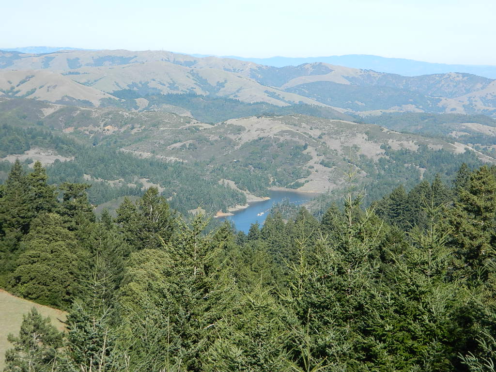
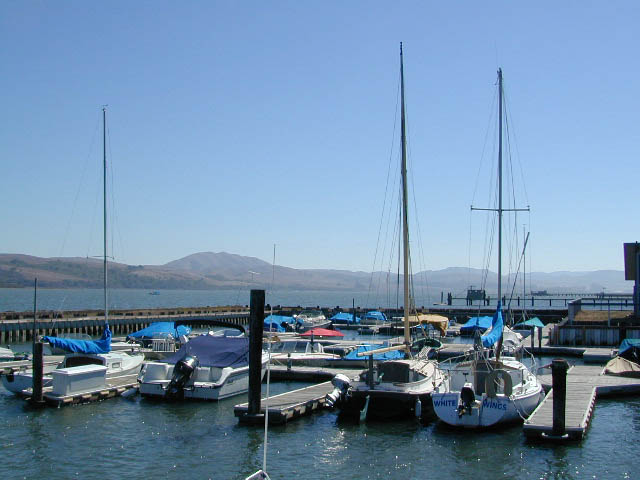
The Tule Elk Reserve has no camping at all. Tomales Bay State Park no longer has car camping or RV camping available; hike-in or boat-in
camping, maybe.

What is available for campground camping on “the Point” is listed below, with phone numbers and links for more info.

foggy seashore

POINT REYES, CALIFORNIA

Point Reyes National Seashore Campground
reservations required
hike-in, bike-in, and boat-in camp sites only
415-464-5100
415-464-5137

Mount Tamalpais State Park Campground State Parks
reservations required
415-388-2070camp

  • Alice Eastwood Campground
  • Frank Valley Campground
  • Horse Camp Campground
  • Pantoll Campground
  • Steep Ravine Campground
  • Steep Ravine Cabins

Marin Headlands Camping
reservations required; no pets & no RVshiker
415-331-1540

Samuel P. Taylor Redwood State Park State Parks
reservations recommended; open year round
415-488-9897

  • Devils Gulch Horse Camp
  • Historic Camp Taylor
  • Madrone Group Camp
  • Car Camping / Tent Camp
  • RV max 27′
  • Cabin Rentals @ SPT

DSCN4484

Cycling, hiking, backpacking, mountain biking, kayaking and boating are all popular outdoor recreation activities.

Small towns located on the Point Reyes peninsula do have a few private campgrounds, some of which can accommodate motorhomes. Follow towns links for those.

RV camping

There are no RV parks, camper trailers or motorhomes allowed in campgrounds on the steep coastal region of Point Reyes. Most of the narrow, winding roads are forbidden for motorhome travels. No shoulder, no guard rails, on many curvy roads. Great viewpoints are best when you STOP to look, off the roadway.

hike NPS

Golden Gate National Recreation Area NPS

Point Reyes National Seashore

Stinson Beach Park

Tomales Bay State Park State Park

Tule Elk Reserve

dockside

nearby towns – 


Lakes Basin Recreation Area

Lakes Basin Area, California

Golden gems of California, a collection of alpine lakes on the north end of Historic Gold Country, North Yuba River, Northern Sierra Nevada

lake dunk
EAST of Downieville, CA

California’s Gold Lake and surrounding lakes; the granite spires of the Sierra Buttes and the creeks, waterfalls, headwaters of the Yuba River — total wild beauty. Steep, granite, river canyon from Downieville drive east on Highway 49 from Sierra City to Bassetts, a gasoline and market stop; they have a small hotel there too.

Historic Lodges

Take the left turn, north on to the Gold Lake Highway. The alpine and extremely scenic Lakes Basin Area consist of all small lakes in between Hwy 49 to Hwy 89, along GOLD LAKE HWY [Road S620] some maps read Road #24 or call this Gold Lake “Road” instead of highway. Snow closes in this route during winter months.

The impressive Lakes Basin Gold Lake Region is in the north part of Tahoe National Forest, on the border of Plumas National Forest. Plumas Eureka State Park is also nearby.

Hiking, Camping, Backpacking, Picnicking, Wildflowers, Stargazing, Fishing, Kayaking, XC Skiing, Snowmobiling

Lakes Basin Map

Lakes Basin Campground

California best lake destinations

lakes basin views

Lakes Basin Recreation Area

Sierra Buttes Map


1N02 – San Berdu NF

Heart Bar Camps

Heart Bar Camp: Forest Road #1N02 – San Bernardino National Forest

Heartbar Campground, Heart Bar Horse Camps, RV Dispersed Sites, Coon Creek Cabin. SE of Big Bear Lake; Hiking & Equestrian Trails

horse camp hikes primitive camp sites

Hwy 38 , the long way into Big Bear Lake, up thru Angelus Oaks CA. Heartbar Campground is a developed recreation area, right up front. 94 camp sites, plus the recreation all around. Big equestrian area.

HART BAR: Heart Bar is large pine valley w/ alpine meadows, great camping, San Gorgonio looms overhead with ridges of 10,000′ elevation.

Heart bar campsites

yellow post camps

free, dispersed, primitive camping
in Southern Cal

HEART BAR DISPERSED AREA

Forest Service Rd #1N02 – the dirt road is graded & maintained, about half the year. Primitive camp sites require permits; see local rangers. Many forest roads can close due to heavy snow, big rain or rock slides. Best traveled in the warmer months. Winter can be questionable with open gates and road access.

bigsign

site14

Large open sites, with tables & moderately level dirt access. Seen RV campers way back here. RV’s beyond 30′ are not recommended. At end of this 5 mile dirt route is a hiking trail to Big Morongo Canyon & a really neat historic place called the Coon Creek Cabin.

Coon Creek Cabin

Totally worth a visit, if you plan on driving to the end of the road – just for the heck of it. Cabin area can be reserved for small group camping in summer months.

COON CREEK CABIN reservations
909-794-4861

San Bernardino forest maps:

nearby mountain communities:

nearby cities:

  • Mentone, CA
  • Redlands, CA

site12


Yosemite Topo

merceddownriver

Yosemite Topo Maps

ti_yosemiteYosemite National Park, in California’s Sierra Nevada mountains, is the most visited of all the National Parks. Tourists, visitors and campers fill the main valley all year long, with the crowds peeking in mid summer. Autumn is gorgeous, winter is snowy, spring is glorious and summer is grand.

The park has numerous alpine lakes, granite domes, meadows, Sequoia groves and a snow ski resort. Backpacking is popular here, hiking all over, bike rentals w/ miles of paved trails. Plus, the best in big wall climbing. Waterfalls and granite cathedrals tower above the lush, glacier- carved valley. Mighty MERCED RIVER, right through the middle of granite and forests.

Storms of recent have rearranged the landscape inside the valley with a number camping facilities wiped out by the river. Yosemite lost half of the campsites, which dramatically reduced the amount of camping available inside the main valley. Older cabins at Yosemite Lodge are gone. Less camping, but more people means you should make camp reservations early as possible; or search for camping just outside the National Park boundary.

Sightseeing and hiking should be part of your visit to Yosemite Valley. Bring your raft for a float down the river. Stay away from the crowds and take the back roads, with our great selection of Yosemite backcountry maps.

We now have links to digital maps for download!

Topographic maps for Yosemite National Park – and the outlying regions:

Teneja Lake, Hwy 120. Yosemite National Park
Eastern Sierra Camping

Inyo National Forest

Sierra National Forest

Stanislaus National Forest

Yosemite Lakes

Yosemite Lodging

Yosemite National Park

Mariposa County CA
Ahwahnee
Bass Lake
Coarsegold
El Portal
Fish Camp
Groveland
Lee Vining
Mariposa
Midpines
Nipinnawasee
Oakhurst
Wawona
Vogelsang: High Sierra Camp

th_half_dome_d

Backpacking
Day Hikes
GRANITE TERRAIN
Topographic
Yosemite Trail Maps

TuolumneMdws

Sunrise Lakes
Sunrise Lakes, Yosemite HSC Loop Hike


Wilderness Lakes

Lake Genevieve
Lake Genevieve, hike-in only access. Way up behind Convict Lake @ Mammoth Lakes, CA

calif lakes / secluded lakes / loop hike around lake / best lake in california / lake elevation / geology lakes / alpine lakes

hike-in lakes

Wilderness lakes are as pure as it gets. No cattle, no roads nearby. Snow melt, cool days, good fishing, great mountain scenery, granite, fresh air & clean water. You have to really wanna reach them. You must physically WORK to get to these remote alpine wonderlands – hike, bike, or horseback.

Heart Lake
Heart Lake, near Onion Valley & Kearsarge Pass

Some lakes are accessible via a day hike, with miles of forest trails or granite switchbacks in between. Waterfalls, wildflowers and wildlife will keep you entertained, as you enjoy your trek. No rush, no pressure; Go slow and take it all in. Remember, it’s not a race!

Most people prefer to backpack in to these locations and stay a while. Why not? These puppies are ACCESSIBLE only a few months outta the whole year. May as well enjoy them while you can. The rest of the time they are frozen solid or buried with serious snow. Wilderness areas do not allow dogs nor mountain bikes on trails, so plan accordingly.

camp, fish, hike, horseback, swim

California is lucky to have hundreds of lakes within protected wilderness areas. Almost all are gorgeous and have very limited access. While we haven’t yet been able to hike every Wilderness in Cali, we will leave you with the visuals and links, plus a way to buy the specific topo maps.

California Wilderness Lakes

Ansel Adams Wilderness

Bucks Lake Wilderness

Carson Iceberg Wilderness

Desolation Wilderness

Granite Chief Wilderness

Emigrant Wilderness

Hoover Wilderness

John Muir Wilderness

Lassen National Park

Mokelumne Wilderness

Monarch Wilderness (Kings Cyn)

Jennie Lakes Wilderness

Thousand Lakes Wilderness

Trinity Alps Wilderness

Yosemite National Park

wild California


HIGH ALTITUDE LAKES:
4000′ elevation to 14,000′ elevation

snowflake

SEASONAL deep SNOW makes many of these beautiful lakes inaccessible for more than half the year. Call ahead to local rangers to make sure your desired destination is indeed open for traffic. Certain locations may require snow shoes, snowmobile or a 4WD to access.

Forget the hike!

If you are seeking a remote mountain lake that you can drive to, you will need to search for one that has the fewest people. A high clearance vehicle will help you exit the tourist traps, via plenty of the back roads. Some dirt roads are acessible with just a passenger car or AWD wagon. Talk to the ‘field ranger’ for up-todate road conditions and closures.campfires Make sure to get a campfire permit, before you camp outside of developed campgrounds. Always steer clear of crowded, holiday weekends.

Juniper Lake Table
Juniper Lake – Lassen NPS

California LAKE LIST

The lake list above samples most of the lakes in California. For secluded locations and rare finds (accessible by vehicle), see the list below and follow links for more info.

fernlake
Fern Lake – hike in access, June Lake Loop Hwy 158

More California regions with pristine lakes, but not dubbed Wilderness:

turtleandfriend
Turtle and Friend, Junction City, CA
Sunrise Lakes
Sunrise Lakes, Yosemite Loop Hike


Central Sierra Nevada Mountains

Small Camping Lake
Kirkwood Lake Campground

Central Sierra Nevada: Sequoia to Donner

Although Sequoia trees can be found in the southern Sierra, the National Park is located more in the mid-Sierra. From the Kern River to Kings River,  the southern stretch of Sierra Nevada is home to the southern most Sequoia groves, the longest river in California, and the granite dome wonderlands that overlook the Mojave Desert.

The Tehachapi range is on the tail end to the south w/ Hwy 58, while Kings Canyon Park borders more High Sierra Wilderness to the north end. If you are heading up from SoCal, this is the most accessible portion of the Sierra Nevada range.

While the Kern River Valley can get hot in the summer months, the rivers, streams & higher elevations surrounding it, make it a prime destination for folks seeking cooler mountain breezes, creeks and dark skies. Springtime is one of the best times of year to visit the Kern River. While summer is best for the high wilderness areas, since the snow usually doesn’t melt until May.

Mountain Home State Forest is a little known haven for campers & hikers seeking less-crowded Sequoia groves. With the Tule River, fishing ponds, waterfalls, swimming holes & meadows, this place provides a nice solitude to the busier parks to the north. Balch Park is a county park w/ large campground, that sits adjacent to Mountain Home Forest.

Both National Parks (Seqouia & Kings) are both busy in summer & tourists can be seen lining the main road, Highway 198. Crystal Cave & Boyden Cavern both offer daily tours during the warmer months. Sequoia National Park is open during winter months & is popular among winter sports enthusiasts. Kings Canyon National Park & Hwy 180 are also open during winter, with winter sports recreation.

Big Meadows Road (14S11) offers great camping options for those that wish to camp outside the National Park boundaries.

Sequoia groves

Sequoia forest & parks –

Sequoia National Forest
Mountain Home State Forest
Sequoia National Park
Kings Canyon National Park

Sequoia maps & trails –

Sequoia towns nearby –
Alta Sierra, Camp Nelson, Fairview, Kennedy Meadows, Kernville, Lake Isabella, Mineral King, Ponderosa, Springville, Three Rivers, Wofford Heights

Sierra Nevada

Central Sierra Nevada forest & parks –


Sierra National Forest

Yosemite National Park

Stanislaus National Forest

Eldorado National Forest

Tahoe National Forest

Sierra Nevada

Central Sierra Highways –

Central Sierra Nevada maps & trails –

Rancheria Falls
Rancheria Falls, Huntington Lake, CA

Central Sierra Nevada towns nearby –
Bass Lake, Fish Camp, Huntington Lake, Pine Flat Reservoir, Shaver Lake

stanislaus sonora pass

Gold Country California

is located in the western foothills of the Central Sierra Mountains

Historic Highway 49 is the Gold Country Hwy, which begins down near Yosemite and leads north, thru the foothills, up to Sierra Buttes & ends out near Loyalton, CAgold miner

Santa Cruz Redwoods

hippytownway
BSA Camp Cutter

Santa Cruz Mountains & Santa Cruz Redwood Parks

overnight in the redwoods

Camping out in the Santa Cruz mountains can be a magical experience. It is here where some city dweller first get a glimpse of the coastal giant trees. Towering above in several Redwood Parks, the hiking & camping are endless. Backpacking, day hiking, mountain biking and horseback riding are all popular activities in this region.

NOTE: There is no off-roading, 4×4, OHV trails in these coastal mountains, so it will be more peaceful. Peace and quiet, remember that?

redwoods Santa Cruz

Since this mountain range is in between the Santa Cruz coastline and THE CITY, San Francisco, and situated right next to the mega-city “Bay Area”, you can always expect a few tourists about and lots of locals out enjoying their backyard (at all times of the year).

Make campground or cabin reservations as far in advance as possible. Summers are the busiest months!

State Park hikes tent camp RV

Tent Cabins
Tent Cabins: Big Basin Cabins can be arranged at Big Basin State Park. Campgrounds can be found at all State Parks and some county parks. Private vacation homes are found nearby; a few small towns on Hwy 9 offer hotel accommodations. On the coastal side of this ‘mountain’ is the small community of Pescadero w/ Butano SP.

Small towns nearby offer lodging & dining:

Big Basin Redwoods Camping

Kirch Flat Campground

Kirch Flat NFS
Camp Kings River

kirch flat

Low elevation Western Sierra: a big river at the beginning of Kings Canyon. Fishing, biking and hiking. The Kings Cyn National Park is directly east, upriver.

Oak woodlands, steep granite canyons, waterfall hikes, rock beaches, river fishing, mountain biking and wildflowers. Day time temperatures get triple-digit in summer months, so best time to visit is the rest of the year. Small RV accessible, paved road, river close – and best of all, open all year long!

flora west sierra

Kirch Flat Campground

Due EAST of Fresno, California in a large river canyon, Western Sierra Nevada
Located 18 miles up Trimmer Springs Road (paved), 5 miles above Pine Flat Lake. Sierra National Forest; River rafting take-out spot for Middle Kings River.

• Elevation: 1100′
• Number of Sites: 17
• Camp Fee: No
• Vehicle Accessibility: RV 22′ max
• Campsites Reservation: No
• Length of Stay: 14 Days
• Season: Open Year Round
• Trailheads: Kings River

lowerkings

see also Kings River Camping

nearby destinations –

Big Creek Rd #9
Blackrock Reservoir
Dinkey Creek
Dinkey Lakes Wilderness
Fresno, CA
Kings Canyon NP
Monarch Wilderness
Pine Flat Reservoir
Reedley, CA
Shaver Lake, CA
Sierra National Forest
Sequoia NP
Wishon Reservoir

Sierra NF – Road #9

sierra10S69

Sierra National Forest
Big Creek Road #9

aka. Rd #10S69

Connects Pine Flat Reservoir @ Lower Kings River, to upper elevation Sierra forests near Dinkey Creek Road. McKinley Grove of Sequoia

Sierra Road number 9 is a north turn off of Trimmer Springs Road. Marked as National Forest Rd #10S69, as well as just plain NINE. Big Crk. canyon is after the Maxson Road junction, and before the Balch Camp / Blackrock Reservoir turn off on #11S12. The area is known for abundant wildflowers in the early season.

dirt road climbs 25+ miles thru Sierra NF

sierra9

  • back road exploring
  • camping
  • fishing
  • hiking
  • hunting
  • kayaking
  • picnic areas
  • swimming
  • wildflowers
Tall White Lupine
Tall White Lupine

Big Creek Rd 9

A popular dirt road drive for the western Sierra – Pine Flat Lake region. A forested, south facing canyon in the Southern Sierra Nevada Mountains. Big Creek, wide, graded, dirt road w/ primitive camp sites. 4×4 could be needed in wetter months.

The higher you go on this route, the more pine trees you will experience. Winter weather can close this route. A campfire permit is required to camp along this road.

The lower part of the canyon has rock features, small waterfalls, swimming holes, picnic spots and sometimes cattle grazing. Several prime unmarked, primitive camp sites along this road – but few and far between. High clearance or 4WD may be needed, depending on road conditions.

sierra hiker

Soaproot Saddle Road is a not-so-obvious left fork (dirt, without signs) that leads steeply up away from main road. Climbs a steep hillside, way up above and along Rush Creek; continues for many miles. Less people back this way, if you are seeking seclusion. Few primitive camp sites on right side of road, near where the creek breaks away from road. Good for stargazing way back here. 4×4 may be needed. Road may or may not connect through to desired destination.

The mid-route climbs into pine forest and the dirt road switchbacks, steeply, with a few more camp sites available; usually found on short side roads off the main road.

sierra creek camps

At Sierra #9, a major junction w/ dirt road #10S69, called Dinkey Trimmer Road. This leads way off through the rugged terrain, many miles, over to the pavement at Dinkey Creek Jct – Campground, Trailhead and Dinkey Lakes Wilderness.

Big Creek will turn left (north), and follows the large Big Creek Canyon. Several steep miles climb up into the dense pine forest, following the creek the whole way. Several prime creekside camp sites fill up fast in this stretch. Great views, steep dirt roads. GPS waypoint these camp driveways – so you can find it next time, (first, before everyone) on Friday, Thursday before midnight.

Peterson Mill Road is Rd #10S02, found on the left (west) side of Sierra #9. That westbound route becomes pavement half way back to Highway 168. This way is the quickest way from Fresno, out to the developed NFS Bretz Campground.

Sierra #9 Big Creek Road arrives in the densest of forests. Many camp sites and side routes to explore. Dark, upper elevations, snow lingers long in the shade. 4WD may be needed in wet areas. Mud is quite common MOST of the year in this spot, so know your vehicles capabilities before you get yourself stuck (or stranded). It’s a very long walk to any kinda civilization!

Hunters like to use these upper camps during hunting season. A camp fire permit is required, so bring your shovel and bucket; self-sufficient campers enjoy the back roads most often.

wild sierra flora

Bretz Campground NFS is up here on the main road, number nine. Clock it w/ dash trip meter; 15 miles from the road start @ Pine Flat Lake. Popular with OHV and 4×4 groups. Max RV or trailer length = 24′
Open all year long; No fee.

Sierra Forest Road #9 the far north end, enters Blue Canyon @ #10S18, but the Rd #9 route continues NE as Providence Creek Road. Eventually intersecting @ Dinkey Creek Rd w/ Rock Creek & Dinkey Dome closeby. Great granite 4×4 Trail @ Bald Mountain (elev. 7832′) overlooking Shaver Lake.

Jeepers on granite @ Bald Mtn, above Shaver Lake, CA

Kings River Camping

2 tone lupine

SIERRA MAP
sierra National Forest map

places nearby –
shaver lake map

Balch Camp (utility & NFS)
Black Rock Reservoir
Courtright Reservoir
Dinkey Creek
Huntington Lake
Lakeshore, CA
Pine Flat Lake
Shaver Lake, CA
Trimmer Springs
Wishon Reservoir

1S63 – Inyo NF

junelakeloop

June Lake Loop – Hwy 158

also known as Road #1S63 – Inyo NF
and as California State Route 158
CA SR 158, or just Highway 158

Eastern Sierra Nevada

The quieter side of outdoor life can be found around June Lake. Fishing, camping, cabins, lodging, several lakes and one ski resort. When the busy-ness and crowds of Mammoth Mountain annoy, it is time to look elsewhere for your Eastern Sierra vacation.

June Lake is the neighboring community to the north, just a few miles from Mammoth, off US 395. The paved loop highway (158) is a wondrous scenic drive and awesome for outdoor recreation; but is subject to winter closures during NOV-MAY.

backpacking
boating
camping
fishing
hiking
horseback
snow ski

Autumn colors on this highway attract a fair amount of annual visitors. Book campgrounds or lodging (in summertime) for late September to early October for the best timing on fall foliage. First snow of the season usually arrives sometime in October.

grantcontrast
lake and creeks near the loop –

June Lake
Gull Lake
Silver Lake
Grant Lake

Rush Creek
Reverse Creek
Walker Creek

fernlake

Fern Lake – hike-in

walkerlake

Walker Lake – hike-in

Inyo Forest Road #1N17 is a dirt road, off the main highway. Route leads north from Grant Lake over to Lee Vining junction @ CA 120. Numerous side routes up into scenic canyons, most of which are well signed. Perfect exploring for day hikers, creek fishing, small lakes and primitive camping spots.

Parker Lakes
Walker Lake

Inyo National Forest
Ansel Adams Wilderness

June Lake, CA

nearby towns:
Lee Vining, CA
Mammoth Lakes, CA

area maps:
Inyo National Forest USDA
Ansel Adams Wilderness Maps
Mammoth Lakes Map by NatGeo

Ansel Adams Wilderness

anselwoodsign

Alpine high country hiking, Sierra Nevada mountains, California

Ansel Adams Wilderness Area

Ansel Adams Trail Map, Tom Harrison
Ansel Adams Map, Forest Service USDA
Ansel Adams Map, NatGeo

Ansel Adams Hiking Map
The Ansel Adams Wilderness is an area in the Sierra Nevada of California. The wilderness is part of the Sierra and Inyo National Forests, in the Eastern Sierra portion of the range, overlooking Mono Lake. Yosemite EAST is what NatGeo likes to call it. The wilderness spans 231,533 acres with Yosemite National Park lies to the north and northwest, while the John Muir Wilderness lies to the south.

The wilderness was established as part of the original Wilderness Act in 1964 as the Minarets Wilderness. The 109,500-acre Minarets Wilderness was created by enlarging and renaming the Mount Dana-Minarets Primitive Area.

In 1984, after his death, the area was expanded and renamed in honor of Ansel Adams, well-known environmentalist and nature photographer who is famous for his black and white landscape photographs of the Sierra Nevada.

Ansel Adams Wilderness Map

outdoor recreation –

  • backpacking
  • camping
  • fishing
  • hiking
  • horseback
  • ice climbing
  • lakes
  • mountaineering
  • peaks
  • wildflowers

surrounding park & forest lands –

nearby towns –

leeviningvalley
lee vining canyon

Ansel Adams Wiki
Ansel Adams Hiking on Summit Post

Day hikes or overnight backpacking trips require a Wilderness permit and can be obtained at the local ranger station. A good topo map will also prove invaluable on your hike. Access trailheads for Ansel Adams Wilderness from EAST and WESTERN sides of the Sierra Nevada range.

Ansel Adams Trailheads from the west –

Onion Springs Meadow trailhead, Vermillion @ Lake Edison (Sierra NF)

Isberg trailhead & Mammoth trailhead @ Granite Creek Campground via Beasore Road, way up behind Bass Lake (Sierra NF)

Isberg Pass trailhead from Yosemite National Park

Ansel Adams Trailheads from the east –

Bloody Canyon, Walker Lake trailhead, near Grant Lake on June Lake Loop (Inyo NF)

Rush Creek / Fern Lake trailhead, near Silver Lake on June Lake Loop (Inyo NF)

Agnew Meadows trailhead & Minaret Vista trailhead, Mammoth Lakes CA (Inyo NF)

Devil’s Postpile trailhead, behind Mammoth Lakes CA (Inyo NF)

Fern Lake Reflection
Fern Lake, day hike from Hwy 158 (June Lake Loop)

California Camping Maps

California Campground Maps

Maps are the key to finding your very own slice of heaven in the Wilderness. Online map sources can barely get you to your city destination correctly, much less the remote waterfall you desire. You will need a real map for your adventure. A topographical map, with all the details, dirt roads & hiking trails. If you are seeking to stay away from the touristy crowds, this is the best possible place you can be…. on this site, searching for ways to make it happen – this weekend.

BACKPACKERS BACKPACKING MAPS –

maps of California
Mount Whitney, John Muir & way beyond the High Sierra. DanaMite has all the California Wilderness maps on the new map shop. Various brands and types of maps. Most are printed on waterproof plastic now & are tear-resistant.

CAR CAMPING MAPS –

El Dorado Camping
Planning on camping outside of the developed campgrounds & finding that perfect stream side spot without the reservation & the fees? Then you will need a free fire permit (from a ranger station), plus a good map of the forests & a vehicle capable of handling the rugged the back roads. Much of California is prone to wildfires, so make sure campfires are even allowed on the backroads, before you get out there. Call the “field rangers” for back road advice and current recommendations.

CALIFORNIA OFF ROAD MAPS –

Wanna take that 4×4 vehicle somewhere really special this season? Camp well beyond the masses, way down that dirt road. We have OHV maps for SoCal, the deserts & all the National Forest maps too.

CALIF CAMPGROUND MAPS –

Start your search on the perfect campground or camp site with the destination in mind. Mountains, deserts, coastal. Parks & forests all have their own maps with all nearby camp grounds listed. We feature all the National Forest maps, as well as some State Park & National Park maps

See all California topo, hiking, camping maps

Sierra Nevada maps

coolsprings

  • California A to Z
  • California Camping
  • California Elevations
  • Camp Firewood
  • Camp Potty
  • RV camping deep in the Sierra
    RV camping at it's best in the Sierra; This rig found themselves deep in the alpine lush meadows with towering trees and a view and a very private camp site.
    Big Bend CA
    Big Bend Ranger Station, off I-80

    California Wildflower Blooms

    Lupine Oroville
    Wildflowers in California 

    Wildflowers bloom all over California – from the desert in winter months, to the High Sierra in mid summer.  Remember that the timing is everything, since most of these precious, delicate beauties only last a week or so. Out there alone, all day in the bright sunshine, whipping in the seasons strongest breezes. Flora!Ocotillo Joshua Tree

    The higher the elevation, the later the bloom.
    Lower elevation deserts begin to show as early as February and higher elevation peaks thaw in May. Wilderness meadows and flowers can be found in the mountains in summer. Generally in California, Springtime – between MARCH and JUNE is the best viewing time.

    Places to find Wildflowers in California

    West coast wildflower blooms in relation to elevation; Order of bloom is typically

    • low deserts (FEB)
    • high deserts (APRIL)
    • river canyons
    • central valley
    • mountain foothills (MAY)
    • coastal foothills
    • mountain forests (JUNE)
    • high altitude meadows
    • mountain lakes
    • mountain peaks (JULY)

    some recent finds:

    Carrizo Plain Super Bloom – W of Taft, CA

    Klipstein Canyon, Kern County @ Hwy 166Gorman Post Road

    Cottonwood Canyon
    W of New Cuyama, CA

    School House Canyon
    W of New Cuyama, CA

    Figueroa Mountain Rd – Los Padres NF @ Santa Ynez, CA

    Table Mountain – Cherokee Road, N Oroville, CA


    Box Canyon @ Mecca, California

    Turtle Mountain Road, Needles, CA

    Mill Creek, Lassen NF

    Lassen Peak Lupine Way HikeNPS
    Lassen NP (mid-to-late summer)

    Lassen Peak Lupine Summer Hikes

    more pages on wildflowers –

    California Wildflowers

    California Golden Poppies

    Poppy Reserve Antelope Valley, LA Co.

    Poppy Stompers

    popstrollin

    Anza Borrego Desert Wildflowers

    Mojave Desert

    19S01 – Inyo NF

    south sierra ridges

    Walker Creek Road #19S01
    – Inyo National Forest

    Southern Slopes, Eastern Sierra Nevada

    Just south of Olancha, off US Hwy 395 is a dirt road that takes you 5 miles up to an oak canyon lined with rocks. There are several primitive camp sites along the Walker Creek. A high clearance vehicle may be needed in some sections, but 4×4 is not required. Small RVs might attempt this, but if the first mile frightens you, turn around while you’re ahead.

    Dirt Road near 395

    This private, shaded, creek area is perfect for those traveling Highway 395, looking for a quick and free camp spot near Olancha, CA

    nice shady spots
    Shady picnic or camp spots above 4000′ elevation.

    some granite
    Hiking trails at the end of the road lead deep into the mountains. One on the right takes you to waterfalls. The trail on the left will take you to meet up with the Sage Flat Trail, which leads up to Olancha Pass, Summit Meadows & a small lake, in the South Sierra Wilderness. The Pacific Crest Trail runs the ridges here, just west of Monache Meadows, which is at 8000′ elevation, way above here – up on top. 

    First Camp

    US 395 highway – the dirt road turn off is very close to a gas station, and it maybe be signed, or not. The gas stop may be in business, or perhaps not. This is rural California, wide open desert and things come and go quickly.

    On a good topo map, located Olancha Creek and Summit Creek to the south. Walker Creek is the canyon in between those two, just so know where you are going and can visualize. This one is an easy-to-miss dirt road turn off – especially if you are going over 50 mph.

    Dispersed Camping Sequoia

    bone creek

    Sequoia maps

    Open Camping in Sequoia National Forest – Forest Road Camping

    Seeking secluded campsites? This is one of the best areas to camp in pine forest w/ privacy, relatively close to Southern California. Plenty of primitive car camping on the dirt roads throughout this whole Sequoia & Kern River area.

    nfs primitive back roads mountain biking hiking mountains

    No facilities. No picnic tables, no toilet, no fees. Just a rock campfire ring & a clearing. Previously used sites have already been established usually near streams. Try to use these first, if at all possible. It takes a bit of exploring but you will find the perfect spot. Don’t even attempt to try to find these kinds of camp spots at night. They are often buried deep in the forest with no visible markers what-so-ever. But in trade, you will be lulled to sleep by your own private mini waterfall & no RV generators. Many of these back roads are closed & gated during winter months due to snow & rock slides.

    No amenities are available in this neck of the woods, but plenty of seclusion & wilderness. Check official Wilderness rules for proper knowledge of the area restrictions. You must get a free camp fire permit from the ranger station in order to build a fire outside of a developed campground. A large shovel, plus bucket w/ water are a bare minimum for the privilege of camping like this. Certain dry seasons (summers into autumn) have very strict camp fire restrictions. Check with the ranger to see the latest on building campfires on the back roads. camping

    A Sequoia Forest Service Map is highly advised for this area. There are so many dirt roads for dispersed primitive camping on the back roads. Due to weather & erosion, some roads may require 4×4 or high clearance, so come prepared with a plan B.

    Camping Checklist to make sure you’ll have what you need. The drive up from the Los Angeles area averages 3-4 hours and is well worth the trip. Once you’ve found that perfect spot, take detailed note of it, for the next time you visit the area. Then, you will be able to get there easily in the middle of the night, if need be.

    Backroad Camping Sequoia: Follow the forest road numbers with your Sequoia map to discover amazing back road camping options. Your own private stream or meadow. Secluded campsites with your own mini waterfall.

    overview

    see also –
    Sequoia Campground Camping

    monache mdw