Camping Lakes – Campground Lakes
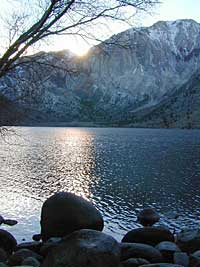
Lake Eastern Sierra California
There is not enough room on this web site to list every single alpine lake in the majestic Eastern Sierra range, since there are hundreds, but we highlight a few of the hike-in accessible ones & the more popular camping lakes below.
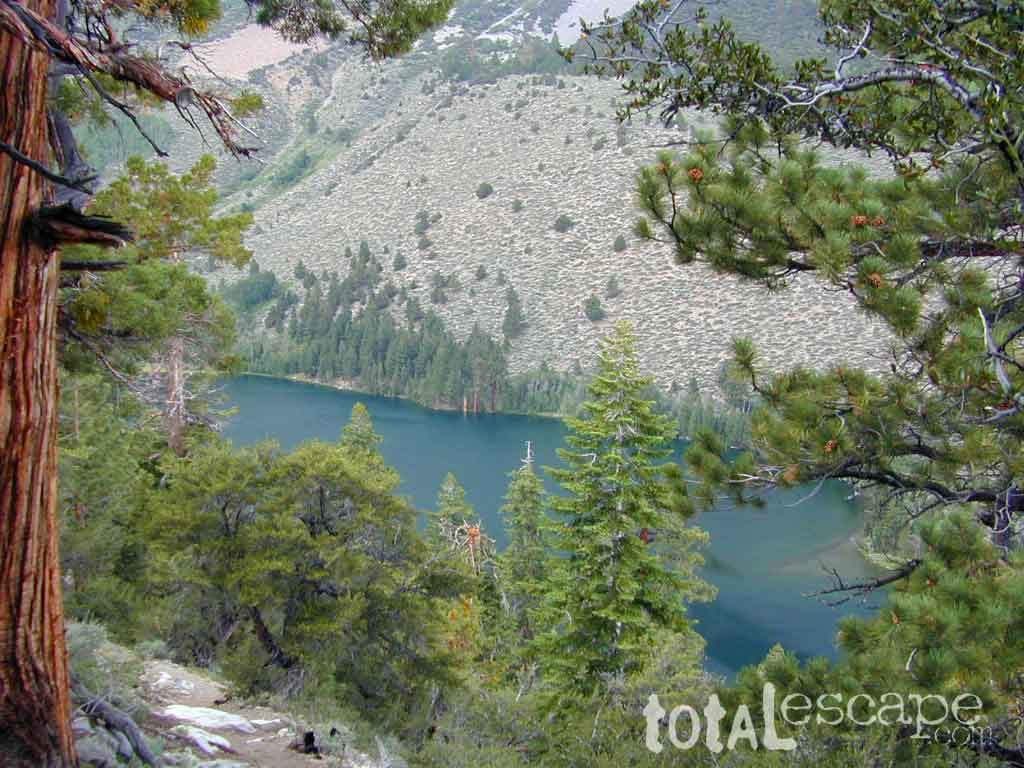
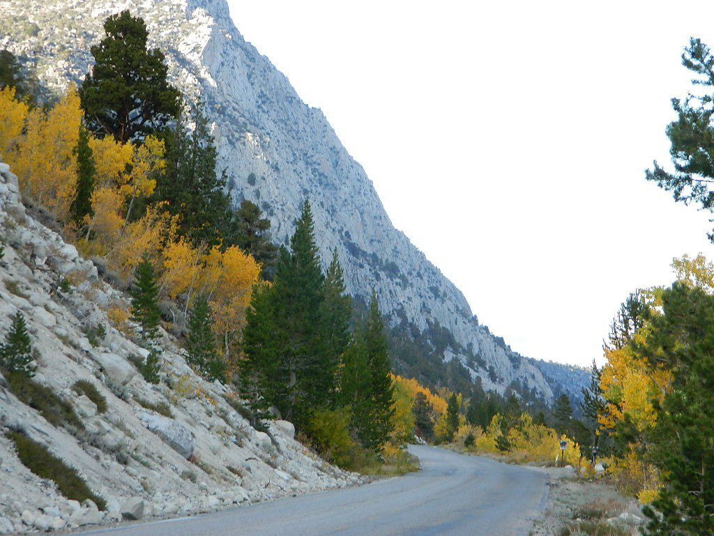
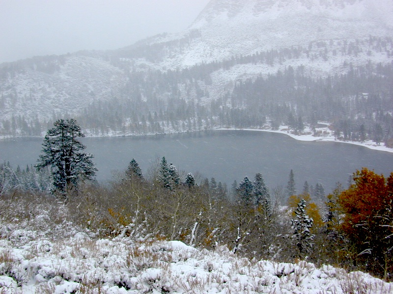
June Lake Loop is a paved, scenic drive highway that has multiple lakes with cabin rentals, camping, fishing, boat rentals. One of the best places to spend autumn looking for fall colors among the aspens.
DanaMite also knows a picture is worth 1000 words, so just click links for photos & enjoy!!!
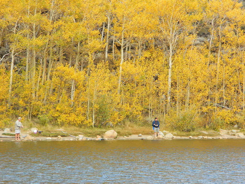
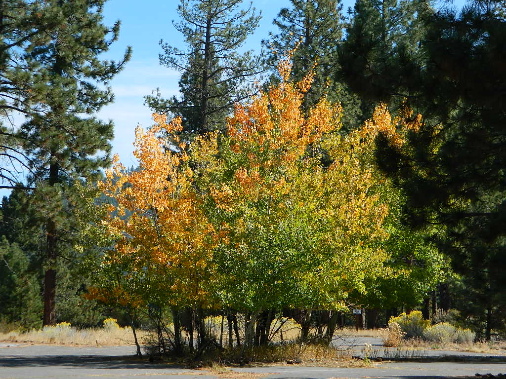
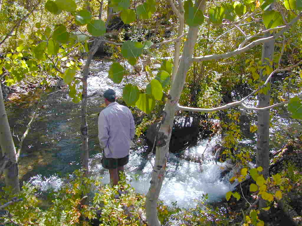
Aspen Groves are easy to recognize with their thick stands. White trunks with dark knots, slender, with oval shaped leaves. Growing in a network of roots, which are found lining creeks, alpine lakes, or spilling out from higher elevations, along scenic canyons.
The unique round leaves which can turn spectacular colors in the fall season. The fluttering and flapping of the oval-shaped, thick, green leaf is a sure sign of summer. When breezes get cooler, Autumn is only a few weeks away and as quick as the cold comes in, what a short and special show they put on.
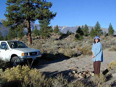
Green Creek historic cabin, on the Eastern Sierra
California Fall Colors
Aspen trees can be found at higher mountain elevations in California, usually above 4000′ – all the way up to about 10,000′ or higher, depending on the mountain range and local water flows. Groves have an extensive root systems underground, so they often withstand wildfires and can come back after the rest of the forest is gone.
Beavers build dams in creeks around aspen trees, fishermen and campers love to camp next to aspens, and lovers carve their initials into their white bark. These trees do indeed take a beating, from all angles, winter weather included… so stop from cutting them!
BIKE
CAMP
FISH
HIKE
KAYAK
PICNIC
summer and autumn
These deciduous trees are naked half the year, typically from November to April, as winter buries them in snow and ice. Time is of the essence, limited to Summer and Autumn – to enjoy their shade and the beauty of the groves. Scenic meadows and fishing creeks are just an added bonus for searching out the aspen.
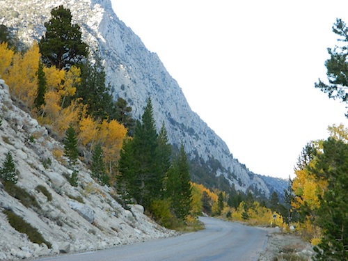
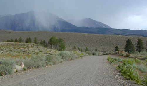
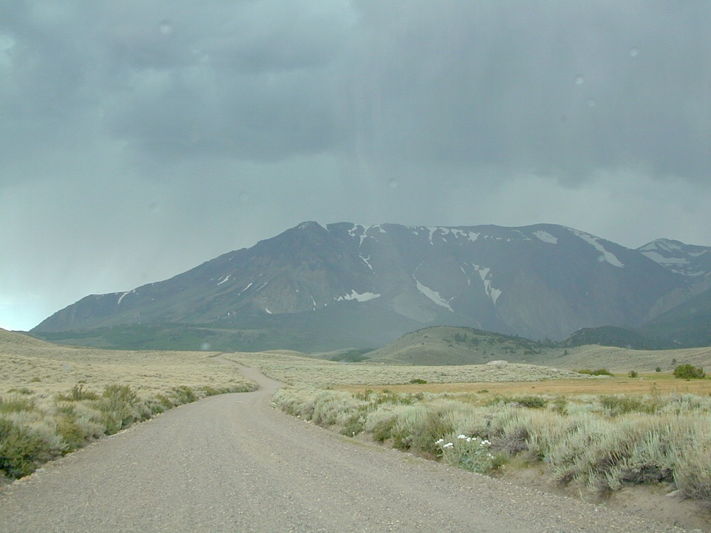
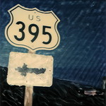
Aspens can be found in hidden canyons, primarily along the Eastern Sierra US Hwy 395 and surrounding mountain lakes. Some Sierra Passes have decent displays of color as well – like Carson Pass Hwy 88 and Yosemite’s Tioga Pass Hwy 120.
Below is a list of Total Escape’s favorite aspen areas of California
Blue Lake in Modoc National ForestHiking Lake w/ Loop Trail in far Northern California
Blue Lake
Modoc National Forest
When you really wanna get away from it all, take a week off and head up to Modoc – the top northeast corner of California, where the volcanic mountains line the Great Basin. The population is minimal, cattle are abundant and the campers few. Even in mid summer, this ideal lake campground rarely fills up.
Jess Valley Road leads east off US 395 @ Likely, CA – 16 miles back to this hidden gem.
Headwaters to the Pit River.
NFS Campground is shady, well managed, and spread out on the eastern slope w/ numerous paved loops. Tent campers, cross country cyclists, truck campers w/ canoes, SUV families, motorhomes with kayaks and kids.
Modoc Map
Blue Lake Campground NFS
• Elevation: 6,050′
• Number of Sites: 48
• Vehicle Accessibility: 32′ RV
• Camp Fee: Yes
• Campsite Reservation: No
• Water: Piped
• Length of Stay: 14 Days
• Season: May –October
• Trailhead: Lake Loop
• Boat Ramp: Yes
Group Camp Facilities (by reservation only)
Modoc NF Warner Ranger District
@ 530-279-6116
Lava Rock @ Blue Lake Loop, in Modoc County, CA
Blue Lake National Recreation Trail
Right next to camp: A pretty much perfect LAKE LOOP (1.5 mi) hiking trail is worth a serious stroll; footbridge, wildflowers, fishing spots, minimal hills, lava rocks, and awesome scenery. Plenty of wildlife can be seen, including butterflies and bald eagles. Trail is shaded by tall white fir and ponderosa pine trees. Trailhead is located at the Day Use parking lot, w/ paved boat ramp, dock, and picnic area.
back roads
boating
camping
canoeing
fishing
hiking
kayaking
mountain biking
picnicking
swimming
stargazing
wildflowers
wildlife
NOTE: not every CAMPSITE has a LAKE VIEW
Certain campsites are adjacent to the lake; some are set facing a meadow (Autumn w/ aspen groves), or the alpine forest w/ deer grazing. Perhaps an inner circle (interior) campsite, for those who like to be close to bathrooms and piped water. Large families will love the abundance of camp settings and accommodations.
Paved Loop Plenty of Vault Toilets Piped Water Recycles & Trash Service
Large Campsites can accommodate Motorhomes
no paved camp stall
no hook-ups
no dump station
no cell phone signal
popular lake camp for motorhomes
When driving a large RV back in here, be courteous of other campers. Nothing sucks more than driving a long distance to the boonies, to arrive at camp just before dark and annoying everyone else already there.
Those needing to drive the campground loops (more than twice) looking for the biggest, levelest, best camp site – and burning $10 in gasoline doing so, should consider walking in.
Park that beast (near boat ramp area, before the camp entrance). Get out and walk the hills and loops, BREATHE & relax – prior to a choosing camp site.
Unhitch any tow vehicles; use that to scout out your perfect spot, if you cannot hike it. Trailers and large motorhomes will find this place ideal, but getting the right camp, can make all the difference.
Paved Trail around Campground
The wildfire: BLUE FIRE burned this region in 2001, but it is lush and green again (2019). Northern California gets some real weather. Rain and snow, more than half the year. The campground closes annually due to snow.
Kayaking is best done in the morning, cuz wind picks up in the afternoon. Canoes can launch at boat ramp, or at shoreline from trails near campsite.
Hiking trails can be found all around lake and campground. Wilderness access can be found at South Warner trailheads within a short drive from the lake.
Cyclists also love this camp, as it is located near a major highway and is a perfect place to really relax, soak in the scenery and get some quiet-nights sleep.
South Warner Wilderness is close by, driving distance; accessible by graded dirt roads. Signage is decent.
Modoc Forest Road #64 is a through-route, across the lower South Warners – 40
miles connecting to east side of the mountain, at Eagleville, CA.
Dirt Roads are suitable for trucks w/ trailers. SUVs and rugged passenger cars are okay. Motorhomes are not advised on this route. Washboard conditions are typical. Winter closure on this route is common.
MODOC RD 64
Several miles away from Blue Lake, 2 rustic trailhead campgrounds are located back this way – East Creek Campground & Patterson Campground. Less than 10 camp sites each, equipped w/ horse stalls, vault toilets and maybe piped water. Trailhead parking for backpackers. No RVs!
Autumn colors w/ aspen groves. Open, large meadows and mature forests w/ wildfire scars. Cattle can be found grazing all around, many cattle crossing.
Minimal primitive camping options, along road sides. Campfire permits required. No camping within one mile of a developed campground.
Modoc is Cow CountryDay Trippin – Out exploring Modoc Road 64 (and cutting firewood)
Amazing autumn colors can be found through OCTOBER and NOVEMBER in California, but you’ll need to leave the city in order to find the very best colors and scenic beauty. Fall season happens quickly (within weeks) in the high country and slower (months) in the lowlands. Plenty canyons and parks in the urban centers have hiking trails thru some nice trees, but nothing compares to the backroads, creeks and rivers of the big mountains.
Elevations, the higher the better, is where you’ll find the real displays of color. Aspen groves can be found along mountain slopes, creek canyons from 5000′-10,000′ in elevation. Cottonwood trees are found in the drier regions, in ranching areas and in desert canyons – up to about 6000′ elevation. Aspen trees start to turn yellow as soon as the chill of nights drop; if the temperature shift is subtle, the aspen leaves become more orange as the days go into the fall season. If an early snow or freeze happens, just one night, the glorious foliage becomes dead brown crispies dangling in the wind.
CAMP FIRE RESTRICTIONS are still be in place from the dry summer, and now comes the autumn winds. Any decent amount of rain can change the fire burn status, so make sure to check with the rangers for up-to-date fire info.
Best Autumn Campgrounds in California
Many of these campgrounds are located in or near aspen groves & are simply spectacular during the fall months. Some may be located near alder groves. Maple trees located along rivers turn golden between September and October.
Higher elevation (7000′-9000′) colors will change faster and earlier in the year (as soon as September), whereas the lower countryside may wait until late October.
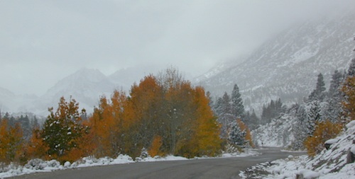
Pack warmly, cuz the cooler temps at night (20-30 degrees) is what makes these awesome, little autumn leaves change colors. The change can happen very fast (in days). When the early season snows move in – usually a minimal dusting by October, fall colors can fade fast.
The North Sierra Nevada Mountains covers the region with Lake Tahoe and Donner Pass, and north Gold Country. River canyons with fall colors include American River,Yuba River, and the Feather River.
Aspen Group Campground
@ Jackson Meadows Reservoir
near Truckee, CA
Berry Creek, CA
Milsap Bar, Middle Fork of the Feather River
Bucks Lake, CA
Haskins Valley & Grizzly Creek Campground
Oro-Quincy Highway – Plumas NF
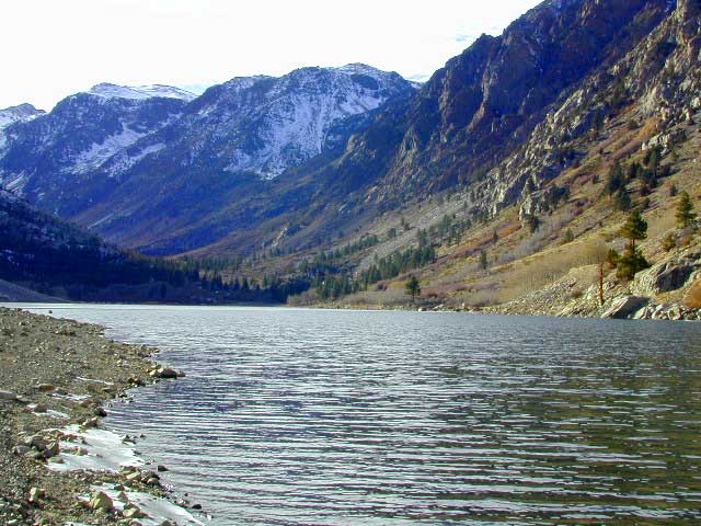
The Eastern slopes of the Sierra Nevada is the ‘place to be’ for Autumn Colors in California. The dramatic desert meets the tallest granite peaks. Every canyon is a different scene, many lakes lined with aspen groves, some have a creek with aspens.
Aspendell, CA
North Lake Campground
Lake Sabrina Road
Bishop Pass (high country hikes)
Lee Vining, CA
Lee Vining Canyon / Hwy 120
One of the biggest aspen grove canyons in the state of California.
NFS Campgrounds in Lee Vining Canyon: Big Bend, Aspen Grove, Boulder, Moraine, and Cattleguard Campground.
NFS Camps @ Yosemite’s EAST GATE (9000′ elev): Ellery Lake, Junction, Saddlebag Lake, and Sawmill Campground.
Impressive Rock Creek Road #4S12 in Rock Creek Canyon, one of the very best “Scenic Autumn Drives” in the whole Eastern Sierra. Numerous NFS Campgrounds on this road; many of which close for the season, just about the time then fall colors peak.
Lundy Canyon is located at the very northern boundaries of the Inyo National Forest, bordering the Humboldt Toiyabe National Forest & Virginia Lakes. Mill Creek flows down Lundy Canyon from the Sierra Nevada; Lundy is a small lake in a deep, rugged canyon with wilderness trailheads, East of Yosemite National Park.
Lundy Canyon Campground
Mono County Dept of Public Works
760-932-5440
36 camp sites w/ picnic tables, fire-rings & bear boxes
Lundy Lake Resort
Bait, tackle, general store, fishing lake, boat ramp.
626-309-0415
21 camp sites, 8 cabins, 3 camp huts, 5 RV camp sites
There is not any NFS Campgrounds in this Lundy Canyon, but plenty can be found nearby at Lee Vining Canyon, at junction US 395 & Hwy 120.
Mono Lake also has camping at the county park. And free camping (boondocking) can be found – all up and down US 395
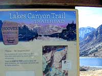
Lakes Canyon Trailhead
Backpackers & Horse Packer Trains have excellent access to the Hoover Wilderness in the High Sierras. Plus this prime Lundy Canyon location is situated at the back door of Yosemite NP.
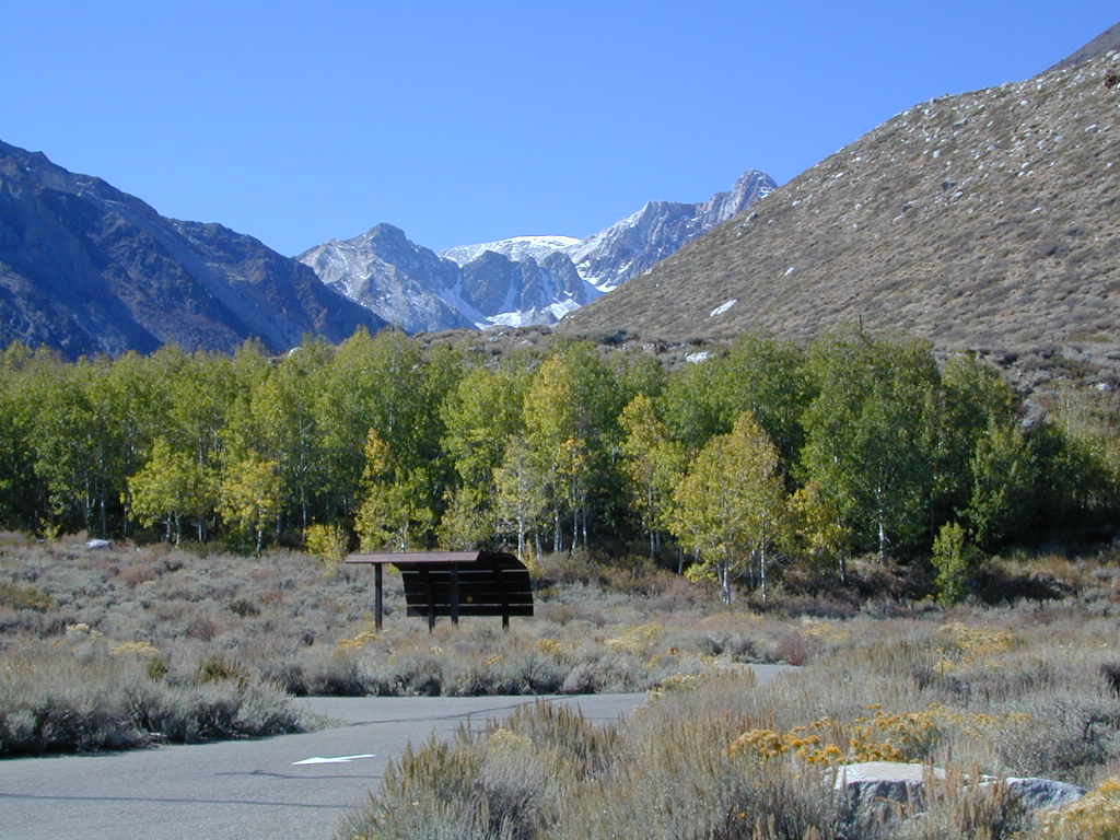
near Crowley Lake, CA
Inyo National Forest Campground, Eastern Sierra Nevada
• Elevation: 7600′
• Number of Sites: 28
• Vehicle Accessibility: RV 22′
• Camp Fee: Yes
• Campsites Reservation: Yes
• Length of Stay: 14 Days
• Season: May – September
• Trailheads: McGee Creek, John Muir Wilderness
Mc GEE CREEK CAMP is located –
8 miles north of Mammoth Lakes exit
4 miles from Lake Crowley
2 miles from McGee Creek Canyon trailhead
Aspen trees line McGee Creek that flows down from the Eastern Sierra peaks. Autumn is short and sweet, when the fall colors come and go – usually within a week or two. First snow fall of the season is generally in October and the camp closes for the winter season.
Located about a mile away from Highway US 395 in the wide open high desert. Sage meadows w/ minimal trees at camp. USFS has built shade structures for each camp site, so your time here is not spent in direct sunlight. Summer can get hot and it can also be quite windy at this location.
backpacking
camping
fishing
hiking
mountain biking
more McGee?
Closer to US 395 highway, there is a McGee Creek Lodge & Restaurant, right along the frontage road (Crowley Lake Drive).
Bald Mountain (elev 9382′) Lookout in Sequoia National Forest
NFS Fire Lookout Towers
JULY 2019 – Many thanks goes to Pike County Lookout for initially spotting the #RockFire – in the Plumas National Forest, near Berry Creek, CA
Lookouts in the California National Forests
Ready to see far and wide – with wild terrain? Views for 100 miles out and the best scenery California has to offer. Be prepared to off road or hike to reach one of these destinations.
Below is a list of historic look out towers & cabins used for spotting wildfires. Some are located on steep granite peaks, ridge lines or dirt roads. 4WD may be recommended to reach some of these. Road conditions can change w/ harsh mountain weather, so be prepared to rough it. Thunderstorms are common on these mountain ridges.
Several of these places are cabins, some are stone houses, but most fire lookouts are basic metal towers – with high climbing staircases, so you must be in decent physical strength to haul your ass up this high.
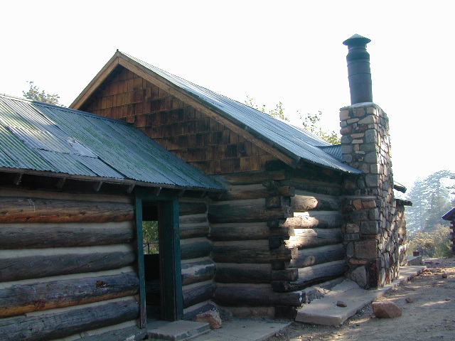
Cabins are also called guard stations, huts, bunkhouses. Most are located on mountain tops, but a few exist in desert regions. Some are refurbished & available for overnight rentals. Bare bones furnishings, so forget the frills. People come up here for the thrills. To be outside w/ epic views, way away from the urban grind & to feel on top-of-the-world.
See the full list of overnight accommodations on mountain peaks & ridges, some near meadows @ National Forest Cabin Rentals
Bald Mountain Lookout (no overnight stays) off of Sherman’s Pass Road #22S05, 4×4 may be needed.
Bald Mountain 9382′ elevation; in between the Kern Plateau & Kern River
Always check for local fire conditions at nearest ranger station, obtain a free campfire permit when camping outside of developed campgrounds, and always practice fire safety when visiting our public lands. You can be held liable for wildfires. Outta control campfire, cigarettes, idling vehicles on tall, dry grass. Be very cautious with fires on the often dry, west coast.
Inyo Forest Road #4S12
also known as Inyo Road 12, and also Rock Creek Rd.
Majestic mountain scenery. Popular paved route that leads from US 395 up to Rock Creek Lake, on the edge of granite wild lands; lake is situated above 9000′ elevation and the hiker trailheads are further up, beyond the lake at over 10,000 feet. Steep canyon, large canyon, rocky granite canyon, high elevation.
Super scenic drive, but open less than half the year, due to deep snow. Eastern Sierra Nevada mountains. Inyo National Forest
A popular and favorite place for summer camping, fishing and hiking. Backpacking, horse trails, high elevation lakes, mountain passes, peaks, wilderness areas. RV campgrounds, tent camping, car camping. Mountain biking in vast canyon, near campgrounds and creek. No bikes in the Wilderness (up and above Rock Creek)
Autumn colors, aspen groves usually best in early October. Snow closure in winter months (Nov-May).
elevation 7072′ @ Tom’s Place, CA (US Hwy 395)
elevation 9682′ @ Rock Creek Lake
elevation 10,272′ @ Trailhead Parking (end of road)
UP, UP, HIGHER & AROUND LAKE
One lane, paved route gets narrow, but keeps on climbing. Road #6S05 continues up – past Rock Creek Lake and ends at hiking trailheads, paved parking lot and a few picnic spots.
Iris Meadow Campground NFS
12 NFS Campgrounds in this region, starting with one at the highway, several along the way and the campgrounds at Rock Creek Lake.
No campfires are allowed in this canyon – outside of a developed campground. Not much in the way of primitive car camping options either, except for strapping on a backpack and heading into high elevation wilderness.
Forest Road 1N17 is a major graded dirt road that connects June Lake Loop to the Lee Vining junction, the back way. West side of US 395; south of Hwy 120.
At north end of Grant Lake, slow down and look for the signed intersection. Sage brush hills and big drainage, with towering granite peaks above.
This well-traveled, wide dirt road leads along the base of the mountain range on BLM land, skirting the National Forest. Several side routes head up into numerous canyons, which are part of Inyo NF. Suitable for SUV, passenger cars, camper van and small RVs. Easy access off US Highway 395 and June Lake Loop #1S63
Several hike-in only lakes, creek camping, some seclusion. Great picnic areas, trail head access, short or long hikes. National Forest lands. Backpacking, day hiking and primitive camps, some deep in the aspens. Autumn here can be gorgeous, and these are all prime summer time camp sites, for free. Make sure to get your campfire permit ahead of time, at ranger station in Mammoth. Wilderness permits may also be required for overnight camping in this canyon, so check with the NFS rangers on that issue.
Certain areas back here can be muddy in springtime, other major routes can even be over whelmed with water when creeks swell. Summer thunderstorms are common. One lane bridges should always be driven with caution, especially on dirt roads. Always be extra slow when driving thru water at creek crossings.
Desert ghost towns to Sierra meadows & waterfalls, Inyo National Forest offers plenty of diversity for scenery. To list all the hikes in the Eastern Sierra would be obsurd, cuz there are so many trails. This side of the Sierra Nevada is all about hiking, fishing & camping.
No matter where you hike you will probably get a great view over the Owens Valley, Long Valley Caldera or Mono Lake. So that means most of those trails are hiking up a canyon, or a ridge line. Thousands of trails over this region require a good map to make the best decision for your hiking interest.
US HWY 395: The Eastern Sierra is one of the premier hiking destinations of California. Featuring the granite crags of the HIgh Sierra peaks. Mount Whitney, the tallest peak is closest to Lone Pine. Southern Californians love Eastern Sierra destinations, cuz they can avoid Los Angeles Basin and stay outta traffic.
Lone Pine Lake – Whitney Portal is a great, but crowded place for hiking. DO NOT ATTEMPT to hike to Mount Whitney in one day! Leave it to the seasoned pros. The first good stop up the Whitney Trail is gorgeous Lone Pine Lake, a great moderate day hike from there.
Alabama Hills – just below Mt. Whitney and has a totally different landscape than the backdrop granite Sierras behind. Try some boulder hopping & explore the dirt roads. Bring your mountain bike too.
Cottonwood Lakes (Pacific Crest Trail) – day hikes to alpine lakes. US 395 @ Lone Pine, W on Whitney Portal Rd. Left on Horseshoe Meadow Rd & continue up 19 mi. to the Horseshoe Meadow campground. Mostly a trail head camp, way, way up there. Open May – November
Kearsarge Pass – from 9000′ Onion Valley you can access the incredible High Sierra & numerous alpine lakes. The elevation gain makes this a full days hike; rated strenuous. Or continue on w/ backpack into Kings Canyon National Park.
lake camp, hike, mountain bike, off-road, ski, snowmobile
Tahoe Trail Maps / Tahoe National Forest
Numerous State Parks dot the shoreline at Tahoe, while the National Forest lands and Wilderness Areas span most of the peaks above. Camping, backpacking, boating, kayaking, fishing, climbing, mountaineering, mountain biking, snow skiing, snowmobiling are all popular recreation in this Sierra region. US Highway 50 and Interstate 80 are the main western access routes to Lake Tahoe. US Hwy 395 leads to Tahoe, up from the Eastern Sierra and Southern California.
Wanna find every waterfall or every creek to fish? This is the place that will help you find them. Easily, with good old fashion printed maps. Hard copies, some waterproof & tear resistant, most with topographical data and all roads, trails, campgrounds and parks. Whether or not you water ski or cross country ski, these maps will save your ass – when you are way back there in the boonies.
Tahoe’s Rubicon Trail connects the historic Gold Country to the alpine lake via granite wilderness sky ways above 7000′ elevation, but a real 4×4 and overnights are required. The back roads and trails are endless in these parts of the Central Sierra Nevada mountains.
Primitive Camping Inyo National Forest – Eastern Sierra Car Camping
The mighty US Highway 395 runs from the Mojave Desert north through the eastern side of California, where the state line of Nevada meets. Mount Whitney and the tallest peaks run on the western range @ 14,000’+ the highest in elevation.
The Inyo Mountain range sits @ 11,000′ to the east side of the Sierra Nevada. Major elevations but little vegetation, when compared to it’s neighboring Sierra range. The Inyos lay in the rain shadow of the taller western mountains – but still get snow. Plenty of primitive SUV camping on the dirt roads throughout this desert area north of Death Valley.
A more forested part of the Inyo National Forest is the Eastern Sierra region. Encompassing Mount Whitney & Mammoth Mountain area, plus the entire Hwy 395 corridor. This side of the Inyo National Forest is quite different that the desert range of Inyo.
Eastern Sierra back roads lead all over the place & may require 4WD. A high clearance 2WD can still get you to some awesome viewpoints & scenery. No picnic tables or toilets are available out in the boonies, but plenty of seclusion & vast open space wilderness. INYO Forest Service Map is highly advised for this area. There are many dirt roads for dispersed primitive camping w/ no fees. See the Camping Checklist to make sure you’ll have what you need.
Open (free) Camping along Hwy 395
Monache Meadows – This high elevation (8000′) south Sierra Meadow is accessible by 4WD truck or SUV. Near Kennedy Meadows CA
Walker Creek Rd – quick camp in the lowlands; an easy in route camping near oaks & creek. Southside of Olancha CA, look for turn off & follow dirt road up into the tight canyon. No RVs whatsoever.
Fish Slough Road – open desert camping w/ popular bouldering & rock climbing areas; near Indian Petroglyphs. N of Bishop, CA
Lower Rock Creek Road– signed turn off US Hwy 395. Only a couple good camp spots tucked away in the trees. Small creek, very overgrown, traffic noise minimal. Nearby Round Valley @ Sherwin Pass had a big wildfire in wintertime (dry) FEB 2015!
Road# 4S02 – Owens Gorge Road – N of Bishop behind Lake Crowley. Free RV camping w/ boulders & pines
Road# 2S05 – Deadman Creek – Camp in pine forest on creek; no facilities. N of Mammoth
Road# 2S07 – Owens River Road – Camp in pine forest, near hot springs; no facilities. N of Mammoth
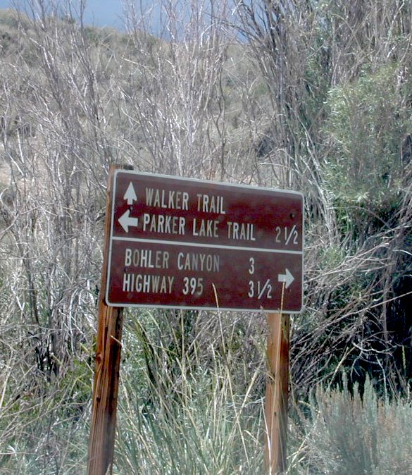
Parker Lake Road – Camp along aspen creeks or in pine forest, near lakes; no facilities. E of Grant Lake on June Lake Loop (Hwy 158)
Coyote Flat 4×4 Bishop – just west of Bishop CA is a 4 wheel drive paradise, Coyote Creek – This steep dirt road is quite a climb. A true off-roaders dream of open space, great views, large meadows, & alpine lakes. Great primitive camping along creeks, in pine or aspen forest or near small secluded lakes. Real remote Sierra high country, usually only reached by backpackers, is accessible to those who dare to venture off the beaten path of Highway 395.
At the golf course keep your eyes peeled — from the highway take Schober Ln. / Underwood Ln. due west through a residential neighborhood to the backside of the town. Find the electrical power station to the left at the base of the hills. Veer onto the slightly paved /dirt road to the right of the station & continue straight up the sandy wash. 4×4 is recommended, since the lowest gears are needed for the careful climb. The road will begin to get steep & gain in elevation fast. The area up here changes with the mileage: passing pinyon pines on cliffs, topping off to high meadows & aspen lined creeks, finally reaching large towering pines & small alpine lakes with snow melt still visible. Basically TREE LINE. This region is most likely open only half the year, due to its high elevation of 8000’+ and winter snow.


 Lone Pine Lakes include –
 (hike in)

 Rock Creek Lake

 Eastern Sierra topographic trail maps to lakes


 Cuyama Peak Lookout Tower


