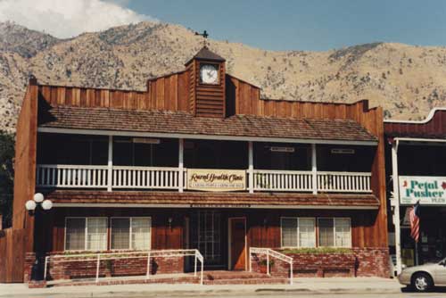
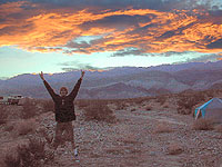
(before the dot com crash, before digital cameras, before GPS, before social media & way ahead of smartphones)
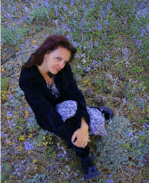
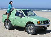
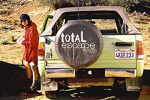
Sole creative force of Total Escape, Dana Williams left her 3D animation career to start living and working her dream job, online and off. Utilizing artistic talents, computer skills, a vast knowledge of the California landscape and a simple love of nature, to make it all come together for a killer web site called Total Escape.
27 years online means fresh content & updates every month; reworking web code every few years to keep up with various browsers, apps, maps, and wildfires.
“travel agent to the back woods”
Living close to the earth with organic gardening and rural living, DanaMite strives to offer California residents, new-comers and visitors unique, local destinations, concentrating on the outdoors – well away from overcrowded, busy, urban cities and tourist traps. Total Escape can show you how to discover the secret, hidden spots on your public lands that the gov web sites will not even dare to mention.
help keep
total escape
online
the independent source for California travel
NO CORPORATE sponsorship No venture capital No government subsidies No annoying pop-up ads
No scripts chugging bandwidth No membership needed
Decades without a television set lends plenty of time for studying terrain, topographic maps, GPS coordinates and thousands of photographs to compile more than 8000 pages on just California travel. Far from the daily grind of everyday life, DanaMite continues in educating the public about local travel, camping, family farms, organic cafes, outdoor recreation, respecting the land, responsible use of our resources & how to get more enjoyment out of weekend travels.
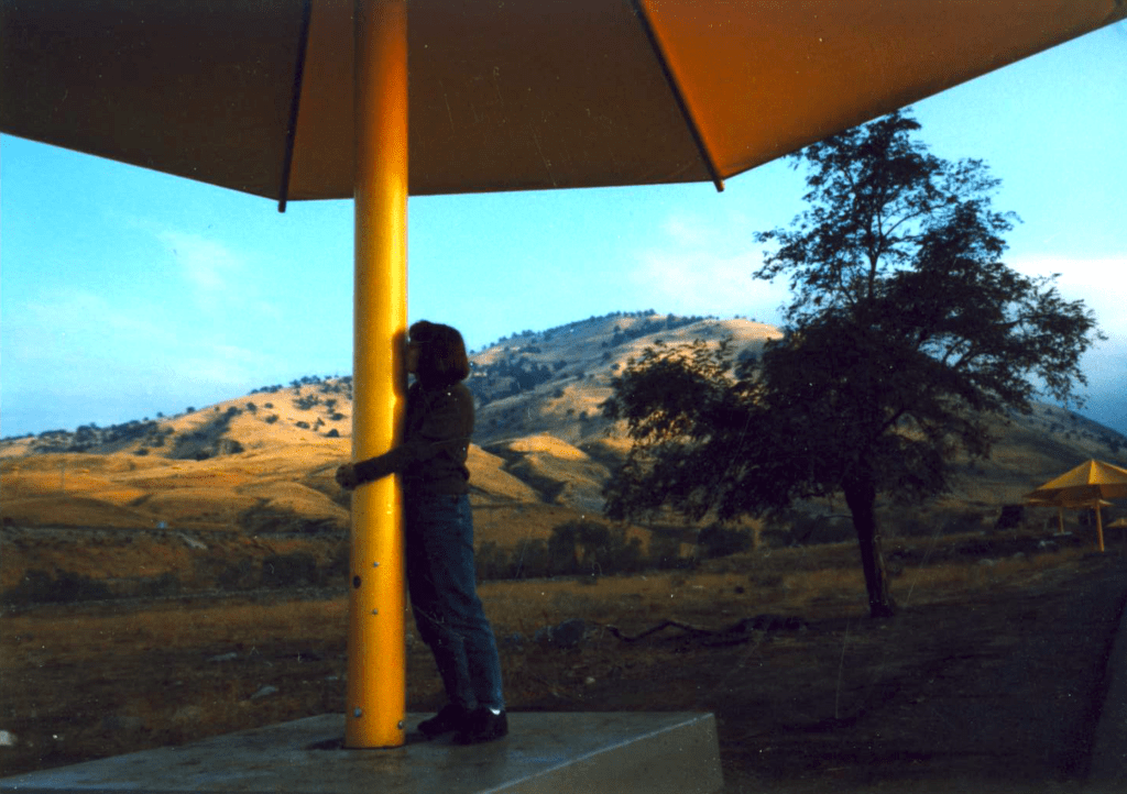
40+ years of documenting back roads of California, plus some Baja & Utah too!DanaMite loves Utah, almost as much as she loves California.Tejon Pass “Cristo’s Umbrellas” art installation 1991. Photo copyright – Kevin Robinson
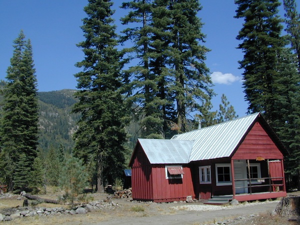
California Fire Lookouts for Rent
US Forest Service Cabins
Rent a secluded cabin with an amazing view, a historic tower for wildfire spotting, or a USFS guard station – hidden deep inside USDA California National Forests. Several of these NFS lookouts have been closed recently, so the ones listed below have links to status and reservation information.
Dirt road access is common to reach these remote locations. Some require stair climbing, or steep access hikes. Winter months are usually snowy, inaccessible and sometimes dangerous for these high country locations. Access roads suffer from closures due to rock slides or landslides. Check with the locals ranger station for current conditions.
A few of these rentals are open all year long – in the southern part of the golden state.
El Dorado National Forest
Harvey West Cabin
4,720′ elev. on Silverfork American River, Gold Rush
Feather River Camping, Lake Almanor Campgrounds, Hat Creek, River Fishing NorCal, Topo Maps, California Campground Reservations, Lassen National Forest camp sites and all the outdoor recreation you can imagine.
Volcanic lands of Lassen National Park are surrounded by Lassen National Forest, which means if you cannot find camping inside the National Park – you can surely find it in the outlying regions – with rivers . The National Park Lassen Hwy 89 is often closed during winter months due to snow, as Diamond Peak & Reading Peak are around 8000′ elevation. In 2011 the south entrance did not open until late summer due to heavy snows.
A few Lassen campground sites may be reservable, more info with links below; the rest of the campgrounds in the green lists are on a first come, first serve basis.
A few PG&E Campgrounds can be found near Lake Alamanor, which are managed by the utility company and not listed on National Forest or National Park web sites.
MOST ALL CAMPGROUNDS CLOSED, due to Dixie Fire damages
LAKE ALMANOR – PG&E Campgrounds
Southshore @ Canyondam, CA
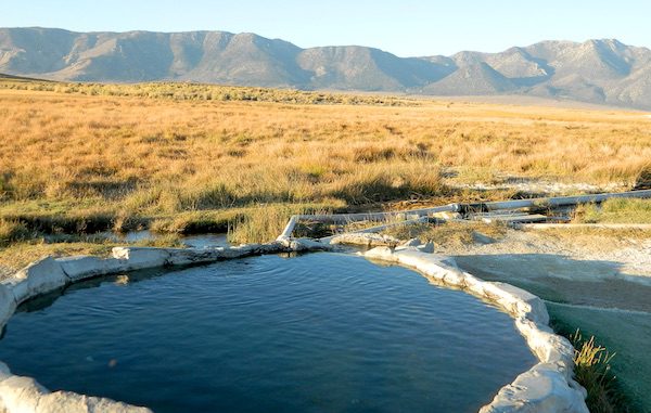
The Eastern Sierra Nevada mountains run the length of US Highway 395, through most of the eastern side of California. Mammoth mountain is a volcano, so naturally hot springs come with the package. These hot tub destinations listed here are mostly part of the Long Valley Caldera, an ancient volcanic table land. North of Bishop and near the snow ski destination towns of June Lake and Mammoth, California in Mono County, California.
(This region is not to be confused with Mammoth Hot Springs in Yellowstone National Park, nor the Mammoth Site in Hot Springs, South Dakota.)
Backroads Camping is allowed throughout Inyo National Forest, but there is private ranch lands mixed in w/ public lands. Respect property boundaries, and speed limits around gates and intersections.
Camp sites are not located next to the soaking tubs. A few may be within walking distance. Parking is often limited at these remote, public use hot pools. Total Escape TIP: Behind Lake Crowley: abundant, free camping – wide graded dirt roads (RV and passenger car suitable). Inyo National Forest Map is recommended.
Eastside of Highway 395
Casa Diablo Hot Springs near the Mammoth exit, is a location noted on most maps, but this seems to be the geothermal power plant for the region. If you are looking for hot springs tubs to soak in, you’ll need to get off the main drag for those beauties, way off the highway.
On to dirt roads
Hot Creek
Inyo Forest Road #3S45
Hot Creek Hatchery Road
(near Mammoth Airport)
Minimal dirt road driving. A very popular spot where hot springs are located within the big creek, so you can feel cold and hot water flowing by you. Scalding can occur near vents underwater, so use caution when wading. Large parking lot overlooks the soaking area and creek canyon. Swimsuits required.
Benton Crossing Road
leads east, around Lake Crowley, to the small town and camping resort and inn of Benton Hot Springs
Inyo Forest Road #2S84
Benton Crossing Road
This rural intersection at US Hwy 395 is known for the little green church on the corner. Turn east off the highway on to this road > BENTON CROSSING.
Pull over, get out and stretch. Look at your maps, get the GPS out and then start your exploring. First timers might be able to find a soaking tub within half an hour, if you don’t get lost. Or get stuck in a muddy spot, which is easy to do at night.
Hill Top Hot Springs
Latitude: 37.6642
Longitude: 118.7883
Elevation: 6873′
also known as – “Hilltop, Pulky’s Pool”
Willy’s Hot Spring
Latitude: 37.6591
Longitude: 118.8425
also known as – “Wild Willie’s, Crowley Springs”
Inyo Forest Road #2S07
Whitmore Tubs Road
a major graded dirt road that leads north off of the paved road, becomes Owens River Road and connects back to US 395 many miles to the north.
Several primitive hot tubs can be found on dirt roads in this region, which lead off the main paved road. At night these remote pools can be hard to find – with no signage, no street lights and pitch black darkness. Plus the mud bogs and grassy fields all around make the landscape difficult to navigate. If you plan a nighttime arrival, then plan to drive in slowly around the pools, have your GPS handy and look for steam in the air. Cut your headlights if you see other cars or people, and proceed slowly.
Be considerate of others and friendly. Do not litter. Do not crank up music. Wait for others to finish soaking and do not rush anybody. Give others space and privacy to get dressed.
Crab Cooker Hot Springs
Latitude: 37.6633
Longitude: -118.7995
Elevation: 6857′
also known as – “Fleur de Lys”
Shepard Hot Springs
Latitude: 37.6668
Longitude: -118.8025
Elevation: 6940′
also known as – “Shepard Springs”
Rock Tub Hot Springs
Latitude: 37.6474
Longitude: -118.8080
Elevation: 6990′
also known as – “The Rock Circle”
Little Hot Creek
Latitude: 37.6902
Longitude: -118.8424
Elevation: 7000′
Inyo Forest Road #3S138 high clearance vehicle required
Whitmore Hot Springs
904 Benton Crossing Road Mono County Park w/ public swimming pool & day use fee
Phone: 760-935-4222
also known as – “Whitmore Tubs, Whitmore Springs”
Minarets at Mammoth
The Backside
Inyo Forest Road #3S11
Minaret Summit Rd
This wilderness region is located the on the west side of Mammoth Mountain, accessible by the paved Minaret Summit Road, which closes due to deep snow and is generally only open during summer months.
Red’s Meadow Hot Springs
developed campground w/ wooden sheds for baths: showers & tubs.
near Devil’s Postpile National Monument
Latitude: 37.618
Longitude: 119.074
Elevation: 7000′
also known as – “Red’s Meadow Hot Showers”
Iva Bell Hot Springs
remote, wilderness; hike-in hot springs.
south of Mammoth & Rainbow Falls, via trail #2622
Latitude: 37.532
Longitude: 119.025
Elevation: 7400′
also known as – “Fish Creek Hot Springs”
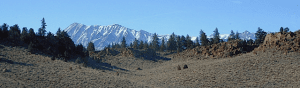
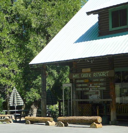
Lassen Camping for Free – on Mill CreekMill Creek w/ Lassen Peaks (July 2011)
Numerous Mill Creeks exist in the golden state of California. Here we will list most of them, some with campgrounds and others without. Waterfalls, big rivers and
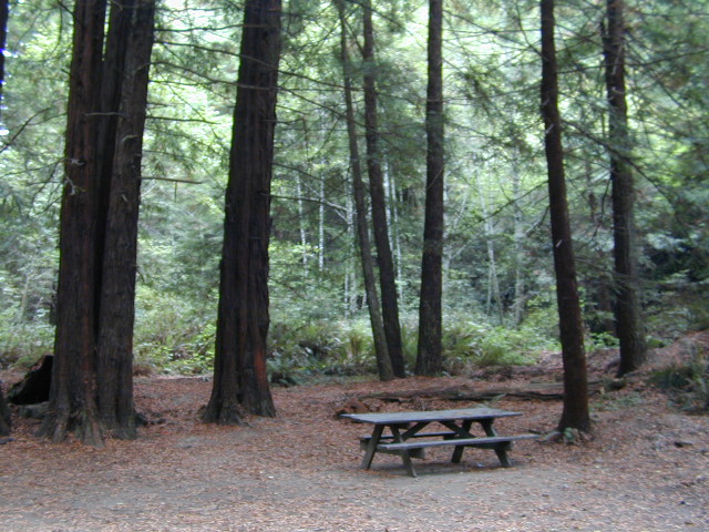
Small mountain resort in the forest near Mill Creek, with cabin rentals, RV camping and campgrounds nearby. A general store is open in summer months, and snow can be found in winter. Highway 172 makes a nice paved loop around this forested area and joins back to Hwy 36. Route may be closed due to snow in winter & spring. Free camping can be found along this creek, although a campfire permit is always required for camping outside of developed campgrounds.
Mill Creek Resort
40271 Highway 172, Mill Creek CA 96061
530-595 4449
Mill Creek Resort Campground
elevation = 4720′
14 tent sites
8 RV sites
reservations & fees
closed in winter
showers & flush toilets
picnic tables
camp fire rings
Mill Creek Indians: Described as a group of ‘renegade and outlaws’, from multiple tribes in NorCal. Mill Creek Indians took shelter in secluded Mill Creek gorge, located below the Mill Creek Rim, a volcanic ridge which extends from Mount Lassen to the Sacramento River Valley. See more on Ishi Wilderness.
Fouts Springsis a popular off-road camping area on the far east side of Mendocino National Forest. Many miles off I-5, near Stonyford, CA. Numerous NFS campgrounds exist is this rugged canyon. One of them is called Mill Creek Campground and it has few pine tree and lots of chaparral, plus a decent little creek flowing nearby. OHV – off highway vehicle use is heavy in this region, so know when to go. At certain times of the year this remote canyon can be quiet and peaceful. Call the local rangers to find out.
Stonyford Workcenter
5171 Stonyford-Elk Creek Road
Stonyford, CA 95979
530-963-3128
NOTE: RANCH FIRE, this whole Mendocino Forest was badly burned by recent wildfires. Mendocino Complex Fire 2018
All of the Snow Mountain Wilderness was burnt and affected, including all the National Forest land surrounding it. Fouts Springs Campgrounds may have been spared, but the hills, trails and roads now lead to blackened forest. Many routes could be closed; check with ranger station in advance of travel.
Mill Creek Waterfall is located on the western slopes of the Warner Range, near the South Warner Wilderness. On the headwaters to the Pit River; About 6 miles east of US Highway 395, near the town of Likely, south of Alturas, California
TheBucks Lake Wilderness region also has a developed NFS Mill Creek Campground. The camp location is well off the Bucks Lake Road, tucked deep in a tight canyon; northern most point and near a dam for the large Bucks Lake.
elevation = 5200′
10 camp sites
fee
closed in winter
14 night camp limit
RV = 21′ max
pit toilets
picnic tables
camp fire rings
Bucklin Road (aka Bucklin Dam Rd and Road 33) #24N24 a paved road on the west end of Bucks Lake, connects to Road #24N88X which leads back to this smaller campground; camp sites are paved. Steep driveway down.
This Mill Creek intersects Bucks Lake at the campground, then connects to the PCT hiking trail, although the narrow dirt road #24N88X veers away from creek a few miles up.
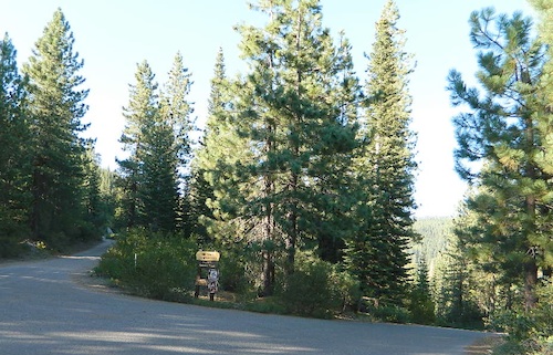
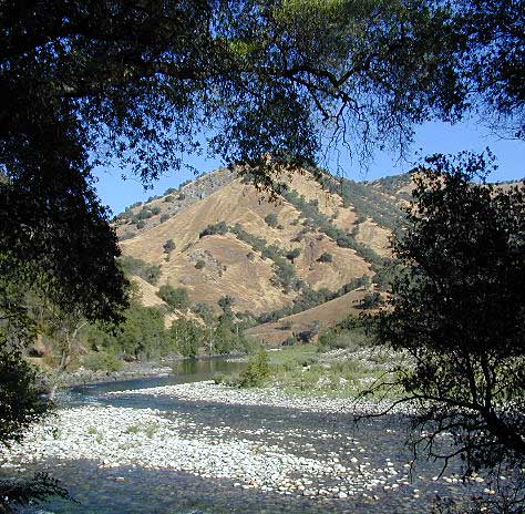
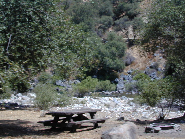
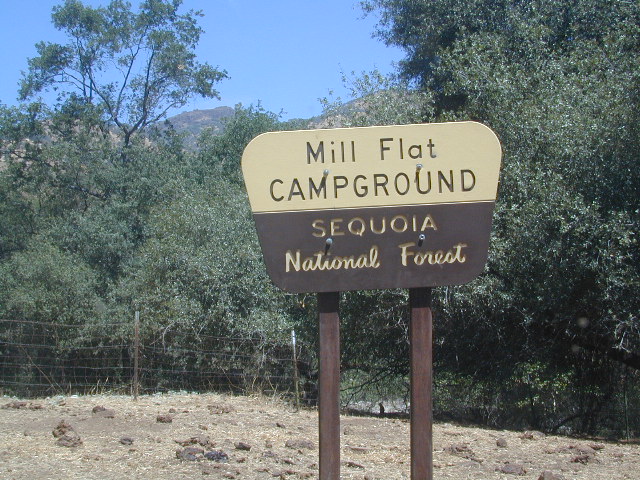
This Mill Creek is located on the south shore of the lower Kings River, above Pine Flat Reservoir. This is the boundary where Sequoia NF meets the big river, and on the other side of the water is the Sierra NF.
Mill Flat Campground (also known as Mill Creek Camp) is a shady, oak flat campground on a dirt road, located at a dead end canyon site, right on the rocky rivers edge.
As usual – the further you drive, the more seclusion you will find. This observation holds true for this Mill Creek location. During peak summer months, there may be families enjoying this spot, but most of the year it is virtually empty and rarely used.
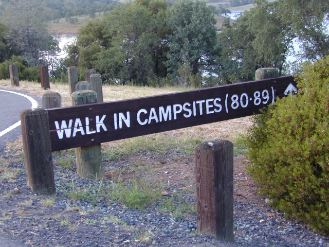
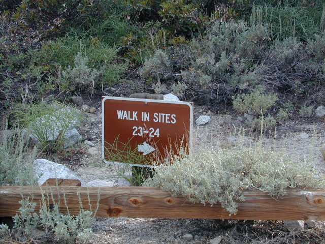
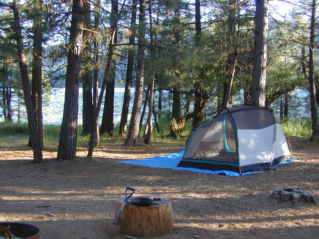
Below are developed campgrounds in California that have walk-in camp spots available. Vehicles are parked and you must carry your gear into the camp site (usually a short distance, but can be up to a half mile).
California Campgrounds with more than a 1-mile trek are not included in this list below. Areas such as – Catalina Island, Crystal Cove SP, Angel Island SP, Point Reyes National Seashore, indeed have many hike-to camps, but most are measured in miles (one way).
walk in campsites are perfect for –
people who wish not to see cars @ camp
people who prefer less noise while camping
physically fit folks, who want exercise
backpackers, who plan to hit the trails soon
avid hikers, who may be out day hiking
cyclists, just passing through
mountain bike campers
one nighters, travelers who only stay one night
late comers to the campground
(hint: these are usually the last campsites to fill up)
Walk in campsites are often located away from car campers & RVs. Some camp sites may have more privacy, tucked away in trees, while others have shared community area with fire pits and/or barbecues. All camp sites will have picnic tables and a some kinda toilet nearby. Bear boxes may be available for storing food properly. Sharing these food storage boxes with neighboring campers is common practice.
Campgrounds with walk-in sites range in elevation from sea level marshlands to high altitude alpine lakes. Most of these camps listed below are located inside developed campgrounds with overnight fees. Many are small campgrounds, while others are large hubs of activity. Some may be smaller campgrounds, with just a few camp sites. The most popular places can be reserved, with the links provided.
Many parks can also have day use fees, so know where you park and what time span is allowed. Ask the campground host if needing assistance. Some campgrounds lock their gates at sunset and do not permit entry at night. Others may not allow campers to check in anytime after sundown. Know their rules before you make reservations.
If you plan on not making camp reservations; make sure to have a plan B or C choice camp – in case your desired campground is already full. Many popular destinations can fill up fast (by noon in the summer).
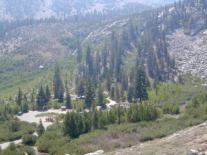
Spacious Camp @ Aspen Grove Campground, Eagle Lake, CA
Niagra Creek Campground, OHV 4×4 trails, Stanislaus NF
North Battle Creek Reservoir, PG&E Camp, West of Lassen North Grove Campground, Calaveras Big Trees State Park
Southwest Walk-In Camp, 6700′ elev @ Lassen Volcanic NP Squaw Leap Campground, San Joaquin River, Auberry CA Stillwater Cove Regional Park, N of Fort Ross, Sonoma Coast
Table Mountain Group Camp, Bishop Creek Canyon, Inyo NF
Tahoe National Forest
Donner Area Camping Lakes
NFS 530-265-4531
Carr Lake Campground 10 miles north of Highway 20 6,700′ elev 5 walk-in campsites
Rucker Lake Campground 6 miles north of Highway 20 5,462′ elev 7 walk-in campsites
Sterling Lake Campground 9 miles north of Interstate 80 7,000′ elev 6 walk-in campsites
Toad Lake Walk In Camp, PCT @ Shasta National Forest Tuolumne Meadows Camp, Yosemite National Park
(reservations & wilderness permits required)
Walk in campgrounds are considered ‘tent camping‘, as opposed to ‘car camping‘, which is literally camping next to your vehicle. This type of hike-in camping may also be referred to as ‘trailhead camping‘, as many ideal hikes begin at these prime locations. Boat-in, bike-in or hike-in camp sites are also available at some of these locations.
“It was sport to have a gale in such weather as this. Yet it blew like a hurricane. The wind seemed to come with a spite, an edge to it, which threatened to scrape us off the yards. The mere force of the wind was greater than I had ever seen before.”
– Richard Henry Dana, Jr. Two Years Before the Mast (1843)
In the early days of California cargo shipping, the sailers referred to the wild winds as “south-easterlies”. So strong and unpredictable in fact, that they often had to cut anchor and drift far out to sea – to wait out the wind event.
offshore winds
Various nicknames have been given to the easterly winds in California. They develop from a high or low pressure system that builds in the Great Basin, pushing winds from the desert towards the west, over the Sierra mountains and into California.
Wind events can last for days, but usually not a full week.
Santa Ana Winds
Southeasters
Sundowners
Mono Winds
Diablo Winds
Indian Summer
Northeasters
North-easterlies
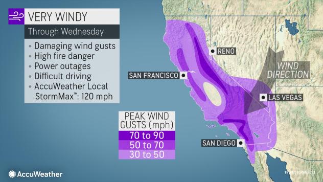
Wind gusts measuring over 100 mph typically recorded in Sierra passes
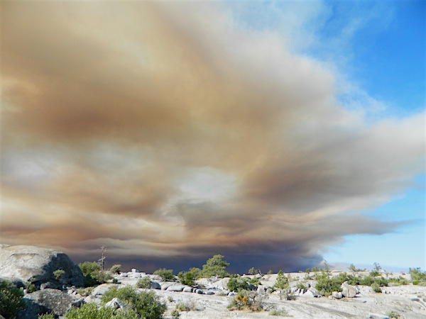
RED FLAG – Weather forecasters announce “Red Flag Warnings” when predicting, banning all outdoor burning and all use of campfires. Humidity levels drop into single digits or teens, and created extremely critical wildfire conditions. Utility companies are now preemptively cutting electric power to millions of customers across the state to reduce the risk of fires (sparking from power poles). Extreme fire weather can last for months, usually in the last half of the year. December rains usually put an end to the wildfire dangers, but the wind events can last all winter long.
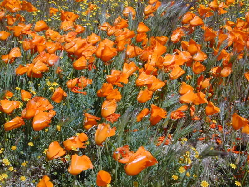
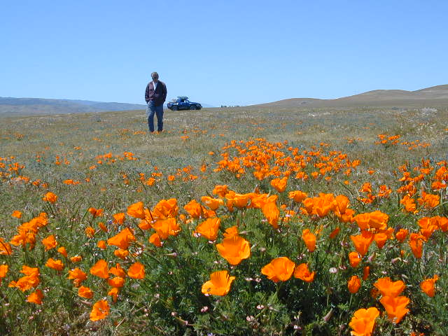
Wind whipped Golden poppies in the high deserts of Antelope Valley.Desert winds are harsh. Not properly staking down your tent results in gear rolling down canyon.
This is a term often used for travel. High profile vehicles can literally tip over (while driving) in strong winds. Aircraft can be grounded and unable to fly, during such events. Helicopters generally do not fly during strong winds. Boats at harbor may need to be secured.
Electronic Freeway signs can display messages about high winds. These type of vehicle should heed the warnings.
big rigs
camper vans
5th wheel travel trailers
motorhomes
moving trucks / rentals
RVs (recreational vehicles)
trailers in tow
truck campers
u-haul trucks
California places that experience top wind speeds –
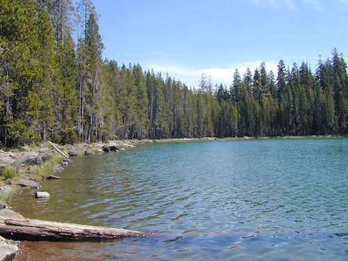
Silver Lake Road #10
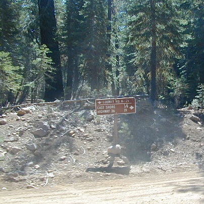
20 miles off Highway 89. Northbound, outside of Westwood @ Lake Almanor, take County Road A21 to County Road 110 (Silver Lake Rd)
Dirt road boat ramp @ southern end of lake. Winter weather & snow closes this area annually, so this lake is mainly a summertime destination. Mid-week tends to be less popular for those seeking seclusion.
backpacking
fishing
camping
canoe
hiking
kayaking
Hiking trails lead to Caribou Lake, Emerald Lake, Betty Lake, Trail Lake, Shotoverin Lake & Caribou Wilderness.
Silver Bowl Campground NFS
• Elevation: 6400′
• Number of Sites: 18
• Vehicle Accessibility: small RV
• Campsites Reservation: No
• Camp Fee: Yes
• Toilet: Vault
• Water: piped/potable
• Length of Stay: 14 Days
• Season: May – October
• Trailheads: Caribou Wilderness
Lassen National Forest
Lassen National Forest
Almanor Ranger District
900 East Highway 36
Chester, CA 96020
530-258-2141
2 Silver Lake in East Lassen? Surely.
Only 12 miles apart. As the crow flies.
Largest is Silver Lake, south of Caribou Lake, Lassen National Forest. East of the National Park, accessible by vehicle. The popular one that is mentioned above.
Small Silver Lake at 6600′ elevation, is a hike-in only lake. Inside Lassen National Park, west of Snag Lake and the Fantastic Lava Beds.
There once was a time when we connected more with nature. Before we closed ourselves off, behind the doors and windows, behind the computer screens, before the internet became part of daily life.
Overweight and obesity is now epidemic in America (as if you didn’t notice). Fast food feasting and soda pop, GMO-gut disorders – and yet we’re still frustrated or disappointed with life; Addicted to television, processed food, copious amounts of sugar, daily coffee, smoking, prescription drugs, and what else.
Wi-fi streaming, video games, always indoors, online, enjoying air conditioned cubes. Inactive physically, emotionally vacant, bored with our choices and always on social media.
Stop and think. Look what has happened to us.
Is this the life you envisioned?
Cooking over a camp fire and real conversation are just a few examples of what we have lost in our modern world of technology, fantasy and face-time. Fresh air, wild flowers, alpine lakes, star filled skies and total silence – all still exist in certain areas, but you must know where to look. Birds and bees, wildlife is disappearing at extinction levels. Pollution, powerful corporations and politics.
Stop and look. See what has happened to earth.
Is this the world you envisioned?
Gone! Away, split, out of town. Off work, out of school, on vacation. Outdoors, always. Far, far away. Unplugged, out of range, vacant lands, big trees, open skies, clear views. California is the land of dreams. Opportunity, fantasy, education, agriculture, terrific terrain and epic scenery. Campfires, waterfalls and mountain meadows are waiting for you.
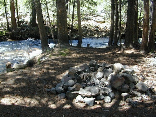
Taking time off of work – or your typical daily routine – is often rewarding physically as well as mentally. Imagine a week away in a gorgeous location, with minimal to do. Really relax, zone out, chill. Gaze at the water, nap in a hammock, find wildflowers, deer bones, or bear fur on a tree. Cook over the campfire, stargaze every night.
Running to a general store for ice will be your biggest task of the week.
Wilderness boundary, abundant dirt roads and freedom; cell phone calls dropped. Beyond the city limits. Well past the county line.
Roads do lead out of the matrix, if you desire to follow them. Concentrate on a new reality – and disconnect long enough to commune with nature. Find the free time to really relax and re-evaluate life. Explore other options, consider real life in the bigger picture. Hike, bike, walk, camp, birdwatch. Be outdoors, often!
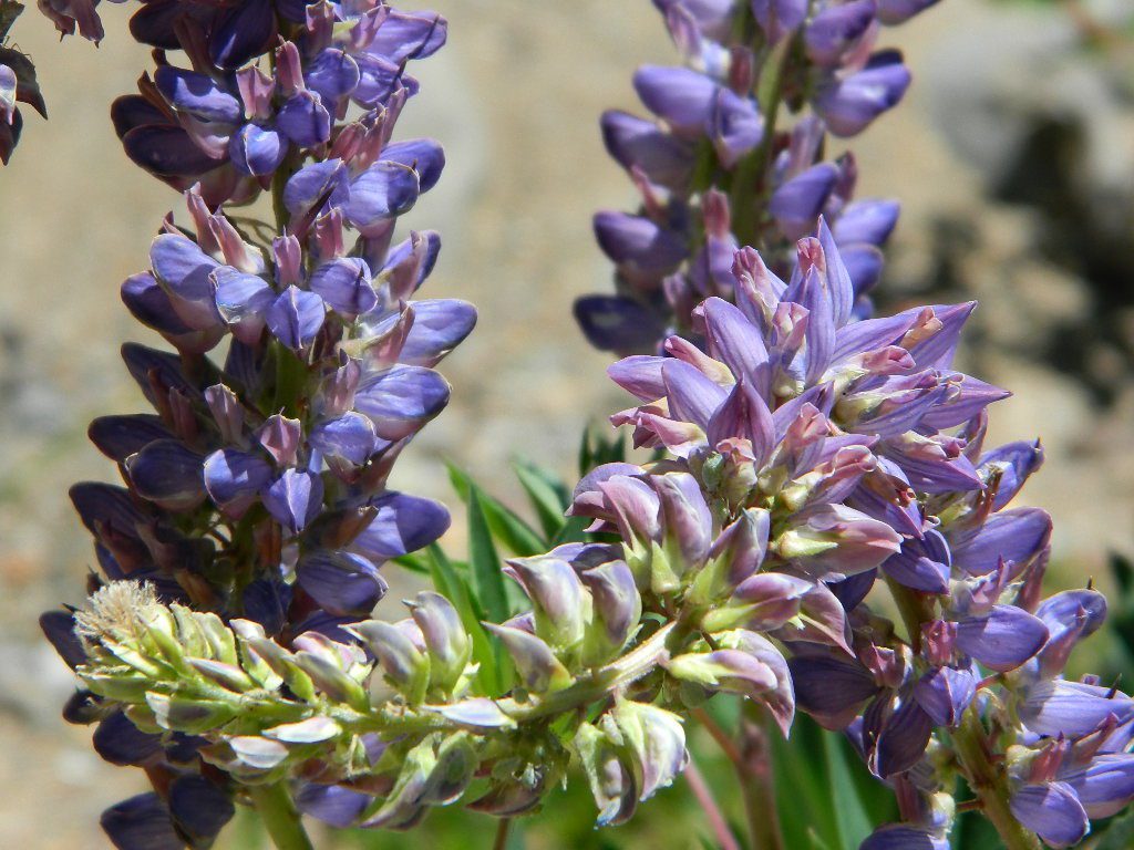
Beat the Summer Heat and head to upper elevation Cool ForestsCurly Lupine @ Mill Creek, CA
Cheap Road Trips
Total Escape is your California planner. We’ve been doing this “region” for more than 30 years, always focusing on the back roads. Discover hidden secrets, meadows and unknown waterfalls. Find free campsites, canyons, rivers, creeks and new places to explore.
Merced Lake is one remote destination along the High Sierra Camp Loop, Yosemite Wilderness.
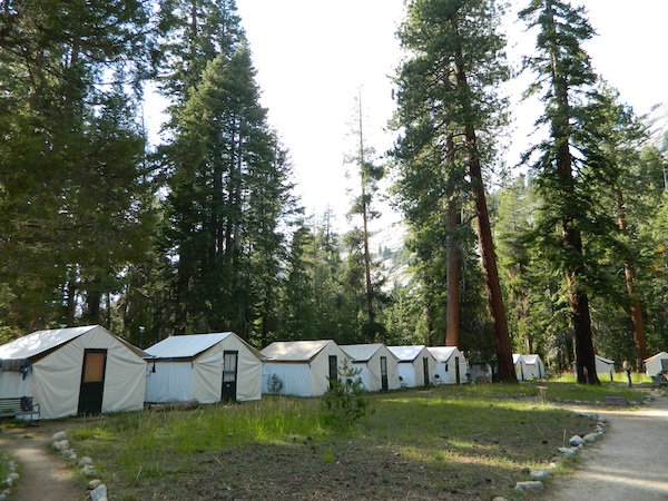
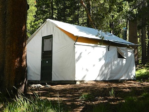
Tent Cabins & Yurt Rentals
around California
Tent cabins are made up of wooden floors, canvas walls & a canvas roof – a combination between a tent & a rustic cabin. Most have sleeping cots for beds; some have heaters, wood burning stoves or electrical outlets. A shared community bathroom is often close by.
Yurts are round versions of this same concept, with a wooden floor, real beds and usually nicer decor. Often these places request that you bring your own bed linens and towels, but each resort is different, so check the web links for detailed info.
Hike-in locations in the wilderness, rural river resorts or an easy drive to campground right off the freeway. These popular lodging accommodation are often marketed as GLAMPING, as in Glamour Camping – for the (luxury loving) princess who likes to try out nature – in a very controlled setting. Just watch out for mountain lions and bears.
Below are unique places in California that offer tent cabins, tree houses and yurt rentals.
Yosemite Lakes Resort
Cabins & Yurt Rentals
South Fork of the Tuolumne River
31191 Hardin Flat Rd
Groveland, CA
209-962-0121
800-533-1001 Western Sierra Nevada
Yosemite Pines RV Park
20450 Old Highway 120
Groveland, CA
209-962-7690 Western Sierra Nevada
HSC: HIGH SIERRA CAMP
Yosemite National Park Tent Cabins:
(advanced reservations required)
White Wolf Lodge
Backcountry wilderness area along Highway 120, Yosemite NP
ALLERGY NOTE: Most tent cabins are constructed out of heavy canvas material (fabric), which can mold when exposed to moisture (rain, fog, snow). Often they get dismantled, cleaned and stored properly over each winter season, sometimes not; All depends on weather, terrain difficulty and individual resort practices. If you suffer w/ allergies, moldy tent walls and dust mites can trigger asthma or other allergic reactions. If in doubt speak to the innkeeper or caretaker ahead of time.
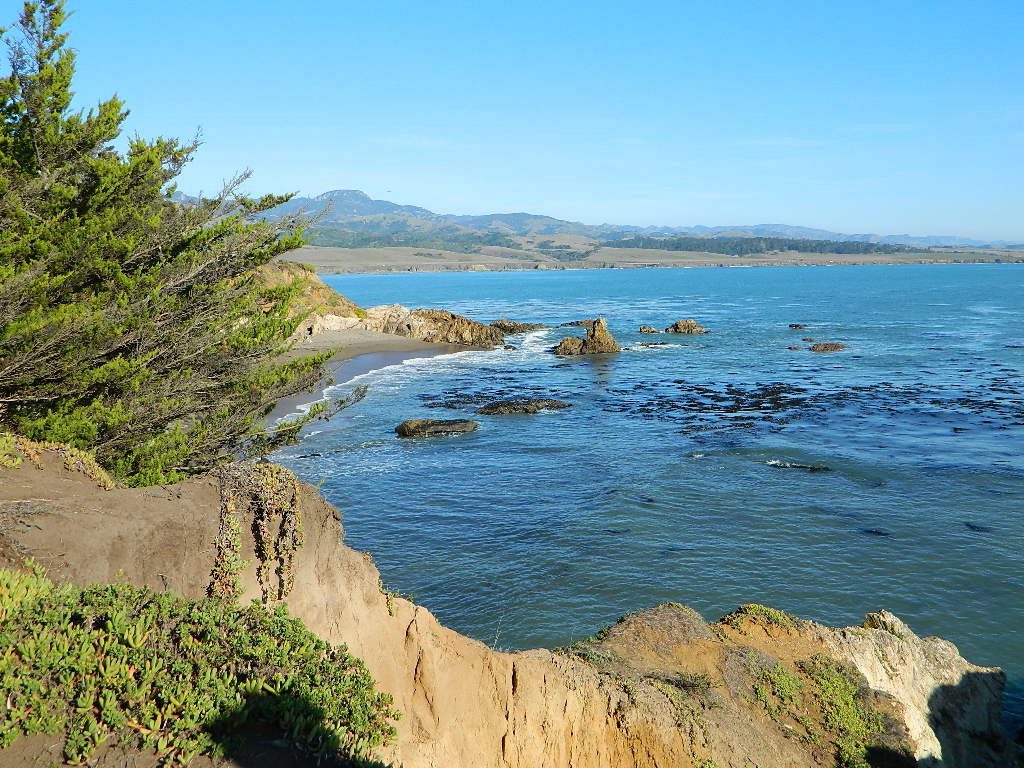
San Simeon SP. Central Coast of California
Rent a Treehouse
Post Ranch Inn
Tree-House Rentals in California
Big Sur, CA Big Sur Coastline
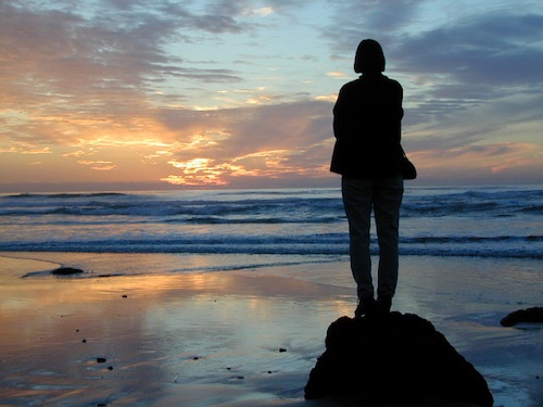
enjoying quality time alone is not weird, wrong, or unnatural, no matter how many strange looks you get from friends & envious co-workers
Stop waiting for someone to do things with. Quit thinking that your best friend or partner will one day magically suggest an outdoorsy road trip, or day hike, or mountain bike ride. YOU are the one who craves the wildness of the earth, the unexplored, the secluded. The time is now for you to start living the life you want, outdoors, in California – today!
maybe it’s time to leave the city, for good
If you’ve just about had it with the pressures of everyday stresses, the wifi city life and the busy pace of civilized society is starting to get to you. Get a clue fast – before you loose your marbles. It’s time for much needed rest and relaxation. Nature is the best place to relax and reconnect with yourself and mother nature.
A change in scenery. A fresh perspective. A real break from the norm. No shopping, no errands, no phones, no television, no computers, nobody around. No one, except you.
Unplug yourself from the hectic rat race and go exploring. Give yourself time to fully unwind: time to think, time to enjoy the outdoors and really find that special place of peace that comes only from earth. Yes, all by yourself.
VISION QUEST
Call it an annual primal ritual, or a first time experiment, traveling solo can be a blessing in disguise. Learning to be alone outdoors, become more aware of the physical world and enjoying yourself is an important key to a balanced life. Whether you seek a quick refresher course for the weekend or a full blown month long road trip, seeking a new comfortable destination and the art of basic relaxing is the main focus for this trip.
slow going
When you travel alone, it’s easy to take your own sweet time. Going slow is something we don’t usually do in our busy city lives. Time is so precious, so you may as well stretch that vacation out as long as possible. Savor the moments.
Take as long as you like for – photography, picnicking, hiking, stretching, yoga, cooking and stargazing. Firewood collection becomes the biggest chore of the day, and it could take hours. Walking from camp, every direction will lead to a new adventure. Driving back roads at 20 mph is luxurious. No one to be your back seat driver. Sleep in every day if you want. No pressures, no schedules, no big worries. Sunlight, food, heat, weather, cooking and cleaning. Sit back and learn to really relax. Enjoy a secluded camp site for a full week, and get to know the wildlife on a first name basis.
Follow the back roads to seclusion, or reserve several days at a unique campground. Imagine night after night of peaceful rest, with the sounds of nature surrounding you & the stars of the heavens dancing across the darkest skies.
Explore new terrain every day & move to a new camp every night. Or make it a “stay put” week-long meditation, in one spot. Whatever fits your needs. Either way, you’ll enjoy the solitude & the healing powers of nature. Answering to no one but yourself, you may feel guilty or kinda selfish the first few days, but this will fade as you learn to embrace the solo journey.
And it doesn’t hafta be all about roughin it either. While backpacking into the almighty wilds of the true wilderness has its good points – along with life threatening dangers possible every day, a simple quick weekend trip to a nearby small inn, fishing lodge, or a bed & breakfast could work for the pampered types. Choose something different and unique, yet know your own limitations (on comfort & on a physical level). Make sure your destination choice is surrounded by some nature and preferably wilderness.
Good California Maps are a must have! Don’t rely on digital cell service or count on online maps being readily available. The hard-copy versions are always the best back up plan. Old paper maps are the very best, cuz they can often show more hidden waterfalls, trails and old mines than the newer maps.
National Forest maps are best for getting and staying away from the tourist crowds. Visit Destinations to decide what kinda place you wanna explore this season.
which is why the golden state population always seems to be increasing, right? Helping you get away from your normal routine and the masses is what we do best here at Total Escape. Discover thousands of pages, photos and links on this site to create your very own unique retreat.
The mountains, deserts, coastal, rolling oak countryside & even urban escape inside city villages, are perfect starting points for planning your little escape.
Desert camping in autumn, winter and springtime months is perfect timing for any kinda soul searching, catching up on a good book, or just gazing out at the vast vistas. Meteor showers fall within the latter part of the year, so stargazing and camping is excellent with the new moon. Temps start to drop come September, so be warned. Mountain cabins drop to their off season rates after summer, but be prepared for chilly temps and get proper outdoor gear.
SAFETY TIPS: Give your schedule to someone. Any bit of info is helpful. A map or written itinerary given to a neighbor or close friend will help ensure your safety and timely return. Bring your cell phone, plenty maps, bear mace, a firearm and emergency supplies for additional security.
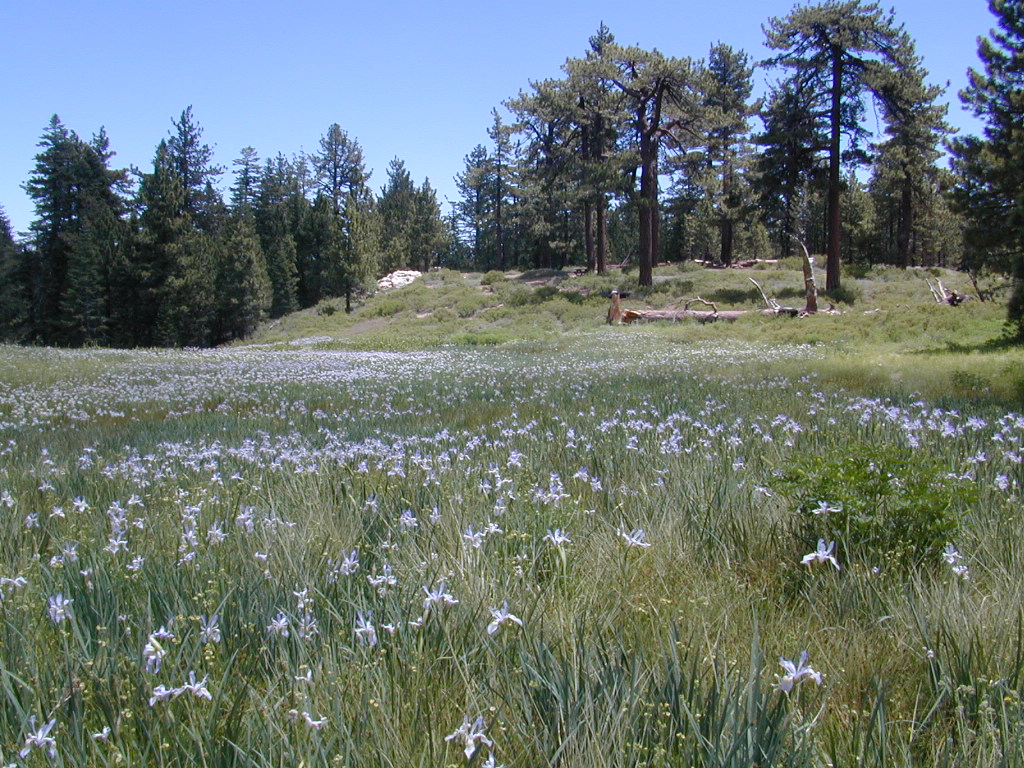
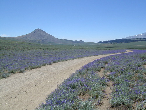
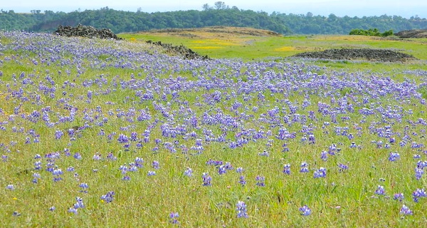
California meadow is a common term people search for when dreaming of their mountain retreat vacation or upcoming weekend camping trip.
Meadows are places in the forest where cool air collects and settles. Deer among other wildlife, can often be found here grazing around dawn and dusk. Alpine meadows are usually surrounded by trees with lush green grasses, located at higher altitudes above 6000′ – the ‘highcountry’ as most like to say.
Find meadows on National Forest lands from 3000-10,000′ elevation, and it is not uncommon to see cattle grazing in these same regions. California National Parks have some of the most protected meadows in the golden state!
MT SAGE – mountain sage meadows
High desert mountains have drier landscapes, with large sage brush meadows surrounded by sparse pinon pine and/or juniper forest. The Mojave desert’s sagebrush reaches out westward to the peaks of West Kern County. High deserts and mountain meadows can both have significant wildflower blooms. The deserts start to show color in March & April, while the highest elevations of the Sierra Nevada can bloom as late as July & August. All California Wildflowers depend on autumn seasonal rains & snow melt.
Kennedy Meadows from Bald Mountain Fire Lookout
Wilderness Meadows
The best places to find secluded wildflower meadows is on the high country trails of various mountains – Mount Pinos, Sierra Nevada, Shasta, Trinity & Lassen – all have marvelous meadows, some have easy access w/ parking nearby and others are hike-in only. Locate hiking trailheads for meadows and possibly find camp nearby.
Excellent near Meadows:
Stargazing, Wildflowers, Wildlife Viewing, Horse Camping
Explore dirt back roads of California to find your very own meadow. If you would like to explore at this level, a good topo map is highly advised. The Sierra Nevada mountains have the most beautiful meadows in the state (by far). Their scenery w/ granite outcroppings and wild flowers, surpasses all else. Although on rare occasions, even the Antelope Valley can look amazing — with poppies.
Mountain Meadows are sacred spaces: Do not disturb the lush, grassy landscape, as wildlife rely on these areas for survival.
No driving on meadows. No camping on meadows; No Campfires; Camp next to (or nearby), but not on top of the meadow. Picnicking should be kept on the sidelines.
Stay on designated dirt roads: No tires across the meadow; No mountain biking, No dirt bikes, No off roading. You’re not spreading the seeds, you’re destroying a fragile ecosystem.
Ranch FENCING w/ barbed-wire is quite common around meadows, to keep cattle out of certain problem areas. Fences also help keep the wandering public out of private lands or sensitive areas.
When hiking – stay out of the muddy spots and know that if you choose to hike directly across meadow, you may encounter water and deep, sinking mud. HINT: There is usually a shallow creek running through most meadows, during all times of the year.
Winter snow usually blankets these fragile areas in winter, and when deep enough – making this terrain prime destinations for snowmobilers.
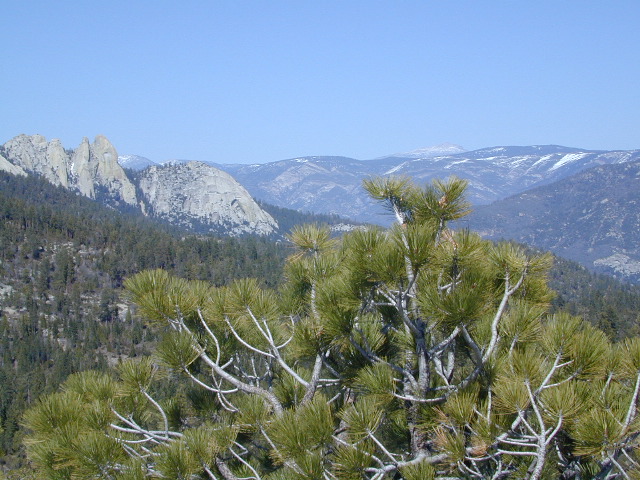
Bald Mountain (elev 9382′) Lookout in Sequoia National Forest
NFS Fire Lookout Towers
JULY 2019 – Many thanks goes to Pike County Lookout for initially spotting the #RockFire – in the Plumas National Forest, near Berry Creek, CA
Lookouts in the California National Forests
Ready to see far and wide – with wild terrain? Views for 100 miles out and the best scenery California has to offer. Be prepared to off road or hike to reach one of these destinations.
Below is a list of historic look out towers & cabins used for spotting wildfires. Some are located on steep granite peaks, ridge lines or dirt roads. 4WD may be recommended to reach some of these. Road conditions can change w/ harsh mountain weather, so be prepared to rough it. Thunderstorms are common on these mountain ridges.
Several of these places are cabins, some are stone houses, but most fire lookouts are basic metal towers – with high climbing staircases, so you must be in decent physical strength to haul your ass up this high.
Cabins are also called guard stations, huts, bunkhouses. Most are located on mountain tops, but a few exist in desert regions. Some are refurbished & available for overnight rentals. Bare bones furnishings, so forget the frills. People come up here for the thrills. To be outside w/ epic views, way away from the urban grind & to feel on top-of-the-world.
See the full list of overnight accommodations on mountain peaks & ridges, some near meadows @ National Forest Cabin Rentals
Bald Mountain Lookout (no overnight stays) off of Sherman’s Pass Road #22S05, 4×4 may be needed.
Bald Mountain 9382′ elevation; in between the Kern Plateau & Kern River
Always check for local fire conditions at nearest ranger station, obtain a free campfire permit when camping outside of developed campgrounds, and always practice fire safety when visiting our public lands. You can be held liable for wildfires. Outta control campfire, cigarettes, idling vehicles on tall, dry grass. Be very cautious with fires on the often dry, west coast.
Canon Sin Nombre – Anza Borrego
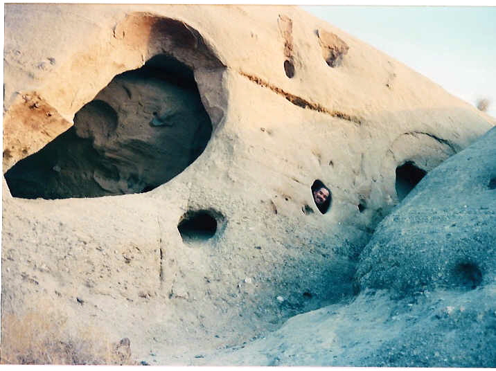
Mud Caves and Slot Canyon Hikes
Desert Slot Canyons – South Anza Borrego State Park region, just off County Road S-2 east of the ‘badlands overlook’ view point is a whole network of narrow walkways & skinny canyon trails to explore. Some are so tight you have to turn side ways to fit through. There are more than one of these sandstone topless caverns. Finding a new one each time you visit is a fun challenge. Just north in the Diablo canyon there are dry mud tunnels & trails as well. Explore & be careful not to get lost. And don’t camp at the canyon openings during the threat of heavy rains…duh.
Drive down steep, sandy road into Canon Sin Nombre entrance (the dirt road just to the north of Badlands Overlook). A high clearance vehicle is recommended and 4WD may be required in soft sand. 2WD SUVs/trucks should keep their speed up through the soft sandy areas & try not to turn or stop suddenly. Go slow in narrow sections of the canyon & slow over the rocks to save your oil pan.
Clock your mileage 1 mile exactly from the paved road (s2) & park out in desert wash, pull over between the smoke trees. Hike over to the left side & look for an opening in the canyon walls to a deep secluded trench. A campsite may exists here.
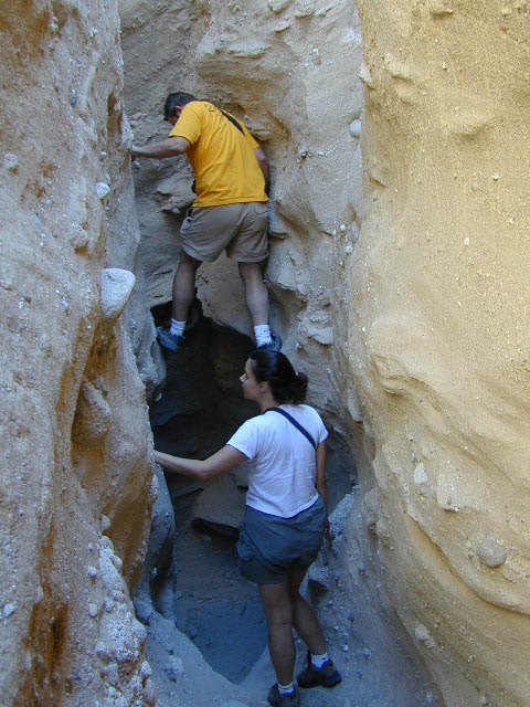
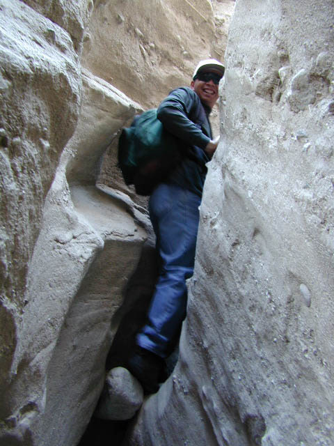
Hike up the first canyon which does require some rock scrambling. The gorge lets you out at the very top with an impressive view over the Sweeney Pass area. The canyon walls are so tight in some spots you may have to turn sideways to fit through. Upper body strength is needed to climb high ledges & boulder scramble through this natural maze.
Once on top, wander on the ridge & check out the views; keeping to the right & then follow the next wash down to start the much longer & easier exit. Hike down in the main slot canyon which leads out to a big camp site & clearing. Exit slot area and turn right, walking back to the vehicle in the big wash.
This particular hike is a blast on a full moon night, but not for a first timers try.
Best time to visit: October – April
HIGH CLEARANCE VEHICLE access to reach trailhead. Moderate hike, boulder scrambling w/ dangerous mud walls. Flash floods here are possible during rains.
Plenty of 4×4 roads, SUV trails, & box canyons in the desert region.
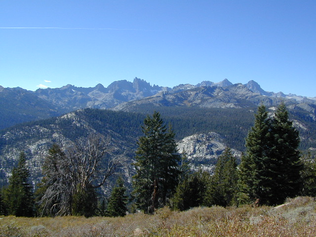
Golden gems of California, a collection of alpine lakes on the north end of Historic Gold Country, North Yuba River, Northern Sierra Nevada
EAST of Downieville, CA
California’s Gold Lake and surrounding lakes; the granite spires of the Sierra Buttes and the creeks, waterfalls, headwaters of the Yuba River — total wild beauty. Steep, granite, river canyon from Downieville drive east on Highway 49 from Sierra City to Bassetts, a gasoline and market stop; they have a small hotel there too.
Take the left turn, north on to the Gold Lake Highway. The alpine and extremely scenic Lakes Basin Area consist of all small lakes in between Hwy 49 to Hwy 89, along GOLD LAKE HWY [Road S620] some maps read Road #24 or call this Gold Lake “Road” instead of highway. Snow closes in this route during winter months.
Frazier Falls Trail
Length: 1 mile RT / Directions: Trail head is located on Old Gold Lake Road, about 5 miles from the Highway 89/Gold Lake Road intersection. Take the signed, narrow paved access road 4 miles to the trail head.
Lake Genevieve, hike-in only access. Way up behind Convict Lake @ Mammoth Lakes, CA
calif lakes / secluded lakes / loop hike around lake / best lake in california / lake elevation / geology lakes / alpine lakes
hike-in lakes
Wilderness lakes are as pure as it gets. No cattle, no roads nearby. Snow melt, cool days, good fishing, great mountain scenery, granite, fresh air & clean water. You have to really wanna reach them. You must physically WORK to get to these remote alpine wonderlands – hike, bike, or horseback.
Heart Lake, near Onion Valley & Kearsarge Pass
Some lakes are accessible via a day hike, with miles of forest trails or granite switchbacks in between. Waterfalls, wildflowers and wildlife will keep you entertained, as you enjoy your trek. No rush, no pressure; Go slow and take it all in. Remember, it’s not a race!
Most people prefer to backpack in to these locations and stay a while. Why not? These puppies are ACCESSIBLE only a few months outta the whole year. May as well enjoy them while you can. The rest of the time they are frozen solid or buried with serious snow. Wilderness areas do not allow dogs nor mountain bikes on trails, so plan accordingly.
camp, fish, hike, horseback, swim
California is lucky to have hundreds of lakes within protected wilderness areas. Almost all are gorgeous and have very limited access. While we haven’t yet been able to hike every Wilderness in Cali, we will leave you with the visuals and links, plus a way to buy the specific topo maps.
HIGH ALTITUDE LAKES: 4000′ elevation to 14,000′ elevation
SEASONAL deep SNOW makes many of these beautiful lakes inaccessible for more than half the year. Call ahead to local rangers to make sure your desired destination is indeed open for traffic. Certain locations may require snow shoes, snowmobile or a 4WD to access.
Forget the hike!
If you are seeking a remote mountain lake that you can drive to, you will need to search for one that has the fewest people. A high clearance vehicle will help you exit the tourist traps, via plenty of the back roads. Some dirt roads are acessible with just a passenger car or AWD wagon. Talk to the ‘field ranger’ for up-todate road conditions and closures.Make sure to get a campfire permit, before you camp outside of developed campgrounds. Always steer clear of crowded, holiday weekends.
The lake list above samples most of the lakes in California. For secluded locations and rare finds (accessible by vehicle), see the list below and follow links for more info.
Fern Lake – hike in access, June Lake Loop Hwy 158
More California regions with pristine lakes, but not dubbed Wilderness:
The north coast of California is dubbed the Redwood Empire, and driving north on US Hwy 101 passing the well-known wine country and communities near Clear Lake, means you’ve entered the official redwood region of Cali.
With over 150 mile stretch between Ukiah & Crescent City, on the Oregon border, coastal redwoods thrive in this wet climate. All along US Highway 101 you can find every assortment of lodging, from standard hotels walking distance to village shops, to small secluded cottages tucked behind a winery. Sonoma & Mendocino vineyards merge on ridge lines, at the edge of oak countryside, with redwood forests & recreational rivers to the north.
BALD HILLS ROAD: Old logging roads lead way up in elevation, behind Redwood National Park, where you can find free camping spots and firewood piles all over the clearings. A real 4×4 vehicle will be needed in wet or snowy weather conditions. AWD wagons should be cautious of deep mud and know the weather conditions ahead of time. The main gravel/dirt route traverses the Bald Hills range at 3000′ elevation and ‘epic view’ campsites are abundant. Pine Creek Road drops east into Klamath River Canyon down to Klamath Hwy 96.
USAL BEACH: In the olden days, USA Lumber Company had a prime place on the Lost Coast. Now it is a wonderful destination w/ remote beach campground hidden in the trees, next to the redwoods and creek, and the cliffs – and a big sandy beach w/ giant driftwood!
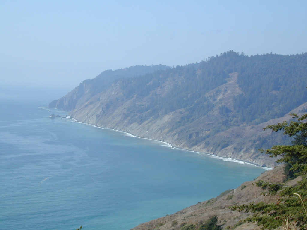
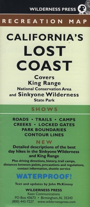
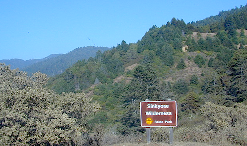
Lost Coast California Sinkyone Wilderness State Park
King Range National Conservation Area
Redwood groves and wilderness meet the Pacific Ocean at the infamous Lost Coast of California. Northern California is NorCal – steep trails, creeks, waterfalls, ocean views, and coastal cliffs. Mendocino and Humboldt County has numerous redwood parks and picnic grounds located near Pacific Coast Hwy 1 & US Hwy 101. This particular wilderness area is located in between Westport and Shelter Cove, just west of Leggett, CA. Situated on the west side of US Hwy 101 and only accessible via a long dirt road. The Sinkyone wild lands are managed under the California State Park system.
Sinkyone Wilderness Ranger Station 707-986-7711
Sinkyone Wilderness access –
North end – Needle Rock: 36 miles southwest of Garberville & Redway, California. Briceland Road west from Redway, this road becomes Mendocino County Road 435. The last 3.5 miles are unpaved, steep, & narrow. South end – Usal Beach: Approximately one hour north of Ft Bragg on PCH or 15 miles west of Leggett on PCH from Highway 101. Look for mile marker 90.88 on PCH. Turn north on small dirt road; 6 miles to Usal on unpaved, steep, narrow road.
ROADS MAY BE IMPASSABLE IN WET WEATHER. RV’S & TRAILERS NOT RECOMMENDED.
Usal Campground – USA Lumber Company staged a logging operation here in the early 1900’s. Now this remote spot is a popular back road campground accessibly only by a long dirt road drive. 4×4 and car camping only; No trailers or RV campers!
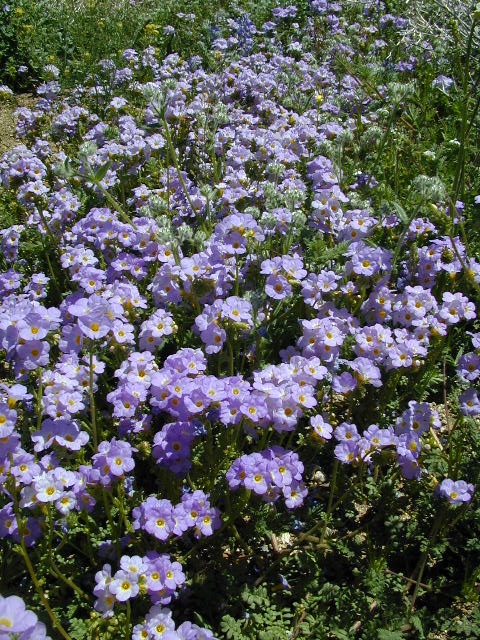
Wildflowers bloom all over California – from the desert in winter months, to the High Sierra in mid summer. Remember that the timing is everything, since most of these precious, delicate beauties only last a week or so. Out there alone, all day in the bright sunshine, whipping in the seasons strongest breezes. Flora!
The higher the elevation, the later the bloom.
Lower elevation deserts begin to show as early as February and higher elevation peaks thaw in May. Wilderness meadows and flowers can be found in the mountains in summer. Generally in California, Springtime – between MARCH and JUNE is the best viewing time.


 Living close to the earth with organic gardening and rural living, DanaMite strives to offer California residents, new-comers and visitors unique, local destinations, concentrating on the outdoors – well away from overcrowded, busy, urban cities and tourist traps. Total Escape can show you how to discover the secret, hidden spots on your public lands that the gov web sites will not even dare to mention.


 If you plan on not making camp reservations; make sure to have a plan B or C choice camp – in case your desired campground is already full. Many popular destinations can fill up fast (by noon in the summer).


 There once was a time when we connected more with nature. Before we closed ourselves off, behind the doors and windows, behind the computer screens, before the internet became part of daily life.
 smoking, prescription drugs, and what else.
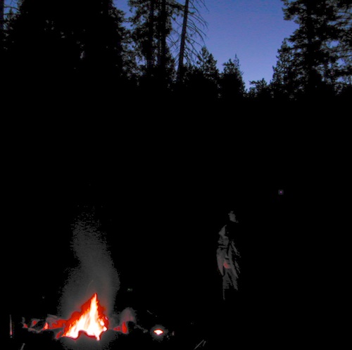
 Fresh air, wild flowers, alpine lakes, star filled skies and total silence – all still exist in certain areas, but you must know where to look. Birds and bees, wildlife is disappearing at extinction levels. Pollution, powerful corporations and politics.


 Desert Slot Canyons – South
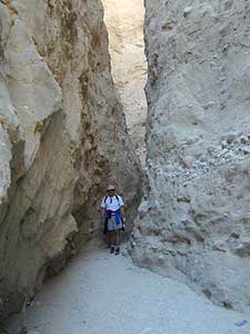


 The north coast of California is dubbed the Redwood Empire, and driving north on US Hwy 101 passing the well-known wine country and communities near Clear Lake, means you’ve entered the official redwood region of Cali.


