Camping Lakes – Campground Lakes
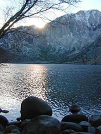
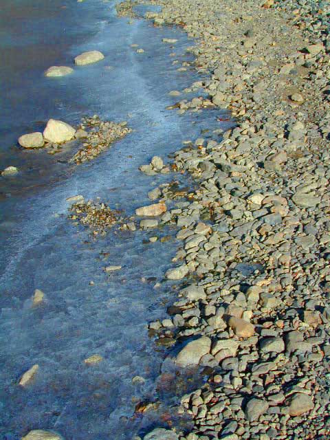
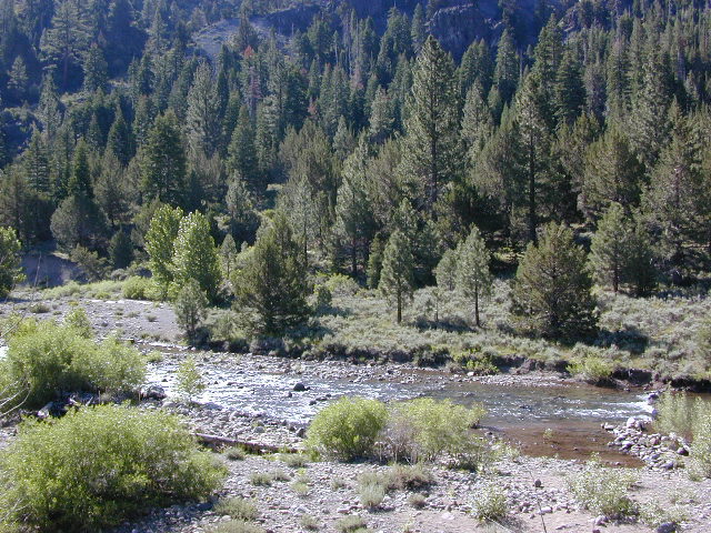
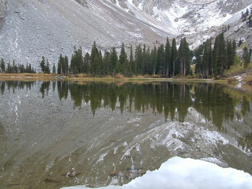
Lake Eastern Sierra California
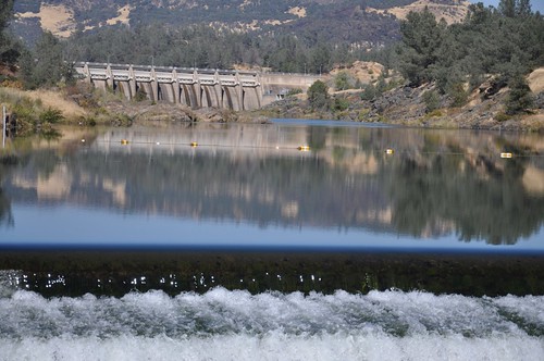
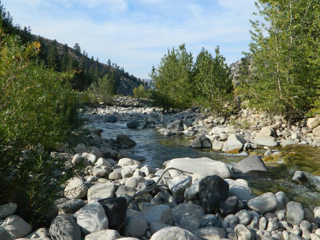
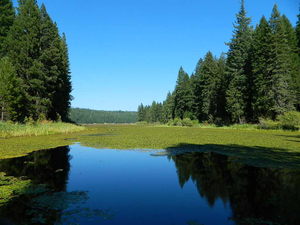
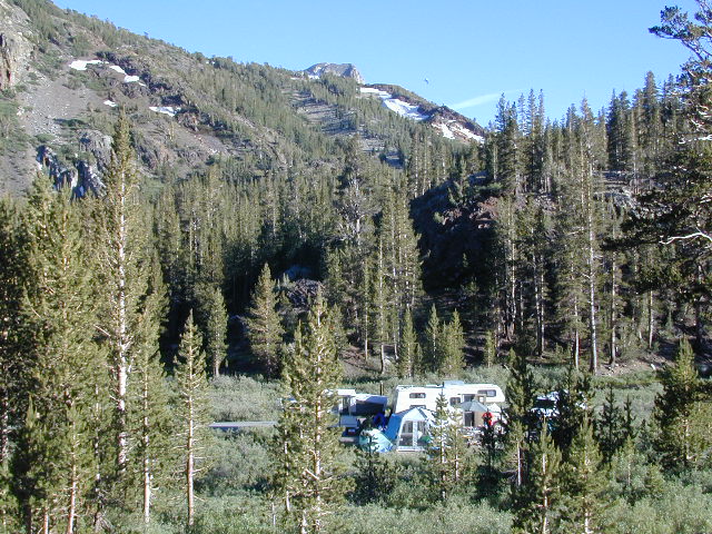
There is not enough room on this web site to list every single alpine lake in the majestic Eastern Sierra range, since there are hundreds, but we highlight a few of the hike-in accessible ones & the more popular camping lakes below.
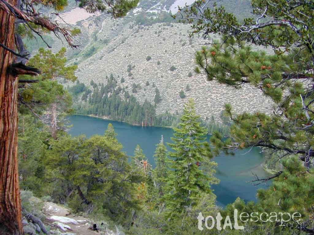
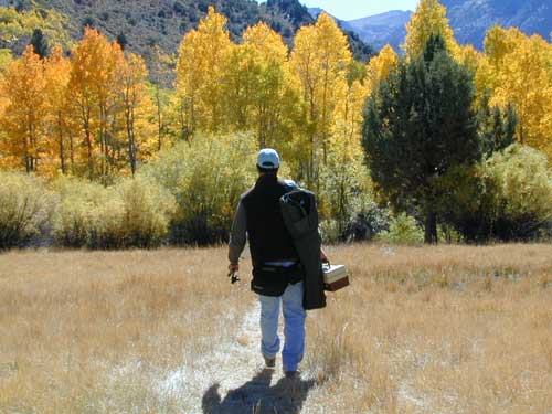
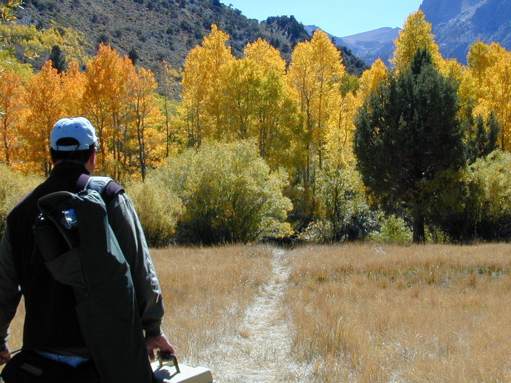
June Lake Loop is a paved, scenic drive highway that has multiple lakes with cabin rentals, camping, fishing, boat rentals. One of the best places to spend autumn looking for fall colors among the aspens.
DanaMite also knows a picture is worth 1000 words, so just click links for photos & enjoy!!!
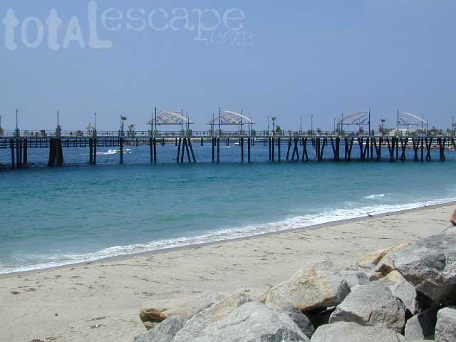
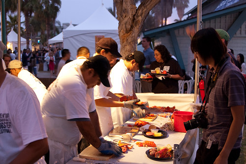
30 years running, this Redondo Beach event is a hot hit, especially for beach-goers near Los Angeles, California
3 day event held at the Seaside Lagoon next to King Harbor, just north of the Redondo Beach Pier. Live music, entertainment, lobster recipes, celebrity chefs, craft beer, kids activities and vendor booths.
Numerous Silver Lakes, Creeks and other “silver” terrain can be found inside California. After the Gold Rush of 1849 in the western Sierra, Silver was discovered in Nevada shortly after (east of Sierra Nevada mountains). This page is an overview on all places with SILVER in the name, or places that have had a history of silver mining. California Counties are listed in parenthesis. Links below will lead to more detailed pages or campground reservations.
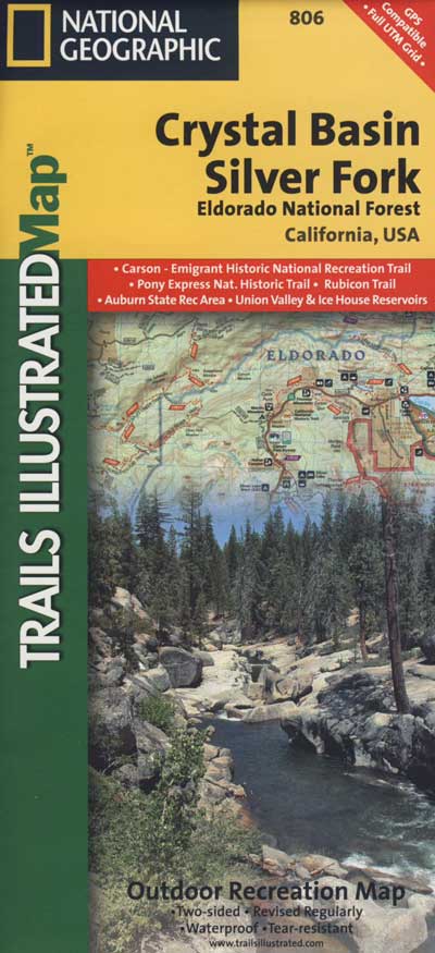
Silver Fork of the American River. Silver Fork Road connects US Highway 50 & Carson Pass Hwy 88. Silver Fork Campground & China Flat Campground (NFS) are both located on this remote, backcountry route, about 8 miles from US Hwy 50
Autumn aspen groves ignite with color in October. Often, some of the best fall colors in the Eastern Sierra. Day trips w/ fishing. Hiking everywhere. Overnighters or backpackers could be greeted with snow at anytime in October or later. The June Lake Loop (SR 158) closes for snow annually!
below are silver mining camps and other silver related destinations, plus some campgrounds
Bodie SHP (State Park)
(Mono Co)
8375′ elev. US Hwy 395 near Bridgeport, CA. Infamous, high desert ghost town, now a California Historic State Park. Large gold mining camp w/ well-preserved, wooden, old town structures. Silver was discovered in nearby Aurora Canyon. All dirt road access. No developed campground @ Bodie, so try nearby Green Creek Road instead. Or high desert, back road camping on Aurora Canyon Road over to Bridgeport Reservoir.
Cerro Gordo
(Inyo Co)
8500′ elev. Inyo mountains, West of Death Valley, east of US Hwy 395 @ Junction 136. Old mining camp rich in silver history. Someone might even live up there. Extreme remote location in rugged, high desert mountains. 4×4 is always required!
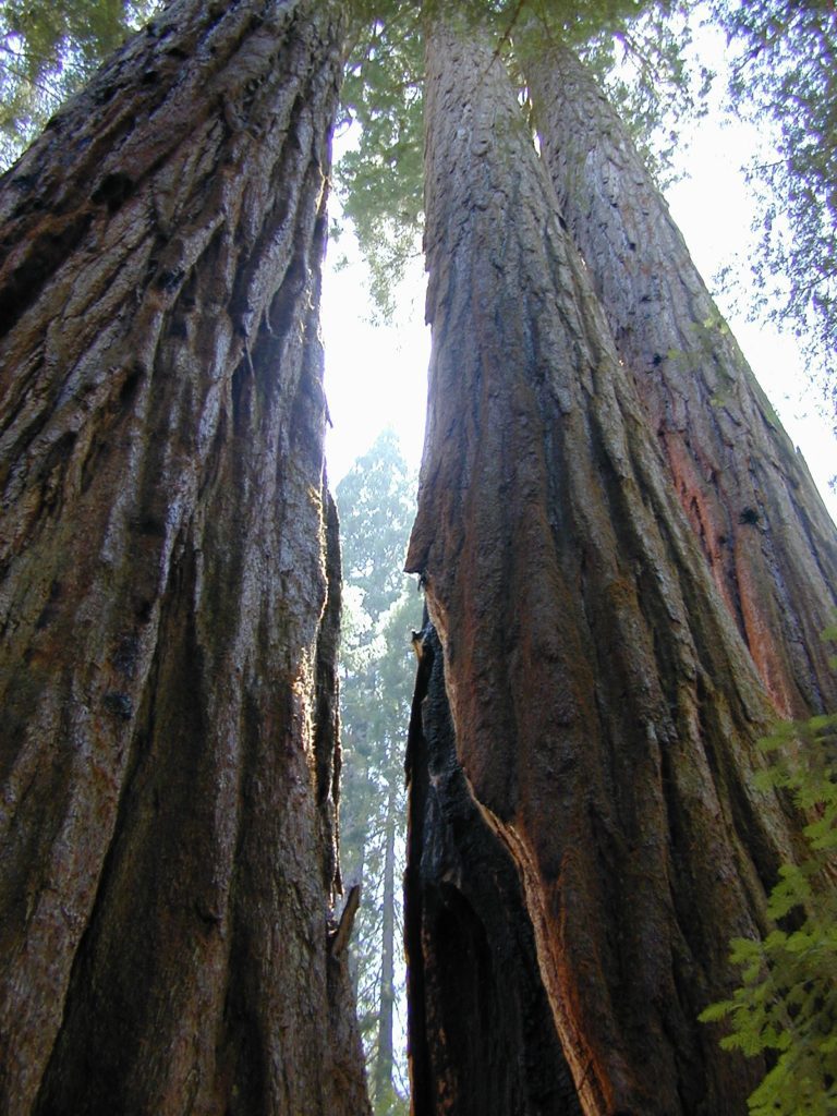
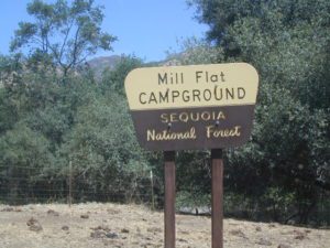
Silver City Sequoia
(Tulare Co)
6935′ elev. cabin resort on Mineral King Road, in the South Sequoia National Park
Silver Valley Campground & Silver Tip Campground (Alpine Co)are both located near Lake Alpine on Highway 4 Ebbetts Pass , Central Sierra
Silvertip is also a Group Camp at Jackson Meadow Reservoir (Sierra Co) off Hwy 89, North of Truckee, CA. Silvertip Group Campground, as with all group camping facilities, is by reservation only.
Silver Lake @ LA (Los Angeles Co) a hip and popular, tree-lined neighborhood in Los Angeles, near Griffith Park.
Silver Lake
(San Bernardino Co)
Silver Dry Lake, a dry lakebed in the Mojave desert, near the Hollow Hills Wilderness, north of Baker, CA off I-15
Silver Lakes
(San Bernardino Co)
2430′ elev. a desert community southwest of Barstow, near Helendale, CA. Located on the Mojave River (which flows underground) in between Historic Route 66 & US Hwy 395. Attraction nearby – Exotic World, the Burlesque Hall of Fame.
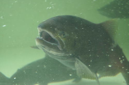
Lake Oroville Salmon Festival
Salmon Fest in O’ville
Feather River Fish Hatchery, Feather River Nature Center and Riverbend Park
On the Feather River between Historic Downtown Oroville and the Fish Hatchery, the town bursts with fish-flavored activities during the annual Salmon Festival. Friday night starts @ Feather River Nature Center for dinner & dance. Saturday brings on the fun, food, music and vendors on Main Street. Lots of great local info – salmon recipes, water/drought, fishing and environmental issues. Big pancake breakfast, a farmer’s market, live music, a craft fair, clowns, rides for the kids. Hatchery tours. The Bounty of Butte County will be located atop Myers Street, next to the Municipal Auditorium leading into Salmon Court. FREE to attend and tastes sold as desired. There will be food demonstrations, local food vendors, restaurant tastings and so much more.
Blue Lake in Modoc National ForestHiking Lake w/ Loop Trail in far Northern California
Blue Lake
Modoc National Forest
When you really wanna get away from it all, take a week off and head up to Modoc – the top northeast corner of California, where the volcanic mountains line the Great Basin. The population is minimal, cattle are abundant and the campers few. Even in mid summer, this ideal lake campground rarely fills up.
Jess Valley Road leads east off US 395 @ Likely, CA – 16 miles back to this hidden gem.
Headwaters to the Pit River.
NFS Campground is shady, well managed, and spread out on the eastern slope w/ numerous paved loops. Tent campers, cross country cyclists, truck campers w/ canoes, SUV families, motorhomes with kayaks and kids.
Modoc Map
Blue Lake Campground NFS
• Elevation: 6,050′
• Number of Sites: 48
• Vehicle Accessibility: 32′ RV
• Camp Fee: Yes
• Campsite Reservation: No
• Water: Piped
• Length of Stay: 14 Days
• Season: May –October
• Trailhead: Lake Loop
• Boat Ramp: Yes
Group Camp Facilities (by reservation only)
Modoc NF Warner Ranger District
@ 530-279-6116
Lava Rock @ Blue Lake Loop, in Modoc County, CA
Blue Lake National Recreation Trail
Right next to camp: A pretty much perfect LAKE LOOP (1.5 mi) hiking trail is worth a serious stroll; footbridge, wildflowers, fishing spots, minimal hills, lava rocks, and awesome scenery. Plenty of wildlife can be seen, including butterflies and bald eagles. Trail is shaded by tall white fir and ponderosa pine trees. Trailhead is located at the Day Use parking lot, w/ paved boat ramp, dock, and picnic area.
back roads
boating
camping
canoeing
fishing
hiking
kayaking
mountain biking
picnicking
swimming
stargazing
wildflowers
wildlife
NOTE: not every CAMPSITE has a LAKE VIEW
Certain campsites are adjacent to the lake; some are set facing a meadow (Autumn w/ aspen groves), or the alpine forest w/ deer grazing. Perhaps an inner circle (interior) campsite, for those who like to be close to bathrooms and piped water. Large families will love the abundance of camp settings and accommodations.
Paved Loop Plenty of Vault Toilets Piped Water Recycles & Trash Service
Large Campsites can accommodate Motorhomes
no paved camp stall
no hook-ups
no dump station
no cell phone signal
popular lake camp for motorhomes
When driving a large RV back in here, be courteous of other campers. Nothing sucks more than driving a long distance to the boonies, to arrive at camp just before dark and annoying everyone else already there.
Those needing to drive the campground loops (more than twice) looking for the biggest, levelest, best camp site – and burning $10 in gasoline doing so, should consider walking in.
Park that beast (near boat ramp area, before the camp entrance). Get out and walk the hills and loops, BREATHE & relax – prior to a choosing camp site.
Unhitch any tow vehicles; use that to scout out your perfect spot, if you cannot hike it. Trailers and large motorhomes will find this place ideal, but getting the right camp, can make all the difference.
Paved Trail around Campground
The wildfire: BLUE FIRE burned this region in 2001, but it is lush and green again (2019). Northern California gets some real weather. Rain and snow, more than half the year. The campground closes annually due to snow.
Kayaking is best done in the morning, cuz wind picks up in the afternoon. Canoes can launch at boat ramp, or at shoreline from trails near campsite.
Hiking trails can be found all around lake and campground. Wilderness access can be found at South Warner trailheads within a short drive from the lake.
Cyclists also love this camp, as it is located near a major highway and is a perfect place to really relax, soak in the scenery and get some quiet-nights sleep.
South Warner Wilderness is close by, driving distance; accessible by graded dirt roads. Signage is decent.
Modoc Forest Road #64 is a through-route, across the lower South Warners – 40
miles connecting to east side of the mountain, at Eagleville, CA.
Dirt Roads are suitable for trucks w/ trailers. SUVs and rugged passenger cars are okay. Motorhomes are not advised on this route. Washboard conditions are typical. Winter closure on this route is common.
MODOC RD 64
Several miles away from Blue Lake, 2 rustic trailhead campgrounds are located back this way – East Creek Campground & Patterson Campground. Less than 10 camp sites each, equipped w/ horse stalls, vault toilets and maybe piped water. Trailhead parking for backpackers. No RVs!
Autumn colors w/ aspen groves. Open, large meadows and mature forests w/ wildfire scars. Cattle can be found grazing all around, many cattle crossing.
Minimal primitive camping options, along road sides. Campfire permits required. No camping within one mile of a developed campground.
Modoc is Cow CountryDay Trippin – Out exploring Modoc Road 64 (and cutting firewood)
Group Camping can be reserved at Whiskey Creek Group Picnic Area
3 group camping sites with excellent views of the lake and mountains, on the northeastern shore of Whiskeytown Lake.
Salmon River @ Somes Bar:
Oak Bottom Campground NFS
elevation 700′
26 sites
No electricity, water or sewer hookups
Six Rivers National Forest – Oak Bottom Campground loops around a forested hillside with large trees providing ample shading for multiple sites within the campground. A variety of wildlife makes its home in the area.
Located off the main highway, on a side road, with the epic Salmon River! This NFS campground is popular with whitewater enthusiasts in the spring. Rafters, kayakers. Many challenging rapids ranging from Class 3 to 5 are available. Swimming is also popular in the summer and numerous river access areas are a short drive or walk from the campground.
Oak foothills of the Historic Gold Country, at the edge of the Sierra Nevada mountains.
boating
canoe
camping
fishing
hiking
houseboats
kayaking
wildflowers
Most Central Valley Reservoirs have blooming wildflowers in early springtime. Summer heat can measure triple digits for months as most of these lakes are located below 1000′ elevation.
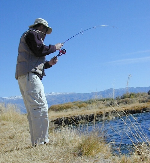
California fishing recreation ranges from sport-fishing, an open sea adventure, to solo casting in deep river canyons. Big Sierra Reservoirs near Gold Rush Country to High Country Alpine Lakes, the golden state has the water – and the outdoor recreation you crave.
Below is an alphabetical list of popular fishing destinations within California. Mountains to coastline, there are many maps to choose from.
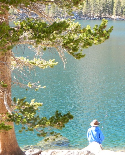
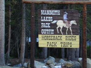
Sure splendor for fishing, most of the time. Lake fishing, stream fishing, river fishing. Fishing the Eastern Sierra area, near Mammoth Lakes, California can be very rewarding. You may have read about places like these in the sports magazines, seen them on a television program, or imagined them in a fishing vacation day dream. Summers can be crowded, so pick a lake and camp carefully. Weather can change quickly, so come prepared. Autumn fishing w/ the golden aspens and less crowds is preferred.
Most of these Eastern Sierra lakes listed below are accessible by car, others by foot. Look at the photos, pick a destination and get a good map of the area, so you can explore everything around too.
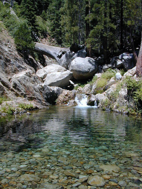
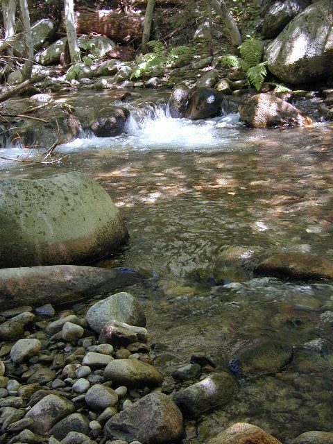
Located right on the middle north fork of the Tule River
Small developed campground on the back roads of Mountain Home State Forest. Campground closes seasonally, for winter snow.
Usually open: MAY-OCT
Swimming Holes on Tule River
MOSES GULCH CAMPGROUND
• Elevation: 5,500′
• Number of Sites: 10 walk-in camp sites
• Reservations: No
• Sites Available: First come, First serve
• Vehicle Accessibility: No RVs
• Length of Stay: 14 Days
• Water: River nearby
• Toilet: Vault
• Bear Boxes: Yes
• Trailheads: Tule River; Moses Mountain; Golden Trout
• Season: Closed for winter months
• Fee: Yes
• Operated By: National Forest Service
• Closest Town: Springville, California
tent camping on river
Motorhome RV campers beware; no hook-ups, no paved roads. This is a primitive style camp, way back on a dirt road – not suitable for large vehicles.
NOTE $ This used to be FREE CAMPING, but they recently started charging an overnight fee for this campground.
bike
camp
fish
hike
picnic
stargaze
Golden Trout Wilderness is closeby. Plenty of hiking opportunities, great scenery and several Sequoia groves to visit. Mountain biking is allowed on the dirt roads. Single track trails may be overgrown or even off-limits, due to the fragile eco-system around Sequoia trees.
Tule River, north fork of the middle Tule
Both Moses Gulch and Hidden Falls are accessible via a long, narrow, paved mountain road; then a dirt road, leading 3 miles back to the remote reaches of the Wilderness edge.
western south sierra
North of Springville on Highway 190, turn left (north) on to J37, some call it Balch Park Road (Google Maps has it as Wagner Drive) and follow it up 3.5 miles to Bear Creek Road (#220). Drive 17.5 miles on curvy Bear Creek Road, turn right and follow signs to campground.
Located right on the middle north fork of the Tule River
Inside an unknown area called Mountain Home State Forest, this small campground has a few spots that fill up quickly on weekends and at anytime during in the summer months. Campground closes seasonally, for winter snow.
Usually open: MAY-OCT
HIDDEN FALLS CAMPGROUND
• Elevation: 6,150′
• Number of Sites: 8 walk-in camp sites
• Reservations: No
• Sites Available: First come, First serve
• Vehicle Accessibility: 20′ max.
• Length of Stay: 14 Days
• Water: River nearby
• Toilet: Vault
• Bear Boxes: Yes
• Season: Closed for winter
• Fee: Yes
• Operated By: National Forest Service
• Closest Town: Springville, California
tent camping on river
Motorhome RV campers beware; no hook-ups, no paved roads. This is a primitive style camp, way back on a dirt road – not suitable for large vehicles.
NOTE $ This used to be one of our favorite FREE spots, but they recently started charging an overnight fee for this campground.
Views from Camp
bike
camp
fish
hike
picnic
stargaze
Golden Trout Wilderness trailheads nearby. Plenty of hiking opportunities, great scenery and several Sequoia groves to visit.Mountain biking is allowed on the dirt roads. Single track trails may be overgrown or even off-limits, due to the fragile eco-system around Sequoia trees.
You may actually love this little camp so much, you won’t want to go anywhere else. How ’bout just chillin out: relaxing near the water. Shady swimming holes. Fishing in the Tule River.
Pack a picnic: Back road exploration is a great day trip, for there are many dirt roads weaving in and around this park, near the Giant Sequoia.
Tule River, North Fork
Hidden Falls is accessible via a long, narrow, paved mountain road; then a dirt road, leading 3 miles back to two very secluded campgrounds: this one & neighboring Moses Gulch Campground.
western south sierra
North of Springville on Highway 190, turn left (north) on to J37, some call it Balch Park Road (Google Maps has it as Wagner Drive) and follow it up 3.5 miles to Bear Creek Road (#220). Drive 17.5 miles on curvy Bear Creek Road, turn right and follow signs to campground.
Mountains of Northern California / NorCal Mountain
California sure has a lot of mountains. West Coast land is home to the tallest Sierra Nevada range, plus the Cascade range, which extends northwards to Canada. (Many of which have volcanic peaks.)
We break down all the mountainous regions in the north part of the state below w/ links, topo maps, lakes, rivers, wilderness, parks and forests. Small towns & cities are linked in red.
Sacramento River, above Lake Shasta
North Coast Mountains
Redwood forests and rivers are what make up most of the Northwest part of California, just below the Oregon coast. Logging and fishing are the big industries up here. Lumber mill towns and camps still exists today. Wilderness areas, dirt back roads, river kayaking, stream fishing, camping and real wild indians. Oh yeah, and Big Foot!
The landscape in more dramatic along the North Coast of California, as the steep rocky terrain tumbles into the sea w/ the San Andreas fault running parallel to the shore. Marine life, rocky shores w/ small towns. Del Norte County & Humboldt County. Wild rainy weather, at least half the year; fog and sun the other half.
The furthest north is Siskiyou County, which borders the state of Oregon. We have the Klamath River flowing south into California, with plenty of mountain peaks, forests and wilderness. Interstate 5, Highway 3 and Highway 96
Pacific Crest Trail passes through the area and backpacking is common (all year long). Notable spots – Klamath Knot and The Eddy’s. Prominent Mount Shasta is actually situated inside Siskiyou County, not Shasta.
Giant Mount Shasta is located inside Siskiyou County, and Shasta County & Trinity is everything located to the south of it. Interstate 5, Highway 3 and Highway 299. Recreational lakes, rivers and streams, and off roading trails.
Waterfalls, hot springs, mountain biking and stream fishing can be found within this region. Mining history and museums are primarily situated around Weaverville. Houseboats and boat rentals can be found on the big reservoirs. Whiskeytown was totally toasted in wildfire of 2018. Alpine lakes, granite spires, campgrounds and cavern tours, all located along the Interstate 5 corridor.
Beautiful park setting @ Lee Fong Park, in historic Weaverville, CATrinity River Camping, Douglas City, CA
Mendocino Mountains
Coastal mountains located above the Napa & Sonoma wine country. US 101 & Highway 20. Rivers, forests, wilderness and redwoods is the key terrain that make up the Mendocino County mountains.
There is a fair amount of off road trails and dirt roads located in and around Mendocino, so you can expect to see 4x4s, dirt bikes and toy haulers on the east side of the mountain range. The coastal side of the Mendo National Forest will have the rivers and redwood parks.
Northern Sierra Nevada mountains is where the granite rock of the Sierra meets to volcanic rock of Lassen Volcano. Butte County and Plumas County is the Feather River drainage, all flowing south from Mount Lassen.
Pacific Crest Trail is routed through Bucks Lake Wilderness and the Feather River Canyon, so backpacking is popular. Highway 70
Technically speaking, the Susan River is the top waterway of the Sierra Nevada mountains. Lassen County spans the distance from the Nevada state line, west to Plumas forest and the Feather Rivers (all 4 forks).
Lassen Peak is the middle of the National Park and the National Forest totally surrounds that. Numerous lakes, hiking trails, wilderness areas and dirt roads make up this huge forested area. Snow-mobiling is popular in winter months around the town of Chester.
The far northeast corner of the golden state is the remote cattle range lands of Modoc Country inside Modoc County. Drier than the rest of NorCal, the high desert sage brush meadows, a few lakes and pine forest mountains. Highway 299 & US 395
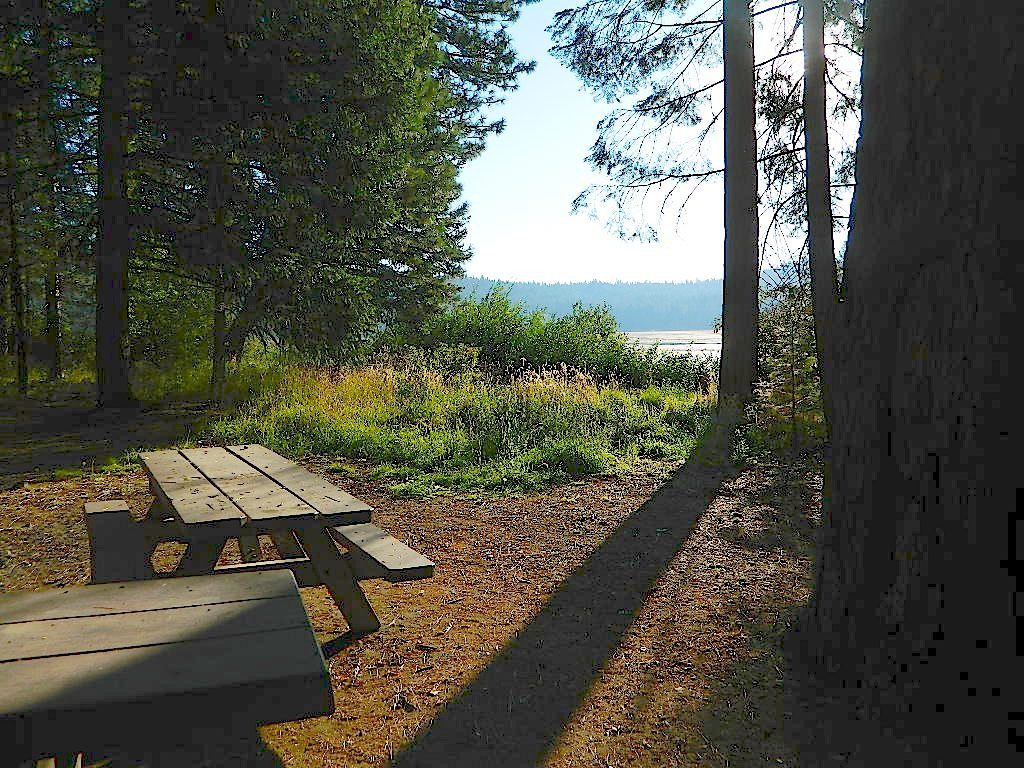
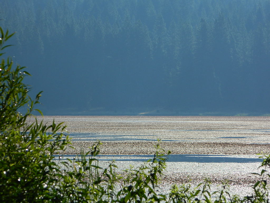
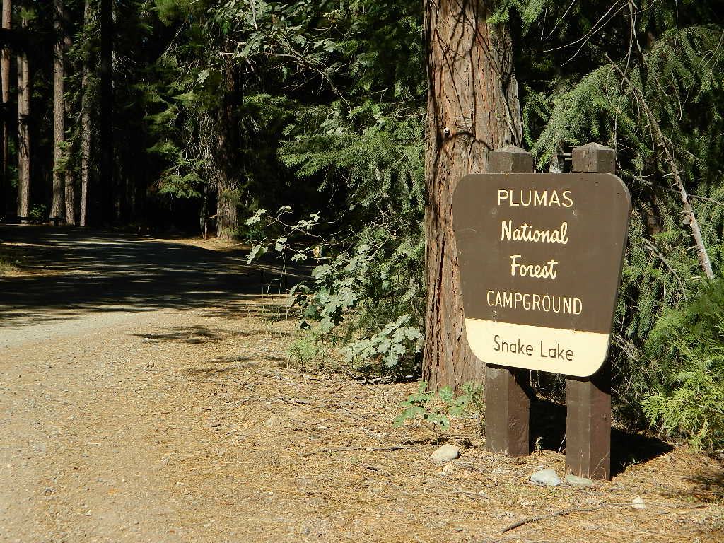
Don’t let the name frighten you, Snake Lake is a very scenic fishing lake – but you will NOT want to swim in it. Lily pads cover the water surface most of the year so it is considered “frog heaven” during the warmer months. NFS has been upgrading these camping facilities recently. Snake Lake Campground has new picnic tables, camp fire rings, bear boxes, vault toilet and expanded equestrian camps and corrals. No piped water, so bring your own. A bucket & shovel are always required for proper campfire maintenance.
One of the best campgrounds in the region, Plumas National Forest and close to Quincy, CA. Paved road access means an easy 3 miles off the main road (Bucks Lake Road, aka Oroville-Quincy Highway, Oro Quincy Hwy). 7 miles west of the town of Quincy, the green, metal, one-lane bridge is easy to spot, but the small sign for “Snake Lake 3” is easy to miss, if driving 50 mph or faster. Turn off is located in between Quincy and Meadow Valley.
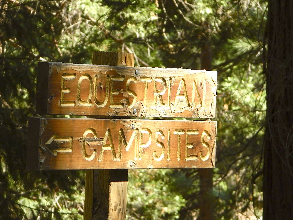
Equestrian camp sites, horse corrals, OHV trails, group picnic areas. Hiking, fishing, mountain biking, off roading, horseback trails, kayaking or canoe.
Snake Lake Campground NFS
• Elevation: 4200′
• Number of Sites: 17
• Vehicle Accessibility: small RV
• Campsites Reservation: No
• Camp Fee: Yes
• Length of Stay: 14 Days
• Season: May – October
• Trailheads: OHV, Horse & Winter Rec
This lake camp serves as a central hub for travelers, motorcyclists, campers, hikers, fishermen, off roaders and equestrians alike. Mountain biking & OHV trails go off in numerous directions and horseback trails are readily accessible. Winter Recreation Area means snowmobile trails too.
Another smaller lake, Smith Lake, is a short drive or short hike (on dirt road) further into the woods, with the Butterfly Valley Botanical Area neighboring it.
another Snake Lake?
Another SNAKE LAKE exist inside Plumas National Forest. The smaller Snake lake can be accessed by off-road trail Road#12E66, off the Gold Lake Highway; 4×4 is required to reach this one. West of Gold Lake in the Lakes Basin Recreation Area. The PCT is routed nearby one mile away.
Free Campgrounds in the Sierra Nevada Mountains, California
no charge camp, no fee camping, free campgrounds
No fee camping: Bare bones. California Sierra Campgrounds without the fee.
Developed BLM or NFS campgrounds, where you can still have a campfire. Vault toilets, panic tables and fire rings. Use bear boxes when provided for proper food storage.
secluded campgrounds
Below is a good long list of some favorite free developed campgrounds in the Sierras. Many will require dirt road driving, as most are located well of the highway. Perhaps the 12 mile rough road will thin out the crowds. Free overnight stay!
2020 update:this list is shrinking, as more California National Forests start charging for the smallest of campgrounds.
Pack in your drinking water and pack out your trash. Campfire permits are not required at developed campgrounds; but a bringing a water bucket and shovel is necessary for tending your campfire. Piped water is not always available, or perhaps, not in working order at these primitive style camps. Be prepared to rough it a little.
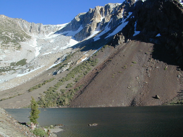
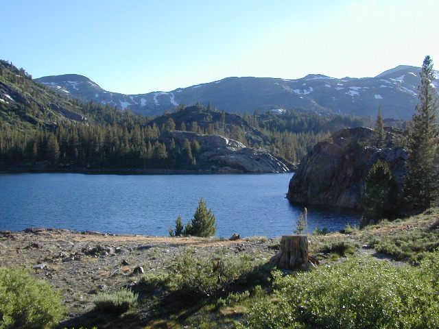
Inyo National Forest @ Yosemite East
Tioga Pass Hwy 120
This spectacular setting has a top-of-the-world feeling to it. Gorgeous meadow area, right along the main highway, with a small lake next to giant rock slides and impressive granite mountains.
The air is thin, the sky is clearest blue, the snow is melting, the stream is trickling and the nights are chilly – even in summer. Bring a winter coat and extra blankets, if you plan to camp.
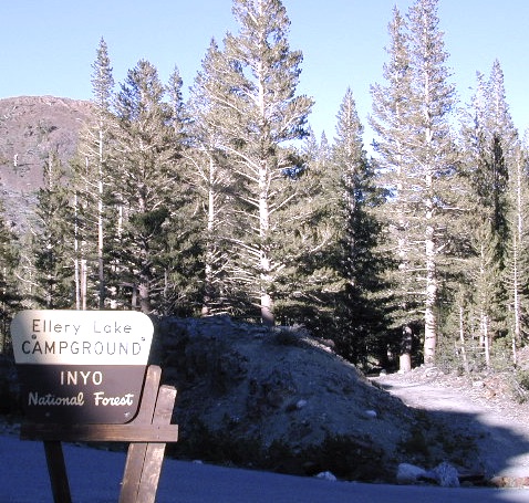
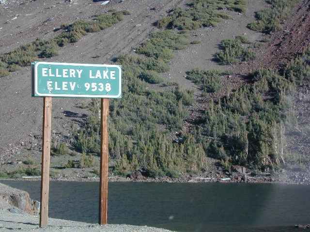
Ellery is small campground is located just outside the EAST GATE of Yosemite National Park, along Highway 120 Tioga Pass. Easily accessible and fully paved, this camp is only open half the year due to deep snowpack. The snow usually melts by June, and camp often closes early due to higher elevation weather, sometime in October or November.
Lee Vining Canyon is to the east and Mount Dana is to the west.
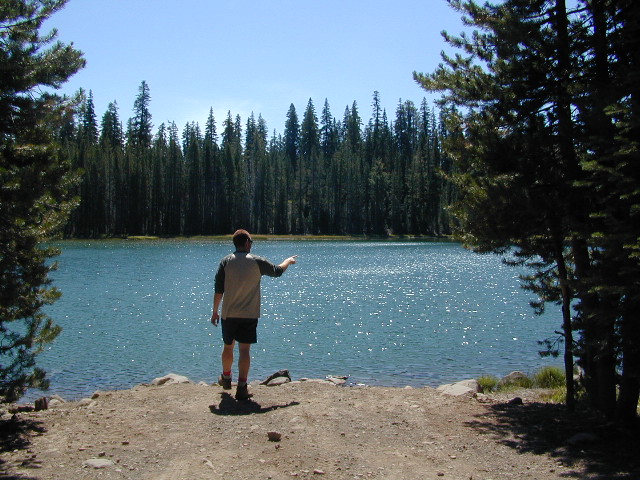
Ellery Lake is one of those magical places, where you can spend all day out in nature – without needing to drive anywhere. Gorgeous high country scenery surrounds you in every direction. Walk over to nearby meadows, creeks or neighboring lakes. Climb mountain peaks or enjoy extended day hikes. Watch wildlife from camp or fish in the lake. Stargaze at night w/ the darkest skies around.
Or how about, walk to dinner? This place is easy walking distance to the historic Tioga Pass Resort, where you can enjoy a real, sit-down meal at the cafe. (Hope they will re-open 2020)
Ellery Lake – camp, hike, fish or kayak. No motor boats allowed.
Travelers heading to or from the National Park, often stop at Ellery to take photos and walk around. There is always a flurry of activity around easily accessible lakes and this one is no different. The busy highway and constant traffic may be heard from camp, but the ideal location and epic lake makes up for the inconvenience.
This NFS campground is one of many small camps located along the highway, on the east side of Yosemite National Park. This special place is in high demand, can fill up fast and is quite busy most of the summer.
perfect for tent campers
Small parking areas, tight walkways, landscape and minimal campsites makes this a “no-turn-around” kinda campground, so don’t bring that huge RV (cuz it won’t fit).
Most sites do not have enough room to park a second vehicle at all. Each campsite has a locker for food storage. (bear country = store food properly)
Ellery Lake Campground
• Elevation: 9,538′
• Number of Sites: 12
• Camping Reservations: No
• Sites Available: First come, First serve
• Vehicle Accessibility: Vehicle limit 28 ft.
• Length of Stay: 14 Days
• Water: Potable water
• Toilet: Vault
• Season: Closed during winter & spring
• Fee: Yes
• Operated By: National Forest Service
• Closest Town: Lee Vining, CA
Lassen Volcanic Park is surrounded by beautiful mountains and lakes, some inside the National Park boundary, but most outside. Lassen National Forest, Thousand Lakes Wilderness, Lake Almanor, Hat Creek and Burney Falls encompass this pristine water wonderland of NorCal. Outdoor recreation all over – rivers, fish, hunt, camp, mountain bike, off road.
Backpack camps, RV campground, fishing lakes, day hikes, off-road and lake side camp sites, we have it all listed on Total Escape.
Hiking, camping, fishing all over this region! Mountain bike, kayak, or relax all day in the hammock – in a shady spot with a view. Water flows freely and annual snow melt is abundant in this part of California. Some locales may not open until July 4th weekend. Always check with the Lassen NFS rangers to make sure.
(lakes on the trail)
Crumberg Lake
Twin Lakes
Jakey Lake
Snag Lake 6076′
Horseshoe Lake
Willow Creek
Long Lake
Lassen National Forest lakes:
Majority of these lakes require dirt road driving to reach them. Often forest roads close for snow, usually during winter months (DEC-MAY)
Wilson Lake 5267′ Crater Lake ^ 6800′
Echo Lake
Widow Lake
Star Lake 6362′
Rising River Lake
Baum Lake
Murken Lake
Haynes Reservoir
Heart Lake
Willow Lake
Shotoverin Lake
Killer Camp @ Echo Lake
Caribou Wilderness:
Campsites with hiking lakes and wilderness trailhead access, right next to Lassen Volcanic National Park.
Echo Lake ^
Caribou Lake ^
Silver Lake ^ – Silver @ Lassen
Triangle Lake
Find Lassen Maps, NFS Topo Atlas
Thousand Lake Wilderness:
North of Mount Lassen is the less-popular Wilderness Area w/ many miles of dirt roads to travel.
North Battle Creek Lake ^ 5571′
Logan Lake
Buckhorn Lake 4776′
Lake Eiler
Terry Lake
Lundy Canyon is located at the very northern boundaries of the Inyo National Forest, bordering the Humboldt Toiyabe National Forest & Virginia Lakes. Mill Creek flows down Lundy Canyon from the Sierra Nevada; Lundy is a small lake in a deep, rugged canyon with wilderness trailheads, East of Yosemite National Park.
Lundy Canyon Campground
Mono County Dept of Public Works
760-932-5440
36 camp sites w/ picnic tables, fire-rings & bear boxes
Lundy Lake Resort
Bait, tackle, general store, fishing lake, boat ramp.
626-309-0415
21 camp sites, 8 cabins, 3 camp huts, 5 RV camp sites
There is not any NFS Campgrounds in this Lundy Canyon, but plenty can be found nearby at Lee Vining Canyon, at junction US 395 & Hwy 120.
Mono Lake also has camping at the county park. And free camping (boondocking) can be found – all up and down US 395
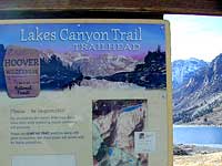
Lakes Canyon Trailhead
Backpackers & Horse Packer Trains have excellent access to the Hoover Wilderness in the High Sierras. Plus this prime Lundy Canyon location is situated at the back door of Yosemite NP.
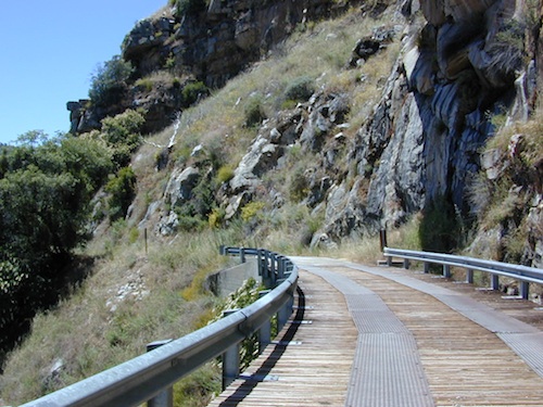
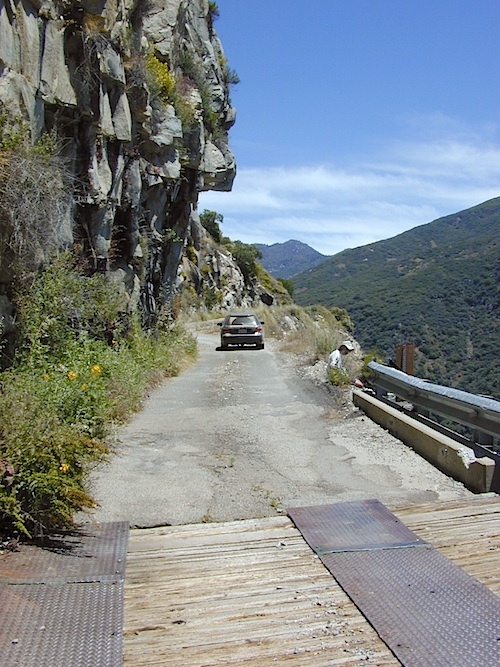
connects Kings River @ Pine Flat to Blackrock Reservoir.
Road closed seasonally for winter; call ahead.
This impressive Sierra Nevada route literally climbs a granite cliff high above the Kings River, near Pine Flat Lake north of Sequoia Parks, inside Sierra NF. This granite gorge is due east of farm city Fresno at the edge of Kings Canyon National Park.
If you are a nervous, inexperienced driver and scared of heights – be forewarned: this is not the road for you. The views are amazing, but the terrain can be unforgiving, even deadly.
Paved, narrow, one lane, giant rock overhangs, no guard rails (except on the bridge) the route skirts the North Fork of the Kings, coming down from Wishon Reservoir.
Click image above to enlarge and see the tiny Kings River far below the road.
Black Rock Lake
Blackrock Reservoir, located up the road – has a PG&E campground in a secluded canyon, with lake fishing and hiking, so it is well worth trouble to take this crazy road. Granite rock canyon, steep mountains, minimal roads. Seclusion can be found, up this way.
Utmost safety should be taken on this road due to the extreme terrain. When driving one lane roads always keep an eye out for possible turn-outs and oncoming traffic. Forest and lake personnel have living quarters at the base of this road @ BALCH CAMP, so keep driving when passing thru. Follow signs to Blackrock.
Above Blackrock Reservoir, further up the canyon, the road becomes DIRT when the pavement stops; this continues to Sawmill Flat Campground and eventually on to Dinkey Creek Road. This whole upper (dirt road) portion is gated for winter and closed during the wetter months. Call ahead to the ranger station at Trimmer to find out if this road is open.
Historic Town Site: Kongsberg, Eastern Sierra, California
Silver Mountain City
Remains of City Jail @ Kongsberg, CA
Located on the lightly forested slopes of the Carson River. About 7 miles east of Ebbett’s Pass, Highway 4 (CA SR 4)
Silver Boom Town in 1866
population 3000
Founded as Kongsberg in the late 1850’s by Scandinavian mining prospectors, the town name was later changed to Silver Mountain City. This wild, remote locale was the county seat for Alpine County from 1864 to 1875. The mining camp town was abandoned by 1886.
This canyon stretch of SR 4 highway has limited primitive camping options along the water. Flat dirt clearings and maybe a rock fire ring. No facilities, no bathrooms.
Silver Creek runs parallel to the highway and meets East fork of Carson River. Google Maps has this named Alpine State Hwy (which is closed in winter)
Drive less than 55 mph to take in all the scenery, slower if you want to find a decent place to stop. Look for easy pull-offs on dirt, a few trails, parking spots, picnic trees, some favorite fishing spots. Campfire permits are needed for dispersed camping.
Carson River SR 4
Humboldt-Toiyabe National Forest
NFS Campgrounds nearby :
Silver Creek Campground @ 6800′ elev.
NFS developed camp w/ fee (open June-Sept)
Centerville Flat Campground @ 5900′ elev.
undeveloped sites. Silver Creek meets East fork of Carson River


 Lone Pine Lakes include –
 (hike in)

 Rock Creek Lake

 Eastern Sierra topographic trail maps to lakes


 Coastal mountains located above the Napa & Sonoma wine country. US 101 & Highway 20. Rivers, forests, wilderness and redwoods is the key terrain that make up the
 Northern Sierra Nevada mountains is where the granite rock of the Sierra meets to volcanic rock of Lassen Volcano.
 Technically speaking, the Susan River is the top waterway of the Sierra Nevada mountains.


 Pack in your drinking water and pack out your trash. Campfire permits are not required at developed campgrounds; but a bringing a water bucket and shovel is necessary for tending your campfire. Piped water is not always available, or perhaps, not in working order at these primitive style camps. Be prepared to rough it a little.


