Tag Archives: cuyama

32S13 – Los Padres NF

Sierra Madre Road
Sierra Madre Ridge, San Rafael Wilderness

Los Padres National Forest
Forest Road #32S13

off of Cuyama Valley Hwy 166

32S13 Sierra Madre Road

East of Santa Maria, CA – along Highway 166 (on the south side of the pavement) are several dirt roads that lead up to the main ridge road that access this part of Los Padres National Forest.

  • backpacking
  • camping
  • dirt bike trails
  • dirt roads
  • hiking
  • horse camping
  • mountain biking
  • off road routes
  • petroglyhs
  • wildflowers

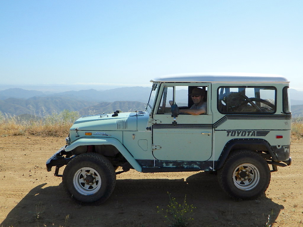
4WD not required, but high clearance is helpful. Open almost all year. Rainy season gate closures (at hwy) during winter months.

4x4

dirtbikes

cruiseronridge

Sierra Madre Mountains

Miranda Pine Mountain (elev. 4120′)
Timber Peak (elev. 4754′)
Peak Mountain (elev. 5843′)
McPherson Peak (elev. 5749′)
Samon Peak (elev. 6221′)

Sierra Madre Ridge is forest road #32S13, which parallels Hwy 166 (Cuyama River) for over 50 miles on the Sierra Madre Ridge at approx. 5000 feet elevation.

NOTE: A good stretch of this dirt road is closed to vehicle traffic. Although it connects to Santa Barbara Canyon near Ventucopa, you cannot drive it. Only hike or mountain bike!

Hog Pen Sign

NFS Gate locked at the HOG PEN trailhead, and from there you can bike or walk all the way the other end at Santa Barbara Canyon near Cuayama Fire Lookout @ Dick Smith Wilderness

Still Standing

camp

Small campgrounds in the region:

off Highway 166
Miranda Pine Campground (on 32S13 @ 11N03)
Bates Canyon Campground (via Cottonwood Canyon Rd)
also known as White Oaks Campground
Aliso Canyon Campground (via Aliso Canyon Road)
not accessible by vehicle, from dirt road 32S13; only by trail

in the backcountry
Painted Rock Camp (hike-in)
Sycamore Camp (hike-in)

high clearance, off road accessible
Horseshoe Springs (11N04)
Lazy Campground (11N04)
Wagon Flat Campground (11N03)
Barrel Springs (10N06)
Colson Canyon (11N04)

wildflower

coastridges

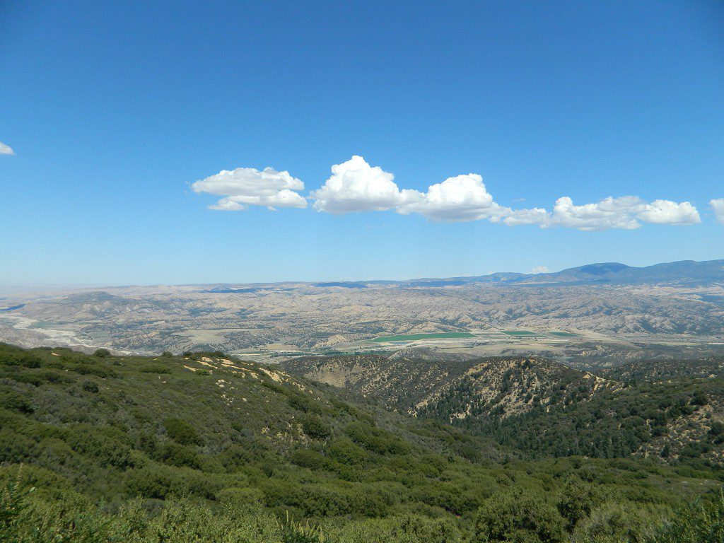
Highway 166 Cuyama River Valley
EAST San Luis Obispo County

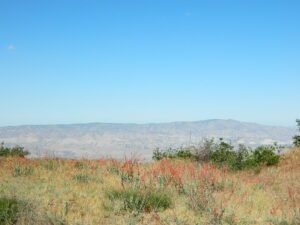
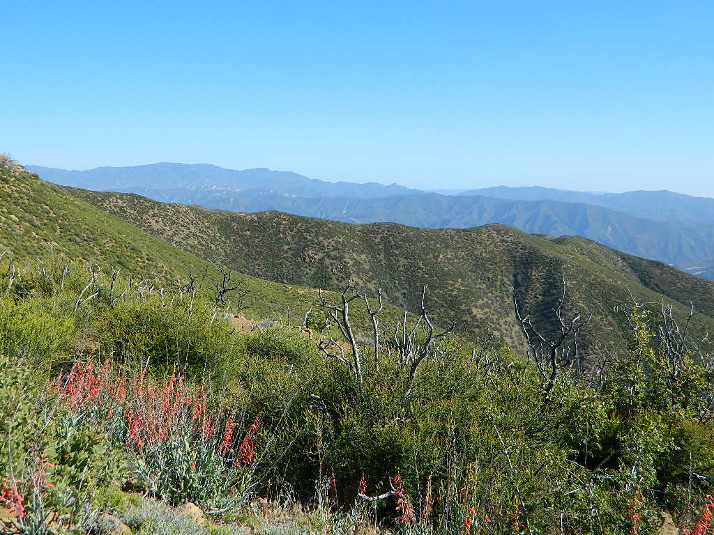
Wildflowers Bloom: APRIL-MAY
mayflowers

redflora

San Rafael Wilderness

Sisquoc River
Native Rock Art
Sierra Madre Mountains

Rock Art Sign

MAPS of the Area:

hiker

Los Padres USFS MAP
Los Padres Topo Atlas
Los Padres West NatGeo Map
Dick Smith Wilderness Map
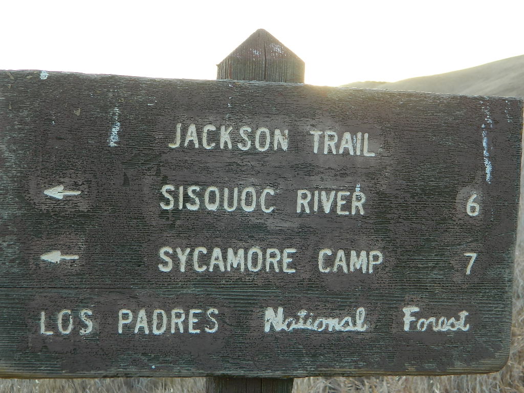
sisquocriver6nearby destinations: 

Cuyama Peak Fire Lookout
New Cuyama, CA

Rock Front Ranch 4×4
Santa Maria, CA
Ventucopa, CA

Rock Front Ranch

rockfrontranch

Rock Front OHV

San Luis Obispo County Off Roading
Los Padres National Forest

Rock Front Area is located on the north side of Hwy 166 in between New Cuyama and Nipomo, on the very edge of San Luis Obispo county in the center of the Santa Lucia Ranger District of Los Padres National Forest.  Landscape varies from rock covered canyons to ridge line trails with outstanding vistas of the the mountains and Cuyama Valley. Remote area features Los Machos Hills, Alder Creek, Branch Creek, Cuyama River, cool rock formations.

15,328 acres
41 miles of trails

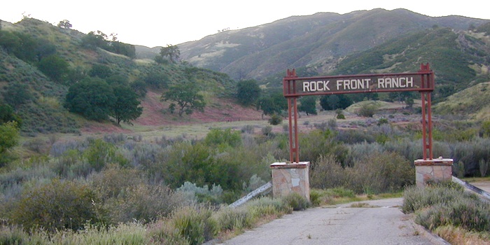
From US Hwy 101 @ Hwy 166 travel east 25 miles, left turn into Rock Front Ranch gate on left side. (This road may also be known as Branch Creek Rd on some maps). This off road area can be closed during rainy seasons, so it is best to call rangers ahead of time to ensure the gates are open. There is also one brown Forest Service sign along gate10mileshighway 166, (couple of miles from 101)  letting eastbound traffic know if this OHV area is open or closed.

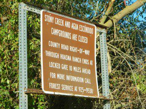
The dirt Road #32S07 (Arroyo Seco) from the west connecting historic Huasna townsite to Rock Front is CLOSED to thru traffic and has a locked gate. Private properties and ranches are abundant in the backcountry of Arroyo Grande, CA

Los Padres National Forest
Santa Lucia Ranger
805-925-9538

vistas

Rock Front Ranch Campgrounds

Off Road Trails in Rock Front Ranch

OHV trail ratings in this region are designated below
Rock Front OHV

  • Green diamond – easy & least difficult
  • Blue diamond – moderate & more difficult
  • Black diamond – extreme & most difficult

Logan Ridge Trail #17E05
Green diamond. Least difficult. Open to motorcycles, ATVS, 4WD. 1.4 miles long. This route is a good route for beginning riders. It is located on the main ridge top of Logan Ridge. Route dead-ends at a locked gate.

Shaw Ridge Trail #17E06
Black diamond. Most difficult. Open to motorcycles, ATVS, 4WD. 8 miles long. This route leaves the Twin Rocks route on a spur ridge that drops into the Alamo Creek drainage and dead-ends. A very steep section of trail exists at the end of this route where specialized equipment is recommended. This section is recommended for advanced riders.

maps Los Machos Trail #17E07
Green diamond. Least difficult. Open to motorcycles, ATVS, 4WD. 2.8 miles long. This route is a good route for beginning riders. It is located on the main ridge top of the Los Machos Hills. Route dead-ends at a locked gate.

Paradise Trail #17E08
Blue diamond. More difficult. Open to motorcycles, ATVS, 4WD. 2 miles long. Access to Paradise Campground and Los Machos route. It is best suited for intermediate riders due to a steep section along the route. Route dead-ends at a locked gate.

Branch Creek Trail #17E09
Blue diamond. More difficult. Open to motorcycles, ATVS, 4WD. 5.5 miles long. Access to Buck Springs Campground, parallels the Big Rock route and offers a loop ride.

Big Rocks Trail #17E10
Blue diamond. More difficult. Open to motorcycles, ATVS, 4WD. 4 miles long. Located on the main ridge top and intersects with the Jack Springs route.

Twin Rocks Trail #17E12
Blue diamond. More difficult. Open to motorcycles, ATVS, 4WD. 3.5 miles long. This route intersects Shaw Ridge and dead-ends at a locked gate. The first half-mile of this trail is steep. Once on top of the ridge you have excellent views of the Cuyama Valley and the Santa Lucia Range.

Kerry Canyon Trail #30W02
Black diamond. Most difficult. For motorcycles only. 6 miles long. This trail must be accessed through Colson Canyon or Sierra Madre. The trail is highly technical and is recommended for advanced motorcycle riders only.

HORSE TRAINING – Along the highway at the gate of Rock Front Ranch is a rock house and ranch, which may or may not offer equine services.

Dick Smith Wilderness

Santa Barbara Mountains
Ojai Backpacking, Ventura, CA

old cabin cuyama
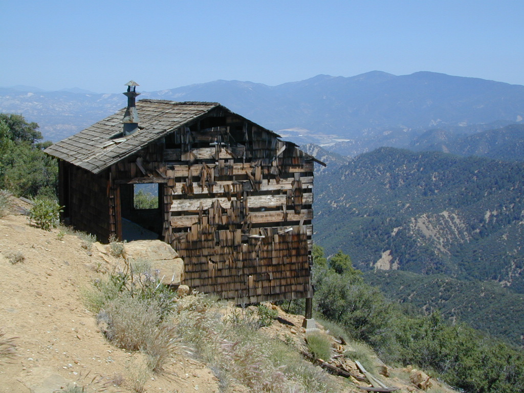
Old Cabin at Cuyama Peak Fire Lookout, Dick Smith Wilderness Area in the background

64,800 acres

30 miles N of Ojai, CA
Los Padres National Forest

Dick Smith Wildernessreyes lift off

  • backpacking
  • camping
  • hang gliding
  • hiking
  • horseback riding
  • parasailing
  • OHV trails nearby

Los Padres National Forest – Located in between the Santa Barbara coastline and the Cuyama Valley, this coastal wilderness area is situated miles north of Ojai, off Highway 33.

The Dick Smith Wilderness is where the San Rafael Mountains and the Sierra Madre Mountains merge on the east side, next to Pine Mountain Summit (elevation 5080′ @ highway).

This PINE MTN turn off should not to be confused w/ the Pine Mountain Club, on the north side of Cerro Noroeste.

Significant mountain peaks within Dick Smith Wilderness Area:

Big Pine Mountain – 6828′ elevation
Cuyama Peak – 5875′
Lizard Head – 5350′
Madulce Peak – 6536′
Samon Peak – 6527′

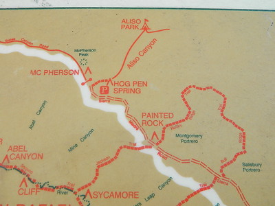
Closer to Ojai, Matilija Wilderness is on the southern boundary of DickSmith and the San Rafael Wilderness sits to the west side. Native American petroglyphs can be found in this mountainous region.  Access to “Painted Rock” on the Sierra Madre ridge, via Road #32S13 (which has a locked gate on both ends), is a long one so you might want to bring the mountain bike. The dirt road hike is about 10 miles (one way) and it starts at the Santa Barbara Canyon trailhead. If you plan to visit the rock art from the west side – take the dirt road up past Bates Canyon Campground. The turn off on Hwy 166 is called Cottonwood Canyon. Park at the hog pen trailhead and follow Road #32S13 for miles.

Dick Smith Trails
hiking trailheads –

  • Chorro Grande (Hwy 33)
  • Potrero Seco (Hwy 33)
  • Santa Barbara Canyon (Hwy 166)

 area campgrounds –

 nearby towns –

more Ojai camping

ojai backpacking

Dick SMith Wilderness

Ozena Valley Badlands

Cerro Noroeste Road

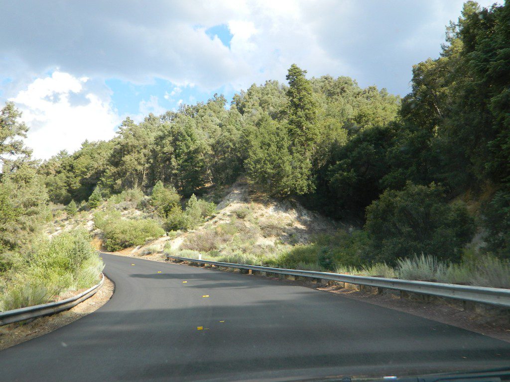
Fresh Blacktop 2011

Scenic Drive California: Cerro Noroeste

Tejon Pass, Frazier Mountain, Tecuya, San Emigdio, Mount Pinos, Apache Saddle, Mount Abel, Quatal Canyon, BitterCreek, Klipstein Canyon

Los Padres NF – Cerro Noroeste Road #9N05

One of the best driving roads in Central California!

Motorcycles love this route.

Los Padres National Forest stretches from Ojai to Monterey, mostly along the California Central Coast. If you are traveling on Interstate 5 (atop the Grapevine, Tejon Pass) and you wanted to head westbound,  then you really want to take this scenic route.

Exit Frazier Park Rd @ Lebec, on the top of the Grapevine (Interstate 5 N of jct Hwy 138). Proceed westbound thru the Frazier Park stop sign (5 mi), up the hill past the turn off for Lockwood Valley Road. Frazier Mountain Park Road now becomes Cuddy Valley Rd, continue up to pine trees. Turn right on Mil Potrero Highway & drive thru Pine Mountain Club (4-8 mi). Continuing past the golf course, heading up to Apache Saddle.

Approximately 6000′ at a forested intersection is the ‘saddle’ with ranger station. The paved road is now considered Cerro Noroeste Road.

A left turn will bring you up to Cerro Noroeste 8286′ elevation. (10 mi/closed in winter) This mountain peak is also known as Mount Abel.

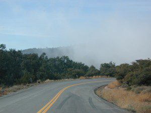
At the saddle, continuing straight (veering right) through the P&J forest (pinyon and juniper) to the gorgeous rolling hills, fog & cloudscape countryside of ..

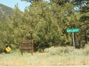
HUDSON RANCH ROAD

WTF? Recently county authorities have renamed Cerro Noroeste Rd to Hudson Ranch Rd, which has many locals infuriated and of course, keeping visitors confused. There is a popular Hudson Ranch up near Napa Wine Country, but this is not named after that location. Rumor has it that one local family complained to Kern County about the difficulty of spelling ‘Cerro Noroeste’ for outsiders. Go figure! Want a local roadway name changed? Easier process than imagined – just file a suggestion w/ Kern County.

HUDSON RANCH ROAD

Bitter Creek Wildlife Area & Highway 166 (23 mi) are all out this way. Sports cars & motorcyclists love this route, so do hikers & hunters. Every weekend you can find hundreds of bikes cruising this scenic byway.

Best Sunset Drives
Numerous forest roads can be found out this way. Quatal Canyon #9N09 is a great side route to explore if you like long dirt roads, red dirt, lupine & pinyon pines. Chumash Wilderness backcountry access is way back in this super scenic canyon. Toad Spring Campground is a small site located near the top of the canyon, only half mile off the pavement.

Forest Road #9N27 leads up to Caballo Campground & even further out to the steep ridge line, Marion Campground & Blue Ridge 4×4 trail. Across from the Apache Saddle Ranger Station, San Emigdio dirt road #9N34 climbs to 7400′ elevation and has a great viewpoint. Unsigned San Emigdio 4×4 trail starts at the viewpoint and heads east.

Way out west on Cerro Noroeste Road is Valle Vista Campground, with new a outhouse. This small campground is perched on the edges of red cliffs overlooking the great Central Valley of California.

Klipstein Canyon, a side route/short cut to Taft, offers decent wildflower displays in springtime. San Andreas faultline uplift is also evident on this detour. Road Closed barriers seem insignificant, as many drivers just skoot around them.

CerroNoroeste

nearby towns:

Pine Mountain Club, CA
Frazier Park, CA
Ventucopa, CA
Taft, CA
New Cuyama, CA

9N09 – Los Padres NF

Quatal Canyon

Quattale

Quatal Cyn: Forest Road #9N09 – Los Padres National Forest

Toad Spring Campground is located at high elevations (5700′) of Quatal Canyon, on a dirt road, half mile off the pavement of Cerro Noroeste Rd. The Chumash Wilderness, the Cuyama River Valley, Apache Saddle, Mount Abel plus the Bittercreek National Wildlife Refuge all surround this region. Los Padres National Forest meets the vineyards, orchards & farmlands, near Ventucopa. This is the badlands – 18 mile scenic dirt road, well signed at Hwy 33 & mostly graded. Quatal Cyn connects Ojai’s Highway 33 to the pinyon pine forest above near Pine Mountain Club (@ nearly a straight line?) Motorcycle dirt bikes & off-roaders dig this place. Street bikes will prefer paved Cerro Noroeste which runs the rim above to the north.

This major dirt road is not gated at either end, but winter sometimes closes the route due to snow depth. It never stays closed very long, as some beefy 4×4 will break thru the snow berm soon enough. Top elevation @ Cerro Noreste is approximately 5500′.

Quatal Canyon (possible Chumash word for Snake) is a giant high desert wash, ripping down from Cerro Noroeste (aka Mt Abel). Serious erosion w/ San Andreas fault lines – make it a very interesting canyon to explore on foot, horseback, motorbike, or mountain bike. The lupine & wildflowers here are incredible in late Spring in this red dirt canyon. Both nearby mountain peaks of Mount Abel & Mount Pinos are the tallest in Kern County.

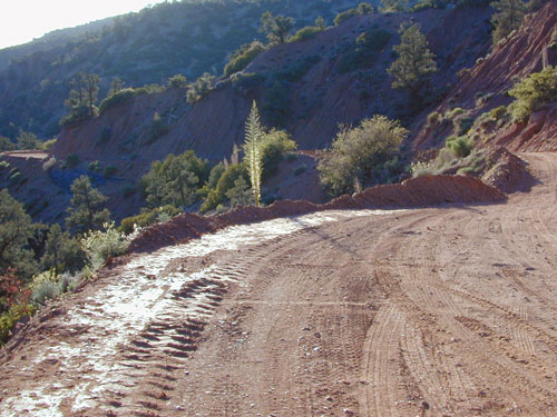
This rugged primitive canyon gets torn up during a good storm in late summer or a big winter storm. Red dirt gets very slippery – especially on the edges of a cliff. Boulders in the road, flash floods – or no road, river of mud! 2WD passenger cars can take this route in dry months, but high clearance is usually preferred. 4×4 is needed during heavy rain or snow – which could be half the year (Nov-April). Flash flooding is possible all over Los Padres NF, so know the weather forecast in advance.

Seen small RVs, trucks pulling trailers & even a U-haul moving truck down this way. MapQuest always amazes me where they route you. This is a graded dirt road, some of the time. MapQuest should post a ‘see Total Escape for this route’. Come on folks, if you’re traveling cross-country, while moving your residence, buy a real map to explore the National Forests of California. You may end up sleeping way out here – broken down in the moving van, in the boonies & no cell coverage, cuz you had a one page, wrinkled map in faded ink, wet & smeared. And MapQuest told you it was paved. It’s not paved 90% of the way.

Primitive camping is also allowed in the canyon wash or on the side routes, in certain seasons. Use an existing camp site when possible. Clean out the rock fire ring of litter & bottles, pull back all dry brush at camps & leave these places better than you found ’em. There are hundreds of dispersed campsites out here. The open wash is especially nice on a full moon hike, just bring friends – cuz it is considered “big cat country”. Camp fire restrictions are in tight control on this SoCal region. You will need a camp fire permit, a big shovel & lotsa water. Check with the Los Padres rangers to make sure. Recently Zaca Fire (2007) & the month long Day Fire (2006) both came very close to this precious sanctuary.

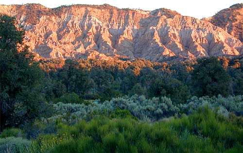
The high desert terrain is pinyon forest, with yucca & manzanita. The eroded cliffs of red rock, white & orange hues, glow best during the clearest sunsets. You will almost think your in Utah, until you get up on a ridge & see the smog in the Central Valley of California.

Mahu Tasen, a Native American camp and sweat lodge, has ceremonial grounds in a canyon off of Quatal. There is also a large rock quarry mining operation, as well as numerous wineries and ranches along this route. Several private residences too.

Ballinger Canyon OHV Park is close by, 5 miles N on Hwy 33

Carrizo Plain National Monument is also pretty close, N off Hwy 166

towns nearby –

PINE MOUNTAIN CA

MARICOPA CA

VENTUCOPA CA

helpful maps of the region –

Quatal Chumash Lands