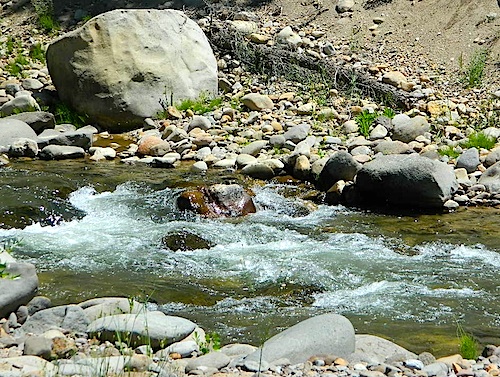
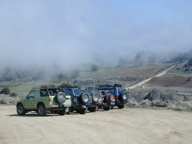
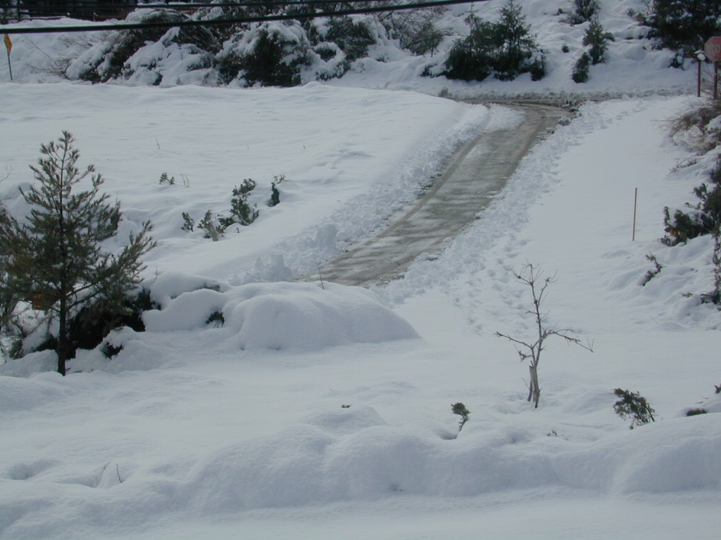
Due the nature of gravity, erosion and heavy rocks, creek beds tend to be rocky ravines near mountains – which collect rocks as they slide downhill. Creeks work as water drainage off the mountains. Inside California we have plenty of mountain ranges and plenty of movement, as the Pacific plate plows into North America, tectonically speaking.
How many Rock Creeks are inside the golden state of California? Heck, I dunno. Let’s try to find them all.
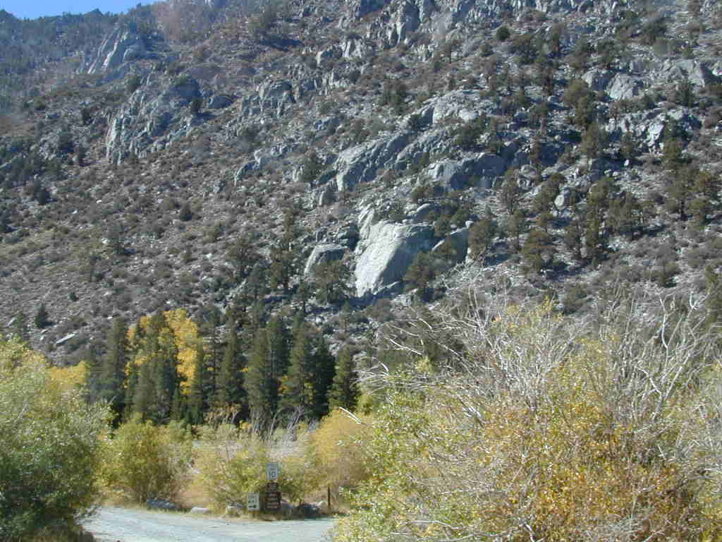
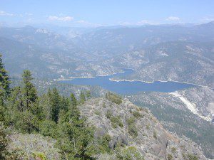
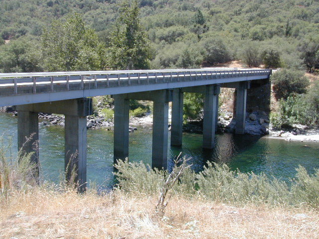
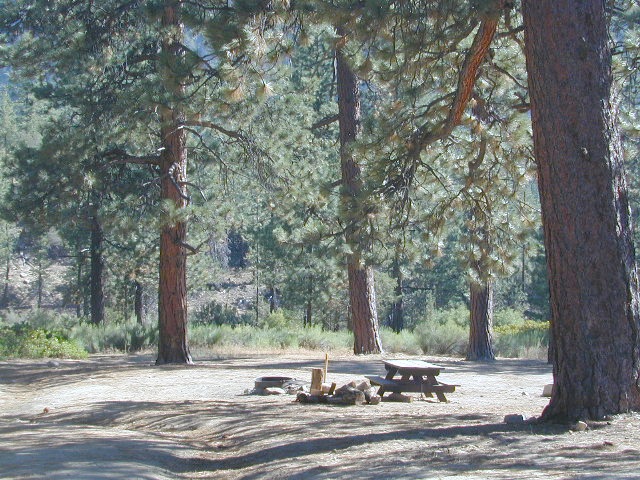
Large feeder creek from the north side of highway (California SR 70), in Plumas National Forest. Located in the popular railroad canyon known as the Feather River Canyon. Right here Rock Creek even has a reservoir.
Sugar Loaf Mountain elev 3553′ with Tobin Ridge line each side of Rock Creek as it descends the mountain tops. The junction where the creek meets the big river is just south of Bucks Creek Power Station @ STORRIE, CA. The overall location is half way in between OROVILLE, CA and QUINCY, CA
Rock Creek Campground – US Hwy 101 NorCal Redwood forests, north of Leggett, CA. Camp located on the Eel River, in the Standish Hickey State Recreation Area. (36 camp sites)
Also the is a small ROCK LAKE located insideLakes Basin Recreation Area, northern Gold Country @ Yuba River headwaters. Hike-in access only.
Similarly named ROCK FRONT RANCH is 4×4 trails & 4WD camping area. Cool wind caves, super steep driving terrain (Granny low anyone?) and of course, wildflowers.
Off Highway 166, east of the city of Santa Maria & US 101 – on the Central Coast of California. Way back there, at the edge of the forest, behind the wineries!
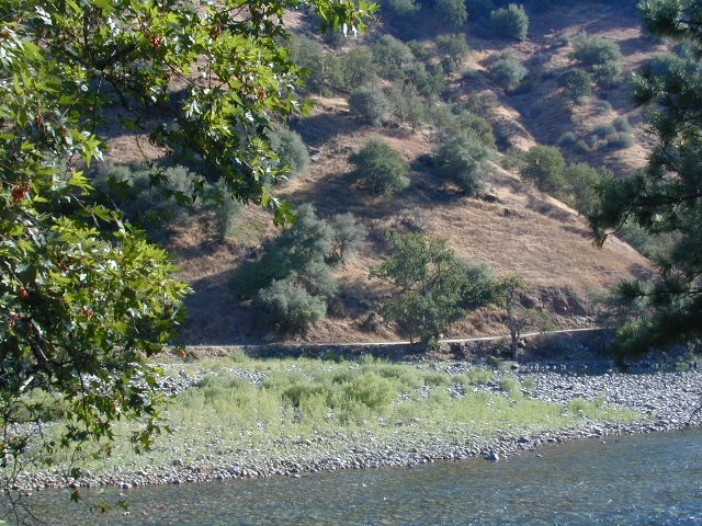
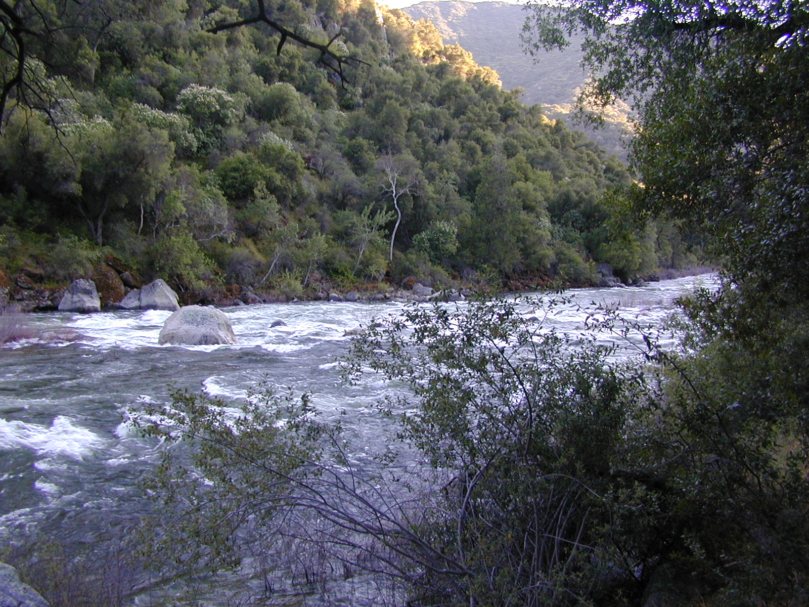
Camping areas along Kings River, Sierra Nevada California
Kings is the longest river in the Sierra Nevada and very rugged and remote in most of the length. The Upper Kings is situated in the Wilderness and National Park at the highest of elevation. Granite alpine back country, with abundant small lakes, the Pacific Crest Trail and numerous Wilderness areas.
The tallest peak, Mount Whitney, drains this way – down waterfalls and whitewater, westward to the San Joaquin Valley. Agriculture, farmlands and orchards of fruit.
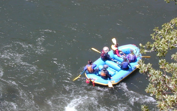
The Lower Kings is popular among campers, fishermen, kayakers and rafters, accessible most of the year. Upper Kings River is located inside the National Park boundaries.
Upper Kings River Headwaters
8000-10,000′ elevation
PCT trail camping, hiking trails lead 20+ miles from Cedar Grove, skirting the Joh Muir Wilderness
NPS Campgrounds @ National Park South Fork Kings River
Inside Kings Canyon National Park:
Cedar Grove Village @ end of Highway 180
elevation 4600′
may be closed during winter months.
reservations recommended.
Roads End Trailhead
Backpacking trails lead up river from the paved parking area.
NPS – wilderness permits required for overnight stays.
Camping, day hikes and horseback trails. Wildlife and wildflowers abundant in this Cedar Grove / South Fork canyon.
Camping near Lower Kings River
Open all year round. Outside the National Park boundary, westward in lower elevations, many more camping options are available.
NOTE: Sierra National Forest is located on the north side, along the river shore in between Pine Flat Lake & Kings Canyon National Park. But Sequoia National Forest is located on the south side, so you may need more maps. Cell phone service is spotty or non-existent in this deep canyon.
Trimmer Springs Road #11S12: a paved access road, that wraps around the northern shore of Pine Flat Reservoir. Very curvy and long, with 25 mph curves; this main route continues east into the massive Kings River Canyon.
Google Maps may have this road crossing the river, towards the end. Proper signage is questionable in the area, since local rednecks love to shoot up signs. Trimmer route quickly peters out to narrow dirt roads, anywhere past the Mill Flat Campground area.
Lower Kings is NOT easily reached via the National Park, nor Kings Canyon Highway 180. Dirt road travel is required on Road #12S01, which can be steep and rocky at best. The drive is a steep climb up to the highway, which may require 4 wheel drive in some sections, depending on weather and land slides. This road is rough, so you will need at least a high clearance rig and a good forest map. Winter brings some snow and abundant rains (NOV – APRIL).
LANDSLIDES and ROCK SLIDES are common with ROAD CLOSURES not always posted on the Sierra National Forest, NFS web site.
Wildflowers are abundant in this region for springtime. (MARCH-MAY)
both above camps are free camp spots: boondocking, dispersed camps, primitive car camping, tent camping, RV camping, river fishing, kayaking, rafting
Sierra Road #12S01– primitive camping, few pit toilets; fishing access, some trailhead camps and RV spots along river. The northern most arm of this road is also referred to as Road# 12S001 Garnet Dike, on the NFS web site.
BlackRock ReservoirRoad #11S12, another side route (paved) climbs steeply in elevation, along a cliff edge. This spot offers a small NFS campground near a lake, and is located along the North Fork of the river.
Avocado Lake Park is down river and a perfect spot for a picnic or BBQ. A 210 acre day use park providing recreation that includes swimming, fishing and picnicking. The park has picnic tables, a group picnic area, BBQs, boat launching ramp and a playground. West of Pine Flat Reservoir, this grassy county park is only open during daylight and no overnight camping is allowed.
Next park down river is Kings River Green Belt Park, which seems to be popular with joggers and dog walkers. Also run by the county, this place closes at sundown and no camping facility is offered.
@ Highway 180
Riverbend RV Park
17604 E Kings Canyon Rd
Sanger, CA 93657 with seasoned organic firewood
Sierra Madre Road Sierra Madre Ridge, San Rafael Wilderness
Los Padres National Forest Forest Road #32S13
off of Cuyama Valley Hwy 166
East of Santa Maria, CA – along Highway 166 (on the south side of the pavement) are several dirt roads that lead up to the main ridge road that access this part of Los Padres National Forest.
backpacking
camping
dirt bike trails
dirt roads
hiking
horse camping
mountain biking
off road routes
petroglyhs
wildflowers
4WD not required, but high clearance is helpful. Open almost all year. Rainy season gate closures (at hwy) during winter months.
Sierra Madre Ridge is forest road #32S13, which parallels Hwy 166 (Cuyama River) for over 50 miles on the Sierra Madre Ridge at approx. 5000 feet elevation.
NOTE: A good stretch of this dirt road is closed to vehicle traffic. Although it connects to Santa Barbara Canyon near Ventucopa, you cannot drive it. Only hike or mountain bike!
NFS Gate locked at the HOG PEN trailhead, and from there you can bike or walk all the way the other end at Santa Barbara Canyon near Cuayama Fire Lookout @ Dick Smith Wilderness
Small campgrounds in the region:
off Highway 166 Miranda Pine Campground (on 32S13 @ 11N03) Bates Canyon Campground (via Cottonwood Canyon Rd) also known as White Oaks Campground Aliso Canyon Campground (via Aliso Canyon Road) not accessible by vehicle, from dirt road 32S13; only by trail
in the backcountry Painted Rock Camp (hike-in) Sycamore Camp (hike-in)
Yellow Stake Camp Sites / Back Roads Camping NFS
near Cajon Pass, Big Bear & Idyllwild CA
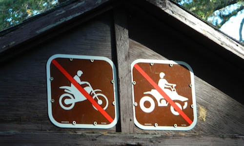
YELLOW POST CAMPS are dispersed camping sites on the back roads in Southern California, where fire danger is greatest. Forest authorities have designated certain spots as ‘fire safe’ for remote, open camping options around Big Bear Lake, Fawnskin and the Idyllwild mountain area.
If you prefer to stay out of the developed campgrounds, you will be the minority. But you must know how to read a map well to reach these beauties.
SoCal camping doesn’t have to mean crowded campgrounds. Seek your seclusion on the dirt back roads, where there are no fees, minimal noises & a private site waiting just for you. These are usually on a first come, first serve basis. A high clearance vehicle (SUV, truck or 4×4) may be needed to reach some of the premium camp spots, but there are also sites accessible by passenger cars. And, of course, a fire permit is required.
In the San Bernardino National Forest there are several back woods ‘fire safe’ camping spots, that are noted with a single yellow post & some may require reservations in busy summer months. You can find out more on reserving from the Big Bear Discovery Center, 909-382-2790
Extra caution should be used when winds are high, camp fires are often banned due to wildfire danger. Check with local rangers for up to date conditions and always get your campfire permit.
No restrooms, no water, no facilities. Just a dirt road, a fire ring & a single picnic table. Hopefully your table will not be shot up, by the local rednecks who ‘get off’ doing stupid stuff like this. Pick up any litter & leave the place better than your found it.
These backroad camps are perfect for the 4×4 group, stressed out social club, church group w/ rugged van, or the city SUVer who wants to get away from the crowds. The most sought after camp spots are nearest to the lake or a site accessible by RVs and horse trailers, but there are many more excellent camp sites to be discovered. USDA Forest Service Map is highly advised to reach these remote, dirt road camp areas. Rugged, steep, one lane dirt roads that lead to some of these spots. A passenger car is sometimes not suitable for all dirt roads. Rutted and steep means turn around. Wet weather changes dirt roads. Often routes close for winter w/ locked gates.
Sherman’s Pass, Sequoia National Forest
Big Meadow borders Dome Land Wilderness
in the Southern Sierra Nevada mountains
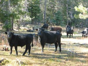
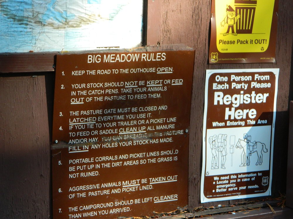
There are many large and gorgeous meadows inside Sequoia National Forest, but none compare in ‘grandeur’ to this southern Sierra public pasture. BIG MEADOW KERN
Find your way north of Kernville and the river really comes into view. Up close, right there! Stop, get out of the vehicle for a stretch break and breathe; take it all in. This is only the start of the adventure. Gorgeous Big Meadow is located up on the Kern Plateau, 3000′ above the river on the eastern ridges. Only accessible half the year due to snow, this meadow is a must see for those exploring the eastern side of the Kern River.
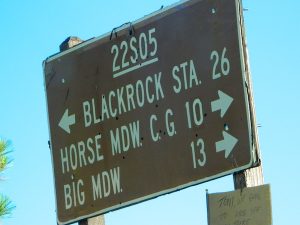
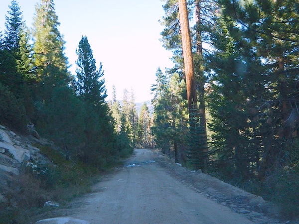
Sherman’s Pass Road #22S05 is a hard right turn after the Johnsondale Bridge. It is well signed and still easy to miss. Climb out of the dryness and into the dense forests and meadows of higher altitudes. Driving this southern Sierra-crossing route, Sherman’s Pass Rd. will require all of your concentration. Steep, curvy road without guard rails. Plus epic, scenic views (NOT to die for).
At this point – Rock slides, snow gates and road closure are typical in winter months. Check w/ rangers in Kernville about road conditions (before you head up this way).
The partially paved road will lead south a few miles, then becomes GRADED DIRT and ventures another 15+ miles – way, way out into dead-end territories. Not one road connects down to Lake Isabella!
Spur roads (all one lane, dirt roads) lead out to various places like – Cherry Hill, Big Meadow, Horse Meadow Campground, Dome Land Wilderness Trailheads, Manter Meadow, Salmon Creek Falls, Cannel Meadows, dozens of trails and spurs. Plenty of primitive camping back in these forest areas. A high clearance rig may be required the further back you go. Mud and snow are quite common in spring and fall.
Extra Large Camp Sites
BIG MEADOW is a favorite camp area among –
backpackers (trailheads)
equestrian (horse campers)
hunters
mountain bikers
off-road campers
westside drive: ample parking and camping for horse trailers
no ‘froading on meadows
Back Loop Road, around the Big Meadow. Narrow & muddy
Or perhaps this is not the Big Meadow near Sequoia that you are seeking. The scenic, giant, public horse pasture listed above is not to be confused with #14S11 Big Meadows Road, also in National Forest land, located in between popular Sequoia National Park and Kings Canyon. (100 miles north of here)
Small campgrounds and secluded camps, accessible by dirt bikes or 4-wheel drive vehicles. Numerous dirt roads, sand dunes and canyons to explore, some with developed campgrounds, other areas w/ primitive camping. Self sufficient campers will enjoy this list.
4×4 camping in California
Okay, you got your 4 wheel drive vehicle dirty, it is now several years old & maybe you even have a scratch or two. Now is the time to finally start using that beast for real off road adventures. The real edge-of-wilderness trips you dream about when your sitting in your cubical wondering what life is really about. Fishing, camping, off roading and enjoying nature, of course!
4×4 camping in California is plentiful. California has trails for OHV use – which means ‘off highway vehicle’, that can accommodate your machine. These remote camps are always primitive camp sites, with picnic tables, fire rings & maybe a pit toilet (if you are lucky). You can find total seclusion on these back roads & trails, well away from the developed campgrounds & RV parks.
Anza Borrego Desert 4×4 Trails – pretty much everywhere in Borrego desert is off road heaven. Minimal pavement and maximum desert means dirt roads galore, white sandy washes, slot canyons, badlands, wind caves, wildflowers, petroglyphs, boulder outcroppings, old railroad trestles and so much more. The San Diego desert elevations range from near sea level to 4000′ on the eastern slopes of Laguna Mountain.
San Bernardino National Forest – has a few trail camps for 4×4 enthusiasts. John Bull Trail (near Holcomb Valley) has one real awesome camp spot with great views over the desert night lights. Holcomb Creek Trail also has a few spots near the creek. Overall this area is somewhat crowded for wheelin’ (especially on the weekends), as the population is so dense nearby.
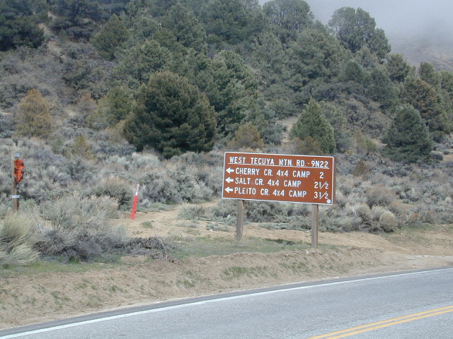
Los Padres National Forest – the most 4×4 camping, readily accessible to Southern California. This is truly the best kept secret for Angelinos wanting an escape. The southern portion of the forests has Tecuya Ridge #9N22, with several camps only minutes from I-5. Cherry Creek 4×4 Camp, with a few other campsites tucked way back in there. Dome Springs Campground is located off Lockwood Valley Road, while Nettle Springs Campground is over near Highway 33.
Out west, Cerro Noroeste Road has the Blue Ridge w/ Marion and Caballo Camps. Red dirt high desert wash Quatal Canyon #9N09, is right next to the Chumash Wilderness.
2 OHV parks in the Los Padres Area: Hungry Valley & Ballinger both serve the off road crowds and have ample facilities, large camp spots to accommodate RVs and trailers.
The northern section of Los Padres (near Big Sur) has plenty of dirt roads & primitive camps, but none are truly 4×4 routes, as most can be accessed easily with a passenger car. See more on Big Sur Camping and Big Sur BackRoads.
Sequoia National Forest– Southern Sierra Nevada area has 4×4 camping right along the Kern River @ Keyesville, at the junction where Hwy 178 meets Hwy 155. Also, further up the river, Forest Rd#22S82 leads to primitive Camp 4, where there are several spots near granite pools, that can only be accessed by 4 wheel drive. The Big Meadows area also has some gorgeous forested back roads worth exploring. Kern Plateau has hundreds of miles of OHV trails near Troy Meadow.
High elevation Monache Meadows is a prime fishing & hiking destination on the south fork of the Kern River, accessed by an authentic “Jeep Road”.
Sierra National Forest– central Sierra forest has plenty of 4×4 routes that lead to granite rock gardens & mighty fine, secluded, forested camp sites. Gorgeous Red Lake & Coyote Lake are popular spots that require some technical skills & much patience to access. Both are frequented by fishermen & horses. Bald Mountain trailhead has awesome creekside camps on Rock Creek. Up near Wishon Reservoir is the dead end trail of Spanish Lake. Onion Springs Meadow is awesome back behind Edison Lake. Near the granite wonderland Courtright Reservoir is the infamous Dusy Trail signed #28E34 (aka #7S32, the Dusy Ershim), second only to the Rubicon Trail for high Sierra granite.
Stanislaus National Forest– camping in the Crandall & Niagara Creek OHV section of the forest, right off Hwy 108. Elevations range from 5000′-7000′. Higher up on the other side, Levitt Lake (access road near Levitt Falls) on the east end of the mountain range, east of the Sonora Pass sign.
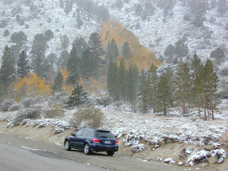
El Dorado National Forest – has an area called Rock Creek for off roading in the Gold Country. Plus the ever popular Rubicon Trail starts hear (near Georgetown) & leads 20 miles across the High Sierra Nevada granite slabs to Lake Tahoe. Tons of camping back here in the National Forest.
Lakes Basin Recreation Area – Northern Gold County, just above the Yuba River. Gold Lake has many campable lakes. The area sees a lot of snowmobile traffic during winter snows, but warmer months are the time for fishing and camping. Most of the big lakes have small developed campgrounds, some are minimal, or primitive style camp sites on dirt roads without facilities. Maybe a picnic table at most.
Smith Lake is a place that fishermen and 4×4 enthusiasts love. It is small, secluded and kinda hard to find. You’ll need a good topo map of the region. Situated on the border of Tahoe and Plumas National Forest off the Gold Lake Hwy (aka Road #24). The PCT cuts thru this Lakes Basin area w/ Sierra Buttes There are dirt roads and off road trails leading deep into the backcountry from the Packer Lake and Gold Lake areas. Snag Lake is a free camp right on the main road.
Snake Lake Campground has numerous dirt roads and trails leading out to Butterfly Valley. Horse campers use this popular camp spot, so no loud vehicle activity inside the campground. No shooting up the bear locker either!
Milsap Bar is a long, narrow 9 mile dirt road which leads from Bald Rock Road in Berry Creek, down to the Middle fork of the Feather River. NFS Campground on the big river without fees!
China Gulch Road #60, a very long and winding dirt road, leads from Oro-Quincy Highway down to the Little North Fork. Although the NFS Campground is closed due to a landslide (1 mi before camp) there still is primitive camping at the second bridge. Be warned: the campsite at the first bridge is often over run with giant, juicy slugs at night.
Out there east of Quincy, somewhere off the historic, long and winding La Port Road, a few decent 4WD trails thru forest, access ridge lines or the big river below. Great fishing, amazing scenery & very secluded.
(north of La Porte Road)
– Feather River access
@ Cleghorn Bar Campground, 4 campsites (Road #23N24)
@ Stag Point Campground, 5 campsites (Road #22N80Y)
@ Hartman Bar NRT to Dan Beebe Camp (Road 94 to #22N42Y)
(south of La Porte Road)
– Poker Flat Camp near Sawmill Ridge & Table Rock (Road 800)
Sly Creek Reservoir is a super popular NFS Campground with trailheads and dirt roads leading deeper into the forests. The camp area is a favorite amongst the off roaders and dirt bikers that migrate up to the mountains for the weekend, to escape from the heat of the summer in the Sacramento Valley. LGVR is another body of water back in these parts and is more scenic and peaceful than the Sly Creek.
This coastal range is dirt road heaven, graded dirt roads, ridge routes, hiking trails, equestrian trails, big lakes, small lakes, creeks, meadows, forests, wilderness and 4×4 routes. Snow can be the most fun and challenging for the 4WD crews. Mud, snow, some road closures seasonally.
2019 WILDFIRE: Ranch Fire – wiped out most of this area. South of Snow Mountain Wilderness, plenty off road trails leading to peaks and ridge lines. Numerous small campgrounds to choose from, trailheads everywhere, acres and acres of wild mountainous areas, and a lake resort nearby. Lake Pillsbury is kinda the center of all the 4×4 action in Mendo.
Fouts Springs – Numerous NFS Campgrounds catering to the off-road types a portion of the year, but mostly quiet other times.
Tucked way back in the granite high elevations, near Donner Pass is a wilderness water flow called Canyon Creek. Connecting small lakes and big reservoir, this creek is part of the Nevada District water supply. The Sierra Nevada region is Tahoe National Forest and the terrain is abundant rock.
Campground is perched on the edge of rock overlooking the impressive whitewater; sounds of crashing water at certain campsites is deafening. Half of the campsites are located in a forest loop and the rest are out in the open, with much granite and fewer trees, perfect for star watchers.
Canyon Creek California
Lake Faucherie is a mile up the creek and Sawmill Lake is a mile down stream, so it’s a great fishing location, as well as hiking, kayaking and canoeing destination. The Pacific Crest Trail (PCT) is also routed close by. A hiking trailhead at the north end of Sawmill Lake leads to a loop hike of small lakes.
roughest roads in the region
Campground loop is paved, but the 12+ mile access road is NOT.
Twenty plus miles of paved & gravel backroads in boulder-hopping bliss, leads to granite lined lakes and forested campsites. Two different driving routes into this canyon:
One is the longer way Road 18 – paved access off of Gold Country Highway 20, which becomes an 8 mile long, rocky, rough, one-lane road around Bowman Lake.
The other is slightly shorter, county road #843 that comes in the back way from Jackson Meadow Reservoir (off Hwy 89, N of Truckee).
Both of these primitive roads join at Jackson Creek Campground, a favorite among off-roaders.
Canyon Creek Campground is another few miles up Road ##843-037, a rugged canyon route towards Lake Faucherie, where the road comes to a dead end.
Don’t let the old maps fool you: these National Forest Roads are labeled as gravel roads, but boulders and rock slides are quite common. 4×4 would be nice, but high clearance is recommended.
Minimal signs designate trails, roads and lake access; What signs that do exist are old, faded and broken. No warning signage reading ‘high clearance’ or ‘4WD recommended’ – so obviously Tahoe NF won’t be installing new signs anytime soon.
backpacking
camping
canoeing
fishing
hiking
kayaking
stargazing
Faucherie, Sawmill and Bowman Lakes are all along this waterway called Canyon Creek.
National Forest Campground Latitude: 39.436863 Longitude: -120.579564
Canyon Creek Campground
• Elevation: 6600′
• Number of Sites: 20
• Toilet: Vault
• Vehicle Access: High Clearance Vehicle, no trailers
• Campsites Reservation: No
• Camp Fee: No
• Length of Stay: 14 Days
• Season: June – October
• Trailheads: Faucherie & Sawmill Lakes
• Managing agency: Nevada Irrigation District
530-265-5302
Canyon Creek Campground is an excellent campground for staying away from the crowds, which seem to focus more around Bowman Lake & Jackson Meadows Reservoir.
All campsites at this campground have steel bear boxes – for proper food storage in black bear country.
Prefer camping outside of developed campgrounds? then the primitive camp sites that line Canyon Creek will be a welcomed surprise. Most are clearly marked with small signs and some may require 4×4 to access. When fire restrictions are tight, campfires are only allowed in the developed campgrounds.
Graded dirt road near Clarks Fork junction @ SR 108. Dirt road travels up into forest, hiking trails and meadows; South side of the volcanic Dardanelles @ Tuolumne Co. & Alpine Co. boundary
County Line Trailhead
Wheats Meadow Trailhead
Carson Iceberg Wilderness Area
The Dardanelles (9524′ elev)
winter road closure, annually check with local rangers on road access and conditions.
Rd# 6N06, climbs to mountain scenery at upper elevations, well of the main highway. Route is a 2-lane wide road at times, narrower and private towards the end of roads; several dirt roads, overgrown 2 tracks w/ many camp sites to choose from. Dispersed primitive camping requires a camp fire permit.
OHV off-roaders will only find dead ends on dirt route 6N06. NO motorized access in nearby wilderness. Wheelers should try south of Highway 108 @ Niagra Campgrounds; Niagra Off Road #5N01 for all the noise-makers, gear heads, dirt bikes, and toy boxes. Niagra Creek, Niagra OHV, Niagra 4×4.
Tecuya Mountain 4x4camps, Los Padres National Forest
4×4 Camps @ Tecuya:
Cherry Creek Camp
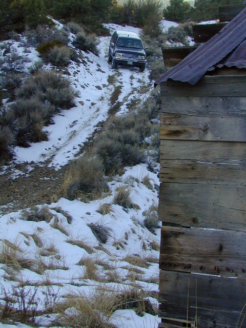
Seeking a dark shady hole to spend the night? Then Cherry Creek canyon is choice for a quick overnighter near Frazier Park and the I-5 Tejon Pass. Steep dirt road access will challenge even the biggest skeptic.
free campsite
4WD only access
The 4×4 Camp (signed) turn off is along Cuddy Valley Road, on the north side of the pavement – just a few miles west of Frazier Park, inside Los Padres National Forest.
Oak trees and brush clog the dense hillsides. Owls live in this canyon. Deer and wildlife sightings are common – which makes this an ideal hunters camp for those looking to explore on foot.
The canyon gets narrower as it heads down hill (northward) w/ the single track route becoming a blanket of slick dark mud (in the wet months). Without trees on the worst section, making a self-rescue impossible.
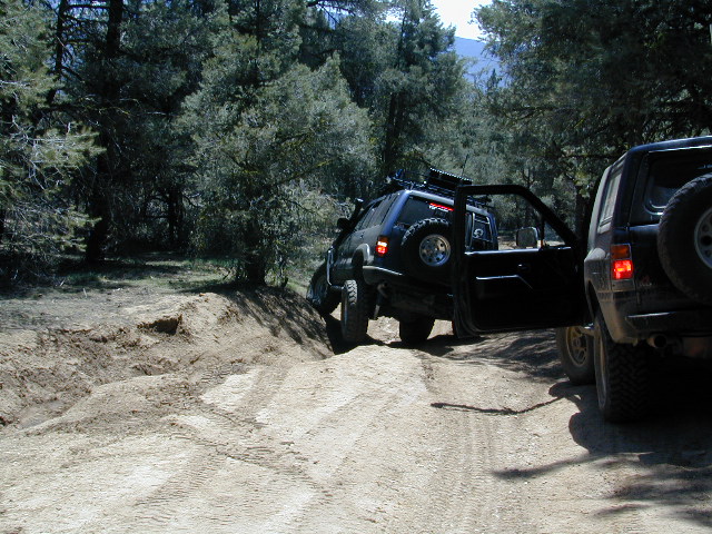
Real 4 wheel drive is needed for this camp! All wheel drive vehciles (SUV & sportwagons) should not attempt this location without a tow strap or winch – AND another 4WD vehicle to help out. Yep, seriously. We know, because we had to rescue someone last time we were here.
Sparse accommodations w/ minimal sunlight reaching this steep canyon
On the eastern mountain slopes of Big Bear Lake, Holcomb Creek creates a forested sage valley – called Holcomb Valley, located only a few miles away from the big lake. A graded dirt road leads out to this pine forest & a prime campground area. Perfect location for picnics and sightseeing.
Although the developed campground is open all year long, please take into consideration that SNOW and mud is the norm for winter months.
Nice shady sites to beat the summer heat. Camp spots spaced out fairly well. Hikers parking lot is located at one end of the campground. Bears are well known in the region, so please lock all food in the provided metal bear lockers.
The epic Pacific Crest Trail runs right through the Holcomb Valley. Doble Trail Camp is out this way for PCT parking, next to Holcomb Valley Road #3N16 which encircles this whole forested area inside San Bernardino National Forest.
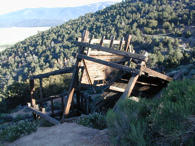
Holcomb Valley has a historic cabin to see. Numerous old mines exist around this area. Nearby Gold Mountain is a popular 4WD route.
The dirt back road leads east down to the high desert @ Highway 162. Down to Pioneertown and Yucca Valley, and eventually Joshua Tree National Park.
Plumas National Forest Camping – Primitive Camp Sites
Spanish Creek, Quincy, CA
Plumas Forest Camping
North Sierra Nevada, Northern California
Listed below are primitive campgrounds w/ minimal facilities or open camping areas in Plumas National Forest. Plumas has excellent fishing as the big rivers & numerous creeks run thru this northern Sierra Nevada landscape. Open camping is allowed on almost any dirt road w/ a current campfire permit
Brady’s Camp
[on Pine Creek near Argentine Rock]
near Quincy, CA – east on Squirrel Creek Rd. & go 8 mi. to the campground. Elevation 7200′ / Open May – October
Bucks Lakehas numerous NFS Campgrounds and PCT access; Overall elevation 5000′ w/ abundant boating, fishing and hiking. Snow in winter closes roads. Cabins, marina, lodge, restaurants. Bucks Lake Wilderness, Gold Lake, Silver Lake
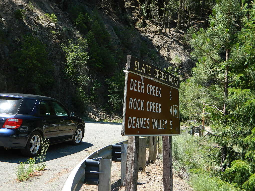
Deanes Valley Campground
[along Rock Creek] Hwy.70 Quincy, go 3.5 mi. west on Buck Lake Rd. Head south & 7 mi. to the campground. Elevation 4400′ / Open April – October
Backpacking trails w/ dirt road access. Above Chico, beyond Cohassett; on the border of Tehema Co. and Butte Co. (Lassen NF & Plumas NF)
Inskip, CA – Way up beyond the Ridge, well past Magalia and Stirling City – find dense forests, dirt roads and camping. Philbrook Reservoir w/ West Branch Campground NFS. Elevation 5546′
Ohio Valley – Seneca Road
[off Hwy 89 to southside] Primitive forest camping near Lake Almanor. ATV trails, hunting. Creeks and river camping closer to Seneca. High clearance or 4WD may be needed on these dirt back roads – depending on snow and mud. There is plenty dirt roads back here to explore.
Snake Lake
[good fishing area] Hwy.70 Quincy, go 5 mi. west on Buck Lake Rd. Head north & 5 mi. to the campground at the lake. Elevation 4200′ / Open April – October
Located inside the Sierra Juarez Mountains
Parque Nacional Constitucion de 1857, or
Constitucion de 1857 National Park, Baja California, Mexico
Pine forests in Baja California: Dirt roads access Laguna Hanson, so come prepared to drive many miles with dust & potholes — more than 20+ miles from the paved highway just to reach this prime high elevation destination. Since most of Baja is desert, dirt and coastline, this location is a rare treat for those wishing to travel (off the beaten path). The tallest mountain peak in Baja is nearby with the University Observatory.
San Pedro Martir
Baja Camping in the Mountains
Water levels drop well below normal & what we end up with is a shallow lake with huge boulders emerged. Kinda surreal looking. Tall pines & dense forest surrrounding lake. Wide open & flat areas perfect for biking, stargazing and group camping.
This Baja National Park campground is more like dispersed, or open camping around lake shore. Very popular place in the summer months & if you want seclusion camp away from the lake, deep in the forest. The best quiet spots are located in the north east vicinity.
No motorhomes allowed: the road is steep, long, all dirt and narrow in certain spots.
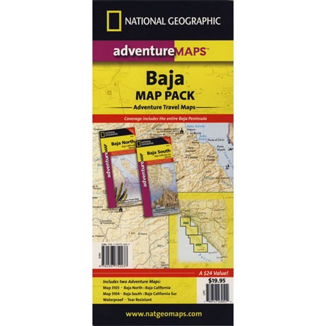
Baja Maps from NatGeo
bouldering (rock climbing)
camping
dirt bike trails
hiking trails
horseback trails
hunting
kayaking
mountain biking
off-roading
sightseeing
No services at lake. Minimal camping facilities. Self sufficient campers a must.
BRING EVERYTHING = ice chest w/ block ice, drinking water, flat tire repair kits, tow strap; extra blankets, medication, first aid kit. There is no store within 30+ miles of here, and the dirt road is very long (both ways) – so it is best to be prepared with all food and beverages.
LOCALS NOTE: An occasional rancher may approach your camp with his farm truck, selling fresh made cheese, beef jerky or other farm produce.
No pavement, no picnic tables. Minimal pit toilets, few rangers patrolling and rock fire rings.
CAMPERS TIP: The toilets can be nasty!! Bring a shovel and wipes; walk into the forest for your bathroom break.
OHV trails are nearby. OFF ROADING, dirt biking and 4×4 routes are essentially any dirt road that is within this forest; Drive slower, keep your ears peeled and watch out when they pass you, cuz they are most nimble and quicker.
No motorcycles signs are posted, but that doesn’t stop them riding all hours of the night. The mountains near Tecate and Mike’s Sky Ranch both cater to dirt bikers and tours, and are located nearby (sorta).
Park rangers & rules here are a lot more lax that in the “States”.
MAP NOTE: Google Maps has this place listed as Laguna Juarez
Winter wet weather doesn’t need to put a damper on your outdoor exploring, if you can get your hands on a 4×4 vehicle. Almost any SUV or truck with 4 wheel drive is capable of driving through some snow or mud. Just how deep is the mud (underneath the snow) is usually the big question. Many National Forests and State Parks close certain dirt roads due to over-use, or to control soil erosion and prevent the deep muddy ruts which are costly to re-grade come springtime. Call ahead to the rangers to find which back road routes are indeed open, or bring your printed topo map and wing it.
The California destinations listed below are popular winter spots for off roading enthusiasts. Some places may be busier than others. The dirt roads surrounding these spots are real treasures, so try to plan an all-day loop trip if possible. Camping w/ a campfire permit is an option on many back roads. Plenty lodging in nearby small towns if winter camping is not your thing.
Tribal lands are mostly located in rural regions which always have plenty of dirt roads to explore. Get a good back roads map for the public lands nearby, parks, BLM, National Forest. If the overnight camping is dropping into the twenties or teens, then know the forecast. A good rule of thumb for California hotel stays: If the low temps overnight are below the cost of a hotel room at the nearby casino, the comfy lodge might be well worth considering.
Avi Casino
@ California – Arizona border.
The Laughlin casino in the middle of nowhere, right on the Colorado River. Jet ski rentals, swimming pools and spas, restaurants, RV park. The historic Mojave Trail, aka Mojave Road, starts next to the property.
Gold Country Casino
@ Lake Oroville, California
Sierra Nevada mountains Northern California. Conveniently located near Feather River (all 4 forks) and Plumas National Forest, with Berry Creek and Bucks Lake Wilderness to explore. Snow often closes the highest elevations.
Viejas Casino
@ Pine Valley, East County San Diego
Great bouldered mountains with back road exploring, hiking, mountain biking trails, all easy access from Southern California. Get a Cleveland National Forest map and expect some road closures near Laguna Mountain Sunrise Highway, especially when it snows.
Diamond Mountain Casino
Susanville, Northern California
Located in between US Highway 395 and Mount Lassen, the scenic Susan River region has lots to offer for the outdoor enthusiasts. Plenty of roads to explore, some big lakes too. Many Forest roads could be closed due to snow, so be warned and call ahead to the ranger.
The whole Carson City area in Nevada has some excellent dirt roads to explore. Old mines, caves, many miles of pinyon forests. Lake Tahoe is nearby with luxury resorts, casinos and snow skiing.
If you just can’t stand the cold and snow, then warmer climates lie to the south. Baja California is a tourist/traveler and off-roader haven in the wintertime.
Holiday Wheeling
Jawbone Canyon for Thanksgiving weekend will get dirt bikes by the thousands and big families. Christmas is busy around the Palm Spring desert destinations – like Joshua Tree. Easter weekend is popular w/ wildflowers and campers in Anza Borrego Desert.
RV camping
Occasionally, wide graded dirt roads lead to secondary routes, so overnighting it with a motorhome on the back roads is very possible (if deep mud is not present). RV camping is quite the tradition for Southern Californians. Desert off roaders in tow, all over the Mojave. Steer clear of busy family groups. Pick a lesser known area to camp and explore. Get your real topo maps out and choose easy access from pavement, but wide graded dirt roads are best. Plenty roads like this in the Eastern Sierra, on the east side of US Hwy 395. RV campers that follow Total Escape might very well be interested in testing the limits of their recreational vehicle, slowly.
AWD Sportwagons
Before AWD got marketed as 4WD, Total Escape was way out there exploring in a 2 wheel drive and posting it online for you. All wheel drive station wagons should stick to the paved and plowed roads. If you plan to do a lotta dirt road driving in the old Subaru, keep the rock crawling to a minimum. If not, you may want to invest in a skid plate for the oil pan. Nothing beats first hand experience and learning ahead of time how your car will behave before you loose control on icy dark steep roads. Go practice with the emergency break and get the vehicle in a wide open snow plowed area if possible, just avoid the temptations to get wild. Don’t get the doughnut urge and plant yourself in a tree. Remember, it’s not like the commercial showed us, those are closed roads they are filming on.
Snow Chains
If you plan to be off roading in snow or mud at all you might want to consider some important safety items: tire chains for snow, a tow strap and tire plugs for flats. If you own a high clearance 2WD SUV, you could benefit from running chains on all four tires when snow is present. How deep the snow gets and how steep the hills are, determines how far you can go without a real 4 wheel drive. Some choose to rent a 4WD for the weekend road trip.
Snow Plow First Pass
Carry these items when traveling in winter conditions:
tools, jumper cables, tow strap, emergency gear, first aid kit, real boots, extra clothes, blankets, flashlights, food, drinking water, cell phone, maps
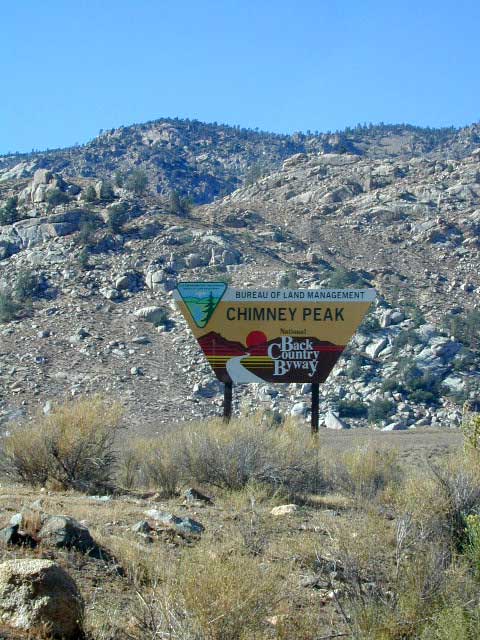
East of Lake Isabella and west of Walker Pass, there is a small community called Canebrake along Highway 178 Canebrake Road, a graded dirt road climbs up into pinyon pine forests. Lamont Peak (aka Lamont Pinnacles) is a decent hike & rock climbers dig it too.
Chimney Creek Campground is along the main road and has RV access (28′ max), for the motorhomes who do not mind a little dirt road driving. Easy trail access to numerous area hikes. The PCT is routed close by.
Long Valley Campground is tucked way back in the boonies with trailhead leading into the granite Dome Lands; Fishing and river access to the South Fork of the Kern.
Long Valley Loop Road (2001)
Long Valley Loop Road circles the Chimney Peak Wilderness, which skirts the Domeland Wilderness. THE LOOP is washed out and ROAD is NOW CLOSED in one portion. See BLM web site for up to date info.
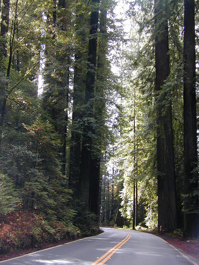
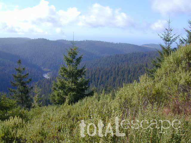
There are a few special places in California where redwood trees grow right down to the shore, but it is rare. Searching for place to pitch a tent (under the redwoods at the coast) is possible, but a bit harder to find than you might imagine. State Parks usually offer the standard paved camp site. Maybe need to drive dirt roads to find redwood seclusion.
If you are seeking free or dirt cheap, primitive camping on the coast, then LOST COAST CAMPING on the Mendocino border is one option. Or head east, inland to the abundant National Forest. Dirt roads of the Six Rivers National Forest offer old logging roads, creeks, and secluded places to pitch a tent. Campfire permits are needed for dispersed camping, or ‘boondocking’ as some call it.
Dirt back roads can get muddy during the wet season, so know your vehicles capability and if you are unsure, check with the local rangers over the phone (preferably a ‘field ranger’) before venturing out. Remember that rain and mud are the norm, most of the year.
Fog is typical of the region. Enjoy the sunshine – when you can!
Eastern Sierra Nevada – Inyo Mountains
Inyo Forest Back Roads – Mammoth Off Road
Off Road near US Highway 395. Yep, Olancha has some OHV (off-road) areas near the dunes, but this web site is dedicated to the real deal, the scenery, the trail heads, the hot springs, great secluded camping & of course, back road exploring.
You will need a Inyo National Forest map to discover these back roads. These are minimally traveled routes, un-maintained, sometimes washed out, eroded & maybe even creek crossings (without a bridge). Some gravel two-lane routes, some one lane roads leading deep into dead end canyons.
A few popular routes are paved, but most of these listed are indeed dirt roads. Some may require high clearance vehicle, or even 4×4. Know your vehicles limitations & be prepared to turn back when the road worsens. Cuz more often than not, it’s a sign of what more difficult terrain is to come.
Watch out for live stock – they are dumber than they look.
Owenyo Rd – Wanna parallel the highway (395) on dirt; Sure, it’s a long bumpy route – from Hwy 136 @ Dolomite to Bend City @ Mazourka Cyn.
Road# 13S05 – Mazourka Canyon Rd – leads up to some old mining camps & way behind Mazourka Peak (9410′) deep into the Inyo mountains. It’s all desert on this side, but these canyons have pinyons & more vegetation than you would imagine. Road# 9S15 & 9S14 circle Andrews Mountain (9460′) then join back up w/ Death Valley Rd (the North Pass into Saline Valley).
Ancient Bristlecone Pine Forest has some great dirt roads surrounding it. After you are finished with all the touristy sights & you don’t wanna spend the rest of the day in the visitors center or back at camp, try Cottonwood Canyon – full of aspens, camp sites & fishing, not cottonwood trees. 4×4 is required. Crooked Creek has boulders, boulders & more boulders. Plus some amazing camp sites with open sky views. Silver Canyon is for high clearance only, 2WD okay. This will lead you down to Laws Railroad Museum on Hwy 6, on the back side of Bishop, CA
Benton Crossing Rd (green church @ 395)
This wide road leads out to multiple dirt roads that peel off in every direction. Many Eastern Sierra Hot Springs can be found out here – on the east side of the highway. No hot spring resorts, no facilities, no clothing & very primitive.
Bishop 4×4 route Coyote Flat
Coyote Wash leads up to Coyote Flat & out to Coyote Lake. This a a spectacular high altitude plateau overlooks the Owens Valley & requires 4 wheel drive just to get up there. Pinyons, junipers, aspens, wildflower meadows, old mines, & yes, lakes at 11,000′ elevation. Views of the High Sierra & South Lake.
Buttermilk Road – This dirt road is north turn off of Hwy 168, W of Bishop, CA. “The Buttermilks” are a popular spot among rock climbers. A great place for indian petroglyphs too!
Road# 9S21 – Glacier Lodge Road – Paved road. Creek exploring & fishing. Plenty Campgrounds. W of Big Pine CA
Horseshoe Meadows Rd – Paved route with great views over Owens dry lake bed; access via Lone Pine CA; A nice day trip to meadows & High Sierra scenery. Picnic & day hike!
McMurray Meadows Rd – south off of Glacier Lodge Rd (#9S21) just W of Big Pine CA. You can find ancient cinder cone volcanoes & cave-like lava tubes in between this long dirt road & the highway.
Monache Meadows is a high elevation meadow that takes some time & determination to get to. This area is part of the Inyo National Forest, but can be accessed by either: backpacking thru the high Sierra’s or driving a high clearance vehicle thru Sequoia NF # 22S05 Sherman Pass Road, behind the Black Rock Ranger Station & Troy Meadows Campground. High clearance is needed, 4×4 maybe. Great camping sites near Olancha Peak trailhead. The area is surrounded by Golden Trout Wilderness & South Sierra Wilderness. From US Highway 395 to Kennedy Mdws & then Monache is a full day of exploring, so you may as well stay the night up there. But bring warm gear, a campfire permit & a capable vehicle.
Manzanar Routes – Back behind Manzanar Camp there are miles of dirt roads to explore. Many creeks side camp sites can be found even with a passenger car. Small trees & sage brush. Secluded camping (for free) is possible in the Eastern Sierra.
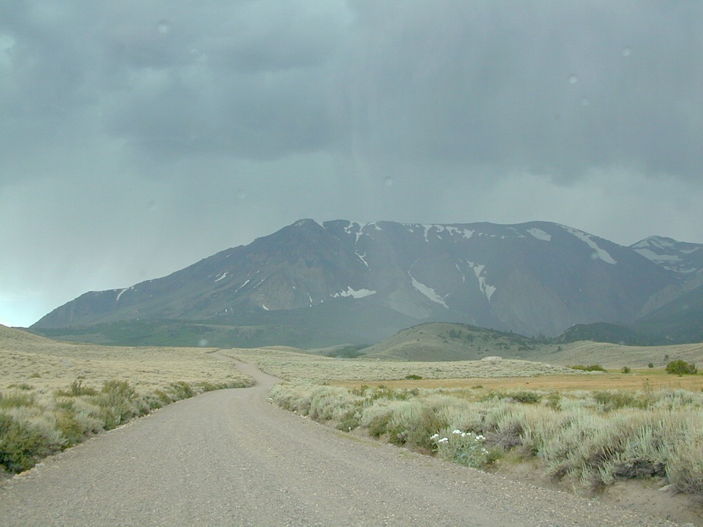
Mono Craters (Rd# 1N11) – the youngest mountain range on the continent. Just south of Mono Lake, this route skirts the pumice cones & climbs over the Aeolian Buttes, before it meets back up with Hwy 395.
Walker Creek Rd #19S01 – Oaks & creek. South of Olancha CA, look for turn off & follow dirt road up into the tight canyon.
Inyo Road# 6S16 – Pine Creek Road – Creek exploring & fishing. NW of Bishop behind Rovana, also known as Round Valley, CA
Road# 4S02 – Owens Gorge Road – N of Bishop behind Lake Crowley. Camping w/ boulders & pines. Good open sky views for stargazing.
Road# 4S86 (Inyo Rd #28E201) – Laurel Lakes Road – Camp in aspens @ Laurel lakes, high elevation; access to alpine lake trailheads; SE of Mammoth Lakes, CA
Road# 2S05 – Deadman Creek – Creek fishing in forest. N of Mammoth
Road# 2S07 – Owens River Road – Pine forest, near hot springs; no facilities. N of Mammoth
Road# 1S63 – June Lake Loop is CA SR 158 (Hwy 158) paved main route, which is often closed for winter months, due to deep snow.
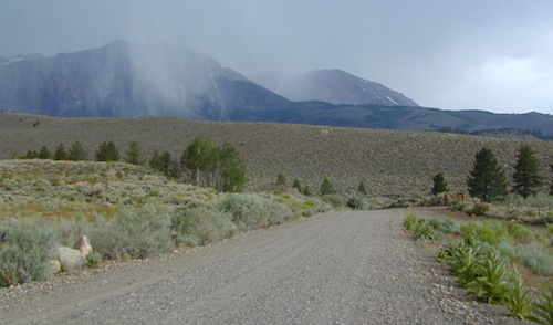
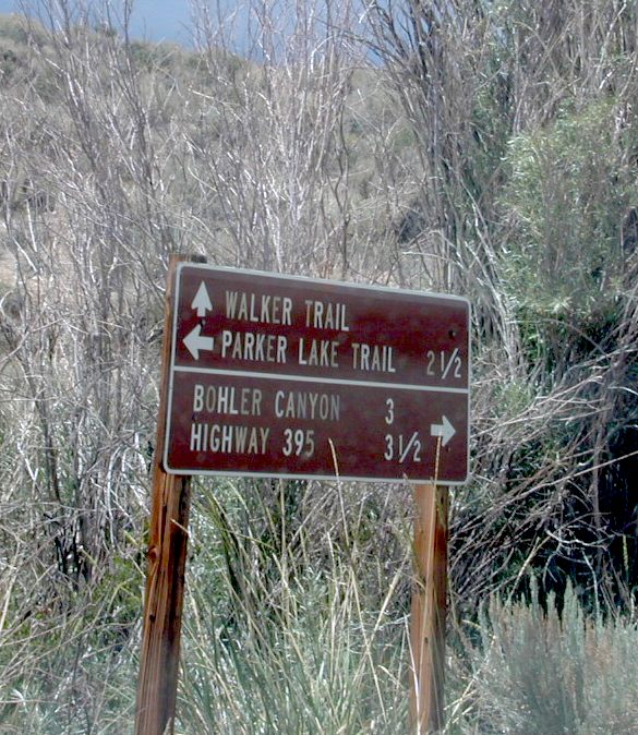
Road# 1N17North of June Lake Loop; dirt road access to Parker Lakes & Walker Lake trailheads; Side canyon routes offer (unmarked) picnic areas and fishing spots; few primitive camping options.
Road# 1S25A Parker Lakes Road– Aspen & pine forest, near creeks; E of Grant Lake / N of June Lake
Road# 1S23 Walker Lake Road – Pine forest route to Walker Lake; E of Grant Lake / N of June Lake
Dirt roads, backroads, desert trails, OHV routes, single tracks, dunes, fire roads, gravel roads, 4×4 roads
When you wanna explore a new area, California has plenty of public land to offer. Off Road Maps can get you away from the crowds & the main staging areas. Maps can show you prime areas to ride & camp that you may not have ever imagined. Secluded, wide open, or freeway close. Terrain – the endless deserts, the mountain foothills, the higher hills , way above the city. The choice is yours.
Whether you seek secluded stream side camp sites, with some fishing or a dusty, long, desert trail that spans the entire Mojave desert, you can find these secret spots with good old fashioned topographic maps. Hard copies! The real deal. No cell signal? No problem.
4×4 Panamint Valley has numerous canyons & ridges to conquer
The most trusted full-state book-atlas that Total Escape recommends. When you must have a (hard copy) map for local road trips – Benchmark Atlas is the best one by far.
NFS, USDA
Forest Atlas: National Forest Topo Atlas
Spiral bound book of all topographic quads, of select National Forests in California.
Awesome California locations w/ off-road trails nearby. DanaMite has compiled a list of first-hand knowledge information, links, photos, campsites, maps, all revolving around rural California. Check out the ever growing list and get ready to explore the back roads, like never before.
OHV area, motor vehicle use, 4×4 camps, dirt trails, forest routes; Download maps for various off-roading areas in California.
What the heck is it ???
4WD = 4 wheel drive
4×4 = (same as above)
2WD = 2 wheel drive
4×2 = (same as above)
AWD = All wheel drive
SUV = Sport Utility Vehicle
MTB = Mountain Bike
MX = Motocross (dirt bike motorcycle)
SNOMO = Snow Mobile (sled machine)
GAS-POWERED RECREATION: The past two decades have emerged with vehicle redesigns from well known brands, creating a number of new “utility vehicles” for the sport of off-roading (otherwise known as, burning gasoline while recreating in the outdoors). Here is a breakdown on the acronyms, but they all basically refer to much of the same “off road type vehicles”.
ATV = All Terrain Vehicle (quad)
MOHUV = Multipurpose Off-Highway Utility Vehicle
ROPS = Roll Over Protection System
ROV = Recreational Off-Highway Vehicle
RUV = Recreational Utility Vehicle
SxS = Side by Side Vehicle (2 seated)
SSV = (same as above)
UTV = Utility Task Vehicle
Common abbreviations for off-road on public lands:
OHV – Off Highway Vehicle SVRA – State Vehicular Recreation Areas BLM – Bureau of Land Management NFS – National Forest (USDA) MVUM – motor vehicle use map (NFS)
PVT – private land / keep out
MTR – motorized
RD – road
CO – county
RTE – route
SR – state route
FR – forest route / road
EXT – exit
CK – creek
EL – elevation
MT – mountain
STA – station (ranger/fire station)
PO – post office
Around 2012 the National Forest Service printed up a bunch of nice off-road maps for various popular regions of California. Oddly, they told me not to sell them and I never heard anything about them again after that. Not even sure if these above are available to the public, but if you dig around you might find ’em. Call the rangers, they might know.
If interested, you could call the ranger station and ask about any local off-road maps, and availability. Mostly they have freebie one page print-outs, black & white — to keep the crowds where they want them. Other times they might have real color, printed maps for sale at the station. Maps that can get you deeper into the terrain, with wild edges of reality nearby. 4×4 maps, OHV map, MVUM
BLM Maps (Bureau of Land Management)
Government agency that manages large amounts of California land. Public lands that do not fall into the National Forest or National Park or State Park realm. BLM oversees some mountain areas, river canyons and primarily, desert regions within California. Visit a local BLM office to see the selection of area maps.
Turtle Mountain Road
Decent & FREE: dirt road maps can be found at BLM ranger station, south of NEEDLES, on US Hwy 95. Explore Turtle Mountain and find free camping IN ROUTE; Eastern California Desert.
Forest Road 1N17 is a major graded dirt road that connects June Lake Loop to the Lee Vining junction, the back way. West side of US 395; south of Hwy 120.
At north end of Grant Lake, slow down and look for the signed intersection. Sage brush hills and big drainage, with towering granite peaks above.
This well-traveled, wide dirt road leads along the base of the mountain range on BLM land, skirting the National Forest. Several side routes head up into numerous canyons, which are part of Inyo NF. Suitable for SUV, passenger cars, camper van and small RVs. Easy access off US Highway 395 and June Lake Loop #1S63
Several hike-in only lakes, creek camping, some seclusion. Great picnic areas, trail head access, short or long hikes. National Forest lands. Backpacking, day hiking and primitive camps, some deep in the aspens. Autumn here can be gorgeous, and these are all prime summer time camp sites, for free. Make sure to get your campfire permit ahead of time, at ranger station in Mammoth. Wilderness permits may also be required for overnight camping in this canyon, so check with the NFS rangers on that issue.
Certain areas back here can be muddy in springtime, other major routes can even be over whelmed with water when creeks swell. Summer thunderstorms are common. One lane bridges should always be driven with caution, especially on dirt roads. Always be extra slow when driving thru water at creek crossings.
Maps are the key to finding your very own slice of heaven in the Wilderness. Online map sources can barely get you to your city destination correctly, much less the remote waterfall you desire. You will need a real map for your adventure. A topographical map, with all the details, dirt roads & hiking trails. If you are seeking to stay away from the touristy crowds, this is the best possible place you can be…. on this site, searching for ways to make it happen – this weekend.
BACKPACKERS BACKPACKING MAPS –
Mount Whitney, John Muir & way beyond the High Sierra. DanaMite has all the California Wilderness maps on the new map shop. Various brands and types of maps. Most are printed on waterproof plastic now & are tear-resistant.
Planning on camping outside of the developed campgrounds & finding that perfect stream side spot without the reservation & the fees? Then you will need a free fire permit (from a ranger station), plus a good map of the forests & a vehicle capable of handling the rugged the back roads. Much of California is prone to wildfires, so make sure campfires are even allowed on the backroads, before you get out there. Call the “field rangers” for back road advice and current recommendations.
Wanna take that 4×4 vehicle somewhere really special this season? Camp well beyond the masses, way down that dirt road. We have OHV maps for SoCal, the deserts & all the National Forest maps too.
Start your search on the perfect campground or camp site with the destination in mind. Mountains, deserts, coastal. Parks & forests all have their own maps with all nearby camp grounds listed. We feature all the National Forest maps, as well as some State Park & National Park maps
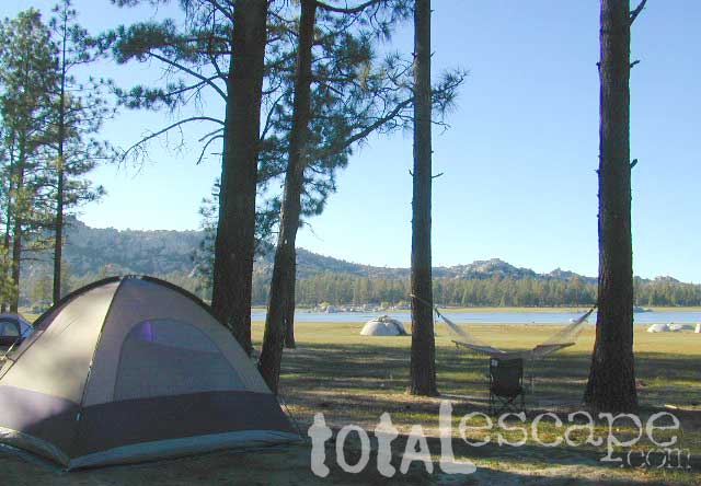
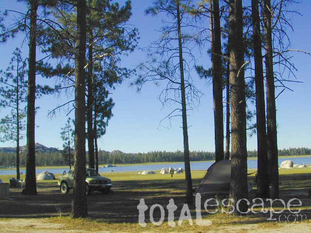
RV camping at it's best in the Sierra; This rig found themselves deep in the alpine lush meadows with towering trees and a view and a very private camp site.
The mysterious topographic map maker, Landon Crumpton, is gone. Although his Baja Almanac book of the Mexican peninsula is still as popular as ever.
The Total Escape crew has been using this amazing topo map for Baja Mexico since our the very first excursions in 1990. Click below to read more about the famous, hard-to-find Baja Almanac publication.


 nearby destinations:


 Holcomb Valley has a historic cabin to see. Numerous old mines exist around this area. Nearby Gold Mountain is a popular 4WD route.


 No pavement, no picnic tables.
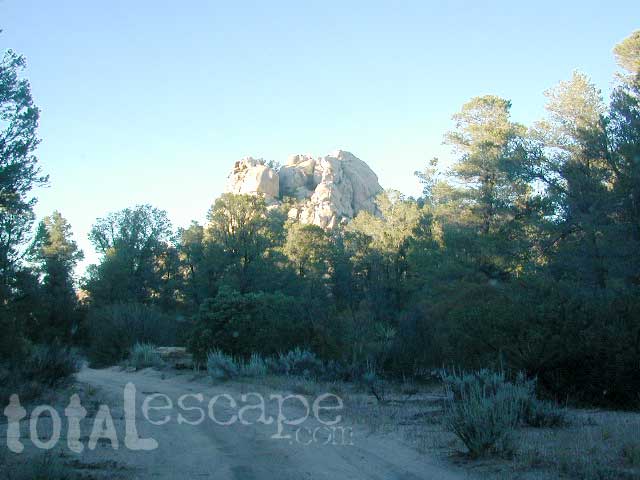


 Inyo Road# 6S16 – Pine Creek Road – Creek exploring & fishing. NW of Bishop behind Rovana, also known as Round Valley, CA
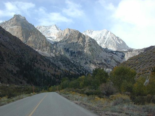


