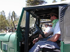
California has no shortage of 4 wheel drive vehicles, but how many of them actually use them for what they were intended? If you’ve had your 4WD for a while and are itching to get to know the local trails, then grab yourself a few good OHV maps & head for the hills.
If you are a total novice and think you might want to get familiar with routes, what your vehicle can and cannot do, and learn the ropes from the pros, then you might want to discover the friendly folks in your local 4×4 club. Below we list as many legitimate groups we can find, with or without web sites. If your club is not listed, then please contact us & we might add it.
Anza Borrego Desert Washes
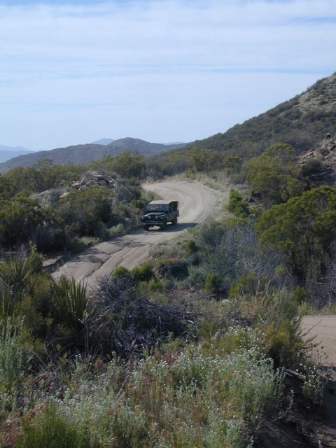
Off roaders (with running rigs) can enjoy pre-planned back road trips with various 4×4 Groups in California:
Forty-something years running, this San Diego county desert 4×4 event is one of the most popular off-roading weekends. Tierra Del Sol, a local 4 wheel drive club sponsors this wheelin fest in Southern California.
California Association of 4WD Clubs holds a vehicle show, contests, dinners & seminars for 50+ years now. Event located in the California Central Valley.
22,700 acres
Kaiser Pass Road
Sierra National Forest
2020 wildfire: CREEK FIRE has burnt the majority of this wilderness, roads, trails, lake shores and most campgrounds
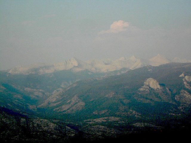
Central Sierra Nevada Mountains/ Kaiser Pass & Kaiser Peak / Highway 168
One of the best cell phone coverage areas for any California Wilderness location, this central Sierra region is located south of Yosemite National Park and known primarily for Shaver Lake.
California Hwy 168, along with Dinkey Creek Road (southward) and Kaiser Pass Road (northward) leads off in all splintered directions to secluded campsites, rivers, creeks, lakes, developed campgrounds and amazing forest scenery. Off road trails and hiking trails, everywhere back here! But it is best to have several good maps for cross reference.
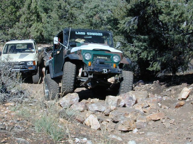
Dusy Ershim Trail 4×4 travels past Kaiser Peak and the cell phone towers. Several primitive camp sites with views on ridge. Numerous developed NFS Campgrounds out this way along Kaiser Pass Road.
Trailheads for horseback, hiking, backpackers, mountaineers, rock climbers. Snowmobiles love this amazing route when the snow is deep; some west coast winters can be better than others. Know before you go!
Kaiser Wilderness are granite mountain peaks, near Huntington Lake & the China Peak ski resort, formerly called Sierra Summit Ski; One lane narrow backcountry paved roads: Kaiser Pass Road 80 (east of Huntington Lake) and Stump Springs Road 5 is West Kaiser (west of Huntington Lake)
Sierra Views in 2002White Fir CampsiteChina Peak Hike w/ Map
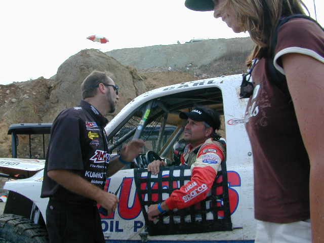
This one is a huge deal in the Los Angeles area. 4×4 extremes – in every direction. Tons of offroad industry vendors, displays, demos, and custom rigs and hot chicks in skimpy shirts for your viewing pleasure. Drool over every suspension, roll cage and locker. Lucas Oils is the big sponsor and this event is held annually, Family Events off road expo, summertime, air conditioning, in gorgeous Pomona.
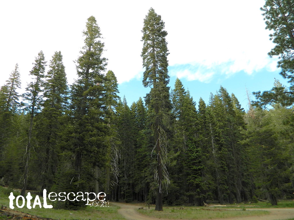
Jamison Creek Canyon: the small stream flows all year long
Small Sierra Nevada camp on Upper Jamison Creek in a granite canyon, within a gorgeous red fir forests, wildflowers and fresh mountain air.
high clearance vehicle recommended
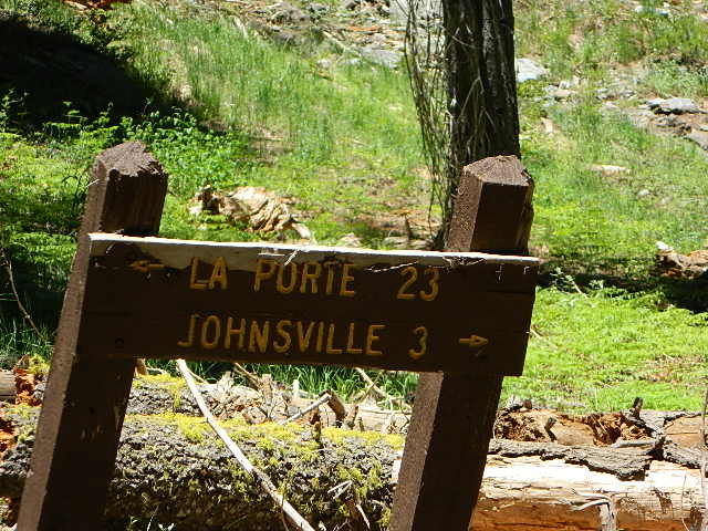
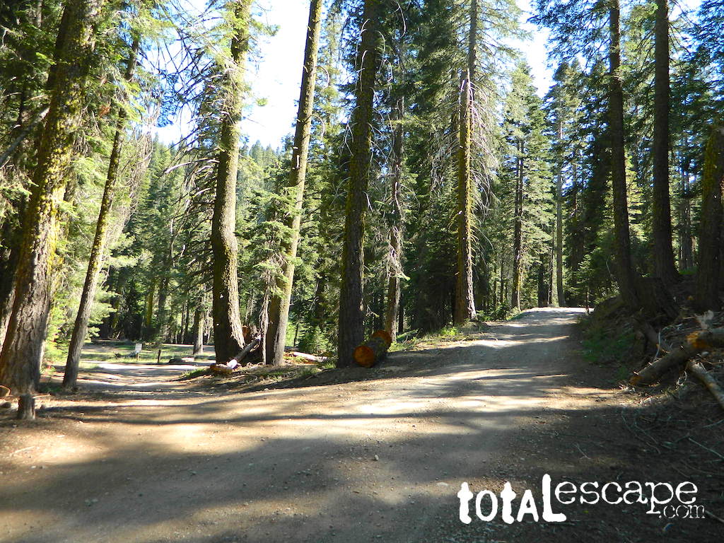
Gravel (rocky) road access, and here we use the word “road” loosely: Plumas County Road #507
Plumas Forest Route 507
also known as Johnsville Road; Johnsville McRea Road (misspelled McCrea on Google Maps)
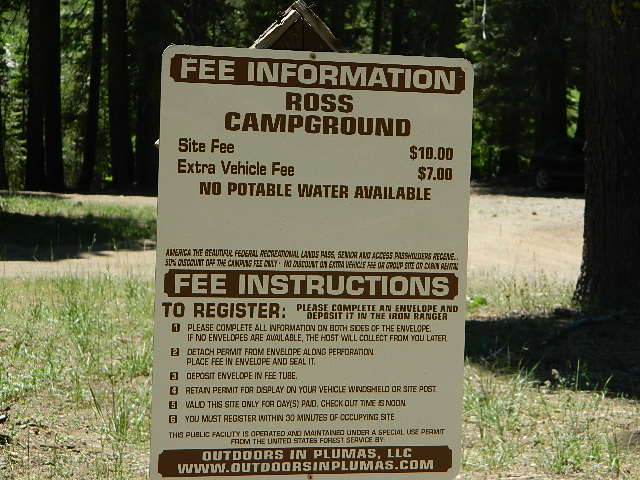
Ross Campground NFS
• Elevation: 6,070′
• Number of Sites: 5
• Vehicle Accessibility: High clearance; No RVs or trailers
• Camp Fee: Yes
• Campsite Reservation: No
• Toilet: Vault
• Water: Creek only
• Length of Stay: 14 Days
• Season: May–October
• Trailhead: McRea Ridge & PCT
camping
dirt roads
hiking
mountain biking
off-roading
swimming holes
stargazing
wildflowers
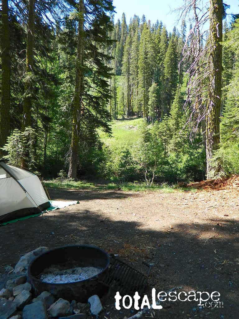
RUSTIC CAMP: No Picnic Tables!
4 camp sites are located at this turnoff @ driveway. Another single camp spot is located half mile up road, next to 2 nice swimming holes. Although the National Forest web site states that this place has 3 sites, it does indeed have 5 camp fire rings. All are available on a first come basis.
No OHV off-road riding in camp.
Snow is possible at this elevation, between October-April. Thunderstorms are common in summer in the Sierra Nevada mountains. 4×4 will be needed to access this area, if winter weather sets in.
Across Jamison Creek from Ross Camp
is Mount Fillmore @ 7715′ elev. Up canyon is Mc Rae Ridge PCT trailhead Mt Etna @ 7063′ Blue Nose Mtn @ 7290′
USFS just started charging a fee for this remote creekside camp. It used to be free, but no more.
Sierra Madre Road Sierra Madre Ridge, San Rafael Wilderness
Los Padres National Forest Forest Road #32S13
off of Cuyama Valley Hwy 166
East of Santa Maria, CA – along Highway 166 (on the south side of the pavement) are several dirt roads that lead up to the main ridge road that access this part of Los Padres National Forest.
backpacking
camping
dirt bike trails
dirt roads
hiking
horse camping
mountain biking
off road routes
petroglyhs
wildflowers
4WD not required, but high clearance is helpful. Open almost all year. Rainy season gate closures (at hwy) during winter months.
Sierra Madre Ridge is forest road #32S13, which parallels Hwy 166 (Cuyama River) for over 50 miles on the Sierra Madre Ridge at approx. 5000 feet elevation.
NOTE: A good stretch of this dirt road is closed to vehicle traffic. Although it connects to Santa Barbara Canyon near Ventucopa, you cannot drive it. Only hike or mountain bike!
NFS Gate locked at the HOG PEN trailhead, and from there you can bike or walk all the way the other end at Santa Barbara Canyon near Cuayama Fire Lookout @ Dick Smith Wilderness
Small campgrounds in the region:
off Highway 166 Miranda Pine Campground (on 32S13 @ 11N03) Bates Canyon Campground (via Cottonwood Canyon Rd) also known as White Oaks Campground Aliso Canyon Campground (via Aliso Canyon Road) not accessible by vehicle, from dirt road 32S13; only by trail
in the backcountry Painted Rock Camp (hike-in) Sycamore Camp (hike-in)
San Luis Obispo County Off Roading
Los Padres National Forest
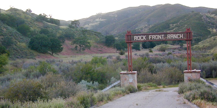
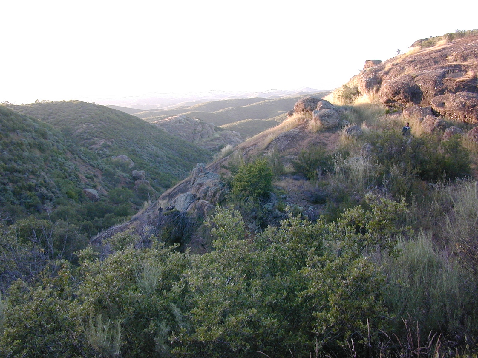
Rock Front Area is located on the north side of Hwy 166 in between New Cuyama and Nipomo, on the very edge of San Luis Obispo county in the center of the Santa Lucia Ranger District of Los Padres National Forest. Landscape varies from rock covered canyons to ridge line trails with outstanding vistas of the the mountains and Cuyama Valley. Remote area features Los Machos Hills, Alder Creek, Branch Creek, Cuyama River, cool rock formations.
15,328 acres
41 miles of trails
From US Hwy 101 @ Hwy 166 travel east 25 miles, left turn into Rock Front Ranch gate on left side. (This road may also be known as Branch Creek Rd on some maps). This off road area can be closed during rainy seasons, so it is best to call rangers ahead of time to ensure the gates are open. There is also one brown Forest Service sign along highway 166, (couple of miles from 101) letting eastbound traffic know if this OHV area is open or closed.
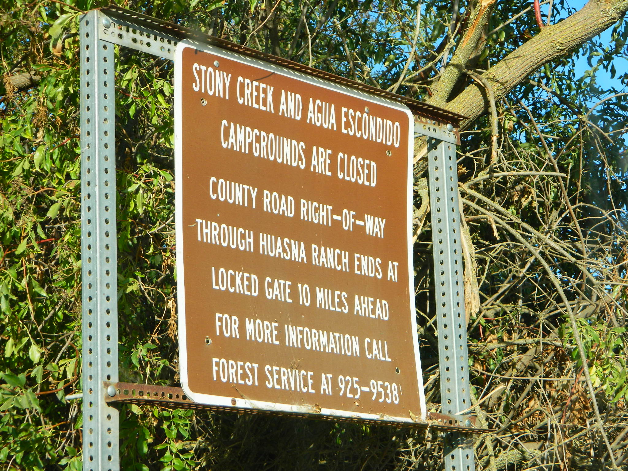
The dirt Road #32S07 (Arroyo Seco) from the west connecting historic Huasna townsite to Rock Front is CLOSED to thru traffic and has a locked gate. Private properties and ranches are abundant in the backcountry of Arroyo Grande, CA
OHV trail ratings in this region are designated below
Green diamond – easy & least difficult
Blue diamond – moderate & more difficult
Black diamond – extreme & most difficult
Logan Ridge Trail #17E05
Green diamond. Least difficult. Open to motorcycles, ATVS, 4WD. 1.4 miles long. This route is a good route for beginning riders. It is located on the main ridge top of Logan Ridge. Route dead-ends at a locked gate.
Shaw Ridge Trail #17E06
Black diamond. Most difficult. Open to motorcycles, ATVS, 4WD. 8 miles long. This route leaves the Twin Rocks route on a spur ridge that drops into the Alamo Creek drainage and dead-ends. A very steep section of trail exists at the end of this route where specialized equipment is recommended. This section is recommended for advanced riders.
Los Machos Trail #17E07
Green diamond. Least difficult. Open to motorcycles, ATVS, 4WD. 2.8 miles long. This route is a good route for beginning riders. It is located on the main ridge top of the Los Machos Hills. Route dead-ends at a locked gate.
Paradise Trail #17E08
Blue diamond. More difficult. Open to motorcycles, ATVS, 4WD. 2 miles long. Access to Paradise Campground and Los Machos route. It is best suited for intermediate riders due to a steep section along the route. Route dead-ends at a locked gate.
Branch Creek Trail #17E09
Blue diamond. More difficult. Open to motorcycles, ATVS, 4WD. 5.5 miles long. Access to Buck Springs Campground, parallels the Big Rock route and offers a loop ride.
Big Rocks Trail #17E10
Blue diamond. More difficult. Open to motorcycles, ATVS, 4WD. 4 miles long. Located on the main ridge top and intersects with the Jack Springs route.
Twin Rocks Trail #17E12
Blue diamond. More difficult. Open to motorcycles, ATVS, 4WD. 3.5 miles long. This route intersects Shaw Ridge and dead-ends at a locked gate. The first half-mile of this trail is steep. Once on top of the ridge you have excellent views of the Cuyama Valley and the Santa Lucia Range.
Kerry Canyon Trail #30W02
Black diamond. Most difficult. For motorcycles only. 6 miles long. This trail must be accessed through Colson Canyon or Sierra Madre. The trail is highly technical and is recommended for advanced motorcycle riders only.
HORSE TRAINING – Along the highway at the gate of Rock Front Ranch is a rock house and ranch, which may or may not offer equine services.
Score International holds off road races throughout California & Baja. The Baja 500 Race is epic, historic, south of the border race action. Ensenada hosts several races throughout the year. This one is held in summer and is very popular.
If you’ve had it with the traditions, the big meal prep, or just sick of the family. Maybe you are a solo traveler, or a new transplant to California and need to explore more. Take a holiday away – for once this time.
Camping for turkey day? What a concept.
California is the perfect place for camping, all year long!
Stick to the lower elevations, look for canyons, and seek seclusion
California mountains often have snow during November. Avoid camping in snow @ 4000-5000′ elevation and above; Freezing temps above 3000-4000′ elevation.
Deserts, coastal regions and foothills are top choices for late Autumn car camping. Always check the weather ahead of departure, and have a plan B as an alternative. NorCal will be much wetter than the rest of the state.
MEALS: Prepare dinner meals ahead of trip departure. Bake turkey days before your trip and create meals based around that. Make mash potatoes at home and don’t forget to bring the butter. Pack pre-baked turkey for sandwiches, plus other quick snacks & meals for on-the-go travel.
Non Traditional: Seafood Feast
Desert Camping is premium at this time of year. Luckily the eastern half of Southern Cal is desert. The lower the elevation, the better the temps will be overnight. Be prepared for wind when the ‘storm fronts’ approach, the winds do get a cranking! Dirt roads can become flowing washes during a good rainstorm, so know the weather forecast.
Coastal campgrounds may need advanced reservations. Be prepared for wet weather, especially up north. The redwoods groves are gorgeous anytime of year.
Gold County Reservoirs are prime areas for relaxing in nature, while everyone else is out shopping. Oak hills, rivers and canyons. RV campers love these large lakes; boating, fishing, mountain biking trails, kayak rentals, hiking near historic Gold Rush towns.
River Canyons of California are always beautiful destinations in the autumn months with fall leaves changing color. Many campgrounds can be found at lower elevation, river access areas.
California’s abundant Hot Springs are also top picks for holiday weekends.
Anza Borrego Desert State Park is always a nice, easy and relatively close get-away for any holiday. Open camping on the backroads (for free) makes it one of the most attractive camping options in all of SoCal. Many dirt roads are accessible for passenger cars, if extreme caution is used. Don’t plan on driving more than a few miles on dirt.
froaders
Masses of off roaders love to camp out, especially on Thanksgiving weekend. Wheel all day, eat, drink, bon fires every night and rumor has it ‘they roast their big bird outdoors – deep in a dirt pit’. Really?
El Centro, Glamis, Imperial Dunes, Ocotillo Wells, Truckhaven Hills, Johnson Valley. All popular off roading areas in Southern California, so consider yourself warned.
Mojave Desert, near US Hwy 395 Jawbone Canyon expect to see RVs, toy-boxes and families outside enjoying the weekend. OHV style. Often the group tries to create a round corral with their huge convoy of vehicles, to keep thru traffic to a minimum around “their camp”. Just stay well away from those gear-heads. In general, it is a very busy area around Mojave up to Hwy 178 during the holidays. Try high desert Horse Canyon instead.
Small campgrounds and secluded camps, accessible by dirt bikes or 4-wheel drive vehicles. Numerous dirt roads, sand dunes and canyons to explore, some with developed campgrounds, other areas w/ primitive camping. Self sufficient campers will enjoy this list.
4×4 camping in California
Okay, you got your 4 wheel drive vehicle dirty, it is now several years old & maybe you even have a scratch or two. Now is the time to finally start using that beast for real off road adventures. The real edge-of-wilderness trips you dream about when your sitting in your cubical wondering what life is really about. Fishing, camping, off roading and enjoying nature, of course!
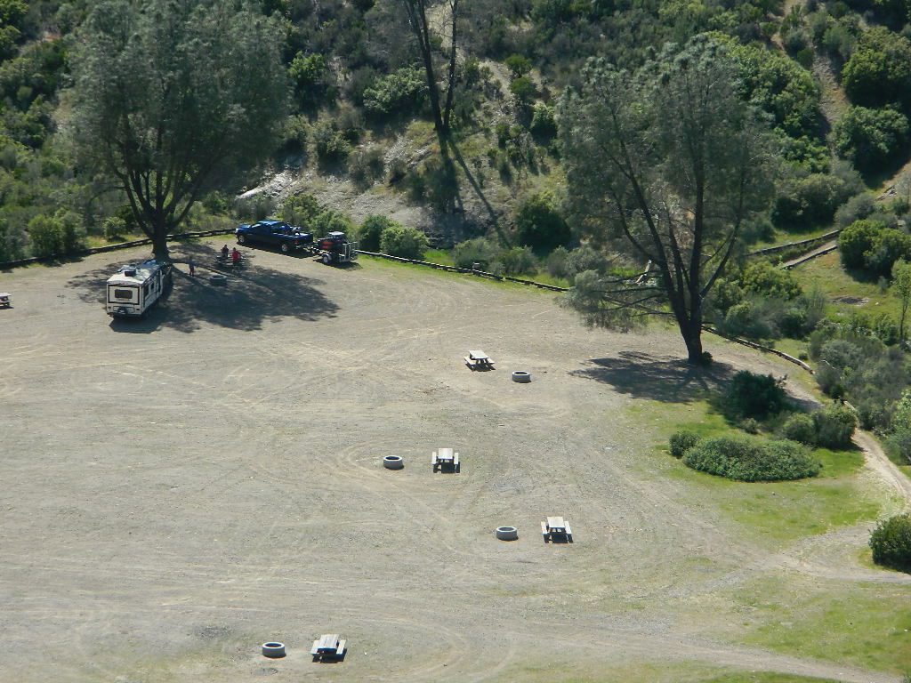
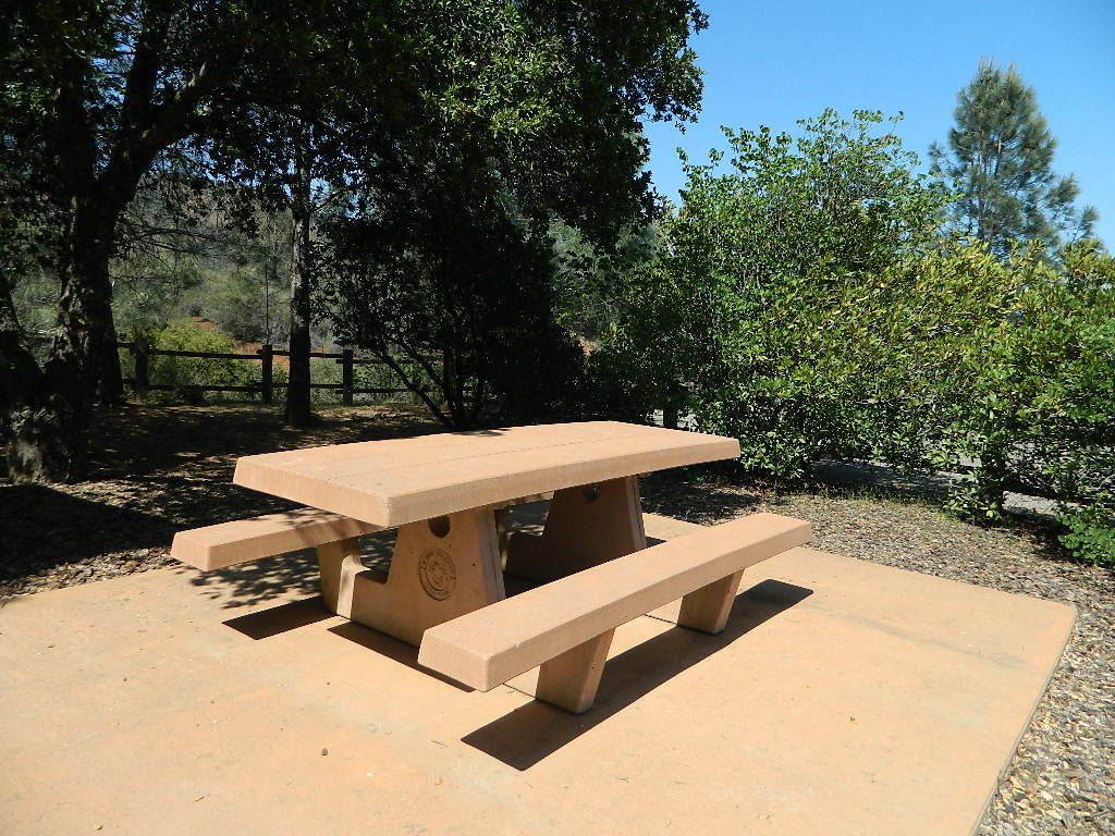
4×4 camping in California is plentiful. California has trails for OHV use – which means ‘off highway vehicle’, that can accommodate your machine. These remote camps are always primitive camp sites, with picnic tables, fire rings & maybe a pit toilet (if you are lucky). You can find total seclusion on these back roads & trails, well away from the developed campgrounds & RV parks.
Anza Borrego Desert 4×4 Trails – pretty much everywhere in Borrego desert is off road heaven. Minimal pavement and maximum desert means dirt roads galore, white sandy washes, slot canyons, badlands, wind caves, wildflowers, petroglyphs, boulder outcroppings, old railroad trestles and so much more. The San Diego desert elevations range from near sea level to 4000′ on the eastern slopes of Laguna Mountain.
San Bernardino National Forest – has a few trail camps for 4×4 enthusiasts. John Bull Trail (near Holcomb Valley) has one real awesome camp spot with great views over the desert night lights. Holcomb Creek Trail also has a few spots near the creek. Overall this area is somewhat crowded for wheelin’ (especially on the weekends), as the population is so dense nearby.
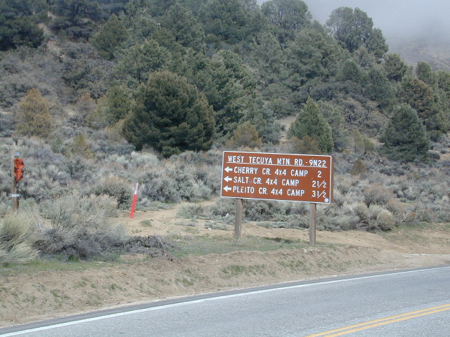
Los Padres National Forest – the most 4×4 camping, readily accessible to Southern California. This is truly the best kept secret for Angelinos wanting an escape. The southern portion of the forests has Tecuya Ridge #9N22, with several camps only minutes from I-5. Cherry Creek 4×4 Camp, with a few other campsites tucked way back in there. Dome Springs Campground is located off Lockwood Valley Road, while Nettle Springs Campground is over near Highway 33.
Out west, Cerro Noroeste Road has the Blue Ridge w/ Marion and Caballo Camps. Red dirt high desert wash Quatal Canyon #9N09, is right next to the Chumash Wilderness.
2 OHV parks in the Los Padres Area: Hungry Valley & Ballinger both serve the off road crowds and have ample facilities, large camp spots to accommodate RVs and trailers.
The northern section of Los Padres (near Big Sur) has plenty of dirt roads & primitive camps, but none are truly 4×4 routes, as most can be accessed easily with a passenger car. See more on Big Sur Camping and Big Sur BackRoads.
Sequoia National Forest– Southern Sierra Nevada area has 4×4 camping right along the Kern River @ Keyesville, at the junction where Hwy 178 meets Hwy 155. Also, further up the river, Forest Rd#22S82 leads to primitive Camp 4, where there are several spots near granite pools, that can only be accessed by 4 wheel drive. The Big Meadows area also has some gorgeous forested back roads worth exploring. Kern Plateau has hundreds of miles of OHV trails near Troy Meadow.
High elevation Monache Meadows is a prime fishing & hiking destination on the south fork of the Kern River, accessed by an authentic “Jeep Road”.
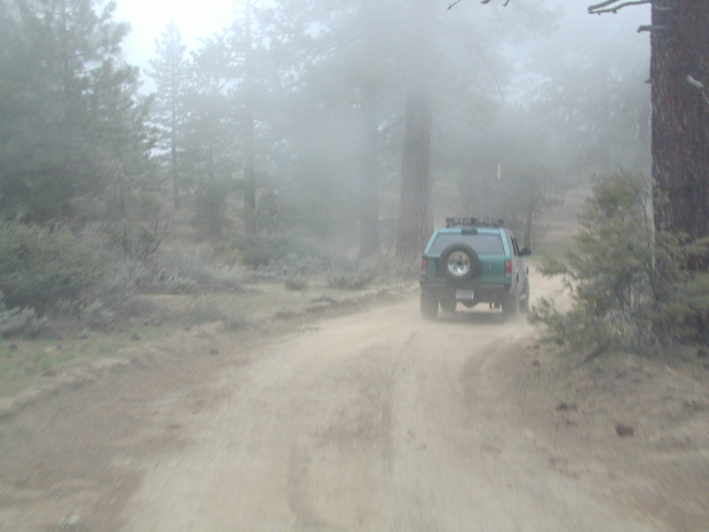
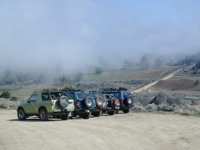
Sierra National Forest– central Sierra forest has plenty of 4×4 routes that lead to granite rock gardens & mighty fine, secluded, forested camp sites. Gorgeous Red Lake & Coyote Lake are popular spots that require some technical skills & much patience to access. Both are frequented by fishermen & horses. Bald Mountain trailhead has awesome creekside camps on Rock Creek. Up near Wishon Reservoir is the dead end trail of Spanish Lake. Onion Springs Meadow is awesome back behind Edison Lake. Near the granite wonderland Courtright Reservoir is the infamous Dusy Trail signed #28E34 (aka #7S32, the Dusy Ershim), second only to the Rubicon Trail for high Sierra granite.
Stanislaus National Forest– camping in the Crandall & Niagara Creek OHV section of the forest, right off Hwy 108. Elevations range from 5000′-7000′. Higher up on the other side, Levitt Lake (access road near Levitt Falls) on the east end of the mountain range, east of the Sonora Pass sign.
El Dorado National Forest – has an area called Rock Creek for off roading in the Gold Country. Plus the ever popular Rubicon Trail starts hear (near Georgetown) & leads 20 miles across the High Sierra Nevada granite slabs to Lake Tahoe. Tons of camping back here in the National Forest.
Lakes Basin Recreation Area – Northern Gold County, just above the Yuba River. Gold Lake has many campable lakes. The area sees a lot of snowmobile traffic during winter snows, but warmer months are the time for fishing and camping. Most of the big lakes have small developed campgrounds, some are minimal, or primitive style camp sites on dirt roads without facilities. Maybe a picnic table at most.
Smith Lake is a place that fishermen and 4×4 enthusiasts love. It is small, secluded and kinda hard to find. You’ll need a good topo map of the region. Situated on the border of Tahoe and Plumas National Forest off the Gold Lake Hwy (aka Road #24). The PCT cuts thru this Lakes Basin area w/ Sierra Buttes There are dirt roads and off road trails leading deep into the backcountry from the Packer Lake and Gold Lake areas. Snag Lake is a free camp right on the main road.
Snake Lake Campground has numerous dirt roads and trails leading out to Butterfly Valley. Horse campers use this popular camp spot, so no loud vehicle activity inside the campground. No shooting up the bear locker either!
Milsap Bar is a long, narrow 9 mile dirt road which leads from Bald Rock Road in Berry Creek, down to the Middle fork of the Feather River. NFS Campground on the big river without fees!
China Gulch Road #60, a very long and winding dirt road, leads from Oro-Quincy Highway down to the Little North Fork. Although the NFS Campground is closed due to a landslide (1 mi before camp) there still is primitive camping at the second bridge. Be warned: the campsite at the first bridge is often over run with giant, juicy slugs at night.
Out there east of Quincy, somewhere off the historic, long and winding La Port Road, a few decent 4WD trails thru forest, access ridge lines or the big river below. Great fishing, amazing scenery & very secluded.
(north of La Porte Road)
– Feather River access
@ Cleghorn Bar Campground, 4 campsites (Road #23N24)
@ Stag Point Campground, 5 campsites (Road #22N80Y)
@ Hartman Bar NRT to Dan Beebe Camp (Road 94 to #22N42Y)
(south of La Porte Road)
– Poker Flat Camp near Sawmill Ridge & Table Rock (Road 800)
Sly Creek Reservoir is a super popular NFS Campground with trailheads and dirt roads leading deeper into the forests. The camp area is a favorite amongst the off roaders and dirt bikers that migrate up to the mountains for the weekend, to escape from the heat of the summer in the Sacramento Valley. LGVR is another body of water back in these parts and is more scenic and peaceful than the Sly Creek.
This coastal range is dirt road heaven, graded dirt roads, ridge routes, hiking trails, equestrian trails, big lakes, small lakes, creeks, meadows, forests, wilderness and 4×4 routes. Snow can be the most fun and challenging for the 4WD crews. Mud, snow, some road closures seasonally.
2019 WILDFIRE: Ranch Fire – wiped out most of this area. South of Snow Mountain Wilderness, plenty off road trails leading to peaks and ridge lines. Numerous small campgrounds to choose from, trailheads everywhere, acres and acres of wild mountainous areas, and a lake resort nearby. Lake Pillsbury is kinda the center of all the 4×4 action in Mendo.
Fouts Springs – Numerous NFS Campgrounds catering to the off-road types a portion of the year, but mostly quiet other times.
Tecuya Mountain 4x4camps, Los Padres National Forest
4×4 Camps @ Tecuya:
Cherry Creek Camp
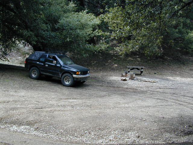
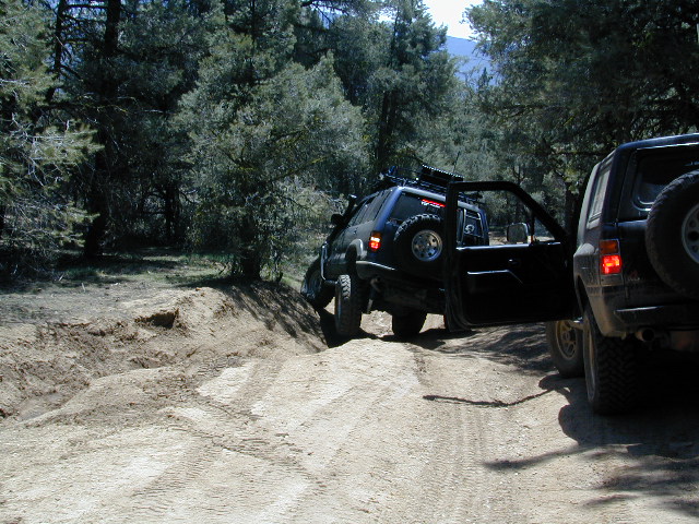
Seeking a dark shady hole to spend the night? Then Cherry Creek canyon is choice for a quick overnighter near Frazier Park and the I-5 Tejon Pass. Steep dirt road access will challenge even the biggest skeptic.
free campsite
4WD only access
The 4×4 Camp (signed) turn off is along Cuddy Valley Road, on the north side of the pavement – just a few miles west of Frazier Park, inside Los Padres National Forest.
Oak trees and brush clog the dense hillsides. Owls live in this canyon. Deer and wildlife sightings are common – which makes this an ideal hunters camp for those looking to explore on foot.
The canyon gets narrower as it heads down hill (northward) w/ the single track route becoming a blanket of slick dark mud (in the wet months). Without trees on the worst section, making a self-rescue impossible.
Real 4 wheel drive is needed for this camp! All wheel drive vehciles (SUV & sportwagons) should not attempt this location without a tow strap or winch – AND another 4WD vehicle to help out. Yep, seriously. We know, because we had to rescue someone last time we were here.
Sparse accommodations w/ minimal sunlight reaching this steep canyon
On the eastern mountain slopes of Big Bear Lake, Holcomb Creek creates a forested sage valley – called Holcomb Valley, located only a few miles away from the big lake. A graded dirt road leads out to this pine forest & a prime campground area. Perfect location for picnics and sightseeing.
Although the developed campground is open all year long, please take into consideration that SNOW and mud is the norm for winter months.
Nice shady sites to beat the summer heat. Camp spots spaced out fairly well. Hikers parking lot is located at one end of the campground. Bears are well known in the region, so please lock all food in the provided metal bear lockers.
The epic Pacific Crest Trail runs right through the Holcomb Valley. Doble Trail Camp is out this way for PCT parking, next to Holcomb Valley Road #3N16 which encircles this whole forested area inside San Bernardino National Forest.
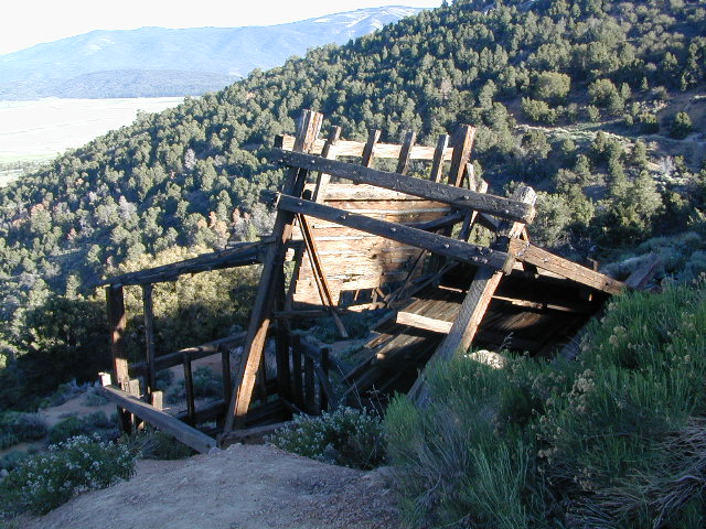
Holcomb Valley has a historic cabin to see. Numerous old mines exist around this area. Nearby Gold Mountain is a popular 4WD route.
The dirt back road leads east down to the high desert @ Highway 162. Down to Pioneertown and Yucca Valley, and eventually Joshua Tree National Park.
Gold Hill Campground (which is now closed) – right next to Piru Creek.
Frazier Park and neighboring towns, like freeway-close Lebec and Gorman, is where the Los Angeles hills meet the Kern County mountains. Mojave Desert meets to Coastal Range. EXIT I-5 @ Tejon Pass (elev 4144′)
Wildflower hills, seasonal creeks, forested peaks, high desert canyons. Bike trails, hike trails, off road routes. High elevation backpacking, hang gliding, mountain biking and camping in every direction.
Mountain Bikers love the trails at Mount Pinos.
High desert washes, oak creeks, pinyon pine forests, mountain meadows and numerous peaks – Frazier Peak, Reyes Peak, Alamo Mountain, Mount Pinos, Mount Abel (Cerro Noroeste) and north facing San Emigdio ridge.
Many dirt roads are gated seasonally for wet weather or snow. Call rangers to find out which routes are open before you plan your weekend. Or have a plan B and C camp site ready if route is closed. Flashfloods, thunderstorms, and erosion means you may all-of-a-sudden need to use your 4WD. This is the mountains after all. UNpredictable weather is common.
Primitive Camping in Quatal Wash, next to the OHV Route and the Chumash Wilderness
Peak-to-Peak Hike: the toughest climb you’ll do, this decade.
2018 & 2019 Hit especially hard by wildfires recently. Certain campgrounds and roads are closed to the public, due to the significant fire damage.
Mendocino National Forest has an abundance of small campgrounds and 4×4 camps, many of which, due to snow & elevation, can only be accessed in summer months. Many developed campgrounds are located on dirt roads, so know the road conditions before you get out there.
NOTE: all camps 2000′ elevation or lower are OPEN ALL YEAR LONG Red text for OHV = off road use, dirt bikes, quads, 4x4s, trailers.
OFF-ROADERS NOTE:3 OHV camps are located in higher elevations; the rest are 2000′ or lower and open year round. Always check with National Forest for road closures and conditions.
Mill Creek Camp @ Fouts Springs
Mendocino Ranger Stations can be found on link below
Located inside the Sierra Juarez Mountains
Parque Nacional Constitucion de 1857, or
Constitucion de 1857 National Park, Baja California, Mexico
Pine forests in Baja California: Dirt roads access Laguna Hanson, so come prepared to drive many miles with dust & potholes — more than 20+ miles from the paved highway just to reach this prime high elevation destination. Since most of Baja is desert, dirt and coastline, this location is a rare treat for those wishing to travel (off the beaten path). The tallest mountain peak in Baja is nearby with the University Observatory.
San Pedro Martir
Baja Camping in the Mountains
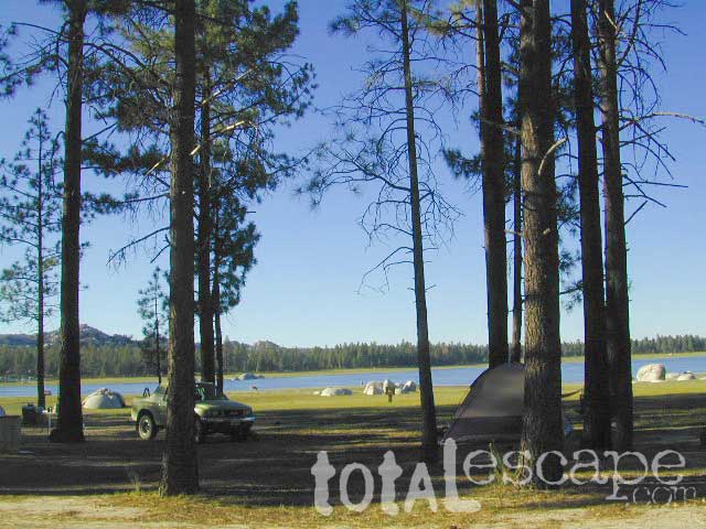
Water levels drop well below normal & what we end up with is a shallow lake with huge boulders emerged. Kinda surreal looking. Tall pines & dense forest surrrounding lake. Wide open & flat areas perfect for biking, stargazing and group camping.
This Baja National Park campground is more like dispersed, or open camping around lake shore. Very popular place in the summer months & if you want seclusion camp away from the lake, deep in the forest. The best quiet spots are located in the north east vicinity.
No motorhomes allowed: the road is steep, long, all dirt and narrow in certain spots.
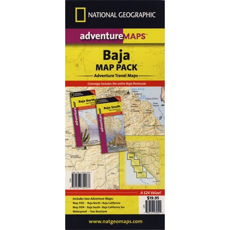
Baja Maps from NatGeo
bouldering (rock climbing)
camping
dirt bike trails
hiking trails
horseback trails
hunting
kayaking
mountain biking
off-roading
sightseeing
No services at lake. Minimal camping facilities. Self sufficient campers a must.
BRING EVERYTHING = ice chest w/ block ice, drinking water, flat tire repair kits, tow strap; extra blankets, medication, first aid kit. There is no store within 30+ miles of here, and the dirt road is very long (both ways) – so it is best to be prepared with all food and beverages.
LOCALS NOTE: An occasional rancher may approach your camp with his farm truck, selling fresh made cheese, beef jerky or other farm produce.
No pavement, no picnic tables. Minimal pit toilets, few rangers patrolling and rock fire rings.
CAMPERS TIP: The toilets can be nasty!! Bring a shovel and wipes; walk into the forest for your bathroom break.
OHV trails are nearby. OFF ROADING, dirt biking and 4×4 routes are essentially any dirt road that is within this forest; Drive slower, keep your ears peeled and watch out when they pass you, cuz they are most nimble and quicker.
No motorcycles signs are posted, but that doesn’t stop them riding all hours of the night. The mountains near Tecate and Mike’s Sky Ranch both cater to dirt bikers and tours, and are located nearby (sorta).
Park rangers & rules here are a lot more lax that in the “States”.
MAP NOTE: Google Maps has this place listed as Laguna Juarez


 nearby destinations:


 Holcomb Valley has a historic cabin to see. Numerous old mines exist around this area. Nearby Gold Mountain is a popular 4WD route.
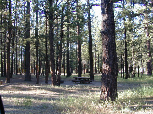


 BRING EVERYTHING = ice chest w/ block ice, drinking water, flat tire repair kits, tow strap; extra blankets, medication, first aid kit. There is no store within 30+ miles of here, and the dirt road is very long (both ways) – so it is best to be prepared with all food and beverages.
 No pavement, no picnic tables.
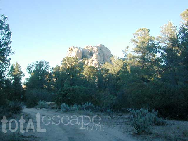