Tag Archives: planning

Closed Indefinitely

UPDATE SEPT 20, 2021
California National Forests, most have re-opened.
See Sequoia Wildfires & Closures

pinetree

Twenty five years ago, when I began this outdoor web site for California, did I ever imagine ‘times like these’ – where we would be held up inside our homes during summer, as annual wildfires destroyed our vast and beautiful forests. Frightened to breathe the toxic, smokey air outside. Saddened by news of yet another town or historic structure burning to the ground. Checking the destruction daily online, in hopes of more containment, fresh photos or any good report.

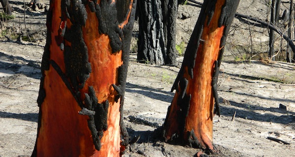
Now I fear Total Escape  may become photographic documentation of how beautiful California once was.

burnt forest

wildfire closures

Most California National Forest are currently closed!

Lassen Volcanic National Park is CLOSED due to damages from the Dixie Fire.

In case you missed it: 2020 was the worst year for wildland fires in California history, but 2021 is shaping up to be just as bad. Many forests, roads, trails, campgrounds and parks listed below have been closed to the public for the 2021 season, and possibly longer.

BIG SUR COAST
Julia Pfeiffer Burns SP
Prewitt Ridge
Nacimiento Road
Lucia Restaurant
Tassajara Canyon

SANTA CRUZ MOUNTAINS
Big Basin Redwoods SP
Butano Redwoods SP
Boulder Creek, CA

NORTHERN CALIF
Armstrong Redwoods SP
Austin Creek SRA
Mendocino National Forest
Lake Berryessa
Mad River / Ruth Lake
Forest Glen, CA
Salmon River
Six River National Forest
Snow Mountain Wilderness
Yolla Bolly Wilderness
Lassen National Forest
Lassen Volcanic National Park
Caribou Wilderness
Lake Almanor
Feather River (North Fork)
Susan River (near Caribou)
Trinity Alps Wilderness
Trinity River (W of Weaverville)

SIERRA NEVADA
Alta Sierra
Balch Park

Berry Creek, CA
Bucks Lake, CA
Butte Meadows
Caldor
Consumnes River
Dinkey Creek
Eldorado National Forest
Feather River (Middle Fork)
Huntington Lake, CA
Indian Valley
Greenville, CA
Mammoth Pool Reservoir
Mountain Home Sequoia
Plumas National Forest
Sequoia National Forest
Sierra National Forest
Shaver Lake, CA
Shirley Meadows
Silver Fork
Western Divide Highway
22N82 Forks of the Kern

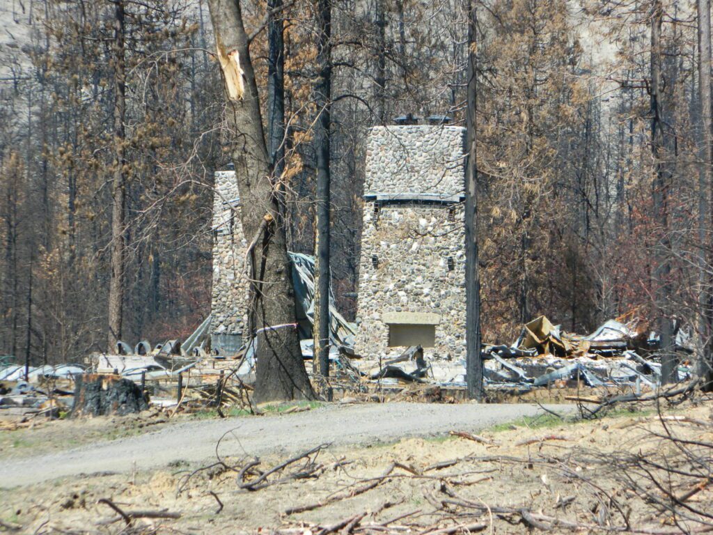
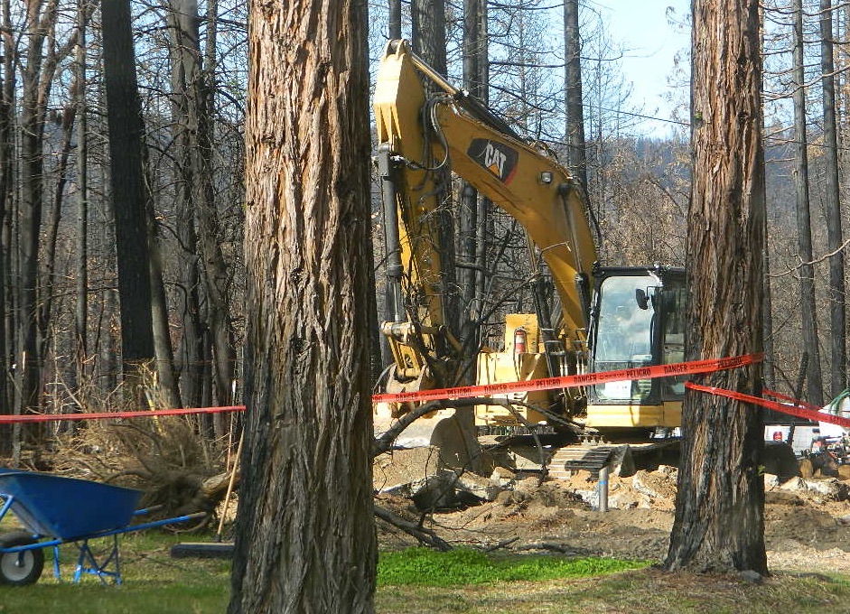
aftermath
Camp Okizu

camp

Expect that campfire rules will be tighter in the future, overall. Campfires will likely be restricted to ‘only inside developed campgrounds’. Or only allowed during the wet season on the backroads or in the backcountry.

campfire

hazmat
My Front Yard (literally)

*Unfortunately, this is not a complete list of all the closures inside California parks and forests. I am adding more to this list, as more places burn. This page is a work in progress for autumn 2021

58 counties
58 Counties in Calif

California Eclipse

Moon Eclipse

The Blood Moon

Solar Eclipse & Lunar Eclipse

Eclipse schedule, as seen from California

Make plans for your nights spent camping out, under the stars, watching the celestial events and meteor showers. Comfortable: Hat, blanket, radio. Hot cocoa and sugary treats will help keep you awake and alert.

Next Solar Eclipse, 2024

April 8, 2024 — Great North American Eclipse
(see more info)

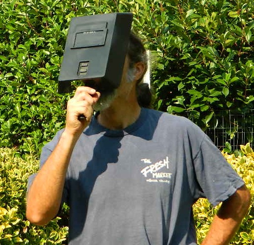
faceshield

stars

Upcoming Lunar Eclipse

2021 Lunar Eclipses


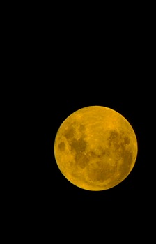
May 26: “Blood moon” total lunar eclipse

Across western North America you will be able to witness the moon blush red as it undergoes a total lunar eclipse. This dramatic astronomical event happens when the sun, Earth, and moon are precisely aligned so that our planet’s shadow completely blankets the moon’s face. (see more info)

orange, red or amber colored moon
A total lunar eclipse is sometimes called a Blood Moon, because of the reddish tinge the Full Moon takes on when fully eclipsed.

November 19: Partial lunar eclipse

Last lunar eclipse of the year will greet sky watchers across North and South America. Technically a partial eclipse, up to 95 percent of the full moon will be cast within Earth’s dark shadow. During the maximum phase, it should briefly appear as a total eclipse, which means the lunar disk may show hints of orange or red. (see more info)

moonfire

best places to watch the skies

 The California Deserts are sometimes the best place to watch the nights sky, unless the winds are kicking up. Deserts are warmer than other locations and if you position yourself well you can be far from any city lights.

The California Foothills, both coastal foothills or mountain foothills – are the second best choice, if you can drive up canyons and get well away from the sprawling suburbs. Choice spots would be ridges above 2000′ elevation, with minimal trees. Oak foothills are choice spots. Higher than 4000′ and you will be chillin overnight.

The California Mountains are the prime choice for summertime recreation of all kinds. Primitive camping on the back roads will save you fees at a developed campground. The higher in altitude, the less atmosphere above you – the better night sky viewing is above. Choose a meadow or mountain ridge w/ minimal trees. Burn areas provide wide open spots, so you can seek old wildfire ridges. Nights can get pretty chilly most all year long, so go well prepared. Jackets, gloves, hats and all. Keep all campfires to a bare minimum after 9pm, so you can focus on the stars in the sky.

your pupils will welcome the dark skies

The California Coast is often covered with a thick layer of clouds and moisture, so star gazing along the ocean front is not always great. Central Coast and NorCal beaches have less less population, so these would be the ideal locations. Choose an inland valley w/ rolling oak hills and dirt roads, over the busy beaches. There might be clear days and nights, especially if forecast call for heat – check the local weather forecast for accurate up to date conditions.

Large urban areas, the cities and towns of California are the worst place you can sky watch, due to light pollution, traffic and smog. Drive to the outskirts of town – pick a dark location, a park, open space or forest lands nearby. Arrive before dark to get the best spots, well off the main road. Choose viewing spots without street lights and without passing traffic. Find a nice level spot to set chairs up and bring lots of snacks.

Stargazing California

How to watch a meteor shower

Follow YouTubeYoutube
SuspiciousObservers

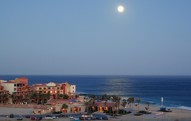
moonrise


Creekside Camping

California Creek Camping
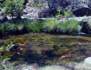
California Camping CreeksClear cool stream waters flow from snow melt at 10,000′ elevation, down to these pristine camps at under 4000′ on both sides of the Sierra. The further you drive up the mountain, the better it gets. Where the Eastern Sierra side tends to be more dramatic desert like with sage brush, the western range is much more lush with ferns & dense trees.

Everyone dreams of it. The perfect camp, along the creek. Maybe a waterfall or two, a shady hammock spot & plenty of trees, a flat tent spot, maybe a view. A big, sturdy, rock fire ring (without a bunch of broken glass in it).

This dreamy camp isn’t only in your imagination, nor is it at the local county campground a few miles from home. This kinda beauty & rare finds are out there, deep in the back woods, the mountains. You gotta know where to look & what to bring in order to have a good, easy, relaxing time.

These secluded sites really are around in your favorite forest, way back there. Best of all, they are free.

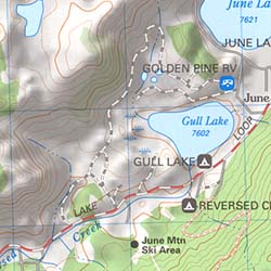
forest mapsHaving the opportunity to camp in your very own private, secluded spot, along dirt roads, outside of the annoying rules and fees of a developed campground is a privilege. Use these lands wisely and be a responsible camper. Camp eco-wise! Respecting the land, knowing some basics and following fire safety precautions is all mandatory. A topographic hiking map or a National Forest map is optional, but highly recommended.
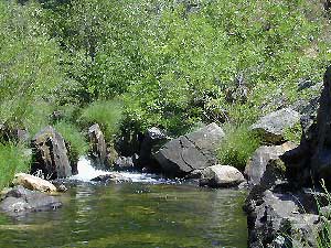
Creekside Camping CaliforniaCreek water can make an easy refrigerator if the cooler is full. Chill that bottle of wine, keep the watermelon cool .. just don’t forget about it. (cuz that kinda litter maybe a welcomed good surprise for the next camper.) Secure your wet creek valuables. Even a heavy watermelon can float! Put some rocks around items or tye them in a mesh bag, with rope, something to keep them from getting away in the swift water.

There is nothing that beats a good detailed forest map of where you are going. If you are the type of person who can never make a straight B-line for home on Sunday afternoon, and find yourself wandering just for the sake of wandering – then it’s best to have a larger state wide map like this beauty from Benchmark Maps.

California Creekside Camp Sites

Small Campgrounds on a Creek

Primitive Style – Dispersed Camping secluded camp sites

If you are the kinda sport who can really rough it, you may learn to love it. After your first real back woods camping experience, the privacy, serenity and beauty of the land will inspire and relax you so much, that the drawback on the lack of toilet won’t bother you.

Make a new hobby of learning how to stay away from the crowds. The less cars you see at camp, the better. Learn to be immersed within nature and enjoy your space outside. Unwind, next to the creek in the shade, with a chair and read for hours, or bring the sketchbook, or just daydream as butterflies go floating by.

  • Remember to be camp clean, California is black bear country.
  • You’ll need a free camp fire permit; pick up at the local rangers station.
  • Classic camp potty info.  Proper disposal of human waste is important.
  • Use biodegradable soaps when outside.

Streamside Camping Basics

what you need:

capable vehicle – SUV or Truck, high clearance is best. 4×4 is NOT required. AWD wagons should be more cautious when venturing out on the back roads. 2WD is fine for most graded dirt roads, but way out exploring dirt roads, deep mud and snow is quite possible.

destination – Pick a locale. A general area you wanna check out. Not a quickie overnight deal, but an enjoyable lazy multi-day camping trip.

exploration – Narrow down a canyon or river that you have always wanted to explore. The Sierra Nevada & NorCal is the place to concentrate your efforts, as SoCal is near desert climate w/ way too much development.

more maps please – National Forest map or similar backroads Map/Atlas. Large topo maps may be too detailed, but will do okay for finding dirt roads (& backpacker trailheads also).

The more homework you do before hand, the better chances of finding that secret camp spot, especially on holiday weekends. Go ahead & call the forest rangers. Have your decent topo maps handy, along with pen and paper. That’s what they are there for. Have a list of questions on specific areas you want more info on. If you do the prep work well in advance, it makes a more enjoyable camp trip. Cuz you’ll be less worried about finding the ultimate places (before dark, or before the other guy does). With your new profound Wilderness Vision, you will have not only a plan B ready, but a plan C as well.

what to look for:

getting permits – If you really wanna camp like this, all secluded on the dirt back roads without the hordes of other campers nearby…. you’ll need a capable vehicle, a camp fire permit & the understanding of the concept “totally self sufficient campers”. This means bringing your own water, a bucket, a shovel, maybe some firewood, plus packing out all your own garbage, plus any litter left over by the last campers. It’s the least you can do, not having to make reservations. Visit the FireSafe page

it’s on your map – After you have a general area narrowed down, some place you always wanted to go, then it’s time to get your maps out & start reading them. Or at least staring at them – maybe over a meal, whenever you have free time to study it. Look for dirt roads, the further off the paved roads is not necessarily the better. Some of the best camp sites are within a few short miles from the pavement, so get them maps out & start visualizing.

gas up – Make sure you fuel your vehicle before you head into remote areas (like the ones we are mentioning). Maybe even an extra can of gasoline too, just in case.

the blue lines – You’ll know a decent road when you see it. When you start planning at home, you need to concentrate of what dirt roads are along what water sources. And will these streams be flowing at this time of year? Many are seasonal creeks & can dry up in summer. The most likely place to find great water flow is to look for the streams flowing directly into a major river or Lake/ Reservoir.

Are you willing to clean up your camp, before & after, leaving it pristine?
Yes indeed, it is free to camp outside of developed campgrounds.

Finding a Creek & Reading a Map

California Topo Maps

topo linesCalifornia Terrain

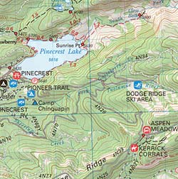
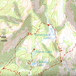
Topographical maps feature the terrain of a wilderness or hiking area, through colored shading & thin contour lines to represent elevations. Park boundaries, trail routes, trail heads & campgrounds are noted, as well as major landmarks like lakes, rivers, creeks, meadows, peaks, canyons, hot springs, waterfalls & all roads (dirt or paved).

Backpackers & hikers must rely on such maps for planning & trekking their journey. Hard copy, printed, waterproof maps are top choice, but topo maps now come in digital format for download as well. DanaMite has recently started including these digital map links within the Total Escape Map Shop – totalescape.net/shop/

Here in California we are lucky to have so much public land available to us for enjoyment. Numerous map vendors make maps for nearly all of the regions across California.

Affiliate Button

QUADS: 7.5 minute topographic quadrangle maps, available from the USGS, can be found online w/ Avenza Maps (often for free) and also, direct from the government site https://www.usgs.gov/products/maps/topo-maps

A while back, the NFS offered handy books of these sought-after topo maps. They were compiled into booklet form called an ATLAS, with sturdy covers & a spiral bound. Overall size is close to 9″x12″ & they are much easier to handle than the individual paper maps. Look for Forest Topo Atlases

List of topo maps available for California:

wilderness maps CA kings canyon
conradkid
Hiking the High Sierra @ 12,000 feet above sea level

Where to Camp

Where to set Camp in California?
Camping Spots
Small campgrounds have fewer facilities than the larger developed campgrounds, but less sites means more nature and less people. Roughing it on the back roads with dispersed camping is by far the best experience for seclusion and privacy

real peace and quiet.

Primitive, free camping requires more thought and planning than just pitching a tent in a flat spot at a developed campground.

First off, you will need a decent topo map to find the dirt back roads, the trailheads and the creeks with the best camp sites; a dependable and capable rig to get you out there, plus your camping gear.

Campfire permits are usually required for camp stoves, BBQs and any open fires. (bucket & shovel needed).

And most importantly, since California is known for its super dry climate and seasonal wildfires, make sure to check with local rangers to find out about any current campfire restrictions.

Streamside Camping
some tips for a good camping experience – without scoldings or citations from Mr. Ranger:

  • Choose existing campsite in a used area – rather than creating another rock ring & trampling a fresh spot.
  • Always know fire conditions; get a fire permit if you have a campfire outside of a developed campground.
  • Set up camp away from other people. The majority of people go to the wilderness to experience quiet, peace, & solitude. There is plenty space for everyone, so spread out.

mountains

  • Never set camp in a meadow. It is a very fragile ecosystem.
  • Use an existing camp site when possible. Rebuilding and cleaning campfire pits is part of the job!
  • Camping right on the a creek bed or lake shore is damaging to the vegetation and wildlife areas. Place tent at least 20+ feet away from waters edge. Many camp site already exist in prime areas on creek front, so seek out those first. The deeper you go into the wood, the more you will find. Seclusion is possible, if you want to drive beyond the pavement.
  • Do not camp beneath large dead trees. Check tent spots for old overhanging branches too.
  • Do not camp near a mine shaft; Toxic heavy metals or radioactive debris could be present in the dirt.
  • Camping next to a lake, wetlands or a meadow can often result in abundant mosquitoes & insects overall.
  • Snow is possible anytime from October to May above 5000′ elevation. Chilly nights are common in summer.

deserts

  • Avoid camping inside desert canyons when the threat of rain is approaching: possible flash floods.
  • Consider the benefits of potential windbreaks in desert terrain. Large rocks, bushes, trees, your vehicle & even a hillside.
  • Picking a camp spot on a ridge line means sun exposure and windy conditions. Breezes will keep the bugs away and you can’t beat the better view, but wind can pick up at any time especially in desert regions.
  • Low elevation in late spring and fall means very warm temps; summer is triple digit heat most days.
  • Do not camp near a mine shaft; Toxic heavy metals or radioactive debris could be present in the dirt.

coastal

  • Avoid camping on fragile coastal cliffs; unstable, which can give way, caving in, resulting in danger to you.
  • Camping on the beach means watching the tides. Know where high water mark is before you set camp up.
  • Beach camping in early summer means low clouds and fog are likely. June Gloom can last months.

countryside

  • Avoid building campfires up against a large boulders or against a rock face.
  • Rivers controlled by hydroelectric dam systems mean that the water levels can change at any time without warning.
  • Never set camp in a wildflower meadow. It’s too fragile of an ecosystem.
  • Lower elevations in summer time means potential triple digit heat during mid-day.
  • Do not camp near a mine shaft; Toxic heavy metals or radioactive debris could be present in the dirt.
National Parks National Forests State Parks California BLM OHV routes California Wilderness
Beach Camping
California Forests
Wineries
Desert Parks
California Back Roads California Lakes