Tag Archives: recreation

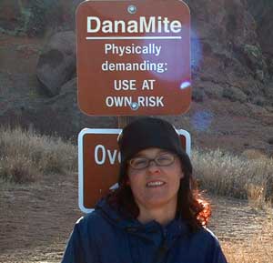
DanaMite

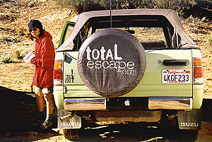
DanaMite founder of Total Escape

Internet Pioneer

totalescape.com  – online since 1996

(before the dot com crash, before digital cameras, before GPS, before social media & way ahead of smartphones)

Sole creative force of Total Escape, Dana Williams left her 3D animation career to start living and working her dream job, online and off. Utilizing artistic talents, computer skills, a vast knowledge of the California landscape and a simple love of nature, to make it all come together for a killer web site called Total Escape.

27 years online means fresh content & updates every month; reworking web code every few years to keep up with various browsers, apps, maps, and wildfires.

facebook flickr twitter 

“travel agent to the back woods”

greenhouseLiving close to the earth with organic gardening and rural living, DanaMite strives to offer California residents, new-comers and visitors unique, local destinations, concentrating on the outdoors – well away from overcrowded, busy, urban cities and tourist traps. Total Escape can show you how to discover the secret, hidden spots on your public lands that the gov web sites will not even dare to mention.

Support this site

help keep
total escape
online


the independent source for California travel

NO CORPORATE sponsorshipCalifornia Camping Photos
No venture capital
No government subsidies
No annoying pop-up ads
No scripts chugging bandwidth

No membership needed


Decades without a television set lends plenty of time for studying terrain, topographic maps, GPS coordinates and thousands of photographs to compile more than 8000 pages on just California travel. Far from the daily grind of everyday life, DanaMite continues in educating the public about local travel, camping, family farms, organic cafes, outdoor recreation, respecting the land, responsible use of our resources & how to get more enjoyment out of weekend travels.

outdoor girls

Things that started Total Escape:


entrepreneur

YOUR SUPPORT keeps Total Escape going:

youtube100

Expert Camping Pro California
40+ years of documenting back roads of California, plus some Baja & Utah too!
utahlover
DanaMite loves Utah, almost as much as she loves California.
tejonpass
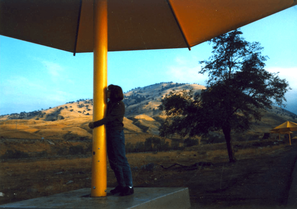
Tejon Pass “Cristo’s Umbrellas” art installation 1991. Photo copyright – Kevin Robinson

condor costume

Dana’s Dirt

Dana is all about Total Escape!

Never married, No kids
No wifi, No smartphone
No tattooed eyebrows

Red Dirt HikesIf you could care less about celebrity gossip or television, you are not alone. Many people seek more relaxing travel in their lives, but can barely afford a vacation, or a day off of work.

DanaMite is all about dirt – being outside and inspiring you to be outside as much as possible.


I began car camping in the Borrego desert while in college as an easy, inexpensive “weekend away from the city”. Cheap, literally dirt cheap outdoor vacations. Free camping, if you really know the good areas.

Whether you dig hiking or biking on dirt, sleeping in the dirt (tent camping) or wheelin in the dirt, we have the TOTAL DIRT on California. Back Roads, Hot Springs and tons of outdoor destinations inside the golden state. Nearly 3 decades online, we’ve been here from the start.

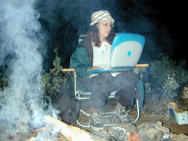
ibook with campfire 2002

Dirt roads, dirt campsites, dirt trails. Desert dirt, mountain dirt, coastal cliffs to country canyons w/ huge reservoirs. All California dirt, terrain, forests and water too.

dana's dirt

Start discovering your own back yard California. 

twitter
blogger
flickr

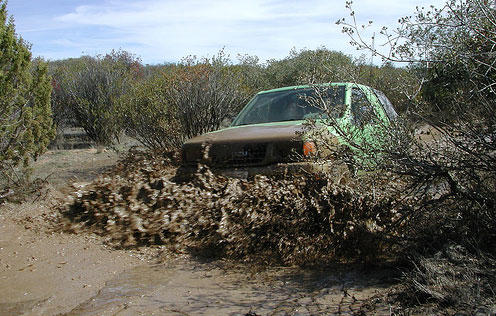
HeresTrouble
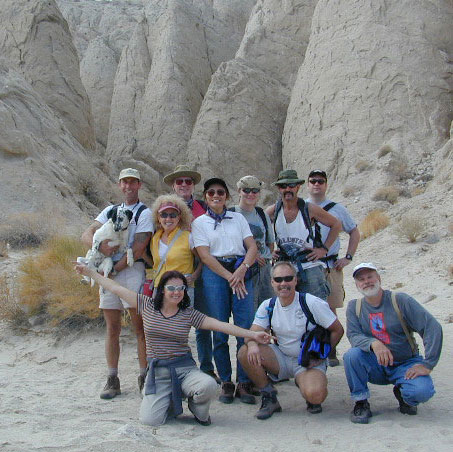
Anza Borrego SLOT CANYON hike, circa 1999
Teenage Dana
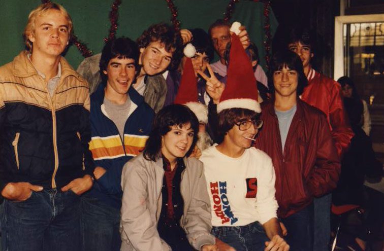
Teenage Dana, 1983
microtrash
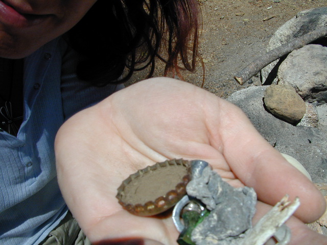
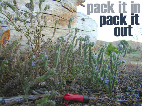
Microtrash is all that small stuff that seems to miss the trash bag.

California 4×4 Club

4WD clubs / 4×4 off road / 4×4 vehicles / 4×4 club

California has no shortage of 4 wheel drive vehicles, but how many of them actually use them for what they were intended? If you’ve had your 4WD for a while and are itching to get to know the local trails, then grab yourself a few good OHV maps & head for the hills.
If you are a total novice and think you might want to get familiar with routes, what your vehicle can and cannot do, and learn the ropes from the pros, then you might want to discover the friendly folks in your local 4×4 club. Below we list as many legitimate groups we can find, with or without web sites. If your club is not listed, then please contact us & we might add it.
anzawashes
Anza Borrego Desert Washes

Off roaders (with running rigs) can enjoy pre-planned back road trips with various 4×4 Groups in California:

The very best place to start searching for 4WD routes inside California — is right here on Total Escape. After you’ve narrowed it down to a general location, then buying a decent topo map is a necessity. We have extensive sections devoted to California back roads, SUV interests, OHV Parks, off road tour guides, and of course, offroad trail maps.

califrepublic

Giant Sequoias
Hidden Sequoia Groves, Western Divide


4WD clubs
4×4 Camps @ Los Padres National Forest

DanaMite’s dirt roads list

4x4

Lake Davis

Baker Creek
Upper Baker Creek, Inyo NF – 4×4 Camp

More Time, Offline

boulder fire ring

sunflower3There once was a time when we connected more with nature. Before we closed ourselves off, behind the doors and windows, behind the computer screens, before the internet became part of daily life.

Overweight and obesity is now epidemic in America (as if you didn’t notice). Fast food feasting and soda pop, GMO-gut disorders – and yet we’re still frustrated or disappointed with life; Addicted to television, processed food, copious amounts of sugar, daily coffee, butterflysmoking, prescription drugs, and what else.

Wi-fi streaming, video games, always indoors, online, enjoying air conditioned cubes. Inactive physically, emotionally vacant, bored with our choices and always on social media.

Stop and think. Look what has happened to us.
Is this the life you envisioned?

blue light special

Campfire Community

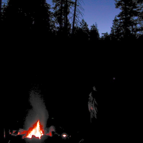
Cooking over a camp fire and real conversation are just a few examples of what we have lost in our modern world of technology, fantasy and face-time. campfireFresh air, wild flowers, alpine lakes, star filled skies and total silence – all still exist in certain areas, but you must know where to look. Birds and bees, wildlife is disappearing at extinction levels. Pollution, powerful corporations and politics.

Stop and look. See what has happened to earth.
Is this the world you envisioned?

Highland Wildflowers


Gone! Away, split, out of town. Off work, out of school, on vacation. Outdoors, always. Far, far away.
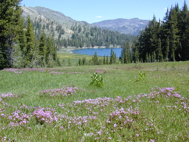
Unplugged, out of range, vacant lands, big trees, open skies, clear views. California is the land of dreams. Opportunity, fantasy, education, agriculture, terrific terrain and epic scenery. Campfires, waterfalls and mountain meadows are waiting for you.

Taking time off of work – or your typical daily routine – is often rewarding physically as well as mentally. Imagine a week away in a gorgeous location, with minimal to do. Really relax, zone out, chill. Gaze at the water, nap in a hammock, find wildflowers, deer bones, or bear fur on a tree. Cook over the campfire, stargaze every night.

Running to a general store for ice will be your biggest task of the week.hiker

Wilderness boundary, abundant dirt roads and freedom; cell phone calls dropped. Beyond the city limits. Well past the county line.

Wilderness Lakes

Roads do lead out of the matrix, if you desire to follow them. Concentrate on a new reality – and disconnect long enough to commune with nature. Find the free time to really relax and re-evaluate life. Explore other options, consider real life in the bigger picture. Hike, bike, walk, camp, birdwatch. Be outdoors, often!

Vbeardrive
Beat the Summer Heat and head to upper elevation Cool Forests
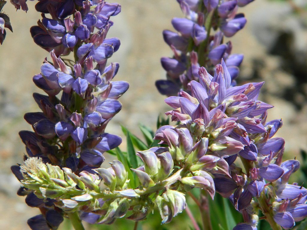
Curly Lupine
Curly Lupine @ Mill Creek, CA

Cheap Road Trips

Total Escape is your California planner. We’ve been doing this “region” for more than 30 years, always focusing on the back roads. Discover hidden secrets, meadows and unknown waterfalls. Find free campsites, canyons, rivers, creeks and new places to explore.

Find something OUTDOORS, this weekend –

canoe

All posts alphabetical
California A to Z

avoid crowds

back roads

lake list

out of the box

play hooky

recreate

camp fish  4x4

Most popular pages on Total Escape –

Granite Creek
Granite Creek Campground NFS

nicemeadows

Eco Camping California

eco-friendly camping
eco-wise camp tips

microtrash
Microtrash is all that small stuff that seems to miss the trash bag.


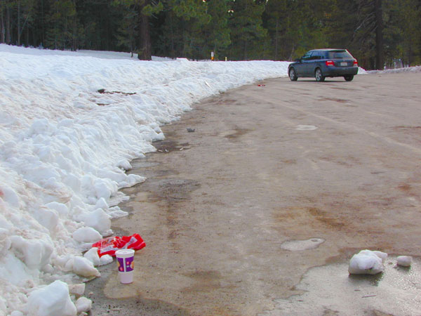
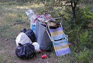
campYou manage to drag yourself off the couch, congratulations! You’ve packed up your ride and are heading out to your favorite “secret” spot. Anticipation builds as you arrive and pull into the empty lot. Your heart sinks however when you discover that your once pristine camp spot has been transformed into the new town dump. An old lawn chair, candy wrappers and beer cans litter the area that you once loved. Impromptu fire rings are strewn about and armies of weekend warriors have trampled your favorite meadow into a dust bowl.

No Littering California
DON’T BRING THE CITY TO THE WILDERNESS. The noise, the food containers, the beer bottles, the fast food wrappers, the broken plastic crap and the balled up baby diapers. The disposable society we have created now makes us all too LAZY. Getting off your ass and outdoors means you need to take some responsibility.

You get much needed exercise, outdoors breathing fresh air, and enjoying life,  while discovering new destinations and awesome terrain. The least you can do is clean up a little, and encourage others to do the same.

thinking about that plastic water bottle you dropped on the trail?

Trash isn’t specific to just campers and target shooters. Hunters are notorious pigs, especially when gathering in groups. Day hikers ‘accidentally’ loose stuff all the time – from sunglasses to bottle caps. Picnickers often forget something at the site.

Family day in the snow sounds great. Sledders leave massive amounts of trash – from broken sleds to food trash.

Mount Pinos

unaware

Litterbugs include many types of folks: disruptive teens, toothless alcoholic contractors, local yolkels, urban mishaps, gangster wanna-bes, home boys, totally oblivious yuppies & even uneducated families…

keep the trash & tagging to the city!

EDUCATION is key on this matter & it starts with you.
Please pass along good outdoor ethics.

tread lightly wilderness trail crews

Seems you can’t go deep enough. The further into the forest you go, you still seem to see it – evidence of neglect for our land. In every outing these days, we constantly notice tons of litter and graffiti. Deliberate disrespect for the open spaces and valued wilderness lands. What is going on here?

Please report graffiti in action to the local law enforcement or nearest rangers office! Or better yet, get them on video and post it on YouTube.com

Garbage while Camping
What’s the worst that can happen?

Small fragments of plastics are being found inside birds, wildlife and marine life, due to the vast amounts of micro-trash that is found outdoors. Ingested plastics often kill the animals.

Our secluded swimming holes and creek trails are now littered so badly, that the smaller trash is making it into major rivers and into the bellies of fish and the near-extinct California condors.

Misuse and sheer disregard is how OUR lands get closed (by OUR OWN government). Closed off forever, turned into ‘off limit’ roads and more totally closed wildernesses, that only can be explored on foot. OHVs, dirt bikes, 4x4s need to realize their overall impact on natural habitats could have a detrimental effect on these lands. There is a balance. Play wisely. This includes all the red necks with guns too.

camp


King of Litter?

Originally uploaded by danamight

Graffiti, Soda Cans, and Cigarette Butts are a nuisance to nature.

As more and more office drones venture from their cubicles and out onto the unbeaten path, they leave behind the remnants of their bold treks for all to see. Refuse, human waste, smoldering campfires and crushed flora from selfish tent placements and trail blazing destroy our fragile eco-system and pollute the environment for years to come.

  • Be cautious walking around to avoid destroying the fragile ecosystems, such as meadows, seedlings, wildlife & wildflowers.
  • Pick up all your trash & even some left behind by previous campers. Leaving the camp or picnic site in better condition than you found it.

dirtbikes

litterlogs

Below are some simple tips that, coupled with common sense, will enable you to stop being part of the problem and start being part of the solution!

Kern Graffiti

Central Valley Reservoirs

California’s Central Valley Recreational Lakes & Reservoirs

boatingcampingRV campshiking fishing

(listed from north to south)

North State / North Valley / North Sacramento Valleyboatramp

Black Butte Reservoir
Stony Gorge Reservoir
East Park Reservoir
Lake Berryessa
Lake Oroville SRA
Thermalito Afterbay
Thermalito Forebay
New Bullards Bar
Collins Lake

Sunset at the Lake
fishOak foothills of the Historic Gold Country, at the edge of the Sierra Nevada mountains.

  • boating
  • canoe
  • camping
  • fishing
  • hiking
  • houseboats
  • kayaking
  • wildflowers

Most Central Valley Reservoirs have blooming wildflowers in early springtime. Summer heat can measure triple digits for months as most of these lakes are located below 1000′ elevation.

Central Sacramento & California Delta

Trimmer Boat Ramp
Trimmer Boat Ramp @ Pine Flat

Central Valley / San Joaquin Valley

Lake Amador
Lake Camanche
Pardee Reservoir
New Hogan Lake
New Melones Lake
Woodward Reservoir
Salt Spring Valley Reservoir
Lake Tulloch
Don Pedro Lake
Turlock Lake SRA
Modesto Reservoir
Lake McClure
San Luis Reservoir SRA
Eastman Lake
Hensley Lake
Woodward Reservoir
Millerton Lake SRA
Redinger Lake
Pine Flat Reservoir
Lake Kaweah
Lake Success
Buena Vista Reservoir

Walk-In Camp Site at Lake
Walk-In Camp Site at New Melones Lake, Gold Co

Kaweah Sequoia Sierra
Lake Kaweah, near Mineral King & Southern Sequoia NP

New Bullards Bar Reservoir

Bullards Bar California

Bullards Bar Boat-in Camps

BULLARDS BAR Dark Day is a lakeside walk-in campground on a small reservoir, located deep in the Gold Country foothills. Flush toilets and hiking trails, kayak rentals and fishing.

fish

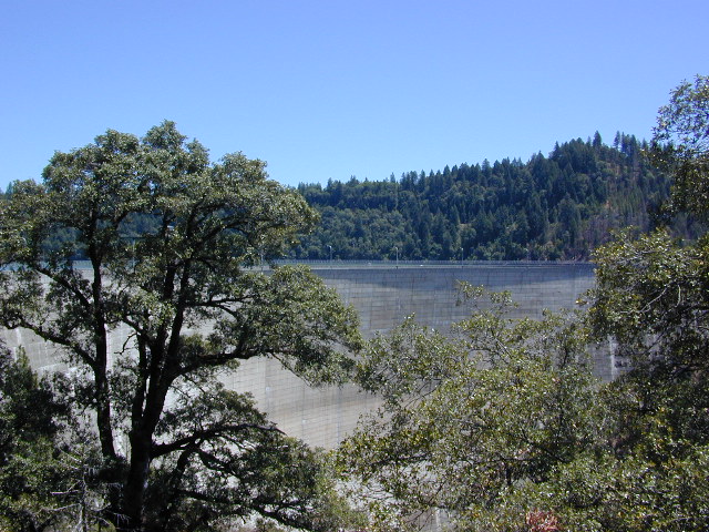
West of Highway 49. Huge dam for hydro-electric power. Minimal roadways along the lake and steep canyons make for optimum hiking and boating. Floating and fishing. Relaxing in the mountains, with fresh water!

On most maps the official name of this lake may read New Bullards Bar Reservoir, or Lake Bullards Bar, but locals just call it simply – Bullards Bar!

Sierra Nevada Foothills. Yuba River, California.

Northern Gold Country, California

Near Camptonville, West off Hwy 49
in between Oroville and Nevada City, CA

Located not far from historic Downieville, Bullard’s Bar is an excellent base camp location for exploring the upper reaches of the Gold Country region. Old mining locations, museums, a covered bridge, various parks, Yuba River, Sierra Buttes, Lakes Basin. Grass Valley & Nevada City are also nearby. Mountain bike trails, river rafting and hiking all around.

New Bullards Bar

lake surface area: 969,600 acrespaddle sports

lake elevation: 2000′ above sea level

lake county: Yuba County California

roads around lake: Marysville Road (south of lake and east side w/ Hwy 49), Moonshine Road (south of lake), Oregon Hill Road (west side), Pendola Road (north side), and Forest Route #47 (dirt road on north side)

boatramp

nearest towns:

Bullards Bar
Shade @ the marina, just when you needed it most

Yuba River Recreation

camp

Bullards Bar water is a beautiful teal color of greenish-blue – due to heavy mineral content in the local soil (red dirt) and the dense forest above.

This water comes down the north fork of the Yuba River, as snowmelt from Lakes Basin Recreation Area, the Sierra Buttes, and the Yuba Pass on Highway 49. Northern Gold Country, California.

Bullards Bar Lake – Emerald Cove Marina
New Bullards Bar Reservoir
877-692-3201

boating boating gasoline marina

New Bullards Bar Reservoir

boat in camping

One of the few lakes in the Sierra Nevada that offer boat in camping at developed camp sites, and also to allow boaters primitive camping along the shoreline. No drinking water is available. No pit toilets, so a portable chemical toilet is always required. Plus, pack out all garbage.

No charge for DAY USE areas: parking or boat launch ramps

NOTE: Dark Day & Schoolhouse Campgrounds are the only car camping & RV accessible camping on this lake. These both have flush toilets and drinking water piped in. Hiking trails & boat launch nearby. Wheelchair accessible campsites are available.

CAMPS OPEN: APRIL – OCTOBER
Campgrounds @ BullardsBar are usually open from April to October annually and all are closed for winter months.

camping walkin camps hiking camping boating camping RV camping mountains

Bullards Bar Campgrounds

camp information 530-692-3200

  • GardenPoint: 17 boat-in sites
  • Madrone Cove: 10 boat-in sites
  • Shoreline Camp: 2 boat-in sites
  • Dark Day Walk-In Camp: 30 sites
  • Schoolhouse Campground: 56 sites
  • Hornswoggle Group Camp

Frenchy Point Campground USDA

Located 5 miles northwest of Dark Day Boat Ramp on the west side of the reservoir. Boat in only access. It is used as an over flow campground. There are campsites, but no bathrooms. Portable chemical toilet required. More info call Emerald Cove Marina at (530) 692-3200

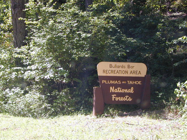
National ForestsBullards Bar Lake located on the Yuba River, bordering
between Tahoe National Forest & 
Plumas National Forest


bullards bar California

lake recreation 

  • boat in camps
  • canoe
  • fish
  • houseboat rentals
  • kayak
  • picnic sites
  • sail
  • watercraft rentals

land recreation

  • backpack
  • campgrounds
  • hike
  • mountain bike
  • walk-in camps

bikingbullardsdam

also in the area


View Larger Map

califrepublic

Second Spillway – in the works?
Yuba Water Agency has just committed to building a $160 million second spillway at the New Bullards Bar Dam; beginning in 2021, with a completion date of 2025.

check

https://en.wikipedia.org/wiki/New_Bullards_Bar_Reservoir
https://en.wikipedia.org/wiki/New_Bullards_Bar_Dam

Balch Park

Balch Park / Sequoia Park

Balch Park Campground

BALCH PARK campground is on a first come basis; no campground reservations needed.

2021 – THIS CAMPGROUND IS CLOSED indefinitely,
due to the Castle Fire 2020

Balch Park open May to October
Park info # 559 539-3896

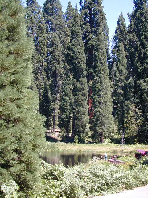
Hedrick Pond lined w/ Sequoia trees

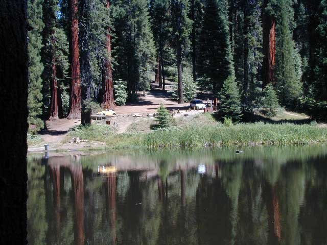
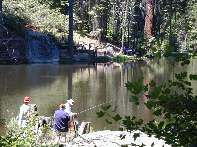
Balch County Park is right in the middle of Mountain Home State Forest, which is within the bigger Sequoia National Forest (aka Giant Sequoia National Monument). But don’t let all the bureaucracy mislead you, this is an ideal park and location, well worth your trip. The campground is the most developed one within the area – with paved roads, RV spaces, flush toilets and a fee to go along with all that. Even gotta fishing pond.

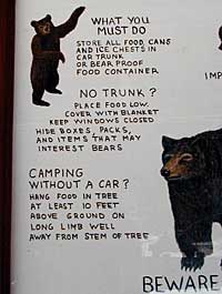
  • Bears are a big deal in these neck of the woods. Please store all your food properly to avoid a un-welcomed visitor
  • A Sequoia Grove is nearby with plenty of creeks & meadows.
  • Trailers not recommended due to the long curvy road leading up the mountain.

Balch Park & Campground NOT TO BE CONFUSED with utility company residences of BALCH CAMP between Pine Flat & Blackrock Reservoirs


View Larger Map

Helpful Maps:

Nearby cities & towns:

campground elev. spots veg toilet water fee
Balch Park
559-539-3896
6500′ 71 pines flush piped yes no reservations
first come basis

DSCN0021

Ventura Beach Camping

Ventura Campgrounds

DSCN0825

Ventura County Park Campgrounds

on US Hwy 101 Seacliff / Mussel Shoals stretch of beach

Ventura City Campground RV Parks

blue links lead to State Park pages with camp reservations.

State Park

Ventura State Beach Campgrounds

Ventura County coastal towns

DSCN0810
Beach city w/ nice downtown, north of Los Angeles, CA


canoe

Ventura Lake Parks
located inland from coast

see also – Ojai Camping, Santa Barbara Beach Camping and Santa Barbara Mountains Camping

porthuen_hike_3

Remington Hot Springs

lower kern river
hike-in hot springs

Remington Kern River

Remington Kern River

This place was the alternate choice to Miracle Hot Springs, but since that one is now closed – this is the main attraction out here, along the lower stretch of the Kern River.

USFS Forest Hobo Campground is about a mile away and it may be closed due to landslide repairs. There is also plenty primitive style camping options if you so choose.

Remington is by far, one of the nicest primitive hot tubs in the whole region and easy to access. If you can find it, the rewards are great!! Can be crowded on weekends. If the dirt parking lot is totally full, come back later or wait it out. You can find travelers, mountain bikers, dirt bikers, hikers, backpackers, campers, off-roaders, RVers, burners, desert rats, military boys, local kids, LA couples,  techno DJs from Russia – a wide variety of people soaking at this not-so-secret spot.

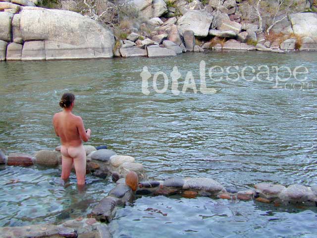
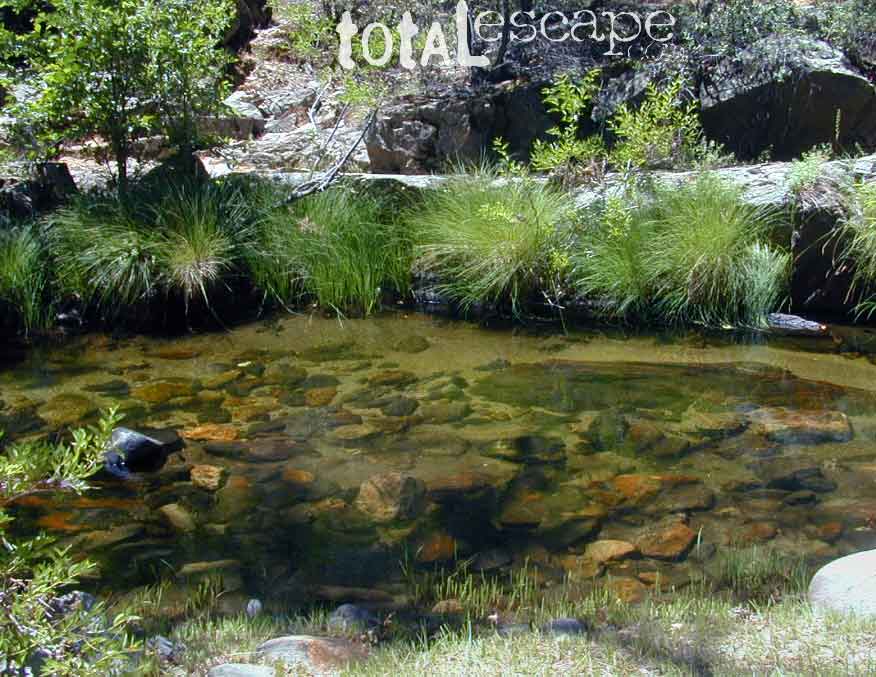
These unique hand-crafted stone tubs are located on the Lower Kern, overlooking the big river and the fish. 3 volunteer built cement & river rock hot spring pools sit adjacent to the Kern River. There is also another small cooler tub on the trail perched above the thick brush.

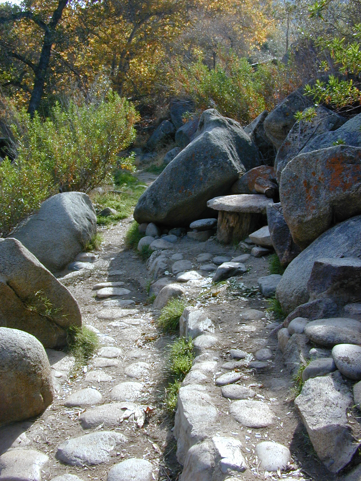
This prime recreation spot is located a few miles west of Hobo Campground (old Miracle Hot Springs) is sometimes busy: dirt parking lot, minimal sign & the tubs are not viewable from the road. From parking area you must hike down a steep grassy trail for about a mile.

Bring towels, beverages & everything you will need from the vehicle, as turning around to go back & get everything half way down will prove to be a challenging trail up. Boulders & oaks on steep hillsides. A few campsites down along main trail. Wildflowers here are wonderful in Spring (April-May). Please pick up litter & keep this place beautiful.

West of Kernville & Lake Isabella, CA
along Kern River in the Lower Kern Canyon Gorge, Southern Sierra Nevada mountainsSequoia Kern Hot Springs

Remington primitive hot springs are located inside the lower Kern Canyon, southwestern part of Sequoia National Forest. Take Highway 178 east to the 4 lane portion, look for Borel Road right turn which climbs a steep hill up to Old Kern Canyon Road. At this stop sign you will see a sign for Remington Trail (3.5 miles) pointing to the right.

NFS

Remington Trailhead (signed) & dirt parking lot across from trail, is located on Old Kern Canyon Rd, which runs parallel to the 4-laner  Hwy. 178 on the opposite side of the Kern River. The well known Kern Canyon Road is also labeled as “Cort 214” on GoogleMaps.

Remington Ridge Trail #32E51 – Mountain bike, hike and horseback trail

Breckenridge Road #28S06, access via Havilah, CA. Breckenridge has pine forest at higher elevation, and is the tallest mountain to the south of Kern River.

lower Kern hikes

clothing optional is the norm

Ardell’s Tip: Remington is one of the few spots in California that you can fish a major river from inside a hot tub.

Best Naked Fishing
click on the photo for more

lodging in nearby townsRiver Path

camp

Minimal camping spots with very little privacy at the main dirt parking lot at Remington Hot Springs. The best tent camping is located down on the trails, so you may choose to hike-in to the secluded oaks to the sandy beach camps below. No facilities at Remington, no tables, no toilets, no electricity, so come very prepared to “rough it”.

Primitive Camping in California

USFS Sandy Flat Campground and Hobo Campground are a few miles away (to the east), on the same Kern Cyn Road; Breckenridge Campground is on a tall pine forested ridge just to the south, but requires a long drive around the mountain, or a super rugged 4WD vehicle for a steep dirt road.

Folks seeking more seclusion can choose to primitive camp along the narrow paved road leading to the west. Motorhome campers like the option of road side boondocking with great views; several level pullouts can accommodate most any camper. 4×4 camping is closer to Lake Isabella @ Keyesville or BLM River Camping. Primitive camp spots on numerous dirt roads are located in this Lower Kern River area, but you will need to check with Sequoia National Forest ranger for gate closures, fire permit & fire current restrictions.


View Remington Hot Springs in a larger map

Creekside Camping

California Creek Camping
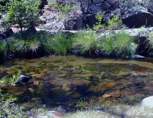
California Camping CreeksClear cool stream waters flow from snow melt at 10,000′ elevation, down to these pristine camps at under 4000′ on both sides of the Sierra. The further you drive up the mountain, the better it gets. Where the Eastern Sierra side tends to be more dramatic desert like with sage brush, the western range is much more lush with ferns & dense trees.

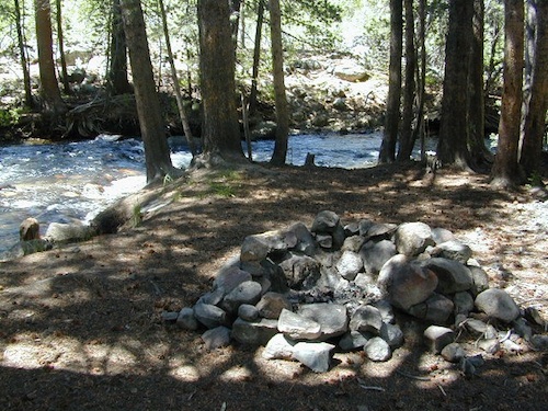
Everyone dreams of it. The perfect camp, along the creek. Maybe a waterfall or two, a shady hammock spot & plenty of trees, a flat tent spot, maybe a view. A big, sturdy, rock fire ring (without a bunch of broken glass in it).

This dreamy camp isn’t only in your imagination, nor is it at the local county campground a few miles from home. This kinda beauty & rare finds are out there, deep in the back woods, the mountains. You gotta know where to look & what to bring in order to have a good, easy, relaxing time.

These secluded sites really are around in your favorite forest, way back there. Best of all, they are free.

forest mapsHaving the opportunity to camp in your very own private, secluded spot, along dirt roads, outside of the annoying rules and fees of a developed campground is a privilege. Use these lands wisely and be a responsible camper. Camp eco-wise! Respecting the land, knowing some basics and following fire safety precautions is all mandatory. A topographic hiking map or a National Forest map is optional, but highly recommended.
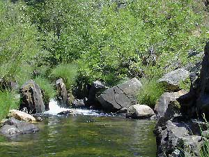
Creekside Camping CaliforniaCreek water can make an easy refrigerator if the cooler is full. Chill that bottle of wine, keep the watermelon cool .. just don’t forget about it. (cuz that kinda litter maybe a welcomed good surprise for the next camper.) Secure your wet creek valuables. Even a heavy watermelon can float! Put some rocks around items or tye them in a mesh bag, with rope, something to keep them from getting away in the swift water.

There is nothing that beats a good detailed forest map of where you are going. If you are the type of person who can never make a straight B-line for home on Sunday afternoon, and find yourself wandering just for the sake of wandering – then it’s best to have a larger state wide map like this beauty from Benchmark Maps.

California Creekside Camp Sites

Small Campgrounds on a Creek

Primitive Style – Dispersed Camping secluded camp sites

If you are the kinda sport who can really rough it, you may learn to love it. After your first real back woods camping experience, the privacy, serenity and beauty of the land will inspire and relax you so much, that the drawback on the lack of toilet won’t bother you.

Make a new hobby of learning how to stay away from the crowds. The less cars you see at camp, the better. Learn to be immersed within nature and enjoy your space outside. Unwind, next to the creek in the shade, with a chair and read for hours, or bring the sketchbook, or just daydream as butterflies go floating by.

  • Remember to be camp clean, California is black bear country.
  • You’ll need a free camp fire permit; pick up at the local rangers station.
  • Classic camp potty info.  Proper disposal of human waste is important.
  • Use biodegradable soaps when outside.

Streamside Camping Basics

what you need:

capable vehicle – SUV or Truck, high clearance is best. 4×4 is NOT required. AWD wagons should be more cautious when venturing out on the back roads. 2WD is fine for most graded dirt roads, but way out exploring dirt roads, deep mud and snow is quite possible.

destination – Pick a locale. A general area you wanna check out. Not a quickie overnight deal, but an enjoyable lazy multi-day camping trip.

exploration – Narrow down a canyon or river that you have always wanted to explore. The Sierra Nevada & NorCal is the place to concentrate your efforts, as SoCal is near desert climate w/ way too much development.

more maps please – National Forest map or similar backroads Map/Atlas. Large topo maps may be too detailed, but will do okay for finding dirt roads (& backpacker trailheads also).

The more homework you do before hand, the better chances of finding that secret camp spot, especially on holiday weekends. Go ahead & call the forest rangers. Have your decent topo maps handy, along with pen and paper. That’s what they are there for. Have a list of questions on specific areas you want more info on. If you do the prep work well in advance, it makes a more enjoyable camp trip. Cuz you’ll be less worried about finding the ultimate places (before dark, or before the other guy does). With your new profound Wilderness Vision, you will have not only a plan B ready, but a plan C as well.

what to look for:

getting permits – If you really wanna camp like this, all secluded on the dirt back roads without the hordes of other campers nearby…. you’ll need a capable vehicle, a camp fire permit & the understanding of the concept “totally self sufficient campers”. This means bringing your own water, a bucket, a shovel, maybe some firewood, plus packing out all your own garbage, plus any litter left over by the last campers. It’s the least you can do, not having to make reservations. Visit the FireSafe page

it’s on your map – After you have a general area narrowed down, some place you always wanted to go, then it’s time to get your maps out & start reading them. Or at least staring at them – maybe over a meal, whenever you have free time to study it. Look for dirt roads, the further off the paved roads is not necessarily the better. Some of the best camp sites are within a few short miles from the pavement, so get them maps out & start visualizing.

gas up – Make sure you fuel your vehicle before you head into remote areas (like the ones we are mentioning). Maybe even an extra can of gasoline too, just in case.

the blue lines – You’ll know a decent road when you see it. When you start planning at home, you need to concentrate of what dirt roads are along what water sources. And will these streams be flowing at this time of year? Many are seasonal creeks & can dry up in summer. The most likely place to find great water flow is to look for the streams flowing directly into a major river or Lake/ Reservoir.

Are you willing to clean up your camp, before & after, leaving it pristine?
Yes indeed, it is free to camp outside of developed campgrounds.

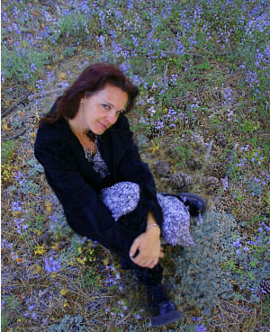
Finding a Creek & Reading a Map

Thanksgiving Day Turkey Trot

Turkey Trot

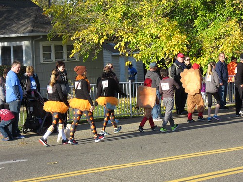
Many California cities and towns host holiday runs or races called the Turkey Trot, or the Gobble Wobble (or any other equally silly name).

Traditionally held on Thanksgiving Day (in the morning hours), this event can be family friendly, with costumes or to some folks, a more serious race with thousands of runners. Each city has it’s own unique history of this annual favorite.

also known as –

Turkey Run, Thanksgiving Race, Thanksgiving Day 5K Run

driftwood

Anaheim Turkey Trot

Apple Valley Turkey Run

Arroyo Grande Turkey Trot

Belmont Shore Turkey Trot

Big Bear Turkey Trot

Burbank Turkey Trot

Concord Turkey Trot

Coronado 5K Turkey Trot

driftwood

Dana Point Turkey Trot

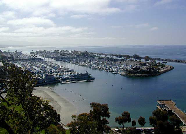
Orange County is the place & Dana Point holds the annual Turkey Trot every Thanksgiving Day. Over 10,000 runners participate in the coastal marathon event.

harbor dana point

driftwood

Davis Turkey Trot

Elk Grove Gobble Wobble

Encinitas Turkey Trot 5k & 10K

Fallbrook Turkey Trot

Folsom Turkey Trot

FTR047 Folsom Turkey Trot

Huntington Beach Turkey Wobble

La Cañada Thanksgiving Day 5K Run

Lake Almanor  5K Turkey Trot

Lompoc Turkey Trot @ River Park

Los Angeles Turkey Trot 5K & 10K

Marin Turkey Trot in Novato

Napa Valley Turkey Chase

Oakland Turkey Trot

Oceanside O’Side Turkey Trot

Orange County Turkey Trot 5K

Pacific Palisades Turkey Trot

Palm Desert Thanksgiving Day 5K Run

Pasadena Rose Bowl 5K Turkey Trot

Petaluma Turkey Trot

Piedmont Turkey Trot

Roseville Turkey Trot

San Bernardino Turkey Trot

San Francisco Turkey Trot

San Jose Silicon Valley Turkey Trot

20071122 016.JPG

San Luis Obispo Gobble Wobble 5K

San Mateo Gobble Wobble

Santa Barbara UCSB Turkey Trot

Santa Cruz Turkey Trot

Santa Maria Turkey Trot

Santa Monica Turkey Trot

Solano Turkey Trot

Solvang Turkey Trot

Turlock Turkey Trot

South Warner Wilderness

Warner Mountains
Modoc Country
Northeast California

Road 64

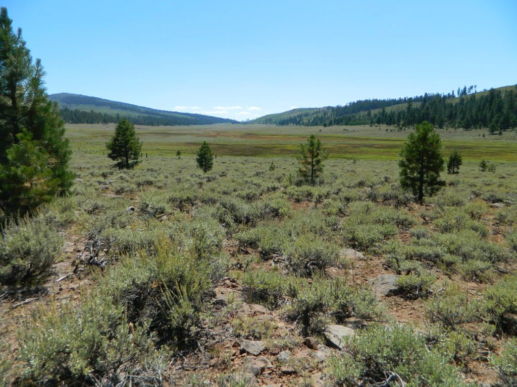
Wide open spaces, mountains, rivers and ranch lands. The very last of the unexplored high country of California. Rural and rustic regions are full of forested mountain ranges with sage brush meadows lying below. Valleys are high elevation deserts with a base terrain sitting above 4000′; Peaks @ 8000′ above sea level.

South Warner Wilderness

70,000 acres
80 miles N of Susanville, CA
Modoc National Forest
NFS

South Warner Wilderness is in the southern portion of the Warner Mountains, a north south positioned range, located in the top corner of the golden state. Surprise Valley lies to the east, bordering the Nevada state line and Alturas w/ US Hwy 395 on the west side.

California SR 299
Hwy 299, the only paved thoroughfare cuts right through the middle of the Warner Mountains. Paved Parker Creek Road #56 climbs up Parker Creek from Alturas, accessing camping, hiking, dirt back roads and wilderness trailheads. Warner Mountains State Game Refuge is north of the wilderness area.

One dirt route skirts the wilderness boundary – West Warner Road #5, which leads from Parker Creek due south to Jess Valley Rd #64. Blue Lake Road, Patterson Mill and Road #39N15 are nearest to East Creek. Winter driving tips from NFS.

butterfly

  • backpacking
  • camping
  • creeks
  • fishing
  • hiking
  • horseback riding
  • hot springs
  • lakes
  • waterfalls
  • wildflowers
  • wildlife

South Warner Lakes & Reservoirs lake

  • Clear Lake
  • Patterson Lake
  • Porter Reservoir (elev 6682′)
  • West Valley Reservoir (elev 4761′)
  • Blue Lake
  • Sworinger Reservoir (elev 5868′)

South Warner Trailheads hikes

  • Summit North Trailhead (Road #31)
  • Pine Creek Trailhead (Road #5)
  • Mill Creek Trailhead (Road #40N24)
  • Clear Lake Trailhead (Road #5)
  • Summit South Trailhead (Road #64)

mill creek falls modoc

South Warner Campgrounds camp

All these campgrounds listed can be accessed by a vehicle, most by narrow back roads (some dirt). If you prefer to drive on paved roads only, then you’ll need to choose Blue Lake or Mill Creek Falls. Deep snow closes forest roads and campgrounds are generally only open a few months per year, from May to October.

South Warner Mountain Peaks

  • Squaw Peak (elev 8646′)
  • Warren Peak (elev 9710′)
  • Dusenbury Peak (elev 9710′)
  • Eagle Peak (elev 9892′)
  • Cole Peak (elev 8970′)
  • Emerson Peak (elev 8989′)
  • Hat Mountain (elev 8737′)
  • Red Rock Mountain (elev 8518′)

south warner mountains map

Wilderness permits can be obtained at local ranger station: NFS
Modoc National Forest
225 West 8th Street
Alturas, CA 96101
530-233-5811

Blue Lake Modoc
Blue Lake Modoc

nearby towns –

Sardine Lake California

Sardine Lake California Camping

Lakes Basin California, Northern Sierra

Lakes Basin Recreation Area

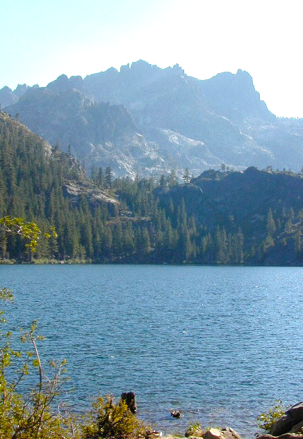
The granite spires of the Sierra Buttes (8591′) tower above both Upper & Lower Sardine, making for a glorious backdrop to these two lakes. This is a popular fishing lake with no swimming allowed. The water is so clear that at noon you can see to the bottom!fish

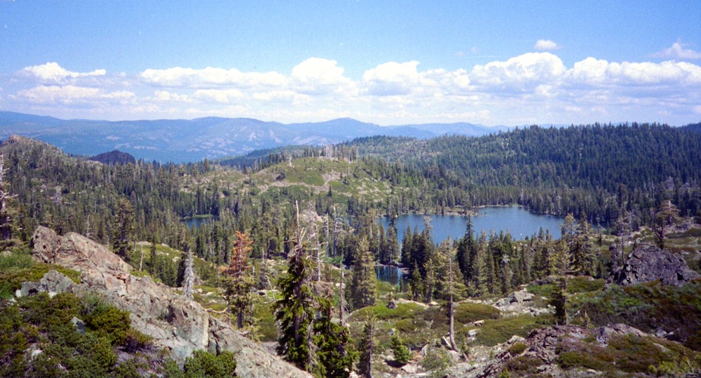
There are numerous, super-scenic, small lakes in this region and one trip here is not nearly enough. Total Escape rates this collection of small lakes up there w/ the ‘best hiking lakes’ in California. The Pacific Crest Trail runs through this awesome lakes area, which is located north of Truckee, east of Downieville.

backpacking
boating
camping
canoeing
fine dining
fishing
hiking
granite peaks
kayaking
mountain biking
off-roading
stargazing
waterfalls
wildflowers


snowmelt lake snowmelt lake snowmelt lake
high elevation means snow

Plumas Co Road #24 is the Gold Lake Road, also referred to as the Gold Lake Highway – which skirts the lakes, the buttes and connects Historic Gold Country Hwy 49 to Graeagle Golfing @ Hwy 89. SNOW CLOSES THIS ROAD, but the area remains open for winter recreation.camp

SARDINE LAKE ROAD, a paved turn off the main road. NFS Campground is located one mile from the shore at Lower Sardine. Sardine Lake Resort rents cabins and the restaurant serves dinners w/ lake view!

fishing lake Gold Country Lake hiking trailheads National Forest Service Developed Campground

Sardine Lake Campground

• Elevation: 5800′
• Number of Sites: 29
• Vehicle Accessibility: RV 22′
• Campsites Reservation: Yes
• Camp Fee: Yes
• Facilities: piped water, vault toilet
• Length of Stay: 14 Days
• Season: June – October
• Trailheads: Sierra Buttes & PCT

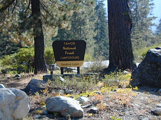
sardine campground sign

National Forest Service Rangers Quarters

Sardine Peak Lookout
SARDINE PEAK FIRE TOWER LOOKOUT (NFS)
Built in 1935, a three story enclosed tower with external stairs. 2019 – No longer available as an overnight rental. (elevation 8138′)

panoramic

Upper Sardine Lake California

Upper Sardine Lake: Takes only a short hike to get to. This is a pure glacial bowl; the rock plunges straight into the water, no beach at all. Great fishing; ice-cold swimming.

local contacts for this lake:

Sardine Lake Resort
530-862-1196

Row boat rentals on Sardine Lakecanoe
530-862-1196

Canoes rentals on nearby Packer Lake
530-862-1221

Plumas County Visitors Bureau:
800-326-2247

Plumas National Forest Rangers:
530-862-1368

Sierra County Visitors Bureau:
800-200-4949ranger

nearby towns:
Downieville, CA
Graeagle, CA
Sierra City, CA

nearby lakes:
Gold Lake
Sand Pond
Packer Lake

maps of the region:
Lakes Basin Map USDA
NatGeo Sierra Buttes Map
Plumas National Forest Map
Tahoe National Forest Map

California Locations

La Porte Road
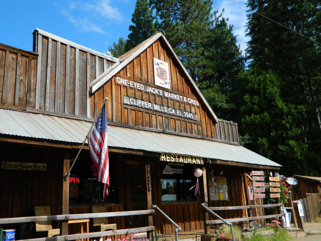
One Eyed Jacks Market & Grill – on La Porte Road. Clipper Mills, CA

Abundant on California Locations

califrepublic

depot desert
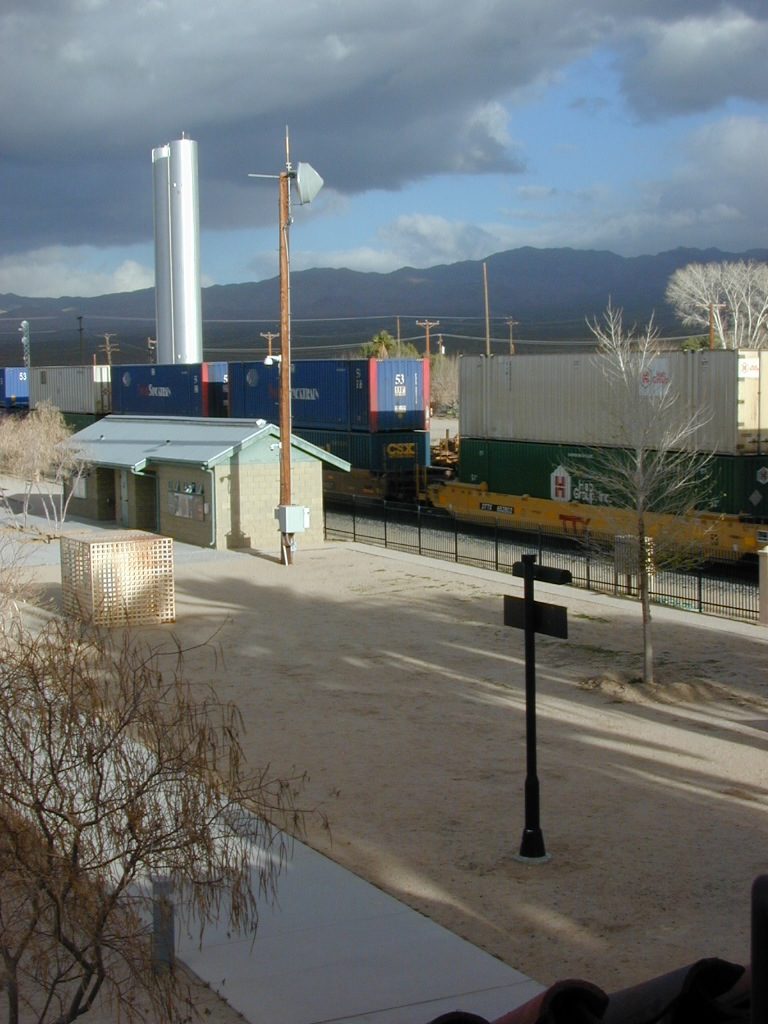
Kelso Depot, Mojave National Preserve

train

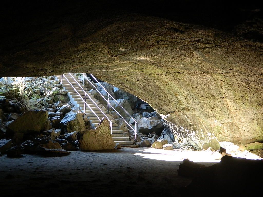
Subway Cave California

ranger

bridge kings
Kings River, California

hiker

kongsberg_town


Camp Help

California Camping Lakes

campTotal Escape loves camping so much that this web site literally has hundreds of pages on the topic, but we won’t overwhelm you with the list on this page. Below is a good cross section of what camping pages we have & what to expect.

camp hike

Camp Clueless an overview & great for beginners
Camp subset of the California camping world
Camping a growing photo journal of lakes & info
Campers Check List PDF print it & tape it to your gear
Where to Go! small towns, parks, forests, lakes, rivers
California Lakes List a growing journal of lakes, photos & info
Camp Clean be bear aware, keep a clean site
Eco Friendly escape to no rules (except a few)
Outdoor Gear best outdoor gear we recommend
Maps & GPS get lost & love it, but make sure you have backup
Camp Comforts luxury inspired, comfy camping review
Camp Potty backcountry camping rules & etiquette
Camp Fires backcountry campfires & permits
Fire Safety campfire rules, wildfires, restrictions
Firewood extensive list of all wood dealers
Poison Oak be careful, California is full of it
California Back Roads dirt roads, off the beaten universe
SUV 4×4 Camping get that dang sport utility dirty
Lassen Camping for Free, Mill Creek @ 172
Lassen Camping for Free on Mill Creek
site14
Heart Bar Campground, SoCal

RV

campfire

NFS

NPS

Your public lands: What’s the Difference?
California State Park , State Recreation Area, National Park, National Forest, BLM

California Firewood Dealers


taylorsvillecamp

Camping in California is a blast! Enjoy nature, sleep under the stars, exercise & save money while vacationing. We show you road trips geared around nature, all local, all outdoors, all California. Exploring dirt roads for secluded spots and small campgrounds, learning new survival skills in the back country and enjoy the wilderness without the tourist crowds. The average weekend trip can run you as little as $100.00. This includes fuel, groceries, firewood and maybe camp or park fees. Once purchased your basic camping gear – tent, sleeping bag and stove can last you decades if properly cared for.

Whiskeytown Lake

Or search by TAG, now on Total Escape!

Driving on the Beach

beach sunset

Driving on the Beach in California

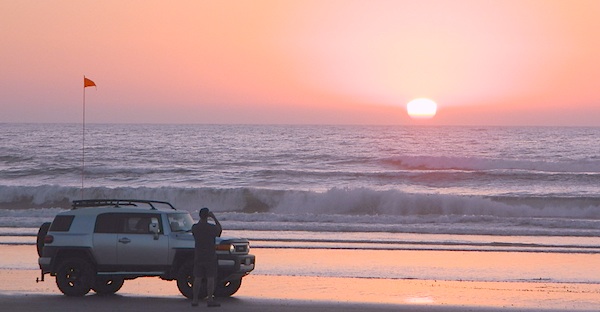
Gone are the days of ‘beach blanket bingo’ where film crews glamorized California – the beautiful people, the nice vehicles, the sport of surfing and the glorious beaches. There are very few places left on the California coast that you can actually drive a vehicle on the sand, right next to the ocean. The military bases, oil corporations and the utility companies have the front row seats to the Pacific genocide, and the rest of the population is restricted with extreme limited access.

Baja California has minimal regulations on coastal access with a car. No pavement, no signs, no cell phone signal, and no help for miles – something to consider if you get stuck south of the border in Mexico. Baja has numerous places to explore below Ensenada, but asking locals is always a favored approach. Pay attention to private property signs and always close the cattle gate (if you found it closed).

silverstrand

Southern California, no beaches allow vehicle traffic. San Diego offers a sliver of sand @ Silver Strand SB, which is a developed campground for motorhomes and car campers, located right on the beach south of Coronado, CA. Fiesta Island in Mission Bay, San Diego allows driving on sand and a favorite among active dogs, but not camping is allowed. In Los Angeles you can park a motorhome at a sandy, paved campground for a hefty overnight fee. Dockweiler Beach, right near the Chevron plant and LA sewage treatment facility. Sounds delightful, not.

Ventura & Santa Barbara Coastal Regions have many awesome State Beaches, but none allow vehicles on the sand.

AWD on the sand

Central Coast California:

  • Oceano SVRA – off road sand dunes and open camping on the beach. Day use or overnight camp fee required; near Pismo Beach, CA
  • Red, White and Blue Beach – nude beach w/ campground (now closed); north of Santa Cruz, CA

Northern California:
Lost Coast

  • Usal Beach Campground – redwood creeks and forests meets coast and cliffs. Camp fee for overnight use. Long dirt road access. No RVs!
  • Black Sands Beach (OHV 4×4 trail, now closed to all vehicles) near Shelter Cove, CA

chico couple

after-the-fun maintenance tip:

Salt water and sand is very corrosive to metal – which will rust your truck or car badly. Now that you’ve had fun on the beach, we remind you to clean the underneath of your vehicle ASAP. Spraying powerful hose in your wheel wells and all underneath the vehicle. You might need to lay on the ground and get wet to do this job properly. Some car wash places might be able to do this service for you, but it will cost ya.

Mammoth Pool Reservoir

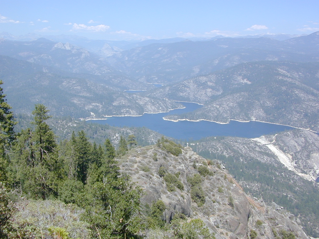
Mammoth Pool Lake, Sierra Nevada

San Joaquin River, Sierra National Forest

Mammoth Pool California

Awesome granite domes of the western Sierra, plus a scenic recreational lake that is only accessible half the year. Home to “Hells Half Acre” – Mammoth Pool Lake is one of the lesser known reservoirs in the western Sierra Nevada mountains. It’s kinda hard to get to although it is located on the border of Yosemite National Park. Area is totally surrounded by granite creeks, hiking trails, dirt roads and wilderness. This Mammoth Pool is an hours drive, way back behind Bass Lake (off Highway 41), and NOT located near Mammoth Lakes in the Eastern Sierra.

Camping just outside of Yosemite. Although the National Park boundary and trailheads are near by, accessing Yosemite Valley for day trips from this location will be quite tiresome and difficult, with long winding roads and over 2 hours drive one way. Better to camp near Bass Lake if you wanna be convenient to Yosemite NP.

Mammoth Pool
Sierra National Forest
3330′ elevation
123,000 acres

Sierra Vista Scenic Byway

(loop road, backcountry route closed in winter months)

Near the town of Oakhurst and Bass Lake California, get off the main highway and head over to the small town of North Fork. Take South Fork Road 225 (Italian Bar Rd) to Minarets Road (#81) also called Mammoth Road. Side trip paved Auberry Road (#222)  which skirts oak hills down to Redinger Lake Road. Hook up w/ Minarets Road (#81) that parallels the San Joaquin River on the forested ridge above, traveling 20 miles to  Numerous developed campgrounds and primitive camping sites off this route. Mammoth Pool is a signed right turn down Mammoth Pool Road, a steep road w/ a couple of campground near the lake shore and the only public boat launch is narrow, one at a time and it is not paved.

boatramp

The lake is closed to the public during May and the first half of June to allow migrating deer to swim across the reservoir. The reservoir is inaccessible following the first snowstorm, as the access road is not snowplowed.

rangerGrizzly Road, a paved route that leads deeper into the woods and connects over to BEASORE. Back on the main route (Road #81) on the far north end of the loop, a narrow, paved side route connects Clover Meadow Ranger Station and the impressive Granite Creek Campground. Plenty water and hiking trailheads that lead into Ansel Adams Wilderness and Yosemite National Park.

Back on the main route (Road #81) – the pavement becomes dirt in some sections and the route loops down to Beasore Road (#7), which traverses past meadows and dense forest, and heads back towards Bass Lake.Sierra Forest Map

backpacking, boating, camping
fishing, water ski, kayaking
sailing, swimming

backcountry side routes

NFS Campgrounds nearby –camp

hikers trailheadsMammoth Reservoir

  • Shake Flat
  • Logan Meadow
  • Hells Half Acre
  • South Fork
  • McCreary
  • Cassidy
  • Mammoth
  • Isberg
  • Fernandez
  • Norris
  • Jackass Lake

 towns nearby –


View Larger Map

Lakes Basin Recreation Area

Lakes Basin Area, California

Golden gems of California, a collection of alpine lakes on the north end of Historic Gold Country, North Yuba River, Northern Sierra Nevada

lake dunk
EAST of Downieville, CA

California’s Gold Lake and surrounding lakes; the granite spires of the Sierra Buttes and the creeks, waterfalls, headwaters of the Yuba River — total wild beauty. Steep, granite, river canyon from Downieville drive east on Highway 49 from Sierra City to Bassetts, a gasoline and market stop; they have a small hotel there too.

Historic Lodges

Take the left turn, north on to the Gold Lake Highway. The alpine and extremely scenic Lakes Basin Area consist of all small lakes in between Hwy 49 to Hwy 89, along GOLD LAKE HWY [Road S620] some maps read Road #24 or call this Gold Lake “Road” instead of highway. Snow closes in this route during winter months.

The impressive Lakes Basin Gold Lake Region is in the north part of Tahoe National Forest, on the border of Plumas National Forest. Plumas Eureka State Park is also nearby.

Hiking, Camping, Backpacking, Picnicking, Wildflowers, Stargazing, Fishing, Kayaking, XC Skiing, Snowmobiling

Lakes Basin Map

Lakes Basin Campground

California best lake destinations

lakes basin views

Lakes Basin Recreation Area

Sierra Buttes Map


1N02 – San Berdu NF

Heart Bar Camps

Heart Bar Camp: Forest Road #1N02 – San Bernardino National Forest

Heartbar Campground, Heart Bar Horse Camps, RV Dispersed Sites, Coon Creek Cabin. SE of Big Bear Lake; Hiking & Equestrian Trails

horse camp hikes primitive camp sites

Hwy 38 , the long way into Big Bear Lake, up thru Angelus Oaks CA. Heartbar Campground is a developed recreation area, right up front. 94 camp sites, plus the recreation all around. Big equestrian area.

HART BAR: Heart Bar is large pine valley w/ alpine meadows, great camping, San Gorgonio looms overhead with ridges of 10,000′ elevation.

Heart bar campsites

yellow post camps

free, dispersed, primitive camping
in Southern Cal

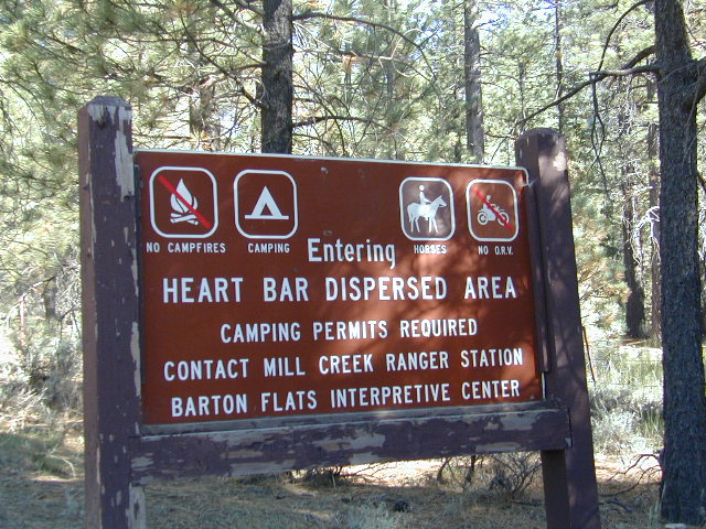
HEART BAR DISPERSED AREA

Forest Service Rd #1N02 – the dirt road is graded & maintained, about half the year. Primitive camp sites require permits; see local rangers. Many forest roads can close due to heavy snow, big rain or rock slides. Best traveled in the warmer months. Winter can be questionable with open gates and road access.

bigsign

site14

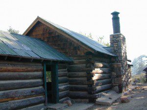
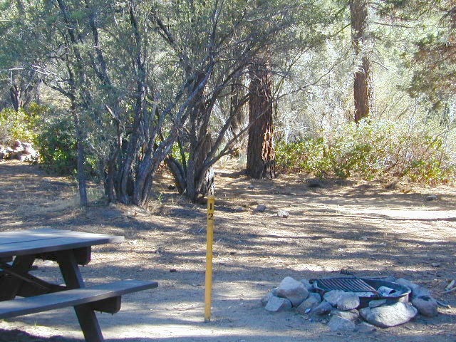
Large open sites, with tables & moderately level dirt access. Seen RV campers way back here. RV’s beyond 30′ are not recommended. At end of this 5 mile dirt route is a hiking trail to Big Morongo Canyon & a really neat historic place called the Coon Creek Cabin.

Coon Creek Cabin

Totally worth a visit, if you plan on driving to the end of the road – just for the heck of it. Cabin area can be reserved for small group camping in summer months.

COON CREEK CABIN reservations
909-794-4861

San Bernardino forest maps:

nearby mountain communities:

nearby cities:

  • Mentone, CA
  • Redlands, CA

site12


California Mountain Maps

The Mountains of California

Camping El Dorado NF, on the Consumnes River

If you know you wanna head up in elevation, higher altitudes – to the pine forests of California, but have no clue where to start, this page may be very helpful in determining your ultimate destination. We have hundreds of pages on adventures & locations throughout the golden state. We sell all California maps for outdoor recreation, hiking topos to off road routes.

Wanna camp under the stars this weekend – and avoid the crowds too? You will need a good back road map to find this awesome camp site, guaranteed. Need a hammock spot, small swimming hole & total seclusion? Or how about a large family camp w/ Sequoia grove nearby? Total Escape has something for every ones budget & lifestyle. See below for an extensive breakdown of California mountain regions.

#1
SoCal mountains have tighter restrictions on campfires, larger number of people camping in a smaller amount of space, minimal primitive camping options in the forests, more fees to access these lands.

#2
The Sierra Nevada mountains are the prime outdoor destination for many in the Central California region. High elevations w/ granite slabs to lower country reservoirs & riverside oak flats. Folks come from all over the world to visit parks and lakes within this mountain range. Indeed, 4 National Parks call the Sierras home: Lassen, Yosemite, Kings Canyon and Sequoia NP – not to mention the 10 National Forest and 15+ Wilderness Areas.

#3
You want big water? Cabins next to a prime fishing river or camping near lakes, creeks with dense forests, then you will have to drive to the mid Sierra or even NorCal to find ’em.

Wilderness maps

California Mountain Regions Defined –
find the details on specific region for California mountains

saabaru_forest
Mountain Home Sequoias

epic finds

Find little known parks, camps and forests within our vast California BACK ROADS data base. Below is a small sampling of our picturesque mountain pages, where you can find the best seclusion: hiking, camping, fishing, mountain biking trails, rivers, creeks and peaks.

NFSlogo

Sierra Buttes
The Sierra Buttes, Northern Sierra near Gold Lake

sierra National Forest map

Outdoor Recreation Maps of California:

inyohighroad
Inyo high roads, of the Eastern Sierra


Sacramento River Camping

The Sacramento River of Northern California

The main artery from the North; the Big River of California

Sac River California

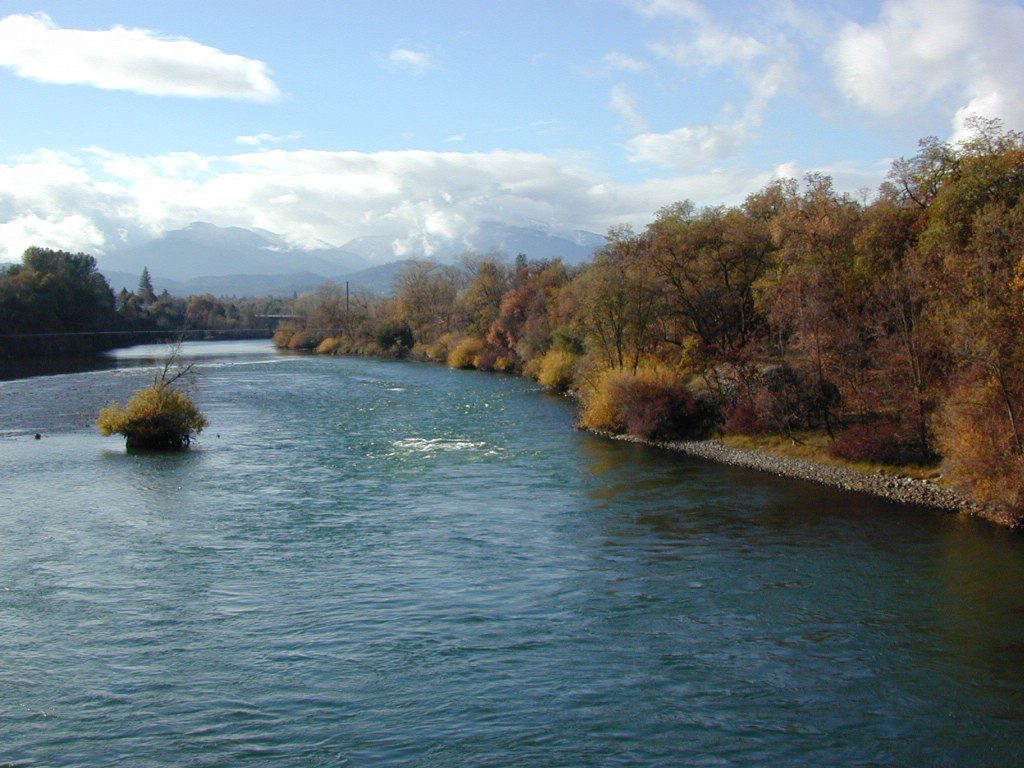
Mighty Mount Shasta snowmelt flows south, bound to meet the giant Lake Shasta, which merges with the Pit River and numerous other major waterways, becoming the big Sacramento River. Running right down the center of the North Sacramento Valley to merge into the California Delta. Shipping channel links the State Capital city of Sacramento with the San Francisco Bay and the Pacific Ocean. Agriculture and wildlife depend on this river heavily.

tent camping camp sites, campground camping, RV camps, dump stations, marinas, bait, gasoline, public boat ramps, boating, fishing, kayak rentals

Redding Winters

CAMPGROUND PARKS below listed from NORTH to SOUTH

JGW RV Park
Riverland Drive
South Redding, CA

Sacramento River RV Park
Riverland Drive
South Redding, CA

Wildlife Refuge
Sacramento River National Wildlife Refuge
Willows, CA
~ Camping is not permitted on the Sacramento NWR. Along the Sacramento River, camping is permitted on GRAVEL BARS for up to 7 days during a 30 day period. For waterfowl hunting, overnight stay is permitted in a vehicle or RV in designated areas. Tents are prohibited. No person may build or maintain fires except in portable gas stoves.

Orchards

Chico Area

Lake Red Bluff Recreation Area
Red Bluff, CA

Driftwood RV & Fishing Resort
@ Mill Creek Park
Los Molinos, CA

Hidden Harbor Marina & RV Park
Los Molinos, CA

River’s Rest Resort
Los Molinos, CA

Woodson Bridge RV Park
Corning, CA

State Parks
Woodson Bridge State Recreation Area
Historic State Park w/ Campground
South Avenue (A9)
Corning, CA

Bidwell-Sacramento River State Park
Chico, CA

Colusa Landing & RV
Butte Slough Road
Colusa, CA

State Parks
Colusa-Sacramento River State Recreation Area
Colusa SRA Camping

Camping Colusa
Tent Camping Colusa SRA

California Delta Region

State Parks
Brannan Island State Park
Rio Vista, CA

Sandy Beach Solano County Park
2333 Beach Drive
Rio Vista, CA

Vieira’s Resort
California Delta
Isleton, CA

State Parks
Old Sacramento State Historic Park
Downtown
Sacramento, CA

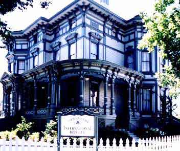
Sacramento Hostel, see more budget lodging

Central Valley CA

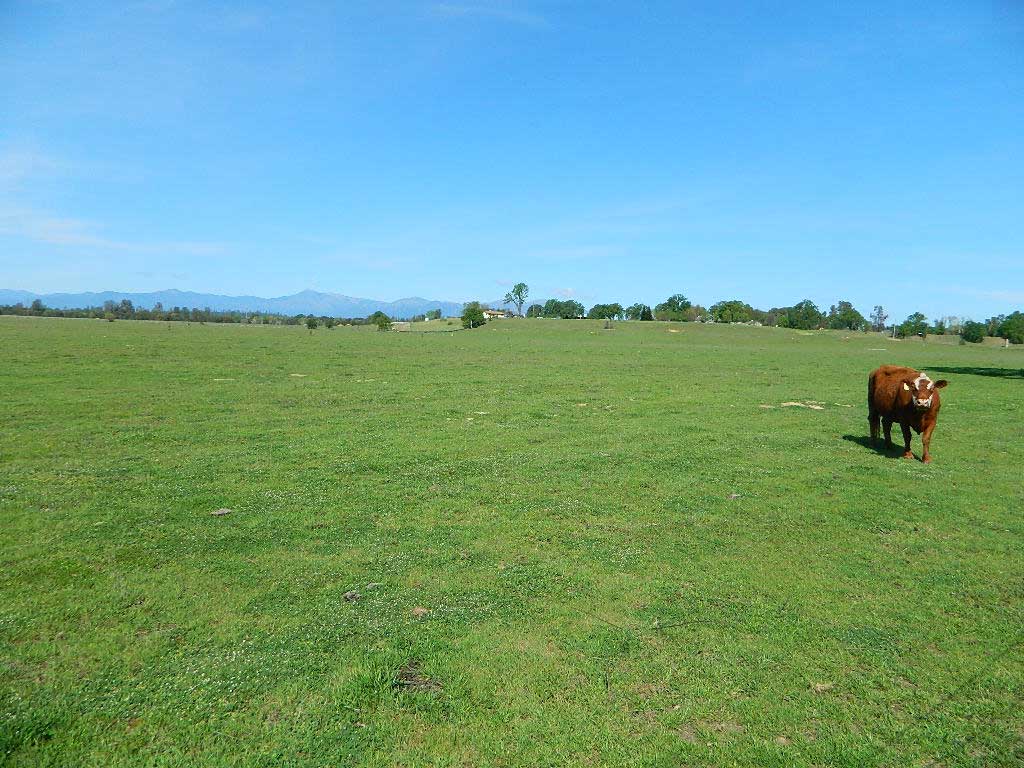
happyvalleycow
Happy Valley Cow

The Great Central Valley of California – the San Joaquin Valley (on the south side) & the Sacramento Valley (on the north) together make up some of the most fertile farmland on the whole West Coast. Agriculture thrives, water flows & smog settles.

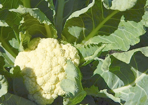
This huge valley, bordered by the Pacific Ocean on the west & the Sierra Nevada mountain range on the east side, is the one of the biggest farm land regions of the U.S. The food that feeds the world is grown right here in the Center of California. Vegetables, rice, fruits, citrus, garlic, onions, nuts, you name it.

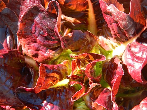
redlettuce

Central Valley residents can easily enjoy fresh produce year round. Centrally located they can access the neighboring Central Coast, Historic Gold Country, and the Sierra Nevada mountains, plus The City (San Francisco) is not too far away either.

Since the capital city of Sacto has a “port of entry”, the California Delta & surrounding waterways, make for excellent fishing, boating & camping.

Unfortunately this low lying area is one of the worse smog basins on the west coast. The upper & lower Central Valley see the worst of it, as wind pushes the emissions right up against the mountains. Triple digit temperatures are common throughout the summer months. The super heat just magnifies the poor quality of air.

cauliflower

California Country – CA Countryside Communities

California Central Valley Map

Counties, Cities & Towns of the San Joaquin Valley:
(south to north)

Kern County
Tulare County
Kings County
Madera County
Fresno County
Merced County
Stanislaus County
San Joaquin County
Solano County
Sacramento County
Yuba County
Sutter County
Yolo County
Colusa County
Glenn County
Butte County
Tehama County
Shasta County

Reservoirs

blue links lead to more info on camp services. camp RV Camping

Central Valley Parks & points of interest:

Henry W Coe State Park
George J. Hatfield State Recreation Area
Carnegie SVRA
Dos Reis County Park, San Joaquin River
San Juan Bautista State Historical Park
Hollister Hills OHV Park
Pinnacles National Monument
Hernandez Reservoir
Los Banos Creek Reservoir
Caswell Memorial State Park
Colonel Allensworth State Historic Park
Codorniz CampgroundEastman Lake
Kern National Wildlife Reserve
Kesterson National Wildlife Reserve
San Luis National Wildlife Reserve
Merced National Wildlife Reserve
Modesto Reservoir Regional Park
Honey Run Covered Bridge
Oroville Wildlife Area
Spenceville Wildlife Management & Recreation Area
Lake Oroville State Recreation Area
Mount Diablo State Park
Auburn State Recreation Area
Sherman Island Waterfowl Management Area
Grizzly Island Waterfowl Management Area
Cache Creek
Sutter National Wildlife Reserve
Gray Lodge Wildlife Area
Colusa Sacramento River State Recreation Area
Colusa National Wildlife Reserve
Delevan National Wildlife Reserve
Sacramento National Wildlife Reserve
Mill Creek Wilderness
Ishi Wilderness
Tehama State Wildlife Area
Red Bluff Recreation Area
Shasta-Trinity NRA
Whiskeytown Reservoir NRA

California Central Valley Lakes & Reservoirs

walk in camps

for more lakes in California, check the BIG LAKES LIST

Hiking Lake

Guide to Hiking Lakes in California

lakes Southern California

This is California – the beautiful, where millions flock on vacation. California is crowded: the population & tourists are only increasing each year. Thousands of people are looking for hiking mountains or better, a hiking lake – each weekend. Many are using the web for destinations, like the research you are doing right now. All folks seeking nature, water, cooler temps, fresh air & views. High Sierra, NorCal, SoCal Reservoirs, we list the best of these hiking lakes below.

Some of the lakes have mountaineering routes nearby; equestrian trails, regular hiking trails, campgrounds, some even have sorta level paved (granny) trails for biking, hiking & skating around.
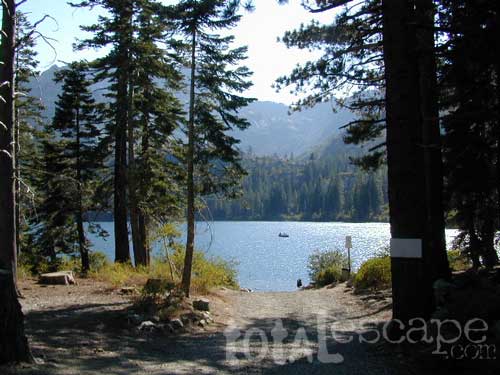
High elevation or alpine lakes can be accessed best in summer months. Mountain bike, backpack, horseback into these hidden treasures. With any Sierra Nevada destination, snow pack deep can be in certain seasons. Major Highways (Sierra Passes) can be closed into June or July, due to rock slides and late snow melt. Snow shoes, snowmobile or 4×4 vehicles may be needed to reach such lakes, any months OCT-MAY (fall to spring). Winter can come early & stay late at these higher elevations of California; Be prepared for true Wilderness experience.

But maybe you are just looking for some easy hiking, loop trails & picnic spots; Or perhaps an overnight stay near a lakeside camp w/ kayak rentals. California reservoirs to alpine lakes, we have a wide variety listed below.

This page contains links to some favorite lakes with hiking trails around the lake, along the shoreline or routes on ridge lines overlooking the lake. If no good lake page could be found, we’ve linked to some photos of the lake on Flickr.

Baja California:

SoCal:

Central California / Sierra Nevada:

NorCal:

Blackrock Reservoir in Sierra Nevada

Lakes California Map: check out all the maps we have for lakes in Cali

Tour of California

oldestrocks
Day hiking near Mammoth Lakes, CA

Tour of California, by Total Escape

DSCN1584

California has so much land and sheer beauty, it’s hard to wrap your mind around the vastness, much less the amazing and awe inspiring scenery. Snow skiing, kayaking, horseback, snowmobile, sleigh rides, dinner cruises, beer trains, wine tasting and so much more.

Drive California top to bottom (from Shasta to Baja) and you could be looking at months of prime vacation time. If you have that kinda luxury free time. If not, you might be looking for a local weekend of adventure, cave history or sightseeing. Total Escape has been featuring California tours for decades. We have something perfect just for you!
see camping & guided tours by Total Escape Adventures

Tour California

viewfromtent

Self Guided Tours of California:

viewfromtent

Looking for the CYCLING EVENT ‘Tour of California’?

kern

California Countryside Hikes

California Wine Country Hikes, Gold Country Hiking, Sierra Foothills, River Trails

DSCN1649

El Dorado Campgrounds

El Dorado Camping

Kirkwood Lake
Kirkwood Lake, California

El Dorado National Forest
Carson Pass Hwy 88, Ebbetts Pass Hwy 4, Gold Rush Country
Sierra Nevada Mountains, Alpine Lakes

campground elev spots veg toilet water notes
Airport Flat Campground 5300′ 16 vault no Ice House Reservoir
Azalea Cove Campground 4900′ 10 vault lake Union Valley Reservoir
Big Meadows Campground 5300′ 54 pines flush piped handicap access
Blue Lake Lower Camp 8100′ 16 vault piped PG&E; fish, boat, camp
Blue Lake Dam Upper 8200′ 25 vault piped PG&E; fish, boat, camp
Caples Lake Campground 7800′ 35 pines vault piped fishing lake
Capps Crossing Campground 5200′ 12 pines vault piped gold panning
China Flat Campground 4800′ 25 vault piped Silver Fork Rd
Dru Barner Campground 3200′ 16 flush piped equestrian trails
Gerle Creek Campground 5300′ 50 pines vault piped handicap access
Fashoda Campground 4900′ 30 vault piped handicap access
Hell Hole Campground 5200′ 10 vault piped walk-in
Upper Hell Hole Campground 4600′ 15 vault lake Hell Hole Reservoir
Ice House Reservoir Camp 5500′ 83 vault lake handicap access
Jones Fork Campground 4900′ 10 vault lake Union Valley Reservoir
Kirkwood Campground 7600′ 12 pines vault piped narrow road; fishing
Lone Rock Campground 4800′ 5 vault lake Union Valley Reservoir
Loon Lake Campground 6500′ 62 pines vault piped equestrian; group site too
Lovers Leap Campground 5800′ 21 pines vault piped rock climbing
Lumberyard Campground 6500′ 5 pines vault RV access
Middle Creek Campground 8200′ 5 pines vault piped fishing creek
Middle Fork Cosumnes River 6780′ 5 vault crk PG&E, swim, fish
Mokelumne River Camp 3200′ 8 vault crk swim
Moore Creek Campground 3200′ 8 vault crk swim
Northshore Campground 6378′ 15 vault lake Loon Lake Campground
Northwind Campground 5500′ 9 vault lake Ice House Reservoir
Pardoes Point Campground 5900′ 10 pit no Bear River Reservoir Rd
Pipi Campground 3900′ 51 pit no handicap access
Sand Flat Campground 3900′ 29 pit no fishing
Silver Fork Campground 5500′ 35 vault piped fishing
Silver Lake Campground 7200′ 62 pines vault piped boating lake
South Fork Campground 5200′ 17 vault piped fishing
South Shore Campground 5900′ 22 vault piped Bear River Reservoir
Strawberry Point Camp 5500′ 10 vault lake Ice House Reservoir
Stumpy Meadows Campgr 4400′ 10 vault lake handicap access
Sugar Pine Campground 6000′ 10 vault no boating
Sunset Campground 4900′ 131 vault piped boating
Wench Creek Campground 4900′ 100 vault crk boating
Wentworth Springs Camp 6200′ 8 vault crk 4WD recommended
West Point Campground 4875′ 8 vault lake Union Valley Reservoir
White Azalea Campground 3500′ 6 vault crk Mokelumne River
Wolf Creek Campground 8200′ 42 vault piped boating, fishing
Woods Lake Campground 4900′ 25 vault pump handicap access
Yellowjacket Campground 4900′ 40 vault piped boating, fishing

see more about El Dorado National Forest

waterfalls

nearby towns –

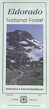
El Dorado Forest Maps –

California Camping Maps

California Campground Maps

Maps are the key to finding your very own slice of heaven in the Wilderness. Online map sources can barely get you to your city destination correctly, much less the remote waterfall you desire. You will need a real map for your adventure. A topographical map, with all the details, dirt roads & hiking trails. If you are seeking to stay away from the touristy crowds, this is the best possible place you can be…. on this site, searching for ways to make it happen – this weekend.

BACKPACKERS BACKPACKING MAPS –

maps of California
Mount Whitney, John Muir & way beyond the High Sierra. DanaMite has all the California Wilderness maps on the new map shop. Various brands and types of maps. Most are printed on waterproof plastic now & are tear-resistant.

CAR CAMPING MAPS –

El Dorado Camping
Planning on camping outside of the developed campgrounds & finding that perfect stream side spot without the reservation & the fees? Then you will need a free fire permit (from a ranger station), plus a good map of the forests & a vehicle capable of handling the rugged the back roads. Much of California is prone to wildfires, so make sure campfires are even allowed on the backroads, before you get out there. Call the “field rangers” for back road advice and current recommendations.

CALIFORNIA OFF ROAD MAPS –

Wanna take that 4×4 vehicle somewhere really special this season? Camp well beyond the masses, way down that dirt road. We have OHV maps for SoCal, the deserts & all the National Forest maps too.

CALIF CAMPGROUND MAPS –

Start your search on the perfect campground or camp site with the destination in mind. Mountains, deserts, coastal. Parks & forests all have their own maps with all nearby camp grounds listed. We feature all the National Forest maps, as well as some State Park & National Park maps

See all California topo, hiking, camping maps

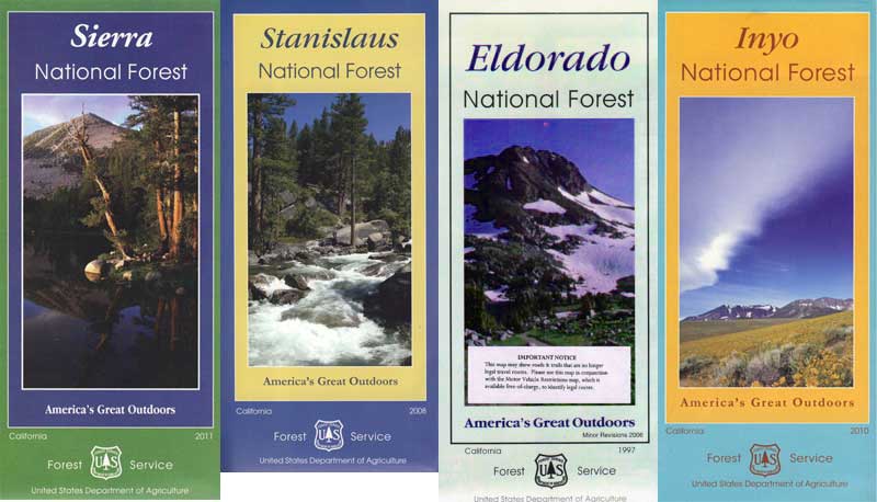
Sierra Nevada maps

coolsprings

  • California A to Z
  • California Camping
  • California Elevations
  • Camp Firewood
  • Camp Potty
  • RV camping deep in the Sierra
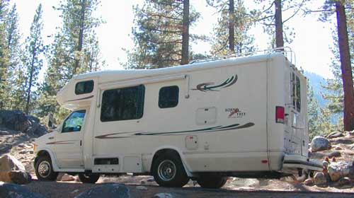
    RV camping at it's best in the Sierra; This rig found themselves deep in the alpine lush meadows with towering trees and a view and a very private camp site.
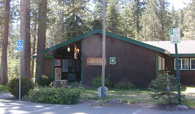
    Big Bend CA
    Big Bend Ranger Station, off I-80

    San Jacinto Wilderness

    Jacinto Maps

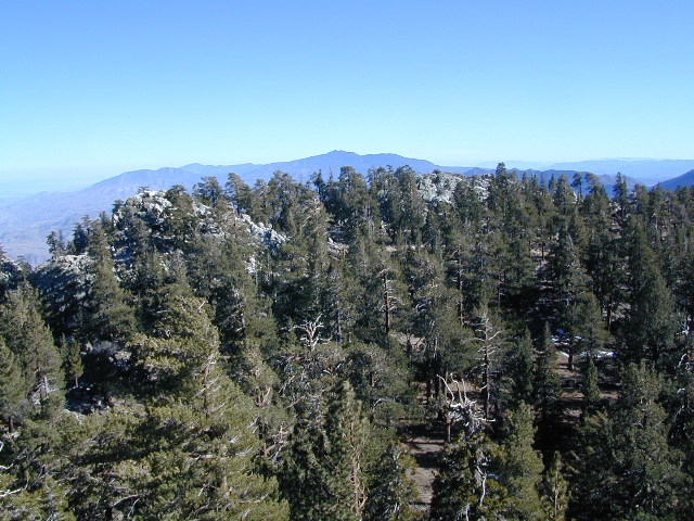
    Southern California / San Jacinto Wilderness Area / San Jacinto Mountain / Palm Springs Mountain Hike

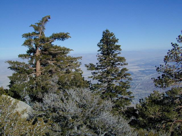
    The well-photographed snowy mountain backdrop behind the desert deluxe resort-land known as Palm Springs, Mount San Jacinto is the second tallest peak in Southern Cal.

    Mighty San Gorgonio peak, across to the east – on the other side of the valley, is the very highest mountain in this desert region. Granite Jacinto peak is located in between the mountains of Idyllwild and the low deserts of Palm Springs.

    32,248 acres

    Mount San Jacinto – 10,834′ elevation

    San Bernardino National Forest

    JACINTO PARK access –

    Palm Springs via Tram

    Book tickets online!

    Nearest towns:
    Idyllwild CA
    Pine Cove CA

    jacinto peak

    Day hikes, picnic in the forest, backpacking, horseback rodes w/ SUPER easy access via the fantastic Palm Spring Tram ride, up to 8000′ elevation.
    The San Jacinto Wilderness is managed by 2 different agencies: The National Forest Service and California Department of Parks & Recreation.

    If you are camping overnight in the forest, you must get your wilderness permit from the agency that administers the area where you plan to spend the night. Day-use permits can be obtained on the day of your trip by visiting one of the ranger stations below. Day-use permits issued by either agency are honored by both, except during the busy summer months when permits to enter the Wilderness via Devil’s Slide Trail can be obtained only from the National Forest Service.
    Camping permits can be obtained in advance by mail, in person, or online w/ PDF. National Forest Service accepts requests up to 90 days in advance; Mount San Jacinto State Park accepts them up to 56 days in advance. You can also get them on the day of your trip, if any are available at that time.


    USDA National Forest Service
    San Jacinto Ranger District
    54270 Pine Crest Ave
    Idyllwild, CA 92549
    951-659-2117

    Mount San Jacinto State Wilderness
    25905 Highway 243
    Idyllwild, CA 92549
    951-659-2607

    regional trail maps –

    San Jacinto Hiking Maps

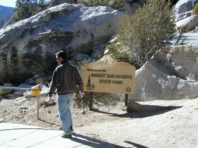
    Mount San Jacinto State Park is surrounded by San Jacinto Wilderness

    More San Jacinto Wilderness Info & Links –

    summitpost.org/jacinto-peak
    San Jacinto Peak Wiki
    USDA San Jacinto Wilderness
    Mount San Jacinto State Park

    California Off Road Areas

    4x4 Sierra

    The list below is of awesome California locations that do have off-road trails surrounding them. Some destinations listed are heavy use off-road – with OHV parks or camping nearby, while others are simply scenic dirt backroads or forest roads for easy driving. Topographic maps can be found for most areas, and should have all roads displayed, dirt and paved routes, as well as campgrounds, hiking trails and trailheads.

    SoCal 4x4 Big Bear

    This California “off road towns” list was originally part of the California Off Road Maps page, but it surely deserves it’s own unique post, since it is an ever expanding list. Ongoing.

    Searching for Off Road Parks inside California?

    Try these links –
    State Vehicular Recreation Areas
    California OHV Parks

    OHV Yields To All

    Borrego Valley

    Sierra Nevada Lakes

    Crystal Clear Faucherie

    California Sierra Lakes
    Sierra Lake Destinations
    Sierra Lake Campgrounds

    One of the best physical features about California is the amount of lakes and reservoirs it holds – in the mountains, foothills and the canyons, throughout the state.

    recreational lakes – Huge, dammed reservoirs to the secluded, alpine lakes in the high country and all the variations in between.

    bowman

    There are literally thousands of lakes located within the Sierra Nevada mountains and it would be ridiculous to try to list them all here. Many of them can only be reached by hiking into Wilderness.

    Most California lakes are popular and well known recreation spots, but others are secluded – if you drive far and long enough back on the dirt road. Some do not allow motorized boats and most do allow fishing and swimming. Some have campsites on the waters edge, while other camps are up on a hill over looking the lake.

    Below listed are some Sierra lakes that allow camping on the lakeshore or nearby. Most campgrounds are suitable for RVs, tent camping, and some may require 4 wheel drive to reach them. bass lake

    huntington lake

    Total Escape has several hundred more lakes & obscure camps listed under Almanor, Lakes Basin, Secluded Lakes, Yosemite Lakes, Tahoe & the Eastern Sierra Lakes page.

    Or just check the tag for Lakes & Reservoir

    sierra lakes

    Kern River Canyon

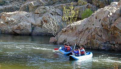
    Kern Spring Wildflowers

    Kern River Valley is one of the all time favorite Sierra Nevada destinations for SoCal escapees. First, it is the southern most ‘big river’ action for the Sierra range. The drive up from Los Angeles is easy access; only a coupe of hours. California Highway 178 leads from Bakersfield up the mountain to Lake Isabella (exit at 155 for Kernville destinations). The 178 continues east past the rural communities of Onyx, Canebrake, Weldon, and then on to the Northern Mojave desert & US Highway 395

    Second, Kern has an abundance of outdoor recreation, from fishing to boating, river rafting to kayaking, backpacking, mountain biking, rock climbing, horseback riding, hiking, camping, & soaking. Kernville is the “recreation headquarters” for the region, where you can find rafting outfitters, camping supplies and rental equipment.

    Kern Rafting

    Third, the mountain scenery is very diverse – with the dry shores of Lake Isabella, the granite lined Kern River, or the ridges with towering cedar forests, plenty sugar pines, plus a few Sequoia groves; Tons of dirt back roads to explore, granite & gorges for the rock climbers, prime wilderness access & several primitive hot springs.

    The whole area is encompassed by the Sequoia National Forest with wilderness areas to the North & East. Giant Sequoia National Monument is located along the Western Divide Hwy in the northern portion of the National Forest.

    campingFIND CAMPING along the Kern River

    camping Sequoia National ForestFIND ALL Campgrounds in the Kern River Canyon

    Kern River Valley communities include:

    Whether you’re an RVer wanting a developed campground near town, a fisherman needing a primitive site right on the river, or a backpacker seeking the high country, the Kern has a little bit of everything. High elevations beyond 8000′ ridge lines, or the lush Lower Kern under 2000′ with granite boulders lining, Kern has it. 4 wheelers will love the extensive network of dirt back roads, or maybe the OHV areas of Keysville. Lake Isabella has numerous oak lined campgrounds & boat rentals available too. Summer is not the best time to visit as the temperatures soar to 100 degrees & the city crowds come in full force to the Kern Valley. Springtime, the best season to visit runs from March to May, or Autumn cools for September to December.

  • SEQUOIA NATIONAL FOREST MAP
  • DOME LAND WILDERNESS MAP
  • GOLDEN TROUT WILDERNESS MAP
  • SOUTH SIERRA WILDERNESS MAP
  • KernWildflowers

    HoboCampground
    Hobo Campground in the Lower Kern Canyon

    California North Coast

    Northern CA Coast / Northern Coast of California

    The redwood north coast of California is very forested region with many rivers & streams running throughout. Fishing, kayaking, rafting, camping & backpacking are all superb here. The wilderness rules, as the majority of the landscape is wild & untouched by development. Mountain ranges near the north California coast span in elevation from 1000′ to 8000′. The Klamath River, Eel River & Trinity River are the predominate waterways in this region, with designated National Forest lining their canyons. There are over 10 parks along the coast that feature the redwood trees as the main attraction. The ones listed below are the inland, mountainous areas of Northern California.

    klamath river

    Mendocino National Forest

    Clear Lake, Kelseyville, Ukiah

    north coast CA

    Redwood National Park

    Klamath, Orick

    north coast CA

    Six Rivers National Forests

    north coast CA

    Smith River Recreation Area

    Crescent City, Orleans

    San Diego Lake

    sutherland Reservoir

    Lakes in San Diego CA
    San Diego County Lakes & Reservoirs

    Salton Sea, way out past Anza Borrego desert is indeed surreal, but nothing too spectacular

    Baja mountain camping at Laguna Hanson. Baja California Norte
    Lake Dixon in North County San Diego, near Escondido, CA

    Barrett Lake, near Tecate CA
    w/ plenty of off-roading trails @ Corral Canyon OHV Park

        • south of Interstate 8
        • steep slopes & granite boulders
        • vegetation is chaparral & coastal sage
        • elevations range – 1,600′ – 3,681′
        • wood fires prohibited
        • portable stoves permitted
        • groups limit – 15 people
        • visitor permit required
    hikes NFS camping

    Looking for alpine lakes, dense forest and dramatic mountain scenery? 

    Of course you are. That’s why half the population relocated to California, to endlessly search for summer vacation destinations in alpine bliss and stay overnight next to a secluded mountain lake. You’ll need to leave SoCal to find these beauties, but they are out there if you have the time to travel and spend a week enjoying one. Midweek, the fish are all yours. Check out our huge California Lake List.

    California Summer Camp

    Kids Summer Camps in California

    a child’s fondest memory, summer camp.

    California Camps

    Coppercreek Camp
    Williams Valley Rd
    Greenville, CA 95947
    800-350-0006
    Northern Sierra Nevada mountains

    Gold Arrow Camp
    60378 Highway 168
    Lakeshore, CA 93634
    800-554-2267
    Central Sierra Nevada mountains

    Kennolyn Camps
    8205 Glen Haven Road
    Soquel, CA 95073
    831-479-6714
    Santa Cruz mountains

    Mountain Meadow Ranch
    Susanville, CA 96130
    530-257-4419
    Northern Sierra California

    Plantation Farm Camp
    4285 Kruse Ranch Road
    Cazadero, CA 95421
    510-849-1084
    707-847-3494
    Coastal Sonoma redwoods

    Pine Springs Ranch
    58000 Apple Canyon Road
    Mountain Center, CA 92561
    951-659-4131
    Idyllwild SoCal mountains

    River Way Ranch Camp
    6450 Elwood Road
    Sanger, CA 93657
    800-821-2801
    559-787-2551
    Central Sierra, Kings Canyon

    Shaffer’s High Sierra Camp
    38782 Highway 49
    Sattley, CA 96124
    866-597-6617
    Gold Country Sierra foothills

    Skylake Yosemite Camp
    37976 Road 222
    Wishon, CA 93669
    559-642-3720
    Bass Lake in Sierra NF

    San Diego Lakes

    San Diego county has numerous recreational lakes, but only a few that allow overnight camping. Oak filled valleys and pine forests are nearby, but if you are seeking alpine lakes, surrounded by granite peaks and towering forests – then look to north for the Sierra Nevada mountains. Southern California landscape is nearly a desert terrain, with seasonal creeks and minimal rivers, so you won’t find lush greenery with natural lakes down here.

    lakes San Diego

    cleveland National Forest map

    Agua Tibia Wilderness

    Agua Tibia Wilderness Area

    • 15,900 acres
    • chaparral & oak at lower elevations
    • pine & fir forest at high elevations
    • elevations range 1,700′ – ­5,000′
    • 25 miles of trail
    • summer temperatures exceed 100°F
    • occasional snow in winter
    • best in winter through spring
    • wood fires prohibited
    • portable stoves permitted
    • water scarce
    • no overnight use of pack or saddle stock
    • groups limit – 15 people
    • visitor permits required
    Agua Tibia lies right on the RIVERSIDE
    & SAN DIEGO COUNTY border

    Cleveland National Forest
    Palomar Ranger District
    1634 Black Canyon Road
    Ramona, CA 92065
    760-788-0250

    Agua Tibia Map

    Agua Tibia Trailhead

    This is the trailhead for Agua Tibia Wilderness located at Dripping Springs Campground on Highway 79, near Temecula CA.

    See more: Agua Tibia Mountain hike details

    hiking SoCal

    Angeles Campgrounds

    Camping Los Angeles – Angeles Crest Camping

    Angeles Crest Hwy CA 2

    campground elev spots veg toilet water notes
    Appletree Campground 6,200′ 8 pines vault piped Big Pines Hwy
    Basin Campground 3,400′ 15 CLOSED
    Bear Campground 5,200′ 15 vault no
    Big Rock Campground 5,000′ 8 vault crk sm RV, 4WD
    Blue Ridge Campground 8,000′ 8 pines vault no May-Nov, sm RV
    Buckhorn Campground 6300′ 40 pines vault no May-Nov, sm RV
    Cabin Flat Campground 5,300′ 12 vault no CLOSED
    Cienaga Campground 2,100′ 12 oaks vault no May-Dec
    Coldbrook Campground 3,350′ 22 vault piped sm RV
    Cottonwood Campground 2,600′ 22 vault no
    Guffy Campground 8,300′ 6 vault no May-Nov, 4WD
    Horse Flats Campground 5,700′ 25 pines vault no April-Nov
    Jackson Lake Campgr 6,100′ 8 pines vault summer May-Dec
    Live Oak Campground 2,000′ 7 oak CLOSED
    Manker Flats Campground 6,000′ 21 flush piped sm RV
    Messenger Flats Camp 5,500′ 10 pines vault no Corrals, April-Nov
    Millard Campground 1,900′ 5 oaks vault no Altadena, Chaney Trail
    Monte Cristo Camp 3,600′ 19 oaks vault piped RV, Hwy 2, N3
    Mount Pacifico 7,100′ 7 pines vault no May-Nov
    Mountain Oak 6,200′ 17 oak flush piped May-Nov
    Peavine Campground 6,100′ 4 vault piped Big Pines Hwy
    Prospect Campground 2,100′ 22 CLOSED
    Rocky Point Camp 3,400′ 3 vault summer
    Sage Campground 3,400′ 4 vault no Cheseboro Rd
    Sawmill Campground 5,200′ 8 vault no sm RV
    Soledad Campground 2,000′ 6 CLOSED
    South Fork 4,500′ 21 oaks vault no May-Nov, sm RV
    Spring Camp 4,700′ 3 vault no Rincon-Shortcut Route
    Spunky Campground 3,300′ 10 vault no
    Streamside Campground 2,500′ 9 vault no poison oak
    Sycamore Flats 4,200′ 11 vault summer sm RV
    Upper Shake 4,400′ 18 vault no May-Dec.
    Zuni Campground 1,700′ 10 vault no

    Chilao Campground

    tunnel angeles crest

    nearby towns –

    Angeles Maps – hiking, OHV & mountain biking –

    Mount Charleston Vegas

    Mt Charleston Las Vegas NV

    Mount Charleston Las Vegas NV

    Mount Charleston Resort
    Mount Charleston Resort

    Mt Charleston cabin rentals, vacation homes and 2 mountain lodges are located near the Spring Mountain Recreation Area, just outside of the Sin City limits. The tall alpine mountains behind RedRock SP, NW of Las Vegas, Nevada are virtually unknown by many non-locals. Great hiking, mountain biking, camping and waterfalls, plus a small seasonal ski and snowboard resort are some of the highlights. Imagine snowboarding Vegas!

    Mt Charleston Hikes
    Red Rock Canyon Map

    Las Vegas Forest Hikes

    Vegas means “the meadows”, but it sure seems more like desert these days. The forest is just up the hill, past the red rock and tract homes, well past the Joshua Trees. Conifer forests, snow and high elevation, less than an hours drive from the Vegas strip. Toiyabe – Humboldt NF is this public land managed by the US National Forest system. Toiyabe also covers Eastern Sierra slopes. Get California Toiyabe NF maps. Get the Nevada State Park map here!

    Camping Vegas

    Due to extreme dry conditions and wildfire danger no open camp fires are allowed from mid-April to mid-November in the Mount Charleston region. Several developed campgrounds, plus a primitive (dirt road) camp area off Lee Canyon. Cabin rentals are located at the Charleston Lodge.

    • Vegas trails
    • Hiking in Vegas
    • Mount Charleston skiing
    • Mt Charleston hikes