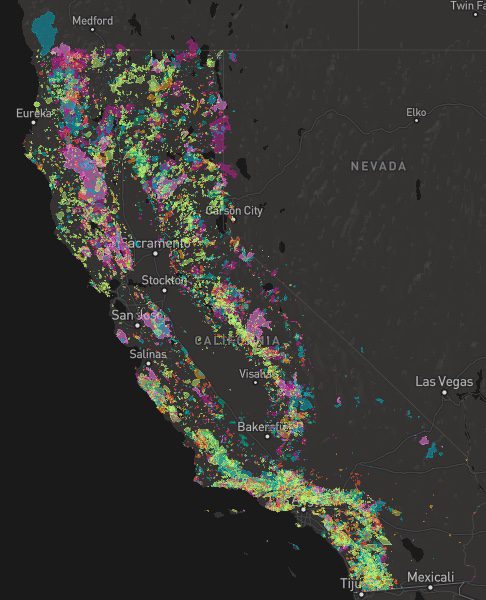
A list of recent wildfires in California, with counties and acres affected. Forest fires listed here are the ones that have affected public lands – like National Forests, National Parks, State Parks and BLM land.
On public lands you may see signs like –
Warning: Entering a Burned Area Potential Hazards include:
LOOSE ROCKS
FALLING TREES + LIMBS
STUMP HOLES
FLASH FLOODING
DEBRIS FLOWS
>>> Entering a CLOSED FOREST with burn scar is a crime and can result in jail time. Check USFS forests web site for current closures.
Forest Fires listed below are alphabetical. Green & blue links to more data on these wildfires.
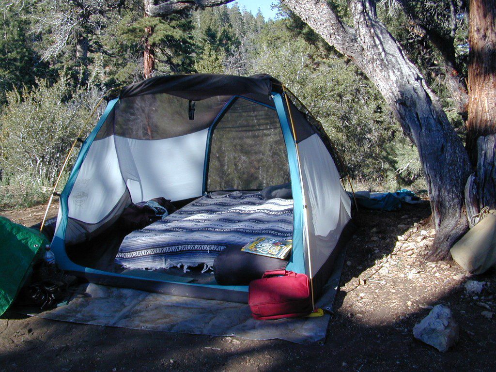
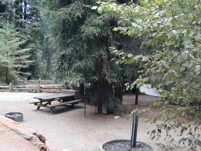
Samuel P Taylor State Park
Samuel P Taylor Campground
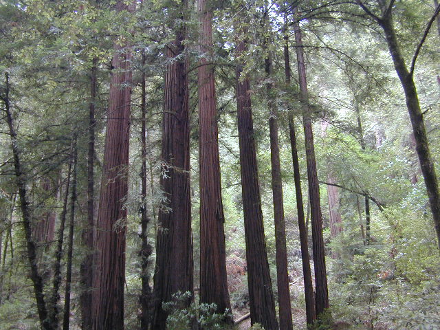
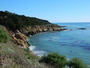
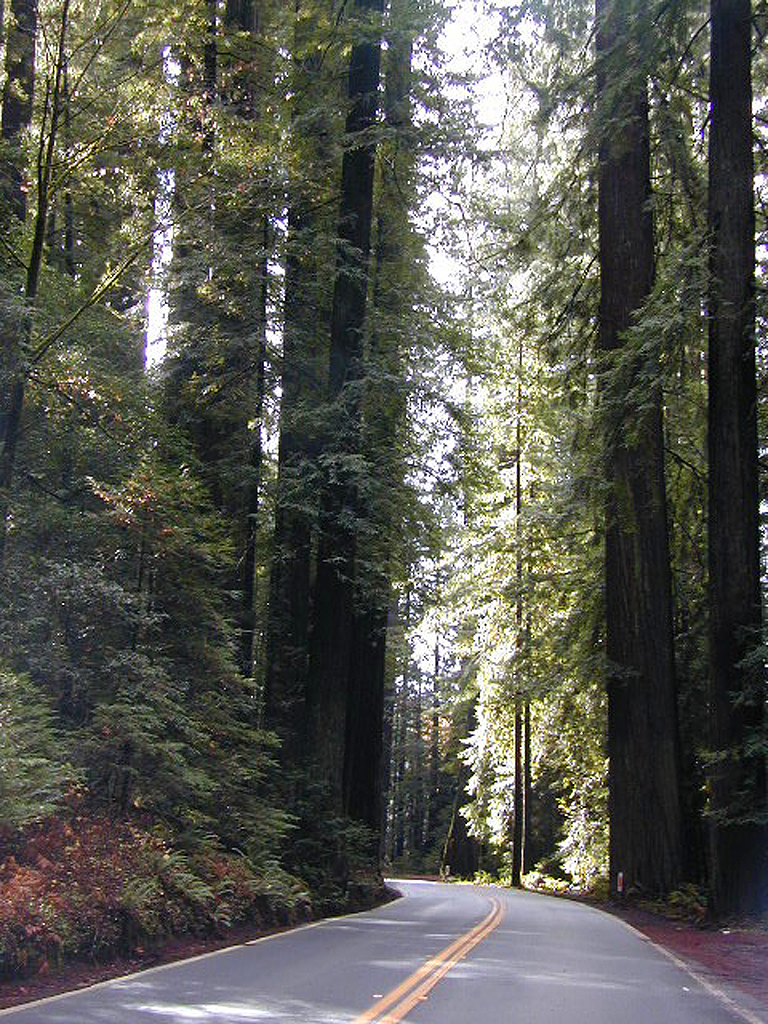
SamP is one of the large redwood parks north of San Francisco, CA. Coastal redwoods can be found in the mountains above Santa Cruz, as well as on the Point Reyes peninsula in Marin County. Hiking in the region is amazing w/ enchanted forests, dramatic fog, waterfalls, numerous trails in every direction.
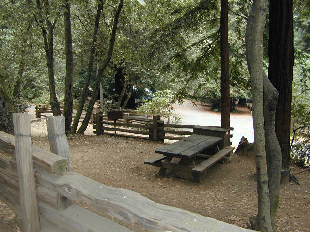
One of the best developed campgrounds in the region for car camping and RV campers.
Consisting of several camp loops, a group camp site, a horse camp and hike-in or bike-in camp sites. There are even cabin rentals in the park. This park has several camp sites that can accommodate visitors with disabilities. Reservations are highly recommended, especially during summer months. Be prepared to pay hefty fees for overnight use.
Max RV Camper Length: 31′
Max Trailer Length: 27′
Creekside Loop
Orchard Hill Loop
Madrone Group Site
Madrone Cabins
Horse Camp
Hike & Bike in Sites
(8 person max)
Samuel P Taylor State Park
59 developed campsites
+ cabin rentals
Sir Francis Drake Boulevard
415-488-9897
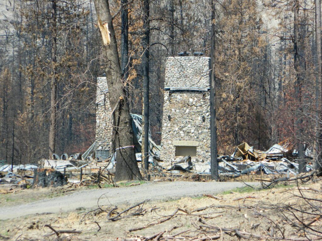
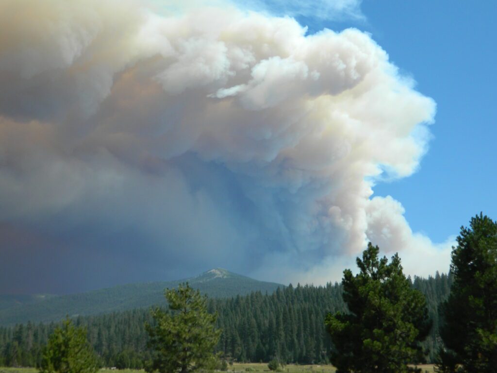
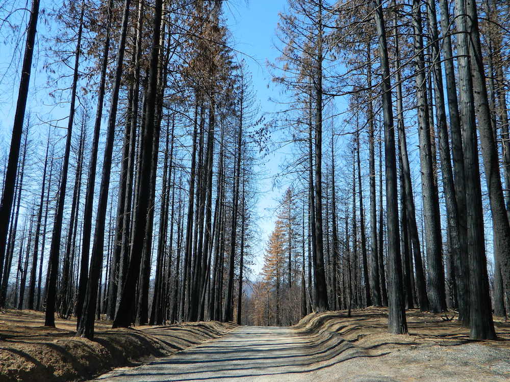
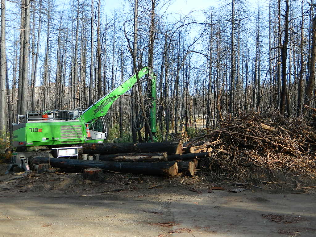
Twenty five years ago, when I began this outdoor web site for California, did I ever imagine ‘times like these’ – where we would be held up inside our homes during summer, as annual wildfires destroyed our vast and beautiful forests. Frightened to breathe the toxic, smokey air outside. Saddened by news of yet another town or historic structure burning to the ground. Checking the destruction daily online, in hopes of more containment, fresh photos or any good report.
Now I fear Total Escape may become photographic documentation of how beautiful California once was.
wildfire closures
Most California National Forest are currently closed!
Lassen Volcanic National Park is CLOSED due to damages from the Dixie Fire.
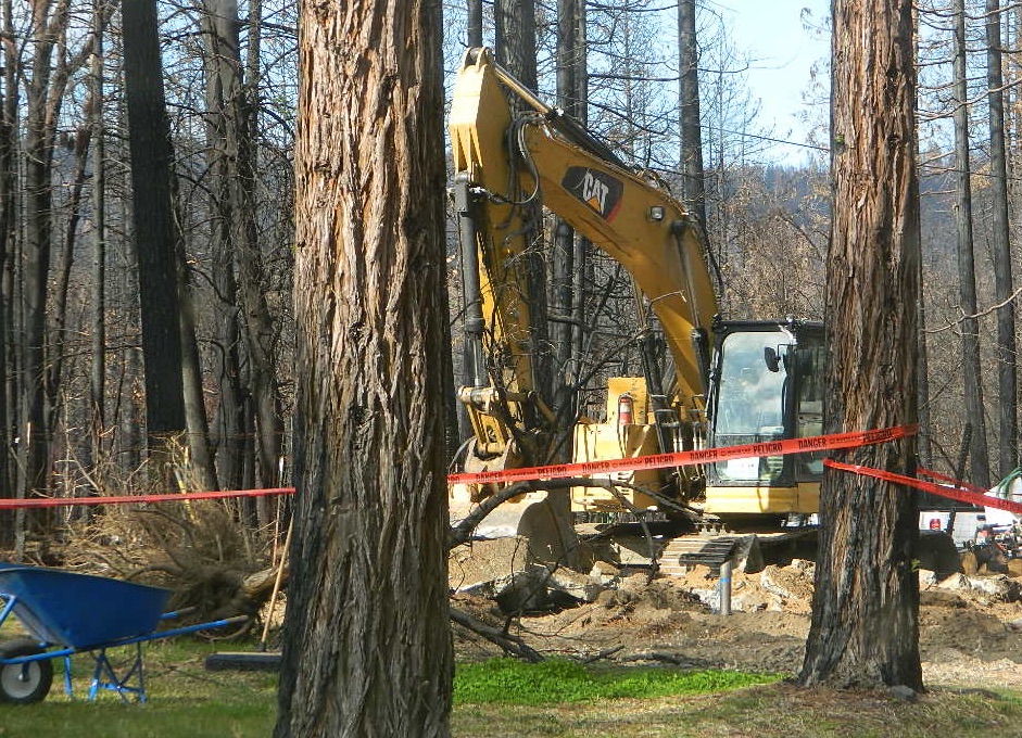
In case you missed it: 2020 was the worst year for wildland fires in California history, but 2021 is shaping up to be just as bad. Many forests, roads, trails, campgrounds and parks listed below have been closed to the public for the 2021 season, and possibly longer.
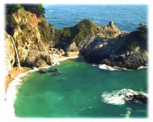
BIG SUR COAST Julia Pfeiffer Burns SP
Prewitt Ridge
Nacimiento Road
Lucia Restaurant
Tassajara Canyon
SANTA CRUZ MOUNTAINS Big Basin Redwoods SP
Butano Redwoods SP
Boulder Creek, CA
Expect that campfire rules will be tighter in the future, overall. Campfires will likely be restricted to ‘only inside developed campgrounds’. Or only allowed during the wet season on the backroads or in the backcountry.
My Front Yard (literally)
*Unfortunately, this is not a complete list of all the closures inside California parks and forests. I am adding more to this list, as more places burn. This page is a work in progress for autumn 2021
State Parks, State Forests, State Recreation Area, National Parks, National Monuments, National Forests – What is the Difference?
Forest, Park, Reserve, Monument, Recreation Area, BLM, Nature Preserve… arghh!
Don’t let all the park and forest names confuse you. It is all California and it is your public land! No bikes on trails, No gathering wood, No dogs here, No camping there; Now what?
Below is our overview graph for all California parks and forests – the basic concepts & the rules broken down for anyone to understand. Permits may be needed in certain areas. Only the government officials understand the true nature of all the ridiculous red tape.
Back country lands very protected from roads and human impact. Off limits to vehicles & mountain bikes. Only accessible by backpacking, hiking or horseback. Endangered species; Hard to reach terrains in the High Sierra. Overnight visits may require a wilderness permit.
Federal lands are national parks, preserves & monuments; highly regarded as some of the most scenic in world & protected. Very popular places and crowds often in summer. Limited use areas for camping & recreation. No mountain biking on trails. No dogs on trails. Try off-season. Drive thru entrance fees.
NM: California
National Monument
Located within the National Park System & more specific to a region. Historic buildings, geological features and deserts ruins qualify. Some National Monuments become National Parks. Many locations have entrance fees.
NRA: National Recreation Area
Located within the National Park System & somewhat specific to a waterways, coastlines, lakes and reservoirs. Some locations have entrance fees.
NSA:
National Scenic Area National Seashore
Located within the National Park System & is basically scenic area worth preserving. Usually no entrance fees.
Areas of forest lands throughout state; some surround the National Parks. 18 national forests make up 20 million acres of federal land. Multiple use areas: snow skiing, mining, grazing, off-roading. OHV & SVRA Tons of small campgrounds, recreation & primitive spots for real seclusion. Best bet for finding a spot away from the crowds. Get a free fire permit & camp on back roads. No entrance fees, some parking or day use fees; SoCal requires an Adventure Pass.
California Department of Parks & Recreation manages more than 260 parks. These smaller parks are located near cities with historical parks, as well as remote wild state land & coastal beaches. Entrance fees, day use, picnic and some have campgrounds. State Parks charge fees for day use, parking and overnight camping.
California SF: California State Forest
California Demonstration Forests, areas to be protected. Redwoods & Sequoia Groves; fragile eco-systems. Handle with care. May charge entrance fee or day use fee.
California SRA:
State Recreation Areas
California Department of Parks and Recreation. Lakes, Reservoirs, Rivers. Many have boat rentals and active marina. Recreation lakes charge entrance, day use, parking or boat launch fees.
Off Roading folks and dirt bikes can have their fun wheelin. Lands set aside for OHV use; dune buggies, quads & 4×4 enthusiasts. Most in desert regions; forest lands. Developed campgrounds large enough to accommodate RVs and trailers. Fees may apply in these off-road areas for day use or camping.
California County Parks
Desert hot springs, oak foothills and campgrounds, local hills w/ hikes, parks close to urban regions. Back roads & rural land protected from freeways & development. May require parking or entrance fees. Find these listed on the California A-Z town pages
City Parks in California
Urban Parks & Recreation, inside the city limits. Usually no entrance fees. Find these on California A-Z town pages
All public lands that do not fall into the above categories. Little to no fees for day use, recreation or overnight camping. Plenty of desert & off roading areas. Some forest lands, certain lakes. Small campgrounds or open camping allowed. Fees may apply in developed campgrounds. Camp overnight almost anywhere out here for free, with a ranger issuedcamp fire permit.
Sequoia – which one?
Sequoia National Park
Sequoia National Forest
Giant Sequoia National Monument
Imagine that the Southern Sierra mountains is home to 3 different public parks named Sequoia. Yep, it’s true. Sequoia National Park, Sequoia National Forest, and Giant Sequoia National Monument. Other parks that have Sequoia groves are – Mountain Home State Forest, Calaveras Big Trees State Park, as well as Yosemite National Park.
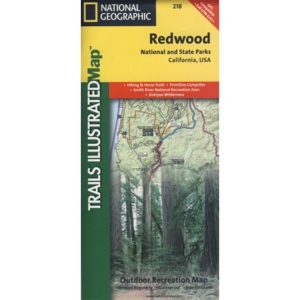
As far as the Coastal Redwoods, most are included under State Parks. Find these parks on the Central Coast Big Sur and Santa Cruz mountains, plus Marin County, and all along the north coast US Hwy 101 from Mendocino to the Oregon border. Numerous redwoods parks are located along rivers.
The super scenic Big Sur coastline is home to Julia Pfieffer Burns State Park and to the similarly named Pfieffer Big Sur State Park. Leave it to park personnel, state officials or the non-locals to create such a confusing naming system within our most-visited state.
Lassen Camping near a creek in Northern California
California Outdoor Recreation:
All parks, forests, preserves, monuments, public lands, lakes, rivers, wilderness, historical sites and museums can be found listed separately on our super duper local A-Z town pages
Big Bear – San Bernardino National Forest Camping & Campgrounds
areas include:
Big Bear Lake, Fawnskin, San Gorgonio, Lake Arrowhead, Forest Falls, Green Valley Lake & Idyllwild
Listed below are all the San Bernardino National Forest campgrounds, public lands for outdoor recreation. SoCal campground reservations can be booked online with the linked campsites below.
New to California? Never camped before? Haven’t been out in years? No idea of where to start? Total Escape is here to help with all your camping questions, local destinations and share tips; Introducing you to the big adventure in inexpensive vacationing, primarily outdoors. Find rural, remote locations, ranches, small towns, rivers, lakes, creeks, well away from the crowds. Get outta town more often for less money.
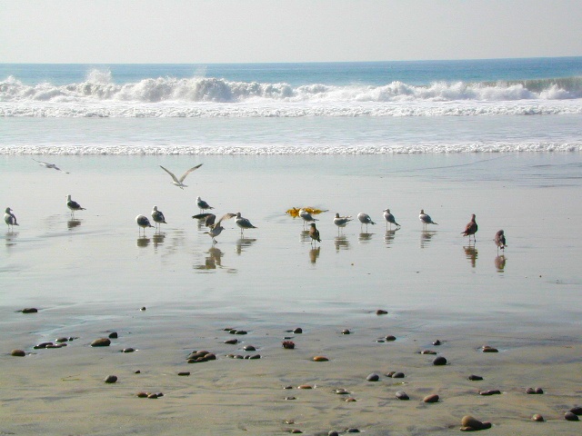
One of the most visited coastlines in the world, San Francisco – where 2 peninsulas almost meet – at the mouth of the “hidden bay”.
This is the Golden Gate to California and the Wild West.
So, you wanna escape the tourist masses… and camp out, overlooking an amazing place?
(put on your hiking boots)
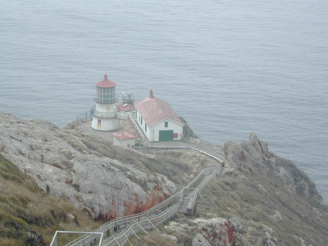
Pt Reyes Lighthouse
Nope, the Lighthouse doesn’t have a campground! There are no camping facilities at Muir Woods National Monument, nor Muir Beach. No camping at Stinson Beach, nor Bolinas.
The Tule Elk Reserve has no camping at all. Tomales Bay State Park no longer has car camping or RV camping available; hike-in or boat-in
camping, maybe.
What is available for campground camping on “the Point” is listed below, with phone numbers and links for more info.
Cycling, hiking, backpacking, mountain biking, kayaking and boating are all popular outdoor recreation activities.
Small towns located on the Point Reyes peninsula do have a few private campgrounds, some of which can accommodate motorhomes. Follow towns links for those.
There are no RV parks, camper trailers or motorhomes allowed in campgrounds on the steep coastal region of Point Reyes. Most of the narrow, winding roads are forbidden for motorhome travels. No shoulder, no guard rails, on many curvy roads. Great viewpoints are best when you STOP to look, off the roadway.
The lands surrounding Las Vegas are NOT managed by the NPS, National Park Service – but Lake Mead is considered a National Recreation Area. Hoover Dam is located at the south end of Lake Mead, then the Colorado river connects further down stream to Lake Mohave.
Tourist are no longer burdened by the constant flow of traffic over the dam, because a beautiful, new bypass bridge has been recently built above the dam.
Boating, kayaking, fishing, hiking, off-roading and camping are popular attractions at both the reservoir lakes. Mohave Lake is lesser known and therefore, less crowded. 4×4 may be need to reach certain coves at Mohave.
Most of the public lands in this Vegas desert are managed by BLM or the USDA National Forests. The Great Basin National Park is located in central Nevada, nearly 300 miles NW of the city of Las Vegas.
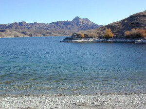
Lake Mohave on border of California, NV & AZ
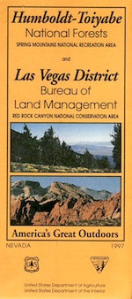
Red Rock Vegas
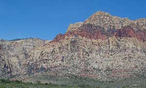
Some folks know these rock walls as Red Rock Canyon, or Red Rock Park near Vegas – but the official name now ‘Red Rock Canyon National Conservation Area’ and the lands are managed by the BLM.
The closest red rock park to Las Vegas, this one is located at the far west end of Charleston Blvd. – an easy exit to find off the freeway Interstate 15. Day hikes, rock climbing, mountain biking, picnics and a large BLM campground. This desert range can get very windy and the only campground around is poorly located along the busy highway, on a ridge. Bring good tent stakes and be prepared for serious wind. Better camping options can be found over at the higher elevation Mount Charleston, see below.
Vegas Valley of Fire
This beautiful desert park is 60 miles N of Vegas and well worth the day trip to explore native petroglyphs, hike among red rocks, sandy washes and just relax to take in breathtaking vistas. See more about the Valley of Fire State Park
Mount Charleston Camping
Several developed campgrounds are available in a pine forest setting. Some may charge a nightly fee, or a day use fee. Mary Jane Falls is well worth the hike. Two lodges grace this mountains, The Mount Charleston Resort is the big log and stone cabin along a straight away on Kyle Canyon Road #157. The Mount Charleston Lodge is above at 7717′ elevation and has a popular restaurant and nice modern mountain cabin rentals.
If you know you wanna head up in elevation, higher altitudes – to the pine forests of California, but have no clue where to start, this page may be very helpful in determining your ultimate destination. We have hundreds of pages on adventures & locations throughout the golden state. We sell all California maps for outdoor recreation, hiking topos to off road routes.
Wanna camp under the stars this weekend – and avoid the crowds too? You will need a good back road map to find this awesome camp site, guaranteed. Need a hammock spot, small swimming hole & total seclusion? Or how about a large family camp w/ Sequoia grove nearby? Total Escape has something for every ones budget & lifestyle. See below for an extensive breakdown of California mountain regions.
#1 SoCal mountains have tighter restrictions on campfires, larger number of people camping in a smaller amount of space, minimal primitive camping options in the forests, more fees to access these lands.
#2
The Sierra Nevada mountains are the prime outdoor destination for many in the Central California region. High elevations w/ granite slabs to lower country reservoirs & riverside oak flats. Folks come from all over the world to visit parks and lakes within this mountain range. Indeed, 4 National Parks call the Sierras home: Lassen, Yosemite, Kings Canyon and Sequoia NP – not to mention the 10 National Forest and 15+ Wilderness Areas.
#3
You want big water? Cabins next to a prime fishing river or camping near lakes, creeks with dense forests, then you will have to drive to the mid Sierra or even NorCal to find ’em.
California Mountain Regions Defined –
find the details on specific region for California mountains
Find little known parks, camps and forests within our vast California BACK ROADS data base. Below is a small sampling of our picturesque mountain pages, where you can find the best seclusion: hiking, camping, fishing, mountain biking trails, rivers, creeks and peaks.
Although Sequoia trees can be found in the southern Sierra, the National Park is located more in the mid-Sierra. From the Kern River to Kings River, the southern stretch of Sierra Nevada is home to the southern most Sequoia groves, the longest river in California, and the granite dome wonderlands that overlook the Mojave Desert.
The Tehachapi range is on the tail end to the south w/ Hwy 58, while Kings Canyon Park borders more High Sierra Wilderness to the north end. If you are heading up from SoCal, this is the most accessible portion of the Sierra Nevada range.
While the Kern River Valley can get hot in the summer months, the rivers, streams & higher elevations surrounding it, make it a prime destination for folks seeking cooler mountain breezes, creeks and dark skies. Springtime is one of the best times of year to visit the Kern River. While summer is best for the high wilderness areas, since the snow usually doesn’t melt until May.
Mountain Home State Forest is a little known haven for campers & hikers seeking less-crowded Sequoia groves. With the Tule River, fishing ponds, waterfalls, swimming holes & meadows, this place provides a nice solitude to the busier parks to the north. Balch Park is a county park w/ large campground, that sits adjacent to Mountain Home Forest.
Both National Parks (Seqouia & Kings) are both busy in summer & tourists can be seen lining the main road, Highway 198. Crystal Cave & Boyden Cavern both offer daily tours during the warmer months. Sequoia National Park is open during winter months & is popular among winter sports enthusiasts. Kings Canyon National Park & Hwy 180 are also open during winter, with winter sports recreation.
Big Meadows Road (14S11)offers great camping options for those that wish to camp outside the National Park boundaries.
is located in the western foothills of the Central Sierra Mountains
Historic Highway 49 is the Gold Country Hwy, which begins down near Yosemite and leads north, thru the foothills, up to Sierra Buttes & ends out near Loyalton, CA
Determining the ideal tent location will vary on whether you are an ‘early riser’ or late night person, otherwise known as the “up-til-wee-hours ’round the campfire” kinda camper.
Night Owl
OK, all you wine-o’s and silly drunks, try to be a considerate camper and place your tent near the campfire if you plan to be up late. You and your partying cohorts will not disturb those who had planned to get ‘a good nights sleep’ and can stumble to your tent close by with ease. Make sure that you have a large bush, boulder or tree on the east side of your tent, as this is where the dreaded sunlight comes in.
Early Riser
If you are the kinda person who welcomes the sunrise, sitting on a boulder with a healthy cup of fresh brewed coffee, then you probably don’t wanna hear folks up late around the campfire discussing philosophy, right next to your pillow. Ear plugs can be good to pack if you plan to camp with more than a few folks. Setting up your tent well away (like 100 feet) from all communal areas will help you get a decent nights sleep, allowing others to do their normal thing without even bugging you.
Light Sleeper
If you wake at the slightest footsteps (or car alarm) you might wanna find a distant camp for your bedding spot. Camp outside of a developed campground for the most secluded and quiet of nature experiences. If you cannot stand anyone snoring, then kindly ask your neighbors ahead of time and position your tent accordingly.
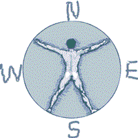
Sunrise: Determining East & the North Star
If you fear the morning sunlight like a true vampire, make sure that your tent is not in the direct line of fire at 6 am, just in case you planned to sleep in until 9 am.
If you arrive at camp after dark & need to decipher where the sun comes up, just locate the North Star silly. Hmmm, sounds easy? Now where is that sucker. See the diagram below for gathering the astronomy part of the lesson.
Now, for all of you who didn’t get a decent high school education: Locating east can be easy if you always remember this small exercise. Standing up, point your face to the north, extend your right arm out sideways & this will be east . The same goes for left/west. South is right behind ya. The sun sit low in the winter months & follows more along the south horizon.
The familiar stars called the big dipper is a nice way to find the north star. Draw a line from the edge of cup — spilling out straight over to the brightest star.
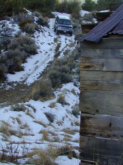
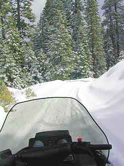
Winter wet weather doesn’t need to put a damper on your outdoor exploring, if you can get your hands on a 4×4 vehicle. Almost any SUV or truck with 4 wheel drive is capable of driving through some snow or mud. Just how deep is the mud (underneath the snow) is usually the big question. Many National Forests and State Parks close certain dirt roads due to over-use, or to control soil erosion and prevent the deep muddy ruts which are costly to re-grade come springtime. Call ahead to the rangers to find which back road routes are indeed open, or bring your printed topo map and wing it.
The California destinations listed below are popular winter spots for off roading enthusiasts. Some places may be busier than others. The dirt roads surrounding these spots are real treasures, so try to plan an all-day loop trip if possible. Camping w/ a campfire permit is an option on many back roads. Plenty lodging in nearby small towns if winter camping is not your thing.
Tribal lands are mostly located in rural regions which always have plenty of dirt roads to explore. Get a good back roads map for the public lands nearby, parks, BLM, National Forest. If the overnight camping is dropping into the twenties or teens, then know the forecast. A good rule of thumb for California hotel stays: If the low temps overnight are below the cost of a hotel room at the nearby casino, the comfy lodge might be well worth considering.
Avi Casino
@ California – Arizona border.
The Laughlin casino in the middle of nowhere, right on the Colorado River. Jet ski rentals, swimming pools and spas, restaurants, RV park. The historic Mojave Trail, aka Mojave Road, starts next to the property.
Gold Country Casino
@ Lake Oroville, California
Sierra Nevada mountains Northern California. Conveniently located near Feather River (all 4 forks) and Plumas National Forest, with Berry Creek and Bucks Lake Wilderness to explore. Snow often closes the highest elevations.
Viejas Casino
@ Pine Valley, East County San Diego
Great bouldered mountains with back road exploring, hiking, mountain biking trails, all easy access from Southern California. Get a Cleveland National Forest map and expect some road closures near Laguna Mountain Sunrise Highway, especially when it snows.
Diamond Mountain Casino
Susanville, Northern California
Located in between US Highway 395 and Mount Lassen, the scenic Susan River region has lots to offer for the outdoor enthusiasts. Plenty of roads to explore, some big lakes too. Many Forest roads could be closed due to snow, so be warned and call ahead to the ranger.
The whole Carson City area in Nevada has some excellent dirt roads to explore. Old mines, caves, many miles of pinyon forests. Lake Tahoe is nearby with luxury resorts, casinos and snow skiing.
If you just can’t stand the cold and snow, then warmer climates lie to the south. Baja California is a tourist/traveler and off-roader haven in the wintertime.
Holiday Wheeling
Jawbone Canyon for Thanksgiving weekend will get dirt bikes by the thousands and big families. Christmas is busy around the Palm Spring desert destinations – like Joshua Tree. Easter weekend is popular w/ wildflowers and campers in Anza Borrego Desert.
RV camping
Occasionally, wide graded dirt roads lead to secondary routes, so overnighting it with a motorhome on the back roads is very possible (if deep mud is not present). RV camping is quite the tradition for Southern Californians. Desert off roaders in tow, all over the Mojave. Steer clear of busy family groups. Pick a lesser known area to camp and explore. Get your real topo maps out and choose easy access from pavement, but wide graded dirt roads are best. Plenty roads like this in the Eastern Sierra, on the east side of US Hwy 395. RV campers that follow Total Escape might very well be interested in testing the limits of their recreational vehicle, slowly.
AWD Sportwagons
Before AWD got marketed as 4WD, Total Escape was way out there exploring in a 2 wheel drive and posting it online for you. All wheel drive station wagons should stick to the paved and plowed roads. If you plan to do a lotta dirt road driving in the old Subaru, keep the rock crawling to a minimum. If not, you may want to invest in a skid plate for the oil pan. Nothing beats first hand experience and learning ahead of time how your car will behave before you loose control on icy dark steep roads. Go practice with the emergency break and get the vehicle in a wide open snow plowed area if possible, just avoid the temptations to get wild. Don’t get the doughnut urge and plant yourself in a tree. Remember, it’s not like the commercial showed us, those are closed roads they are filming on.
Snow Chains
If you plan to be off roading in snow or mud at all you might want to consider some important safety items: tire chains for snow, a tow strap and tire plugs for flats. If you own a high clearance 2WD SUV, you could benefit from running chains on all four tires when snow is present. How deep the snow gets and how steep the hills are, determines how far you can go without a real 4 wheel drive. Some choose to rent a 4WD for the weekend road trip.
Snow Plow First Pass
Carry these items when traveling in winter conditions:
tools, jumper cables, tow strap, emergency gear, first aid kit, real boots, extra clothes, blankets, flashlights, food, drinking water, cell phone, maps
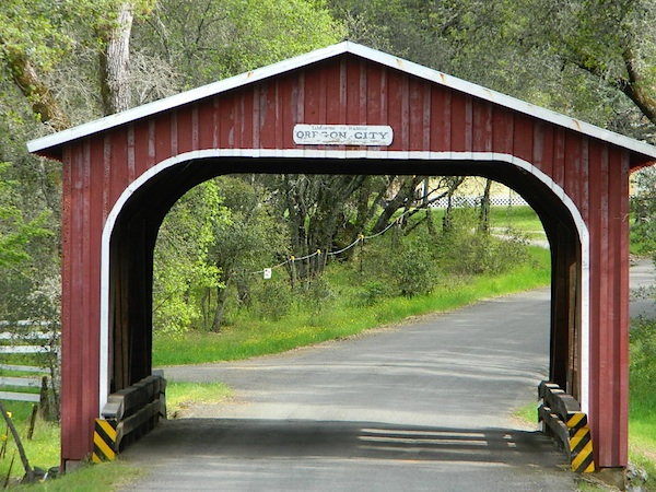
Oregon City Bridge, off Cherokee Rd, N Oroville, CA
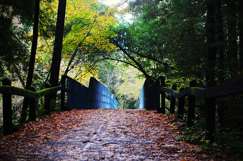
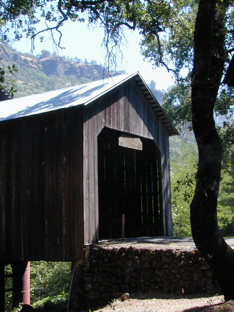
Overland pioneers and miners flooded the Sierra Nevada mountains after 1848, when gold was discovered, transforming the natural landscape and native life of California – in horrendous ways. Industrius, eager and using the abundance of natural resources available to build homes, divert creeks, and construct a new way of life. Mining for precious metals was not a hobby, it was a ‘way of life’ for many who sought westward locales. Most traversed a continent on foot with covered wagons to get out here.
Many early bridges made of wood have disappeared in California. Historic places, such as these few wooden bridges of the West, need to be protected and preserved. So no carving your initials; spray paint (tagging), littering – nor bullet holes.
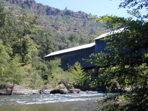
Felton Covered Bridge
Santa Cruz Mountains & Redwoods
Railway Train Rides Felton, CA
The main artery from the North; the Big River of California
Mighty Mount Shasta snowmelt flows south, bound to meet the giant Lake Shasta, which merges with the Pit River and numerous other major waterways, becoming the big Sacramento River. Running right down the center of the North Sacramento Valley to merge into the California Delta. Shipping channel links the State Capital city of Sacramento with the San Francisco Bay and the Pacific Ocean. Agriculture and wildlife depend on this river heavily.
Sacramento River National Wildlife Refuge
Willows, CA
~ Camping is not permitted on the Sacramento NWR. Along the Sacramento River, camping is permitted on GRAVEL BARS for up to 7 days during a 30 day period. For waterfowl hunting, overnight stay is permitted in a vehicle or RV in designated areas. Tents are prohibited. No person may build or maintain fires except in portable gas stoves.
Plaskett Creek Campground has green lawns, pine trees, & flush toilets. Located across the highway from Sand Dollar Beach, right on Hwy 1. Ponderosa Campground, on the other hand, has native grasses, oak trees, a seasonal creek and is located on a paved back road, with easy access from US Hwy 101
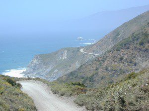
Central Coast Camping
Monterey Ranger District of Los Padres National Forest manages several Campgrounds along the Central Coast. Some are first come, first serve.
Backpacking trails lead into the wilderness backcountry, along ridge lines with vast ocean views and also deep into fern creeks with redwood canyons. Sykes Hot Springs is a remote destination, if you like to hike, although summer can get crowded. Overnight wilderness permits and campfire permits may be needed.
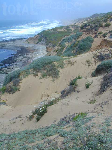
Free camping in Big Sur
can be found on dirt back roads:
DISPERSED CAMP: No charge camp sites means dirt road access, tighter camp fire restrictions & no facilities (table, bathrooms, fire pits). Campfire permits are required for primitive camping (stoves & BBQ), but unfortunately much of the time camp fires are not even allowed in the backcountry due to extreme wildfire danger.
None of these free camp sites are located on the beach or ocean shoreline. They are situated in the mountains near the coast. These premium, hard to find camp spots usually require that you venture off the beaten path – w/ a National Forest map or regional topo map. If you want to camp without the tourists and crowds, with excellent views of the coast & the night sky, plus avoiding all fees – then take one of these dirt roads off the main highway & start exploring (preferably before sunset, with a high clearance vehicle).
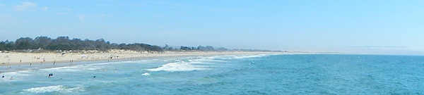
Camping right on the sand is possible in California, you just need to drive far enough to find it. Campground reservations are common (year round) on this stretch of coastline, since PISMO is a premier vacation spot for most of Central California.
blue links lead to State Park pages for camp reservations
This camping page features all beach front camping options along the Central Coast, from Santa Barbara to Big Sur. State Parks, State Beaches, bay side marinas and rugged rural coast camps. We even list private campgrounds and RV parks, just so you have more choices.
USDA National Forests lies inland along the Central Coast of California, all the way from Ventura to Monterey. Numerous recreational lakes and back roads that lead to secluded small campgrounds. Primitive dispersed camping is allowed, but campfires are limited to local fire restrictions. The later part of the year means drier conditions and sometimes campfires are not allowed during wildfire season. Obtain a free campfire permit & check current conditions from the local ranger before venturing into the backcountry.
San Diego Coastal Campgrounds
Mission Bay & North County
SD Beach RV Parks & Camping
San Diego’s mild climate means camping is available all year round. Winter storms can get windy and rainy, but most campgrounds are still open. From north county where the coastal cliffs overlook the ocean, to downtown bay side marinas w/ RV camping, to camping right on the sand w/ ocean crashing just feet away. Bike paths are common around downtown San Diego, so you can bring your bike or skates.
San Diego has 2 BAYS, both located along Interstate 5: The main bay downtown is called San Diego Bay (one of the deepest on the west coast) and the other a few miles north, is named Mission Bay (a man-made coastal waterway w/ green parks and paved bike trails).
Reservations are required at almost ALL coastal campgrounds, especially around holidays, any 3 day weekends, and all summer long. Tons of tourists flock to Southern California and this is a very popular coastline – with busy little cities and crowded beach towns. Beware: if you are seeking secluded camping – this would not be the place.
San Onofre State Beach Camp Pendleton or Camp Nuclear; I-5 freeway close
in between Oceanside & San Clemente, CA
There are numerous private RV resorts, some quite large, like KOA and GoodSam parks located in and around San Diego county. Most are metro-close and not located on the beach. This list is primarily coastal camping options for the San Diego region.
There are a few special places in California where redwood trees grow right down to the shore, but it is rare. Searching for place to pitch a tent (under the redwoods at the coast) is possible, but a bit harder to find than you might imagine. State Parks usually offer the standard paved camp site. Maybe need to drive dirt roads to find redwood seclusion.
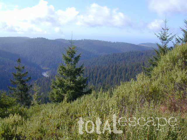
If you are seeking free or dirt cheap, primitive camping on the coast, then LOST COAST CAMPING on the Mendocino border is one option. Or head east, inland to the abundant National Forest. Dirt roads of the Six Rivers National Forest offer old logging roads, creeks, and secluded places to pitch a tent. Campfire permits are needed for dispersed camping, or ‘boondocking’ as some call it.
Dirt back roads can get muddy during the wet season, so know your vehicles capability and if you are unsure, check with the local rangers over the phone (preferably a ‘field ranger’) before venturing out. Remember that rain and mud are the norm, most of the year.
Fog is typical of the region. Enjoy the sunshine – when you can!


 Max RV Camper Length: 31′