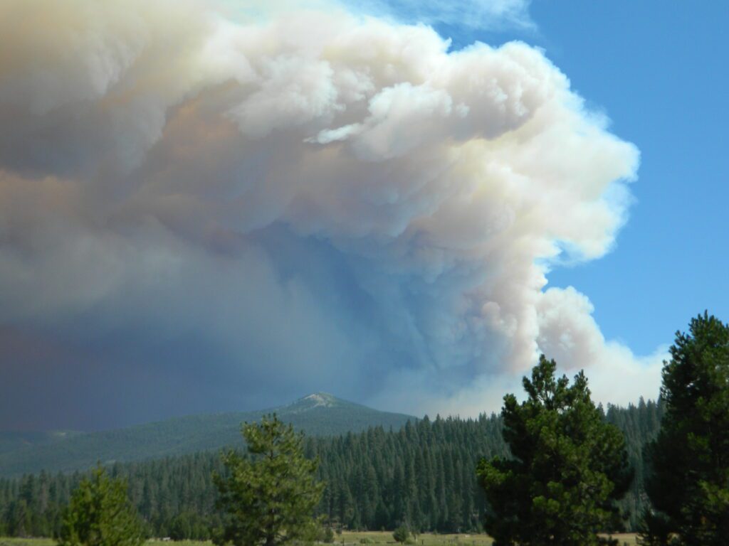
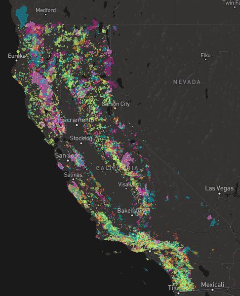
A list of recent wildfires in California, with counties and acres affected. Forest fires listed here are the ones that have affected public lands – like National Forests, National Parks, State Parks and BLM land.
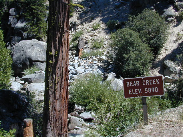
On public lands you may see signs like –
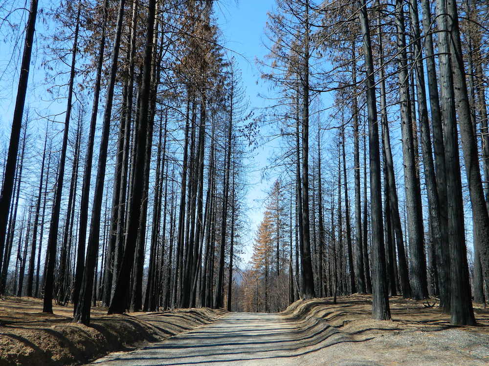
Warning: Entering a Burned Area Potential Hazards include:
LOOSE ROCKS
FALLING TREES + LIMBS
STUMP HOLES
FLASH FLOODING
DEBRIS FLOWS
>>> Entering a CLOSED FOREST with burn scar is a crime and can result in jail time. Check USFS forests web site for current closures.
Forest Fires listed below are alphabetical. Green & blue links to more data on these wildfires.
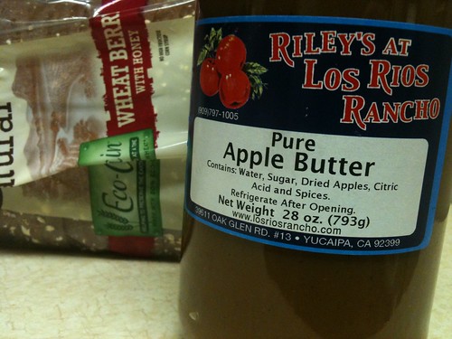
Yucaipa’s hidden secret – rural area of OAK GLEN, is a apple orchard canyon near the Inland Empire.
After the harvest is finished and the apples have all been picked from the trees – celebrate the coming winter with a historic festival that traces its roots back to the 16th century.
Public Apple Butter Making
Harvest Dinner and Dance
Historic Crafts
Children’s Games
Live Music
Wagon Rides
Merchant Vendors
Water Color Painting Class
Los Rios Ranch holds the annual Apple Butter Festival & Apple Butter Hoedown on Thanksgiving weekend.
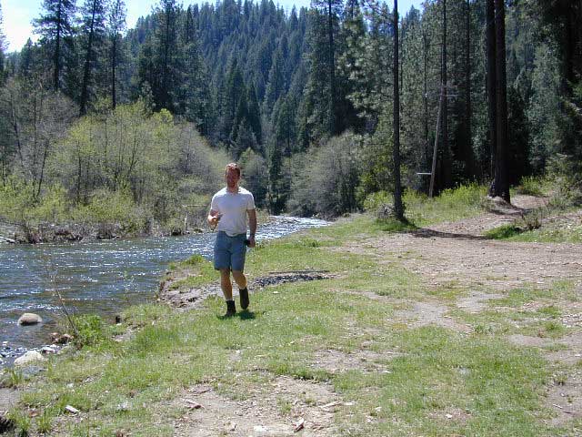
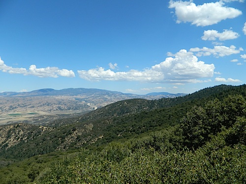
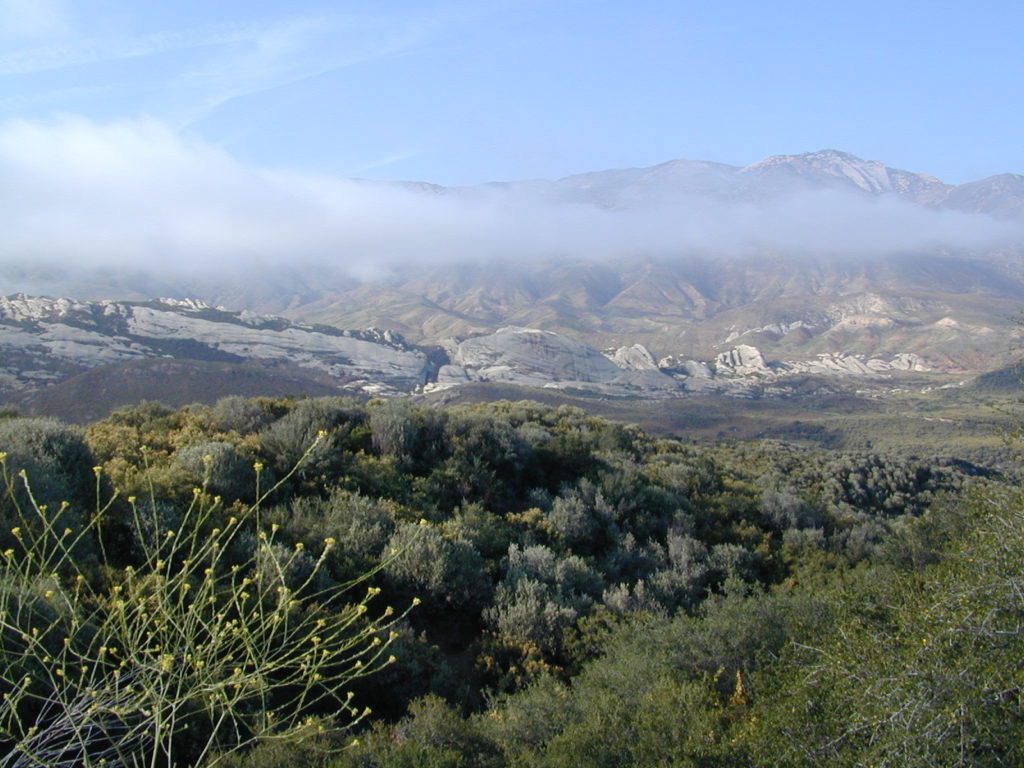
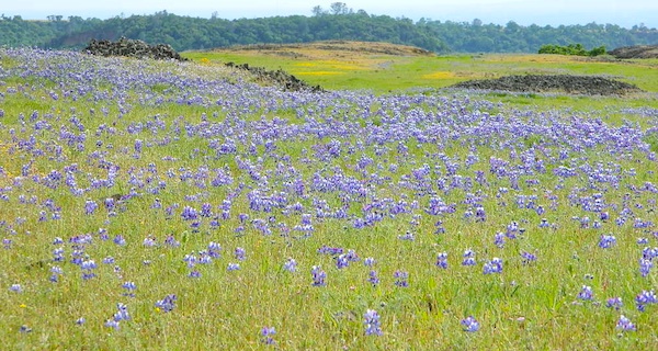
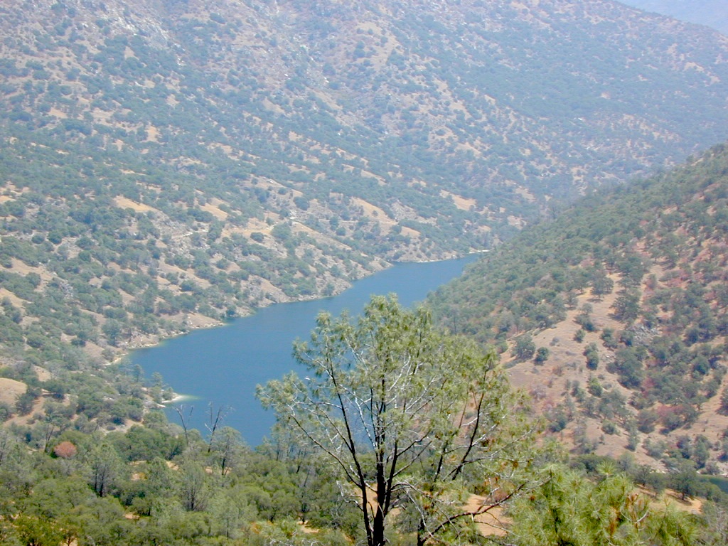
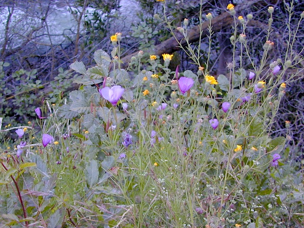
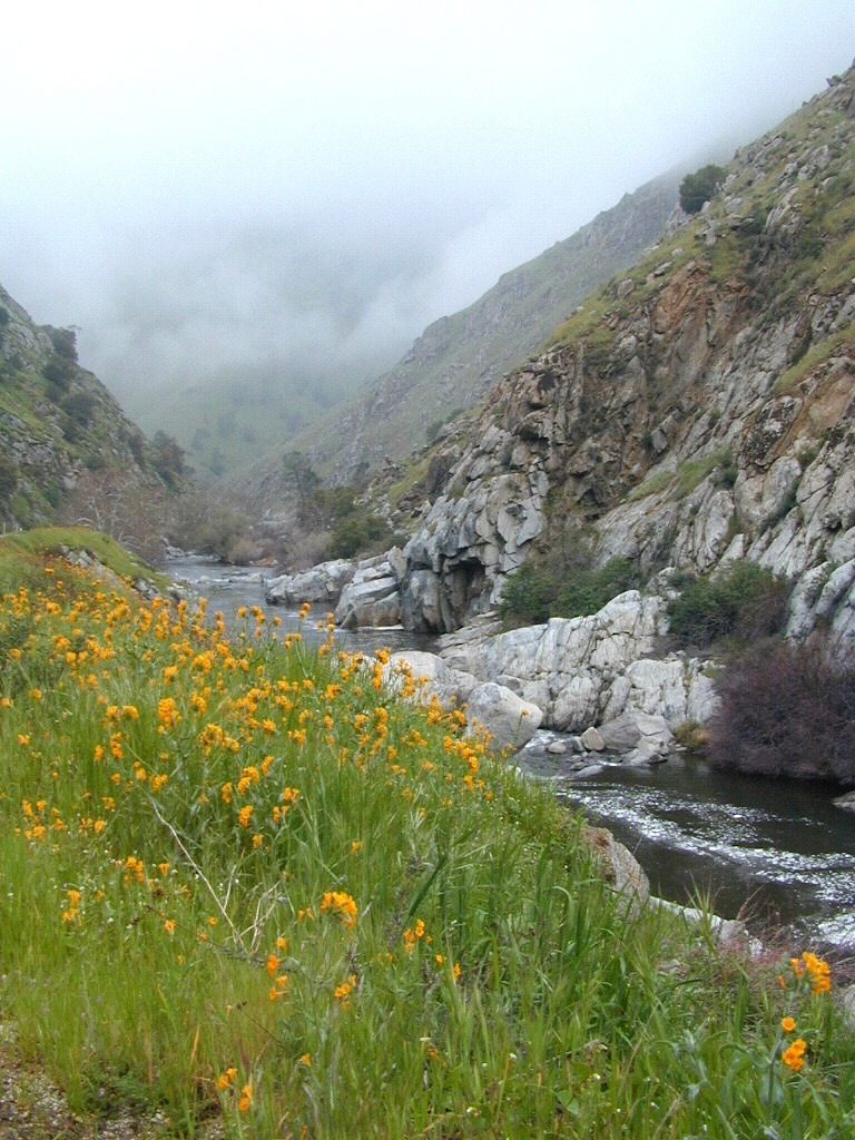
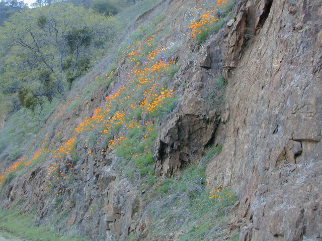
West facing canyons of the Sierra Nevada mountain range are prime spots for wild flora, especially in Springtime. Lots of rain means a great show can usually be found. Rivers exit the mountains and carve deep into the landscape. Lush green hills, oaks, boulders. Perfect picnic spots everywhere.
wildflowers bloom: March – July
make a whole day of it
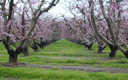
Lower elevations bloom first in the year. Remember if the Central Valley is blooming fruit trees, the mountain foothills are starting up too. Mid-elevations, above 3000′ bloom in summer months, but below that – plenty of river canyons and reservoirs are superb locations to search for wild flowers.
High Sierra wildflowers start to bloom after the snow melt (and roads open) usually JUNE – JULY
Orchards Blooming, San Joaquin Valley, California
The steep Eastern Sierra canyons near US 395, do have some wildflowers in Spring. Rocky, higher elevations bloom in mid-summer. And what Eastern Sierra may lack in wildflowers, they make up for in Autumn Colors (best in the state)
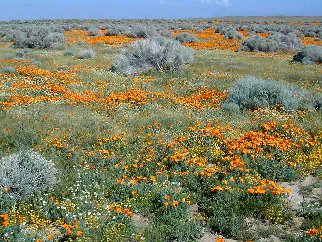
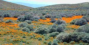
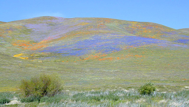
One of the premiere counties for wildflowers inside California. Kern offers amazing displays (blankets of flowers) along roadways, on hillsides, and in the numerous canyons.
Obvious I-5
Interstate 5 – from the Grapevine up past Tejon Ranch, and over to Gorman is epic blooms of poppy and lupine. Annually in April and only if the previous winter was wet or snowy. For safety sake, please exit the freeway to view the flowers!
The famous high desert Poppy Preserve is located off of I-5, east on Hwy 138, way before the town of Lancaster, CA
But all this mentioned above is not technically the Sierra Nevada mountains, so we will move on…
CALIENTE ROAD
Off of Hwy 58 west (below Tehachapi) Often called Caliente exit, or Caliente Creek Road – the Bodfish-Caliente Road is a narrow, paved, back road that connects Highway 58 to the Lake Isabella area.
Driving this countryside route is long and curvy, but there are numerous pull-outs and places to see wild flora. Plan for half a day to reach Hwy 178. Gold Pan Canyon and rolling oak hills. Dirt roads lead into National Forests, but watch for private property and no trespassing signs. NOTE: You may need to stop the car. Get out and walk around to find these little beauties.
Historic Havilah has an old schoolhouse and a museum.
LewisHillPreserve (559) 738-0211
Along N Plano Street. North of Porterville, CA
NOTE: Lewis Hill Preserve is not open to the public except for special tours and events.
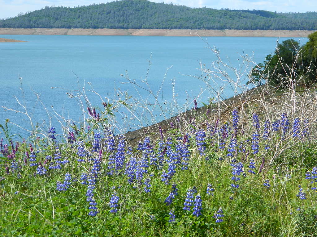
Lake Kaweah @ Three Rivers, CA
south of Sequoia National Park has wildflower displays along the lake shore, and with snow capped mountains in the background, it can make for excellent photos.
Sequoia Road J21 – HOMER RANCH Dirt back road on the north side of the Lake Kawaeah which connects to Sequoia National Park (the long way). Dry Creek Preserve, McKee Canyon, Ragle Canyon, Indian Canyon. Homer Ranch Preserve, open to the public weekends only, from November 1st – June 1st
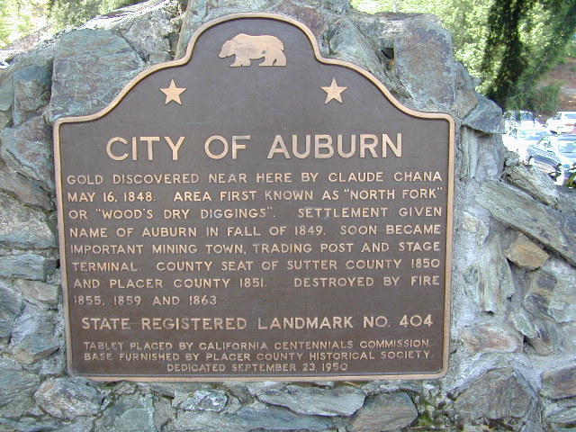
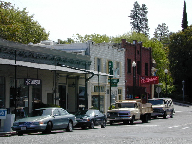
Calif Gold Country
Foothills & River Canyons
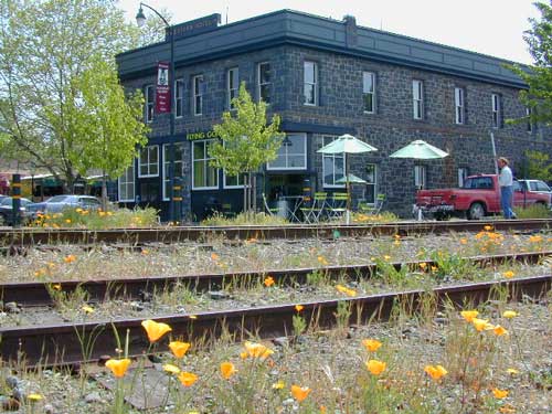
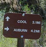
American River Canyon – Hwy 49, South of Auburn, CA
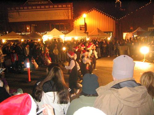
From 5-9pm the whole community is invited to share in the holiday fun. Crafters and artists will have their wares on sale for that special one-of-a-kind Christmas gift. Great food and entertainment, pictures with Santa. Shops and restaurants open. Holiday Open House in all the old town village shops!
Annual event; December – multiple days
(2 different Saturday nights)
An abundance of tasty citrus, from fresh fruit samples offered by local growers to market products featuring the Sierra foothill’s mandarin oranges. Thousands of filled orange mesh bags await and jams, jellies, infused olive oils, balsamic vinegar, barbecue sauces and body care products are all available for purchase. Visitors are delighted to discover that the food vendors offer everything from mandarin pizza to mandarin glazed wings, mandarin doughnuts and mandarin pulled pork, just to name a few.
Oak foothills of the Historic Gold Country, at the edge of the Sierra Nevada mountains.
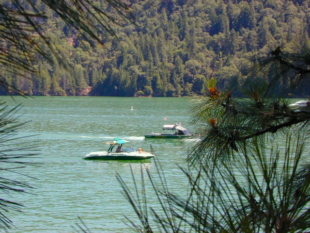
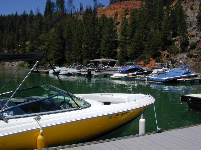
boating
canoe
camping
fishing
hiking
houseboats
kayaking
wildflowers
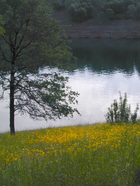
Most Central Valley Reservoirs have blooming wildflowers in early springtime. Summer heat can measure triple digits for months as most of these lakes are located below 1000′ elevation.
BULLARDS BAR Dark Day is a lakeside walk-in campground on a small reservoir, located deep in the Gold Country foothills. Flush toilets and hiking trails, kayak rentals and fishing.
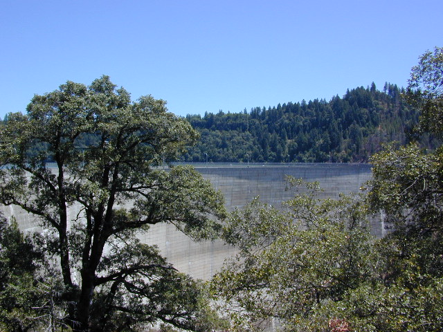
West of Highway 49. Huge dam for hydro-electric power. Minimal roadways along the lake and steep canyons make for optimum hiking and boating. Floating and fishing. Relaxing in the mountains, with fresh water!
On most maps the official name of this lake may read New Bullards Bar Reservoir, or Lake Bullards Bar, but locals just call it simply – Bullards Bar!
Sierra Nevada Foothills. Yuba River, California.
Northern Gold Country, California
Near Camptonville, West off Hwy 49
in between Oroville and Nevada City, CA
Located not far from historic Downieville, Bullard’s Bar is an excellent base camp location for exploring the upper reaches of the Gold Country region. Old mining locations, museums, a covered bridge, various parks, Yuba River, Sierra Buttes, Lakes Basin. Grass Valley & Nevada City are also nearby. Mountain bike trails, river rafting and hiking all around.
roads around lake: Marysville Road (south of lake and east side w/ Hwy 49), Moonshine Road (south of lake), Oregon Hill Road (west side), Pendola Road (north side), and Forest Route #47 (dirt road on north side)
One of the few lakes in the Sierra Nevada that offer boat in camping at developed camp sites, and also to allow boaters primitive camping along the shoreline. No drinking water is available. No pit toilets, so a portable chemical toilet is always required. Plus, pack out all garbage.
No charge for DAY USE areas: parking or boat launch ramps
NOTE: Dark Day & Schoolhouse Campgrounds are the only car camping & RV accessible camping on this lake. These both have flush toilets and drinking water piped in. Hiking trails & boat launch nearby. Wheelchair accessible campsites are available.
CAMPS OPEN: APRIL – OCTOBER Campgrounds @ BullardsBar are usually open from April to October annually and all are closed for winter months.
Located 5 miles northwest of Dark Day Boat Ramp on the west side of the reservoir. Boat in only access. It is used as an over flow campground. There are campsites, but no bathrooms. Portable chemical toilet required. More info call Emerald Cove Marina at (530) 692-3200
Second Spillway – in the works?
Yuba Water Agency has just committed to building a $160 million second spillway at the New Bullards Bar Dam; beginning in 2021, with a completion date of 2025.
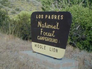
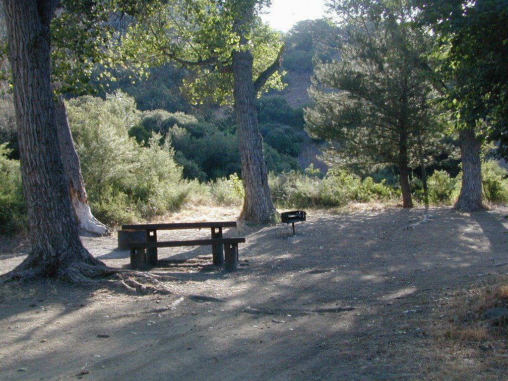
BALCH PARK campground is on a first come basis; no campground reservations needed.
2021 – THIS CAMPGROUND IS CLOSED indefinitely, due to the Castle Fire 2020
Balch Park open May to October
Park info # 559 539-3896
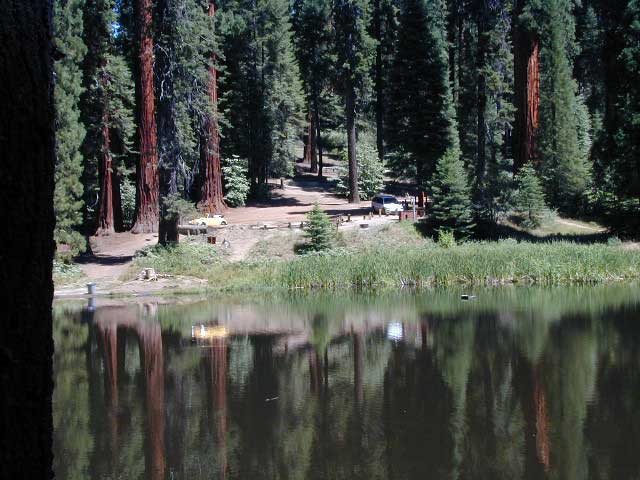
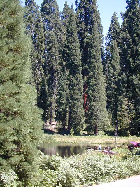
Hedrick Pond lined w/ Sequoia trees
Balch County Park is right in the middle of Mountain Home State Forest, which is within the bigger Sequoia National Forest (aka Giant Sequoia National Monument). But don’t let all the bureaucracy mislead you, this is an ideal park and location, well worth your trip. The campground is the most developed one within the area – with paved roads, RV spaces, flush toilets and a fee to go along with all that. Even gotta fishing pond.
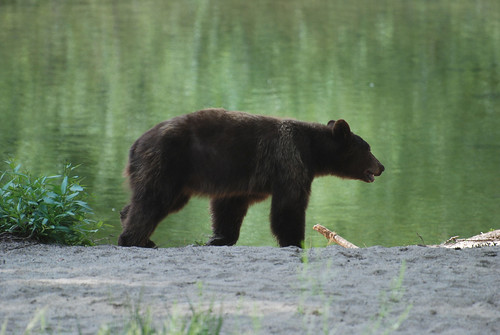
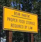
Bears are a big deal in these neck of the woods. Please store all your food properly to avoid a un-welcomed visitor
A Sequoia Grove is nearby with plenty of creeks & meadows.
Trailers not recommended due to the long curvy road leading up the mountain.
Balch Park & Campground NOT TO BE CONFUSED with utility company residences of BALCH CAMP between Pine Flat & Blackrock Reservoirs
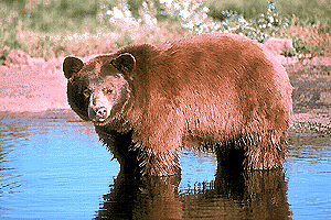
Although the grizzly bear image graces the state flag, grizzlies were killed off during the gold rush days. Black bears are found in California mountains and foothills, down to lowest elevations in NorCal. California black bears come in more than one color – light brown, cinnamon, dark brown, and of course, black. For the most part, bears usually stay away from people.
Some areas are more prone to bear problems due in large part to the overpopulation of tourists and abundance of food provided by them. Certain California National Parks are particularly notorious for their brazen bear populations. Concentrated bear problems are sometimes posted so be very aware and read signs. If you see steel bear boxes, leave no food or drink in your vehicle. Use the boxes to keep bears from breaking into your car!
Follow some simple rules:
Keep a very clean campsite
Clean up all dirty dishes & beverage containers (especially before bedtime)
Keep clothing & sleeping bags free from food odors or heavy scents
Never leave any type of food garbage ‘bagged up’, sitting outside of a cabin rental, motorhome, trailer, or mountain home
Store garbage properly inside a locked, sturdy container inside garage or a shed
Stay away from bear cubs, there is sure to be a protective (aggressive) mother in close proximity
Try not to hike alone. Make noise & sing on trails to scare away any unwanted animals.
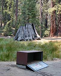
Bear storage canisters are available at sporting good stores & at stores in most National Parks.
Proper Food Storage Outdoors:
Store food in closed up automobile, not visible. Store food correctly: in trunk of your car, or hidden from sight; in campground food lockers when available.
Lock all food, beverages and coolers in the provided metal bear boxes or bear lockers where available.
Toothpaste, deodorant & anything that has a scent should be thought of as food and stored accordingly.
Bears are so strong they can rip your car door open (in places like Yosemite, where bears are problem and you can get cited for not storing food items properly)
Bears are so strong they can break open a garage door to get to the smelly trash inside, so make sure you utilize the curbside pickup service available in some mountain communities or take a trip to the dump once per week.
DO NOT LEAVE FOOD OUT, UNATTENDED, outdoors…
during a picnic lunch, a quick snack, maybe a barbeque, or dinner around the campfire.
Birds, dogs, squirrels and wild animals can move in quickly.
Backpackers should hang food in nylon bag & drape over weak branch in high in tree: hang your food using the counterbalance method. Ranger who issues your wilderness permit can explain the hanging procedure;
2 stuff sacks (with drawstrings) for your food items, and 60 feet of medium weight cord. 2 carabiners make hanging much easier.
When primitive car camping on a dirt road, which does not have campgrounds, nor bear lockers, it is possible to store food in the vehicle. BEST location is on the front floorboards with towel over it. With the car alarm set at bedtime, any ruckus should trigger a decent alarm. Any large animal trying to break in will get blasted with alarm siren & most likely will run away. The noise will wake you up as well, to deal with the intruder, if need be.
If a bear does get into your camp area:
At night, bring bear repellent can into tent, storing it close to the door. Bring a weapon for added protection.
Make as much noise as possible: yell, bang pots/pans, whistle, air horn and get your bear mace or pepper spray ready in hand
Raise your hands up to appear larger; lift clothing, increase appearance of size and yell aggressively toward bear.
Get your entire camp group together, join hands and spread out; Everyone at the camp should be outside the tents in order to be as effective as possible
Throw rocks & small objects; pots, pans, chairs
If possible, try to get to your car for protection
Sound the alarm on a vehicle &/or honk the horn
If you encounter a bear on a hiking trail:
Make as much noise as possible while walking solo. Hum, sing, talk to the birds. Sing or talk to yourself – out loud. Bear bells can be worn on hiking boots. Do not hike w/ headphones on listening to music/radio.
Carry bear spray (mace or pepper) in a belt holster, or easy to reach pack.
If a bear approaches: stand still, slowly retreat, say a few calming words in a friendly voice and calmly retreat, keep eyes on the bear
More & more people are venturing off the beaten path. Tourist flocks to Gold Country, and many do not even leave Highway 49. Get up the mountains, higher than the foothills.
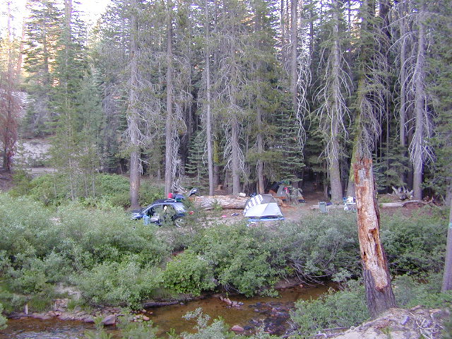
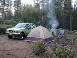
Getting outta the developed campgrounds to discover the joys of dispersed back woods camping is a new adventure, not to be taken lightly.
With truck or SUV ownership come some great rewards! Order a good map & go find some dirt roads. Waterfalls, dense forests, secluded creekside camp sites & more await you. Obtaining a camp fire permit is mandatory for this style of camping.
Campfires are often banned in California, due to extreme wildfire danger. Since the gold mining foothills are usually oak and dry grass, with large steep river canyons, extra caution should be given. Always know the fire conditions before you build a campfire.
Discover the hidden back roads: like Caldor Road off of Grizzly Flat Rd. – above Placerville CA
Hey, now this is what we’re talking about. Plenty of great dispersed camping down by the Cosumnes River & Consumnes Mine Rd. There are hundreds of miles of small roads to discover back behind this historic mining area. Rivers, waterfalls & decent fishing too. Make sure you clean up some litter. This is the only price you pay for the beauty, serenity, peace & quiet & no neighbor campers next to you.
Out exploring these parts, you may run into a dead end road that peters out at some Private Property, which is usually signed & fenced. Make nice with the old crazy miner dude & turn your ass around politely, everything will be okay as soon as you are not within gun shot of him. Yes, there still are plenty of small time mining experts tucked away back here in the hills.
Plenty creeks and rivers run throughout this central Sierra region, so you can fish all day – until your hearts desire. River rafting and river kayaking opportunities are also great reasons to get wet.
Several mountain reservoirs around offer camping and boating too. Eldorado lakes are listed below.
The main road parallels the big wash. Quatal Road #9N09 is graded (annually) and usually passenger car accessible; side routes to camps in the big wash or up any canyons may require high clearance or 4WD vehicle. No services in this canyon at all; Cell service is minmal. Gasoline is somewhere along the hwy (near a pistachio orchard).
Although Sequoia trees can be found in the southern Sierra, the National Park is located more in the mid-Sierra. From the Kern River to Kings River, the southern stretch of Sierra Nevada is home to the southern most Sequoia groves, the longest river in California, and the granite dome wonderlands that overlook the Mojave Desert.
The Tehachapi range is on the tail end to the south w/ Hwy 58, while Kings Canyon Park borders more High Sierra Wilderness to the north end. If you are heading up from SoCal, this is the most accessible portion of the Sierra Nevada range.
While the Kern River Valley can get hot in the summer months, the rivers, streams & higher elevations surrounding it, make it a prime destination for folks seeking cooler mountain breezes, creeks and dark skies. Springtime is one of the best times of year to visit the Kern River. While summer is best for the high wilderness areas, since the snow usually doesn’t melt until May.
Mountain Home State Forest is a little known haven for campers & hikers seeking less-crowded Sequoia groves. With the Tule River, fishing ponds, waterfalls, swimming holes & meadows, this place provides a nice solitude to the busier parks to the north. Balch Park is a county park w/ large campground, that sits adjacent to Mountain Home Forest.
Both National Parks (Seqouia & Kings) are both busy in summer & tourists can be seen lining the main road, Highway 198. Crystal Cave & Boyden Cavern both offer daily tours during the warmer months. Sequoia National Park is open during winter months & is popular among winter sports enthusiasts. Kings Canyon National Park & Hwy 180 are also open during winter, with winter sports recreation.
Big Meadows Road (14S11)offers great camping options for those that wish to camp outside the National Park boundaries.
is located in the western foothills of the Central Sierra Mountains
Historic Highway 49 is the Gold Country Hwy, which begins down near Yosemite and leads north, thru the foothills, up to Sierra Buttes & ends out near Loyalton, CA
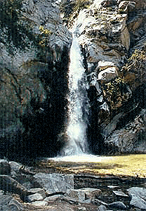
Millard Falls
2 mi RT; 1200′ elevation; oaks.
Arroyo Seco District –
of Angeles National Forest
818-790-1151 Altadena CA
From Interstate 210 in San Gabriel Valley, exit Lake Ave., go N & turn left/west onto Loma Alta Dr. & to Chaney Trail & follow signed dirt road
Sturtevant Falls
5 mi RT; 4600′ elevation; oaks, creek-crossings.
Santa Anita District –
of Angeles National Forest
818-899-1900
inside Big Santa Anita Canyon
From Interstate 210 in San Gabriel Valley, exit Santa Anita Ave.Go North/East, through neighborhood & up mountain to paved parking lot.
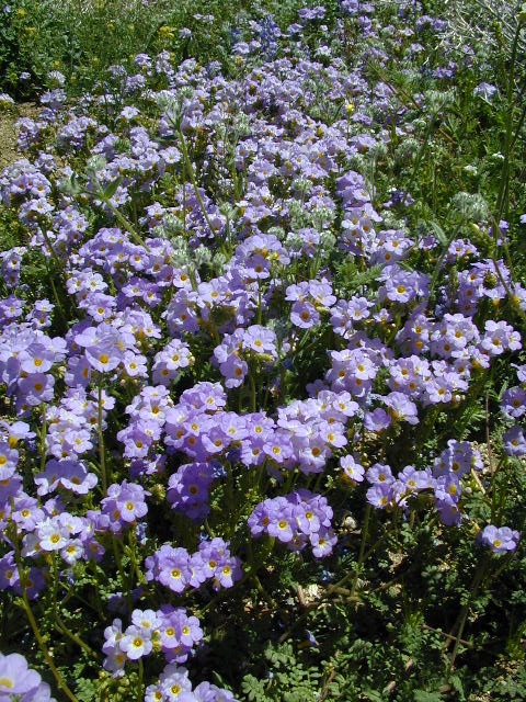
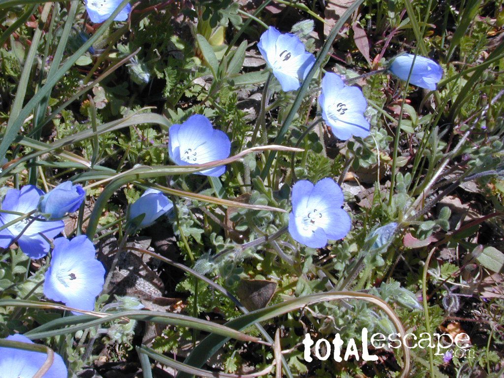
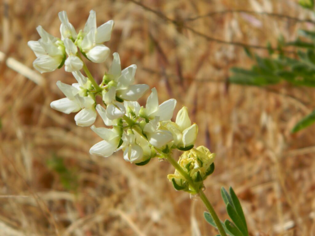
Wildflowers bloom all over California – from the desert in winter months, to the High Sierra in mid summer. Remember that the timing is everything, since most of these precious, delicate beauties only last a week or so. Out there alone, all day in the bright sunshine, whipping in the seasons strongest breezes. Flora!
The higher the elevation, the later the bloom.
Lower elevation deserts begin to show as early as February and higher elevation peaks thaw in May. Wilderness meadows and flowers can be found in the mountains in summer. Generally in California, Springtime – between MARCH and JUNE is the best viewing time.
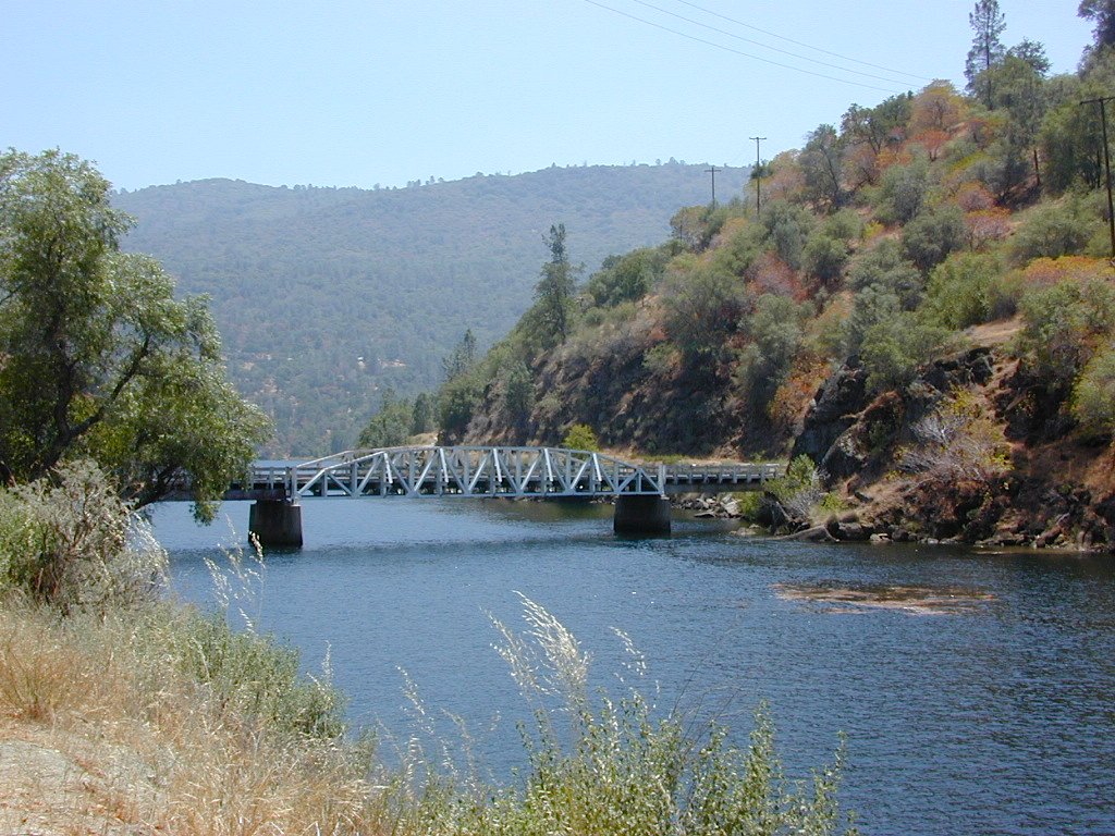
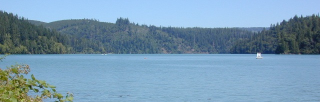
Officially this lake is actually a reservoir, located in the low lands of the Sierra foothills country. Narrow, winding back roads, a way outta the way kinda spot.
a long, narrow lake w/ steep hills, inside a tight canyon
canoe
fishing
hiking
jetski
kayak
waterski
The San Joaquin River flows west, down from the highest granite peaks of the Sierra Nevada and into the Central Valley foothills. If you find your way off the main highway 41, exploring way back behind Bass Lake, CA – then you may consider this scenic loop to Redinger.
off the beaten path
Truthfully, this place is usually an afterthought, sorta near Yosemite National Park. Not exactly a top destination for tourists, but it is very accessible most anytime of the year due to low elevation.
Spring wildflowers can be decent.Summers do get super hot here, so take that into consideration when planning your visit. Due to extreme wildfire danger, no campfires are allowed at any time.
Lake, Reservoir, or a good wide section of the San Joaquin River w/ hydro-electric dam.
elev. 1000′
public boat launch ramp
Camping is restricted to a large open area near the dam. No fee is charged. No campfires are permitted. Services limited, no drinking water or garbage pick-up available. Nearest town 7 miles away.
Redinger Lake Road (Rd# 235) can be found south of the town of North Fork, CA. The paved route down is long, steep and winding. At the bridge crossing, the road loops to Joe Basin Road, which connects to the small community of Auberry, CA
Way up river, a dozen plus miles, is the utterly beautiful Mammoth Pool, only accessible half the year.
A few miles down river from Redinger, around the horse shoe bend, another neighboring reservoir called Kerschoff Lake (elev 971′) has a developed campground.
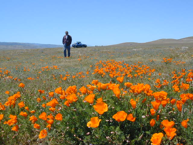
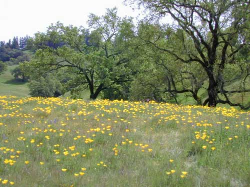
The official state flower of California is the POPPY
Spring usually means it’s warming up, to a great wildflower season in California. Time to get outdoors more! Hike, bike and picnic near the wildflowers and see some poppies.
California Golden Poppies can be found throughout the state, in small patches near the roadways, rolling hills behind vineyards, in high desert flats (where wind gets whipping) or even out near a ranch, with oak hills and fields of golden orange.
POPPIES can blanket hillsides, resulting in a show stopping event – which can be deadly on freeways? N of L.A. interstate 5 (the Grapevine) TEJON PASS (Lebec, Gorman, Junction 138) >> Please pull to nearest exit and stop the car. (It will be safest and well worth the 10 minute stretch break.)
Golden poppies can be found all over California. Flowers like lupine and owls clover can often be found nearby. Wildflowers may only last a few weeks, so go enjoy them while they last.
Bright yellow, gold, deep orange – or any shade in between!
best places to find poppies
NORTHERN CALIFORNIA
Table Mountain @ Cherokee Road
North of Oroville, CA
Auburn, CA Central California Reservoirs Located all around most rivers w/ dams (reservoirs) poppies can easily be found along highways, rural roads and on oak hillsides.
SOUTHERN CALIFORNIA
Boulder Creek Road (dirt) Descanso to Julian, CA
San Diego Mountain Foothills
Remember, stay on thetrail! Getting a picture of that one really nice poppy will crush all the plants along the way, and compact the ground leaving lifeless bare dirt for the next year or longer. If someone else has started a trail, do not add to the damage. Please be a responsible park visitor and leave the park as nice as you found it.
Or you can avoid the crowds & tour buses at the Poppy Park to head off on your own adventure. All along both sides of high desert Hwy 138 you can find fields of California Poppies, from the small town of Neenach, CA east to Hwy 14. Plus the hills of Gorman are usually full of color.


 Oak foothills of the Historic Gold Country, at the edge of the Sierra Nevada mountains.


 provided by them. Certain California