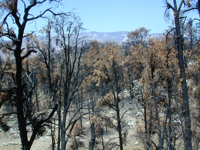
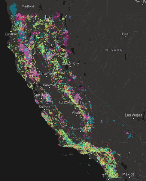
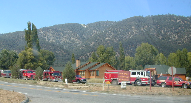
A list of recent wildfires in California, with counties and acres affected. Forest fires listed here are the ones that have affected public lands – like National Forests, National Parks, State Parks and BLM land.
On public lands you may see signs like –
Warning: Entering a Burned Area Potential Hazards include:
LOOSE ROCKS
FALLING TREES + LIMBS
STUMP HOLES
FLASH FLOODING
DEBRIS FLOWS
>>> Entering a CLOSED FOREST with burn scar is a crime and can result in jail time. Check USFS forests web site for current closures.
Forest Fires listed below are alphabetical. Green & blue links to more data on these wildfires.
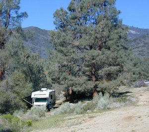
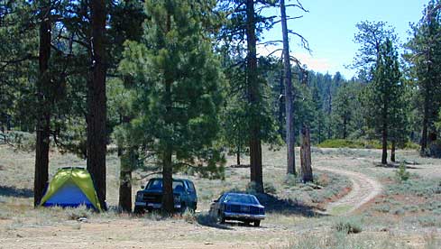
Free camping outside of a developed campground, for a self-contained camper who wants seclusion and privacy. Real relaxation in total peace and quiet. More nature, less people and minimal vehicles.
Free Campsites • Dispersed Camps • Open Camping • Boondocking
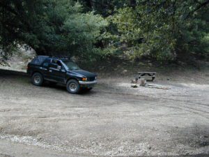
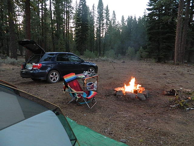
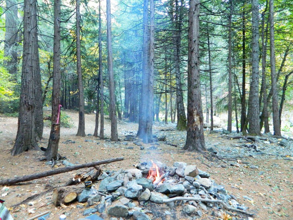
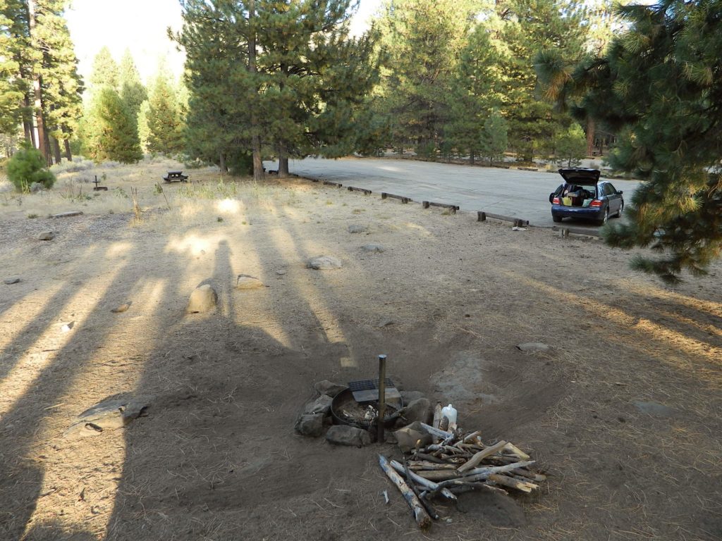
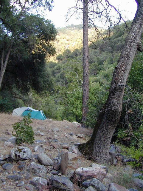
primitive camp sites –the bare minimum. a clearing for a tent, maybe a fire ring. no toilet, no fees; dirt road access.
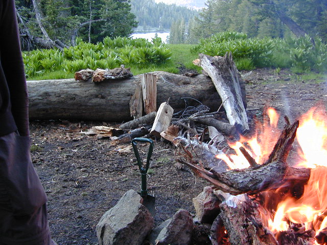
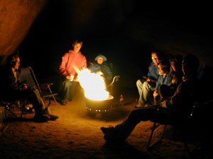
campfire permits required. And it is up to you to know the current fire restrictions in the area you seek to camp overnight.
The further out you are willing to drive, the more remote you can be. Good topo maps of the region help you to find these ultimate, secret camping spots. National Forests & BLM Lands require a free camp fire permit to have a campfire.
Fire safety is always a big concern in wildfire prone areas like California. Additional Permits & Passes may be needed in some forests or parks; each location is different. Check with the local ranger station for up to date restrictions.
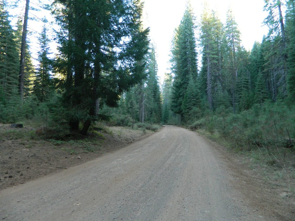
Many dirt roads lead avid campers to the best out-of-the-way camp sites. Camps may have picnic tables or just a fire ring, but usually NO toilets. Have the “No Bathroom Blues”? Don’t sweat it. check out the page onCamp Potty
Some camp sites are as bare as a small clearing, a rock fire ring if you’re lucky. A detailed backcountry map is always advised. If you count on your digital mobile device and online access for mapping, you could find yourself very lost. GoogleMaps is known for mislabeling the smallest of back roads – and they do not feature dirt roads either.
Turtle Mountain Road, SoCal
A high clearance vehicle may be needed to reach certain camp spots, but many can be accessed with a standard passenger car. Low riders will likely bottom out and motorcycle riders will get dusty.
Know your vehicles limitations for any off-road use and don’t get stuck in a bad situation. Soft sand is quite common in deserts and 4×4 might be needed. There aren’t any tow trucks out in the boonies and if you do find one, it’ll cost you something fierce. Watch for large rocks, deep ruts or tree limbs in the road (at any time) and watch low overhanging branches when driving a motorhome in to such spots. Some dedicated, hard-core RV campers prefer to camp in remote locations.
Southern California has something called yellow post camps, but we’ve really ONLY seen them inside San Bernardino National Forest areas, which includes Idyllwild and Mount San Jacinto, plus all the Big Bear Lake Mountains.
YELLOW STICK? These are fire safe spots w/ picnic table; secluded in the forest, some accessible by passenger cars, while other camps require a 4×4 to reach. Yellow post sites campfires are often off limits during fire restrictions, when only fires are allowed inside the larger developed campgrounds.
dirt road and trailheads
Backpackers trailheads often have a few camp sites near the parking lot, but these may be busy during summer months. Dirt roads leading to trailheads can have primitive camp sites along them as well. Long, big creeks in the forests are notorious for having awesome camp sites. Big river camp sites are sometimes free, if you know where to look. Sometimes the smallest of California campgrounds have no charge, first come, first serve (BLM, National Forest, or State run).
Before it got labeled BOONDOCKING: Primitive Camping in remote spots was what we lived for. Camp outside of developed campgrounds, for free. Campfires will usually be banned on these back roads during the driest part of the year. Check with local ranger stations for current fire restrictions.
possible dirt road access, seclusion, privacy, darker skies, no fees, no crowds, real peace & quiet
no toilet, no picnic tables, no pavement, no hospital, a long hike out, no cell phone service?
always be prepared to hike out (if need be).a giant tree can come down and block your exit road. landslides often happen on dirt back roads. the vehicle could break down or become disabled. get a topographic map and know how to read the terrain, without your device/phone.
PAY extra close attention when driving in (visually with terrain and your eyes and your map). You never know when you may need to back track – or turn around to find a PLAN B campsite.
Avid camper people are indeed known to GPS waypoint their favorite pick campsites (way on the back roads), so they can arrive after work, in the dark, on a Thursday night. Now that’s planning ahead!
California has many different National Forest districts and each region has their own fire restrictions. State Parks & BLM also manages recreation areas & camping in the Golden State. Each agency & region has different rules, so blanket answers cannot apply to general questions on campfires.
CAMPFIRE PERMITS
Campfire permits are required for fires outside of designated recreation sites. During fire restrictions, campfires could be banned. Campfire Permit are available from Forest Service, CalFire or BLM offices or online, http://www.preventwildfireca.org/
Manter Fire [2000], Dome Land Wilderness, Southern Sierra Nevada
the new abnormal
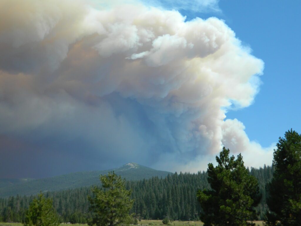
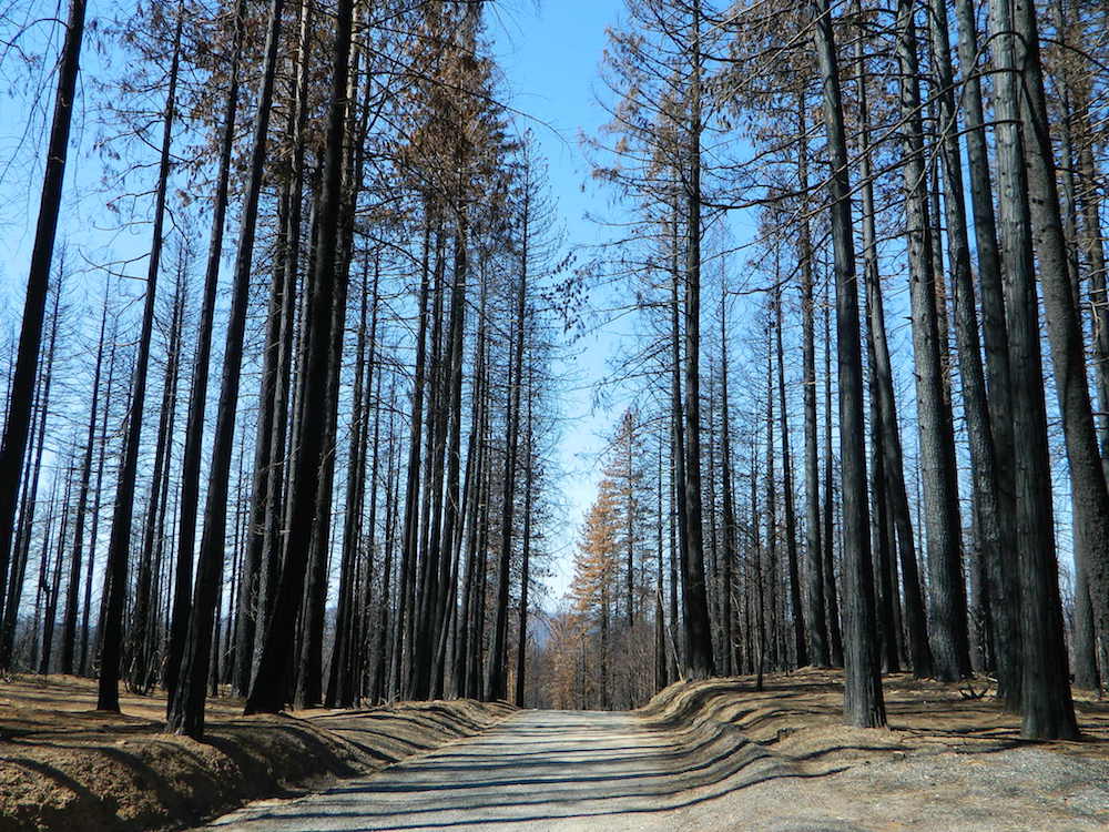
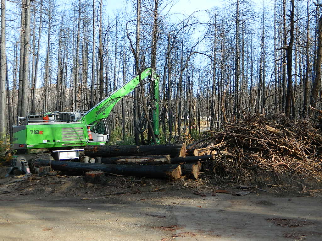
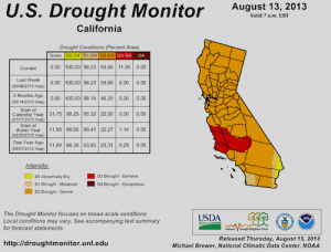
California suffers more from wildfires now than ever before. Native tribes let lightning strike wild fires burn and they did not suppress wildfire. Residential development creeping ever higher and denser into the foothills, an abundance of roadways, with the overgrown forest make fire danger ever more real.
Closed off wilderness areas, impassable dirt roads, landslides, fallen trees everywhere. Utility services (power lines), plus high winds and overgrown forest also play a huge part in the current wildfire catastrophes. Drought conditions or record winter rains, the huge population on the west coast -along with many other factors – means more fire danger. Educate yourself and others on fire safety, forests and weather patterns. Heed the wind, while in the wild. Wind spreads fire easily!
By mid summer we have usually have several wild land fires burning, which means campfire restrictions are usually in place before JULY 4th weekend. When this happens – No open campfires are allowed in the backcountry or on the back roads.
Often in the driest of years, no campfires are allowed (even inside the campgrounds).
If you love to primitive camp outside of developed campgrounds, you need to plan more road trips for spring time & autumn. Or head further north, well above Redding – where the forest are moist and snow graces Mount Shasta year round. Or perhaps, go desert camping during winter months. Checking the National Forest web sites can be confusing and their online information could be outdated.
Each forest and area is individually managed. No concise, easy-to-read list or online map exist on which forests are allowing backcountry campfires – and which ones are not. Conditions seem to change so often and they aren’t great about updating those .gov web sites. Best to call a local ranger station and ask about any current fire restrictions. You know, actually “talk on a phone” to a USFS, BLM or CalFire official. If you can speak to a field ranger, they can tell you more on dispersed camping. Or you can navigate the USDA web site to find current ALERTS & RESTRICTIONS. Cryptic lingo may be encountered, and many clicks maybe needed; possibly forcing you to download a PDF of current fire rules.
Bald Mountain (elev 9382′) Lookout in Sequoia National Forest
NFS Fire Lookout Towers
JULY 2019 – Many thanks goes to Pike County Lookout for initially spotting the #RockFire – in the Plumas National Forest, near Berry Creek, CA
Lookouts in the California National Forests
Ready to see far and wide – with wild terrain? Views for 100 miles out and the best scenery California has to offer. Be prepared to off road or hike to reach one of these destinations.
Below is a list of historic look out towers & cabins used for spotting wildfires. Some are located on steep granite peaks, ridge lines or dirt roads. 4WD may be recommended to reach some of these. Road conditions can change w/ harsh mountain weather, so be prepared to rough it. Thunderstorms are common on these mountain ridges.
Several of these places are cabins, some are stone houses, but most fire lookouts are basic metal towers – with high climbing staircases, so you must be in decent physical strength to haul your ass up this high.
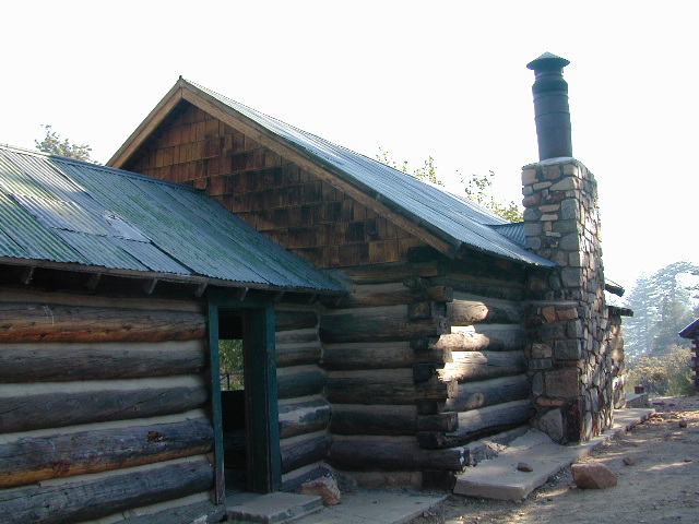
Cabins are also called guard stations, huts, bunkhouses. Most are located on mountain tops, but a few exist in desert regions. Some are refurbished & available for overnight rentals. Bare bones furnishings, so forget the frills. People come up here for the thrills. To be outside w/ epic views, way away from the urban grind & to feel on top-of-the-world.
See the full list of overnight accommodations on mountain peaks & ridges, some near meadows @ National Forest Cabin Rentals
Bald Mountain Lookout (no overnight stays) off of Sherman’s Pass Road #22S05, 4×4 may be needed.
Bald Mountain 9382′ elevation; in between the Kern Plateau & Kern River
Always check for local fire conditions at nearest ranger station, obtain a free campfire permit when camping outside of developed campgrounds, and always practice fire safety when visiting our public lands. You can be held liable for wildfires. Outta control campfire, cigarettes, idling vehicles on tall, dry grass. Be very cautious with fires on the often dry, west coast.


 A high clearance vehicle may be needed to reach certain camp spots, but many can be accessed with a standard passenger car. Low riders will likely bottom out and motorcycle riders will get dusty.