Tag Archives: car camping

What is Camping?

Old Timers Berry Creek

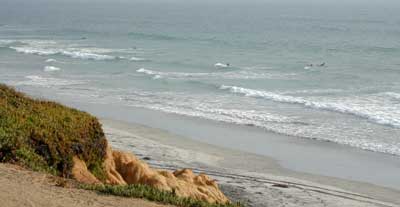
Basically, what is Camping?

4x4 camping RV camping car camping primitive camping backpacking cabin camping

BLM camping State Park camping National Forest campgrounds National Park camping


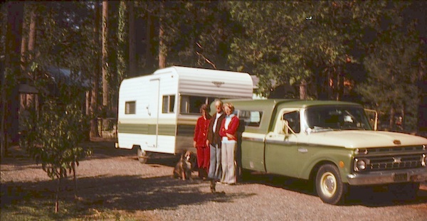
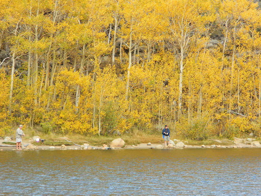
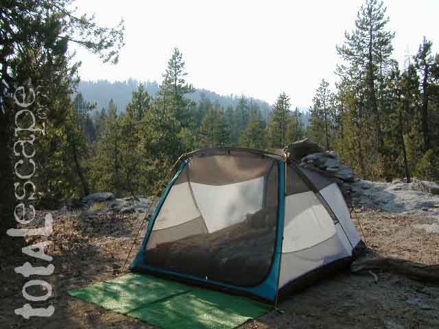
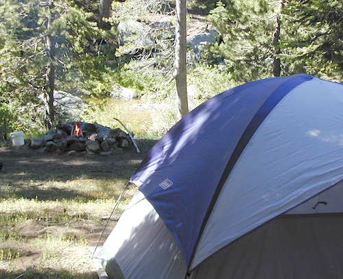
An overnight stay out-of-doors. Sleeping out under the stars.
Air bed, camping cot, tent… or just a tarp on the ground.
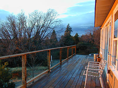
Perhaps a luxury Cabin Rental in the mountains or on the coast. Your choice.

stars camptruck campfire

campFrom a luxurious cabin in the mountains, to a small clearing in near a meadow with a stream nearby – with just a backpack, the idea of “camping” is always a bit different for each person. Roughin’ it for free – in the wilderness, or on the back roads; Or pay dearly for the price of real amenities, while on vacation.

car camping

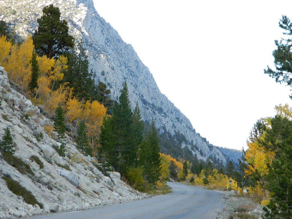
Various types of Camping in California:

type of
camping
average
cost per night
brief description – what to expect
modern cabin $300 – $600 better than a hotel room, full kitchen, phone, internet, TV, real furniture and maybe a hot tub
rustic cabin $90 – $299 bare minimum, beds, kitchen sink, electricity. maybe a bathroom
tent cabins / yurts $60- $150 wood floors, canvas walls, sleeping cots. reservations accepted. (very popular) may be open seasonally
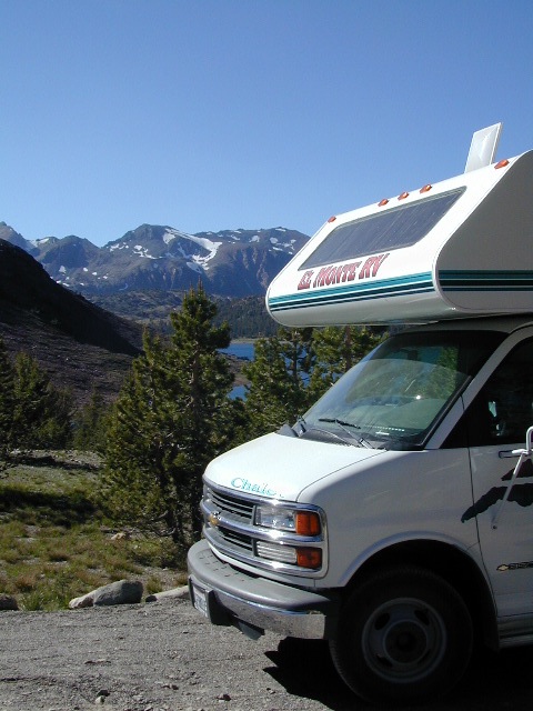
camper vans, motorhome,
recreational vehicle
rentals, or own it all creature comforts on wheels, lots of luxury. camp the back roads.
camper shell own it mini motorhome on the back end of a pickup truck. smaller than RV
RV campground $35- $80 50+ sites, lots of facilities & families w/ RVs. reservations accepted
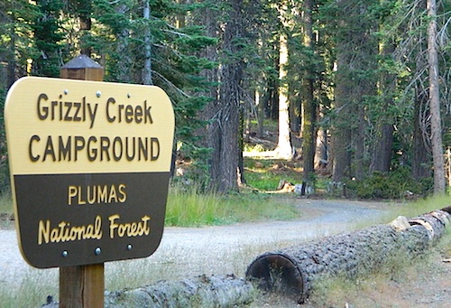
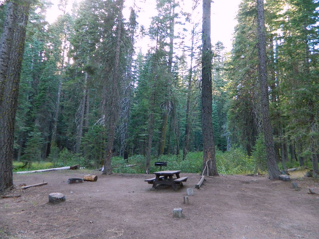
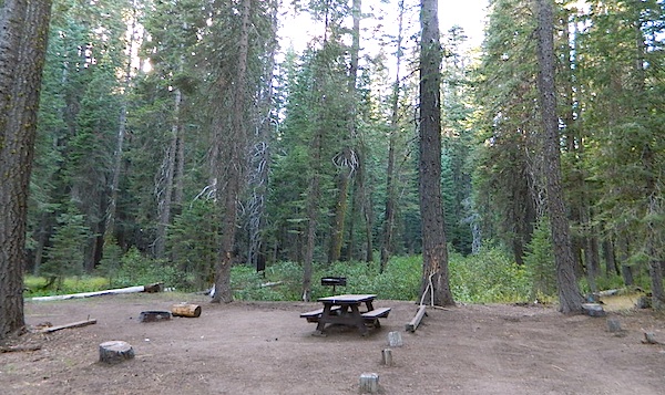
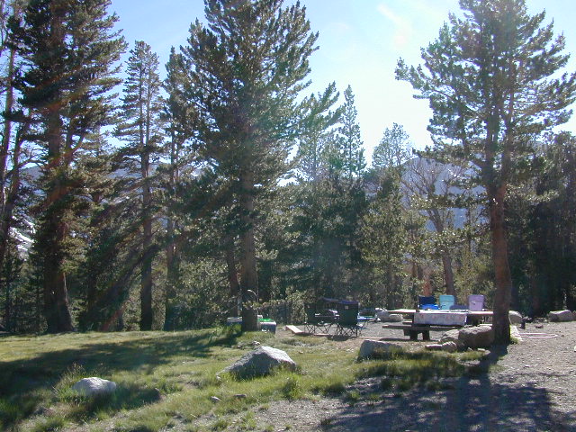
developed campground $20- $50 usually 30 – 100 sites, paved loop, facilities. toilets, piped water. plenty in our camping section (most popular)
small campground $12- $27 less than 25 camp sites, pit/vault toilets. plenty small campgrounds listed in our camping section
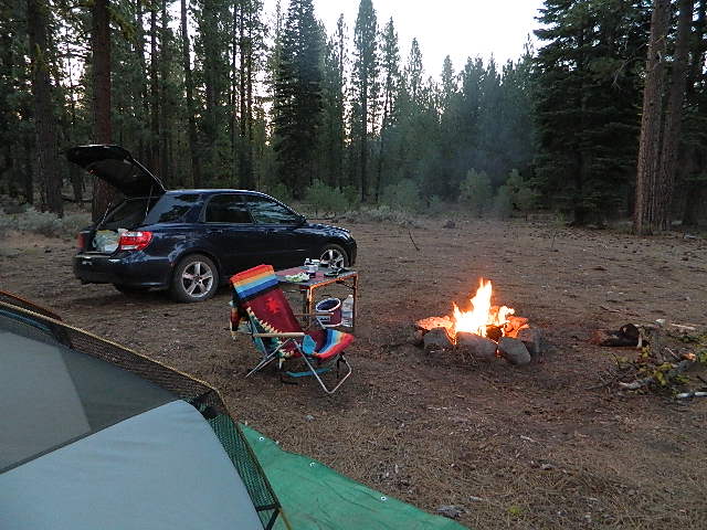
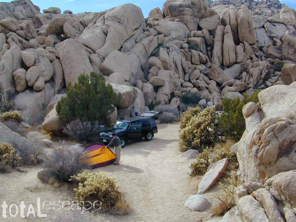
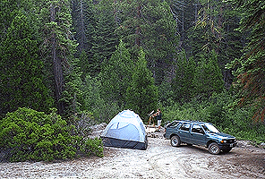
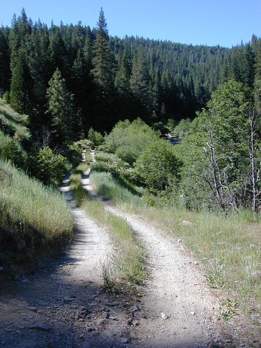
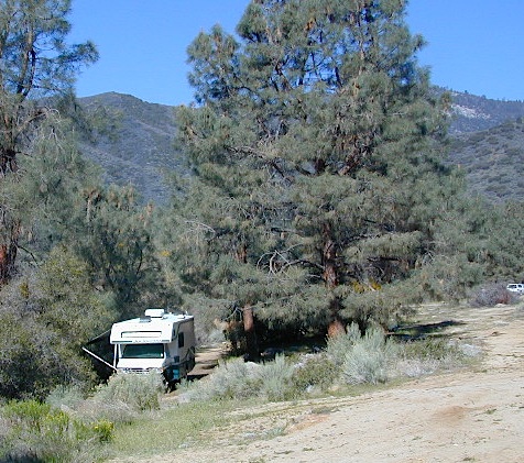
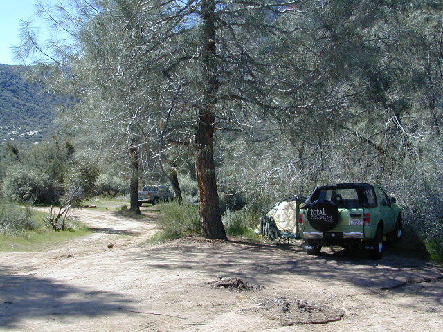
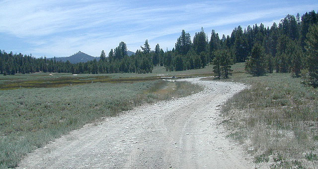
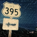
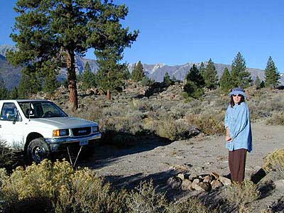
primitive car camping free way-out-there camp spots w/ dispersed camp sites, for the rugged self-contained, self-sufficient camper; access usually via dirt back roads.
SUV/ 4×4 camping free remote spots on long, steep, bumpy dirt roads; dispersed camp sites in secluded areas. 4 wheel drive may be needed
walk-in campsites
bike-in campsites
low cost or free camp sites that require you to physically haul your camp gear from a parking area to the camp spot, ranging from 1/8 mi. walk to a 1-3 mile hike
backpacking free w/ wilderness permit ultimate in seclusion, bring it all on your back, on foot into the wilderness & enjoy trail camps

  pinetree    fish

River Beach Campground
Trinity River Camping, Douglas City, CA

yellowpost

SO CAL CAMP FIRES – Yellow Post Campsites are remote camping spots in secluded areas, in a designated fire safe clearing. Camp FiresNo facilities such as toilets or showers. Maybe a picnic table & fire rings, if you’re lucky. Southern California forests have these kinda spots. Required campfire permit & you must double check on local fire restrictions.

Tent Cabin Rentals

Canvas Tent Cabins & Yurts

These structures are half way between ‘roughing it in a tent on the ground’ & having a ‘mountain cabin’. Tent cabins have wooden floors w/ canvas walls and roof; Dismantled annually for winter rain/snow, they are usually only available in mild, coastal climates or during summer months in the mountains.

deluxe-tent-cabin
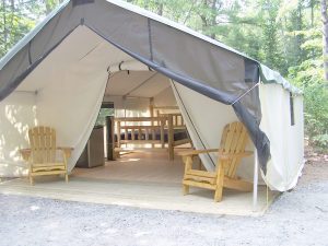
Rentals typically include sleeping cots, but you’ll need to bring your own bedding (sleeping bags, sheets, pillows). Some rentals include shaded porches, wooden decks, minimal furniture, kitchenettes and/or wood burning stoves. Electricity may be available, or maybe not. Ask ahead of time, if you really must have that particular luxury when on vacation.

Yurts are a ’round version’ of this canvas cabin – which need to be aired out, often (to prevent mold). Yurt rentals are very popular and in high demand in California.

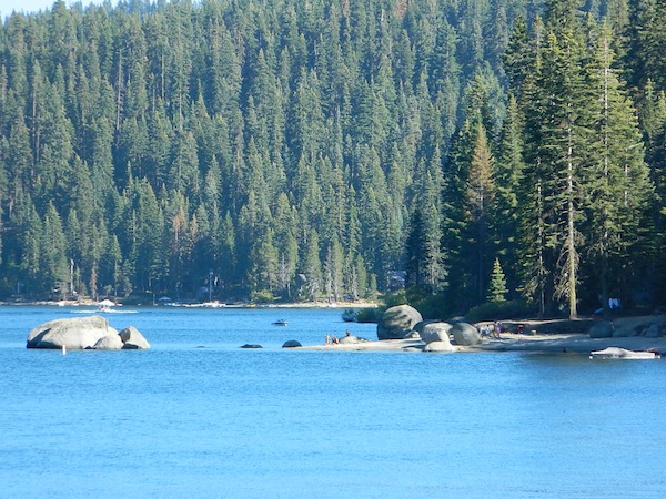
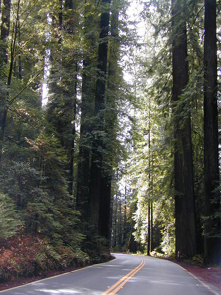
Find these type of rentals at yoga retreats, hot springs, beach canyons, remote lakes, redwood forests, high sierra camps, fishing camps and at certain RV parks.

National Forest Service Rangers wildlife

Deck w/ View

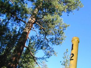
National Forest Fire Lookouts
& Historic Cabins

hiker

Tent Camp Yosemite Valley

Camping California Back Roads


Central Valley Reservoirs

California’s Central Valley Recreational Lakes & Reservoirs

boatingcampingRV campshiking fishing

(listed from north to south)

North State / North Valley / North Sacramento Valleyboatramp

Black Butte Reservoir
Stony Gorge Reservoir
East Park Reservoir
Lake Berryessa
Lake Oroville SRA
Thermalito Afterbay
Thermalito Forebay
New Bullards Bar
Collins Lake

Sunset at the Lake
fishOak foothills of the Historic Gold Country, at the edge of the Sierra Nevada mountains.

  • boating
  • canoe
  • camping
  • fishing
  • hiking
  • houseboats
  • kayaking
  • wildflowers

Most Central Valley Reservoirs have blooming wildflowers in early springtime. Summer heat can measure triple digits for months as most of these lakes are located below 1000′ elevation.

Central Sacramento & California Delta

Trimmer Boat Ramp
Trimmer Boat Ramp @ Pine Flat

Central Valley / San Joaquin Valley

Lake Amador
Lake Camanche
Pardee Reservoir
New Hogan Lake
New Melones Lake
Woodward Reservoir
Salt Spring Valley Reservoir
Lake Tulloch
Don Pedro Lake
Turlock Lake SRA
Modesto Reservoir
Lake McClure
San Luis Reservoir SRA
Eastman Lake
Hensley Lake
Woodward Reservoir
Millerton Lake SRA
Redinger Lake
Pine Flat Reservoir
Lake Kaweah
Lake Success
Buena Vista Reservoir

Walk-In Camp Site at Lake
Walk-In Camp Site at New Melones Lake, Gold Co

Kaweah Sequoia Sierra
Lake Kaweah, near Mineral King & Southern Sequoia NP

Hidden Falls Campground

waterfall hidden
Hidden waterfall is tucked inside a cove of granite, at the far end of the parking lot.


2021 – THIS CAMPGROUND IS CLOSED indefinitely,
due to the Castle Fire 2020

Hidden Falls Campground
Middle North Fork of Tule River

Northside of Western Divide Highway 190, near Springville, CA

Mountain Home State Forest
559-539-2321 summer
559-539-2855 winter

Located right on the middle north fork of the Tule River

Inside an unknown area called Mountain Home State Forest, this small campground has a few spots that fill up quickly on weekends and at anytime during in the summer months. Campground closes seasonally, for winter snow.

Usually open: MAY-OCT

HIDDEN FALLS CAMPGROUND camping

Elevation: 6,150′
Number of Sites: 8 walk-in camp sites
Reservations: No
Sites Available: First come, First serve
Vehicle Accessibility: 20′ max.
Length of Stay: 14 Days
Water: River nearby
Toilet: Vault
Bear Boxes: Yes
Season: Closed for winter
Fee: Yes
Operated By: National Forest Service
Closest Town: Springville, California

tent camping on river

Motorhome RV campers beware; no hook-ups, no paved roads.  This is a primitive style camp, way back on a dirt road – not suitable for large vehicles.

NOTE $ This used to be one of our favorite FREE spots, but they recently started charging an overnight fee for this campground.

viewsfromcamp
Views from Camp
  • hikerbike
  • camp
  • fish
  • hike
  • picnic
  • stargaze

Golden Trout Wilderness trailheads nearby. Plenty of hiking opportunities, great scenery and several Sequoia groves to visit.Mountain biking is allowed on the dirt roads. Single track trails may be overgrown or even off-limits, due to the fragile eco-system around Sequoia trees.

You may actually love this little camp so much, you won’t want to go anywhere else. How ’bout just chillin out: relaxing near the water. Shady swimming holes. Fishing in the Tule River.

Pack a picnic: Back road exploration is a great day trip, for there are many dirt roads weaving in and around this park, near the Giant Sequoia.

Tule River, South Fork
Tule River, North Fork

SEQUOIA_mapHidden Falls is accessible via a long, narrow, paved mountain road; then a dirt road, leading 3 miles back to two very secluded campgrounds: this one & neighboring Moses Gulch Campground.

western south sierra

North of Springville on Highway 190, turn left (north) on to J37, some call it  Balch Park Road (Google Maps has it as Wagner Drive) and follow it up 3.5 miles to Bear Creek Road (#220). Drive 17.5 miles on curvy Bear Creek Road, turn right and follow signs to campground.

saabaru_forest

Autumn Camping California

Autumn Lakeside

RV camping Tent Camp Fishing Hiking

Amazing autumn colors can be found through OCTOBER and NOVEMBER in California, but you’ll need to leave the city in order to find the very best colors and scenic beauty. Fall season happens quickly (within weeks) in the high country and slower (months) in the lowlands. Plenty canyons and parks in the urban centers have hiking trails thru some nice trees, but nothing compares to the backroads, creeks and rivers of the big mountains.

Elevations, the higher the better, is where you’ll find the real displays of color. Aspen groves can be found along mountain slopes, creek canyons from 5000′-10,000′ in elevation. Cottonwood trees are found in the drier regions, in ranching areas and in desert canyons – up to about 6000′ elevation. Aspen trees start to turn yellow as soon as the chill of nights drop; if the temperature shift is subtle, the aspen leaves become more orange as the days go into the fall season. If an early snow or freeze happens, just one night, the glorious foliage becomes dead brown crispies dangling in the wind.

campfire
CAMP FIRE RESTRICTIONS are still be in place from the dry summer, and now comes the autumn winds. Any decent amount of rain can change the fire burn status, so make sure to check with the rangers for up-to-date fire info.

Best Autumn Campgrounds in California  

Many of these campgrounds are located in or near aspen groves & are simply spectacular during the fall months. Some may be located near alder groves. Maple trees located along rivers turn golden between September and October. 

Higher elevation (7000′-9000′) colors will change faster and earlier in the year (as soon as September), whereas the lower countryside may wait until late October. 

Pack warmly, cuz the cooler temps at night (20-30 degrees) is what makes these awesome, little autumn leaves change colors. The change can happen very fast (in days). When the early season snows move in – usually a minimal dusting by October, fall colors can fade fast.

Southern California

Tent Camp

has minimal fall colors.

Big Bear Lake, CA
Lake Arrowhead, CA

Ojai Camping – Wheeler Gorge
Sespe Hot Springs (hike-in access only)

Camping

Southern and Central Sierra

have a few aspen groves and several cottonwood canyons.

Aspen Hollow Campground NFSNFSlogo
Giant Sequoia @ Hume Lake, CA
near Kings Canyon NP

Big Meadows Campground NFS
Stanislaus National Forest
Arnold, CA

Dinkey Creek Campground NFS
Sierra National Forest
Shaver Lake, CA

Kern River Canyon

Ponderosa, CA
Quaking Aspen Campground Tent Camp
Quaking Aspen CabinTent Camp
Giant Sequoia National Monumentcamp

Wishon Reservoir
Lily Pad Campground
Sierra National Forest

Yosemite National Park
Tuolumne Meadows, Hwy 120
Yosemite Valley Campgrounds

Kirkwood, CA
Blue Lakes Road
Carson Pass CA Highway 88

Camping

Northern Sierra

The North Sierra Nevada Mountains covers the region with Lake Tahoe and Donner Pass, and north Gold Country. River canyons with fall colors include American River, Yuba River, and the Feather River.

Aspen Group Campground
@ Jackson Meadows Reservoir
near Truckee, CA

Berry Creek, CA
Milsap Bar, Middle Fork of the Feather River

Bucks Lake, CA
Haskins Valley & Grizzly Creek Campground
Oro-Quincy Highway – Plumas NF

Downieville, CA
Yuba River Campgroundsshowers

Grover Hot Springs State Park  

Hope Valley, CA
Hope Valley Campground Tent Camp

Lake Tahoe

Camping

Autumn Bliss Hike

Eastern Sierra

The Eastern slopes of the Sierra Nevada is the ‘place to be’ for Autumn Colors in California. The dramatic desert meets the tallest granite peaks. Every canyon is a different scene, many lakes lined with aspen groves, some have a creek with aspens.

Aspendell, CA
North Lake Campground
Lake Sabrina Road
Bishop Pass (high country hikes)

sabrina creeking

Bishop, CA
Bishop Creek, Hwy 168
Ancient Bristlecone Pine Forest – both Silver Canyon and
Cottonwood Creek have aspen trees. (both are 4×4 roads)

Bridgeport, CA
Green Creek Road w/ signage for
Dunderburg Meadow
Twin Lakes
Hoover Wilderness (high country hikes)

Independence, CA
Onion Valley CampgroundTent Camp
Kearsarge Pass (high country hikes)

June Lake, CalifoniaTent Camp
June Lake Loop #1S63 / CA Highway 158

Lee Vining, CA
Lee Vining Canyon / Hwy 120
One of the biggest aspen grove canyons in the state of California.
NFS campgrounds
NFS Campgrounds in Lee Vining Canyon: Big Bend, Aspen Grove, Boulder, Moraine, and Cattleguard Campground.
NFS Camps @ Yosemite’s EAST GATE (9000′ elev): Ellery Lake, Junction, Saddlebag Lake, and Sawmill Campground.

Lundy Lake
Virginia Lakes
Trumbull CampgroundTent Camp

Lone Pine, CA
Alabama Hills has a few cottonwoods.
Whitney Portal has some alder trees and a few aspens.hiker

Mammoth Lakes, CA
Red’s Meadow Campground
Devils Postpile NM
Laurel Lakes Road (rough dirt road)
Convict Lake

Tom’s Place, CA
McGee Creek Campground Tent Camp

Rockcreek Road
Impressive Rock Creek Road #4S12 in Rock Creek Canyon, one of the very best “Scenic Autumn Drives” in the whole Eastern Sierra. Numerous NFS Campgrounds on this road; many of which close for the season, just about the time then fall colors peak.

Rock Creek Lake Campground @ 9600′ elev Tent Camp

Iris Meadow Campground @ 8600′ elev

iris meadow
Iris Meadow on Rock Creek Rd

Camping

Northern California

The “North State” primarily has the big river canyons, most of which have fall colors. Eel River, Klamath, Yuba River, Feather Rivers.

Blue Lake Campground
South Warner Mountains
Modoc National Forest

South Warner Mountains
Road 64 Modoc NF

Eagle Lake
Aspen Grove Campground (walk-in camp sites)
Susanville, CA

Large Eagle Lake, N of Susanville, CA

Sundial Bridge, over Sacramento River
River RV Parks
Redding, CA

Weaverville, CA

Mount Shasta, CA
(downtown of Mt. Shasta City)

McBride Springs Campground
(slopes of Mount Shasta)

Lake Siskiyou
Beach Camp Resort & RV Park

4239 W. A. Barr Rd
Mount Shasta CA
530 926-2610

McCloud, CA
McCloud Falls,  South of Mount Shasta

Algoma Campground
McCloud Creek, South of Mount Shasta

MacArthur-Burney Falls State Park
Dusty Campground

Lassen Volcanic National Park
Lassen National Forest
Lassen Camping
Lassen Lakes

Susanville, CA
Bizz Johnson Trail
Roxie Peconom Campground

Siskiyou Autumn Colors
(still to come)

eagle aspens
Paved over aspen groves @ South Eagle Lake, CA


Frazier Park Camping

Mount Pinos Camping & Frazier Park Campgrounds

Drum Circle Camp
Mount Pinos Fire Circle Camp Spot
camp5
Gold Hill Campground (which is now closed) – right next to Piru Creek.

camp

Frazier Park and neighboring towns, like freeway-close Lebec and Gorman, is where the Los Angeles hills meet the Kern County mountains. Mojave Desert meets to Coastal Range. EXIT I-5 @ Tejon Pass (elev 4144′)

Wildflower hills, seasonal creeks, forested peaks, high desert canyons. Bike trails, hike trails, off road routes. High elevation backpacking, hang gliding, mountain biking and camping in every direction.

MTB SOCAL
Mountain Bikers love the trails at Mount Pinos.

High desert washes, oak creeks, pinyon pine forests, mountain meadows and numerous peaks – Frazier Peak, Reyes Peak, Alamo Mountain, Mount Pinos, Mount Abel (Cerro Noroeste) and north facing San Emigdio ridge.

Mt. Pinos District:

campground elev spots veg toilet water notes
Aliso Park, Cuyama 3200′ 11 oak pit no Aliso Cyn Rd. (#10N04)
Ballinger OHV Camp 3000′ 20 pinyon vault no Rd# 9N10, Cuyama Valley
Camp-O Alto 8286′ 12 jefferey pit no ridge, Cerro Noroeste
Caballo Campground 5850′ 5 oaks pit no Rd# 9N27, Cerro Noroeste
Cherry Creek 4×4 5200′ 2 oak no spring 4WD trail, Cuddy Valley
Chuchapate Campground 6000′ 30 pines vault piped Rd# 8N04, closed winter
Chula Vista Walk-In Camp 8300′ 12 pines vault no walk-in camps & RV lot
Cottonwood Campground 4600′ 2 ctnwd no creek 4WD only trail, fish
Dome Springs Camp 4800′ 4 oak pit no Rd# 8N40, Lockwood
Dutchman Camp 6800′ 8 pines no no Rd# 7N01, 4WD trails
Half Moon Campground 4700′ 10 pines pit no Rd #7N03, May-Oct
Kings Campground 4250′ 7 pinyon vault no OHV & Piru Creek
Marian Campground 6600′ 5 pine pit no closed in winter
McGill Campground 7500′ 50+ pine vault seasonal mountain biking
Mount Pinos Campground 7800′ 19 pine vault seasonal closed winter
Nettle Springs Camp 4400′ 9 pinyon vault no Rd# 8N06, Apache Cyn
Ozena Campground 3660′ 12 cottnwd vault no Lockwood Rd
Pine Springs Camp 5800′ 12 pinyon pit no Road #7N03
Pleito Campsite 5000′ 2 mixed no no dirt rd access, dispersed
Rancho Nuevo 3550′ 2 mixed no no river crossing
Reyes Creek 4000′ 30 oaks vault yes creek camping
Reyes Peak Pine Mt 5200′ 6 pines none no ridge camping
Salt Creek 4×4 3000′ 2 mixed no no 4WD only
Sunset Campground 4300′ 2 cottonwd no no Lockwood / Piru Creek
Thorn Meadows 5000′ 5 pine pit no Rd# 7N03C, horse corral
Tinta Campground 3600′ 3 pinyon pit no river crossing
Toad Springs Camp 5700′ 5 pinyon pit no Rd# 9N09, Quatal Cyn
Twin Pines Camp 6600′ 5 pine vault no Dry weather only
Valle Vista Camp 4800′ 7 mixed pit no condors, new toilet

See Mount Pinos Recreation Campgrounds only

Group Camping Sites in Los Padres Forest

Hiking Pinos Signs
Mount Pinos – Peak to Peak hike.

Maps of Los Padres NF –nettle spring camp

Los Padres mountain towns –

DSCN0043

Toad Springs Campground atop Quatal Canyon. Small camps located in Los Padres NF have no fees, and often no toilets – so bring the shovel.

Many dirt roads are gated seasonally for wet weather or snow. Call rangers to find out which routes are open before you plan your weekend. Or have a plan B and C camp site ready if route is closed. Flashfloods, thunderstorms, and erosion means you may all-of-a-sudden need to use your 4WD. This is the mountains after all. UNpredictable weather is common.

frazier park camping

Primitive Camping in Quatal Wash, next to the OHV Route and the Chumash Wilderness

PeaktoPeak
Peak-to-Peak Hike: the toughest climb you’ll do, this decade.


Bucks Lake Campgrounds

indian rock
Indian Rock is a beach (day use only) on the west side.

Bucks Lake, California

Below is a list of all the developed campgrounds & RV Parks surrounding the Bucks Lake region of Plumas National Forest in the Northern Sierra Nevada mountains. The infamous Pacific Crest Trail (PCT) runs through Bucks Lake Wilderness, so there are also trailhead camps and backcountry camp sites that are not in this list. This high elevation region closes the campgrounds for winter: NOV- APRIL

campgrounds RV campgrounds fishing lakes campgrounds launch lake camping hiking lakes

Campgrounds at Bucks Lake

campground elev spots veg toilet water
Hutchins Group Camp 5200′ 10 pines flush piped
Lower Bucks Campground 5200′ 6 pines vault piped
Mill Creek Campground 5200′ 10 pines vault piped
Sundew Campground 5200′ 19 pines vault piped

NFS camps

NFS Camps nearby

campground elev spots veg toilet water
Deanes Valley Campground 4400′ 7 mixed vault creek
Grizzly Creek Campground 5400′ 8 pines vault piped
Silver Lake Campground 5800′ 9 pines vault lake
Snake Lake Campground 4200′ 14 mixed vault lake
Whitehorse Campground 5200′ 20 pines vault creek

USDA
Plumas National Forest

Oroville Ranger Station NFS
530-534-6500

Quincy Ranger Station NFS
530-283-0555

Bucks Lake CA

PG&E Campground @ Bucks Lake

Haskins Valley Campground
16731 Bucks Lake Rd
530-283-0256

Grizzly Forebay Campground
CLOSED in 2013 by PG&E
530-896-4263 (for more info)

RV Parks @ Bucks Lake

Bucks Lake Camp & RV
280 Bucklin Road
530-283-2221

Bucks Lake Marina
16469 Bucks Lake Rd
530-283-4243

Lakeshore Resort
16001 Bucks Lake Rd
530-283-2848

grizzly creek

San Diego Beach Camping

Coastal Cliffs San Diego

San Diego Coastal Campgrounds
Mission Bay & North County
SD Beach RV Parks & Camping

RV camps camp

San Diego’s mild climate means camping is available all year round. Winter storms can get windy and rainy, but most campgrounds are still open. From north county where the coastal cliffs overlook the ocean, to downtown bay side marinas w/ RV camping, to camping right on the sand w/ ocean crashing just feet away. Bike paths are common around downtown San Diego, so you can bring your bike or skates.

San Diego has 2 BAYS, both located along Interstate 5: The main bay downtown is called San Diego Bay (one of the deepest on the west coast) and the other a few miles north, is named Mission Bay (a man-made coastal waterway w/ green parks and paved bike trails).

Reservations are required at almost ALL coastal campgrounds, especially around holidays, any 3 day weekends, and all summer long. Tons of tourists flock to Southern California and this is a very popular coastline – with busy little cities and crowded beach towns. Beware: if you are seeking secluded camping – this would not be the place.

Best Beaches

listed from south to north

Carlsbad Cliffs

There are numerous private RV resorts, some quite large, like KOA and GoodSam parks located in and around San Diego county. Most are metro-close and not located on the beach. This list is primarily coastal camping options for the San Diego region.

camping SoCal

Seagulls at Cardiff

see also
San Diego Campground Camping

see a list of all
San Diego cities & towns

baybridge

San Diego Camping

Redwood Beach Camping

NorCal Redwood Coastal Camping

Redwood Campgrounds

Del Norte County, Northern California

redwood101

There are a few special places in California where redwood trees grow right down to the shore, but it is rare. Searching for place to pitch a tent (under the redwoods at the coast) is possible, but a bit harder to find than you might imagine. State Parks usually offer the standard paved camp site. Maybe need to drive dirt roads to find redwood seclusion.

Crescent City Camping

redwoodmap

Klamath Coast Camping

blue links lead to State Park pages with camp reservations.

State Park

Redwood Park Campgrounds State Parks

Redwood National Park National Park
Camping 

  • Demartin Campground
  • Flint Ridge Campground
  • Mill Creek Campground
  • Nickel Creek Campground (backcountry)

Eureka RV Campgrounds

redwood camping norcal

If you are seeking free or dirt cheap, primitive camping on the coast, then LOST COAST CAMPING on the Mendocino border is one option. Or head east, inland to the abundant National Forest. Dirt roads of the Six Rivers National Forest offer old logging roads, creeks, and secluded places to pitch a tent. Campfire permits are needed for dispersed camping, or ‘boondocking’ as some call it.

Dirt back roads can get muddy during the wet season, so know your vehicles capability and if you are unsure, check with the local rangers over the phone (preferably a ‘field ranger’) before venturing out. Remember that rain and mud are the norm, most of the year.

Fog is typical of the region. Enjoy the sunshine – when you can!

see more towns nearby –

Smith River
Crescent City
Klamath
Orick
Trinidad
Arcata
Eureka
Scotia
Ferndale
Petrolia
Garberville
Redway
Shelter Cove

Perfect Tent Spot

Boulder Cove Camping

Choosing your Perfect Tent Spot

Before you can choose the ultimate place for your tent, you must decide where it is you wanna sleep OUTDOORS. What ultimate location? Your destination can play a huge factor in you getting a peaceful nights rest. And do you really need a campground? Or, are you ready to try to rough it, without the amenities? Best camping is off-the-beaten-path, and usually on the back roads. Trailhead camps, 4×4 camps, best view camps, creek camps; Dispersed camping, often called primitive camping. Focusing here on car camping, tent camping and backpacking routes.

Sierra Granite ViewsJust choosing a flat tent spot isn’t good enough anymore. You crave the best camping experience and seek real nature, with minimal crowds. No annoying neighbors, no parking hassles, no traffic or cars passing by. We at Total Escape are here to help you get to your wilderness goals and experience nature like never before. Right here, right now and it doesn’t hafta cost you a dime.

California Camping Destination:

Let’s start with a terrain overview. California has it all ­ – mountains, deserts, coastal, rolling oaks with rivers in the countryside, plus the infamous wine country and developed campgrounds within city limits. Desert camping in summer months should only be attempted by the experienced camper who loves 90+ temperatures. Mountain camping in winter can be freezing, so make sure you have the proper gear. Good maps are a must have and the readily available National Forest maps are your best avenue for getting and staying away from the masses. Visit our Destinations page to decide what kinda place you wanna ‘call home for the weekend’.

topo maps
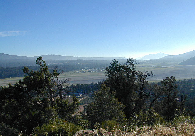
If you are the “I don’t care where I sleep kinda guy, as long as I can do/see this many things” all crammed into a 3-day holiday weekend, then you best do your research ahead of time. Get a good map, measure the mileage, plan picnic stops and sightseeing. Plan to set camp in a central location close to the main highway to call home-base, so you can be off exploring as much as possible.

Schedule in some “down time” or a full day for relaxing. Calculate driving distances and pad it w/ an extra hour. Maybe make a campground reservation if you are visiting a National Park or busy State Park. If you plan to wing it without reservation, always have plan B or plan C  options already picked out. With millions of residents and tourists on the west coast, chances are you won’t be the only person wanting to do Big Sur, Yosemite or Point Reyes that particular weekend.

camp

Helpful Hints
for a Good Nights Sleep @ the Camp Site

  • Bring a decent Sleeping Pad. Air Mattress with the inflator pumps will be the most luxury, without sleeping directly on the hard ground. Therm A Rest sleeping pads are another fine option, for those who like to travel light and still have air underneath them. Extra blankets, always.
  • Flat & Soft ground is the goal in choosing the best tent spot. Park your vehicles over the rocky slanted ground and keep the best flat areas for your camp site.
  • Do not pitch a tent in a meadow, no matter how inviting it looks. Wetlands and meadows are fragile ecosystems, an area that should be protected.
  • Look at the big trees above your sleeping spot and examine them. Do not place your tent near or underneath a dead tree or a dead limb. Trees do break and fall, especially if winds pick up. This could be a life or death choice, so remember to look up.
  • Bring abundant good tent stakes and USE them. Yellow plastic stakes are for soft cedar and sand. Thin aluminum stakes are for backpackers. Large steel nail stakes (some w/ plastic tips) are best stakes for all-around terrain.
  • Bring a mallet to pound stakes or use big rocks to hammer them. Gloves are also a good idea!
  • Never underestimate the use of a big tarp and some rope.
  • Guy lines help hold a tent in place when windy weather turns to big storm. If wind is in the forecast, then do this task before you head out on your day hike away from camp.
  • Make sure selected tent site is flat. Lay on the ground to check it out.
  • Place head of bedding up hill (if any slant can be noticed)
  • Tents should be at least 10 feet away from your campfire. At least 100 feet away from a creek or lakeshore.
  • Beach camping at the ocean edge; Know the high tide mark; place tent accordingly.
  • Slot canyons are awesome, sandy, narrow washes, many with cliffs and caves. In the desert badlands these can become raging rivers w/ flash floods. When rain is heavy in the mountains many miles away, you could get flooded in the low lands. If you hear any thunder – RUN to high ground. Better off picking another camp site, than to die by a wall of water!
  • Shade in the Desert sounds like an oxymoron, unless you find a place with high cliffs, or slot canyons. Tamarisk trees and palm canyon locations are usually an oasis of RV tourists & travelers. Hot Springs are also busy spots. Pinyon pines, juniper and over-sized manzanita can be found in higher elevation deserts above 1000′. The prime desert camping season is generally October thru March, as April can easily soar close to 90 degrees high.
camp

Campgrounds listed individually on
California town pages A to Z

campfires

morning sunshine

Late Nighters & Sunrise:
Determining East & the North Star

reading the stars

Sequoia NF - The Den

Campground vs. Dispersed Camping:

Follow Dirt Roads
Some people swear by the open spaces and back road camping options, as they have more seclusion, plenty privacy and best off all, no campground fees. You might need a GPS and a high clearance SUV to reach some of these camp spots, but you will be blessed with a unique secret spot to call your own.

Campgrounds come in all styles these days: From small primitive camps on a creek to the luxurious RV resorts with laundry room and showers. And then there is everything in between. This web site Total Escape specializes in FREE camping on the back roads and the smallest of campgrounds.

Reservations are usually accepted at the most popular camp locations, many are wide open on weekdays and the majority of campsites overall are available on a first come, first serve basis.

El Dorado Campgrounds

El Dorado Camping

Kirkwood Lake
Kirkwood Lake, California

El Dorado National Forest
Carson Pass Hwy 88, Ebbetts Pass Hwy 4, Gold Rush Country
Sierra Nevada Mountains, Alpine Lakes

campground elev spots veg toilet water notes
Airport Flat Campground 5300′ 16 vault no Ice House Reservoir
Azalea Cove Campground 4900′ 10 vault lake Union Valley Reservoir
Big Meadows Campground 5300′ 54 pines flush piped handicap access
Blue Lake Lower Camp 8100′ 16 vault piped PG&E; fish, boat, camp
Blue Lake Dam Upper 8200′ 25 vault piped PG&E; fish, boat, camp
Caples Lake Campground 7800′ 35 pines vault piped fishing lake
Capps Crossing Campground 5200′ 12 pines vault piped gold panning
China Flat Campground 4800′ 25 vault piped Silver Fork Rd
Dru Barner Campground 3200′ 16 flush piped equestrian trails
Gerle Creek Campground 5300′ 50 pines vault piped handicap access
Fashoda Campground 4900′ 30 vault piped handicap access
Hell Hole Campground 5200′ 10 vault piped walk-in
Upper Hell Hole Campground 4600′ 15 vault lake Hell Hole Reservoir
Ice House Reservoir Camp 5500′ 83 vault lake handicap access
Jones Fork Campground 4900′ 10 vault lake Union Valley Reservoir
Kirkwood Campground 7600′ 12 pines vault piped narrow road; fishing
Lone Rock Campground 4800′ 5 vault lake Union Valley Reservoir
Loon Lake Campground 6500′ 62 pines vault piped equestrian; group site too
Lovers Leap Campground 5800′ 21 pines vault piped rock climbing
Lumberyard Campground 6500′ 5 pines vault RV access
Middle Creek Campground 8200′ 5 pines vault piped fishing creek
Middle Fork Cosumnes River 6780′ 5 vault crk PG&E, swim, fish
Mokelumne River Camp 3200′ 8 vault crk swim
Moore Creek Campground 3200′ 8 vault crk swim
Northshore Campground 6378′ 15 vault lake Loon Lake Campground
Northwind Campground 5500′ 9 vault lake Ice House Reservoir
Pardoes Point Campground 5900′ 10 pit no Bear River Reservoir Rd
Pipi Campground 3900′ 51 pit no handicap access
Sand Flat Campground 3900′ 29 pit no fishing
Silver Fork Campground 5500′ 35 vault piped fishing
Silver Lake Campground 7200′ 62 pines vault piped boating lake
South Fork Campground 5200′ 17 vault piped fishing
South Shore Campground 5900′ 22 vault piped Bear River Reservoir
Strawberry Point Camp 5500′ 10 vault lake Ice House Reservoir
Stumpy Meadows Campgr 4400′ 10 vault lake handicap access
Sugar Pine Campground 6000′ 10 vault no boating
Sunset Campground 4900′ 131 vault piped boating
Wench Creek Campground 4900′ 100 vault crk boating
Wentworth Springs Camp 6200′ 8 vault crk 4WD recommended
West Point Campground 4875′ 8 vault lake Union Valley Reservoir
White Azalea Campground 3500′ 6 vault crk Mokelumne River
Wolf Creek Campground 8200′ 42 vault piped boating, fishing
Woods Lake Campground 4900′ 25 vault pump handicap access
Yellowjacket Campground 4900′ 40 vault piped boating, fishing

see more about El Dorado National Forest

waterfalls

nearby towns –

El Dorado Forest Maps –

Where is your favorite place to camp?

tent camping

This is one of those silly questions that has no real definitive answer from DanaMite. If you have camped California at all, you know it can be awe inspiring around every corner, especially the Sierra Nevada & the Coastline.

Most California transplants get so wrapped up with city life, college & new careers, that they rarely venture past the county park, much less the county line.

When they finally do break away, they are often misled to crowded campgrounds with steep reservation fees and too many RVs, walking distance to a mini mart. Often they assume camping in California is not what they thought it was going to be. Not like the photos they once saw, not the dream-like places of wildness, not the privacy they had envisioned. They may even give up on the whole ‘camping experience’ all together.

It does not have to be like this. Information is power. This web site Total Escape was made for YOU, the avid Escaper, who desires the best camping options available. One who will respect the land & care; Those that will teach their children to clean up litter & respect our precious public lands.

The California deserts are just as magnificent as the alpine meadows; The mountain peaks, the hot springs, coastal cliffs to the forests, and the river canyons!

It’s all good.

There cannot be one favorite camp spot, when you find yourself camping every month. Each site is a new destination, a place to explore, with usually a reason to return. Each season your favorite spot will change & be more desirable some months over others. From aspen trees changing color in the Eastern Sierra to wildflower meadows of the High Sierra, every place has its own unique flavor.

Drive further for less people and more nature!

National Forest Service

California National Forests are a great place to start.

Highland Wildflowers

Collections of California Camping Lists

sierra camps

Specific Places to Camp in California

Sierra Nevada Campground

Kern Flats Camping Free

chamise flat

Dispersed Camping Kern River

boondocking
primitive camping
undeveloped sites

KERNVILLE, CA

Located north of the small community of Riverkern and south of the Johnsondale Bridge, numerous flat camp spots adjacent to the rivers edge can be found.

johnsondale bridge @ KERNAnt Canyon Dispersed Area
Brush Creek Campground
Calkins Flat Dispersed Area
Chamise Flat Dispersed Area
Chico Flat Campground
Corral Creek Campground
Springhill Dispersed Area


Kern River Road
Sierra Way in Kernville travels north along the Upper Kern River & becomes Mountain Hwy 99 – which eventually connects with the Western Divide Highway in Giant Sequoia National Monument.

California NFS Kern RVing kern campgrounds open camping

truckcamping

Dispersed Camping Areas along the Kern River

Open Year Round! These FREE camp areas are called dispersed camping sites. No pavement, no picnic tables, no bathrooms, no piped water. Portable toilets & trash bins may be available in the busier summer months. Campfire permits are required for all campfires, BBQs, and camp stoves. Fire restrictions are common in extreme dry conditions. 14 day limit on camping.

Mountain Biking Kernville kern hiking fishing Kern snow Kern

camping, fishing, kayaking, mountain biking, rafting

Many flats are signed w/ small brown signs, while others are not. Some are actually flat and easy to access, while others are steep, eroded dirt trails unsuitable for RV travel.

Kelly’s Hole, overgrown, unknown, well-known or burnt beyond recognition? Roads End is no more.

Camp sites listed on this page are dispersed camping areas around the Kern River Area. Not all camp spots are listed, cuz many are unnamed. Bring your GPS to mark your favorite camp sites and you can arrive in the dark, late at night, anytime, (avoiding city traffic after work).

chamise pre-wildfire

Several spots known as “dirt flats” are easy accessible right off the pavement of Sierra Way. Primitive river camping, fishing spots and raft launch areas north of town. Vault toilets might be available during busy summer months, but you’re on your own the remainder of the year. Bring a shovel and take a hike, away from the water flow. And if that sounds like too much work for a potty break, maybe you are not cut out for the primitive kinda camping style. No garbage service either: pack it in, pack it out.

Wildflowers are abundant in the Kern Canyon nearly every Spring season (April & May), which is a popular time to enjoy this region. Autumn brings minimal fall colors to this dry, desert mountainous landscape, but the fishing is decent at that time of year.

campfiresCAMPING OUTSIDE OF CAMPGROUND means you must obtain a free fire permit from the local rangers. Sometimes these dispersed spots are fire-safe areas, and you are allowed to have camp fires. Other times campfire restrictions are in place w/ wildfire dangers too extreme and no fires are allowed, anywhere. (Not even inside a developed campground!)

Kern RV spot

river Kern 
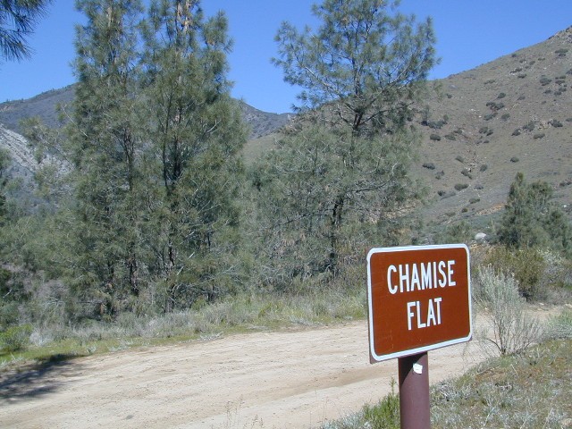
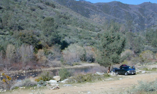
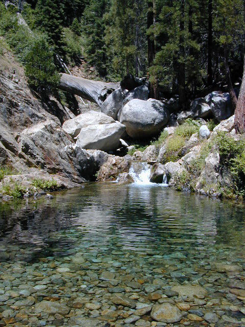
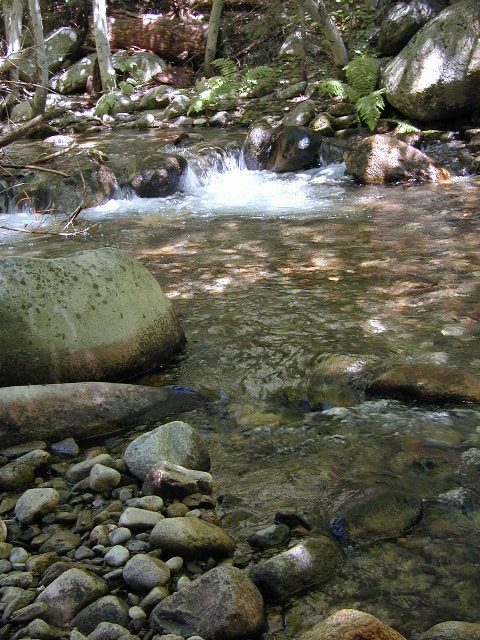
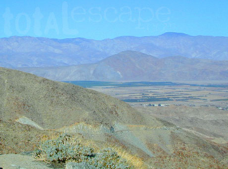
WILDERNESS NOTE: The USDA National Forests web site states that “Camping and campfires within 25 feet of the water’s edge is prohibited due to the Wild and Scenic Designation”, but that doesn’t seem to stop some from setting up right on the fragile rivers edge. Doubtful that this rule is being enforced by the rangers, but consider yourself warned unless they start to get serious about this restriction. Many believe that the free camping along the Kern river is destroying it, so don’t be surprised if these areas get closed or barriers placed at the flats.
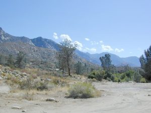
Caulkins FLAT has some new boulder barriers put in place which prevent cars from reaching certain ideal camp spots (right at the waters edge). Tough luck. Now we have to hike more.

California rivers

kern flat camping

Upper Kern River
North of Kernville, CA

all camps below listed from south to north

ALL CAPS = developed campgrounds managed by US Forest Service, w/ links to Kern River Campgrounds. California NFS

HEADQUARTERS CAMPGROUND (NFS)

Both Halfway & Thunderbird used to be dispersed camps, but they were converted to reservation-only Group Campgrounds by the National Forest in 2014

Chico Flat
2500′ elev
Just south of Hospital Flat Campground.
This camp area is known as “Chico Flat Campground” on GoogleMaps.

HOSPITAL FLAT CAMPGROUND (NFS)

Corral Creek
3200′ elev
Hike to Corral Creek Beach & Picnic Area.
This camp area is known as “Corral Creek Campground” on GoogleMaps.

Spring Hill
This camping area is marked as “Upper Springhill Campground & “Lower Springhill Campground” on GoogleMaps.

GOLD LEDGE CAMPGROUND (NFS)

Ant Canyon
Just north of Goldledge Campground, along the Upper Kern River.
South of Salmon Creek; Hike to Salmon Creek Falls.

Chamise Flatchamisespot
12 miles north of Kernville, CA
This camping bluff could be the most forested of all the ‘kern flat’ camping areas, but river is a short hike down a very steep cliff. Fishing is excellent in this stretch.

Calkins Flat
15 miles north of Kernville, along the Upper Kern River. Just south of Fairview (McNalley’s). Sign at the location reads a different spelling of “Caulkins Flat”. Kayak and rafting put-in spot. One of the best sites for large groups. Area is also known as simply “Lower Campground” on GoogleMap.

free kern river camp

FAIRVIEW CAMPGROUND (NFS)

LIMESTONE CAMPGROUND (NFS)

Brush Creek
3600′ elev
Just south of Sherman’s Pass Road turnoff. This place also serves as a Day Use Area, where Brush Creek meets the Kern. Kayaking put in spot. Popular fishing area. Large open dirt parking lot with a vault toilet.


California rivers

Lower Kern River
Southwest of Kernville, CA

Lake Isabella has some shoreline camping with wide open access to the lake. Paradise Cove perhaps?

Historic Keyesville – “off-roaders camping paradise” along the river, but no swimming is allowed due to the extremely dangerous section of river. OHV trails lead (west) down river for many miles. Dirt bikes love the rugged boulder-scapes and steep hills. FREE camping; BLM Kern.

SANDY FLAT CAMPGROUND (NFS) – Open all year long! Terraced & paved hillside with numerous camp sites and plenty of room to spread out. RV campers like this location, due to the proximity to Hwy 178. elev 2300

HOBO CAMPGROUND (NFS)

Remington

Remington Hot Springs can be a zoo at times w/ the amount of people who love to stop here. A busy dirt parking lot, right across from the Remington trailhead sign. Many vehicles park here daily for day hikes, hot springs, fishing – and people also like to camp out, although camp sites are on slopes (not ideal), only a few and they fill up fast (before sunset).

Total Escape TIP: The very best camps at Remington are actually the ones you hafta hike down to. Less than a half mile down to the rivers edge to find a private mini beach. Pack light and arrive prepared to walk several miles (back & forth, several times).

Old Kern Canyon Road parallels Sierra Highway 178 and sits well above the river, so any flat spots you find will have great views w/ minimal river access.

Lower Kern River
Lower Kern River has very limited camping options.

California Off Road Areas

4x4 Sierra

The list below is of awesome California locations that do have off-road trails surrounding them. Some destinations listed are heavy use off-road – with OHV parks or camping nearby, while others are simply scenic dirt backroads or forest roads for easy driving. Topographic maps can be found for most areas, and should have all roads displayed, dirt and paved routes, as well as campgrounds, hiking trails and trailheads.

SoCal 4x4 Big Bear

This California “off road towns” list was originally part of the California Off Road Maps page, but it surely deserves it’s own unique post, since it is an ever expanding list. Ongoing.

Searching for Off Road Parks inside California?

Try these links –
State Vehicular Recreation Areas
California OHV Parks

OHV Yields To All

Borrego Valley

Camping Inyo

Primitive Camping Inyo National Forest – Eastern Sierra Car Camping

395 Sign

The mighty US Highway 395 runs from the Mojave Desert north through the eastern side of California, where the state line of Nevada meets. Mount Whitney and the tallest peaks run on the western range @ 14,000’+ the highest in elevation.

The Inyo Mountain range sits @ 11,000′ to the east side of the Sierra Nevada. Major elevations but little vegetation, when compared to it’s neighboring Sierra range. The Inyos lay in the rain shadow of the taller western mountains – but still get snow. Plenty of primitive SUV camping on the dirt roads throughout this desert area north of Death Valley.

camp sitesA more forested part of the Inyo National Forest is the Eastern Sierra region. Encompassing Mount Whitney & Mammoth Mountain area, plus the entire Hwy 395 corridor. This side of the Inyo National Forest is quite different that the desert range of Inyo.

Eastern Sierra back roads lead all over the place & may require 4WD. A high clearance 2WD can still get you to some awesome viewpoints & scenery. No picnic tables or toilets are available out in the boonies, but plenty of seclusion & vast open space wilderness. INYO Forest Service Map is highly advised for this area. There are many dirt roads for dispersed primitive camping w/ no fees. See the Camping Checklist to make sure you’ll have what you need.

Open (free) Camping along Hwy 395

Monache Meadows – This high elevation (8000′) south Sierra Meadow is accessible by 4WD truck or SUV. Near Kennedy Meadows CA

Walker Creek Rd – quick camp in the lowlands; an easy in route camping near oaks & creek. Southside of Olancha CA, look for turn off & follow dirt road up into the tight canyon. No RVs whatsoever.

Fish Slough Road – open desert camping w/ popular bouldering & rock climbing areas; near Indian Petroglyphs. N of Bishop, CA

Road# 6S16 – Pine Creek Road – Camp on creek, no facilities. NW of Bishop behind Rovana.

Lower Rock Creek Road – signed turn off US Hwy 395. Only a couple good camp spots tucked away in the trees. Small creek, very overgrown, traffic noise minimal. Nearby Round Valley @ Sherwin Pass had a big wildfire in wintertime (dry) FEB 2015!

crowley camps

Road# 4S02 – Owens Gorge Road – N of Bishop behind Lake Crowley. Free RV camping w/ boulders & pines

Road# 4S86 – Laurel Lakes Road – Camp in aspens @ small lakes, high elevation; no facilities. SE of Mammoth

Road# 2S05 – Deadman Creek – Camp in pine forest on creek; no facilities. N of Mammoth

Road# 2S07 – Owens River Road – Camp in pine forest, near hot springs; no facilities. N of Mammoth

Parker Lake Road – Camp along aspen creeks or in pine forest, near lakes; no facilities. E of Grant Lake on June Lake Loop (Hwy 158)

Coyote Flat 4×4 Bishop – just west of Bishop CA is a 4 wheel drive paradise, Coyote Creek – This steep dirt road is quite a climb. A true off-roaders dream of open space, great views, large meadows, & alpine lakes. Great primitive camping along creeks, in pine or aspen forest or near small secluded lakes. Real remote Sierra high country, usually only reached by backpackers, is accessible to those who dare to venture off the beaten path of Highway 395.

At the golf course keep your eyes peeled — from the highway take Schober Ln. / Underwood Ln. due west through a residential neighborhood to the backside of the town. Find the electrical power station to the left at the base of the hills. Veer onto the slightly paved /dirt road to the right of the station & continue straight up the sandy wash. 4×4 is recommended, since the lowest gears are needed for the careful climb. The road will begin to get steep & gain in elevation fast. The area up here changes with the mileage: passing pinyon pines on cliffs, topping off to high meadows & aspen lined creeks, finally reaching large towering pines & small alpine lakes with snow melt still visible. Basically TREE LINE. This region is most likely open only half the year, due to its high elevation of 8000’+ and winter snow.

  • BISHOP PASS TRAIL MAP
  • INYO Forest Service Map
  • PALISADES TRAIL MAP
  • WHITNEY MAPS
  • Saddlebag Lake Campground

    Saddlebag Lake, Yosemite East Side

    Inyo National Forest @ Tioga Pass, Hwy 120

    Yosemite High Elevation Campground

    Yosemite Lake View Camp Sites

    Tioga Pass camping on the eastern side of Yosemite National Park, just outside park boundaries is Inyo National Forest lands. Snow is usually epic up here and some of the deepest on the range of light.

    Several prime campgrounds line this popular Sierra pass, highway 120. Most camps are located along the busy highway just outside the National Park gate. Behold, this prime choice destination is a few miles back off the highway, at the end of a graded dirt road. Smaller RVs okay.

    Saddle Bag Lake

    High altitude, tree line, thin air, snow melt everywhere, spectacular elevations and dark skies make this an awesome stargazing spot. Summer is busy with trailers, boat rentals, horses and day hikers. Locals and fishermen use this small campground often, so tourists should feel lucky to find such a rare camp here. First come, First serve, when it is open (only half the year).

    Elevation: 10,000′
    Number of Sites: 19
    Camping Reservations: No
    Sites Available: First come, First serve
    Vehicle Accessibility: Vehicle limit 22 ft. max.
    Length of Stay: 14 Days
    Water: Piped; lake, creek nearby
    Toilet: Vault
    Season: Closed during winter & spring
    Fee: Yes
    Operated By: National Forest Service
    Closest Town: Lee Vining, CA

    Inyo National Forest
    Bishop Ranger Station
    760-873-2400

    RV Camper Lake