Tag Archives: chico

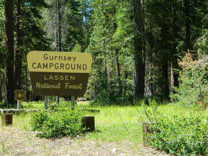
Gurnsey Campground

bestcampgurnsey

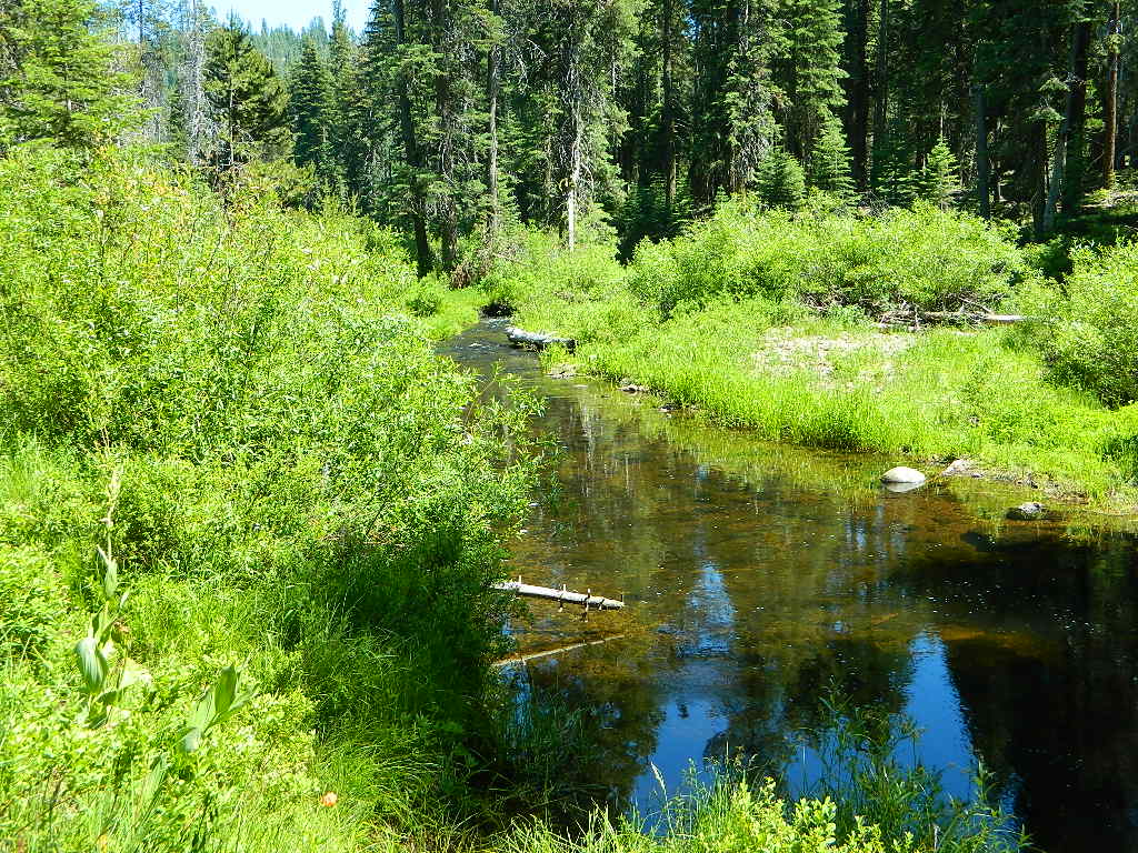
Gurnsey Creek, Lassen Forests & Fishing

NFS Gurnsey Creek Campground: W of Chester, CA

CLOSED 2020-2022: Campground is undergoing some serious work with removal of hazardous trees and forest clean up. NOTE: DixieFire 2021 did not damage this portion of the forest highway (CA 36)

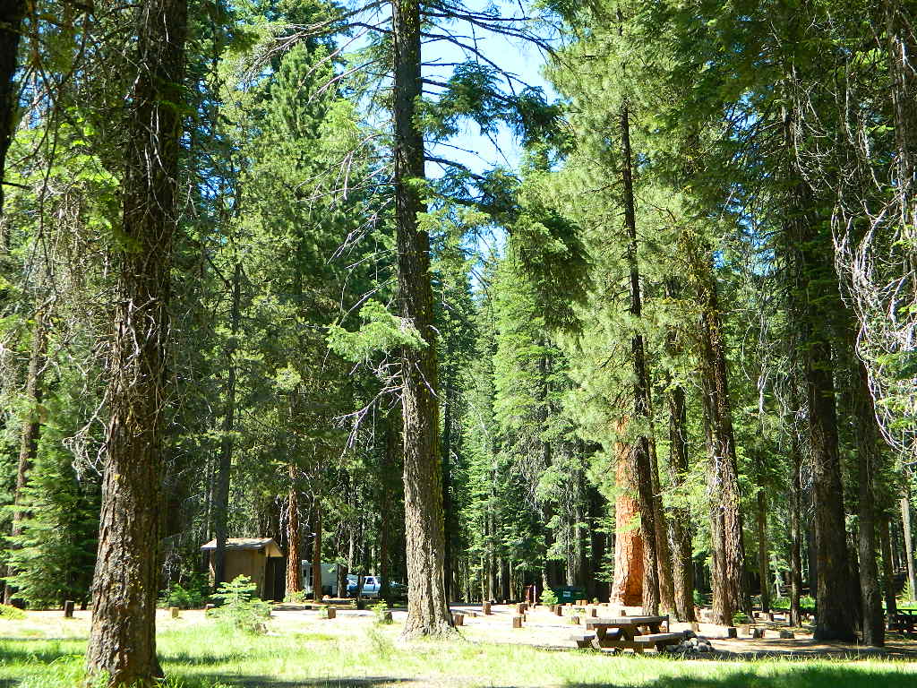
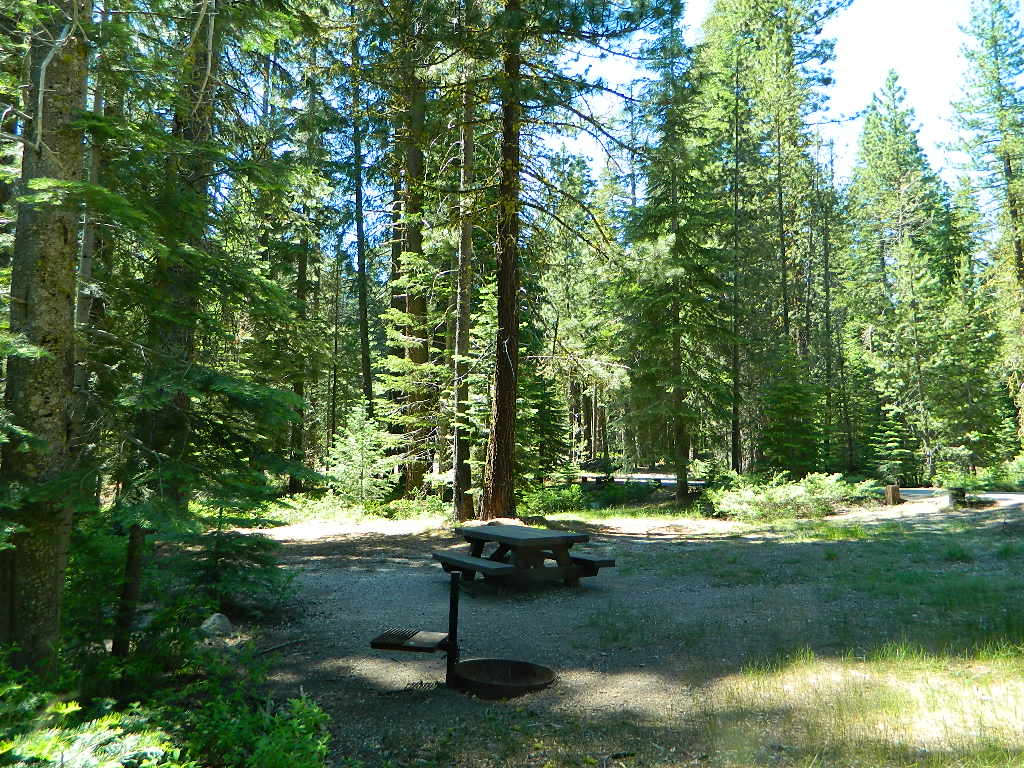
A developed USDA campground along forested Highway 36, near the junction of Chico’s Hwy 32. This stretch of 36  overlaps with north-south Lassen Hwy 89. Awesome fishing creek, meadows, hiking trails and mountain biking trails nearby. Paved, level camp sites w/ easy access to Lassen Volcanic Park and the National Forest.NFSlogo

This is a popular camp just south of the Lassen National Park boundary and 5 miles east of Child’s Meadow Resort. Car camp, tent camping, some spaces for large motorhomes. Plenty fishing, hiking and mountain biking trails.

Gurnsey Creek begins in Childs Meadows, north on Hwy 36 – just outside of Lassen National Park 

gurnseycreek

Gurnsey Creek Campground, California

on Gurnsey Creek; Campground open May-October
(depending on snow)
gurnseysign

Lassen Creek Camping

52 camp sites on Gurnsey Creek @ 4700′ elevation; vault toilets, creek and piped water, bear boxes; first come, first serve camping – and reservations are also accepted

GURNSEY CREEK CAMPGROUND

Max Camper Length: no limitations
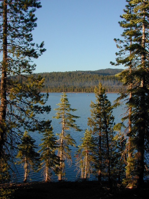
Shady forest camp sites w/ creek. Numerous fishing spots. Close to Lassen Volcanic National Park, Chester and Lake Almanor. Backpackers, day hikers and horseback riders will enjoy the PCT nearby. Pacific Crest Hiking Trail runs to the east side of this campround.pct

CHESTER, CA ranger
Rangers Office: 530-265-4531
Almanor Ranger DIstrict, Lassen NF

GROUP CAMP RESERVATIONS NFS

2 reservable Group Camps are available at this campground. Group Site 1 can accommodate up to 56 people; Group Site 2 can accommodate up to 112 people.

Free Camping nearby.
If you are seeking primitive camping in this Lassen area, look for dirt roads in the USDA National Forest lands, which surround the National Park boundary.

to the west – Lassen Road #14 – the Blue Ridge, north off of Hwy 89 @ Mineral.

to the south – Yellow Jacket Road #29N48 around Turner Mountain, which is south-southwest of Mill Creek.

to the east – Lassen Road #10 – head north off of Highway 89 in between Chester & Westwood.

see also – Lassen Lakes
lassen park mapHighly advised: a real map, a printed ‘hard copy’ shows both the National Park and the National Forest of Lassen on one map – with topographic features, all mountain peaks, creeks, lakes, trailheads, plus all dirt and paved roads.

Trailheads near Gurnsey Campground lead out to –

NEARBY TOWNS:

View Larger Map

Gurnsey overview
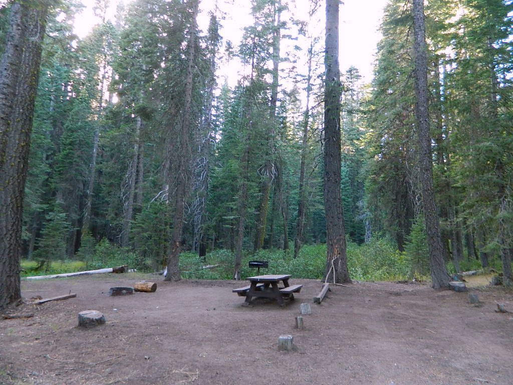
Mature forested, creek campground, close to the highway

Wildflower Century Ride

Butte County Bicycle Ride
Chico Wildflower Century Ride

Bike riders can enjoy the hilly Wildcat 100 & 125, the traditional Wildflower 100 & 65, the Flatflower 60 & 30, and the Childflower 12. Wildfest pre-ride party.

Annual event: April

Chico, CA

wildflowercentury.org

IMG_1625L Chico Velo cycling club

California Central Coast Bike Event:
San Luis Obispo County also has a cycling race / ride called the Wildflower Century SLOBC held in March

wildflower

califrepublic

Snow Goose Festival

BIRDERS unite under the Pacific Flyway

spillwaycrews

20+ years running, the Snow Goose Festival’s mission is to increase public awareness, understanding, appreciation and conservation of the diverse wildlife and unique habitats of the northern Sacramento Valley.

Workshops and field trips; advanced reservations online

Annual event; January
530-592-9092

CHICO CA

snowgoosefestival.org

Rent Camping Gear

Camp Gear Rental / Camping Equipment Rental /

Outdoor Equipment Rentals

Backpacks

recreational equipment

California Camping Rentals: Outdoor gear rentals in California are more common in big cities with large retailers and harder to find in specific, small towns on the back roads. Plan ahead trying to rent gear. Recreation destinations such as Joshua Tree, Mammoth & Bishop might have rental shops, but finding a rental store in an unfamiliar area could be ‘just chancing it’.

Be sure, before you go.

DanaMite has revised this handy list for your wilderness vacation planning, recreational equipment and rental needs.

2020 UPDATE: Recently deleted 4 shops on this page, so don’t be surprised if more gear rental shops vanish.

RENTAL SHOPS specific to California

major retail chain:

REI rents gearREI rents gear!

hiker

independent rental shops in small town Cali:

(listed from south to north)

Stone Equipment Rental (Bishop) 760-873-7907
MammothGear.com (Mammoth Lakes)
Yosemite Equipment Rentals (Yosemite Valley)
Sierra Nevada Adventure Company (Gold Country)
MountainSportsChico.com (Chico)
TheFifthSeason.com (Shasta)
Humboldt State Rentals (Arcata)

camp

California gear rentals

RENTAL SHOPS online

There are many reason people rent gear. Tourists or vacationers passing through, wanting to experience a non-hotel night outdoors; Beginner backpackers wanting to try out equipment before committing to a big purchase; College students on an impromptu road trip; Novice cross country snow skiers;  Doggy now packs in his own food & water too.

A new concept now being delivered is online gear rental, from camping to fly fishing. Seriously. They can ship you quality rental gear, and you can use it, test it, review it, all hands-on, out in the field. These 2 players in the West both ship nationwide. Imagine what else the web will rent in the future?

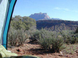
viewfromtent

Centerville, California

Centerville is a popular place name inside California

Carson River
Carson River CA SR 4

Centerville Flat Campground
Alpine Co.

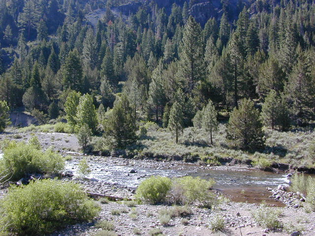
@ California State Route 4 (Hwy 4 east Ebbetts Pass). Silver Creek meets the east fork of Carson River in the majestic Eastern Sierra, W of US Hwy 395.

Humboldt-Toiyabe National Forest
Centerville Flat Dispersed Campground NFS
Open all year, no fee, vault toilet
Latitude : 38.631372
Longitude : -119.723082

Historic Centerville wiki

driftwood

Centerville Beach
Humboldt Co.

Centerville Beach County Park

4000 Centerville Road
Ferndale, CA
Contact: 707-445-7651

North Coast California,  Humboldt County – This long steep coastline was the place of a historic event in 1860s, a ship wreck off the coast. In heavy seas, the ship beached 20 miles below the mouth of Humboldt Bay, near the village of Centerville. https://en.wikipedia.org/wiki/Centerville_Beach_Cross

ferndaletourism
Ferndale has tourism.

Northern Cal

Ferndale, CA – has dining, accommodations, local business, and maybe an RV park. Mostly residential. Rural farmlands, forests, and remote. Wild, windy, rugged coastline.

Shops in downtown Ferndale, CA

driftwood

Centerville, CA
Butte Co.

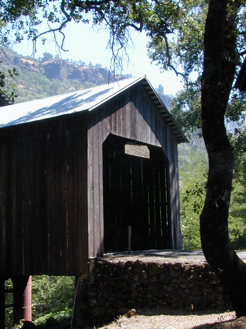
In between Chico and the volcanic ridge (called Paradise), is the historic Centerville Road, which leads to oak lined canyon of the small community of Centerville. Mostly rural residential w/ a museum, schoolhouse, creek, covered bridge, maybe a winery, orchards and a oak canyon.

CAMPFIRE, Butte County – This particular area has been scared by the wildfires of 2018, so expect some back roads to be closed. Landslides and tree falls are quite common after a wildfire, especially on narrow mountain roads. Nearby Paradise got destroyed, but they are rebuilding. rebuildparadise.org

Honey Run Bridge

BELOVED BRIDGE

Located along Honey Run Road. Chico’s historic Honey Run bridge, was built in 1887, reconstructed in the late 60’s,  and recently destroyed by wildfire in late 2018. Honey Run Road intersects w/ Centerville Road further up the canyon.

2020: Reconstruction on a new bridge is already underway.
Honey Run Covered Bridge Association

driftwood

Centerville Road
Modoc County Rd #54

Southwest Alturas, CA

A major backroad (paved connector) in Modoc; connecting South Alturas @ US 395 to Canby @ Highway 299

a whole lotta nuthin’

Rural residential w/ farmlands and cattle grazing. California Pines (POA), Donovan Reservoir and the Pit River is along this route called Centerville. Portions of zoom on GoogleMaps has this Centerville Road listed as N West Street

dirtbikes

Modoc National Wildlife Refuge is @ US Highway 395

cowtown
Alturas, northeast California – is cattle country.


driftwood

100103 - San Joaquin Valley - Sanger/Reedley area

Centerville, CA
Fresno Co

Rural, residential farm community along Highway 180
E of Fresno, CA

W of Sequoia & Kings Canyon National Park

Kings Red Rafters
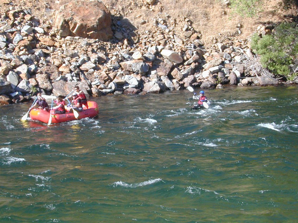
Kings River – Red Rafters + Kayaker

canoe

hiker


Black Rock Campground

Black Rock, California

At least 5 camping grounds called Black Rock around California.

Sierra Blackrock Reservoir

desert

SouthernCal Desert

Black Rock Campground @ Joshua Tree National Park

NPS

This popular camp is in Southern California, near the town of Yucca Valley, California. This is a NPS Campground w/ fee, reservations are recommended. Open all year long.

Joshua Tree National Park is nearby, but the campground is not located inside the park. It is however, a close to the town of Yucca Valley.

Black Rock Campground NPS
760-367-3001

• Elevation: 4,000′
• Number of Sites: 100
• Vehicle Accessibility: RV 40′
• Campsites Reservation: Yes
• Length of Stay: 14 Days
• Season: Open all year
• Trailheads: Warren Peak, High View Nature Loop, Panorama Loop

joshuatrees

Black Rock Horse Camp located next door, can accommodate up to 20 horses w/ corrals and room for RVs. With California Hiking & Riding Trail, group camp and equestrian facilities.

horseback


Sierra Nevada Mountains

LGVR
La Porte camping at the big Reservoir.

LGVR has a Black Rock Campground NFSlogoand boat ramp @ 5000′ elevation in Plumas National Forest. This is the only campground on the western shore of Little Grass Valley Reservoir – La Porte Road, La Porte, CA


northkings
North fork of Kings River , upstream.

Black Rock Lake (also known as Black Rock Reservoir) is located in the lower Kings Canyon region. North fork of the Kings River in Sierra National Forest; West of Kings Canyon National Park.NFSlogo

Sierra Forest Road #11S12 – a one lane, paved road – narrow, steep, RVs and trailers are not allowed.  Small campground, granite rocks, fishing, no boating.

gorgeview
Road #11S12, gorge view

NorthernCal

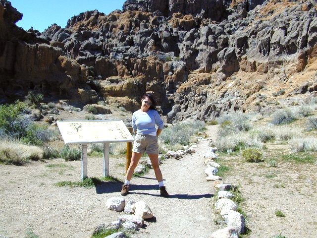
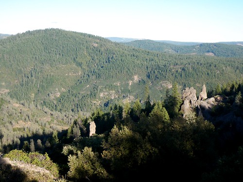
In the rugged volcanic canyons above Chico, CA – the Ishi Wilderness splits the landscape into volcanic rock ridges. Geologically, one of the oldest rocks in the Lassen National Forest. A small, rustic campground is way back in here – and if you are adventurous w/ a proper vehicle and bored – you could to go find it.

Black Rock Campground NFS

• Elevation: 2,100′
• Number of Sites: 6
• Vehicle Accessibility: High Clearance, maybe 4WD
• Camp Fee: No
• Campsites Reservation: No
• Length of Stay: 14 Days
• Vegetation: Oaks
• Season: Open all year
• Trailheads: Ishi Wilderness, Mill Creek Rim

hiker

Very long dirt road. Minimal facilities. Rustic and remote. No RVs.

Access from Highway 36, East of Red Bluff. Take Ponderosa Way.

Access from Cohassett Road in Chico. Cohassett Road all the way – up to Campbell Ridge, and then take Ponderosa Way.

Ponderosa Way is Lassen Forest Road #28N29, a dirt road access of 20+ miles. Unmaintained most of the year. Landslides and erosion are common on long dirt roads, so take caution and call ahead for road conditions.

In this wild canyon area, there are no services, maybe limited cell phone signal too. Beautiful views of the Ishi Wilderness, Mill Creek Rim and great swimming holes on Mill Creek.

This campground is not easy to reach. High clearance required on this route, but 4×4 is usually recommended.

You may need a chain saw depending on the time of year. Flash floods are possible in drainage from Mount Lassen, so check the weather forecast.

  • backpacking
  • camping
  • fishing
  • hiking
  • horseback
  • hunting
  • mountain biking
  • OHV trails
  • swimming

see more on Mill Creek California


butterfly

Black Rock City is a reference to the Burning Man festival

Annual event held in late August, on a dry lake bed in Nevada. Black Rock Desert BLM land, north of Reno, NV

4x4

Also similarly named Black Canyons & Black Mountains –

(located in Mojave Desert)

Black Canyon Road near Barstow, CA. Rainbow Basin, Owl Canyon Campground, Inscription Canyon petroglyphs. BLM Barstow

Black Mountain Wilderness

horseback

blackrockgroup
Mojave National Preserve Group Campground

Black Canyon Group Campground – high desert camping; near the Hole-in-the-Wall hiking trail in the Mojave National Preserve.
760 252-6108

  • group camping
  • equestrian camps
  • picnic areas
  • hiking trails
  • freeway close
mojavehikes
Mojave Hikes @ Hole in the Wall

Bucks Lake Campgrounds

indian rock
Indian Rock is a beach (day use only) on the west side.

Bucks Lake, California

Below is a list of all the developed campgrounds & RV Parks surrounding the Bucks Lake region of Plumas National Forest in the Northern Sierra Nevada mountains. The infamous Pacific Crest Trail (PCT) runs through Bucks Lake Wilderness, so there are also trailhead camps and backcountry camp sites that are not in this list. This high elevation region closes the campgrounds for winter: NOV- APRIL

campgrounds RV campgrounds fishing lakes campgrounds launch lake camping hiking lakes

Campgrounds at Bucks Lake

campground elev spots veg toilet water
Hutchins Group Camp 5200′ 10 pines flush piped
Lower Bucks Campground 5200′ 6 pines vault piped
Mill Creek Campground 5200′ 10 pines vault piped
Sundew Campground 5200′ 19 pines vault piped

NFS camps

NFS Camps nearby

campground elev spots veg toilet water
Deanes Valley Campground 4400′ 7 mixed vault creek
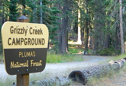
Grizzly Creek Campground 5400′ 8 pines vault piped
Silver Lake Campground 5800′ 9 pines vault lake
Snake Lake Campground 4200′ 14 mixed vault lake
Whitehorse Campground 5200′ 20 pines vault creek

USDA
Plumas National Forest

Oroville Ranger Station NFS
530-534-6500

Quincy Ranger Station NFS
530-283-0555

Bucks Lake CA

PG&E Campground @ Bucks Lake

Haskins Valley Campground
16731 Bucks Lake Rd
530-283-0256

Grizzly Forebay Campground
CLOSED in 2013 by PG&E
530-896-4263 (for more info)

RV Parks @ Bucks Lake

Bucks Lake Camp & RV
280 Bucklin Road
530-283-2221

Bucks Lake Marina
16469 Bucks Lake Rd
530-283-4243

Lakeshore Resort
16001 Bucks Lake Rd
530-283-2848

grizzly creek

Ishi Wilderness

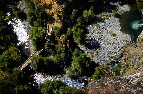
Bridge and Chute from top of Black Rock

NorCal Ishi Wilderness

41,840 acres
20 miles N of Chico, CA
Lassen National Forest

  • Barkley Mountain (elev. 4488′)
  • Black Rock Campground
  • Deer Creek
  • Flat Iron Mountain (elev. 4400′)
  • Iron Mountain (elev. 3274′)
  • Indian Ridge Campground
  • Mill Creek
  • Peligreen Place
  • Pine Creek
  • Pinnacle Peak (elev. 3293′)
  • South Antelope Campground
  • Twentymile Hollow

Up in the mountains behind Chico sits a rugged landscape of deep canyons lined with bizarre rock formations and roaring mountain creeks. Wilderness encompasses lower elevations – ranging from 1500′ – 3500′  – making this outdoor destination a winter haven, when the rest of the backcountry is covered in several feet of snow. One of the most historic wilderness areas in the state, as the aboriginal existence of the Native Americans came to an end in this area.

COHASSET ROAD climbs up the volcanic fin of Cohasset Ridge into the pine forests high above the valley floor. The paved road becomes dirt and the road name changes to Ponderosa Way (Lassen Road# 28N29). The Ishi Wilderness can also be accessed from the north side via Highway 32, near the Tehama State Game Refuge.


View Larger Map

  • backpacking trails
  • hiking trails
  • fishing creeks
  • horseback trails
  • wildlife viewing


Ishi Wilderness mapIshi Wilderness Map

Ishi Wilderness