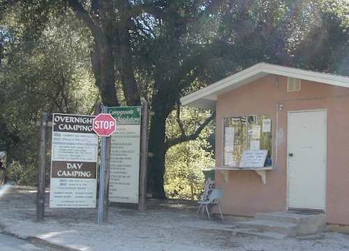
Tag Archives: palomar

Los Coyotes

los coyotes SD

Los Coyotes Camping
Los Coyotes Reservation Campground

North County San Diego
Camping SD

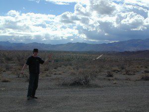
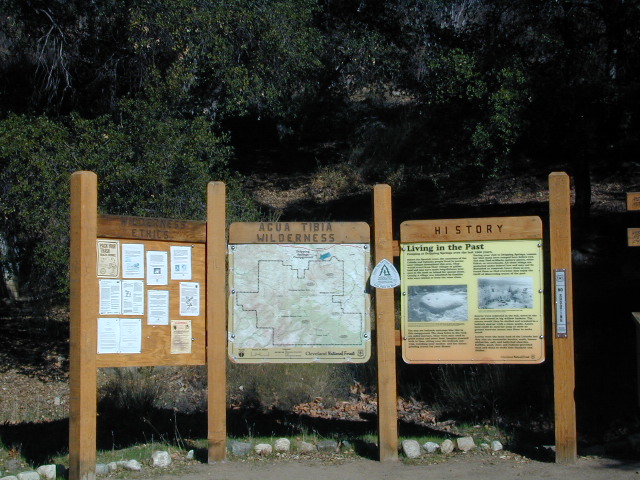
Way out there, on your way to the Borrego desert, past Warner Springs somewhere is this little gem of a location. Near the southern slopes of Palomar Mountain, on the edge of Cleveland National Forest.

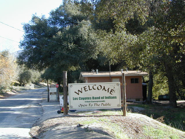
Los Coyotes Band of Indians Tribal Campground

open to the public

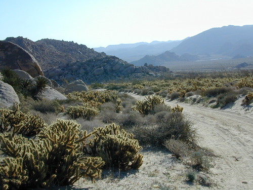
Great rural location, in-route to many destinations in Southern Cal. Temecula wine country, Warner Springs, Culp Valley, Anza Borrego Desert State Park, Borrego Springs.

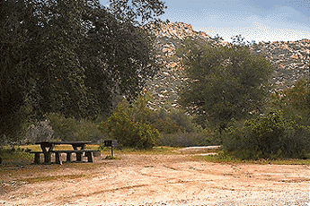
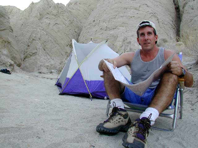
Campground is a popular spot with locals, so note that some weekends can get rowdy. Ask about a more secluded camp site option if needed. There is plenty of primitive land out here.

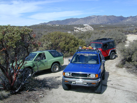
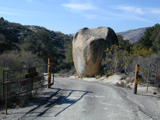
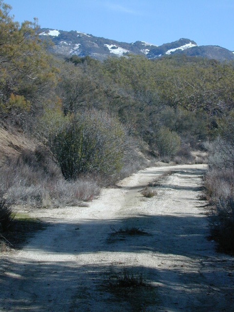
Oak trees and boulder hills, dirt roads, near Hot Springs Mountain. North San Diego County.

Los Coyotes Band of Cahuilla & Cupeño Indians

Warner Springs, CA 92086
RECREATIONAL# 760-782-0712
ADMIN# 760-782-0711

payherebooth

snowx
Hot Springs Mountain SD

San Diego Camping

Anza Backroads

Cleveland National Forest Camping – San Diego Campgrounds – Desert Camping Anza Borrego – SD County Campgrounds – BLM Campgrounds – San Diego Beach Camping – San Diego Mountains

campground elev spots veg toilet water notes
Bobcat Meadow 3800′ 16 oaks vault no no RVs
Burnt Rancheria 5000′ 100+ pines vault piped Sunrise Hwy
Cibbets Flats 4200′ 23 oaks vault piped Interstate 8
Corral Canyon 3500′ 20 oaks vault piped OHV near I-8
Dripping Springs 1800′ 26 oaks vault piped Hwy 79, E Temecula
El Cariso North 2600′ 24 oaks vault piped small RV
Fry Creek Campground 4900′ 20 oaks vault piped Palomar Mountain
Indian Flats Campground 3600′ 17 oaks vault piped off Hwy 79
Laguna Mountain 5500′ 75 pines vault piped Sunrise Hwy
Palomar SP Campground 7000′ 13 pines vault piped Palomar Mountain

Anza Camping

Anza Borrego Desert Camping & Campgrounds

Desert Mountain Biking Open Camping Stargazing Hiking

San Diego County Campgrounds

Sweetwater Reservoir, Otay Lakes, Agua Caliente, Vallecito
Camping Reservations 877-565-3600 or 858-565-3600

Camping

Bureau of Land Management

San Diego BLM Camping

Lark Canyon, Cottonwood @ McCain Valley near Interstate 8
El Centro Desert OHV, Hot Springs, Colorado River

Coastal Cliffs San Diego

San Diego Beach Camping

Coastal Towns with Camping near San Diego –

Chula Vista
Coronado
San Diego
Mission Beach & Bay
Del Mar
Cardiff
Carlsbad
Oceanside

Indian Flats Campground

Indian Flats Campground is located on a dirt road off Hwy 79, near Warner Springs CA. Boulder ridges & manzanita surround this oak filled secluded canyon. Small seasonal creek & waterfall is a short walk from campsite.

Los Coyotes Campground is a tribal camp, located on Hot Spring Mountain in North San Diego County. High desert chaparral, oak groves and boulders.

Free Camping
Anza Borrego Desert by far has the best free camping options available near San Diego.

Maps Mountains / Desert Topo / San Diego Area Maps

Lake Henshaw

henshawabove

Lake Henshaw
North San Diego County

Lake Henshaw is next to Cleveland National Forest with Palomar Mountain State Park closeby. The northern border of Anza Borrego Desert State Park is not too far away either.

MAPS of this region –SAN DIEGO mountains map

Cleveland National Forest USDA
Cleveland Forest Topo Atlas USDA
Anza Borrego Desert Map
San DiegoBackcountry Map
Agua Tibia Wilderness Map

If you are imagining a forested alpine lake near Palomar Mountain, this is not it. Henshaw is a countryside area w/ meadow setting near ranches with open skies and open terrain. Can be windy at times! Can be hot in late summer.

Perfect remote spot for stargazing. Henshaw is the nearest body of water to Mount Palomar & is located on Hwy. 76, but the terrain is quite the contrast to the pine topped mountain nearby.

treebw
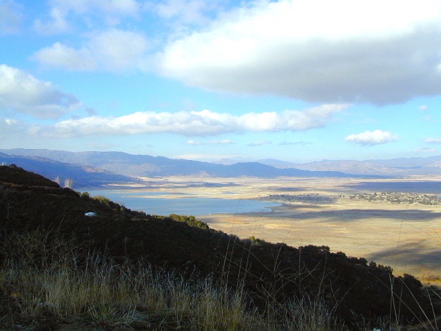
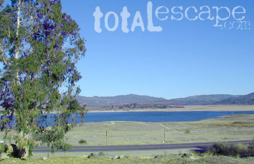
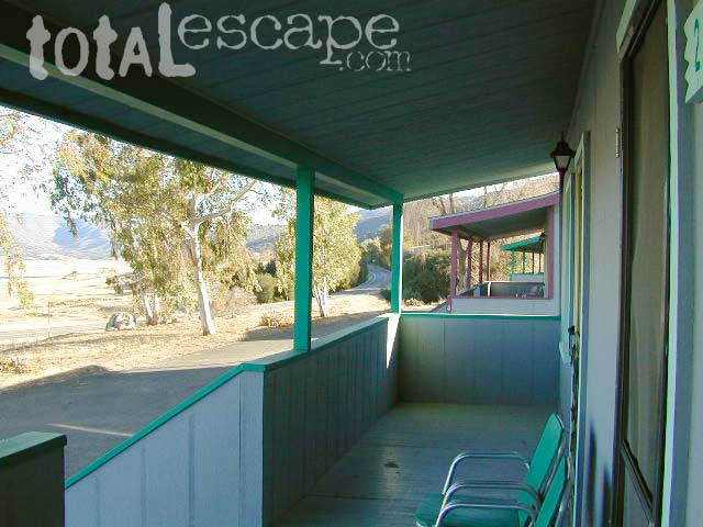
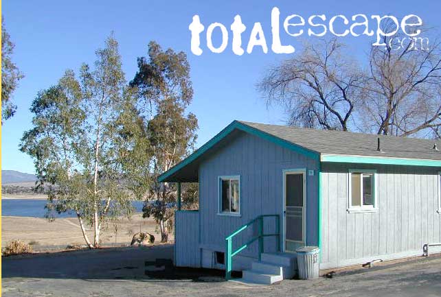
TREES: Lake Henshaw has very few trees; mostly large open spaces & fields surrounding it. Cattle grazing & rolling hills w/ mountain backdrop. Stargazing and fishing cabins is more fitting of a description. This bare bones basic, little cabin resort offers a true get away from civilization for maximum relaxation close to SoCal cities.

Lake Henshaw specs:
elevation: 2740′
surface area: 1137 acres

Lake Henshaw Resort
760-782-3501
lakehenshawresort.com

Camping – 400 developed camp sites for tent and RV. swimming, picnicking, hiking, cabins, groceries

fishing:

  • trout
  • catfish
  • bluegill
  • bass
  • crappie

boating:

  • boat launch ramp
  • canoe
  • kayak
  • row boat
  • power boats
  • boat rentals available
  • inflatables
  • windsurfing

California Fishing Cabins SoCal

Primitive Camp San Diego

Fire Light Cove

Open car camping is allowed in several places inside Cleveland National Forest, although NO campfires are permitted in the backcountry (trailside or dirt roads) – due to the high fire danger. Your best for FREE, open, dispersed camping (with a campfire) is Anza Borrego Desert State Park. Lower elevations w/ summertime temperature can get very hot, so plan for higher elevation camps. The more you explore, the more you can find.

The Tom Harrison San Diego Backcountry Map can get you out there on the back roads.

Laguna Mountain (off Sunrise Hwy. S-1)
[south Cleveland National Forest]
East of San Diego; 40 miles E on Interstate 8

  • Pine Creek Road – with plenty of mountain biking trails
  • Noble Canyon – popular mountain biking trail
  • Kitchen Creek Road (warning, heavy use w/ US Border Patrol)

Palomar Mountain (off Hwy. 76)
[north Cleveland National Forest]
N of San Diego; 40 miles N on Interstate 15

Anza Borrego Desert Camping
East of San Diego CA

  • Dispersed camping nearly anywhere in Anza desert (w/ a metal fire bucket)

[higher elevations (1000-2000′) near Cleveland National Forest]

  • Oriflamme Canyon (off Road S-2)
  • Culp Valley (off Road S-22)
  • Blair Valley (off Road S-2)

[lower elevations (100′) near Hwy 78]

Cupl Valley Camp

A winter day out exploring Culp Valley back roads.

mortero trails

Maps Mountains / San Diego Maps

Indian Flats Campground

Temecula Camping / Warner Springs Campground

San Diego Mountains – Cleveland National Forest

Indian Flats Campground

Indian Flat Campground is located on the seasonal San Luis Rey River in rural North San Diego County.  From I-15 @ Temecula, CA travel eastbound on Highway 79. Look for the tiny turn off  (on left side) for forest road #9N05, sorta near glider airport located west of Warner Springs. This poorly paved backcountry route (half dirt/mud at times) is also known as both Indian Flats Road or Lost Valley Road.

Graded dirt road (paved in some portions) travel is approximately 6.5 miles to campground, look for gate and turn off on the left side. When you see the giant boulder near the entrance, you’ll know you’ve made it to the right place.

Oak trees and a few pines, plenty shade, boulders and mountain scenery, this is a great small campground that is well away from everything in Southern California.  Seasonal creek-sized river and boulder waterfall often dries up in late summer. This means a wet spring is the best time to visit this camp. Hiking, mountain biking trails and hammock spots. Pacific Crest Trail access.

Cleveland National Forest
Palomar Ranger District
760-788-0250

ClevelandMap_07

Elevation: 3,600′
Number of Sites: 17
Camping Reservations: None
Sites Available: First come, First serve
Vehicle Accessibility: Length 15′ max.
Length of Stay: 14 Days
Water: No Piped; Seasonal creek nearby
Toilet: Vault
Season: Closed for mud & snow during winter months
Fee: Yes
Operated By: National Forest Service
Closest Town: Warner Springs, CA

Indian Flat
Indian Flat Campground Entrance

Agua Tibia Wilderness

Agua Tibia Wilderness Area

  • 15,900 acres
  • chaparral & oak at lower elevations
  • pine & fir forest at high elevations
  • elevations range 1,700′ – ­5,000′
  • 25 miles of trail
  • summer temperatures exceed 100°F
  • occasional snow in winter
  • best in winter through spring
  • wood fires prohibited
  • portable stoves permitted
  • water scarce
  • no overnight use of pack or saddle stock
  • groups limit – 15 people
  • visitor permits required
Agua Tibia lies right on the RIVERSIDE
& SAN DIEGO COUNTY border

Cleveland National Forest
Palomar Ranger District
1634 Black Canyon Road
Ramona, CA 92065
760-788-0250

Agua Tibia Map

Agua Tibia Trailhead

This is the trailhead for Agua Tibia Wilderness located at Dripping Springs Campground on Highway 79, near Temecula CA.

See more: Agua Tibia Mountain hike details

hiking SoCal

San Mateo Canyon Wilderness

San Mateo Canyon Wilderness

  • 9,700 acres, South of Highway 74
  • hiking near Temecula, California
  • between Camp Pendleton & Lake Elsinore
  • moderate to steep terrain
  • vegetation chaparral on slopes
  • riparian vegetation in stream channels
  • oak woodland at lower elevations
  • accessible by several routes off Hwy 74
  • accessible by dirt roads
  • some access routes may be closed in wet weather
  • best times to visit are spring & fall
  • wood fires prohibited
  • portable stoves permitted
  • visitor permit required
Cleveland National Forest
Trabuco Ranger District
1147 East Sixth Street
Corona, CA 91719
714-736-1811
San Mateo Wilderness Map