Road conditions on dirt roads change with the weather and the seasons. This route can be rocky and uneven in spots. One lane road, on a big hill w/ minimal pullouts. Snow is possible, during winter & springtime. This route often closed during winter months – or for rock slides. Trailers and RVs are not recommended on this dirt road, although small motorhome campers can try.
Elevation approx 6000′ @ HWY
w / route continuing up to Toro Peak @ 8740′
NFS local camp sites:
Santa Rosa Campground
Santa Rosa Springs Campground
Toro Campground
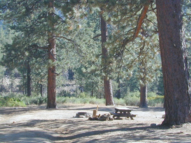
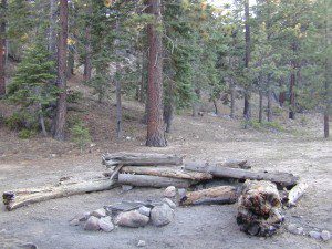
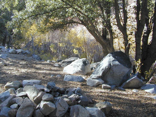
Bare bones, primitive camp sites. Tables, fire rings. Must have a campfire permit for this region. Vault toilets? None.
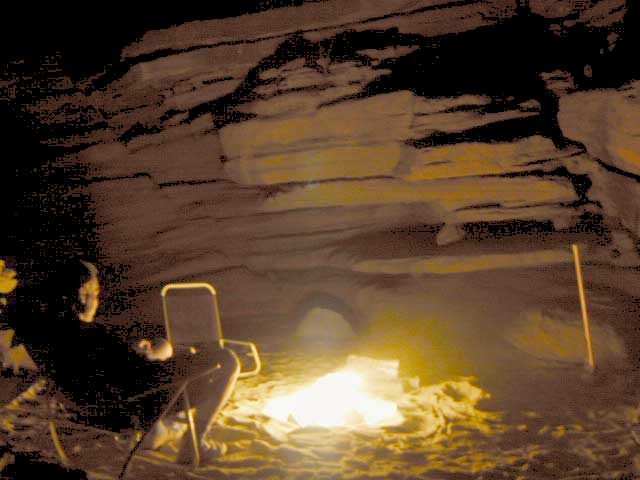
Did I mention the wind yet? Tall trees do block a majority of the wind, but some areas get whipping – so choose your tent site wisely. And stake it down well, before that quick day hike. Since this is a mountain ridge line, expect thunderstorms, wind and possibly light snow.
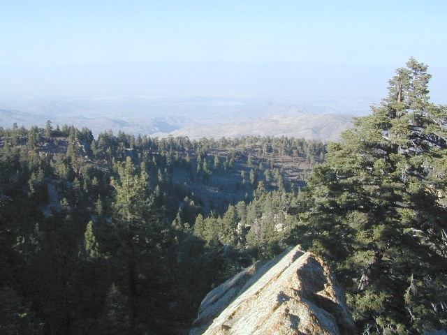
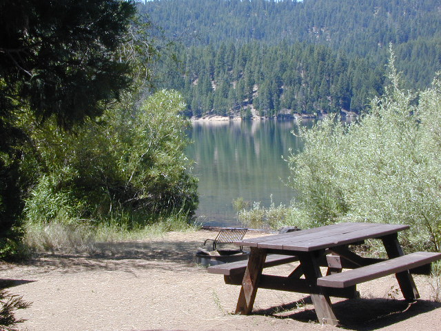
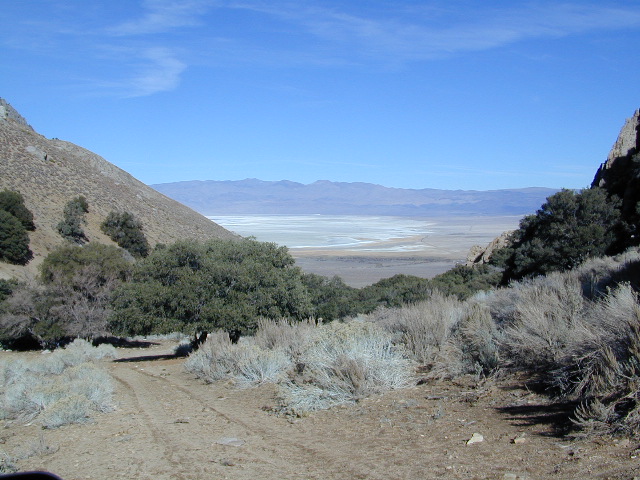
The big, famous Palm Canyon in Palm Springs starts below. The impressive desert canyon trails lead up to highway 74. Continue on foot uphill, southbound, cross the pavement, and end up in this Toro Peak region. Small campgrounds, few people, great views over the desert. Pick a smog free weekend (with wind) for best Coachella Valley views.
Yellow Stake Camp Sites / Back Roads Camping NFS
near Cajon Pass, Big Bear & Idyllwild CA
YELLOW POST CAMPS are dispersed camping sites on the back roads in Southern California, where fire danger is greatest. Forest authorities have designated certain spots as ‘fire safe’ for remote, open camping options around Big Bear Lake, Fawnskin and the Idyllwild mountain area.
If you prefer to stay out of the developed campgrounds, you will be the minority. But you must know how to read a map well to reach these beauties.
SoCal camping doesn’t have to mean crowded campgrounds. Seek your seclusion on the dirt back roads, where there are no fees, minimal noises & a private site waiting just for you. These are usually on a first come, first serve basis. A high clearance vehicle (SUV, truck or 4×4) may be needed to reach some of the premium camp spots, but there are also sites accessible by passenger cars. And, of course, a fire permit is required.
In the San Bernardino National Forest there are several back woods ‘fire safe’ camping spots, that are noted with a single yellow post & some may require reservations in busy summer months. You can find out more on reserving from the Big Bear Discovery Center, 909-382-2790
Extra caution should be used when winds are high, camp fires are often banned due to wildfire danger. Check with local rangers for up to date conditions and always get your campfire permit.
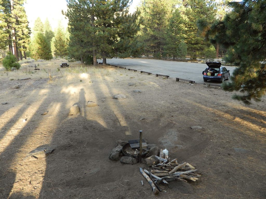
No restrooms, no water, no facilities. Just a dirt road, a fire ring & a single picnic table. Hopefully your table will not be shot up, by the local rednecks who ‘get off’ doing stupid stuff like this. Pick up any litter & leave the place better than your found it.
These backroad camps are perfect for the 4×4 group, stressed out social club, church group w/ rugged van, or the city SUVer who wants to get away from the crowds. The most sought after camp spots are nearest to the lake or a site accessible by RVs and horse trailers, but there are many more excellent camp sites to be discovered. USDA Forest Service Map is highly advised to reach these remote, dirt road camp areas. Rugged, steep, one lane dirt roads that lead to some of these spots. A passenger car is sometimes not suitable for all dirt roads. Rutted and steep means turn around. Wet weather changes dirt roads. Often routes close for winter w/ locked gates.
Cleveland National Forest Camping – San Diego Campgrounds – Desert Camping Anza Borrego – SD County Campgrounds – BLM Campgrounds – San Diego Beach Camping – San Diego Mountains
Indian Flats Campground is located on a dirt road off Hwy 79, near Warner Springs CA. Boulder ridges & manzanita surround this oak filled secluded canyon. Small seasonal creek & waterfall is a short walk from campsite.
Los Coyotes Campground is a tribal camp, located on Hot Spring Mountain in North San Diego County. High desert chaparral, oak groves and boulders.
Anza Borrego Desert by far has the best free camping options available near San Diego.
Maps Mountains / Desert Topo / San Diego Area Maps
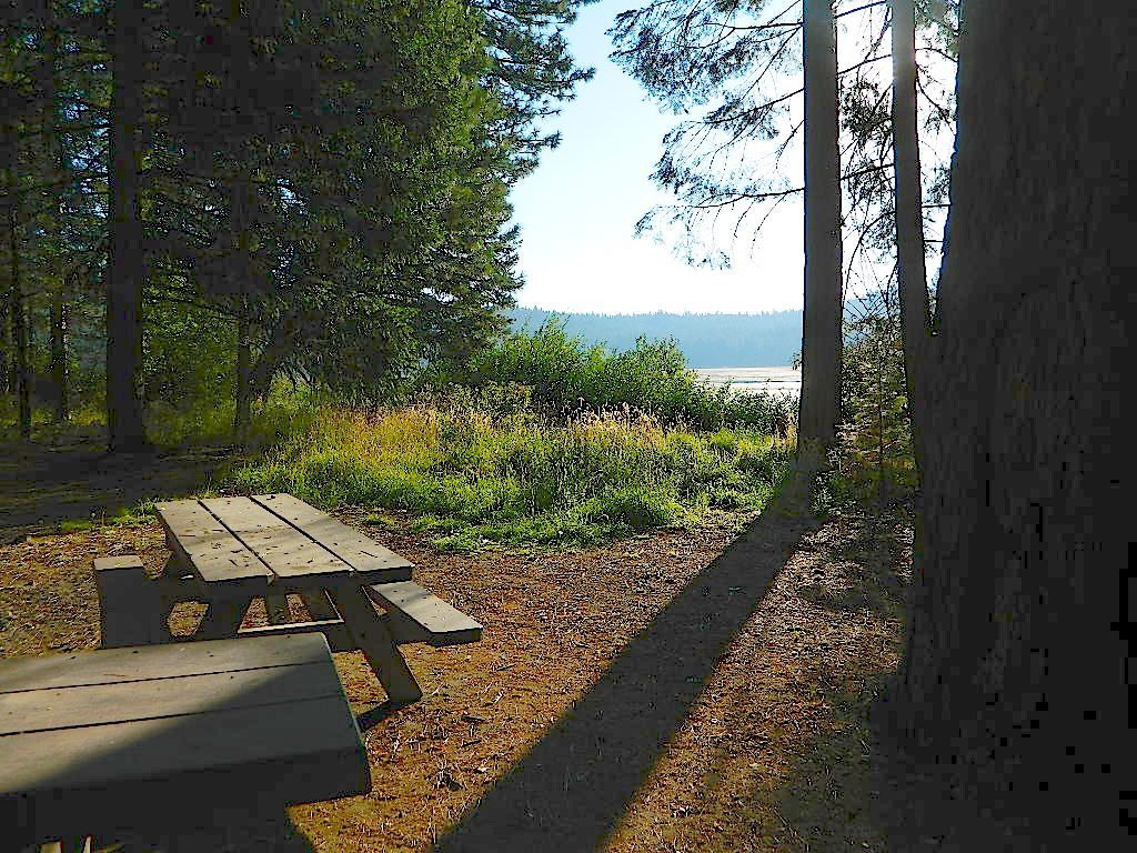
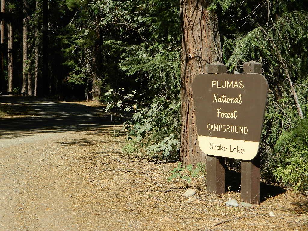
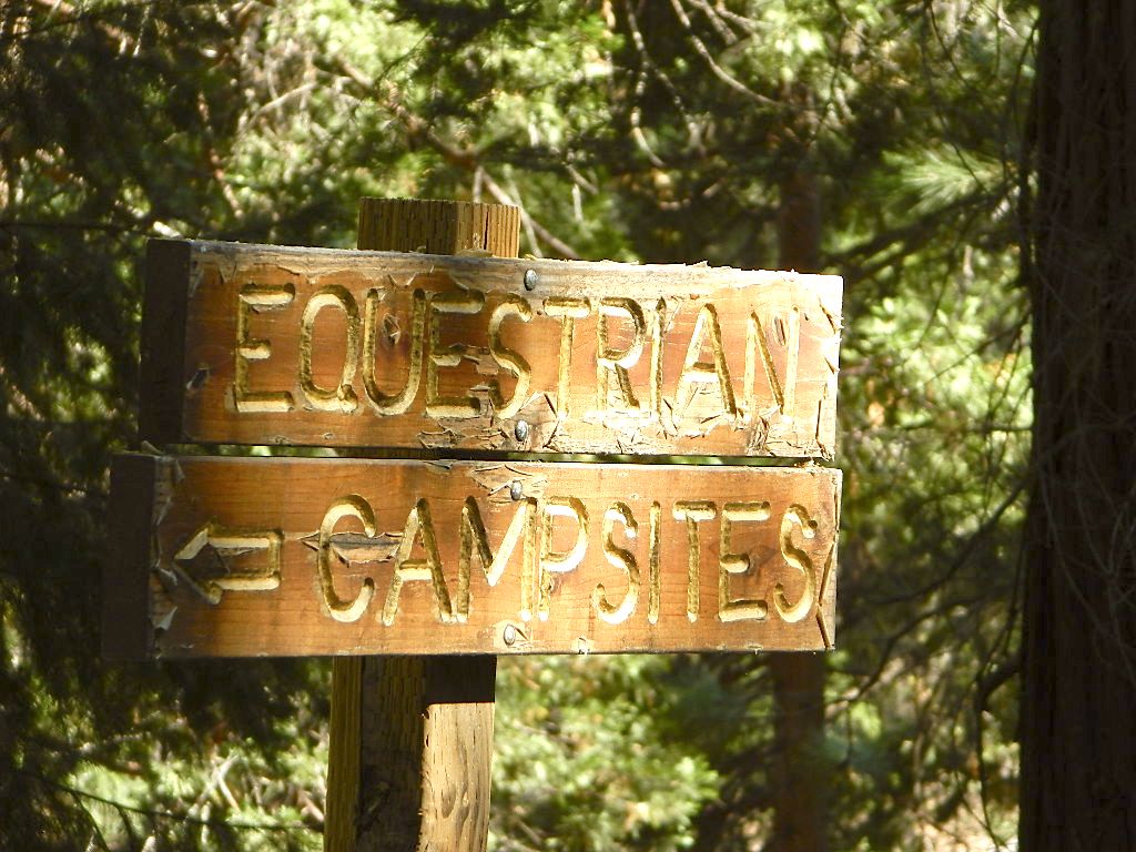
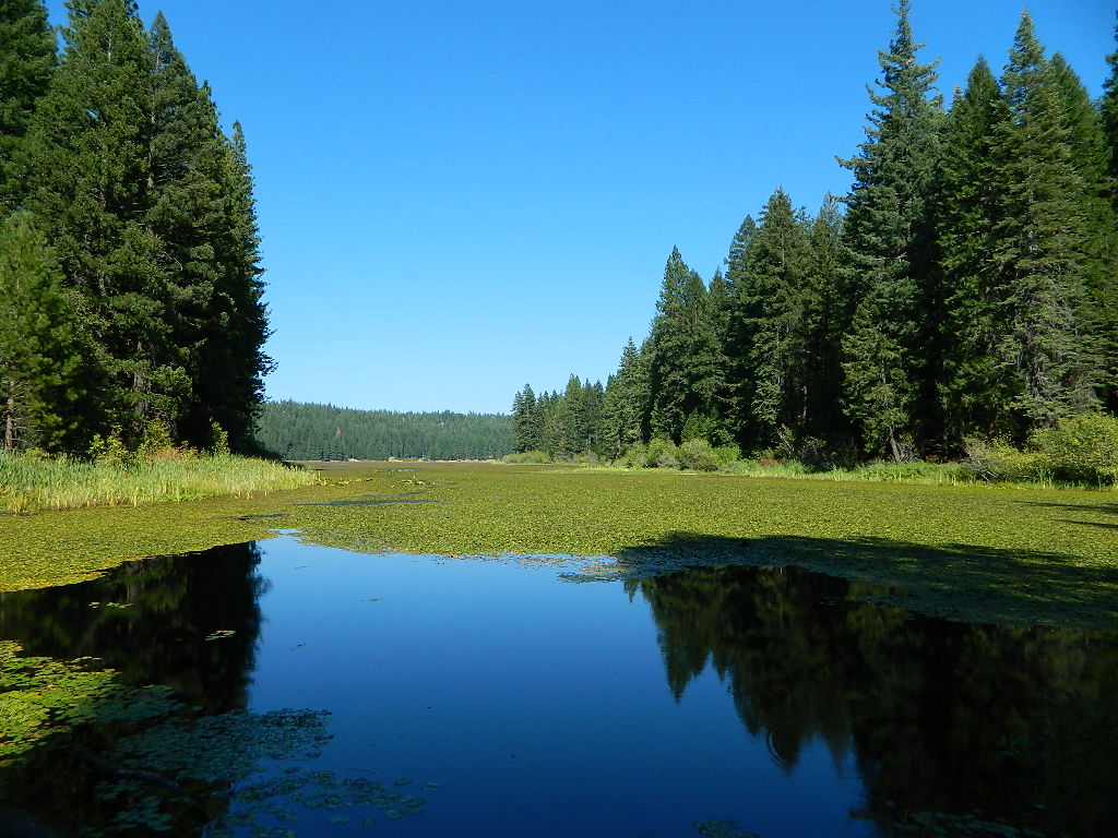
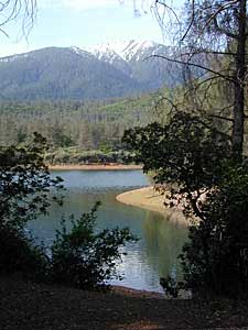
Don’t let the name frighten you, Snake Lake is a very scenic fishing lake – but you will NOT want to swim in it. Lily pads cover the water surface most of the year so it is considered “frog heaven” during the warmer months. NFS has been upgrading these camping facilities recently. Snake Lake Campground has new picnic tables, camp fire rings, bear boxes, vault toilet and expanded equestrian camps and corrals. No piped water, so bring your own. A bucket & shovel are always required for proper campfire maintenance.
One of the best campgrounds in the region, Plumas National Forest and close to Quincy, CA. Paved road access means an easy 3 miles off the main road (Bucks Lake Road, aka Oroville-Quincy Highway, Oro Quincy Hwy). 7 miles west of the town of Quincy, the green, metal, one-lane bridge is easy to spot, but the small sign for “Snake Lake 3” is easy to miss, if driving 50 mph or faster. Turn off is located in between Quincy and Meadow Valley.
Equestrian camp sites, horse corrals, OHV trails, group picnic areas. Hiking, fishing, mountain biking, off roading, horseback trails, kayaking or canoe.
Snake Lake Campground NFS
• Elevation: 4200′
• Number of Sites: 17
• Vehicle Accessibility: small RV
• Campsites Reservation: No
• Camp Fee: Yes
• Length of Stay: 14 Days
• Season: May – October
• Trailheads: OHV, Horse & Winter Rec
This lake camp serves as a central hub for travelers, motorcyclists, campers, hikers, fishermen, off roaders and equestrians alike. Mountain biking & OHV trails go off in numerous directions and horseback trails are readily accessible. Winter Recreation Area means snowmobile trails too.
Another smaller lake, Smith Lake, is a short drive or short hike (on dirt road) further into the woods, with the Butterfly Valley Botanical Area neighboring it.
another Snake Lake?
Another SNAKE LAKE exist inside Plumas National Forest. The smaller Snake lake can be accessed by off-road trail Road#12E66, off the Gold Lake Highway; 4×4 is required to reach this one. West of Gold Lake in the Lakes Basin Recreation Area. The PCT is routed nearby one mile away.
California has many different National Forest districts and each region has their own fire restrictions. State Parks & BLM also manages recreation areas & camping in the Golden State. Each agency & region has different rules, so blanket answers cannot apply to general questions on campfires.
CAMPFIRE PERMITS
Campfire permits are required for fires outside of designated recreation sites. During fire restrictions, campfires could be banned. Campfire Permit are available from Forest Service, CalFire or BLM offices or online, http://www.preventwildfireca.org/
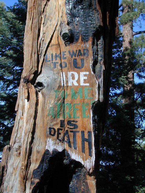
Manter Fire [2000], Dome Land Wilderness, Southern Sierra Nevada
the new abnormal
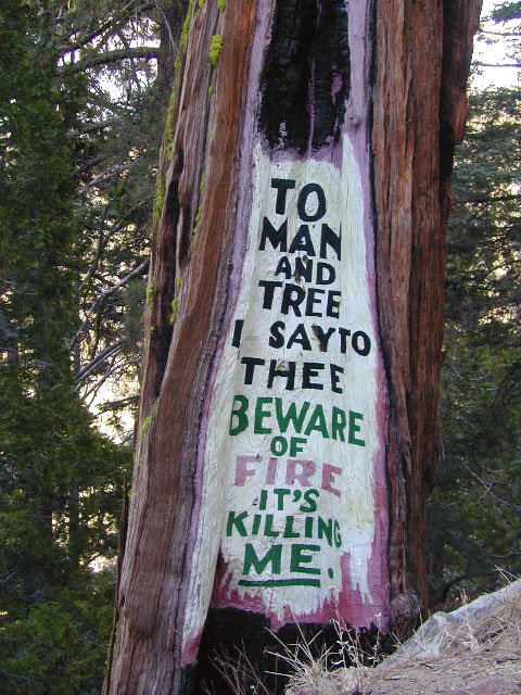
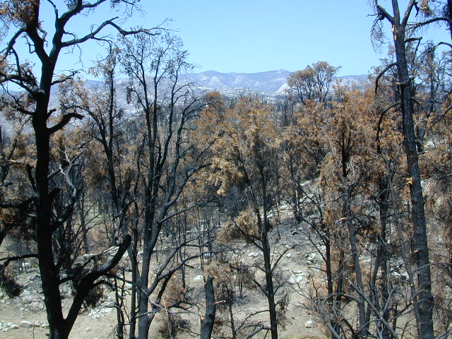
California suffers more from wildfires now than ever before. Native tribes let lightning strike wild fires burn and they did not suppress wildfire. Residential development creeping ever higher and denser into the foothills, an abundance of roadways, with the overgrown forest make fire danger ever more real.
Closed off wilderness areas, impassable dirt roads, landslides, fallen trees everywhere. Utility services (power lines), plus high winds and overgrown forest also play a huge part in the current wildfire catastrophes. Drought conditions or record winter rains, the huge population on the west coast -along with many other factors – means more fire danger. Educate yourself and others on fire safety, forests and weather patterns. Heed the wind, while in the wild. Wind spreads fire easily!
By mid summer we have usually have several wild land fires burning, which means campfire restrictions are usually in place before JULY 4th weekend. When this happens – No open campfires are allowed in the backcountry or on the back roads.
Often in the driest of years, no campfires are allowed (even inside the campgrounds).
If you love to primitive camp outside of developed campgrounds, you need to plan more road trips for spring time & autumn. Or head further north, well above Redding – where the forest are moist and snow graces Mount Shasta year round. Or perhaps, go desert camping during winter months. Checking the National Forest web sites can be confusing and their online information could be outdated.
Each forest and area is individually managed. No concise, easy-to-read list or online map exist on which forests are allowing backcountry campfires – and which ones are not. Conditions seem to change so often and they aren’t great about updating those .gov web sites. Best to call a local ranger station and ask about any current fire restrictions. You know, actually “talk on a phone” to a USFS, BLM or CalFire official. If you can speak to a field ranger, they can tell you more on dispersed camping. Or you can navigate the USDA web site to find current ALERTS & RESTRICTIONS. Cryptic lingo may be encountered, and many clicks maybe needed; possibly forcing you to download a PDF of current fire rules.
Small campgrounds and secluded camps, accessible by dirt bikes or 4-wheel drive vehicles. Numerous dirt roads, sand dunes and canyons to explore, some with developed campgrounds, other areas w/ primitive camping. Self sufficient campers will enjoy this list.
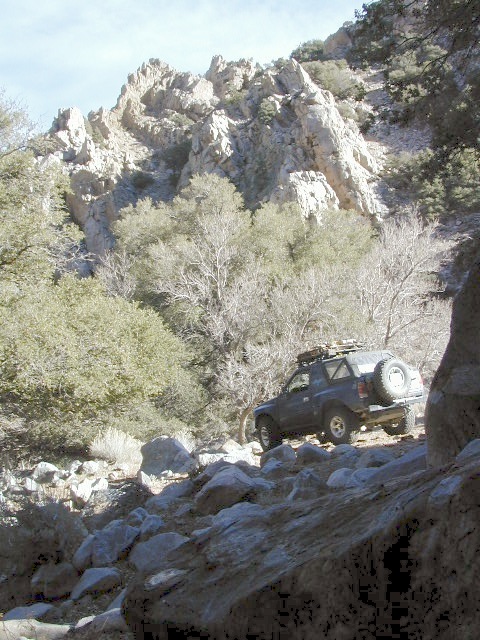
4×4 camping in California
Okay, you got your 4 wheel drive vehicle dirty, it is now several years old & maybe you even have a scratch or two. Now is the time to finally start using that beast for real off road adventures. The real edge-of-wilderness trips you dream about when your sitting in your cubical wondering what life is really about. Fishing, camping, off roading and enjoying nature, of course!
4×4 camping in California is plentiful. California has trails for OHV use – which means ‘off highway vehicle’, that can accommodate your machine. These remote camps are always primitive camp sites, with picnic tables, fire rings & maybe a pit toilet (if you are lucky). You can find total seclusion on these back roads & trails, well away from the developed campgrounds & RV parks.
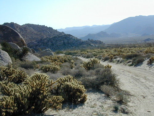
Anza Borrego Desert 4×4 Trails – pretty much everywhere in Borrego desert is off road heaven. Minimal pavement and maximum desert means dirt roads galore, white sandy washes, slot canyons, badlands, wind caves, wildflowers, petroglyphs, boulder outcroppings, old railroad trestles and so much more. The San Diego desert elevations range from near sea level to 4000′ on the eastern slopes of Laguna Mountain.
San Bernardino National Forest – has a few trail camps for 4×4 enthusiasts. John Bull Trail (near Holcomb Valley) has one real awesome camp spot with great views over the desert night lights. Holcomb Creek Trail also has a few spots near the creek. Overall this area is somewhat crowded for wheelin’ (especially on the weekends), as the population is so dense nearby.
Los Padres National Forest – the most 4×4 camping, readily accessible to Southern California. This is truly the best kept secret for Angelinos wanting an escape. The southern portion of the forests has Tecuya Ridge #9N22, with several camps only minutes from I-5. Cherry Creek 4×4 Camp, with a few other campsites tucked way back in there. Dome Springs Campground is located off Lockwood Valley Road, while Nettle Springs Campground is over near Highway 33.
Out west, Cerro Noroeste Road has the Blue Ridge w/ Marion and Caballo Camps. Red dirt high desert wash Quatal Canyon #9N09, is right next to the Chumash Wilderness.
2 OHV parks in the Los Padres Area: Hungry Valley & Ballinger both serve the off road crowds and have ample facilities, large camp spots to accommodate RVs and trailers.
The northern section of Los Padres (near Big Sur) has plenty of dirt roads & primitive camps, but none are truly 4×4 routes, as most can be accessed easily with a passenger car. See more on Big Sur Camping and Big Sur BackRoads.
Sequoia National Forest– Southern Sierra Nevada area has 4×4 camping right along the Kern River @ Keyesville, at the junction where Hwy 178 meets Hwy 155. Also, further up the river, Forest Rd#22S82 leads to primitive Camp 4, where there are several spots near granite pools, that can only be accessed by 4 wheel drive. The Big Meadows area also has some gorgeous forested back roads worth exploring. Kern Plateau has hundreds of miles of OHV trails near Troy Meadow.
High elevation Monache Meadows is a prime fishing & hiking destination on the south fork of the Kern River, accessed by an authentic “Jeep Road”.
Sierra National Forest– central Sierra forest has plenty of 4×4 routes that lead to granite rock gardens & mighty fine, secluded, forested camp sites. Gorgeous Red Lake & Coyote Lake are popular spots that require some technical skills & much patience to access. Both are frequented by fishermen & horses. Bald Mountain trailhead has awesome creekside camps on Rock Creek. Up near Wishon Reservoir is the dead end trail of Spanish Lake. Onion Springs Meadow is awesome back behind Edison Lake. Near the granite wonderland Courtright Reservoir is the infamous Dusy Trail signed #28E34 (aka #7S32, the Dusy Ershim), second only to the Rubicon Trail for high Sierra granite.
Stanislaus National Forest– camping in the Crandall & Niagara Creek OHV section of the forest, right off Hwy 108. Elevations range from 5000′-7000′. Higher up on the other side, Levitt Lake (access road near Levitt Falls) on the east end of the mountain range, east of the Sonora Pass sign.
El Dorado National Forest – has an area called Rock Creek for off roading in the Gold Country. Plus the ever popular Rubicon Trail starts hear (near Georgetown) & leads 20 miles across the High Sierra Nevada granite slabs to Lake Tahoe. Tons of camping back here in the National Forest.
Lakes Basin Recreation Area – Northern Gold County, just above the Yuba River. Gold Lake has many campable lakes. The area sees a lot of snowmobile traffic during winter snows, but warmer months are the time for fishing and camping. Most of the big lakes have small developed campgrounds, some are minimal, or primitive style camp sites on dirt roads without facilities. Maybe a picnic table at most.
Smith Lake is a place that fishermen and 4×4 enthusiasts love. It is small, secluded and kinda hard to find. You’ll need a good topo map of the region. Situated on the border of Tahoe and Plumas National Forest off the Gold Lake Hwy (aka Road #24). The PCT cuts thru this Lakes Basin area w/ Sierra Buttes There are dirt roads and off road trails leading deep into the backcountry from the Packer Lake and Gold Lake areas. Snag Lake is a free camp right on the main road.
Snake Lake Campground has numerous dirt roads and trails leading out to Butterfly Valley. Horse campers use this popular camp spot, so no loud vehicle activity inside the campground. No shooting up the bear locker either!
Milsap Bar is a long, narrow 9 mile dirt road which leads from Bald Rock Road in Berry Creek, down to the Middle fork of the Feather River. NFS Campground on the big river without fees!
China Gulch Road #60, a very long and winding dirt road, leads from Oro-Quincy Highway down to the Little North Fork. Although the NFS Campground is closed due to a landslide (1 mi before camp) there still is primitive camping at the second bridge. Be warned: the campsite at the first bridge is often over run with giant, juicy slugs at night.
Out there east of Quincy, somewhere off the historic, long and winding La Port Road, a few decent 4WD trails thru forest, access ridge lines or the big river below. Great fishing, amazing scenery & very secluded.
(north of La Porte Road)
– Feather River access
@ Cleghorn Bar Campground, 4 campsites (Road #23N24)
@ Stag Point Campground, 5 campsites (Road #22N80Y)
@ Hartman Bar NRT to Dan Beebe Camp (Road 94 to #22N42Y)
(south of La Porte Road)
– Poker Flat Camp near Sawmill Ridge & Table Rock (Road 800)
Sly Creek Reservoir is a super popular NFS Campground with trailheads and dirt roads leading deeper into the forests. The camp area is a favorite amongst the off roaders and dirt bikers that migrate up to the mountains for the weekend, to escape from the heat of the summer in the Sacramento Valley. LGVR is another body of water back in these parts and is more scenic and peaceful than the Sly Creek.
This coastal range is dirt road heaven, graded dirt roads, ridge routes, hiking trails, equestrian trails, big lakes, small lakes, creeks, meadows, forests, wilderness and 4×4 routes. Snow can be the most fun and challenging for the 4WD crews. Mud, snow, some road closures seasonally.
2019 WILDFIRE: Ranch Fire – wiped out most of this area. South of Snow Mountain Wilderness, plenty off road trails leading to peaks and ridge lines. Numerous small campgrounds to choose from, trailheads everywhere, acres and acres of wild mountainous areas, and a lake resort nearby. Lake Pillsbury is kinda the center of all the 4×4 action in Mendo.
Fouts Springs – Numerous NFS Campgrounds catering to the off-road types a portion of the year, but mostly quiet other times.
Although the grizzly bear image graces the state flag, grizzlies were killed off during the gold rush days. Black bears are found in California mountains and foothills, down to lowest elevations in NorCal. California black bears come in more than one color – light brown, cinnamon, dark brown, and of course, black. For the most part, bears usually stay away from people.
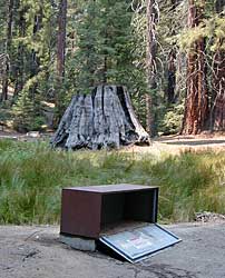
Some areas are more prone to bear problems due in large part to the overpopulation of tourists and abundance of food provided by them. Certain California National Parks are particularly notorious for their brazen bear populations. Concentrated bear problems are sometimes posted so be very aware and read signs. If you see steel bear boxes, leave no food or drink in your vehicle. Use the boxes to keep bears from breaking into your car!
Follow some simple rules:
Keep a very clean campsite
Clean up all dirty dishes & beverage containers (especially before bedtime)
Keep clothing & sleeping bags free from food odors or heavy scents
Never leave any type of food garbage ‘bagged up’, sitting outside of a cabin rental, motorhome, trailer, or mountain home
Store garbage properly inside a locked, sturdy container inside garage or a shed
Stay away from bear cubs, there is sure to be a protective (aggressive) mother in close proximity
Try not to hike alone. Make noise & sing on trails to scare away any unwanted animals.
Bear storage canisters are available at sporting good stores & at stores in most National Parks.
Proper Food Storage Outdoors:
Store food in closed up automobile, not visible. Store food correctly: in trunk of your car, or hidden from sight; in campground food lockers when available.
Lock all food, beverages and coolers in the provided metal bear boxes or bear lockers where available.
Toothpaste, deodorant & anything that has a scent should be thought of as food and stored accordingly.
Bears are so strong they can rip your car door open (in places like Yosemite, where bears are problem and you can get cited for not storing food items properly)
Bears are so strong they can break open a garage door to get to the smelly trash inside, so make sure you utilize the curbside pickup service available in some mountain communities or take a trip to the dump once per week.
DO NOT LEAVE FOOD OUT, UNATTENDED, outdoors…
during a picnic lunch, a quick snack, maybe a barbeque, or dinner around the campfire.
Birds, dogs, squirrels and wild animals can move in quickly.
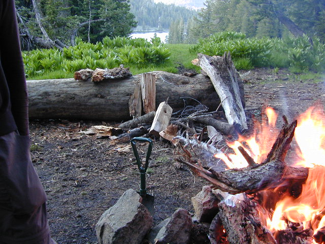
Backpackers should hang food in nylon bag & drape over weak branch in high in tree: hang your food using the counterbalance method. Ranger who issues your wilderness permit can explain the hanging procedure;
2 stuff sacks (with drawstrings) for your food items, and 60 feet of medium weight cord. 2 carabiners make hanging much easier.
When primitive car camping on a dirt road, which does not have campgrounds, nor bear lockers, it is possible to store food in the vehicle. BEST location is on the front floorboards with towel over it. With the car alarm set at bedtime, any ruckus should trigger a decent alarm. Any large animal trying to break in will get blasted with alarm siren & most likely will run away. The noise will wake you up as well, to deal with the intruder, if need be.
If a bear does get into your camp area:
At night, bring bear repellent can into tent, storing it close to the door. Bring a weapon for added protection.
Make as much noise as possible: yell, bang pots/pans, whistle, air horn and get your bear mace or pepper spray ready in hand
Raise your hands up to appear larger; lift clothing, increase appearance of size and yell aggressively toward bear.
Get your entire camp group together, join hands and spread out; Everyone at the camp should be outside the tents in order to be as effective as possible
Throw rocks & small objects; pots, pans, chairs
If possible, try to get to your car for protection
Sound the alarm on a vehicle &/or honk the horn
If you encounter a bear on a hiking trail:
Make as much noise as possible while walking solo. Hum, sing, talk to the birds. Sing or talk to yourself – out loud. Bear bells can be worn on hiking boots. Do not hike w/ headphones on listening to music/radio.
Carry bear spray (mace or pepper) in a belt holster, or easy to reach pack.
If a bear approaches: stand still, slowly retreat, say a few calming words in a friendly voice and calmly retreat, keep eyes on the bear
Total Escape loves camping so much that this web site literally has hundreds of pages on the topic, but we won’t overwhelm you with the list on this page. Below is a good cross section of what camping pages we have & what to expect.
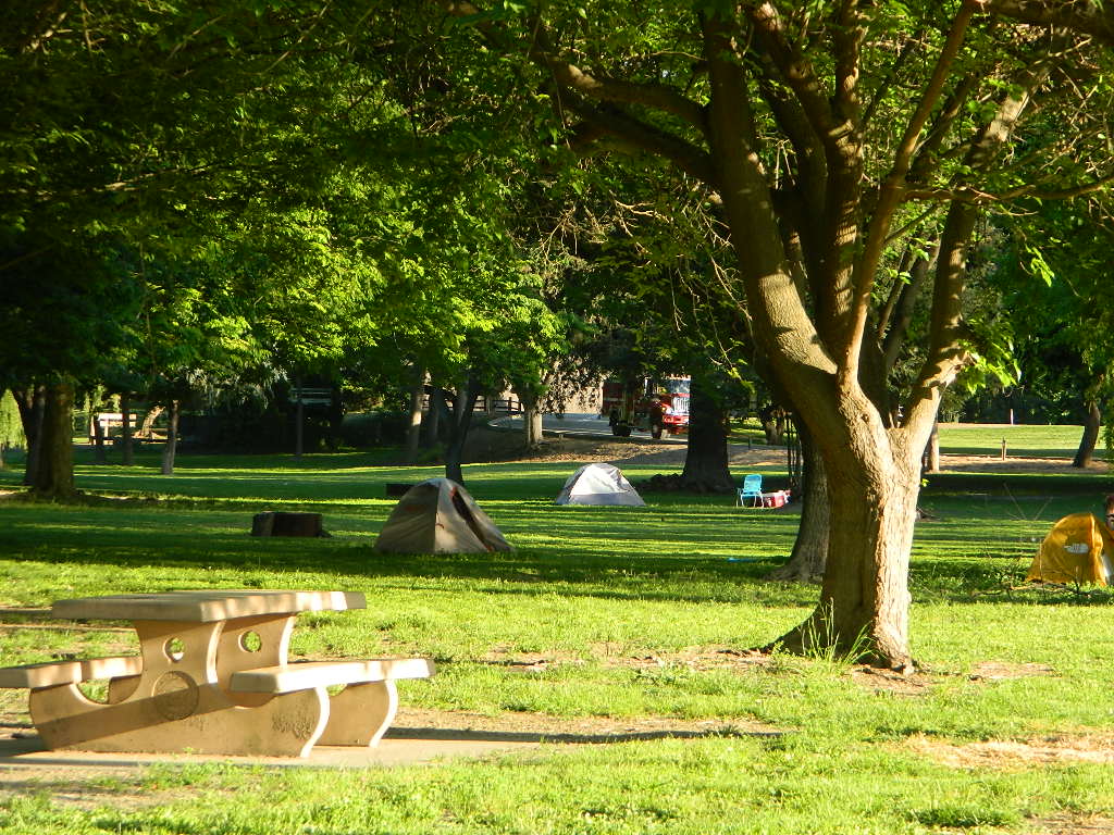
Camping in California is a blast! Enjoy nature, sleep under the stars, exercise & save money while vacationing. We show you road trips geared around nature, all local, all outdoors, all California. Exploring dirt roads for secluded spots and small campgrounds, learning new survival skills in the back country and enjoy the wilderness without the tourist crowds. The average weekend trip can run you as little as $100.00. This includes fuel, groceries, firewood and maybe camp or park fees. Once purchased your basic camping gear – tent, sleeping bag and stove can last you decades if properly cared for.
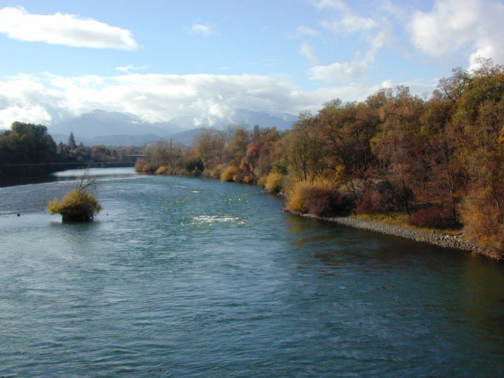
The main artery from the North; the Big River of California
Mighty Mount Shasta snowmelt flows south, bound to meet the giant Lake Shasta, which merges with the Pit River and numerous other major waterways, becoming the big Sacramento River. Running right down the center of the North Sacramento Valley to merge into the California Delta. Shipping channel links the State Capital city of Sacramento with the San Francisco Bay and the Pacific Ocean. Agriculture and wildlife depend on this river heavily.
Sacramento River National Wildlife Refuge
Willows, CA
~ Camping is not permitted on the Sacramento NWR. Along the Sacramento River, camping is permitted on GRAVEL BARS for up to 7 days during a 30 day period. For waterfowl hunting, overnight stay is permitted in a vehicle or RV in designated areas. Tents are prohibited. No person may build or maintain fires except in portable gas stoves.
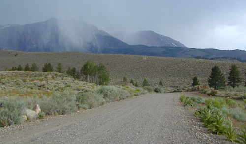
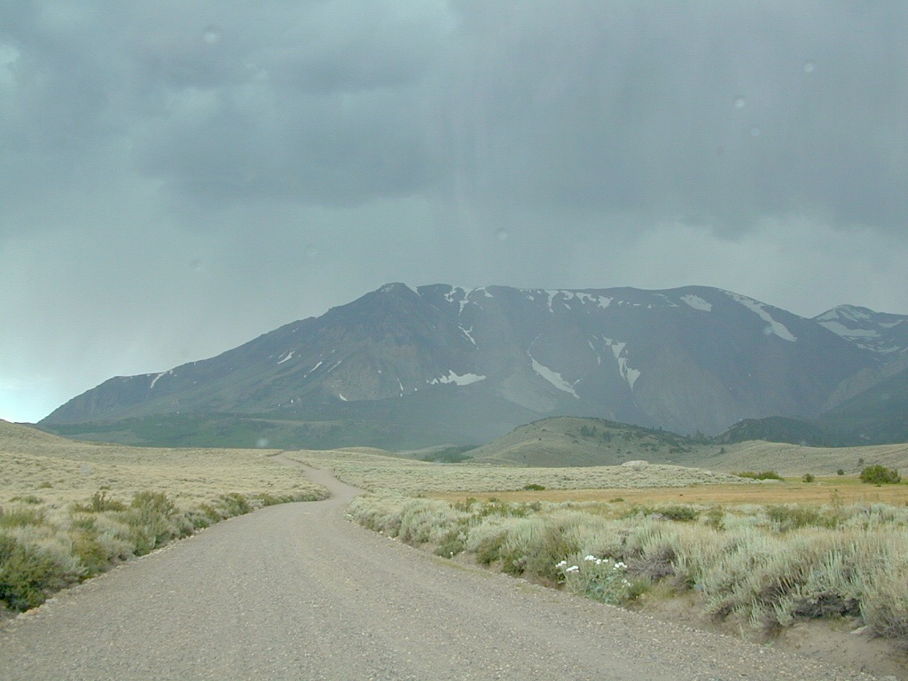
Forest Road 1N17 is a major graded dirt road that connects June Lake Loop to the Lee Vining junction, the back way. West side of US 395; south of Hwy 120.
At north end of Grant Lake, slow down and look for the signed intersection. Sage brush hills and big drainage, with towering granite peaks above.
This well-traveled, wide dirt road leads along the base of the mountain range on BLM land, skirting the National Forest. Several side routes head up into numerous canyons, which are part of Inyo NF. Suitable for SUV, passenger cars, camper van and small RVs. Easy access off US Highway 395 and June Lake Loop #1S63
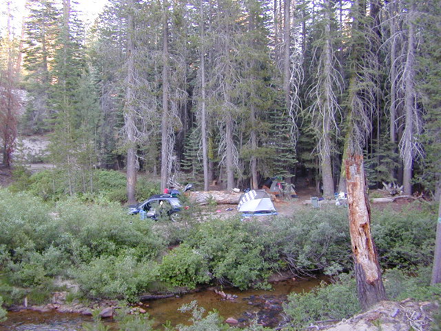
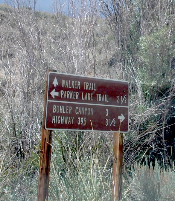
Several hike-in only lakes, creek camping, some seclusion. Great picnic areas, trail head access, short or long hikes. National Forest lands. Backpacking, day hiking and primitive camps, some deep in the aspens. Autumn here can be gorgeous, and these are all prime summer time camp sites, for free. Make sure to get your campfire permit ahead of time, at ranger station in Mammoth. Wilderness permits may also be required for overnight camping in this canyon, so check with the NFS rangers on that issue.
Certain areas back here can be muddy in springtime, other major routes can even be over whelmed with water when creeks swell. Summer thunderstorms are common. One lane bridges should always be driven with caution, especially on dirt roads. Always be extra slow when driving thru water at creek crossings.
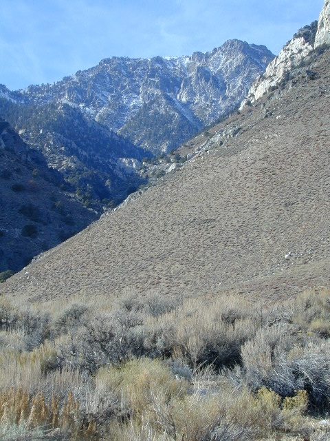
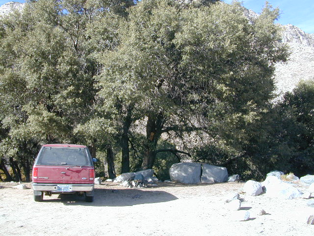
Just south of Olancha, off US Hwy 395 is a dirt road that takes you 5 miles up to an oak canyon lined with rocks. There are several primitive camp sites along the Walker Creek. A high clearance vehicle may be needed in some sections, but 4×4 is not required. Small RVs might attempt this, but if the first mile frightens you, turn around while you’re ahead.
This private, shaded, creek area is perfect for those traveling Highway 395, looking for a quick and free camp spot near Olancha, CA
Shady picnic or camp spots above 4000′ elevation.
Hiking trails at the end of the road lead deep into the mountains. One on the right takes you to waterfalls. The trail on the left will take you to meet up with the Sage Flat Trail, which leads up to Olancha Pass, Summit Meadows & a small lake, in the South Sierra Wilderness. The Pacific Crest Trail runs the ridges here, just west of Monache Meadows, which is at 8000′ elevation, way above here – up on top.
US 395 highway – the dirt road turn off is very close to a gas station, and it maybe be signed, or not. The gas stop may be in business, or perhaps not. This is rural California, wide open desert and things come and go quickly.
On a good topo map, located Olancha Creek and Summit Creek to the south. Walker Creek is the canyon in between those two, just so know where you are going and can visualize. This one is an easy-to-miss dirt road turn off – especially if you are going over 50 mph.


 Don’t let the name frighten you, Snake Lake is a very scenic fishing lake – but you will NOT want to swim in it. Lily pads cover the water surface most of the year so it is considered “frog heaven” during the warmer months. NFS has been upgrading these camping facilities recently. Snake Lake Campground has new picnic tables, camp fire rings, bear boxes, vault toilet and expanded equestrian camps and corrals. No piped water, so bring your own. A bucket & shovel are always required for proper campfire maintenance.
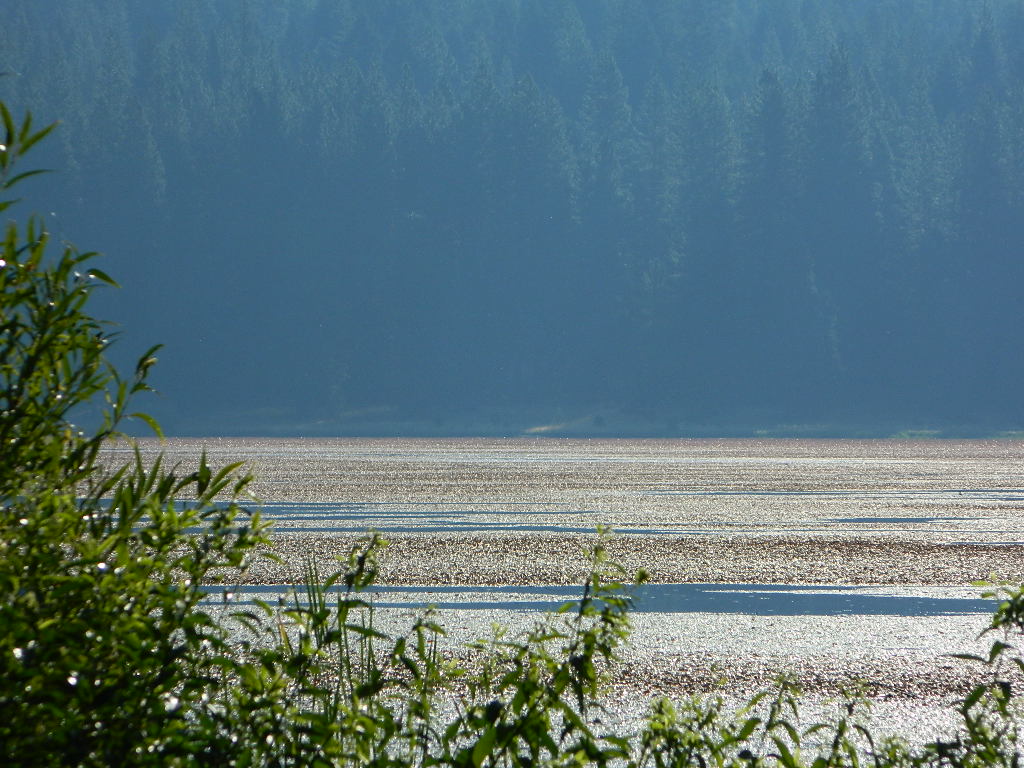


 When & Where – Campfires in California


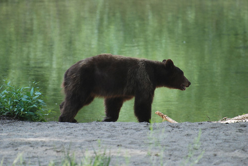
 Although the grizzly bear image graces the state flag, grizzlies were killed off during the gold rush days. Black bears are found in California mountains and foothills, down to lowest elevations in NorCal. California black bears come in more than one color – light brown, cinnamon, dark brown, and of course, black. For the most part, bears usually stay away from people.
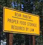 provided by them. Certain California
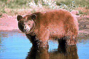


