Tag Archives: volcanic

Gurnsey Campground

bestcampgurnsey

Gurnsey Creek, Lassen Forests & Fishing

NFS Gurnsey Creek Campground: W of Chester, CA

CLOSED 2020-2022: Campground is undergoing some serious work with removal of hazardous trees and forest clean up. NOTE: DixieFire 2021 did not damage this portion of the forest highway (CA 36)

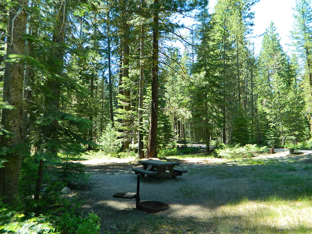
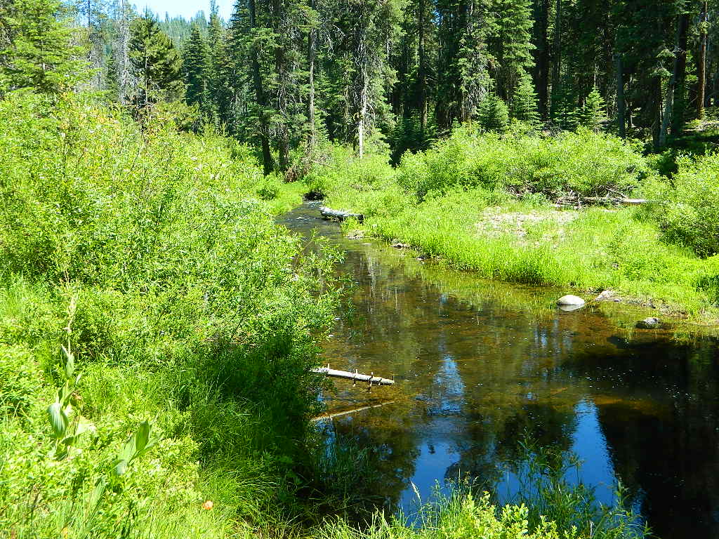
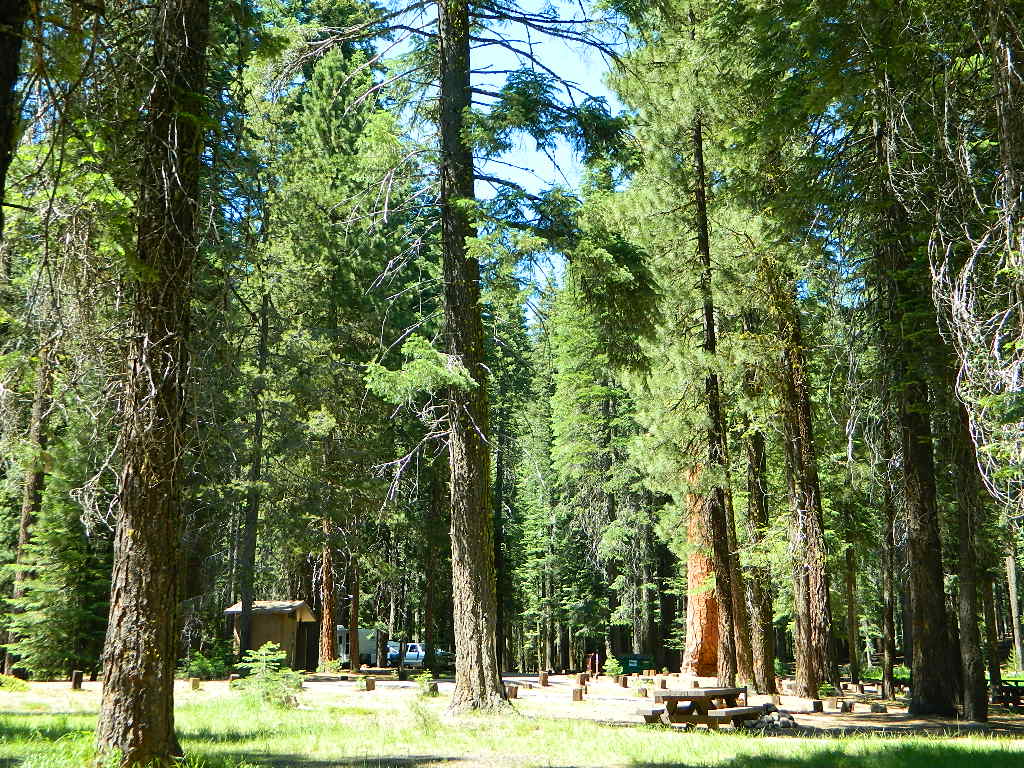
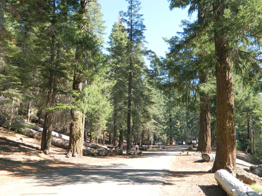
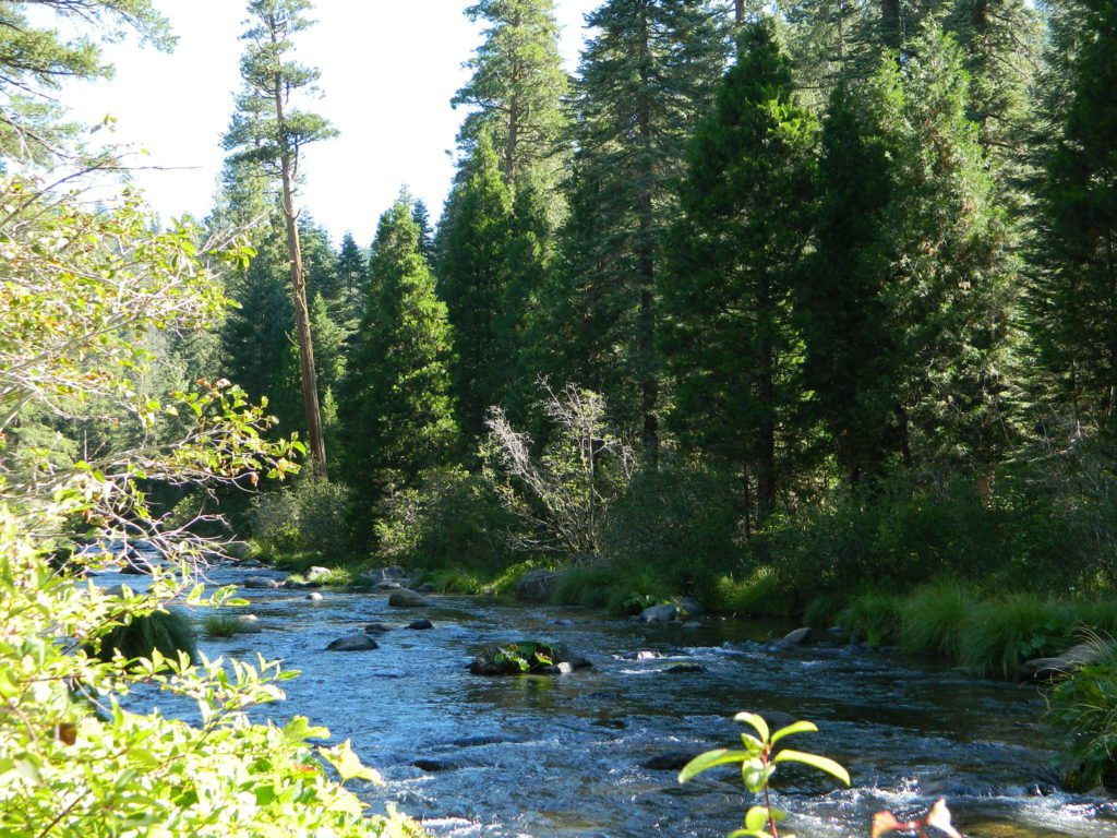
A developed USDA campground along forested Highway 36, near the junction of Chico’s Hwy 32. This stretch of 36  overlaps with north-south Lassen Hwy 89. Awesome fishing creek, meadows, hiking trails and mountain biking trails nearby. Paved, level camp sites w/ easy access to Lassen Volcanic Park and the National Forest.NFSlogo

This is a popular camp just south of the Lassen National Park boundary and 5 miles east of Child’s Meadow Resort. Car camp, tent camping, some spaces for large motorhomes. Plenty fishing, hiking and mountain biking trails.

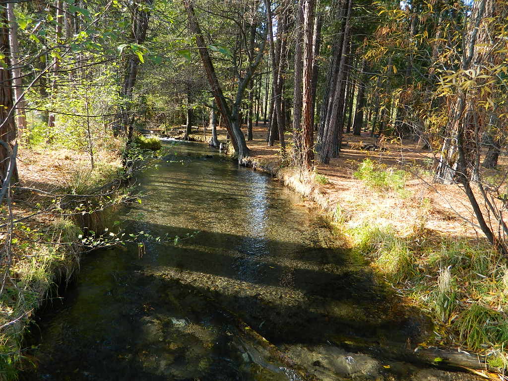
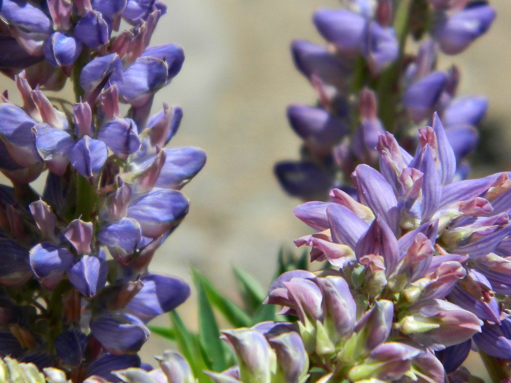
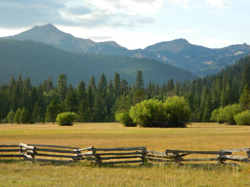
Gurnsey Creek begins in Childs Meadows, north on Hwy 36 – just outside of Lassen National Park 

gurnseycreek

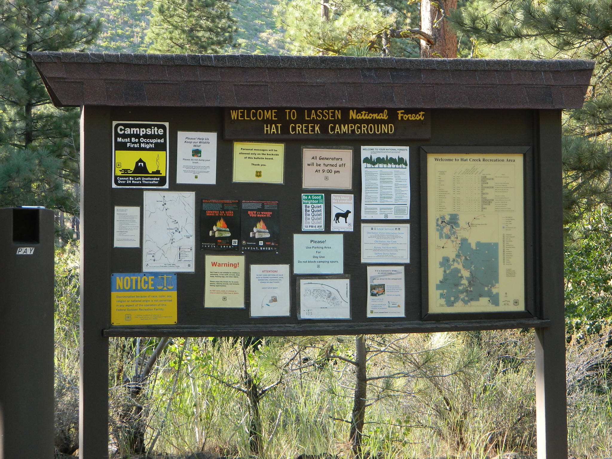
Gurnsey Creek Campground, California

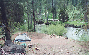
on Gurnsey Creek; Campground open May-October
(depending on snow)
gurnseysign

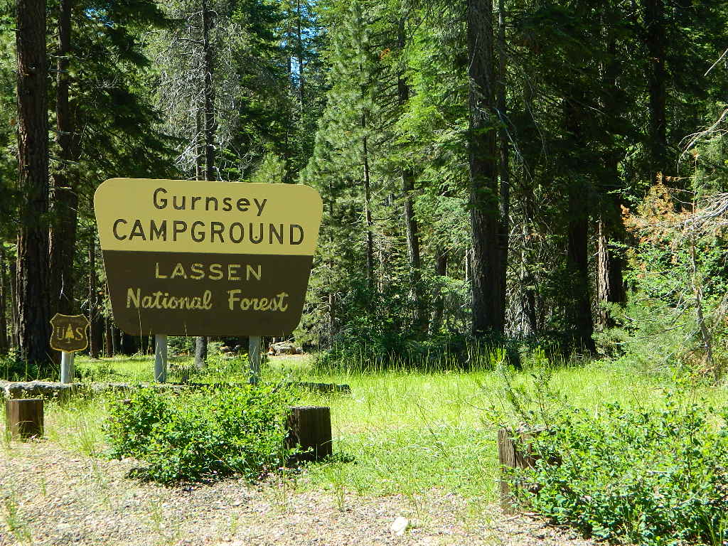
Lassen Creek Camping

52 camp sites on Gurnsey Creek @ 4700′ elevation; vault toilets, creek and piped water, bear boxes; first come, first serve camping – and reservations are also accepted

GURNSEY CREEK CAMPGROUND

Max Camper Length: no limitations
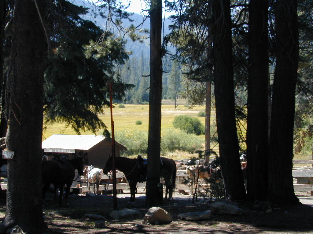
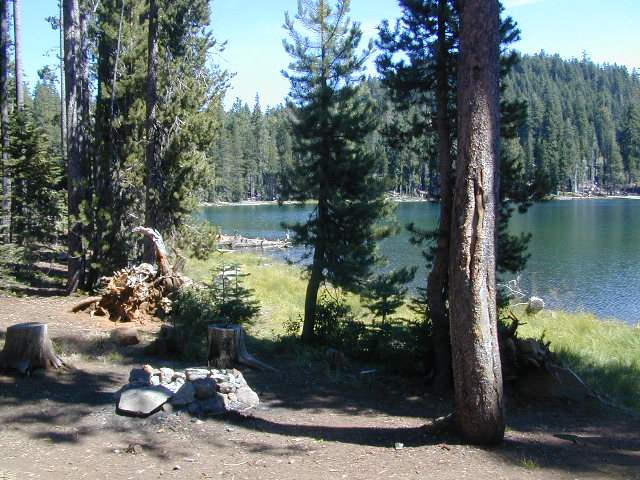
Shady forest camp sites w/ creek. Numerous fishing spots. Close to Lassen Volcanic National Park, Chester and Lake Almanor. Backpackers, day hikers and horseback riders will enjoy the PCT nearby. Pacific Crest Hiking Trail runs to the east side of this campround.pct

CHESTER, CA ranger
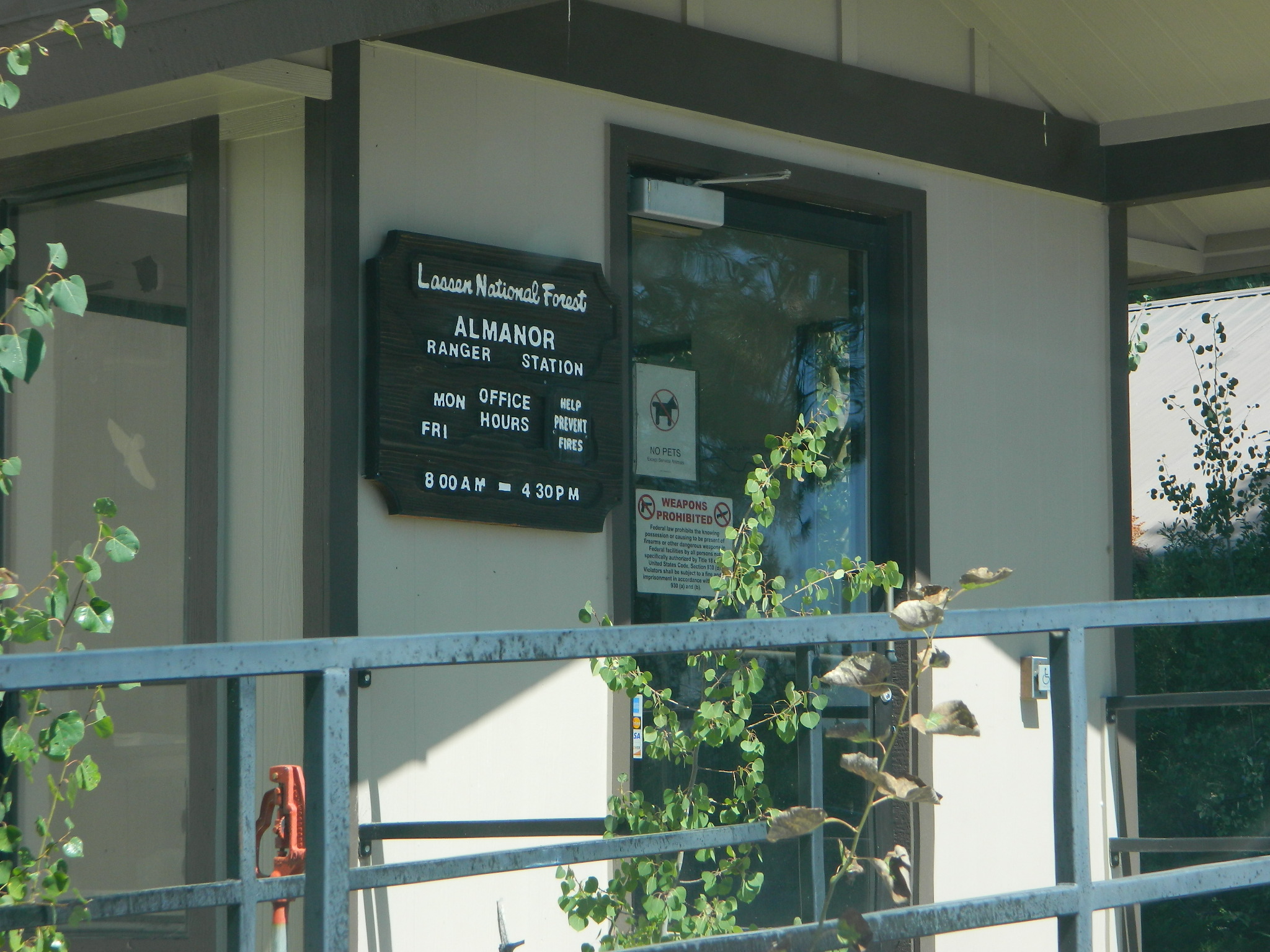
Rangers Office: 530-265-4531
Almanor Ranger DIstrict, Lassen NF

GROUP CAMP RESERVATIONS NFS

2 reservable Group Camps are available at this campground. Group Site 1 can accommodate up to 56 people; Group Site 2 can accommodate up to 112 people.

Free Camping nearby.
If you are seeking primitive camping in this Lassen area, look for dirt roads in the USDA National Forest lands, which surround the National Park boundary.

to the west – Lassen Road #14 – the Blue Ridge, north off of Hwy 89 @ Mineral.

to the south – Yellow Jacket Road #29N48 around Turner Mountain, which is south-southwest of Mill Creek.

to the east – Lassen Road #10 – head north off of Highway 89 in between Chester & Westwood.

see also – Lassen Lakes

lassen park map
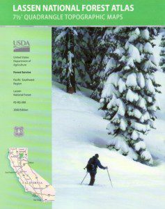
Highly advised: a real map, a printed ‘hard copy’ shows both the National Park and the National Forest of Lassen on one map – with topographic features, all mountain peaks, creeks, lakes, trailheads, plus all dirt and paved roads.

Trailheads near Gurnsey Campground lead out to –
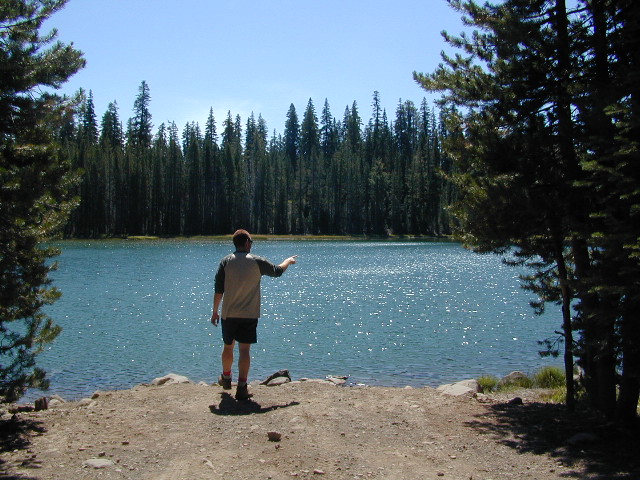
NEARBY TOWNS:


View Larger Map

Gurnsey overview
Mature forested, creek campground, close to the highway

Lassen Camping

NFS ELAM
Elam Creek Campground, Hwy 32

Camping near Lassen Park

Lassen River Camp
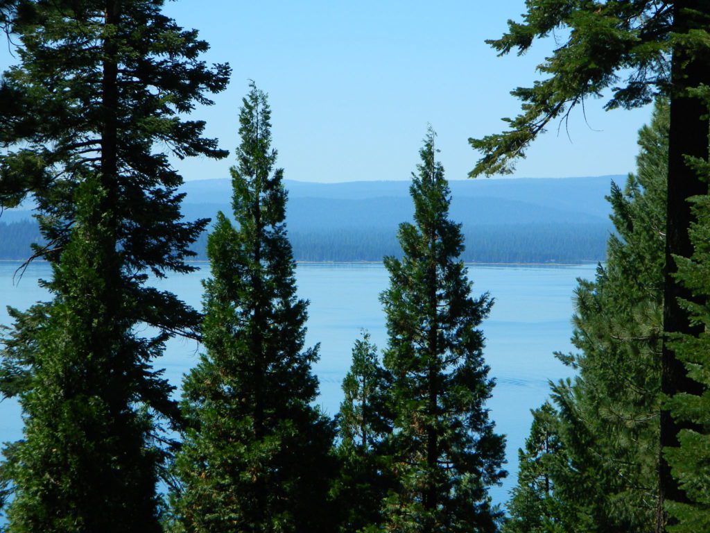
Mount Lassen is part of the Cascade Mountain Range, located north of the Sierra Nevada. The Lassen forest encompasses a large area of wilderness land, snowmelt creeks and an abundant dirt road system. Most of which is covered in deep snow about half the year, so plan accordingly.
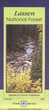
Plenty of great dispersed camping along the old logging roads in this Lassen Forest area, surrounding the Volcanic National Park; in Northern California. Many dirt roads are graded annually to allow for passenger car access. You can make it way back there in a car – just watch for the mud and some boulders!

lassen maps

Camp fire permits required (see below). Pease try to choose a camp that has been used before and pack out your garbage.

HINT: a USDA Lassen National Forest Map is very helpful when camping these remote, Lassen back roads. Stay away from the crowds, avoid camp fees & really enjoy your vacation.

Camp right on a rushing river, alone. With no one in sight or sound. Have that secluded camping experience you’ve always dreamed about. Fishing, relaxing, maybe some hiking too. Or better, your mountain bike. Plenty forest roads to explore.mountains

Numerous waterfalls to discover, water flowing everywhere. Mount Lassen @ 10,457′ elevation, is often snow-capped year round. This Northern California region is covered with pine forests and volcanic history.

Cool Springs PGE
Cool Springs @ Butt Lake, California
(PG&E Campground)

CAMP LASSEN
is our guide to all camping and campgrounds
in Lassen Forest, Parks and nearby towns

camp

NFS

If you wanna find the nearest biker bar, head over to the rustic and forested Bambi Inn @ Butte Meadows. The place is popular all the time, especially on weekends. Scenic day drive from Chico, located near a nice river and bridge, plus they have cabin rentals too. Sometimes they have big events and it can get pretty crowded and loud w/ drinking and outdoor music.

BSA Camp Lassen is a boy scout camp located E of Chico, off Highway 32 near Butte Meadows, CA

Dispersed Camp sites in Lassen in Lake Almanor Area

campground elev. spots veg toilet water notes
Alder Creek Campground 3900′ 6 pines vault creek March-Nov
Benner Creek Campground 5562′ 9 pines vault creek May-Nov
Black Rock Campground 2100′ 6 pines vault creek year round, fish
Echo Lake Campground 6440′ hike pines none lake May-Nov, no tables
Soldier Creek Campground 4890′ disp pines vault creek May-Nov, fall hunters
South Antelope Campground 2700′ 4 pines vault creek year round
Willow Lake Campground disp pines lake May-Nov, no tables

NORTH LASSEN

Free North Lassen
Free Camping Lassen

Northside of Mount LassenNFSlogo

Excellent back roads camping w/ dense forest and free firewood all over the place (bring hand saw). Dispersed, primitive, free camping, near creek, and highway close. Many forest dirt roads turn offs, all along Highway 44 (California SR 44) near junction w/ Hwy 89 @ Lassen National Park.

Big creeks, dense forests, graded dirt roads, dark night skies. PCT access, trailheads, camping, fishing, hiking, hunting, all along Upper Hat Creek.

Campfire permits (shovel, bucket & water) are required when camping outside of a developed campground. Always check on current fire restrictions. Washed out bridges and landslides are common, which means road closed signs can be found on these remote backroads.

campfire

see also –

Hat Creek Campground
Honn Campground on Hat Creek, Hwy 89
Large Lupine Lassen
Large Lupine on Mill Creek

HatCreekCampgr

Lassen Area Maps –

Lassen Towns –

Creeks along Highway 32 - N of Chico, CA
Creeks along Highway 32 – N of Chico, CA
Lake Almanor, California
USFS Chester Ranger Station

Lassen National Forest
Almanor Ranger District
900 E. Hwy 36 | PO Box 767
Chester, CA 96020
530-258-2141


Camp Lassen

Lassen Campgrounds

Mill Creek w/ Lassen Peak
Mill Creek w/ Lassen Peaks (July 2011)

Feather River Camping, Lake Almanor Campgrounds, Hat Creek, River Fishing NorCal, Topo Maps, California Campground  Reservations, Lassen National Forest camp sites and all the outdoor recreation you can imagine.

Volcanic lands of Lassen National Park are surrounded by Lassen National Forest, which means if you cannot find camping inside the National Park – you can surely find it in the outlying regions – with rivers . The National Park Lassen Hwy 89 is often closed during winter months due to snow, as Diamond Peak & Reading Peak are around 8000′ elevation. In 2011 the south entrance did not open until late summer due to heavy snows.

Lassen Camping

A few Lassen campground sites may be reservable, more info with links below; the rest of the campgrounds in the green lists are on a first come, first serve basis.

  • BUTTE LAKE CAMPING
  • JUNIPER LAKE GROUP CAMP
  • MANZANITA LAKE CAMPRGOUND
  • SUMMIT LAKE CAMPGROUND
  • GURNSEY CREEK – CLOSED 2022
  • HAT CREEK CAMPGROUND
  • HOLE IN THE GROUNDCLOSED 2022

Lassen National Park Campgrounds NPS

Camp Lassen / Lassen Lakes

campground elevation spots veg toilet water info
Lake Fork Campground 6792′ 18 pines vault piped June-Oct
Southwest Walk-In 6700′ 21 pines flush piped CLOSED
Warner Valley 5650′ several pines vault piped CLOSED

Lassen National Forest Campgrounds NFS

HOLE IN THE GROUND CAMPGROUND – Mill Creek, CA
CLOSED due to DixieFire

Eagle Lake District

campground elev. spots veg toilet water notes
Bogard Campground 5600′ 22 aspen, pines vault pump May-Oct
Butte Creek Campground 5600′ 20 oak, pines vault creek CLOSED
Crater Lake Campground 6800′ 17 mixed conifer vault pump dirt road, June-Oct
Goumaz Campground 5200′ 5 ponderosa vault creek dirt road
Roxie Peconom Campground 4800′ 10 ponderosa flush pump dirt road

Roxie Peconom

Hat Creek District

campground elev. spots veg toilet water notes
Big Pine Campground 4500′ 19 pines vault pump April-Oct
Bridge Campground 4000′ 25 pines vault piped April-Oct, fish
Honn Campground 3400′ 6 pines vault no CLOSED
Rocky Campground 4000′ 8 pines vault creek CLOSED
Honn Campground
Hat Creek @ Honn Campground

Lake Almanor District

campground elev. spots veg toilet water notes
Alder Creek Campground 3900′ 6 pines vault creek CLOSED
Benner Creek Campground 5562′ 9 pines vault creek May-Nov
Black Rock Campground 2100′ 6 pines vault creek year round, fish
Butte Meadows Campground 4600′ 13 pines vault piped June-Nov
Domingo Springs Campground 5060′ 18 pines vault piped CLOSED
Echo Lake Campground 6440′ disp pines lake CLOSED
Elam Campground 4400′ 15 pines vault piped CLOSED
High Bridge Campground 5200′ 12 pines vault piped CLOSED
Rocky Knoll Campground 6000′ 18 pines vault piped CLOSED
Silver Bowl Campground 6000′ 18 pines vault piped CLOSED
Soldier Meadows 4890′ 15 pines vault creek CLOSED
South Antelope Campground 2700′ 4 pines vault creek CLOSED
Warner Creek Campground 5040′ 13 pines vault creek CLOSED
West Branch Campground 5000′ 15 pines vault piped May-Nov
Willow Springs Campground 5100′ 14 pines vault creek May-Nov, fall hunters
Willow Lake Campground disp pines lake CLOSED

A few PG&E Campgrounds can be found near Lake Alamanor, which are managed by the utility company and not listed on National Forest or National Park web sites.

MOST ALL CAMPGROUNDS CLOSED, due to Dixie Fire damages

LAKE ALMANOR – PG&E Campgrounds
Southshore @ Canyondam, CA

LAST CHANCE CREEK – PG&E Camp, North of Lake Almanor

BUTT VALLEY Reservoir – PG&E Campgrounds
West of Lake Almanor, CA

Juniper Lake Table
Juniper Lake – Lassen NPS

Lassen National Park

Lassen National Forest

Northern California Topographic Maps

Lassen Area Maps & Books –

Lassen Towns –

Lassen Hot Springs

Hot Springs Creek,
Lassen Volcanic National Park

pinetree

Are there any hot springs in Lassen?

ChildsMdw

Fumaroles and Boiling Mudpots
Hot Springs near Lassen Peak Volcano

South side of Mount Lassen, outside the National Park boundary several non-soakable hot springs exist:

  • Growler Hot Springs (private land)
  • Morgan Hot Springs (private land)
    * Measured temperatures of these hot springs range from 126 to 207°F (52-97°C), so basically SCALDING HOT & dangerous

USGS website link w/ detailed info on this whole volcanic region.
https://pubs.usgs.gov/fs/2002/fs101-02/

hiker

  • Little Hot Springs Valley (within the National Park boundary) is also not fit for public use either. Although it may be appealing as a sightseeing destination, (accessible by dirt road) it is far from soaking quality.

mountains

Hot Springs Creek flows south into Mill CreekNPS

DixieFire 2021 ravaged California’s Volcanic National Park. Morgan Mountain lightning strike fire merged with the monster fire to the east. NPS fire crews and CalFire lit a back fire near the Visitors Center on Hwy 89 – to burn and meet the bigger oncoming fire. Winds from the north forced the giant wildfire from the peaks and down hill to Mill Creek and Child Meadows, where firefighters were able to control the leading edge of the fire.

califrepublic

Lassen National Forest
Lassen National Park
Lassen Forest Roads
Lassen Lakes
Lassen Camping
Camp Lassen

drakesbadlodge

Drakesbad Guest Ranch

the only real hot springs worth visiting around Lassen National Park

rumors have it that the resort may still be standing – after the fire!

Built in 1900, this historic, rustic mountain meadow resort is accessible by dirt road through Warner Valley – north of Chester, CA. They have a  swimming pool, naturally heated by the local hot springs. Plus rental horses, hiking trailheads and a developed campground nearby.

JULY 2021 – Drakesbad is CLOSED due to wildfire Dixie Fire

showers

horserental

ranger

nearby towns: 

Chester, CA
Mill Creek, CA
Mineral, CA

Blue Lake Modoc

Modoc Blue Lake
Blue Lake in Modoc National Forest
Hiking Lake
Hiking Lake w/ Loop Trail in far Northern California

Blue Lake
Modoc National Forest

When you really wanna get away from it all, take a week off and head up to Modoc – the top northeast corner of California, where the volcanic mountains line the Great Basin.  The population is minimal, cattle are abundant and the campers few. Even in mid summer, this ideal lake campground rarely fills up.

camp

Jess Valley Road leads east off US 395 @ Likely, CA – 16 miles back to this hidden gem.

Headwaters to the Pit River.

NFS Campground is shady, well managed, and spread out on the eastern slope w/ numerous paved loops. Tent campers, cross country cyclists, truck campers w/ canoes, SUV families, motorhomes with kayaks and kids.

modoc map
Modoc Map

Blue Lake Campground NFS
• Elevation: 6,050′
• Number of Sites: 48
• Vehicle Accessibility: 32′ RV
• Camp Fee: Yes
• Campsite Reservation: No
• Water: Piped
• Length of Stay: 14 Days
• Season: May –October
• Trailhead: Lake Loop
• Boat Ramp: Yes

Group Camp Facilities (by reservation only)
Modoc NF Warner Ranger District
@ 530-279-6116

Lava Blue Lake
Lava Rock @ Blue Lake Loop, in Modoc County, CA

Blue Lake National Recreation Trail

hikerRight next to camp: A pretty much perfect LAKE LOOP (1.5 mi) hiking trail is worth a serious stroll; footbridge, wildflowers, fishing spots, minimal hills, lava rocks, and awesome scenery. Plenty of wildlife can be seen, including butterflies and bald eagles. Trail is shaded by tall white fir and ponderosa pine trees. Trailhead is located at the Day Use parking lot, w/ paved boat ramp, dock, and picnic area.

stars canoe  fish

  • back roads
  • boating
  • camping
  • canoeing
  • fishing
  • hiking
  • kayaking
  • mountain biking
  • picnicking
  • swimming
  • stargazing
  • wildflowers
  • wildlife

Wild Blue Lake

NOTE: not every CAMPSITE has a LAKE VIEW

Certain campsites are adjacent to the lake; some are set facing a meadow (Autumn w/ aspen groves), or the alpine forest w/ deer grazing. Perhaps an inner circle (interior) campsite, for those who like to be close to bathrooms and piped water. Large families will love the abundance of camp settings and accommodations.

Paved Loop
Plenty of Vault Toilets
Piped Water
Recycles & Trash Service

Large Campsites
Large Campsites can accommodate Motorhomes
  • no paved camp stall
  • no hook-ups
  • no dump station
  • no cell phone signalcamptruck

popular lake camp for motorhomes

When driving a large RV back in here, be courteous of other campers. Nothing sucks more than driving a long distance to the boonies, to arrive at camp just before dark and annoying everyone else already there.

Those needing to drive the campground loops (more than twice) looking for the biggest, levelest, best camp site – and burning $10 in gasoline doing so, should consider walking in.RV

Park that beast (near boat ramp area, before the camp entrance). Get out and walk the hills and loops, BREATHE & relax – prior to a choosing camp site.

Unhitch any tow vehicles; use that to scout out your perfect spot, if you cannot hike it. Trailers and large motorhomes will find this place ideal, but getting the right camp, can make all the difference.

Trail around Campground

Paved Trail around Campground

The wildfire: BLUE FIRE burned this region in 2001, but it is lush and green again (2019). Northern California gets some real weather. Rain and snow, more than half the year. The campground closes annually due to snow.

Kayaking is best done in the morning, cuz wind picks up in the afternoon. Canoes can launch at boat ramp, or at shoreline from trails near campsite.

Hiking trails can be found all around lake and campground. Wilderness access can be found at South Warner trailheads within a short drive from the lake.

Cyclists also love this camp, as it is located near a major highway and is a perfect place to really relax, soak in the scenery and get some quiet-nights sleep.

Modoc National ForestNFSlogo
225 West 8th Street
Alturas, CA 96101
530-233-5811


south warner sign

South Warner Wilderness is close by, driving distance; accessible by graded dirt roads. Signage is decent.

Modoc Forest Road #64 is a through-route, across the lower South Warners – 40
miles connecting to east side of the mountain, at Eagleville, CA.

Dirt Roads are suitable for trucks w/ trailers. SUVs and rugged passenger cars are okay. Motorhomes are not advised on this route.  Washboard conditions are typical. Winter closure on this route is common.

south warner mountains map

MODOC RD 64

Several miles away from Blue Lake, 2 rustic trailhead campgrounds are located back this way – East Creek Campground & Patterson Campground. Less than 10 camp sites each, equipped  w/ horse stalls, vault toilets and maybe piped water. Trailhead parking for backpackers. No RVs!

Autumn colors w/ aspen groves. Open, large meadows and mature forests w/ wildfire scars. Cattle can be found grazing all around, many cattle crossing.

Minimal primitive camping options, along road sides. Campfire permits required. No camping within one mile of a developed campground.

Cow Country
Modoc is Cow Country
Road64
Day Trippin – Out exploring Modoc Road 64 (and cutting firewood)

nearby towns –

see also –
Mill Creek Falls Campground

Lassen Lakes

Lassen Lakes in California

Lassen Volcanic Park is surrounded by beautiful mountains and lakes, some inside the National Park boundary, but most outside. Lassen National Forest, Thousand Lakes Wilderness, Lake Almanor, Hat Creek and Burney Falls encompass this pristine water wonderland of NorCal. Outdoor recreation all over – rivers, fish, hunt, camp, mountain bike, off road.

LAVA TUBE: Subway cave

Backpack camps, RV campground, fishing lakes, day hikes, off-road and lake side camp sites, we have it all listed on Total Escape.

Hiking, camping, fishing all over this region! Mountain bike, kayak, or relax all day in the hammock – in a shady spot with a view. Water flows freely and annual snow melt is abundant in this part of California. Some locales may not open until July 4th weekend. Always check with the Lassen NFS rangers to make sure.

^ lakes with campgrounds

‘ feet in elevation, above sea level

Lakes inside Lassen National Park:

(lakes located on Lassen Hwy 89)

Lake Helen

Summit Lake ^
Summit Lake Campgrounds – Summit Lake North & Summit Lake South & Horse Corral Camp

shotoverinlake

Manzanita Lake ^ 5847′
Manzanita Lake Camping – Manzanita Lake Campground

(lakes via dirt backroads)

Juniper Lake NPS Lassen ^ 6792′
Juniper Lake Campgrounds –
Juniper Lake Campground & Juniper Lake Group Site & Horse Corral Camp

Butte Lake ^ 6043′
Butte Lake Campgrounds –
Butte Lake Campground & Butte Lake Group Camp & Horse Corral Camp

(lakes on the trail)
Crumberg Lake
Twin Lakes
Jakey Lake
Snag Lake 6076′
Horseshoe Lake
Willow Creek
Long Lake


Lassen National Forest lakes: fishing lakes

Majority of these lakes require dirt road driving to reach them. Often forest roads close for snow, usually during winter months (DEC-MAY)

Wilson Lake 5267′
Crater Lake ^ 6800′
Echo Lake
Widow Lake
Star Lake 6362′
Rising River Lake
Baum Lake
Murken Lake
Haynes Reservoir
Heart Lakefishing lakes
Willow Lake
Shotoverin Lake

killercamp_echo
Killer Camp @ Echo Lake

lassen camps

Caribou Wilderness:

Campsites with hiking lakes and wilderness trailhead access, right next to Lassen Volcanic National Park.

Echo Lake ^
Caribou Lake ^
Silver Lake ^ – Silver @ Lassen
Triangle Lake

LassenAtlas
Find Lassen Maps, NFS Topo Atlas

Thousand Lake Wilderness:

North of Mount Lassen is the less-popular Wilderness Area w/ many miles of dirt roads to travel.

North Battle Creek Lake ^ 5571′
Logan Lake
Buckhorn Lake 4776′
Lake Eiler
Terry Lake


NorCal Recreation Lakes nearby:

Lake Britton @ Burney Falls ^ 2732′
Eagle Lake ^ 5100′
Butt Valley Reservoir ^ 4142′
Lake Almanor ^ 4500′

Lone Tree @ Eagle Lake

Northern California towns nearby:

BURNEY
FALL RIVER MILLS
HAT CREEK
OLD STATION
SUSANVILLE
WESTWOOD
CHESTER
MINERAL
MILL CREEK


6N06 – Stanislaus NF

graded road

Forest Rd #6N06 – County Line Road, Fence Creek, Stanislaus National Forest

Central Sierra Nevada Mountains, California
N of Hwy 108; W of Sonora Pass

On the very edge of wilderness
Stanislaus National Forest
County Line Road
Fence Creek Campground (NFS)

Graded dirt road near Clarks Fork junction @ SR 108. Dirt road travels up into forest, hiking trails and meadows; South side of the volcanic Dardanelles @ Tuolumne Co. & Alpine Co. boundary

Carson Iceberg Map

County Line Trailhead
Wheats Meadow Trailhead
Carson Iceberg Wilderness Area
The Dardanelles (9524′ elev)

Clark Fork, Middle Stanislaus River

Topo Maps of this Region:

Stanislaus National Forest Map USDA
Carson Iceberg Wilderness Map USDA
Carson, Emigrant, Mokelumne Map NatGeo
Sierra Nevada Topo Map

hiker

  • backpacker access
  • day hiking
  • horse camping
  • primitive camping
  • trailhead camping

winter road closure, annually
check with local rangers on road access and conditions.

Rd# 6N06, climbs to mountain scenery at upper elevations, well of the main highway. Route is a 2-lane wide road at times, narrower and private towards the end of roads; several dirt roads, overgrown 2 tracks w/ many camp sites to choose from. Dispersed primitive camping requires a camp fire permit.

6N06rd

OHV off-roaders will only find dead ends on dirt route 6N06. NO motorized access in nearby wilderness. Wheelers should try south of Highway 108 @ Niagra Campgrounds; Niagra Off Road #5N01 for all the noise-makers, gear heads, dirt bikes, and toy boxes. Niagra Creek, Niagra OHV, Niagra 4×4.

dirtbikes

nearest towns:

Dardanelle
Pinecrest Lake
Twain Harte

volcano mdws

28E201 – Inyo NF

trailsdown

Road #28E201 – Inyo National Forest
also known as Inyo Road #4S86

Laurel Lakes Road
Inyo National Forest
Eastern Sierra, California

Southeast of Mammoth Lakes, CA
West of Crowley Lake, CA

Steep, rocky, gravel road, way up above (and behind) Convict Lake. 4WD may be needed during wet or snowy weather. High clearance is always advised. Locked GATE at the bottom means the NFS rangers have closed the route (seasonally) for deep snow, rock slides, avalanches, or other erosion hazards.

Laurel Canyon, US Hwy 395
Laurel Creek
Laurel Lakes

amigoaspens
Laurel Lake Road, Eastern Sierra

Find more INYO BACK ROADS

  • backpacking
  • camping
  • fishing
  • hiking
  • horseback
  • lakes
  • mountaineering

GenevieveLake

Trailhead to Lake Genevieve (pictured above), hike lake loop, snowy peaks.
NOTE: No easy access to the PCT (Pacific Crest Trail)

Laurel Mountain (elev 11,818′)
Bloody Mtn. (12,544′)

oldestrocks

gnarlyrocks
CLICK TO ENLARGE

Geologic:

Oldest, exposed rock in the Sierra Nevada mountains range. Buckling granite w/ volcanic rocks. Evidence of glacial activity including, terminal, lateral, and recessional moraines, glacial striations and polish, erratic boulders, and of course the numerous lakes. see more

Volcanic Eastern Sierra
Volcanic hikes in the Eastern Sierra

Spicer Reservoir

spicer terrain


Spicer Meadow Reservoir

Spicer Meadows, Spicer Reservoir, Rd #7N01
Spicer Lake, Stanislaus National Forest

lake elevation 6418′
227 surface acres

public boat ramp
hiking trail around lake
more lakes nearby

Ebbetts Pass Sierra Hwy 4

Ancient volcanic peaks mix with Sierra Nevada granite rock, pine forests and fresh, clear, clean mountain water! California, of course.

Stanislaus Forest Road #7N01 leads down from Highway 4 to this popular series of alpine lakes and reservoirs. Camping, fishing, hiking and mountain biking. Sailing, canoeing, kayaking, swimming, floating and fishing are also popular water activities.

Rules of the Reservoir:
10 mph speed limit on Western Arm.
No motorized boating in Eastern Arm.
Camp only in developed Campgrounds.

NFS
2 NFS Campgrounds at west end of lake:

  • Spicer Campground (60 sites)
  • Spicer Group Camp (75 people max)
  • Campgrounds only open June-September. Some campsites at the campground are wheelchair accessible.

    Additionally, Stanislaus River Campground w/ only 8 sites, is located just off the main access road #7N01, right near the river.

    spicer lake shore

    Spicer #7N01

    Numerous smaller lakes in the region make this a hot spot for summer vacations. Union and Utica Reservoirs (both with dirt road access) are good for kayaking and canoes, while power or sail boats prefer the larger Spicer Lake. Summit Lake and Elephant Rock Lake are perfect for quite picnics and day hikes. Trails (many unmarked) connect the lakes to each other. Area gets buried with snow in winter, so these roads are generally only open half the year.

    More reservoirs and lakes nearby:
    Highland Lakes
    Mosquito Lakes
    Lake Alpine, CA
    (all along Hwy 4)

    Stanislaus National Forest Map USDA
    Stanislaus National Forest Map USDA

    Nearby mountain towns:
    ARNOLD, CA
    BEAR VALLEY, CA
    Lake Alpine, CA

    Mono Lake California

    The Great Basin meets California, at the Eastern Sierra Nevada Mountains

    Navy Beach, Mono Lake

    Mono Lake


    elevation: 6383′
    Eastern California
    US Hwy 395 @ CA SR 120

    East of Yosemite NP
    Lee Vining, CA

    Mono Lake

    Rumor has it this lake basin could be the ancient super volcano of the region. MonoLake is located on the north end of the Long Valley Caldera, a volcanic ridge which stretches down to Bishop and parallels Mammoth Mountain & US 395.

    Huge shallow lake with a very turbulent history. Signs and plaques throughout the lake shore give info on ancient history of the lake, the wildlife, and regional detail. Majestic views of the Sierra Mountains, with sparse vegetation, lunar type landscape. Eerie with storm clouds; Beware of bad weather. Kayakers love this lake too!

    Sierra Nevada backdrop

    Canoeing
    Hiking
    Hot Springs
    Kayaking
    Picnic
    Primitive Hot Springs
    Stargazing
    Volcanic Landscape

    Mono Lake Camping

    Camping is closeby, but not located on the fragile lakeshore.
    open camping
    Dispersed camping (FREE) is allowed in Mono Basin National Forest Scenic Area, the region that surrounds the Tufa State Natural Reserve. Campfire permits are required. Contact the park listed below for all the details on the camping policy.

    campgrounds
    Camps include National Forest Campgrounds in Lee Vining Canyon (8 miles), June Lake Loop (15 mi), Lundy Lake (12 mi). Private RV parks can be found in nearby Lee Vining and further south, at Lake Crowley.

    [PDF download]
    Camping In The Mono Basin
    by LeeVining.com

    Inyo National Forest USDA
    Camping Mono Lake Ranger District

    local links:

    Mono Lake Tufa State Natural Reserve
    California State Park
    760-647-6331

    Mono County Tourism
    MonoCounty.org

    760-924-3699

    Mono Lake Committee
    MonoLake.org

    Bookstore @ 3rd, Lee Vining
    760-647-6595

    Tufa Towers

    nearby interests:

    Yosemite National Park
    Inyo National Forest
    Toiyabe National Forest
    Benton Hot Springs
    Bodie Ghost Town
    Convict Lake
    Mono Craters – Panum Crater & Crater Mountain
    Long Valley Caldera
    Lundy Lake
    California Aspen Groves
    Autumn Colors Camping

    Long Valley Craters Mono Lake
    Long Valley Caldera Craters near Mono Lake

    regional maps:

    Tom Harrison Mono Lake Map

    NatGeo Mammoth Lakes & Mono Map

    Inyo National Forest USDA Map

    Ansel Adams Wilderness Maps

    nearby towns w/ lodging:

    Benton Hot Springs
    Bridgeport, CA
    Lee Vining, CA
    June Lake, CA
    Mammoth Lakes, CA


    View Larger Map

    Northern Sierra Nevada

    Sierra Nevada North / Northern Sierra Nevada Mountains

    lakes basin views

    sierra buttes
    the sierra buttes

    Northern Gold Country, Yuba River

    Sierra granite rock meets volcanic rock at Lakes Basin & Lassen NP

    Some California maps consider Mount Lassen to be the top of the Sierra Nevada range, while other maps cut it off at Lakes Basin @ Sierra Buttes, much further south. Lassen Peak is actually part of the Cascade Range of mountains that go up the coast of the Pacific Northwest. Either way, we’ve included Lassen maps in this list.

    Tahoe National Forest Map

    South Yuba River Map

    Lake Basin Recreation Area
    Lake Basin Map
    Sierra Buttes Map
    Gold Lake, Graeagle, Sierra City

    Plumas Eureka State Park
    Plumas Eureka State Park Map
    Middle Fork Feather River Map
    Blairsden, Portola

    View East from Davis
    Crocker Mountain @ Lake Davis, California

    Plumas National Forest
    Plumas Forest Map
    Almanor, Crescent Mills, Greenville, Inskip, Paradise, Quincy, Portola

    Sierra Nevada

    Lassen National Forest
    Lassen Forest Map
    Burney, Chester, Fall River Mills, Paynes Creek

    lassen park

    Lassen National Park
    Lassen Park Maps
    Mineral, Old Station, Westwood

    laseen camps

    Ishi Wilderness

    Bridge and Chute from top of Black Rock

    NorCal Ishi Wilderness

    41,840 acres
    20 miles N of Chico, CA
    Lassen National Forest

    • Barkley Mountain (elev. 4488′)
    • Black Rock Campground
    • Deer Creek
    • Flat Iron Mountain (elev. 4400′)
    • Iron Mountain (elev. 3274′)
    • Indian Ridge Campground
    • Mill Creek
    • Peligreen Place
    • Pine Creek
    • Pinnacle Peak (elev. 3293′)
    • South Antelope Campground
    • Twentymile Hollow

    Up in the mountains behind Chico sits a rugged landscape of deep canyons lined with bizarre rock formations and roaring mountain creeks. Wilderness encompasses lower elevations – ranging from 1500′ – 3500′  – making this outdoor destination a winter haven, when the rest of the backcountry is covered in several feet of snow. One of the most historic wilderness areas in the state, as the aboriginal existence of the Native Americans came to an end in this area.

    COHASSET ROAD climbs up the volcanic fin of Cohasset Ridge into the pine forests high above the valley floor. The paved road becomes dirt and the road name changes to Ponderosa Way (Lassen Road# 28N29). The Ishi Wilderness can also be accessed from the north side via Highway 32, near the Tehama State Game Refuge.


    View Larger Map

    • backpacking trails
    • hiking trails
    • fishing creeks
    • horseback trails
    • wildlife viewing


    Ishi Wilderness mapIshi Wilderness Map

    Ishi Wilderness