
Acura Grand Prix LB
Auto race where the road course carved out of the downtown city streets of Long Beach, California
Annual event: April
LONG BEACH CA
888-827-7333
gplb.com


Auto race where the road course carved out of the downtown city streets of Long Beach, California
Annual event: April
LONG BEACH CA
888-827-7333
map river | hiking river | map gorge

There are many gorgeous rivers in California that are perfect for camping and fishing, but none are located in Southern California. None! Yep, you read that right. If you think about it, the golden state is about half desert! The majority of our natural water in our state is coming from the north – so take this as a warning: you might need to drive a few hours to find your ideal river camp.
The easy-to-access waterways are found mostly along highways in the Sierra Nevada – or way up in NorCal. Deep granite gorges carved out by glaciers, surrounded by forested peaks is only half the appeal. High elevation lakes, waterfalls, big trees, abundant wildlife, and the alpine villages are all part of the Sierra Nevada experience. Raft, kayak, fly fish, hike, bike or just camp out next to a big, rushing, flowing river. Our selection of California maps will get you narrowed down to a specific region, so you can find that perfect river campground, or explore and discover the back roads – for the most seclusion.

EEL RIVER
KLAMATH RIVER
Klamath NF Map
MAD RIVER – NFS Campground
MATTOLE RIVER
McCLOUD RIVER
NAPA RIVER
NAVARRO RIVER
NEW RIVER
NOYO RIVER
PIT RIVER
RUSSIAN RIVER
SACRAMENTO RIVER CAMPING
SALMON RIVER
6 RIVERS NATIONAL FOREST MAP
SMITH RIVER
TRINITY RIVER
VAN DUZEN RIVER

AMERICAN RIVER
AMERICAN RIVER – El Dorado NF Map
CONSUMNES RIVER – Stanislaus NF Map
FEATHER RIVER
FEATHER RIVER Recreation Map
FEATHER RIVER – Plumas NF Map

KAWEAH RIVER – Sequoia
KERN RIVER CAMPING
KERN RIVER – Sequoia
KINGS RIVER California
KINGS RIVER CAMPING
KINGS RIVER – Sequoia Kings Canyon Map
KINGS CANYON NP
MERCED RIVER – Sierra
MERCED RIVER – Yosemite Map
MOKELUMNE RIVER – El Dorado NF Map
OWENS RIVER – Inyo NF Map
SAN JOAQUIN RIVER – Sierra
SOUTH YUBA RIVER Recreation Map
STANISLAUS RIVER – Sonora Pass
STANISLAUS RIVER – Stanislaus NF Map
SUSAN RIVER – Lassen
TULE RIVER – Sequoia
YUBA RIVER – North Gold Country
YUBA RIVER – Tahoe NF Map
![]()
BIG SUR RIVER
SALINAS RIVER
COLORADO RIVER CAMPING
Colorado River Jet Ski
LAKE HAVASU
LAKE MEAD (NV) Recreation Map
LAKE MOHAVE
SANTA YNEZ RIVER @ Lake Cachuma – Santa Barbara Mountains
SESPE RIVER – more creek than river, Los Padres NF & SESPE WILDERNESS

![]()


KERN RIVER: The Kern River is one of the most popular of all the Sierra rivers due to its proximity to SoCal. Hurried, stressed-out, Angelinos (LA) can be at this destination in under 3 hours – which makes it a very busy place most months.
So, let it be told, that summer is not the best time to enjoy the Kern. If you do plan a summer outting, make sure you head for the Upper Kern (10+ mi N of Kernville & Lake Isabella) or the North Fork of the Kern (out in Monache Meadows) where 4×4 is often needed.
The Lower Kern River has only 2 developed campgrounds: Hobo (closed for damage 2019) and Sandy Flat (open all year). Numerous primitive camp spots are available along Old Kern Canyon Rd, which parallels the Hwy 178 on the south side. None of which are located at the rivers edges. Remington Hot Springs is a popular spot for soaking. Fishing trails, mountain biking trails and hiking trails, all over. Fire danger is great in this area, so pay extra close attention to signs and fire restrictions.
Kern River above Lake Isabella and Kernville is a better choice for camping availability.

![]() Everybody loves Yosemite! This is the most popular park in the whole state; maybe the whole nation.
Everybody loves Yosemite! This is the most popular park in the whole state; maybe the whole nation.
The majority of campers want to stay “right on the river” when they visit Yosemite NP, but that is just plain old impossible, since reservations go fast and there is only so much room for everyone in this enclosed, narrow, precious valley.
This particular park has some major floods (1997 & 2005) that wiped out bridges, road ways; all the old wooden cabins (at Yosemite Lodge) are gone and only half of the campgrounds are still available. Yosemite has had 11 winter floods since 1916 that have caused substantial damage to property. That number is expected to increase, as winter precipitation is getting less predictable.
Reservations are taken for camping and cabins – far in advance; like one year. No joke!
![]()
![]()
Way up in the Yosemite high country, which is only open a few months outta the year, the beautiful Tuolumne Meadows Campground is located next to lush meadows and the scenic Tuolumne River. All Yosemite campsites must be reserved well in advance, so visit links above – if you are serious about a Yosemite camping trip anytime soon.


MOKELUMNE RIVER: Way up the road, deep in the western Sierra, Gold Country. Small NFS campgrounds, right on the river; Access is long, narrow paved, switch-back road, not suitable for RVs or trailers.
STANISLAUS RIVER: The Sonora Pass, the fishing is very decent way back in this granite gorge. Highway 108 is only open a few months outta the year, due to deep snow & rock slides – so time is of the essence. Summer time is prime vacation weather up here. Several campgrounds are located right on the river, or on the major feeder streams. Or you can opt for secluded primitive camping on the back roads. Find Sonora camping in Stanislaus National Forest.
YUBA RIVER: The biggest play time river in the northern Gold Country, this runs along Hwy 49 near Downieville and also has a major South Fork for the best swimming holes and primitive camping in this region. Tubing, rafting, kayaking, fishing, camping, gold panning, you name it, Yuba has it. Look for more on the South Yuba Recreation Map, or the USDA issued Tahoe National Forest Map
FEATHER RIVER: Top fishing river in the Lassen to Oroville area. Chester and Lake Almanor in the upper reaches. High Bridge Campground is nice paved-camp-site camping; a forested spot where you can fish 2 rivers on the same day. A Plumas NF or Lassen NF map would be quite helpful for this region. Lower down the mountain, lower Feather Rivers which include all 4 forks which feed Lake Oroville – West Fork (Paradise, CA), North Fork, Middle Fork Feather, (Berry Creek, CA) and the South Fork (Lumpkin). Lots of waterways and creeks worth exploring in between Chico and the mountain town of Quincy.
KINGS RIVER: This one particular river is the longest in the Sierra Nevada mountain range, pulling snow melt from the upper reaches of the High Country and Mount Whitney. The river area just to the West of the National Park, over to Pine Flat Reservoir, is all prime for outdoor recreation. Several river rafting companies work this stretch of river.
CAMP FOUR & A HALF CABIN RENTAL
NFS KINGS RIVER
![]()
![]()
![]()
![]()


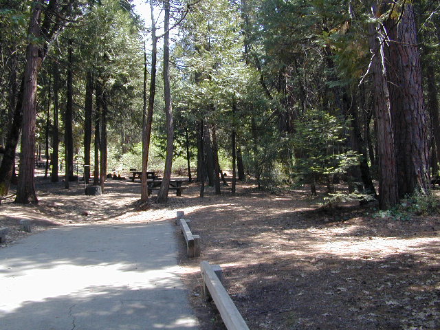
This chunk of National Forest land is perfectly located in between 2 very popular National Parks – Kings Canyon and Sequoia. This primary paved road leads to some great camping, a perfect option for NOT camping inside the crowed National Parks.
Turn east off of Sequoia ‘Generals Highway’ 198, on to the well signed Big Meadow Rd. There is primitive camping all over this area & a few developed campgrounds along this route. Motorhomes be warned: the road narrows to one lane with no “turn outs” or U turn spots for the last 10 miles (on a steep cliff w/ large overhanging rocks)
 In the first few miles, the dispersed camp sites on the right side have great views & some situated on fairly flat granite slabs, perfect for astronomer campers or adventurous RVs. To the left side of the road is more primitive style campsites in wooded areas. The whole area is also a very popular cross country ski & snowmobiling spot for winter recreation. Hunters also like these camps during hunting season (in September).

There is a developed Horse Camp on the left side of the road for equestrian campers. This camp is located across from the biggest meadow and may be the first place you notice on this drive.

Buck Rock Fire Lookout Tower @ 8500′ elevation – is located to the north on Forest Rd # 14S02. It’s a great spot for some impressive views – if you aren’t afraid of heights. To reach the tower you must climb several flights of steel steps. This place is worth a stop if planning a sightseeing day.
Big Meadows Guard Station @ 7500′ elevation (also known as Big Meadows Cabin), is located next to the BIG MEADOW and is available for rent on a weekend basis from the NFS. Hiking Jennie Lakes Wilderness and fly fishing Big Meadows Creek are favorite activities to be enjoyed.
Big Meadows Road is long & narrow – 12+ miles. RVs are not recommended beyond the Big Meadow Campground, as the road is one lane in some spots & it skirts a cliff edge. The views are incredible the farther you go & many creeks feed the region.
The narrow, long paved road eventually forks off into several smaller dirt roads back near Horse Corral Meadow. Way back here, the dirt roads lead out to trail heads for backpacking, horse packing or day hiking in Jennie Lakes & Monarch Wilderness. Backcountry access to either Sequoia or Kings Canyon National Park! Have a good map if you plan to venture out this far. Pay attention & don’t get lost.
GPS would be helpful in this area. Some of the smaller of the dirt roads are not even on the NFS maps. Make sure to GPS way-point your favorite camp site, so you can find in next time…. in the dark.
nearby services:


Southern Sierra mountains and the Giant Sequoias, inside Sequoia National Forest. In the Camp Nelson area, south of the busy National Parks.
GIANT SEQUOIA HWY 190 – Western Divide Highway is the 7000′ ridge line that separates the Upper Kern River from the great Central Valley to the west.
From the San Joaquin Valley – get to Porterville or Springville, continue up the mountain on the main highway, to the paved road turn off (Road #22S94) on the right side of the highway;
After Pierpoint Springs and before Camp Nelson. This quiet campground is located off the highway more than a mile, so traffic noise will not be an issue for the light sleepers. (Unless of course, a loud 4×4 rig screams by at midnight headed to the backwoods, or a horse trailer cruises by at 5am). This camp does border the Tule River Indian Reservation.

Western Divide Highway 190
Giant Sequoia Campground
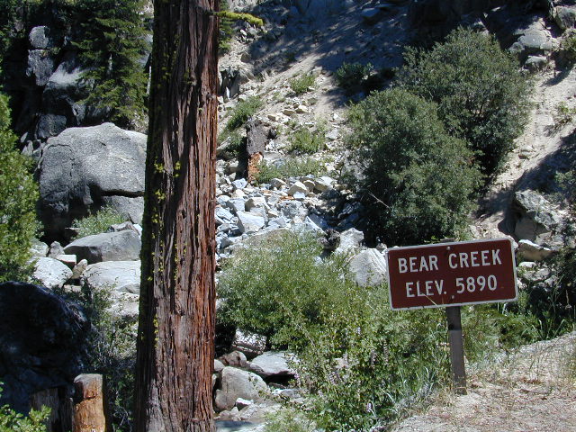
Sequoia Road #22S94 is a loop road leading to many forest meadows, groves, primitive camps and trailhead destinations. Bear Creek and Coy Creek flow near CoyFlat Campground, which both merge north into the Middle Fork of the Tule River @ the highway.
Belknap Grove is nearby, with Black Mountain Grove a few miles further on the dirt back road (Road #22S94) as it continues to Bateman Ridge and Road #21S12, near the Tule Indian lands. Mountain biking, rock climbing, backpacking and hiking all great in this region.
22S94 continues in forest to 8500′ elevation @ Windy Gap, where the Summit National Recreation Trail intersects road. Popular trail among horse riders. 22S94 connects back to Western Divide Highway, in between Ponderosa and Trail of 100 Giants. Awesome loop drive for those seeking seclusion on the dirt roads, away from the tourists and RVs. Call ahead to make sure that the dirt roads and gates are open, before you plan a weekend vacation around it.
• Elevation: 5,000′
• Number of Sites: 19
• Reservations: Yes
• Sites Available: First come, First serve
• Vehicle Accessibility: Vehicle 22 ft. max.
• Length of Stay: 14 Days
• Water: Piped; Seasonal creek nearby
• Toilet: Vault
• Season: Closed for winter months
• Fee: Yes
• Operated By: National Forest Service
• Closest Town: Camp Nelson, Califronia
Sequoia National Forest
Giant Sequoia Ranger Station
559-539-5230
Due to the spread of invasive insects, firewood from outside the area is not permitted. Help protect our forests by purchasing or collecting firewood at or near your camping destination and burning it on-site.

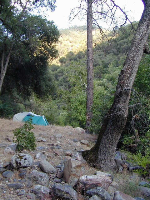
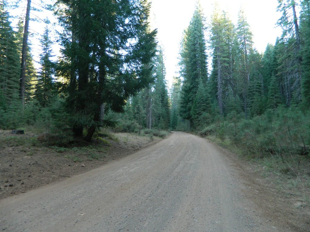
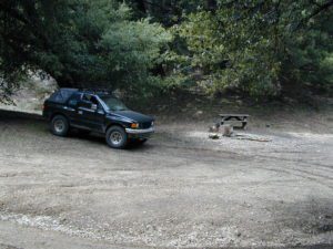
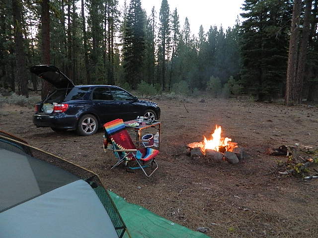
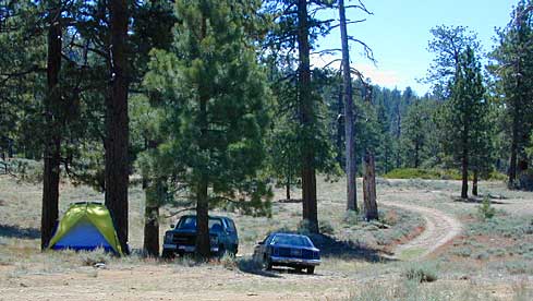
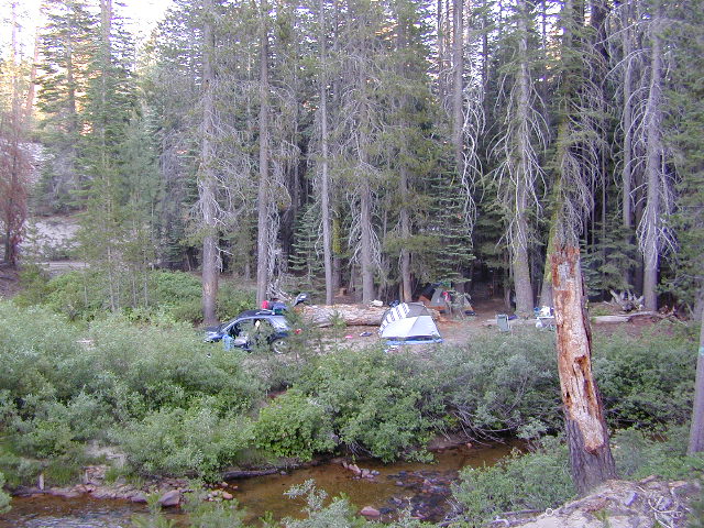
Free camping outside of a developed campground, for a self-contained camper who wants seclusion and privacy. Real relaxation in total peace and quiet. More nature, less people and minimal vehicles.
Free Campsites • Dispersed Camps • Open Camping • Boondocking
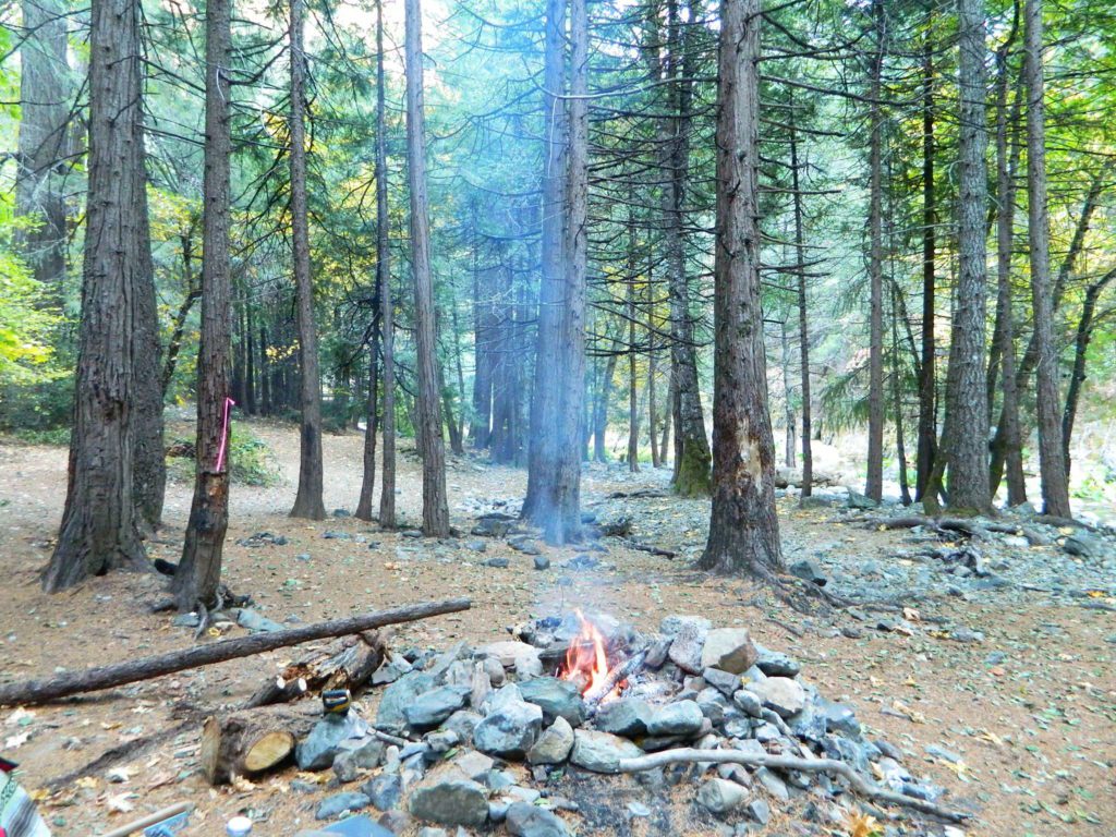
primitive camp sites – the bare minimum. a clearing for a tent, maybe a fire ring. no toilet, no fees; dirt road access.

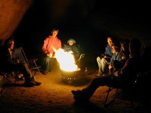
campfire permits required. And it is up to you to know the current fire restrictions in the area you seek to camp overnight.
![]()
The further out you are willing to drive, the more remote you can be. Good topo maps of the region help you to find these ultimate, secret camping spots. National Forests & BLM Lands require a free camp fire permit to have a campfire.

Fire safety is always a big concern in wildfire prone areas like California. Additional Permits & Passes may be needed in some forests or parks; each location is different. Check with the local ranger station for up to date restrictions.
Many dirt roads lead avid campers to the best out-of-the-way camp sites. Camps may have picnic tables or just a fire ring, but usually NO toilets. Have the “No Bathroom Blues”? Don’t sweat it. check out the page on Camp Potty
Some camp sites are as bare as a small clearing, a rock fire ring if you’re lucky. A detailed backcountry map is always advised. If you count on your digital mobile device and online access for mapping, you could find yourself very lost. GoogleMaps is known for mislabeling the smallest of back roads – and they do not feature dirt roads either.

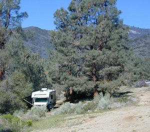
 A high clearance vehicle may be needed to reach certain camp spots, but many can be accessed with a standard passenger car. Low riders will likely bottom out and motorcycle riders will get dusty.
Know your vehicles limitations for any off-road use and don’t get stuck in a bad situation. Soft sand is quite common in deserts and 4×4 might be needed. There aren’t any tow trucks out in the boonies and if you do find one, it’ll cost you something fierce. Watch for large rocks, deep ruts or tree limbs in the road (at any time) and watch low overhanging branches when driving a motorhome in to such spots. Some dedicated, hard-core RV campers prefer to camp in remote locations.
Southern California has something called yellow post camps, but we’ve really ONLY seen them inside San Bernardino National Forest areas, which includes Idyllwild and Mount San Jacinto, plus all the Big Bear Lake Mountains.
YELLOW STICK? These are fire safe spots w/ picnic table; secluded in the forest, some accessible by passenger cars, while other camps require a 4×4 to reach. Yellow post sites campfires are often off limits during fire restrictions, when only fires are allowed inside the larger developed campgrounds.
Backpackers trailheads often have a few camp sites near the parking lot, but these may be busy during summer months. Dirt roads leading to trailheads can have primitive camp sites along them as well. Long, big creeks in the forests are notorious for having awesome camp sites. Big river camp sites are sometimes free, if you know where to look. Sometimes the smallest of California campgrounds have no charge, first come, first serve (BLM, National Forest, or State run).

Before it got labeled BOONDOCKING: Primitive Camping in remote spots was what we lived for. Camp outside of developed campgrounds, for free. Campfires will usually be banned on these back roads during the driest part of the year. Check with local ranger stations for current fire restrictions.

possible dirt road access, seclusion, privacy, darker skies, no fees, no crowds, real peace & quiet
no toilet, no picnic tables, no pavement, no hospital, a long hike out, no cell phone service?


PAY extra close attention when driving in (visually with terrain and your eyes and your map). You never know when you may need to back track – or turn around to find a PLAN B campsite.
Avid camper people are indeed known to GPS waypoint their favorite pick campsites (way on the back roads), so they can arrive after work, in the dark, on a Thursday night. Now that’s planning ahead!
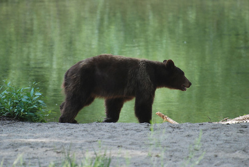
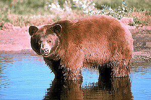
Although the grizzly bear image graces the state flag, grizzlies were killed off during the gold rush days. Black bears are found in California mountains and foothills, down to lowest elevations in NorCal. California black bears come in more than one color – light brown, cinnamon, dark brown, and of course, black. For the most part, bears usually stay away from people.
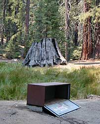
Some areas are more prone to bear problems due in large part to the overpopulation of tourists and abundance of food 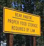 provided by them. Certain California National Parks are particularly notorious for their brazen bear populations. Concentrated bear problems are sometimes posted so be very aware and read signs. If you see steel bear boxes, leave no food or drink in your vehicle. Use the boxes to keep bears from breaking into your car!
Store food in closed up automobile, not visible. Store food correctly: in trunk of your car, or hidden from sight; in campground food lockers when available.
Lock all food, beverages and coolers in the provided metal bear boxes or bear lockers where available.
Toothpaste, deodorant & anything that has a scent should be thought of as food and stored accordingly.
Bears are so strong they can rip your car door open (in places like Yosemite, where bears are problem and you can get cited for not storing food items properly)
Bears are so strong they can break open a garage door to get to the smelly trash inside, so make sure you utilize the curbside pickup service available in some mountain communities or take a trip to the dump once per week.
Birds, dogs, squirrels and wild animals can move in quickly.
Backpackers should hang food in nylon bag & drape over weak branch in high in tree: hang your food using the counterbalance method. Ranger who issues your wilderness permit can explain the hanging procedure;
2 stuff sacks (with drawstrings) for your food items, and 60 feet of medium weight cord. 2 carabiners make hanging much easier.
for your food when exploring the wilderness
![]()
![]()
![]()
![]()
![]()
![]()

Additional Storage Tip
As for storing food inside cars:
When primitive car camping on a dirt road, which does not have campgrounds, nor bear lockers, it is possible to store food in the vehicle. BEST location is on the front floorboards with towel over it. With the car alarm set at bedtime, any ruckus should trigger a decent alarm. Any large animal trying to break in will get blasted with alarm siren & most likely will run away. The noise will wake you up as well, to deal with the intruder, if need be.


![]()
