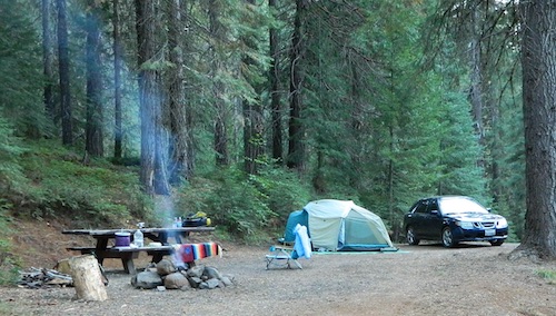
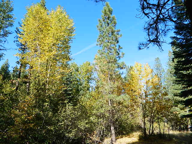
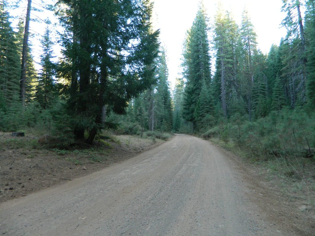
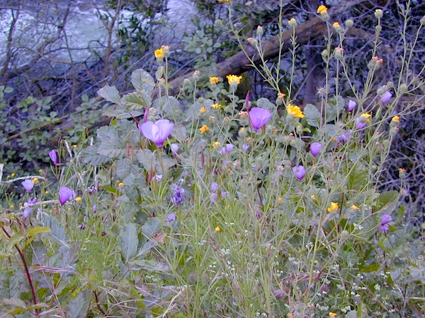
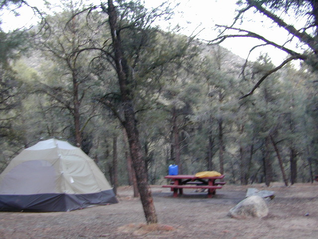
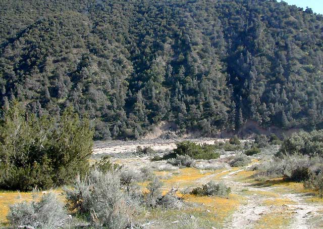
NFS Campground Algoma >>> McCloud Creek becomes McCloud River a few miles downstream from this small camp. Aspen grove, one lane bridge, dirt back roads, river hiking trail, fishing, creek wildflowers.
NOTE: This campground is NOT near the waterfalls, and it’s a 10 mile long hike to reach them.
autumn colors/aspens
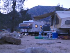
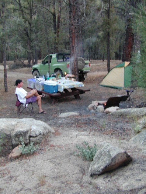
camping
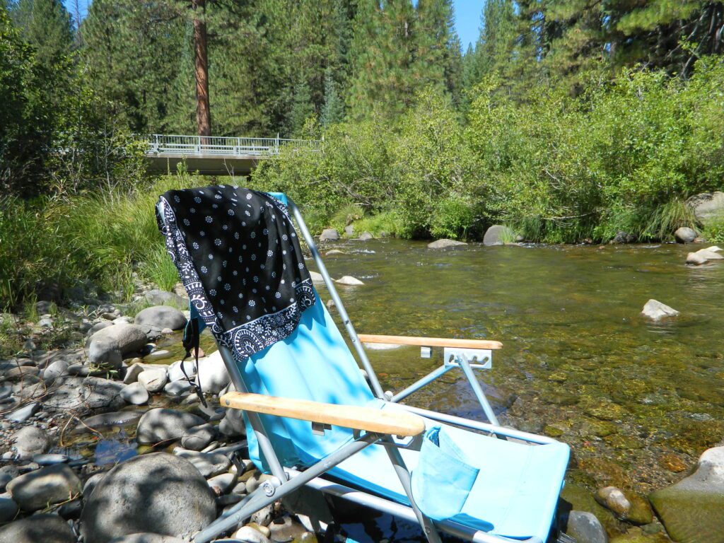
creek/river
hiking
hunting
fishing
mountain biking
off-roading
wildflowers
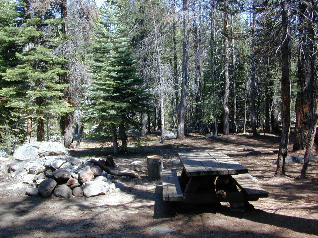
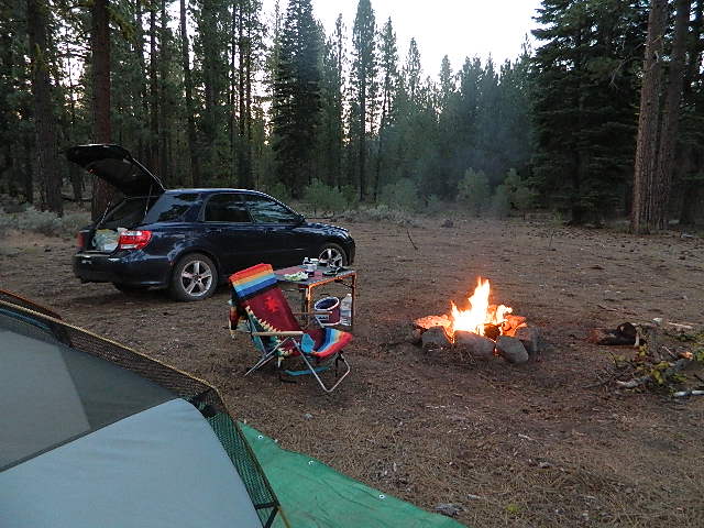
Park that chair in the creek and relax all day long.
• Elevation: 3,800′
• Number of Sites: 8
• Vehicle Accessibility: RV 24′ max
(trailers not advised)
• Toilet: Vault
• Piped Water: No
• Campsites Reservation: No
• Length of Stay: 14 Days
• Season: May – October
• Trailheads: McCloud River Trail
• Operated By: NFS
• Closest Town: McCloud, CA
From McCloud @ Highway 89: Drive 13+ miles (east), past CalTrans warehouse.
TIP: The turn-off for Algoma (Stouts Meadow) is NOT SIGNED from the highway. Rangers recommend turning at the cross country skier sign, but that sign is so small and faded, you can barely even see it. The paved road intersection is the only one around, so it is hard to miss if driving slow, under 50 mph. Turn right off the highway, and drive 1 mile to the campground at bridge.
Only two campsites on north side of bridge, and the rest are on the other side of the river. Algoma Bridge may be closed, so you can park and walk across to reach the campsites. Call ahead to find out current conditions.
An overnight stay out-of-doors. Sleeping out under the stars.
Air bed, camping cot, tent… or just a tarp on the ground.
Perhaps a luxury Cabin Rental in the mountains or on the coast. Your choice.
From a luxurious cabin in the mountains, to a small clearing in near a meadow with a stream nearby – with just a backpack, the idea of “camping” is always a bit different for each person. Roughin’ it for free – in the wilderness, or on the back roads; Or pay dearly for the price of real amenities, while on vacation.
camp sites that require you to physically haul your camp gear from a parking area to the camp spot, ranging from 1/8 mi. walk to a 1-3 mile hike
backpacking
free w/ wilderness permit
ultimate in seclusion, bring it all on your back, on foot into the wilderness & enjoy trail camps
Trinity River Camping, Douglas City, CA
SO CAL CAMP FIRES – Yellow Post Campsites are remote camping spots in secluded areas, in a designated fire safe clearing. No facilities such as toilets or showers. Maybe a picnic table & fire rings, if you’re lucky. Southern California forests have these kinda spots. Required campfire permit & you must double check on local fire restrictions.
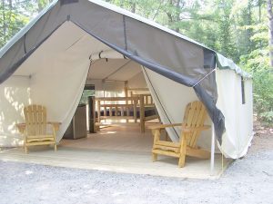
These structures are half way between ‘roughing it in a tent on the ground’ & having a ‘mountain cabin’. Tent cabins have wooden floors w/ canvas walls and roof; Dismantled annually for winter rain/snow, they are usually only available in mild, coastal climates or during summer months in the mountains.
Rentals typically include sleeping cots, but you’ll need to bring your own bedding (sleeping bags, sheets, pillows). Some rentals include shaded porches, wooden decks, minimal furniture, kitchenettes and/or wood burning stoves. Electricity may be available, or maybe not. Ask ahead of time, if you really must have that particular luxury when on vacation.
Yurts are a ’round version’ of this canvas cabin – which need to be aired out, often (to prevent mold). Yurt rentals are very popular and in high demand in California.
Find these type of rentals at yoga retreats, hot springs, beach canyons, remote lakes, redwood forests, high sierra camps, fishing camps and at certain RV parks.
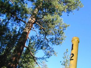
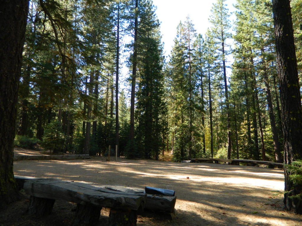
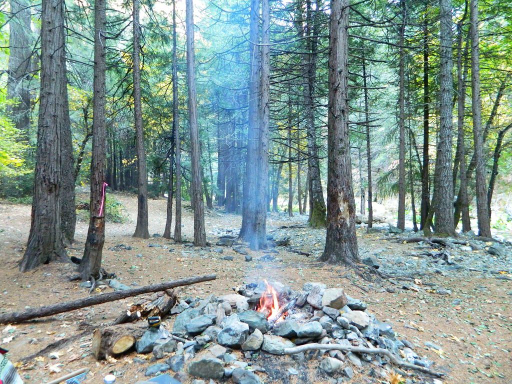
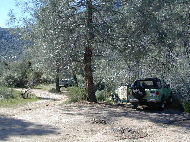
This pine forest is home to the developed NFS campground – which has been named after the tribal elder. The camp location is a sacred spot to the local native tribes. Just above Susanville, CA on the west side, south of the highway; forested w/ creeks and aspen groves. Autumn colors can be found in the creek beds.
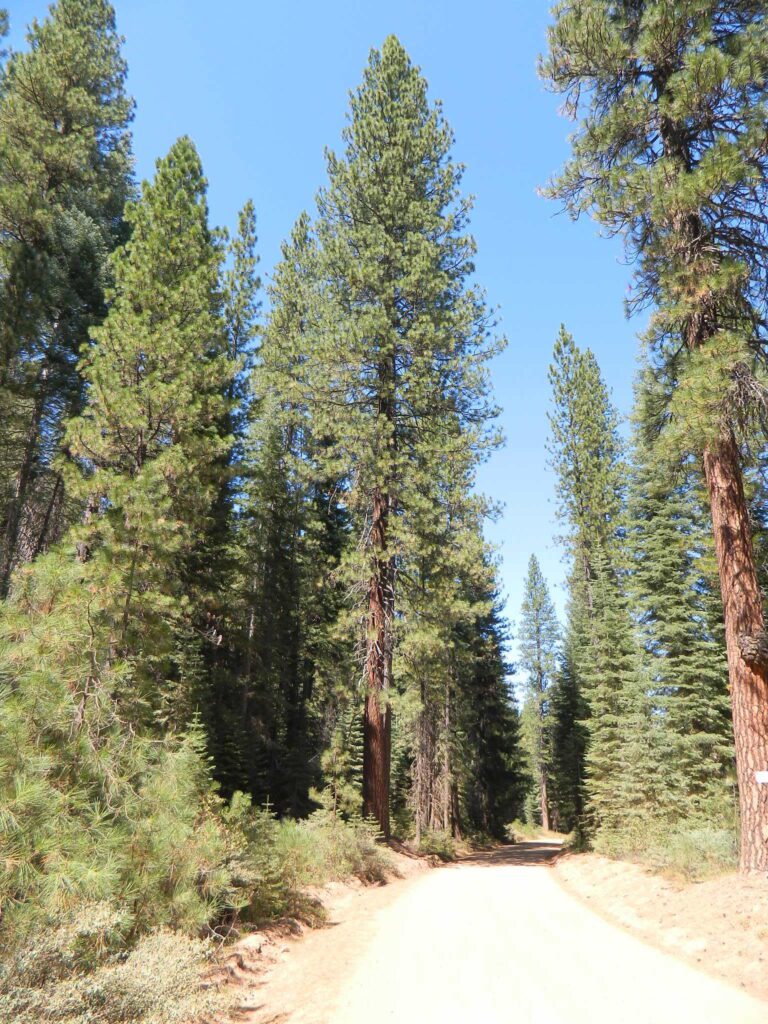
Dirt roads all over the place, leading to far away destinations like Diamond Mountain, Antelope Lake and Taylorsville. The backcountry region was recently damaged by wildfires: 2020 Sheep Fire and now the Dixie Fire
FREE CAMPING – W Susanville, CA en route camp
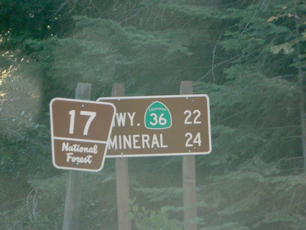
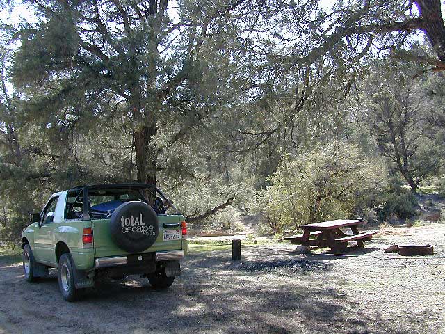
Less than 3 miles of dirt road #29N03 driving will get you back off the highway and into this forest, Hwy 36 W of Susanville. Bring the mountain bike for abundant usage and a week of exploring.
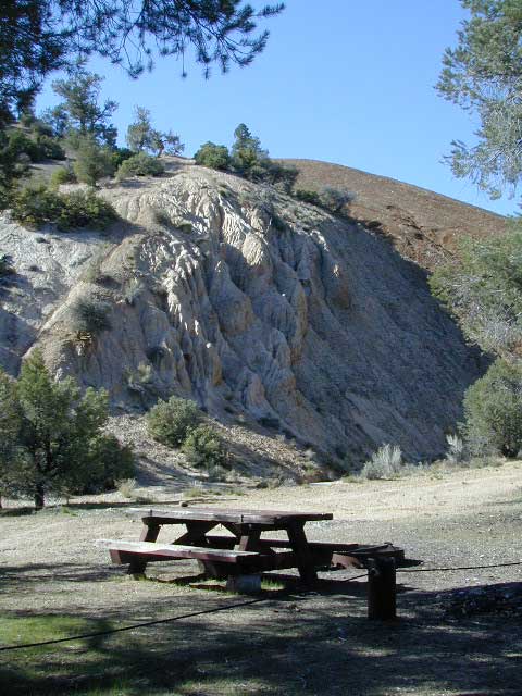
Only 13 miles to downtown Susanville, via the back road. Chaney Creek Road is a main dirt road near Highway 36, which parallels the river, the red rock bluff and the road, downhill into town.
This FREE campground is popular with the hipcampers and pediums – and gets rave reviews; small RV campers do like to use this camp spot, if they don’t mind a little dirt road driving; they’ll need to park in the dirt parking lot, 40+ feet away (not adjacent to the picnic tables or fire rings).
camping
ceremony
drum circle
fishing
hiking
horseback trails
hunting
mountain bike
off road trails
Bear Dance Circle @ Roxie
walk in campground, and close to town
Walk-In Campsites @ Roxie
AUG 2021 – CLOSED due to the Dixie Fire
Roxie P Campground
Susanville, CA – Lassen NF
• Elevation: 4,800′
• Number of Sites: 10 (walk-in only)
• Vehicle Accessibility: any
• Campsites Reservation: No
• Campsite Fee: No
• Length of Stay: 14 Days
• Season: open all year
• Trailheads: Diamond Peak
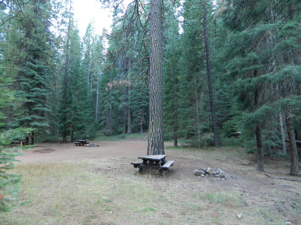
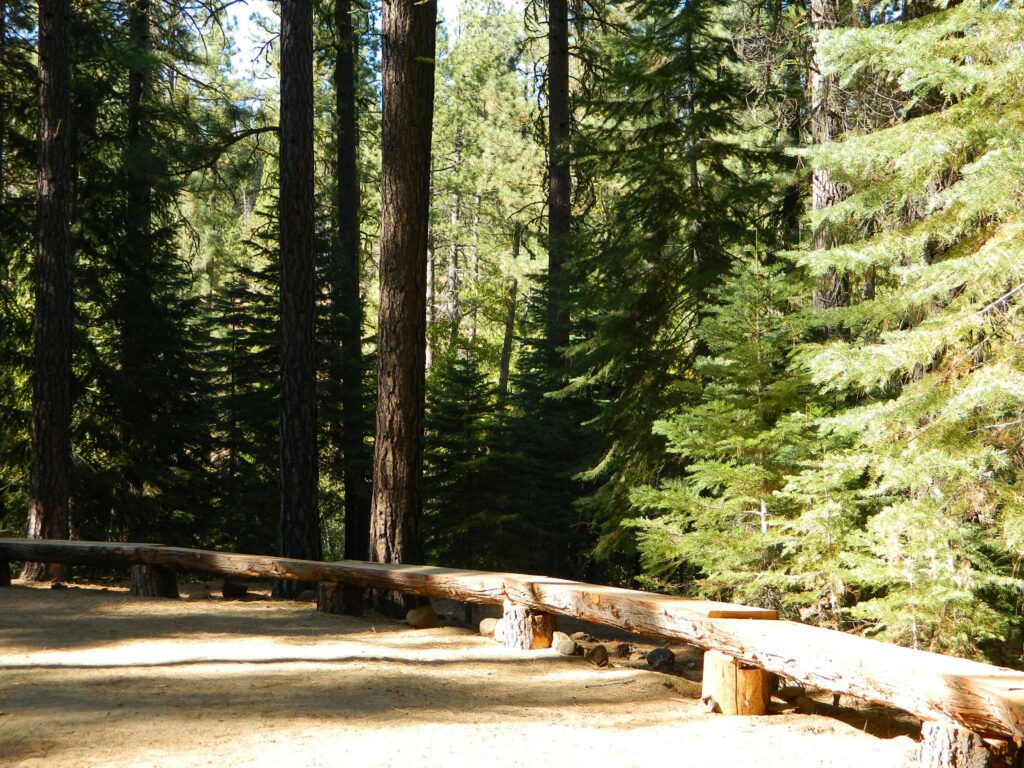
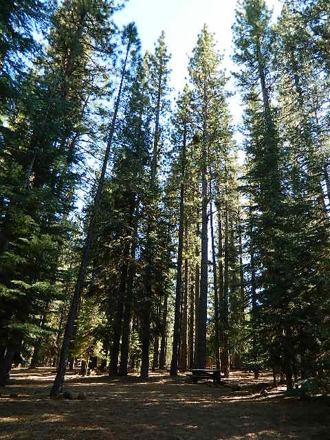
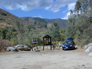
Flat forest and easy to walk. Shade and pine needles, picnic tables and group fire pits. All facilities are encompassed with a sturdy wooden, fence line. No RV or trailer access to camp sites. Mountain bikers like this spot and so do horseback riders. Travelers passing through eastern California will welcome the convenient location, plus the ease of dirt road.
The Roxie Camp is situated near Willard Creek on the south side of the Highway 36, close to Susanville. Willard is a feeder stream into the Susan River, which flows into town. Quiet camp, most of the time. If a big family is camping here w/ children, or there is a tribal gathering, it could get loud.
PLAN B – head over to Goumaz Campground NFS, due north. Located in between, near the junction of Hwy 38 & 44. Near the railroad tracks and the Susan River. Smaller camp near the NRT (National Recreation Trail), the Biz Johnson Trail (BLM). 2021, this camp is CLOSED!
so find someplace else: PLAN C
(make sure any camp is open by calling rangers before traveling).
OHV activity may be passing the developed campground, but are discouraged – due to the layout of camp. Plenty spots for ‘froaders further out – at the end of the road. Way back there!
Jeeps, 4×4 trucks, quads, dirt bikes, anglers and hunters travel these dirt back roads, as well as rangers, campers, horses, mountain bikes, and big logging trucks. 25 mph slow is always best. Daytime headlights help you get seen in the shadows. Forest is dense and road conditions are ever changing.
Forest Road #29N03 is Gold Run Road, the bumpy dirt road – that skirts around Diamond Mountain on the south side. Lots of one single track or one-lane dirt roads, which will require a National Forest map or a decent topo map to navigate properly.
OHV is common in these areas, but not so busy at this camp. If you seek peace and quiet and solitude, know how to read a map and where the noise is expected to be. Avoid the OHV areas, if you want to nap in the hammock and read a book.
Wild red necks with guns live in NorCal, so pay close attention to property lines and trespassing signs.
USFS Ranger Station is located on the west side, just outside of town, on the wide downhill grade on the highway @ the Eagle Lake turnoff. Cal Fire station is also located along this stretch of road.
Lassen National Forest
Ranger Station USFS
CA-36 @ Eagle Lake Rd
Susanville, CA 96130
530-257-4188
Cal Fire Station
697 CA-36, Susanville, CA 96130
530-257-4171
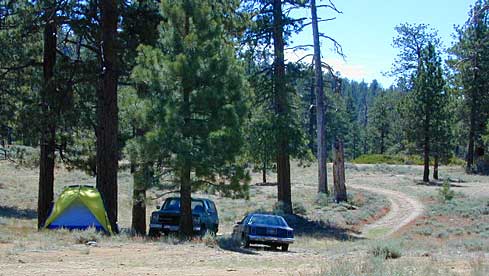
The best free camping in California for RVs & motorhomes is NOT the WalMart parking lot in some random town, but the gems that you find here on Total Escape.
The California back roads is where it’s at. Star filled skies, fresh cedar scents & tall pines, plus the awesome views. Primitive camping at it’s best, with your kitchen sink. No hook-ups, no fees, no problem.
the back roads
So, if you are one of those that are terrified of driving your big luxury camper on dirt roads, these may not suit your taste. But if you crave the back country camps with your RV, then you might enjoy the list below.
Still many dispersed, primitive FREE camp sites to be found – but you’re not gonna find them on those big web sites, that everyone goes to.
no hookups, no paved stalls, no dump station
These are camping areas, that you can pull into anytime of the night or day & find a flat spot. Some places may have picnic tables or campfire rings, but not all. No OHV parks, no large developed campgrounds, just dispersed FREE camp sites on the back roads of Cali.
Plumas Road #24N29, off Bucks Lake Road
East of Bucks Lake, California.
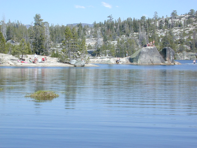
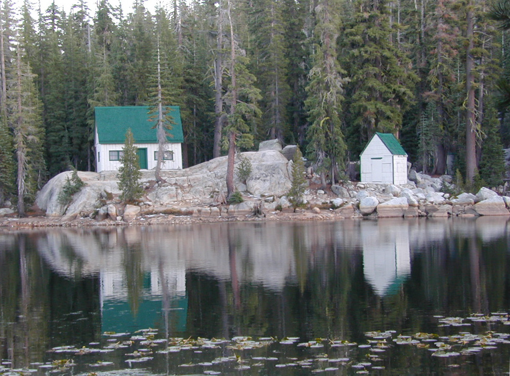
a six mile, one lane, dirt road is the only vehicle access into this high elevation, dammed reservoir, tucked back against the wilderness. Secluded lake campsites await, you’ll just need to get a little dusty first. The turn off, at a small brown sign reading “Silver Lake”, one which is very easy to miss – due to the amount of homes, cabins, fencing and driveways in the vicinity.
No swimming allowed at this Silver Lake, as it serves as a drinking water source for the neighborhoods below. Canoe & kayaking are allowed. Fishing is also popular at this location. Hiking trailheads at Silver Lake lead to the PCT (Pacific Crest Trail), Mount Pleasant, Spanish Peak and a small gem of a swimming hole, we call mini Gold Lake.
This small campground is actually set downhill from the rock earthen dam, which is something to ponder before/during a big earthquake. With sites 1-5 in a shady forest area and the others a bit closer to the lake, no campsite is too close to another. These are all well-spaced-out sites, providing decent privacy and minimal noise from neighboring campers. No campsites are located at the lake edge, as the rocky dam is a long structure and quite complex with water control measures.
All the campsites have new bear boxes for food storage, cuz ‘wilderness’ usually means black bears are roaming about. Deer tend to frequent campsites 1 & 2.
2020 update: overnight camping fees now charged at this campground
Silver Lake Campground NFS
• Elevation: 5800′
• Number of Sites: 9
• Vehicle Accessibility: RV 22′
• Campsite Reservations: No
• Camp Fee: Yes
• Toilet: Vault
• Water: No piped/potable
• Length of Stay: 14 Days
• Season: May – October
• Trailheads: PCT, Gold Lake, Rock Lake, Granite Gap, Bucks Lake Wilderness
As with most of the high elevation lakes in California, winter months can mean deep snow and dirt road closures. This campground is usually open through the end of October, but call head to the local rangers if in doubt.
Plumas National Forest
Mt. Hough Ranger District
39696 State Highway 70
Quincy, CA 95971
530-283-0555
Free Campgrounds in the Sierra Nevada Mountains, California
no charge camp, no fee camping, free campgrounds
No fee camping: Bare bones. California Sierra Campgrounds without the fee.
Developed BLM or NFS campgrounds, where you can still have a campfire. Vault toilets, panic tables and fire rings. Use bear boxes when provided for proper food storage.
secluded campgrounds
Below is a good long list of some favorite free developed campgrounds in the Sierras. Many will require dirt road driving, as most are located well of the highway. Perhaps the 12 mile rough road will thin out the crowds. Free overnight stay!
2020 update:this list is shrinking, as more California National Forests start charging for the smallest of campgrounds.
Pack in your drinking water and pack out your trash. Campfire permits are not required at developed campgrounds; but a bringing a water bucket and shovel is necessary for tending your campfire. Piped water is not always available, or perhaps, not in working order at these primitive style camps. Be prepared to rough it a little.
Free camping outside of a developed campground, for a self-contained camper who wants seclusion and privacy. Real relaxation in total peace and quiet. More nature, less people and minimal vehicles.
Free Campsites • Dispersed Camps • Open Camping • Boondocking
primitive camp sites –the bare minimum. a clearing for a tent, maybe a fire ring. no toilet, no fees; dirt road access.
campfire permits required. And it is up to you to know the current fire restrictions in the area you seek to camp overnight.
The further out you are willing to drive, the more remote you can be. Good topo maps of the region help you to find these ultimate, secret camping spots. National Forests & BLM Lands require a free camp fire permit to have a campfire.
Fire safety is always a big concern in wildfire prone areas like California. Additional Permits & Passes may be needed in some forests or parks; each location is different. Check with the local ranger station for up to date restrictions.
Many dirt roads lead avid campers to the best out-of-the-way camp sites. Camps may have picnic tables or just a fire ring, but usually NO toilets. Have the “No Bathroom Blues”? Don’t sweat it. check out the page onCamp Potty
Some camp sites are as bare as a small clearing, a rock fire ring if you’re lucky. A detailed backcountry map is always advised. If you count on your digital mobile device and online access for mapping, you could find yourself very lost. GoogleMaps is known for mislabeling the smallest of back roads – and they do not feature dirt roads either.
Turtle Mountain Road, SoCal
A high clearance vehicle may be needed to reach certain camp spots, but many can be accessed with a standard passenger car. Low riders will likely bottom out and motorcycle riders will get dusty.
Know your vehicles limitations for any off-road use and don’t get stuck in a bad situation. Soft sand is quite common in deserts and 4×4 might be needed. There aren’t any tow trucks out in the boonies and if you do find one, it’ll cost you something fierce. Watch for large rocks, deep ruts or tree limbs in the road (at any time) and watch low overhanging branches when driving a motorhome in to such spots. Some dedicated, hard-core RV campers prefer to camp in remote locations.
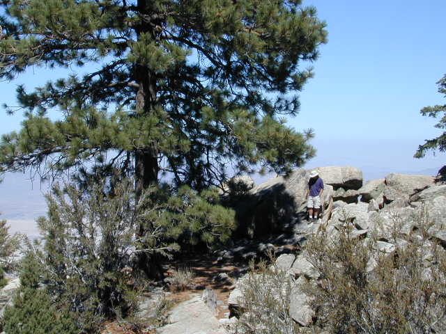
Southern California has something called yellow post camps, but we’ve really ONLY seen them inside San Bernardino National Forest areas, which includes Idyllwild and Mount San Jacinto, plus all the Big Bear Lake Mountains.
YELLOW STICK? These are fire safe spots w/ picnic table; secluded in the forest, some accessible by passenger cars, while other camps require a 4×4 to reach. Yellow post sites campfires are often off limits during fire restrictions, when only fires are allowed inside the larger developed campgrounds.
dirt road and trailheads
Backpackers trailheads often have a few camp sites near the parking lot, but these may be busy during summer months. Dirt roads leading to trailheads can have primitive camp sites along them as well. Long, big creeks in the forests are notorious for having awesome camp sites. Big river camp sites are sometimes free, if you know where to look. Sometimes the smallest of California campgrounds have no charge, first come, first serve (BLM, National Forest, or State run).
Before it got labeled BOONDOCKING: Primitive Camping in remote spots was what we lived for. Camp outside of developed campgrounds, for free. Campfires will usually be banned on these back roads during the driest part of the year. Check with local ranger stations for current fire restrictions.
Inyo High Country RoadsMcCloud #39N06 – Grizzly Peak Lookout Rd
pros and cons
possible dirt road access, seclusion, privacy, darker skies, no fees, no crowds, real peace & quiet
no toilet, no picnic tables, no pavement, no hospital, a long hike out, no cell phone service?
always be prepared to hike out (if need be).a giant tree can come down and block your exit road. landslides often happen on dirt back roads. the vehicle could break down or become disabled. get a topographic map and know how to read the terrain, without your device/phone.
PAY extra close attention when driving in (visually with terrain and your eyes and your map). You never know when you may need to back track – or turn around to find a PLAN B campsite.
Avid camper people are indeed known to GPS waypoint their favorite pick campsites (way on the back roads), so they can arrive after work, in the dark, on a Thursday night. Now that’s planning ahead!
Tucked way back in the granite high elevations, near Donner Pass is a wilderness water flow called Canyon Creek. Connecting small lakes and big reservoir, this creek is part of the Nevada District water supply. The Sierra Nevada region is Tahoe National Forest and the terrain is abundant rock.
Campground is perched on the edge of rock overlooking the impressive whitewater; sounds of crashing water at certain campsites is deafening. Half of the campsites are located in a forest loop and the rest are out in the open, with much granite and fewer trees, perfect for star watchers.
Canyon Creek California
Lake Faucherie is a mile up the creek and Sawmill Lake is a mile down stream, so it’s a great fishing location, as well as hiking, kayaking and canoeing destination. The Pacific Crest Trail (PCT) is also routed close by. A hiking trailhead at the north end of Sawmill Lake leads to a loop hike of small lakes.
roughest roads in the region
Campground loop is paved, but the 12+ mile access road is NOT.
Twenty plus miles of paved & gravel backroads in boulder-hopping bliss, leads to granite lined lakes and forested campsites. Two different driving routes into this canyon:
One is the longer way Road 18 – paved access off of Gold Country Highway 20, which becomes an 8 mile long, rocky, rough, one-lane road around Bowman Lake.
The other is slightly shorter, county road #843 that comes in the back way from Jackson Meadow Reservoir (off Hwy 89, N of Truckee).
Both of these primitive roads join at Jackson Creek Campground, a favorite among off-roaders.
Canyon Creek Campground is another few miles up Road ##843-037, a rugged canyon route towards Lake Faucherie, where the road comes to a dead end.
Don’t let the old maps fool you: these National Forest Roads are labeled as gravel roads, but boulders and rock slides are quite common. 4×4 would be nice, but high clearance is recommended.
Minimal signs designate trails, roads and lake access; What signs that do exist are old, faded and broken. No warning signage reading ‘high clearance’ or ‘4WD recommended’ – so obviously Tahoe NF won’t be installing new signs anytime soon.
backpacking
camping
canoeing
fishing
hiking
kayaking
stargazing
Faucherie, Sawmill and Bowman Lakes are all along this waterway called Canyon Creek.
National Forest Campground Latitude: 39.436863 Longitude: -120.579564
Canyon Creek Campground
• Elevation: 6600′
• Number of Sites: 20
• Toilet: Vault
• Vehicle Access: High Clearance Vehicle, no trailers
• Campsites Reservation: No
• Camp Fee: No
• Length of Stay: 14 Days
• Season: June – October
• Trailheads: Faucherie & Sawmill Lakes
• Managing agency: Nevada Irrigation District
530-265-5302
Canyon Creek Campground is an excellent campground for staying away from the crowds, which seem to focus more around Bowman Lake & Jackson Meadows Reservoir.
All campsites at this campground have steel bear boxes – for proper food storage in black bear country.
Prefer camping outside of developed campgrounds? then the primitive camp sites that line Canyon Creek will be a welcomed surprise. Most are clearly marked with small signs and some may require 4×4 to access. When fire restrictions are tight, campfires are only allowed in the developed campgrounds.
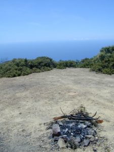
This camp list is comprised of primitive camp sites and developed campgrounds with good views overlooking a large area (valley, town, canyon, desert, river, ocean). Many ideal spots may require dirt road driving, and a few might need a 4-wheel drive vehicle to reach.
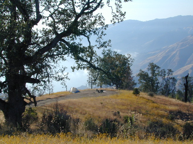
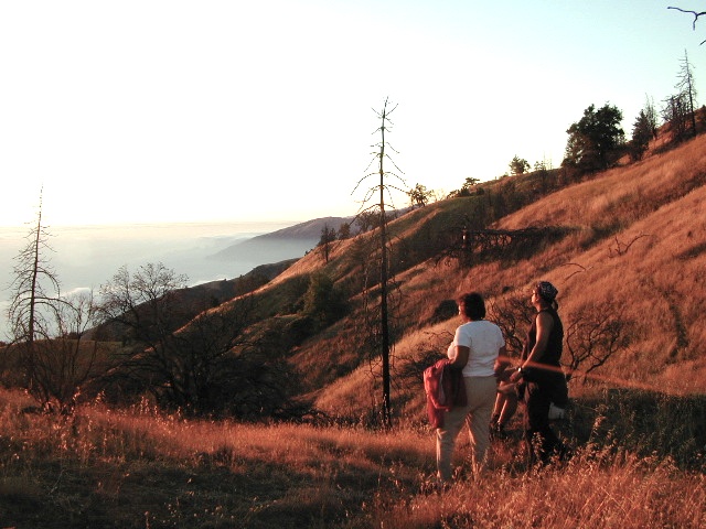
We were suggesting this very spot way back in 1999, well before anyone else was ‘blogging’ about it. This area is by far the best, free coastal camping on the Central Coastline of Big Sur. Dirt roads traverse 10 miles out to vacant ridges overlooking the Pacific, with steep hills down to the highway. Camp above the fog layer and above the crowds. Explore the beaches during the day, and camp above the traffic & crowds at night.
Dry brush is abundant on the mountains of Los Padres National Forest. Camp fire restrictions should be of utmost concern in this area, since wildfires burn here often. Camp fire permits are required for camping on the back roads, and much of the time camp fires are banned in this region. Call ahead to the rangers to find out the current conditions.
Two prime walk-in camp sites, on a shady point, high above a beach cove w/ scenic waterfall.
Called “environmental camps” these highly desirable spots need advanced reservations w/ fees many months in advance. Tables, fire rings and a vault toilet. Bare bones basics, but the ideal location is worth it. A forested cliff on the edge of the ocean, high above a secluded cove. This location a can get windy if a storm moves in (generally October – March).
There are several primitive campsites off of M10 with views of chaparral and canyons. Just above Stonyford, CA, on the way up to Fouts Springs. Unfortunately Mendocino National Forest is may be closed for 2019 due Ranch Fire (wildfire 2018) w/ Snow Mountain Wilderness completely 100% burnt.
Planning more scouting of this region summer 2019. Stay tuned.
Angeles National Forest
Mount Pacifico Campground
Angeles Forest Highway
Lightning Point Group Campground
near Jackson Lake @ Hwy 2
San Berdu has more than a few trail camps for 4×4 enthusiasts. Weekends can be busy all year long. Snow usually closes some routes. Pine forest in southern California means very tight campfire restrictions. All yellow post camp sites include table and a fire ring. Campfire permits are required.
East ridge line, rocky, dusty, 4WD-only route, the John Bull Trail (near Holcomb Valley) has ONE real awesome view camp spot with great spans over the Mojave desert w/ smog and city lights @ night.
Culp Valley – boulders, primitive camps on dirt roads; better views off-road. Vault toilet. Few tables, no signs. Small campground at the highway is easy to find. Boulders and bouldering. Mountain biking and hiking. Wildflowers in spring.
Interstate 15 & I-40 Mojave Desert
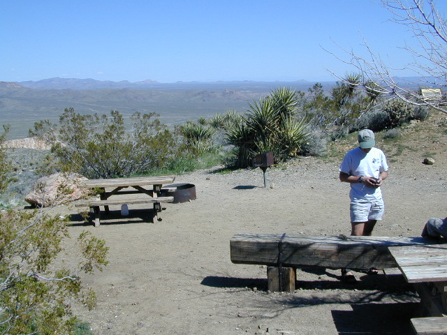
Providence Mountains SRA @ Mitchell Cavern. Campground is perched on rocky hill overlooking desert.
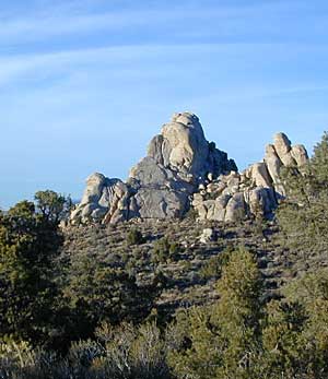
Boulder Outcroppings w/ primitive camp spots, tucked back on one lane dirt roads, behind Mid Hills Campground. Mojave National Preserve
Coyote Flat @ Pinyon Boulders – 4×4 required, one primitive camp w/ great views overlooking the Owens Valley & peaks to the east. Coyote Flat has views toward the Sierra
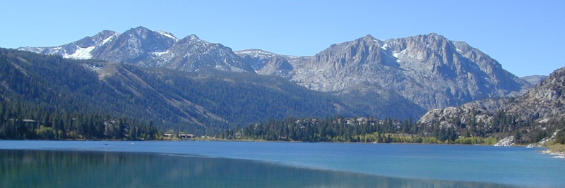
Oh! Ridge Campground Off the main highway 158, June Lake Loop
(148 sites @ 7600′ elev.) near June Lake, CA
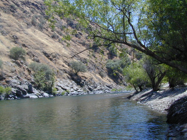
Low elevation Western Sierra: a big river at the beginning of Kings Canyon. Fishing, biking and hiking. The Kings Cyn National Park is directly east, upriver.
Oak woodlands, steep granite canyons, waterfall hikes, rock beaches, river fishing, mountain biking and wildflowers. Day time temperatures get triple-digit in summer months, so best time to visit is the rest of the year. Small RV accessible, paved road, river close – and best of all, open all year long!
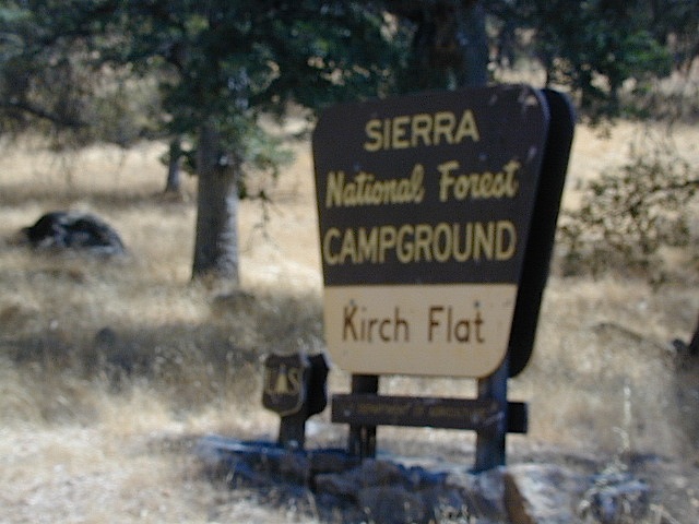
Kirch Flat Campground
Due EAST of Fresno, California in a large river canyon, Western Sierra Nevada
Located 18 miles up Trimmer Springs Road (paved), 5 miles above Pine Flat Lake. Sierra National Forest; River rafting take-out spot for Middle Kings River.
• Elevation: 1100′
• Number of Sites: 17
• Camp Fee: No
• Vehicle Accessibility: RV 22′ max
• Campsites Reservation: No
• Length of Stay: 14 Days
• Season: Open Year Round
• Trailheads: Kings River
San Diego Deserts, San Ysidro Mountains
Montezuma Grade Montezuma Highway, Hwy S-22
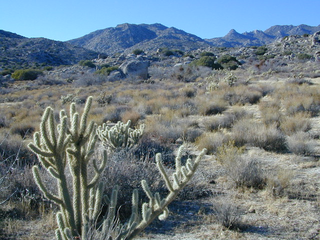
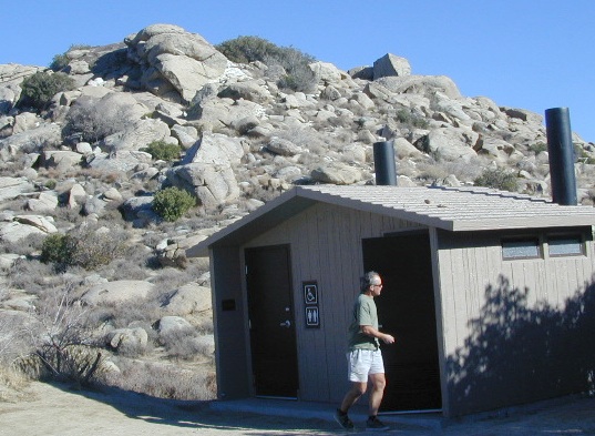
High desert elevations, large boulders, highway w/ primitive campground. No trees, but much vegetation; flat parking, large tent spots, picnic tables, vault toilet. High desert mountain pass, with boulders, canyons and many dirt roads to explore.
• Elevation: 3,350′
• Number of Sites: 10
• Vehicle Accessibility: all
• Campsites Reservation: No
• Camp Fee: No
• Length of Stay: 10 Days
• Season: October – May
• Trailheads: Grapevine Canyon, Pena Springs, Anza Borrego & PCT (Pacific Crest Trail)
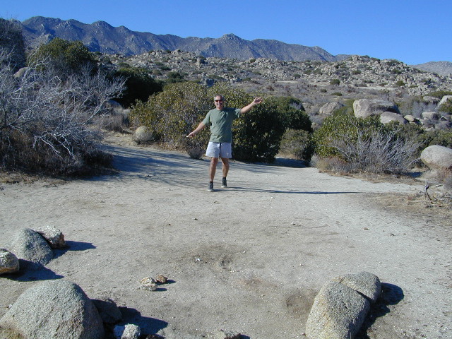
hike highcountry borrego
Culp Valley Trail, Grapevine Canyon, Montezuma Valley, Pena Springs, San Ysidro Mountains.
Sierra Road number 9 is a north turn off of Trimmer Springs Road. Marked as National Forest Rd #10S69, as well as just plain NINE. Big Crk. canyon is after the Maxson Road junction, and before the Balch Camp / Blackrock Reservoir turn off on #11S12. The area is known for abundant wildflowers in the early season.
A popular dirt road drive for the western Sierra – Pine Flat Lake region. A forested, south facing canyon in the Southern Sierra Nevada Mountains. Big Creek, wide, graded, dirt road w/ primitive camp sites. 4×4 could be needed in wetter months.
The higher you go on this route, the more pine trees you will experience. Winter weather can close this route. A campfire permit is required to camp along this road.
The lower part of the canyon has rock features, small waterfalls, swimming holes, picnic spots and sometimes cattle grazing. Several prime unmarked, primitive camp sites along this road – but few and far between. High clearance or 4WD may be needed, depending on road conditions.
Soaproot Saddle Road is a not-so-obvious left fork (dirt, without signs) that leads steeply up away from main road. Climbs a steep hillside, way up above and along Rush Creek; continues for many miles. Less people back this way, if you are seeking seclusion. Few primitive camp sites on right side of road, near where the creek breaks away from road. Good for stargazing way back here. 4×4 may be needed. Road may or may not connect through to desired destination.
The mid-route climbs into pine forest and the dirt road switchbacks, steeply, with a few more camp sites available; usually found on short side roads off the main road.
At Sierra #9, a major junction w/ dirt road #10S69, called Dinkey Trimmer Road. This leads way off through the rugged terrain, many miles, over to the pavement at Dinkey Creek Jct – Campground, Trailhead and Dinkey Lakes Wilderness.
Big Creek will turn left (north), and follows the large Big Creek Canyon. Several steep miles climb up into the dense pine forest, following the creek the whole way. Several prime creekside camp sites fill up fast in this stretch. Great views, steep dirt roads. GPS waypoint these camp driveways – so you can find it next time, (first, before everyone) on Friday, Thursday before midnight.
Peterson Mill Road is Rd #10S02, found on the left (west) side of Sierra #9. That westbound route becomes pavement half way back to Highway 168. This way is the quickest way from Fresno, out to the developed NFS Bretz Campground.
Sierra #9 Big Creek Road arrives in the densest of forests. Many camp sites and side routes to explore. Dark, upper elevations, snow lingers long in the shade. 4WD may be needed in wet areas. Mud is quite common MOST of the year in this spot, so know your vehicles capabilities before you get yourself stuck (or stranded). It’s a very long walk to any kinda civilization!
Hunters like to use these upper camps during hunting season. A camp fire permit is required, so bring your shovel and bucket; self-sufficient campers enjoy the back roads most often.
Bretz Campground NFS is up here on the main road, number nine. Clock it w/ dash trip meter; 15 miles from the road start @ Pine Flat Lake. Popular with OHV and 4×4 groups. Max RV or trailer length = 24′
Open all year long; No fee.
Sierra Forest Road #9 the far north end, enters Blue Canyon @ #10S18, but the Rd #9 route continues NE as Providence Creek Road. Eventually intersecting @ Dinkey Creek Rd w/ Rock Creek & Dinkey Dome closeby. Great granite 4×4 Trail @ Bald Mountain (elev. 7832′) overlooking Shaver Lake.
Jeepers on granite @ Bald Mtn, above Shaver Lake, CA
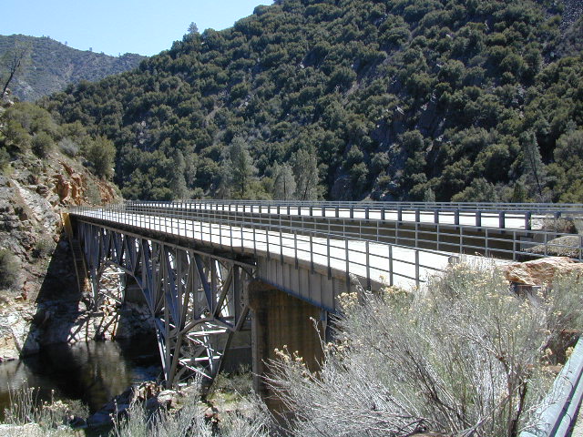
Located north of the small community of Riverkern and south of the Johnsondale Bridge, numerous flat camp spots adjacent to the rivers edge can be found.
Ant Canyon Dispersed Area Brush Creek Campground Calkins Flat Dispersed Area Chamise Flat Dispersed Area Chico Flat Campground Corral Creek Campground Springhill Dispersed Area
Kern River Road
Sierra Way in Kernville travels north along the Upper Kern River & becomes Mountain Hwy 99 – which eventually connects with the Western Divide Highway in Giant Sequoia National Monument.
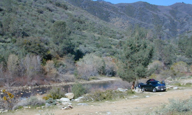
Dispersed Camping Areas along the Kern River
Open Year Round! These FREE camp areas are called dispersed camping sites. No pavement, no picnic tables, no bathrooms, no piped water. Portable toilets & trash bins may be available in the busier summer months. Campfire permits are required for all campfires, BBQs, and camp stoves. Fire restrictions are common in extreme dry conditions. 14 day limit on camping.
Many flats are signed w/ small brown signs, while others are not. Some are actually flat and easy to access, while others are steep, eroded dirt trails unsuitable for RV travel.
Kelly’s Hole, overgrown, unknown, well-known or burnt beyond recognition? Roads End is no more.
Camp sites listed on this page are dispersed camping areas around the Kern River Area. Not all camp spots are listed, cuz many are unnamed. Bring your GPS to mark your favorite camp sites and you can arrive in the dark, late at night, anytime, (avoiding city traffic after work).
Several spots known as “dirt flats” are easy accessible right off the pavement of Sierra Way. Primitive river camping, fishing spots and raft launch areas north of town. Vault toilets might be available during busy summer months, but you’re on your own the remainder of the year. Bring a shovel and take a hike, away from the water flow. And if that sounds like too much work for a potty break, maybe you are not cut out for the primitive kinda camping style. No garbage service either: pack it in, pack it out.
Wildflowers are abundant in the Kern Canyon nearly every Spring season (April & May), which is a popular time to enjoy this region. Autumn brings minimal fall colors to this dry, desert mountainous landscape, but the fishing is decent at that time of year.
CAMPING OUTSIDE OF CAMPGROUND means you must obtain a free fire permit from the local rangers. Sometimes these dispersed spots are fire-safe areas, and you are allowed to have camp fires. Other times campfire restrictions are in place w/ wildfire dangers too extreme and no fires are allowed, anywhere. (Not even inside a developed campground!)
WILDERNESS NOTE: The USDA National Forests web site states that “Camping and campfires within 25 feet of the water’s edge is prohibited due to the Wild and Scenic Designation”, but that doesn’t seem to stop some from setting up right on the fragile rivers edge. Doubtful that this rule is being enforced by the rangers, but consider yourself warned unless they start to get serious about this restriction. Many believe that the free camping along the Kern river is destroying it, so don’t be surprised if these areas get closed or barriers placed at the flats.
Caulkins FLAT has some new boulder barriers put in place which prevent cars from reaching certain ideal camp spots (right at the waters edge). Tough luck. Now we have to hike more.
Upper Kern River North of Kernville, CA
all camps below listed from south to north
ALL CAPS = developed campgrounds managed by US Forest Service, w/ links to Kern River Campgrounds.
Ant Canyon
Just north of Goldledge Campground, along the Upper Kern River.
South of Salmon Creek; Hike to Salmon Creek Falls.
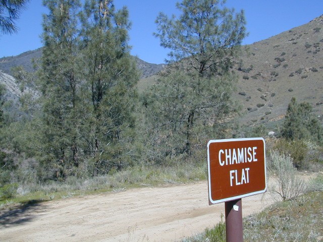
Chamise Flat
12 miles north of Kernville, CA
This camping bluff could be the most forested of all the ‘kern flat’ camping areas, but river is a short hike down a very steep cliff. Fishing is excellent in this stretch.
Calkins Flat
15 miles north of Kernville, along the Upper Kern River. Just south of Fairview (McNalley’s). Sign at the location reads a different spelling of “Caulkins Flat”. Kayak and rafting put-in spot. One of the best sites for large groups. Area is also known as simply “Lower Campground” on GoogleMap.
Brush Creek
3600′ elev
Just south of Sherman’s Pass Road turnoff. This place also serves as a Day Use Area, where Brush Creek meets the Kern. Kayaking put in spot. Popular fishing area. Large open dirt parking lot with a vault toilet.
Lower Kern River Southwest of Kernville, CA
Lake Isabella has some shoreline camping with wide open access to the lake. Paradise Cove perhaps?
Historic Keyesville – “off-roaders camping paradise” along the river, but no swimming is allowed due to the extremely dangerous section of river. OHV trails lead (west) down river for many miles. Dirt bikes love the rugged boulder-scapes and steep hills. FREE camping; BLM Kern.
SANDY FLAT CAMPGROUND (NFS) – Open all year long! Terraced & paved hillside with numerous camp sites and plenty of room to spread out. RV campers like this location, due to the proximity to Hwy 178. elev 2300
Remington Hot Springs can be a zoo at times w/ the amount of people who love to stop here. A busy dirt parking lot, right across from the Remington trailhead sign. Many vehicles park here daily for day hikes, hot springs, fishing – and people also like to camp out, although camp sites are on slopes (not ideal), only a few and they fill up fast (before sunset).
Total Escape TIP: The very best camps at Remington are actually the ones you hafta hike down to. Less than a half mile down to the rivers edge to find a private mini beach. Pack light and arrive prepared to walk several miles (back & forth, several times).
Old Kern Canyon Road parallels Sierra Highway 178 and sits well above the river, so any flat spots you find will have great views w/ minimal river access.
Lower Kern River has very limited camping options.
Mojave Reservoir @ Colorado River: AZ / NV / CA
@ the V, bottom of Nevada state = Arizona – Nevada – California, all merge together
The Colorado River travels through the southwest desert, splitting the Grand Canyon and further south, separating California from Arizona at the southern tip of Nevada. Agriculture lines the big river down to Baja, Sea of Cortez, Mexico.
Up near Las Vegas and down to Searchlight, NV
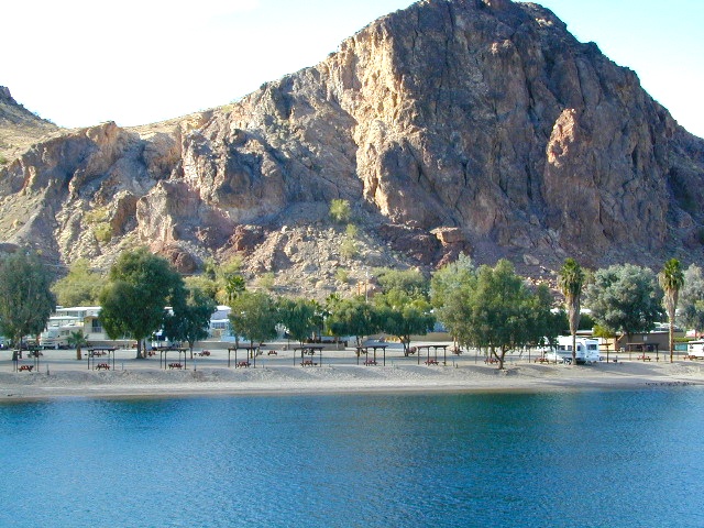
Above Hoover Dam is Lake Mead, sediment from Utah National Parks. Red dirt and silt shorelines. South of Hoover dam is a super deep rock gorge w/ hike-in hot springs. Beyond that, this beauty called Lake Mohave – with the super clear water, secluded coves and abundant fishing.
Lake Mohave: elevation 647′
Desert peaks in this region are around 2000-3000′ elevation. Mohave Lake is actually a wide section of the Colorado River, spanning the region from massive Black Canyon south to busy Laughlin w/ river casinos. This lake is long and skinny in spots with lots of shoreline cliffs, canyons and coves. Minimal vegetation, so please bring your own firewood and don’t chop down the few trees trying to survive. Summer temps exceed 100 degrees, so plan your visit for the winter time.
Lake Mohave Ranger Stations
Cottonwood Cove
Katherine Landing
boating, camping, fishing, hiking, hot springs, kayaking, off-road, picnics, viewpoints
El Dorado Canyon Road, main paved route can be accessed near California’s state border. North of Searchlight, Nevada – off main highway 95, on side route 165 to Nelson, NV
Secluded dirt roads up and down canyons near El Dorado Canyon Rd. Minimal vegetation, maximum open scenery and dark skies. Kayak rentals @ El Dorado Canyon.
desert badlands erosion
Ireteba Peaks Wilderness
4×4 camping routes: 15 day camping limit
Find your own route with many to choose from, drive the soft sandy washes (with a few boulders to dodge) and camp for free, right at the waters edge. Adventurers: Only for the self-contained campers. Some routes marked 4WD only, so pay attention to signs. AWD (all wheel drive) vehicles should fare well on the sandy roads; but standard passenger cars and vans will need to keep their speed up in the soft sand areas.
No garbage collection. Pack it in, pack it out.
No facilities, no fees. No buildings. No campfire rings, no picnic tables, very few vault toilets. Bring your shovel!
Driving off the roads is strictly prohibited. Primitive camp sites can be found both at numerous coves and also inland inside the canyons. The ridges get windy in the deserts, but are favorable for night sky views and self contained camper vans.
Always know the weather forecast, cuz flash floods are possible and these dirt roads will be impassible during big rain. This is the main drainage to the big river!
DRIVING TIPS
Most desert washes here are signed routes 4×4, but mini vans, AWD sport-wagons, trucks, SUVs, small RVs can all be found camping near Lake Mohave. That is – if you know how to ‘drive off road’, which is not fast, but not too slow either.
Avoid getting stuck in the deep sand: keep speed up, do not turn sharply and do not brake hard. Carry tow strap in case you need an emergency pull. Be nice to strangers and you may find help.
Campfires are allowed, but you need to bring firewood. Dogs are allowed. Party animals tend to trash these desert coves, so be warned that there is a fair amount of litter. Bring a black trash bag and take some out! This trash problem could get the area closed off to vehicles so keep that in mind.
The canyons here have giant power lines that cross @ Aztec Wash; they can easily be avoided.
4×4 recommended @ MOHAVE:
Eagle Wash Road #46 – popular spot
Montana Wash #45 – camping ok
Placer Wash #47 – no camping
The rangers don’t wanna be pulling your ass out of the sand, which is why they post the 4×4 signs. Don’t expect to find help without walking a few miles first, or waiting several hours.
desert wilderness
Several wilderness areas are located along the west side of this lake & river. Often dirt roads will parallel a portion of the wilderness boundary, providing excellent access to secluded coves and beaches. Emergency CALL boxes are placed in remote parts of these shores.
Ireteba Peaks Wilderness (northwest, next to El Dorado Canyon)
Nellis Wash Wilderness (western side)
Spirit Mountain Wilderness (southwest)
Bridge Canyon Wilderness (southwest, near Laughlin)
COTTONWOOD COVE
developed campground, boat launch, marina, lodging, hiking, picnic areas
LAUGHLIN, NV
Nevada, California and Arizona states join down in this part of the world. Katherine Landing, full service marina, slip rentals, lodging, city services and casinos.
Mojave Desert – This river-created lake is located on the Colorado River, in between Las Vegas, Nevada and Needles, California. The river water here is crystal clear, very swimmable and the fishing is decent. No paved boat ramps
nearby towns: (with elevation)
Avi Casino
Bullhead City, AZ (540′)
Laughlin, NV (535′)
Kingman, AZ (3340′)
Needles, CA
Nelson, NV (2954′) Nipton, CA (3042′) Oatman, AZ
Searchlight, NV (3470′)
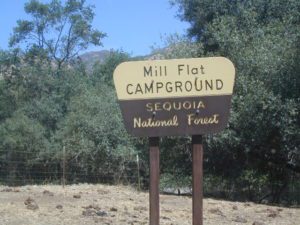
Open Camping in Sequoia National Forest – Forest Road Camping
Seeking secluded campsites? This is one of the best areas to camp in pine forest w/ privacy, relatively close to Southern California. Plenty of primitive car camping on the dirt roads throughout this whole Sequoia & Kern River area.
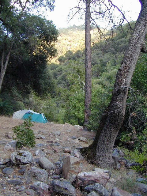
No facilities. No picnic tables, no toilet, no fees. Just a rock campfire ring & a clearing. Previously used sites have already been established usually near streams. Try to use these first, if at all possible. It takes a bit of exploring but you will find the perfect spot. Don’t even attempt to try to find these kinds of camp spots at night. They are often buried deep in the forest with no visible markers what-so-ever. But in trade, you will be lulled to sleep by your own private mini waterfall & no RV generators. Many of these back roads are closed & gated during winter months due to snow & rock slides.
No amenities are available in this neck of the woods, but plenty of seclusion & wilderness. Check official Wilderness rules for proper knowledge of the area restrictions. You must get a free camp fire permit from the ranger station in order to build a fire outside of a developed campground. A large shovel, plus bucket w/ water are a bare minimum for the privilege of camping like this. Certain dry seasons (summers into autumn) have very strict camp fire restrictions. Check with the ranger to see the latest on building campfires on the back roads.
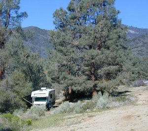
A Sequoia Forest Service Map is highly advised for this area. There are so many dirt roads for dispersed primitive camping on the back roads. Due to weather & erosion, some roads may require 4×4 or high clearance, so come prepared with a plan B.
Camping Checklist to make sure you’ll have what you need. The drive up from the Los Angeles area averages 3-4 hours and is well worth the trip. Once you’ve found that perfect spot, take detailed note of it, for the next time you visit the area. Then, you will be able to get there easily in the middle of the night, if need be.
Backroad Camping Sequoia: Follow the forest road numbers with your Sequoia map to discover amazing back road camping options. Your own private stream or meadow. Secluded campsites with your own mini waterfall.
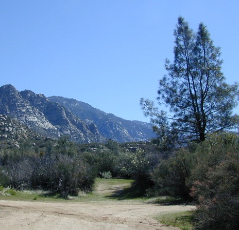
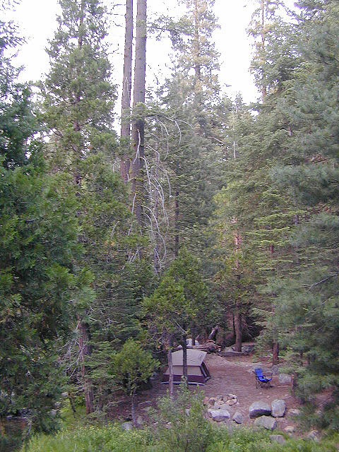
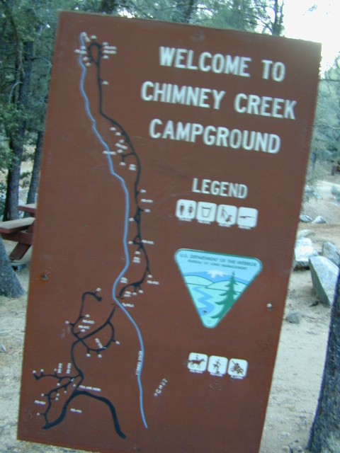
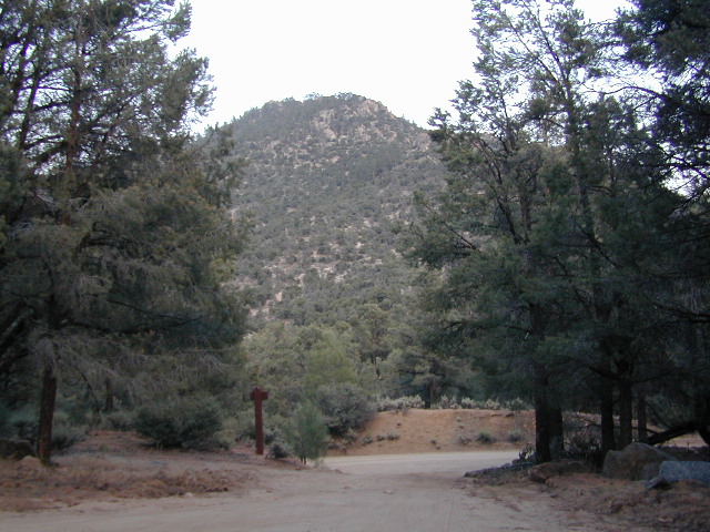
High mountain desert camp is mislabeled on some maps as “Chimney Peak Campground” or “Chimney Rock Campground”. Pinyon pine forest on Chimney Creek, near hiking trailheads, wildflowers and Chimney Peak Wilderness. Southern Sierra ridge near Mojave Desert and California SR 178.
Canebrake Road is a graded dirt road that makes up part of Chimney Peak Back Country Byway. This rural route is a major graded dirt road located north of Highway 178 – which connects Canebrake to Long Valley up near Kennedy Meadows. Pacific Crest Trail passes next to this campground in the Southern Sierra mountains. The campground turn off is way east of Lake Isabella Hwy 178 is (near Walker Pass & PCT) and follow dirt road north to Kennedy Meadows in the far eastern reaches of Sequoia National Forest
• Elevation: 5,700′
• Number of Sites: 32
• Camping Reservations: No
• Sites Available: First come, First serve
• Vehicle Accessibility: RV limit 28′ max
• Length of Stay: 14 Days
• Water: Piped (April – Sept)
• Toilet: Vault
• Season: Open all year
• Fee: No
• Operated By: BLM
• Closest Town: Lake Isabella, CA
Bureau of Land Management
BLM Bakersfield Ranger Station 661-391-6000
elevation 5800′ – Canyon Creek connects Lake Faucherie, Sawmill Lake and Bowman Reservoir in the Sierra, Tahoe National Forest. 20+ miles of backroad travel, off I-80.
While many consider Faucherie to be the most beautiful scenic lake, Sawmill Lake just downstream a couple of miles is still quite attractive – with dense forests and a granite mountain backdrop. Sawmill is especially nice for those who like to primitive camp, ouside of developed campgrounds. Way off the interstate @ Hwy 20, tucked in way back behind Bowman Lake a few miles, you can find Sawmill Lake.
Fishing and camping, kayaking and canoeing are all popular recreation around this lake. A trailhead on the northend of the lake leads out to even more alpine lakes (a day hike “lake loop” or backpacking option). The Pacific Crest Trail is also routed nearby.
No motorized boats or watercraft allowed. No boat ramps, no pavement, no picnic tables, no bathrooms, no fees.
4×4 Lake
Fishing Lake
Free Camping Lake
The north shoreline is abundant with dispersed campsites: metal fire rings and a clearing only; no picnic tables, no toilets. Self sufficient campers only. Campfire permits, a water bucket and a shovel are required. During extreme fire restrictions campfires may not be allowed. Check with local rangers for up to date info.
Most campsites are drive up and park, while others closer to the shoreline have only walk-in access. Hauling your gear down hill won’t seem unthinkable once you’ve seen the lakeside views. There is even a camp below the dam, next to the waterfall.
The main access Road #843-037 is very rocky and 4x4s love to frequent the area. The backroads here are best suite for truck travel, high clearance vehicles, off-roaders and SUVs. No small RVs or trailers. Passenger cars are not recommended. The access roads around the lake and up to the lake are dusty and rugged. The road below the dam is quite rough w/ rocks.
The water at Sawmill Lake is crystal clear snowmelt. The lakes around here are managed by Nevada Irrigation District, so this is why there are no engines allowed on the lake. This canyon area closes to public entry during winter months (NOV-APRIL), due to deep snow.
Way back off there beyond the boonies, 10 miles on a bumpy dirt road #8N06, and far from the pavement. Seclusion, peace and quiet, plus privacy is what this canyon can offer. This small campground is rarely busy, unless a huge family or hunting group has taken over camp. Most of the time it’s so quiet you can hear the wind in the trees, birds chirping and bugs buzzing.
N of Ojai (about an hour), scenic drive Highway 33 N of Ozena @ Lockwood is a little-known signed route called Apache Canyon. Los Padres Road #8N06 leads from the south end of Cuyama River Valley east to the dead end badlands canyon w/ Nettle Springs Camp. OHV trails and Chumash Wilderness access.
• Elevation: 4,400′
• Number of Sites: 8
• Camping Reservations: No
• Sites Available: First come, First serve
• Vehicle Accessibility: small RV ok
• Length of Stay: 14 Days
• Water: No Piped; seasonal creek iffy
• Toilet: Vault
• Season: Open all year
• Fee: No
• Operated By: National Forest Service
• Closest Towns:Frazier Park, CA & Ojai, CA


 Only two campsites on north side of bridge, and the rest are on the other side of the river. Algoma Bridge may be closed, so you can park and walk across to reach the campsites. Call ahead to find out current conditions.
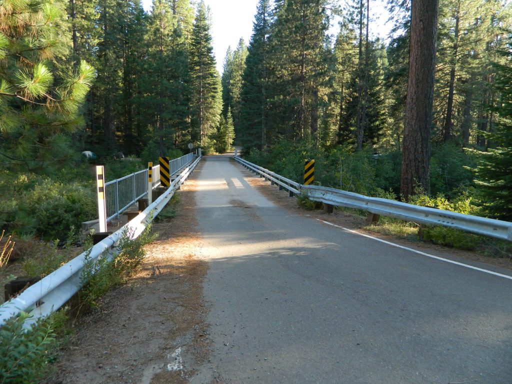


 No facilities such as toilets or showers. Maybe a picnic table & fire rings, if you’re lucky. Southern California
 Rentals typically include sleeping cots, but you’ll need to bring your own bedding (sleeping bags, sheets, pillows). Some rentals include shaded porches, wooden decks, minimal furniture, kitchenettes and/or wood burning stoves. Electricity may be available, or maybe not. Ask ahead of time, if you really must have that particular luxury when on vacation.
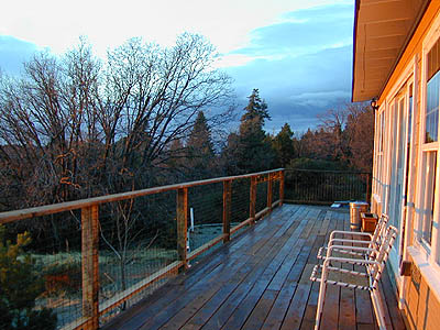


 Mitchell Cavern. Campground is perched on rocky hill overlooking desert.
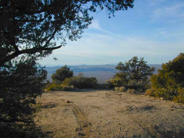


 WILDERNESS NOTE: The USDA National Forests web site states that “Camping and campfires within 25 feet of the water’s edge is prohibited due to the Wild and Scenic Designation”, but that doesn’t seem to stop some from setting up right on the fragile rivers edge. Doubtful that this rule is being enforced by the rangers, but consider yourself warned unless they start to get serious about this restriction. Many believe that the free camping along the Kern river is destroying it, so don’t be surprised if these areas get closed or barriers placed at the flats.
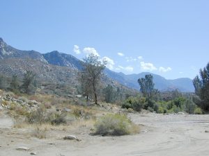


