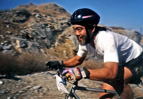
Mountain bike races are few & far in between, so Total Escape is here to promote them. This is one of the longest running races, near Lake Isabella, along the Kern River.
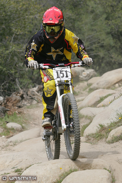
The All Mountain, Down country, Gravel, Vintage, XC, Downhill, Enduro Event or the year.
Up to 500+ bikes in competition w/ various classes. Downhill, cross country & short track. Presented by the Southern Sierra Fat Tire Association. 30+ years running, so we know it’s very popular. Annual event held in the Springtime.
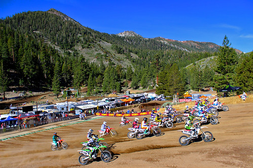
Dubbed the ‘oldest continuously running motocross event’ in the United States. This Eastern Sierra event draws some of the best dirt bike riders in the world.
The mysterious topographic map maker, Landon Crumpton, is gone. Although his Baja Almanac book of the Mexican peninsula is still as popular as ever.
The Total Escape crew has been using this amazing topo map for Baja Mexico since our the very first excursions in 1990. Click below to read more about the famous, hard-to-find Baja Almanac publication.
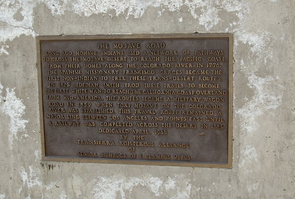
The historic Mojave Road spans the high desert region of east California – crossing the Colorado River westward to roughly Los Angeles. Now a network of dirt and paved routes follow the original overland trade route. Click the plaque photo below to read more.
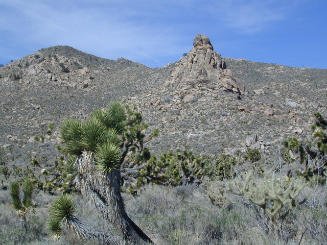
The rugged, dirt road cuts right through the middle of the Mojave National Preserve. Mid Hills, Kelso Depot, Cima.
mojave topo maps
Joshua Trees, mountains, boulders, sand dunes, railroad history. The high desert is abundant with wildlife, plant life, lava tubes, caverns, camping, and dirt roads. Plus wild windy weather.
MOJAVE PARK
Located on the way to Vegas, NV – or the Grand Canyon in Arizona. Mojave NP is in the triangle space in between Interstate 15 and Interstate 40, on the eastern side of southern California. Freeway close, free camping in the Mojave does indeed exist, if you know where to look.
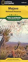
Mojave Map by Trails Illustrated NatGeo
National Geographic acquired Trails Illustrated Maps more than a dozen years ago. Ever since these plastic topo maps have gone 2 sided, full-color w/ more details featured than ever before. Updated regularly. Waterproof plastic, perfect for outdoor desert travels.
Mitchell Cavern, called Providence Mountains SRA, has camping, but it is situated up on an exposed bluff overlooking the freeway. Location gets windy as hell. Better campground is at Hole in the Wall, or even better, Mid Hills Camp.
Primitive, free camping can be found off of Kelbaker Road, but be warned: dirt roads can get deeply rutted and impassible during extreme wet weather. 4WD may be required sometimes.
CAMPGROUND CAMPING
FREE CAMPING
GROUP CAMPING
HIKING TRAILS
HISTORIC MONUMENTS
HORSE CAMPING
HORSEBACK TRAILS
JOSHUA TREES
LAVA TUBES
MINING HISTORY
MOUNTAIN BIKE TRAILS
OFF ROAD CAMPING
RAILROAD HISTORY
RANCHES
RV CAMPING
SAND DUNES
VOLCANIC TERRAIN
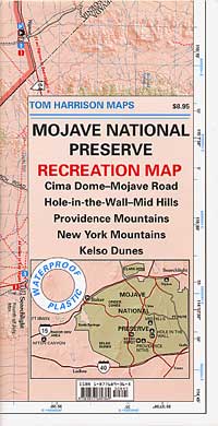
Mojave Desert Map by Tom Harrison
One of the first readily available topographic style maps of the Mojave desert. Waterproof plastic, Tom Harrison brand maps are perfect for any type of backcountry travel, on foot, on horse, or off-road.
AAA & NPS: one-page freebie; excellent overview map created by the Automobile Association of Southern California w/ the National Park Service. Handed out at Visitors Center and ranger stations (1990s)
BLM Maps of Mojave: OHV (off highway vehicle) maps can be found at the local Bureau of Land Management ranger stations:
This premium full state atlas has the whole, massive Mojave desert covered, which extends north into Death Valley National Park and south to Joshua Tree National Park.
14,100 acres
Garcia Peak – 3146′ elevation
Los Padres National Forest
Huasna River
Pozo Creek
campgrounds nearby –
American Canyon Campground
Hi Mountain Campground
La Panza Campground
Lake Lopez Campground
Navajo Campground
trailheads for Garcia Wilderness
Hi Mtn
Santa Lucia
Garcia OHV
POZO ROAD is also known as
Pozo La Panza Rd
Hi Mountain Rd
Pozo Arroyo Grande Rd
San Luis Obispo’s Los Padres Pozo Rd is a 4×4 route that accesses the Garcia Wilderness; the dirt route connects Lake Lopez to Pozo Saloon, out near Santa Margarita. Los Padres National Forest
Located inland from the Pismo Coast in south San Luis Obispo county.
Garcia Peak OHV Route, off Pozo Road behind Lake Lopez, Arroyo Grande, CA
backpacking
camping
hiking
mountain biking
off roading
waterfalls
wildflowers
Steep lush coastal mountains, rugged, remote landscapes close to Central Coast San Luis Obispo.