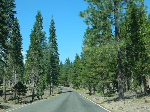
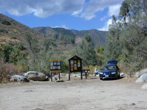
aka Pilgrim Creek Road or Stevens Pass Road East of McCloud, CA
Explore the roads on the backside of Mount Shasta, well off Interstate 5 and miles from Highway 89. This epic paved route will get you away from the tourists at McCloud Falls and all those busy campgrounds.
Loggers and lumber trucks on week days; so drive cautiously. Paved road most of the way. Numerous dirt road turn offs lead deeper into seclusion. Wonderful views of Mt Shasta from many locations. So close, you can ‘reach out and touch it’ kinda views.
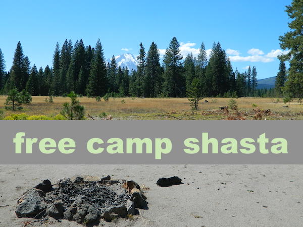
And no, we haven’t been to either, cuz the dang boon-docking is excellent, so why would you need a campground?
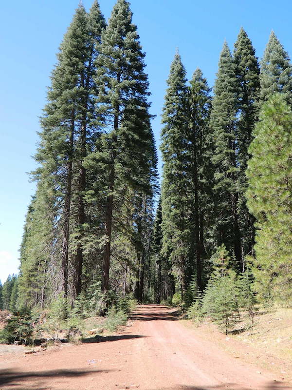
Long paved main road has numerous turn offs on to dirt roads on both sides. Timber lands, National Forest, and some private properties. Watch carefully for gates, fence lines and any signage. The night skies are super dark way back in here, so excellent stargazing!
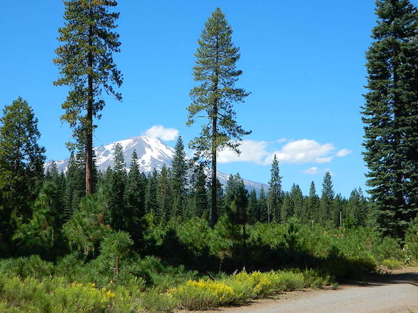
Road #19 Military Pass Road intersects at the snowmobile park and heads NW – behind Mount Shasta.
Past the snowmo parking lot, Road 13 changes from Pilgrim Creek to Stevens Pass Road and continues to gradually climb up in elevation. Eventually Road 13 peters out around the backside of Harris Mountain.
Road #15 Volcanic Legacy Scenic Byway – intersects shortly before Harris Springs, and continues northbound. It eventaully becomes Davis Road (#44N05) which leads up between Pumice Stone Mountain and Little Glass Mountain.
Little Mount Hoffman Lookout (historic fire lookout tower) is way back here on Road #43N77 and it is available to rent overnight (by reservation). The lookout is accessible by car, but the last 4 miles are on unpaved roads and difficult for RVs and cars with trailers to navigate. The accommodations of this lookout may be rustic, but the views guarantee that visitors will have a memorable stay.
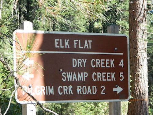
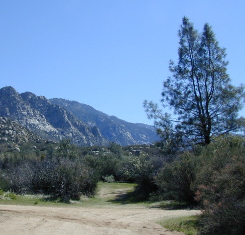
ELK FLAT is an area worth exploring for the meadows and view of Mount Shasta. Stealth camping back in here on dirt roads with a passenger car.
Never married, No kids No wifi, No smartphone
No tattooed eyebrows
If you could care less about celebrity gossip or television, you are not alone. Many people seek more relaxing travel in their lives, but can barely afford a vacation, or a day off of work.
DanaMite is all about dirt – being outside and inspiring you to be outside as much as possible.
I began car camping in the Borrego desert while in college as an easy, inexpensive “weekend away from the city”. Cheap, literally dirt cheap outdoor vacations. Free camping, if you really know the good areas.
Whether you dig hiking or biking on dirt, sleeping in the dirt (tent camping) or wheelin in the dirt, we have the TOTAL DIRT on California. Back Roads, Hot Springs and tons of outdoor destinations inside the golden state. Nearly 3 decades online, we’ve been here from the start.
Dirt roads, dirt campsites, dirt trails. Desert dirt, mountain dirt, coastal cliffs to country canyons w/ huge reservoirs. All California dirt, terrain, forests and water too.
Road conditions on dirt roads change with the weather and the seasons. This route can be rocky and uneven in spots. One lane road, on a big hill w/ minimal pullouts. Snow is possible, during winter & springtime. This route often closed during winter months – or for rock slides. Trailers and RVs are not recommended on this dirt road, although small motorhome campers can try.
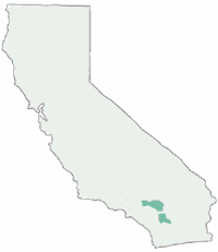
Elevation approx 6000′ @ HWY
w / route continuing up to Toro Peak @ 8740′
NFS local camp sites:
Santa Rosa Campground
Santa Rosa Springs Campground
Toro Campground
Bare bones, primitive camp sites. Tables, fire rings. Must have a campfire permit for this region. Vault toilets? None.
Did I mention the wind yet? Tall trees do block a majority of the wind, but some areas get whipping – so choose your tent site wisely. And stake it down well, before that quick day hike. Since this is a mountain ridge line, expect thunderstorms, wind and possibly light snow.
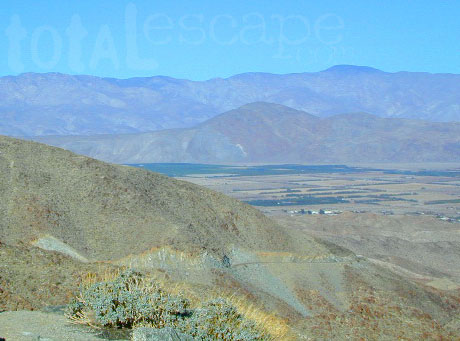
The big, famous Palm Canyon in Palm Springs starts below. The impressive desert canyon trails lead up to highway 74. Continue on foot uphill, southbound, cross the pavement, and end up in this Toro Peak region. Small campgrounds, few people, great views over the desert. Pick a smog free weekend (with wind) for best Coachella Valley views.
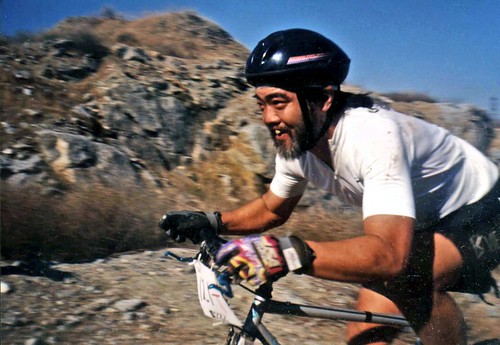
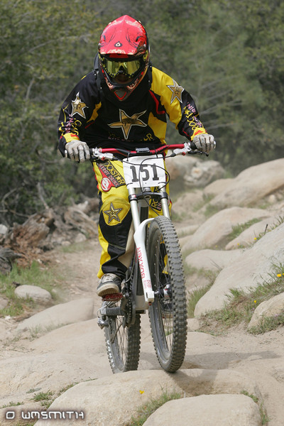
Mountain bike races are few & far in between, so Total Escape is here to promote them. This is one of the longest running races, near Lake Isabella, along the Kern River.
The All Mountain, Down country, Gravel, Vintage, XC, Downhill, Enduro Event or the year.
Up to 500+ bikes in competition w/ various classes. Downhill, cross country & short track. Presented by the Southern Sierra Fat Tire Association. 30+ years running, so we know it’s very popular. Annual event held in the Springtime.
If you are thinking about fishing or camping the Eastern Sierra, North of Bishop & you are not up for the crowds at Mammoth or June Lakes, then try the Bridgeport area, north on Hwy 395. Rural ranch lands along main road, Bodie ghost town turn off across the highway and Virginia Creek Settlement are also nearby
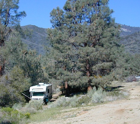
Green Creek is a 11 mile long dirt road in the lush Eastern Sierra the northern portion. The wide, graded dirt road is signed and dead ends at a Toiyabe National Forest campground called Green Creek Campground. The drive up can be washboard bumpy in some parts, but that doesn’t stop the hundreds of adventurous motorhomes that make this trek annually. This place features some of the best prime Sierra back roads camping options for RVs.
Another dirt route, Dunderberg Meadow Road peels off to the left. Dunderberg departs off Green Creek a couple of miles from the highway and well maintained. This route leads to meadows, aspens, picture perfect scenery and much more seclusion. Passenger car accessible, wide graded dirt roads to wilderness edges. Two-track one lane trails lead to meadow edges and more creeks. Very impressive views of the Sierra peaks over here on this side. Meadows are sensitive areas, wonderful for picnics and you should always minimize impact.
Plain old passenger cars can easily make this route deep into the Eastern Sierra aspen canyon. Graded dirt and4x4 could be needed winter months. Backpackers can enjoy easy access to the Hoover Wilderness trailheads. There is plenty semi-primitive camping spots along the way, right on the creek, for free…. so no need to sleep in your vehicle upon arrival.
Autumn Aspen Groves: fall colors peak in October, which is usually when the first snows for the winter season start. November – usually the freeze gets them and lifeless brown leaves dangle, until the Sierra Nevada wind gust blow real good.
Green Creek Camping
DIRT ROAD CAMPING
alpine lakes
backpacking
car camping
day hikes
fishing camping
meadows
RV camping
tent camping
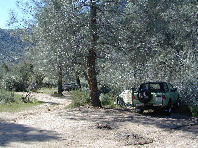
Dispersed, primitive camp spots along this main dirt road are on a first come basis. You’ll need a fire permit. Many flat camps are set along the creek in aspen groves, some pines, others have cubby hole privacy. Large granite valley, big creek, bird, scenery and nature everywhere. Some folks spend weeks camping out here in the warm weather months. Fishing is a big attraction.
Old Cabin in autumn leaves, up near the top of the dirt road deep in the aspen groves
Being the largest State Park inside California, Anza Borrego has certain advantages. Lots of land to explore, abundant dirt roads, free camping and a very diverse terrain. Located in SoCal, this desert has lots to offer the outdoor enthusiasts, all year round.
Anza Borrego Desert
with hundreds of miles of dirt roads to explore
SUV / 2WD / AWD / 4WD / 4×4 / OHV
The Anza Borrego desert, in east San Diego County, is quite large and very easily accessible from Southern California. The park spans mid-elevation, mountain foothills (3000′ elevation) down to dry lake beds near sea level. Large, vast and varied terrain – and full of vegetation in certain spots. Borrego Desert Wildflower blooms attract thousands of visitors between March-May each Spring.
While the majority of the dirt roads inside the ANZA DESERT are passable with a regular passenger car (on most days), some specific areas and routes are indeed considered “too hairy” and may require a 4 wheel drive. Rains change landscape fast in this region, so know before you go.
FLASH FOOD WARNING: Wet weather (anywhere nearby) can make a mild, soft, sandy wash into a wild, flowing river. On occasion desert washes are ‘washed out’ during big rain, often becoming mini rivers that can swallow your vehicle; Road and weather conditions can change suddenly in the California deserts. Wind can also play a huge factor in a selecting a decent camp site. Know the weather report in advance and always be on the watch for big clouds on mountains to the west.
Deep sand washes, steep sandy hillsides, boulder passes, rock yards to boulder hopping, soggy bottoms to straddling ruts, the deserts of SoCal are indeed fun and challenging. Enjoy your public lands responsibly and pick up some litter, stay on the trail and do not target shoot inside park boundaries.
To find these off-roading areas: OHV routes, camp areas and gear heads galore. Or try avoid them. Keep reading.
Anza Borrego Desert State Park itself is NOT AN OFF ROAD PARK. If you want the free-for-all, open, OFF-ROAD areas, with sand dunes and terrain to explore, then the list above should help. Some places can be secluded and private for camping, and only one Jeep may pass by (for the whole weekend).
On the other end of the spectrum, most OHV camping areas are closer to paved routes and busy w/ motorized activity. On weekends, traffic, events and crowds are the norm. ATV, dirt bikes, buggies, quads, jeeps, families, RVs. Often, a big noisy scene.
Seeking to travel to distant places to avoid crowds? then this site can help point to the best destinations. Follow links, browse images, get a decent topo map – and discover private desert camping for free.
most w/ 2WD access; high clearance vehicle is preferred (and as usual, 4WD may be needed in storm conditions). Not all 4×4 routes will be signed. Signs get washed away in desert areas, so don’t count on them. Have a good hard-copy, topo map handy – just in case.
The Tom Harrison Map of Anza Borrego Desert is actually called the San Diego Backcountry Recreation Map and is by far the best seller of the region.
Wilderness Press makes an excellent topographic map for the Borrego Desert, with all the details on terrain and info for camping, hiking & off roading.
MORE AREA MAPS
The infamous west coast backpacking route, the Pacific Crest Hiking Trail runs above the desert (a few thousand feet), on the ridges of Mount Laguna.
Cleveland National Forest borders the west side of Anza Borrego Desert, on the rugged steep slopes of the big mountains (7000′ elev). More Maps links are provided:
Wetlands in the desert? Not that rare, water does flow downhill. Some established well-traveled roads may have added gravel to the soggy marsh areas, but many water crossings are bare, and vulnerable to erosion. Try to avoid driving in and around water. DRIVE SLOW through water where route crossing is obvious. Wildlife need these water sources to survive, so don’t muck it up.
Palm canyons and large boulders are numerous in this desert, water sources scarce. Camping near palms can be limited to walking distance. Several palm oasis camps along San Diego County Road S-2, some RV accessible. Even the county-run Hot Springs Park has some palms. Of course, Palm Canyon is the State Park Campground. Visitors Center headquarters in downtown Borrego Springs has the most popular hikes, hotels, restaurants, with abundant campground camping. Very walk-able town. Super hot during summer, triple digits!
back roads: weekends
Weekends are always busier than week days, in general, all over Cali. Keep that in mind when seeking seclusion. Camping in Anza Borrego desert is always best at least 2 miles off the pavement, well away from the traffic on the highway and for those masses seeking the easy camping.
Campfires always require a metal bucket in Anza!
OPEN-CAMPING: camping outside of developed campgrounds, also referred to as ‘primitive camping’ is quite common in Anza Borrego desert. Many Borrego Camping Areas are accessible with regular cars, close to main roads and usually have no bath rooms, or facilities. The further you drive from the pavement, the more likely you are to encounter obstacles like boulders, deep ruts, soft sand and uneven terrain.
Located north of the small community of Riverkern and south of the Johnsondale Bridge, numerous flat camp spots adjacent to the rivers edge can be found.
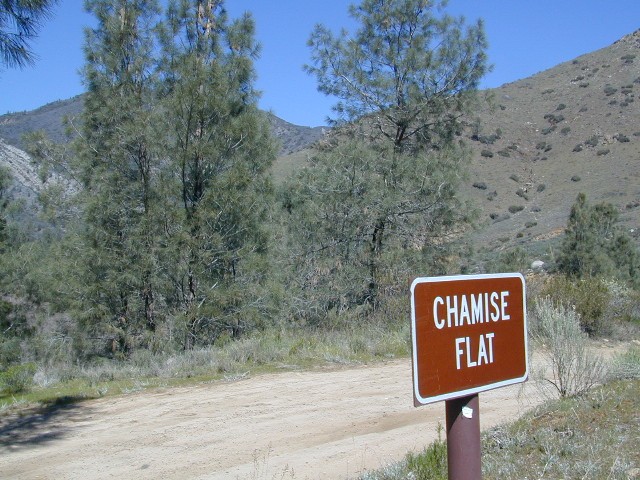
Ant Canyon Dispersed Area Brush Creek Campground Calkins Flat Dispersed Area Chamise Flat Dispersed Area Chico Flat Campground Corral Creek Campground Springhill Dispersed Area
Kern River Road
Sierra Way in Kernville travels north along the Upper Kern River & becomes Mountain Hwy 99 – which eventually connects with the Western Divide Highway in Giant Sequoia National Monument.
Dispersed Camping Areas along the Kern River
Open Year Round! These FREE camp areas are called dispersed camping sites. No pavement, no picnic tables, no bathrooms, no piped water. Portable toilets & trash bins may be available in the busier summer months. Campfire permits are required for all campfires, BBQs, and camp stoves. Fire restrictions are common in extreme dry conditions. 14 day limit on camping.
Many flats are signed w/ small brown signs, while others are not. Some are actually flat and easy to access, while others are steep, eroded dirt trails unsuitable for RV travel.
Kelly’s Hole, overgrown, unknown, well-known or burnt beyond recognition? Roads End is no more.
Camp sites listed on this page are dispersed camping areas around the Kern River Area. Not all camp spots are listed, cuz many are unnamed. Bring your GPS to mark your favorite camp sites and you can arrive in the dark, late at night, anytime, (avoiding city traffic after work).
Several spots known as “dirt flats” are easy accessible right off the pavement of Sierra Way. Primitive river camping, fishing spots and raft launch areas north of town. Vault toilets might be available during busy summer months, but you’re on your own the remainder of the year. Bring a shovel and take a hike, away from the water flow. And if that sounds like too much work for a potty break, maybe you are not cut out for the primitive kinda camping style. No garbage service either: pack it in, pack it out.
Wildflowers are abundant in the Kern Canyon nearly every Spring season (April & May), which is a popular time to enjoy this region. Autumn brings minimal fall colors to this dry, desert mountainous landscape, but the fishing is decent at that time of year.
CAMPING OUTSIDE OF CAMPGROUND means you must obtain a free fire permit from the local rangers. Sometimes these dispersed spots are fire-safe areas, and you are allowed to have camp fires. Other times campfire restrictions are in place w/ wildfire dangers too extreme and no fires are allowed, anywhere. (Not even inside a developed campground!)
WILDERNESS NOTE: The USDA National Forests web site states that “Camping and campfires within 25 feet of the water’s edge is prohibited due to the Wild and Scenic Designation”, but that doesn’t seem to stop some from setting up right on the fragile rivers edge. Doubtful that this rule is being enforced by the rangers, but consider yourself warned unless they start to get serious about this restriction. Many believe that the free camping along the Kern river is destroying it, so don’t be surprised if these areas get closed or barriers placed at the flats.
Caulkins FLAT has some new boulder barriers put in place which prevent cars from reaching certain ideal camp spots (right at the waters edge). Tough luck. Now we have to hike more.
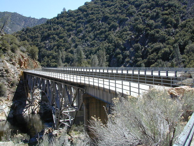
Upper Kern River North of Kernville, CA
all camps below listed from south to north
ALL CAPS = developed campgrounds managed by US Forest Service, w/ links to Kern River Campgrounds.
Ant Canyon
Just north of Goldledge Campground, along the Upper Kern River.
South of Salmon Creek; Hike to Salmon Creek Falls.
Chamise Flat
12 miles north of Kernville, CA
This camping bluff could be the most forested of all the ‘kern flat’ camping areas, but river is a short hike down a very steep cliff. Fishing is excellent in this stretch.
Calkins Flat
15 miles north of Kernville, along the Upper Kern River. Just south of Fairview (McNalley’s). Sign at the location reads a different spelling of “Caulkins Flat”. Kayak and rafting put-in spot. One of the best sites for large groups. Area is also known as simply “Lower Campground” on GoogleMap.
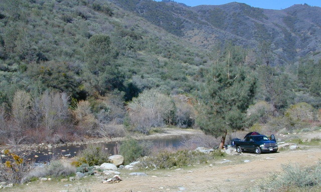
Brush Creek
3600′ elev
Just south of Sherman’s Pass Road turnoff. This place also serves as a Day Use Area, where Brush Creek meets the Kern. Kayaking put in spot. Popular fishing area. Large open dirt parking lot with a vault toilet.
Lower Kern River Southwest of Kernville, CA
Lake Isabella has some shoreline camping with wide open access to the lake. Paradise Cove perhaps?
Historic Keyesville – “off-roaders camping paradise” along the river, but no swimming is allowed due to the extremely dangerous section of river. OHV trails lead (west) down river for many miles. Dirt bikes love the rugged boulder-scapes and steep hills. FREE camping; BLM Kern.
SANDY FLAT CAMPGROUND (NFS) – Open all year long! Terraced & paved hillside with numerous camp sites and plenty of room to spread out. RV campers like this location, due to the proximity to Hwy 178. elev 2300
Remington Hot Springs can be a zoo at times w/ the amount of people who love to stop here. A busy dirt parking lot, right across from the Remington trailhead sign. Many vehicles park here daily for day hikes, hot springs, fishing – and people also like to camp out, although camp sites are on slopes (not ideal), only a few and they fill up fast (before sunset).
Total Escape TIP: The very best camps at Remington are actually the ones you hafta hike down to. Less than a half mile down to the rivers edge to find a private mini beach. Pack light and arrive prepared to walk several miles (back & forth, several times).
Old Kern Canyon Road parallels Sierra Highway 178 and sits well above the river, so any flat spots you find will have great views w/ minimal river access.
Lower Kern River has very limited camping options.
The list below is of awesome California locations that do have off-road trails surrounding them. Some destinations listed are heavy use off-road – with OHV parks or camping nearby, while others are simply scenic dirt backroads or forest roads for easy driving. Topographic maps can be found for most areas, and should have all roads displayed, dirt and paved routes, as well as campgrounds, hiking trails and trailheads.
This California “off road towns” list was originally part of the California Off Road Maps page, but it surely deserves it’s own unique post, since it is an ever expanding list. Ongoing.


 If you could care less about celebrity gossip or television, you are not alone. Many people seek more relaxing travel in their lives, but can barely afford a vacation, or a day off of work.


 SDBKCO Recreation Map


 WILDERNESS NOTE: The USDA National Forests web site states that “Camping and campfires within 25 feet of the water’s edge is prohibited due to the Wild and Scenic Designation”, but that doesn’t seem to stop some from setting up right on the fragile rivers edge. Doubtful that this rule is being enforced by the rangers, but consider yourself warned unless they start to get serious about this restriction. Many believe that the free camping along the Kern river is destroying it, so don’t be surprised if these areas get closed or barriers placed at the flats.
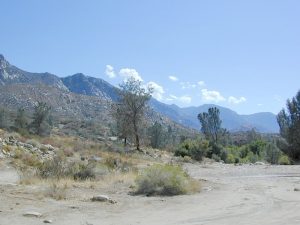

