Tag Archives: dirt road

Mason Valley Truck Trail

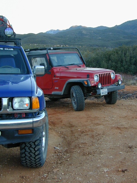
jeepinoriflamme

Mason Valley – Oriflamme Canyon

Mason Valley Truck Trail refers to a network of dirt roads on the west side of San Diego County Road S2, on the steep mountain slopes overlooking the desert badlands of Anza Borrego State Park. These primitive back roads lead up to the Pacific Crest Trail (PCT) on the edge of Laguna Recreation Area.

Oriflamme Canyon, Chariot Canyon & Rodriguez Trail are all in the area. Chaparral mountain trails lead off in many directions with dead end canyons and side routes. This high desert region consists of private property, ranches with gates, various trails and desert dirt roads – between 2400′ and 4000′ elevation.

A good portion of the lands on the west side of paved S2 are not inside the State Park boundary, but Oriflamme is the exception. The Anza Borrego Desert State Park borders includes this particular back road canyon, almost up to the Cleveland National Forest. Awesome locals little secret!
Laguna Recreation Area

  • Oriflamme Mountain @ 4611′ elevation
  • Chariot Mountain @ 4644′ elevation

San Diego Backcountry MapThe main access to Mason Valley Truck Trail is located near the bottom of Box Canyon (on Co. Rd. S2). The sign at the turn off reads Oriflamme Canyon. The first sandy mile or so gets kinda confusing, as the ranch road, dirt trails and natural desert wash merge with the seasons and rains. You might encounter locked gates if you take the wrong turn. In the wash look for signage for Oriflamme.

Approximately 2 miles from S2 the dirt road splits. To the left is Mason Valley Truck Trail, which continues up  Oriflamme Canyon and into wooded Chariot Canyon, eventually connecting with Hwy 78 (at Banner Grade). And the other choice on the right is a rugged 4×4 route called Rodriguez Truck Trail which is 7 miles long and meets back up with the main Oriflamme road about a mile from the highway. These back roads encircle the biggest peak around called Chariot Mountain.

Mountain bikers, hikers, horses and vehicles all use these routes, so be prepared to see others out exploring and please, always yield to equestrian traffic.
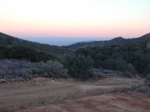
Mason Valley Truck Trail Anza Views

Several open, free camp spots lower in the canyon w/ large cottonwood trees. More hidden camps to be found higher up the mountain. A decent topo map, a campfire permit and a metal fire bucket is highly advised.

PCT: Pacific Crest Trail traverses the ridge line near 4000-6000′ and the desert valley below is nearing 2000′ elevation. The ambitious plan for the California Riding and Hiking Trail is still under construction and routed nearby as well.

Butterfield RV Ranch and the historic adobe Vallecito Stage Stop, are the closest thing to civilization you will find around these parts Don’t count on gasoline or cell phone coverage anywhere near here.

NEARBY TOWNS:Anza Borrego Desert Map

Desert / Mountains
SOCAL MAPS:


View Larger Map


23S01 – Los Padres NF

Big Sur Dirt Roads

Los Padres National Forest Road #23S01

Willow Creek Road
Los Burros Road

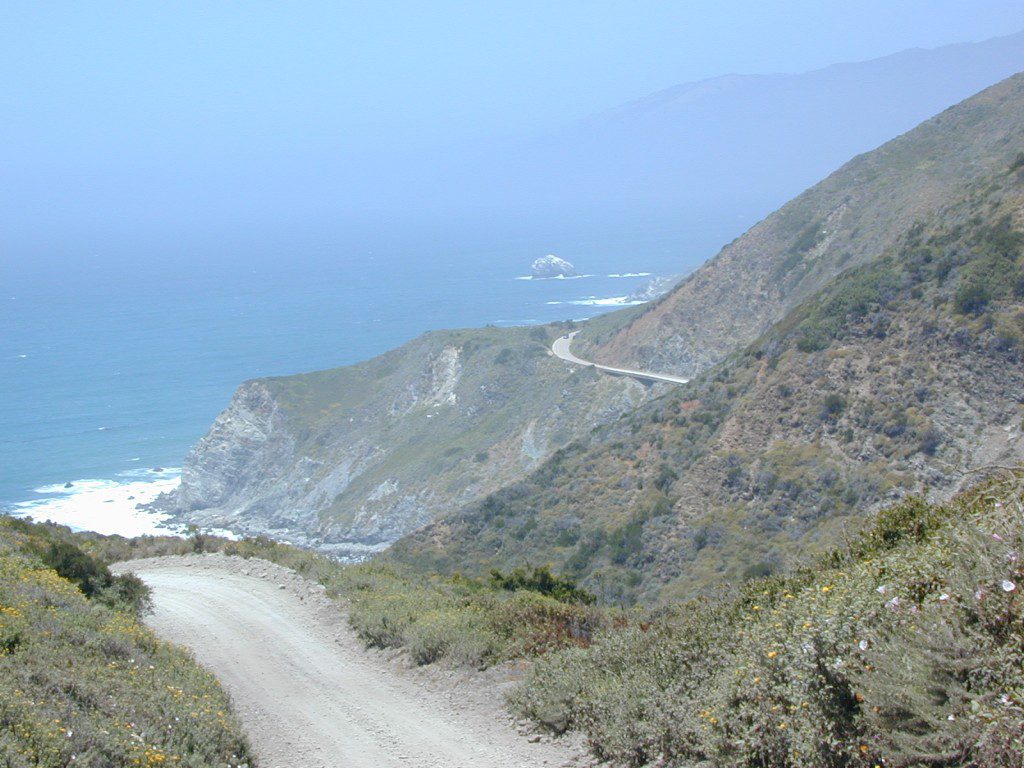
South Big Sur Coast Dirt Roads & super scenic US HWY 1 – North of San Simeon and Hearst Castle, north of Ragged Point and just past Gorda, CA a dirt shoulder, widens, a break in the bushes on the right side of the highway, a small wooden sign for the Yurt Resort called Treebones and the turn off to the back-country of Los Padres National Forest Road #23S01

Willow Creek is a steep coastal canyon w/ Willow Creek Trail #5E08 in the creek below and the dirt road 1000′ above. Willow Creek Day Use Area, the Willow Creek bridge and Willow Creek beach w/ restrooms, picnic tables, and paved parking lot near the highway.

DIRT ROAD, high clearance is recommended, but not required. 4×4 may be needed in wet weather. Motorhomes, trucks w/ trailers and RV campers are not gonna like this rugged, narrow, steep, dirt road and are advised to stick to the pavement. Camper vans and SUVs are be better suited for this terrain.

  • Both Thomas Bros. Maps & Benchmark Map’s California Atlas has this route listed as Los Burros Road
  • Google Maps has this route named Will Creek Road
  • Yahoo Maps has this route as Willow Creek – Los Burros Road
  • Mapquest has this one listed as Los Burros Rd – Fort Hunter Liggett (which is a military base,  on the opposite side of the mountain range near US Hwy 101)


View Larger Map


Free Camping in Big Sur

Willow Creek Rd

Several primitive camp sites can be found along this rugged dirt road, which climbs steeply and switchbacks thru redwoods, madrones, cedars, grass lands and oak hills. Sites within the first 3 miles  of this road offer the serene sounds of the ocean – waves, seals, sea lions as well as traffic on the busy highway. There are a few private properties back here in the boonies too, so read signs and don’t go exploring this region in the dark.

About 8 miles back on Willow Creek Rd is Alder Creek Campground – a small developed camp w/ only 2 camp sites and no piped water and no fees.

Prewitt Ridge  also has numerous ideal top-of-the-world, free camp sites, which do require a lot more dirt road driving and a very good backcountry map.

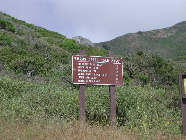
  • Sycamore Flat Road intersects @ 3 miles up
  • Alder Peak Camp is San Martin Top @ 12 miles up
  • South Coast Ridge Road is at the very top @ 14 miles
  • Lions Den Camp is 19 miles of dirt road driving
  • Three Peaks Camp is 21 miles way back there
Los Padres Monterey District Big Sur Map NatGeo

Indian Flats Campground

Temecula Camping / Warner Springs Campground

San Diego Mountains – Cleveland National Forest

Indian Flats Campground

Indian Flat Campground is located on the seasonal San Luis Rey River in rural North San Diego County.  From I-15 @ Temecula, CA travel eastbound on Highway 79. Look for the tiny turn off  (on left side) for forest road #9N05, sorta near glider airport located west of Warner Springs. This poorly paved backcountry route (half dirt/mud at times) is also known as both Indian Flats Road or Lost Valley Road.

Graded dirt road (paved in some portions) travel is approximately 6.5 miles to campground, look for gate and turn off on the left side. When you see the giant boulder near the entrance, you’ll know you’ve made it to the right place.

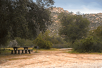
Oak trees and a few pines, plenty shade, boulders and mountain scenery, this is a great small campground that is well away from everything in Southern California.  Seasonal creek-sized river and boulder waterfall often dries up in late summer. This means a wet spring is the best time to visit this camp. Hiking, mountain biking trails and hammock spots. Pacific Crest Trail access.

Cleveland National Forest
Palomar Ranger District
760-788-0250

ClevelandMap_07

Elevation: 3,600′
Number of Sites: 17
Camping Reservations: None
Sites Available: First come, First serve
Vehicle Accessibility: Length 15′ max.
Length of Stay: 14 Days
Water: No Piped; Seasonal creek nearby
Toilet: Vault
Season: Closed for mud & snow during winter months
Fee: Yes
Operated By: National Forest Service
Closest Town: Warner Springs, CA

Indian Flat
Indian Flat Campground Entrance

Guadalupe Canyon Hot Springs

Guadalupe Canyon Baja Hot Springs

Canon de Guadalupe

Baja Hot Springs Camping Resort


Baja California Hot Tub

40 miles SW of Mexicali – Laguna Salada off Mexican Highway 2

Guadalupe Canyon Oasis
Palm Canyon Hot Spring Camping Resort
619-639-7597


Off road destination, palm canyon in Baja California Norte
East of San Diego
SW of El Centro / Mexicali

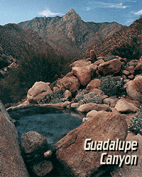
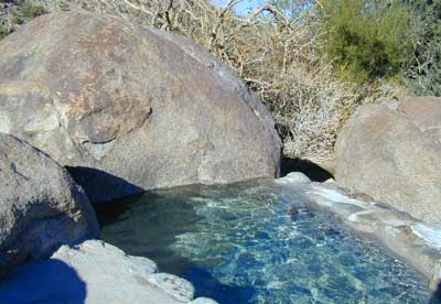
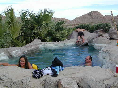
Imagine a palm oasis canyon in a remote area of the Baja desert; Cool springs that feed the lush landscape with huge boulders & cliff diving waterfalls. With each campsite featuring it’s very own custom hot springs tub. This place was a paradise 20 years ago, but is now over-developed w/ large groups, parties and camping families. If you can handle the 30+ miles of unimproved dirt roads, this spot is worth a visit mid-week. Winter months are prime time to visit the desert. Temperatures are moderate, days are pleasant & midweek has minimal tourists. Avoid holiday weekends as crowds a can get rowdy and disrupt the peaceful setting. Summer is triple digit heat for months. This canyon is hard to reach and inside a third world country, but well worth the distant journey.

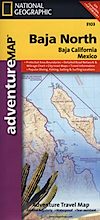
Baja MapsPlenty of great hiking and petroglyph canyons, cool pools and waterfalls, granite boulders, soothing warm waters & gorgeous desert scenery. Summers are usually roasting out here, so plan your vacation accordingly. Palalpas (built for shade) add to the charm & unique look. Each campsite is unique & has a different lay out. Reservations are recommended.

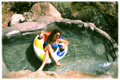
A family run set of campgrounds within a steep palm canyon. Hot Springs are piped to individual pools at each campsite for a maximum of privacy. A cold creek runs through the canyon as well, feeding the palm grove below & waterfalls way up canyon. A desert oasis set upon the slopes of the Sierra Juarez Mountains in Baja.

getting there is a journey –

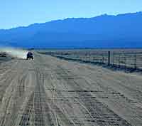
Recommended high clearance vehicle, sport utility vehicle, or truck. The last 35 miles of the trip is through rough & rugged sandy roads.

nearest towns –

Guided tours to Guadalupe Canyon can be booked thru Baja Trek. We are no longer offering Baja California trips with Total Escape Adventures

Baja hot spring photos from Total Escape Adventures trips –
FEB 2000
NOV 2000
APR 2001
NOV 2001
NOV 2002

Lazy Afternoon in Baja

Pool Reflections 5