Tag Archives: RV camping

What is Camping?

Old Timers Berry Creek

Basically, what is Camping?

4x4 camping RV camping car camping primitive camping backpacking cabin camping

BLM camping State Park camping National Forest campgrounds National Park camping


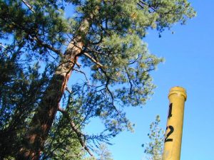
An overnight stay out-of-doors. Sleeping out under the stars.
Air bed, camping cot, tent… or just a tarp on the ground.
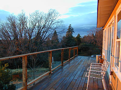
Perhaps a luxury Cabin Rental in the mountains or on the coast. Your choice.

stars camptruck campfire

campFrom a luxurious cabin in the mountains, to a small clearing in near a meadow with a stream nearby – with just a backpack, the idea of “camping” is always a bit different for each person. Roughin’ it for free – in the wilderness, or on the back roads; Or pay dearly for the price of real amenities, while on vacation.

car camping

Various types of Camping in California:

type of
camping
average
cost per night
brief description – what to expect
modern cabin $300 – $600 better than a hotel room, full kitchen, phone, internet, TV, real furniture and maybe a hot tub
rustic cabin $90 – $299 bare minimum, beds, kitchen sink, electricity. maybe a bathroom
tent cabins / yurts $60- $150 wood floors, canvas walls, sleeping cots. reservations accepted. (very popular) may be open seasonally
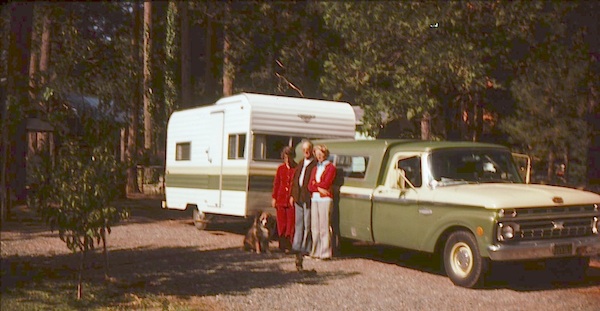
camper vans, motorhome,
recreational vehicle
rentals, or own it all creature comforts on wheels, lots of luxury. camp the back roads.
camper shell own it mini motorhome on the back end of a pickup truck. smaller than RV
RV campground $35- $80 50+ sites, lots of facilities & families w/ RVs. reservations accepted
developed campground $20- $50 usually 30 – 100 sites, paved loop, facilities. toilets, piped water. plenty in our camping section (most popular)
small campground $12- $27 less than 25 camp sites, pit/vault toilets. plenty small campgrounds listed in our camping section
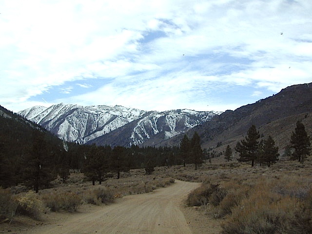
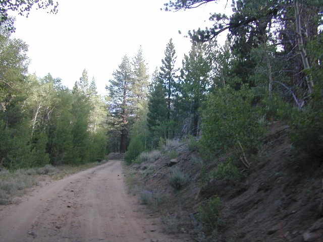
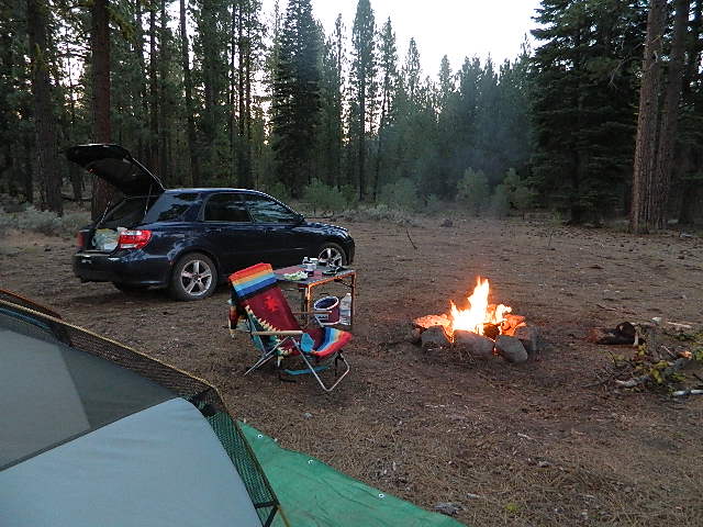
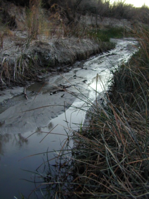
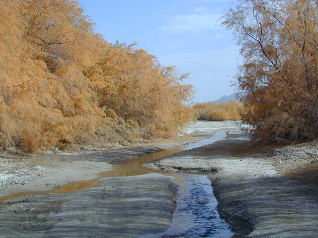
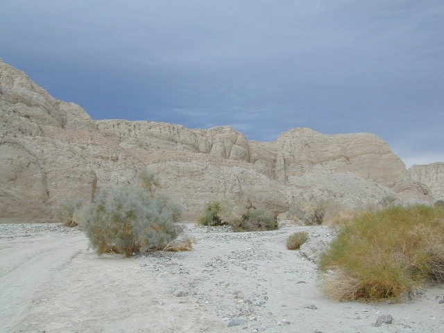
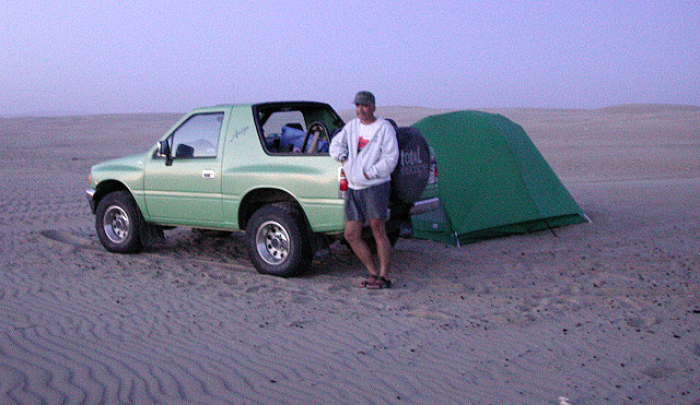
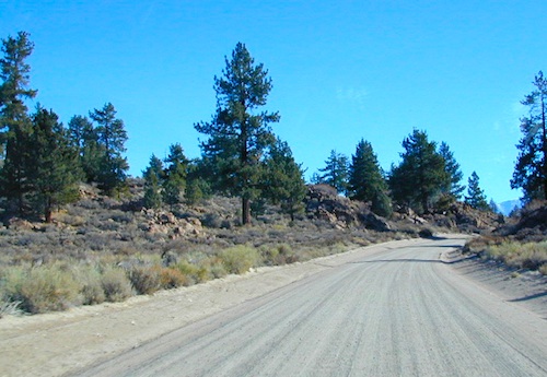
primitive car camping free way-out-there camp spots w/ dispersed camp sites, for the rugged self-contained, self-sufficient camper; access usually via dirt back roads.
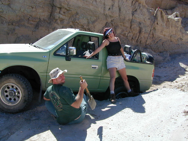
SUV/ 4×4 camping free remote spots on long, steep, bumpy dirt roads; dispersed camp sites in secluded areas. 4 wheel drive may be needed
walk-in campsites
bike-in campsites
low cost or free camp sites that require you to physically haul your camp gear from a parking area to the camp spot, ranging from 1/8 mi. walk to a 1-3 mile hike
backpacking free w/ wilderness permit ultimate in seclusion, bring it all on your back, on foot into the wilderness & enjoy trail camps

  pinetree    fish

River Beach Campground
Trinity River Camping, Douglas City, CA

yellowpost

SO CAL CAMP FIRES – Yellow Post Campsites are remote camping spots in secluded areas, in a designated fire safe clearing. Camp FiresNo facilities such as toilets or showers. Maybe a picnic table & fire rings, if you’re lucky. Southern California forests have these kinda spots. Required campfire permit & you must double check on local fire restrictions.

Tent Cabin Rentals

Canvas Tent Cabins & Yurts

These structures are half way between ‘roughing it in a tent on the ground’ & having a ‘mountain cabin’. Tent cabins have wooden floors w/ canvas walls and roof; Dismantled annually for winter rain/snow, they are usually only available in mild, coastal climates or during summer months in the mountains.

deluxe-tent-cabin
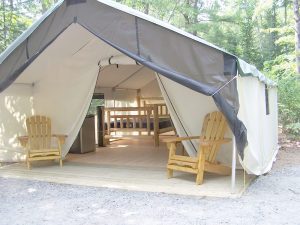
Rentals typically include sleeping cots, but you’ll need to bring your own bedding (sleeping bags, sheets, pillows). Some rentals include shaded porches, wooden decks, minimal furniture, kitchenettes and/or wood burning stoves. Electricity may be available, or maybe not. Ask ahead of time, if you really must have that particular luxury when on vacation.

Yurts are a ’round version’ of this canvas cabin – which need to be aired out, often (to prevent mold). Yurt rentals are very popular and in high demand in California.

Find these type of rentals at yoga retreats, hot springs, beach canyons, remote lakes, redwood forests, high sierra camps, fishing camps and at certain RV parks.

National Forest Service Rangers wildlife

Deck w/ View

National Forest Fire Lookouts
& Historic Cabins

hiker

Tent Camp Yosemite Valley

Camping California Back Roads


Vallecito – Anza Borrego

Vallecito Park, San Diego Desert

Anza Borrego Desert

Great Overland Stagecoach Route of 1849

East San Diego County Road S2 winds thru the lower passes & washes of Anza Borrego Desert State Park. On the edge of the State Park boundary Vallecito is a small campground & park, but it was a stage coach route in the 1800’s.

California Historic Marker #304

Vallecito

VALLECITO STAGE STOP – A 1934 reconstruction of Vallecito Stage Station (originally built in 1852) on the eastern slopes of the mountains in the high desert. A super important stop on the first official transcontinental route, serving ‘The Jackass Mail‘, the Butterfield Overland Stage Line, and the southern emigrant caravans.

backpacking, birdwatching, camping, cycling, hiking, mountain biking, off roading, stargazing, wildflowers

camp


Vallecito Campground
elev. 1555′
camp sites: 44
overnight fee
first come, first serve
reservations accepted
Campfire pits, picnic tables, bathrooms, & historic buildings; 22 sites are tents only. RV 40′ limit; Additional 8 equestrian campsites w/ corrals. No RV hookups, no dump station. No piped water. No gasoline, no store, no amenities. No firewood, no collecting of firewood. No shade trees, just tall desert brush. Arrive adequately prepared for real desert roughin it.

RV

Vallecito Stage Station County Park
760-765-1188
37349 Great Southern Overland Stage Route
County Road S2 @ mile marker 34.7
About 3.5 mi NW of Agua Caliente Hot Springs

Closed during the hottest months of summer: JUNE-AUG. Open seasonally: Labor Day weekend through the fall, winter and spring, up until the last week in May. 

camptruck

see also – Oriflamme Canyon / Mason Valley Truck Trail

muck to stagecoachA neighboring and very rural stage coach stop is further down a long wash, to the south east. Getting there usually requires 4×4, since you must ford a muddy desert wash w/ creek & deep holes. There are no signs out in this sandy desert wash, so you best have a good map and a compass.

The Old Carrizo Stage Station site is accessible by 4 different dirt roads (desert washes) way off the paved highway. None of these are well signed at the highway: Vallecito Creek, Willow Creek near Mountain Palm Springs, Carrizo Creek near Bow Willow, and Canyon sin Nombre.

Agua Caliente, Bow Willow Campground, Canebrake, Sweeney Pass,  the badlands overlook, mud caves and slot canyons are all located south of Vallecito. California SR 78 and Blair Valley are north of Vallecito.

Vallecito Creek

San Diego Desert MapVallecito is located at the apex of the gap in the Carrizo Badlands created by Carrizo Creek and its wash in its lower reach, to which Vallecito Creek is a tributary. Once a seasonal village of the native Kumeyaay people, on a trail across the desert from the Colorado River, this oasis, became a crucial stopping place for Spanish and then Mexican travelers to recover from the desert crossing between Sonora and New Mexico to California. The non native settlement of the site began in 1850, as a camp with a one room sod warehouse as the U.S. Army Depot Vallecito for the supply of Fort Yuma. It was later increased in size and became a store, a stage station, and a ranch house. read more on wiki

find maps for this desert region –

Anza Borrego Desert Map

San Diego Backcountry Map

Cleveland National Forest Atlas

dark skies anza

califrepublic

Another Vallecito, California?

Yep! Small community of about 400 folks in the western Sierra Nevada  foothills. Gold Rush Country, mining region. Up off the Historic 49 and it used to be called Murphy’s Old Diggings.

see Gold Country Maps

Pismo Camping

Pismo Beach Camping – Oceano Dunes SVRA (Pismo Dunes)

This might be the only place on the entire California coast where you can take your vehicle on the sand. Drive on the beach!

RV Camping
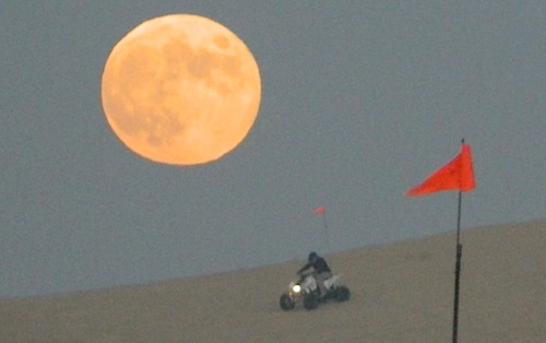
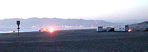
Open dispersed camping is available along Oceano Beach. Watch the high tide line and set camp well beyond that mark. A typical weekend is busy year round. Sand rails, quads, the beefy family SUV, or the ‘garage queen’ trucks. With all these motorized toys, you’re thinking either – yeah, or no way. Option B is listed below.

SAND DUNES
Off-Road playground, Oceano Park is also referred to as Pismo Dunes.

San Luis Obispo: SLO is north of Pismo a few miles. North of Avila Hot Springs. Other amazing parks include – Montana de Oro & Morro Bay.

DSCN1054

Oceano Dunes Camping open camping

Oceano State Vehicle Recreation Area has open camping on the beach, with a toilet within walking distance. No tables, no fire rings or paved anything! This is where all the big boys with the big toys like to hang out. Toy box trailers, bon fires, crowds & exhaust fumes. This crew can be seen each weekend driving Hwy 166, over to Bako.

Option B:

a large 82 site coastal campground is better suited for RVers & tourists wanting to avoid dune buggies. Horseback riding, beach, bike trails, laundry, market, shops & restaurants all close by. State Park Campground within walking distance to downtown Pismo & the Pismo pier.

Pismo State Beach State Park

Pismo State Beach Campground camp

more Pismo camp options:

Coastal Dunes RV Park RV Parks Pismo

La Sage Riviera RV Campground RV Parks Pismo
319 North Highway 1, Pismo Beach

Oceano County Campground
Oceano, CA

Pismo Coast Village RV Resort RV Parks Pismo
Pismo Beach, CA

Lake Lopez, inland
Arroyo Grande, CA

beach camps

nearby cities include:

pismo dunes

see also – Rock Front Ranch

Central Valley CA

happyvalleycow
Happy Valley Cow

The Great Central Valley of California – the San Joaquin Valley (on the south side) & the Sacramento Valley (on the north) together make up some of the most fertile farmland on the whole West Coast. Agriculture thrives, water flows & smog settles.

This huge valley, bordered by the Pacific Ocean on the west & the Sierra Nevada mountain range on the east side, is the one of the biggest farm land regions of the U.S. The food that feeds the world is grown right here in the Center of California. Vegetables, rice, fruits, citrus, garlic, onions, nuts, you name it.

redlettuce

Central Valley residents can easily enjoy fresh produce year round. Centrally located they can access the neighboring Central Coast, Historic Gold Country, and the Sierra Nevada mountains, plus The City (San Francisco) is not too far away either.

Since the capital city of Sacto has a “port of entry”, the California Delta & surrounding waterways, make for excellent fishing, boating & camping.

Unfortunately this low lying area is one of the worse smog basins on the west coast. The upper & lower Central Valley see the worst of it, as wind pushes the emissions right up against the mountains. Triple digit temperatures are common throughout the summer months. The super heat just magnifies the poor quality of air.

cauliflower

California Country – CA Countryside Communities

California Central Valley Map

Counties, Cities & Towns of the San Joaquin Valley:
(south to north)

Kern County
Tulare County
Kings County
Madera County
Fresno County
Merced County
Stanislaus County
San Joaquin County
Solano County
Sacramento County
Yuba County
Sutter County
Yolo County
Colusa County
Glenn County
Butte County
Tehama County
Shasta County

Reservoirs

blue links lead to more info on camp services. camp RV Camping

Central Valley Parks & points of interest:

Henry W Coe State Park
George J. Hatfield State Recreation Area
Carnegie SVRA
Dos Reis County Park, San Joaquin River
San Juan Bautista State Historical Park
Hollister Hills OHV Park
Pinnacles National Monument
Hernandez Reservoir
Los Banos Creek Reservoir
Caswell Memorial State Park
Colonel Allensworth State Historic Park
Codorniz CampgroundEastman Lake
Kern National Wildlife Reserve
Kesterson National Wildlife Reserve
San Luis National Wildlife Reserve
Merced National Wildlife Reserve
Modesto Reservoir Regional Park
Honey Run Covered Bridge
Oroville Wildlife Area
Spenceville Wildlife Management & Recreation Area
Lake Oroville State Recreation Area
Mount Diablo State Park
Auburn State Recreation Area
Sherman Island Waterfowl Management Area
Grizzly Island Waterfowl Management Area
Cache Creek
Sutter National Wildlife Reserve
Gray Lodge Wildlife Area
Colusa Sacramento River State Recreation Area
Colusa National Wildlife Reserve
Delevan National Wildlife Reserve
Sacramento National Wildlife Reserve
Mill Creek Wilderness
Ishi Wilderness
Tehama State Wildlife Area
Red Bluff Recreation Area
Shasta-Trinity NRA
Whiskeytown Reservoir NRA

California Central Valley Lakes & Reservoirs

walk in camps

for more lakes in California, check the BIG LAKES LIST

Dirt Roads Map

California back roads are plentiful, beautiful and exquisitely wonderful – if you know where to look.

Off Road typically means “off the pavement”

graded dirt road

PLUMAS_i

While many argue the phrase “off-road” means only hard core 4×4 routes, rock crawling or rally racing, here at Total Escape, any road that is not paved is a dirt road and “off road” to us, and always well worth exploring. Graded dirt roads, gravel roads, access roads, washboard routes, forest roads, fire roads, secondary roads, desert washes, one laners, single tracks, OHV trails – can all be dirt roads.

Whether or not your vehicle can handle them is your decision, but believe me, you do NOT need a modified Jeep to start your adventuring. Most dirt roads can easily be accessed with a normal passenger car – if you pay close attention to terrain, deep mud ruts and the rocks in the road.

stuck

Vehicle clearance is usually the first thing that will have you hesitating. If you own a truck or SUV – this is enough to be considered a “high clearance vehicle” and good to go on 90% of dirt roads in Cali. Many dirt roads will become 4×4 required or recommended when mud or snow are present, and no signs to warn you, so always check the weather forecast in advance. And most importantly, BRING A REAL MAP.

Paper Maps vs. Online Maps

Driving on Interstates and state highways is one thing, exploring and discovering new routes and real sightseeing is another animal all together. Go prepared to be delayed: to stop and sit, to listen to the wind, to picnic outside, to watch the weather change, photograph the clouds forming above your head, enjoy the process. Remember the journey: Half the fun is getting there!

ELDORADO_iIf you’ve ever tried to travel across the state with a GoogleMap, YahooMap or MapQuest one page printout, you will soon realize the limitations. Stuck in a small town called Julian, at night, on Christmas Eve, arguing with your partner, trying to find your way over to Interstate 10. Not a good plan! A statewide atlas will save you from many unexpected route changes, as well as prove to be an invaluable tool while traveling. Free as a bird, ready to explore the open road and well prepared is the key to less stress in route.

Exploring California

Know your vehicle limitations, and if in doubt, pull over, get out and look. Examine the ruts, the mud depth, the height of the rocks. Sometimes a good camp site is dependent on how far up that dirt road you can drive. RV campers like to stick to the wider, graded dirt roads and plenty can be found on typical topo maps. Tom Harrison, National Geographic & National Forest maps all have dirt roads as well as trails, trailheads, campgrounds listed.

Nearly every map sold on Total Escape has dirt roads noted:

  • US National Forest Maps have all the main routes, the dirt roads and some main hiking trails. Trailheads, ranger stations and campgrounds are well marked.
  • CA Wilderness Map collection have the topographical features you will need to hike the region, peaks, streams, and all dirt roads leading up to the trail heads. Nearby campgrounds will be shown. Equestrian (horse back riding) is okay, but no mountain biking is allowed inside these Wilderness Areas.
  • OHV Routes & Maps will display the “off highway vehicle” routes, which include single tracks for dirt bikes/motorcycles, wider routes for quads and all roads rated for 4×4 only use. Several selected maps will also show hiking biking and equestrian routes.
  • Recreation Maps can feature various types of activities all on one map, from off-roading to snowmobiling, river rafting to waterfalls. These maps cover a smaller area or popular region to enjoy.

dirtroad primtive

dirt roads lead to:

canyons
caves
creeks
dirt bike trails
fire lookouts
fishing holes
forests
groves
hiking trails
horseback trails
hot springs
meadows
mountain biking trails
mountain peaks
off-road trails
petroglyphs
picnic sites
ranches
rafting spots
rivers
scenic viewpoints
secluded campsites
small campgrounds
swimming holes
trailheads
waterfalls
wildflowers

log cabin mine road

‘FROADERS: see also –

California Off Road Areas

California 4×4 Trails

California Off Road Maps

Off-Road Maps PDF