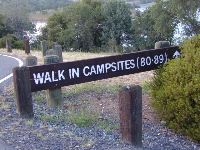
Tag Archives: State Parks

Walk-In Camp Sites

MIneral KIng Walkin Camps

Walk-In Camps

Below are developed campgrounds in California that have walk-in camp spots available. Vehicles are parked and you must carry your gear into the camp site (usually a short distance, but can be up to a half mile).

California Campgrounds with more than a 1-mile trek are not included in this list below. Areas such as – Catalina Island, Crystal Cove SP, Angel Island SP, Point Reyes National Seashore, indeed have many hike-to camps, but most are measured in miles (one way).

walk in campsites are perfect for –

  • people who wish not to see cars @ camp
  • people who prefer less noise while camping
  • physically fit folks, who want exercise
  • backpackers, who plan to hit the trails soon
  • avid hikers, who may be out day hiking
  • cyclists, just passing through
  • mountain bike campers
  • one nighters, travelers who only stay one night
  • late comers to the campground

    (hint: these are usually the last campsites to fill up)

NewMelones WalkIn Camps

camp
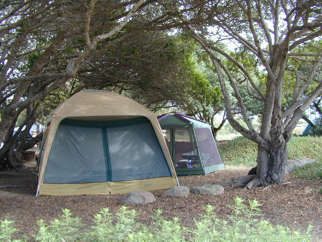
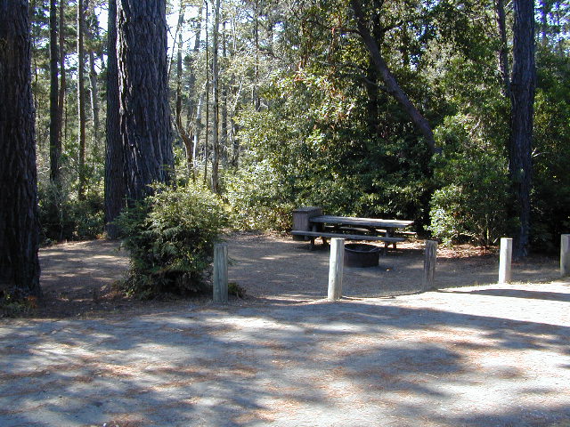
Walk in campsites are often located away from car campers & RVs. Some camp sites may have more privacy, tucked away in trees, while others have shared community area with fire pits and/or barbecues. All camp sites will have picnic tables and a some kinda toilet nearby. Bear boxes may be available for storing food properly. Sharing these food storage boxes with neighboring campers is common practice.

Campgrounds with walk-in sites range in elevation from sea level marshlands to high altitude alpine lakes. Most of these camps listed below are located inside developed campgrounds with overnight fees. Many are small campgrounds, while others are large hubs of activity. Some may be smaller campgrounds, with just a few camp sites. The most popular places can be reserved, with the links provided.

Many parks can also have day use fees, so know where you park and what time span is allowed. Ask the campground host if needing assistance. Some campgrounds lock their gates at sunset and do not permit entry at night. Others may not allow campers to check in anytime after sundown. Know their rules before you make reservations.

hikerIf you plan on not making camp reservations; make sure to have a plan B or C choice camp – in case your desired campground is already full. Many popular destinations can fill up fast (by noon in the summer).

spacious camps
Spacious Camp @ Aspen Grove Campground, Eagle Lake, CA

Walk In Camps in California

hikes campmtb

Andrew Molera State Park, Beach access, North Big Sur Coast
Anthony Chabot Regional Park, East Bay San Francisco
Aspen Grove Campground, Eagle Lake, CA
Austin Creek SRA, Armstrong Redwoods, Guerneville CA
Azalea Cove Campground, Union Valley Reservoir

Bear Campground, North Angeles National Forest
Big Basin Redwoods State Park, Santa Cruz Mountains
Black Rock Campground, Little Grass Valley Reservoir
Blue Lake Campground, PG&E 4×4 @ i80 Donner Pass, Truckee, CA
Boise Creek Campground, Six River National Forest
Bottchers Gap Campground, North Big Sur Mountains
Butano State Park, Pescadero, Santa Cruz Mountains
Butler Creek Camp, Prairie Creek Redwood SP

Carr Campground, i80 Donner Pass, Truckee, CA
Cherry Hill Campground, Butte Creek, Lassen National Forest
Chilcoot Campground, Frenchman Lake, Plumas NF
China Camp State Park, SF @ San Pablo Bay, San Rafael
Chula Vista Campground @ Mount Pinos, Los Padres NF mtb
Clear Lake State Park, North Wine Country, Kelseyville CA
Cold Springs Campground
,
Mineral King @ Sequoia NP
Cool Springs CampgroundPG&E Camp, Butt Valley Reservoirhike
Cottonwood Pass / Cottonwood Lakes
on Horseshoe Meadow Rd, PCT Eastern Sierra @ Lone Pine

coolsprings

Dark Day Campground, New Bullards Bar Reservoir, N Sierra
Donner Memorial State Park, Interstate 80 @ Truckee CA

Dry Lagoon Walk-In, Humboldt Lagoons State Park
Dry Gulch Campground, Sierra NF @ El Portal
18 mi from Yosemite Valley

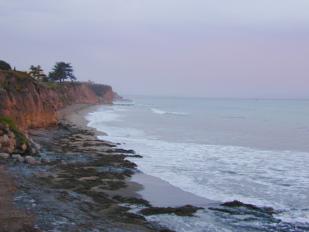
El Capitan State Beach, North Santa Barbara Coast

Gaviota State Park Campground, North Santa Barbara Coast
Glory Hole Campground @ New Melones Reservoir, Gold Co
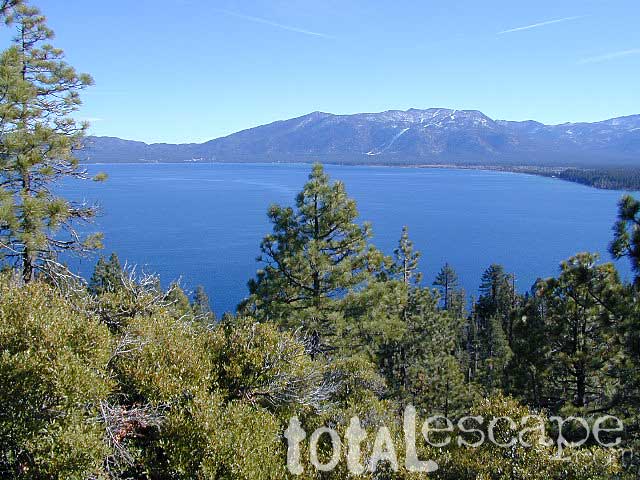
Granite Flat Campground, Truckee River @ Lake Tahoe
Gualala Point Park, 6 sites @ Gualala River, Sonoma Co Park

Half Moon Bay State Beach Campground, Half Moon Bay

Headquarters Campground, Salton Sea SRA @ Mecca CA
Henry W Coe State Park, Santa Cruz Mountains
(wilderness permits required)

Horseshoe Meadow, Cottonwood Pass trailhead, Inyo NF

Intake Campground, Bishop Creek, Eastern Sierra

Jackson Flat Walk-In Camp PCT @ Angeles NF
Jedediah Smith Redwoods State Park Campground, NorCal
Julia Pfeiffer Burns State Park, Big Sur Coast

Kidd Lake Group Campground, PG&E @ i80 Donner Pass, Truckee, CA Kayak, canoe, hike-in camp sites

Kirby Cove @ Golden Gate National Recreation Area
5 tent camp sites on a bluff over the mouth of San Francisco Bay; reservations required

Klamath National Forest –
small campsites on a river

Lassen National Park – Southwest Campground 6700′ elev.
Liberty Glen Campground @ Lake Sonoma Recreation Area
Limekiln State Park Campground, Hwy 1 Big Sur Coastline
Lone Rock Campground @ Union Valley Reservoir

MacKerricher State Park Campground, Mendocino Coast
Macumber Reservoir,
PG&E Camp, West of Lassen NPfishing
Manresa State Beach Campground
, Monterey Bay
Marmot Rock Walk-In Camp, Courtright Reservoir
Mary Smith Campground
@ Lewiston Lake, Trinity River

McCabe Flat Campground BLM @ Merced River Yosemiteblm camps
Merced Recreation Area, Merced River, Mariposa CA
3 small, developed campgrounds on dirt road
Briceburg, Yosemite Hwy 140

Mesa Campground, Silverwood Lake SRA, Cajon Pass (I-15)
Mill Creek Campground @ Bucks Lake, Plumas NF
Mill Creek Campground, Del Norte Coast Redwoods SP
Montana de Oro State Park, Morro Bay, San Luis Obispo mtb
Mosquito Flat Trailhead Camp, One night limit! Camp is for backpackers heading into back country at the end of Rock Creek Road, Inyo NF hike

Niagra Creek Campground, OHV 4×4 trails, Stanislaus NF
North Battle Creek Reservoir
PG&E Camp, West of Lassen
North Grove Campground, Calaveras Big Trees State Park

Oak Bottom Campground

Oak Bottom Campground @ Whiskeytown Reservoir NRA
(*wildfire 2018)

Onion Valley CA

Onion Valley Campground, Eastern Sierra @ Independence, CAhike

Pantoll Campground, Mount Tamalpais State Park, Marin
Pfeiffer Big Sur State Park Campground, Big Sur Coast
Pigeon Flat Campground, Stanislaus River, Dardanelle CA
Pomo Canyon Walk-In Camp, Sonoma Coast State Beach
Portola Redwoods State Park, Santa Cruz Mountains
hikePrather Meadows Camp, Bunny Flat @ Mount Shasta
Providence Mountains SRA @ Mitchell Cavern, Mojave

Railroad Flat Campground BLM  @ Merced River
Briceburg Yosemite Hwy 140blm camps

Redwood National Park, NorCal Coast
(no reservations, no fees. open all year) NPS

  • Flint Ridge Walk-In
  • Nickel Creek Walk-In
chulavistacamp
CHULA VISTA CAMPGROUND – Wild Iris Meadow at Mount Pinos

Refugio State Beach, North Santa Barbara Coast
Rock Creek Campground
, Eel River @ Standish-Hickey SRA
Roxie Peconom Campground, Bizz Johnson Trail, W Susanville mtb
Rucker Lake Campground, PG&E @ i80 Donner Pass, Truckee, CA
Russian Gulch State Park Campground, Mendocino Coast

shadycamp
Roxie Peconom Susanville, CA

San Clemente State Beach, Orange County Coast
Sanborn Campground, Skyline County Park, Saratoga CA
Sand Flat Campground, Clark Fork, Carson Icerberg Wilderness
Sawmill Walk-In Campground, 9800′ elev @ Tioga Pass, E Yosemite
Silver Creek Campground, Truckee River @ Tahoe
Southfork Recreation Camp
, south shore @ Lake Isabella, CA

Southwest Walk-In Camp, 6700′ elev @ Lassen Volcanic NP
Squaw Leap Campground, San Joaquin River, Auberry CA
Stillwater Cove Regional Park, N of Fort Ross, Sonoma Coast

Table Mountain Group Camp, Bishop Creek Canyon, Inyo NF

Tahoe National Forest
Donner Area Camping Lakes

NFS 530-265-4531

  • Carr Lake Campground
    10 miles north of Highway 20
    6,700′ elev
    5 walk-in campsites
  • Rucker Lake Campground
    6 miles north of Highway 20
    5,462′ elev
    7 walk-in campsites
  • Sterling Lake Campground
    9 miles north of Interstate 80
    7,000′ elev
    6 walk-in campsites

Toad Lake Walk In Camp, PCT @ Shasta National Forest
Tuolumne Meadows Camp, Yosemite National Park
(reservations & wilderness permits required)

Union Reservoir Walk In Camps, Arnold CA

Union Valley Reservoir – Eldorado National Forest

  • Azalea Cove Campground
  • Fashoda Campground

Van Damme Redwoods State Park, Mendocino Coast

Walker Pass Campground, PCT, East of Lake Isabella CA
Whitney Portal Trailhead Camp, Mount Whitney, Eastern Sierra

Willow Placer Campground BLM, Merced River Recreation Area
Briceburg Yosemite Hwy 140
Woodside Campground, Salt Point State Park, Sonoma Coast

OnionValleyWalkIns

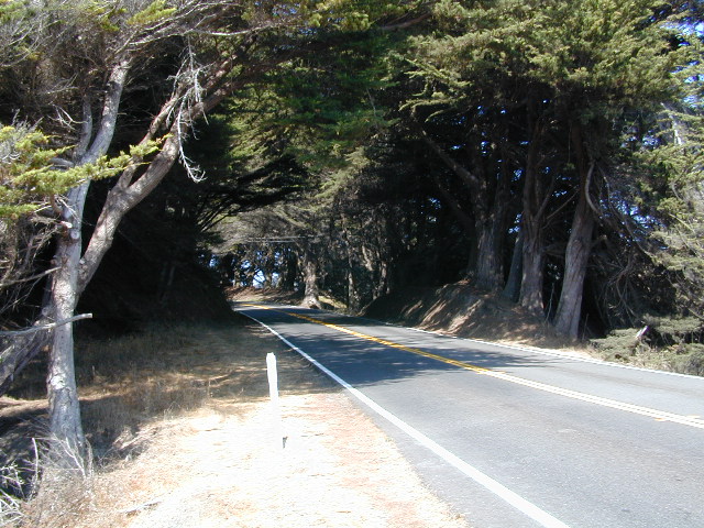
Walk in campgrounds are considered ‘tent camping‘, as opposed to ‘car camping‘, which is literally camping next to your vehicle. This type of hike-in camping may also be referred to as ‘trailhead camping‘, as many ideal hikes begin at these prime locations. Boat-in, bike-in or hike-in camp sites are also available at some of these locations.

Grover Hot Springs

Grover Drive

Grover Hot Springs Park

JULY 2021 State Park CLOSED due to the wildfire, Tamarack Fire.

California State Park
Sierra Hot Spring Camping Resort
open all year

California State Park RV Winter Camping State Park Winter Camping Hot Springs XC Ski Winter Camping Tahoe Ski Camping Tahoe Snow Camping

Meadow Entrance

South of Lake Tahoe, hidden in a forest meadow near the small town of Markleeville, sits this super scenic, year-round camping resort in the Sierra Nevada mountains. Popular place for senior travelers, RV campers, families, snow skiers, and tourists.

No lodging available, no cabins. Only Campground Camping – Reservations are recommended. This is a popular destination for the Eastern Sierra Tahoe region. May thru September are peak season. During mid-winter a portion of the campsites are closed and the remainder may be on a first come, first serve basis. State Park is located 4 miles west of Markleeville, at the end of Hot Springs Road.

camping
fishing
hiking
hot springs
cross country skiing
stargazing

RV Camping

grover springs in the sierra

Camping and Day Use
530-694-2248

Pool Information
530-694-2249

California State Park

Piped water, flush toilets, showers, this is luxury camping by State Park standards. Hiking, fishing, stargazing. Quite an ideal spot, especially if you visit during a slow time. Surrounded by mountains that top 10,000′ elevation, expect to see some snow in the winter months.

SwimSuits Required

The hot pool resort is open to the public for day soaking w/ a fee. Wheelchair accessible areas. The pool hours tend to fluctuate with the seasons, so be prepared for anything. Even a snow storm!

Grover Hot Spring Campground

• Elevation: 5800′
• Number of Sites: 75
• Vehicle Access: RV 27′ max
• Campsites Reservation: Yes
• Camp Fee: Yes
• Length of Stay: 10 Days
• Season: Open all year
• Trailheads: Carson River

GROVER HOT SPRINGS SP Winter Camping Hot Springs

pool hours

hot pools

meadow views

Your Public Lands

west coast public land

Access to wild land, open spaces, parks, forests, lakes, mountain peaks, public land – USDA National Forests, National Parks, State Parks, BLM. There is more public land available in the west half of the U.S., than anywhere else in the nation. This is one of the top reasons people relocate to the West Coast.

California’s Public Lands for Recreation

Federal lands, government managed parks, USDA National Forests, National Parks, National Wildlife Refuge, BLM, State Parks, State Forests, County Parks, Regional Open Spaces

containfire

Campfire Restrictions in California

Sierra Rivers

State Park / National Park / National Forest / BLM / SHP / SVRA / OHV
what’s the difference?
a simple explanation of your public lands & what you can expect to do on them

National Forest Campground
NPS

California National Parks – most National Parks are so crowded you can’t even enjoy the experience in the summer time. Try the off-season times for your best stay. Neighboring National Forests are a much better bet for abundant space, privacy & less taxing on the wallet for fees. These popular (NPS) parks are subject to federal budget cuts and closures.

NF boundary

NFS

California National Forests – protected wilderness areas throughout state are surrounded by National Forests (NFS), and most National Parks (NPS) are surrounded by National Forests. Tons of small campgrounds & primitive spots for real seclusion. Get a free fire permit & camp almost anywhere you want. Use that SUV exploring the many dirt backroads & find that perfect camp spot (for free).

California State Parks

California State Parks – local California parks with a lot to offer the day hikers, picnicking family, tent camper or RV camper. From warm dry deserts soaking in a hot springs to the foggy coastal redwoods, these state run parks encompass a large section of California terrain. These parks are subject to state budget cuts and closures.

BLMBLM: Bureau of Land Management – mostly desert regions on the east side of California. A few coastal redwoods, some river canyons in the Sierra Nevada, many off road areas (OHV) in various mountain ranges. These federal lands are open spaces, generally a free for all on recreation.  Allowable = off roading, target shooting, open camping, campfires, bonfires. Geared toward OHV use, RVs and hunting.

Fire Safe Spot

All California Parks & Forests

hikes

California Lakes List

lake

California Topo Maps

topo maps

rangers

California Terrain & Destinations

  • Coastal California – Southern California beach camping is crowded & sparse, because of developed cities. Central Coast & Northern California offer many more choices in this category.
  • California Mountains – pine forest, mixed oaks & a variety of vegetation. Water sources such as lakes, stream & waterfalls make this choice the perfect camping spots. Granite peaks, high elevations wilderness areas throughout state & surrounded National Parks. Plenty backpacking options & dirt road primitive spots for the ultimate in privacy.
  • Countryside in California – coastal hills or mountain foothills. These rolling hillsides offer small creeks, oak trees & plenty of wide open spaces. Lakes & Reservoirs are located within these regions. Most campgrounds are fairly close driving distance to towns or cities. Wine country or gold country, California has it.
  • California Deserts – perfect for every season except summer, these vast spaces will humble just about anyone. Primitive camping galore & designated areas for real off-roading.
  • City CA / Urban Villages – not the best for really getting away from crowds, but can be an excellent opportunity to visit a city without spending big bucks on lodging. Or could just be a perfect one-nighter for getting familiar with camping. Most campsites are located in the foothill area behind suburbs, in county parks or even coastal.
  • California A to Z: Small Towns – 700 and counting; extensive list of destinations, focusing primarily on the back roads and outdoor recreation hubs
  • California by County – Find every county on Cali, and which towns are located inside of them

Yosemite Lake View Camp Sites

Hiking Trails Los Angeles

Los Angeles Hikes, Angeles National Forest, Angeles Crest, Baldy, Wrightwood, Palmdale, Tujunga, Frazier, and Malibu Coast

DSCN0048
You relocated to California for college or your career – and to enjoy the outdoors more, but you ended up in the Los Angeles Basin instead, breathing smog daily. You will need to escape – soon, for sanity sake.

check

Total Escape – this is your new favorite web site on California outdoors. Bookmark it dude. And be proud to love nature!

PCT hikes – Pacific Crest Trail
The world renowned  hiking trail that runs the entire length of the entire West Coast US. Canada to Baja, by way of Washington, Oregon and California – all on foot.

More PCT MAPS: Pacific Crest Trail Maps

Mount Pinos Recreation Area

Los Angeles Hiking Maps

th_angeles_d

Angeles Front Country
Angeles High Country
Angeles National Forest
Channel Islands Map
Cucamonga Wilderness
Dick Smith Wilderness
Joshua Tree Park Map
Los Padres National Forest Map
Malibu Creek Map
Mojave Preserve Map
Mount Baldy Map
Mount Wilson Trail Map
Pacific Crest Trail Maps
Point Mugu Map
San Bernardino National Forest Map
San Berdoo Mountains Maps
San Diego Backcountry Map
San Gorgonio Wilderness Map
San Jacinto Wilderness Map
Sespe Wilderness Map
Topanga Trail Map
Verdugo Mountains Trail Map
Zuma / Trancas Canyons Map

pinetree

And when you finally get bored with hiking only in Southern California, there’s a whole lot more California to explore – up state!

NORCAL – Well beyond San Francisco and Yosemite, there are meadows to be found. Seclusion and tranquility in nature, without the crowds. Too many dirt roads to drive and dozens of rivers to see. Waterfalls abound, with wildflowers and amazing scenery all around. Small towns to discover!

Fly fishing rivers, kayaking lakes, wineries, organic farms, geysers, volcanoes, caves, old bridges and so much more to find in NorCal.

DanaMite loves to cover the real nooks and crannies of California, just for you – right here on Total Escape.

hiker

Tahoe Camping

Lake Tahoe Campgrounds

tahoe camping

Lake Tahoe California
campOne of the most popular Sierra destinations – be it summer or winter, Tahoe sure is crowded these days.

Below are all the developed campgrounds surrounding beautiful Lake Tahoe, CA. Most of these are located near the lake or, on the Truckee River. Most accept campground reservations in advance. blue links lead to camp info

campground elev spots veg toilet water notes
Bayview Campground 6000′ 10 pines vault Emerald Bay, SLT
Camp Richardson Tahoe 6500′ 330 pines flush piped South Lake Tahoe
Campground by the Lake 6000′ 157 pines flush piped South Lake Tahoe
D.L. Bliss State Park 6000′ 168 pines flush piped Westshore, Lake Tahoe
Eagle Point Tahoe 6100′ 100 pines flush piped California State Park
Emerald Bay State Park 6000′ 16 pines flush piped South Lake Tahoe CA
Fallen Leaf Lake Campground 6737′ 205 pines flush piped South Lake Tahoe CA
General Creek Campground 6000′ 175 pines flush piped Westshore, Lake Tahoe
Kaspian Campground 5800′ 20 pines flush piped Westshore, Homewood CA
Lake Forest Campground 6300′ 21 pines flush piped Northshore, Tahoe Vista CA
Meeks Bay Campground 6000′ 17 pines flush piped Westshore, Tahoma CA
Mount Rose Campground 8500′ 24 pines flush piped in Nevada @ Tahoe
Nevada Beach Campground 6200′ 54 pines flush piped Nevada Lake Tahoe
Pope Beach Campground 6000′ 49 pines flush piped South Lake Tahoe CA
Sandy Beach Campground 6300′ 44 pines flush piped Northshore, Tahoe Vista CA
Silver Creek Campground 5800′ 26 pines vault piped Truckee River fishing
Sugar Pine Point SP 6200′ 30 pines flush piped Westshore, Tahoma CA
Tahoe Pines Campground 6000′ 49 pines flush piped Meyers California
Tahoe Valley RV Campground 6000′ 413 pines flush piped South Lake Tahoe CA
Tahoe Campground SRA 6200′ 16 pines flush piped West shore, Tahoe City
William Kent Campground 6300′ 95 pines flush piped Westshore, Tahoe City
Zephyr Cove Campground 6200′ 170 pines flush piped boat rentals Tahoe NV

All Tahoe Campgrounds charge a fee; Many require advanced reservations. Nightly rates vary per park. Most campgrounds are closed during the winter due to snow. Check with the ranger districts listed here.

camp RV camps NFS hikes fishing mountain biking camps river fishing

bowmanbig
Bowman Lake

Tahoe Forest

NFSlogoTahoe National Forest encompasses a larger region of the Sierra Nevada mountains surrounding the north portion of Lake Tahoe. American River, Yuba River, Northern Gold Country; Plus many small lakes with excellent forests, including Lakes Basin Recreation Area.

Blue Lakes has several campgrounds, south of South Lake Tahoe.

Grover Hot Springs State Park is also beyond SLT, near Markleeville.

Below are Tahoe Campgrounds located away from the Lake Tahoe Basin; Most small camps are on a first come, first serve basis. blue links lead to camp info.


campground elev. spots veg toilet water notes
Ahart Campground 5300′ 12 pines vault American River
Alpine Meadows 5900′ 25 pines vault Martis Creek
Bear Valley Campground 6600 10 pines vault piped OHV trails, Sierraville
Berger Campground 5900 7 pines vault lake Packer Lake, fishing
Big Reservoir Campground 4000 18 pines vault piped non motor lake, Foresthill
Boca Campground 5605′ 26 pines vault boat launch
Boca Rest Campground 5605′ 25 pines vault piped on Boca Reservoir
Boca Spring Campground 5800′ 17 pines vault piped horses
Bowman Lake 5585 7 pines vault lake Donner area
Boyington Mill Campground 5680′ 12 pines vault Boca Reservoir
Cal-Ida Campground 2000′ 21 pines vault piped Yuba River, Downieville
Canyon Creek Campground 6000′ 20 pines vault creek Donner area
Carlton Flat Campground 2200′ 21 pines vault piped Yuba River, Downieville
Carr Lake Campground 5900′ 5 pines vault lake Carr Feeley Lake
Chapman Creek Campground 6000′ 29 pines vault piped Yuba River
Chute Hill Campground 3400′ 30 pines flush piped Malakoff Diggins SP
Cold Creek Campground 5800′ 13 pines vault piped Sierraville
Cottonwood Campground 5600′ 24 pines vault piped Sierraville
Dark Day Campground 2200′ 16 oaks vault piped Bullards Bar Reservoir
Diablo Campground 5800′ 20 pines vault Gold Lake
Donner State Park Campground 5850′ 154 pines flush Donner Lake
East Meadow Campground 6100′ 46 pines flush piped Jackson Meadows Reservoir
Fiddle Creek Campground 2200′ 15 oaks vault piped Yuba River, Downieville
Findley Campground 6100′ 14 pines flush piped Jackson Mdws Res
Fir Top Campground 6100′ 12 pines vault flush Jackson Mdws Res
French Meadows Campground 5300′ 75 pines vault flush French Meadows Reservoir
Garden Point Campground 2000′ 19 variety vault fishing boats
Giant Gap Campground 3700′ 30 pines vault fishing boats
Goose Meadow Campground 5800′ 24 pines vault piped fish Donner
Grouse Ridge Campground 7400′ 9 pines vault Bowman Lake
Hampshire Rocks Campground 5800′ 31 pines vault piped fishing I-80
Independence Lake Campground 6900′ 20 pines vault piped fishing, Sagehen Forest
Indian Springs Campground 5600′ 35 pines vault piped fishing I-80
Indian Valley Campground 2200′ 17 pines vault piped Yuba River, Downieville
Jackson Creek Campground 5600′ 14 pines vault creek
Jackson Point Campground 6100′ 8 vault boat access Jackson Mdws Res
Lakeside Campground 5700′ 41 vault boat ramp Prosser Reservoir
Lake Spaulding Campground 5000′ 24 vault boat ramp PG&E Campground
Laiser Meadow Horse Camping 6200′ 11 vault piped High Sierra PCT access
Lewis Campground 5300′ 40 pines flush piped French Meadows Reservoir
Lindsey Lake Campground 5900′ 7 vault lake
Lodgepole Camping 5800′ 18 vault Lake Valley Reservoir
Loganville Campground 6000′ 29 vault piped Yuba River, Sierra City
Logger Campground 6000′ 252 pines flush piped Stampede Reservoir
Long Ravine Campground 2300′ 28 pines flush piped Rollins Reservoir
Lower Little Truckee 6000′ 15 vault piped Truckee River fishing
Madrone Cove Campground 2000′ 11 vault Bullards Bar Reservoir
Meadow Lake Campground 7200′ 15 vault Sierra fishing camp
Meadow Lake Shoreline 7200′ 10 vault High Sierra Nevada
Mumford Bar Campground 5300′ 5 vault Foresthill Road
North Fork Campground 4400′ 17 vault piped American River
Onion Valley Campground 2300′ 5 oaks vault Sierra fishing camp
Orchard Springs Campground 2300′ 15 oaks flush piped Rollins Reservoir, Colfax
Pack Saddle Campground 6000′ 15 pines vault pump Packer Lake
Parker Flat OHV Camping 3900′ 7 pines vault off roading trails
Pass Creek Campground 6100′ 30 pines flush piped Jackson Mdws Res
Peninsula Campground 2300′ 58 pines flush piped Rollins Reservoir
Pine Aire Campground 2700′ 75 pines flush piped South Yuba River Camp
Poppy Campground 5300′ 12 pines vault French Meadows Reservoir
Prosser Campground 5800′ 29 pines vault Prosser Res.
Ramshorn Campground 2600′ 16 pines vault piped Yuba River, Downieville
River Rest Campground 2700′ 105 pines flush piped South Yuba River Camp
Robinson Flat Campground 6800′ 5 pines vault well
Rocky Rest Campground 2300′ pines vault Yuba River, Downieville
Rucker Campground 5800′ 10 pines vault Rucker Lake fishing
Sagenhen Campground 6480′ 10 pines vault
Salmon Creek Campground 5800′ 32 pines vault fishing Lakes Basin Recr
Sardine Campground 5800′ 29 pines vault Sardine Lake fishing
Schoolhouse Campground 2200′ 56 oaks flush piped Bullards Bar Reservoir
Scott’s Flat Campground 3200′ 86 oaks flush piped Scotts Flat Reservoir
Shirttail Creek Campground 3700′ 30 pines vault Sugar Pine Reservoir
Sierra Campground 5600′ 16 pines vault Yuba River, Sierra City
Silver Creek Campground 5800′ 27 pines vault Truckee River fishing
Snag Lake Campground 6000′ 12 pines vault Gold Lake California
South Yuba Campground 2700′ 16 pines vault South Yuba River Camp
Sterling Lake Campground 6500′ 6 pines vault lake
Talbot Campground 5600′ 5 pines vault American River
Union Flat Campground 3400′ 11 pines vault piped Yuba River, Downieville
Upper Little Truckee Camp 6100′ 26 pines vault Truckee River fishing
Webber Lake Campground 6800′ 60 pines vault lake Sierra fishing
White Cloud Campground 4200′ 46 pines flush piped biking, Nevada City
White Rock Lake Camp 7800′ 8 pines none High Sierra Nevada
Wild Plum Campground 4400′ 47 pines vault piped waterfalls, Sierra City
Woodcamp Campground 6100′ 20 pines flush piped
Woodchuck Campground 6300′ 8 pines vault creek
Yuba Pass Campground 6700′ 12 pines vault piped Yuba Pass, Hwy 49
Sierra Buttes
The Sierra Buttes, Lakes Basin Recreation Area (Gold Lake Highway) 

towns surrounding Lake Tahoe

towns in the Tahoe region

Tahoe Views

Campgrounds Beach

California Campgrounds –
Camping at the Beach

Costal Cliffs

Autumn and Spring are often the best months to enjoy the (somewhat) uncrowded coastline of California. Kids are in school, summer vacation rush is over, and there is plenty of sunshine before those winter storms come rolling in.

reservations are highly recommended

Anything & any place along the coast is “much desired”, worthy of charging for. From seaside restaurants to convenient, paid parking lots – face it – California can be expensive.

Beach camping is no different. Coast camping in California is abundant, but state run campgrounds will run you a pretty penny. Camping fees are well above $20 per night. If you want flush toilets in the bathroom and a level, paved spot for a big RV, it will cost even more. Make sure to reserve a campsite as far ahead as possible. Ask about off-season months to visit.

Privately run campgrounds are often more expensive, but they might be a nicer facility and be in a better location. If you want free camping, then head to the northern part of the state – and take a dirt road to reach your seclusion. Both the Big Sur and Lost Coast both have excellent dispersed camping on backroads, at no charge, and a campfire permit is required for such camping.

Campgrounds situated on a sandy beach or right on a cliff edge overlooking the ocean. Private cove camp sites, tent cabin rentals, yurt resorts, RV campgrounds; Several coastal canyons (from sycamores to redwoods) usually have creeks and abundant camping options.

Pismo Clear Winter Day

Campgrounds Beach: a popular search phrase for camping near the coast in California. The best months to camp along the coast depends on what part of California you wish to visit – at what time of the year.

With 700 miles of ocean front there is a lot to choose from – RV parks w/ small marina, 4×4 camps, hike-in only sites, and plenty of California State Parks & Beaches.

Much of the coastal camping is NOT “on-the-sand” beach camping. Most of the coastline in California is rugged, some forested and usually full of ‘wildfire prone’ chaparral. Cliffside campgrounds, redwood canyons with creeks, green grassy lawns w/ shade trees and paved camp sites, US 101 busy, freeway campgrounds; all are close enough to the shore to be considered COASTAL camping.

Tents at Capinteria
Tents at Capinteria SB

Even in winter, the coast can be quite mild in Southern Cal, so the campgrounds are open all year long. NorCal Coast gets the brunt of WET & COLD winter weather, so those camps are open seasonally, during warmer, drier months (APRIL-OCT).

JUNE GLOOM is a cloud layer that covers the coastline in the early part of summer. Weather is warm to cool with clouds, or the weather can be bright and sunny – if the marine layer ‘burns off’ by mid-day. Consider these local weather patterns, May Gray & June Gloom, when planning a vacation to the beaches of California.

listed from south to north

Southern California Beach Camping

Coronado Island
San Diego Beach Camping
Encinitas
Carlsbad
Orange County Beach Camping
San Clemente
Dana Point
Laguna Beach

carpinteriabeach

carpfirewood

Los Angeles Beach Camping

Bolsa Chica State Beach
Capinteria SB
Doheny State Beach
Malibu Creek State Park
Ventura Coast Camping

Coast Campgrounds


Central Coast Beach Camping

Santa Barbara Beach Camping
Pismo Beach Camping
Morro Bay Camping
Big Sur Campground

marina

Monterey Bay Camping

Monterey Bay Camping
Half Moon Bay
Santa Cruz Camping
Santa Cruz Redwoods

Angel Island

San Francisco Camping

Point Reyes Camping
Marin Redwoods Camping
Sonoma Coast – Camping Jenner

Northern California Coast Camping

Mendocino Coast
Kings Range
Lost Coast: Shelter Cove
Usal Beach Campground
NorCal Redwoods Camping
Crescent City Camping

Stairwell to Beach


Borrego Campground


Camping Borrego

Anza Borrego Desert State Park & Borrego Springs Campgrounds

Anza Borrego Desert is the largest of the California State Parks. Borrego Palm Canyon Campground is the official name of this popular palm oasis & developed campground located very close to Borrego Springs CA. Hike or bike to town. There is also a private RV Park named Palm Canyon Resort in town, just to confuse you.

Desert wildflowers blooms, popular hiking & biking trails, plus mud caves & slot canyons draw plenty visitors here, mostly in the winter months. Summer high temps exceed 90 degrees for months at a time.
There are hundreds of miles of dirt roads to explore, and one could easily spend every weekend for a full year, checking out all there is to see in this vast desert, where elevations range from near sea level to 5000′ peaks.

Borrego Desert Campgrounds

Anza Borrego State Park Campgrounds calsp
760-767-5311, Anza Borrego Desert SP

BORREGO PALM CANYON CAMPGROUND
main campground near Visitors Center, in town Borrego Springs, CA
120 camp sites for tents & RVs, flush toilets, overnight / day use fees
reservations accepted

TAMARISK GROVE CAMPGROUND
27 camp sites, flush toilets, fee
on S-3 @ Highway 78 jct (closed June – Sept)
reservations accepted (Oct-May)

Vern Whitaker Horse Camp
equestrian campground w/ corrals, 10 camp sites, flush toilets
elev, 960′, located N of Borrego Springs, near scenic and rugged Coyote Canyon.
reservations accepted

Backcountry Campgrounds Anza

Arroyo Salado
16 miles east of Borrego Springs on County Road S-22

Blair Valley Camping Area
open car camping & RV spots, vault toilets
on SAN DIEGO County Rd S-2 near Highway 78 jct

Bow Willow Campground
elev, 950′, hwy access, 16 camp sites, pit toilets, overnight fee
near Sweeney Pass & badlands overlook; located on S-2, 9 miles N of Interstate 8

Canon Sin Nombre
off S-2 near Sweeney Pass; entrance near Badlands Overlook; slot canyon hikes

Coyote Canyon Camping
N of Borrego Springs via Di Giorgio Road
rugged backcountry dirt road, tent camping only
car camping near ocotillo gardens; 4×4 needed @ creek crossing & Sheep Canyon

Culp Valley Campgound
elev, 3400′, hwy access, 8 camp sites, pit toilets, free camp
located on S-22, atop Montezuma Grade

Culp Valley Boulders
elev, 3700′, dirt road access, primitive camp sites, free
located off S-22, 4×4 near Montezuma Grade

Fish Creek Campground
Hwy 78 near Ocotillo Wells & Split Mountain
elev, 280′, dirt road access, 8 camp sites, pit toilets, free camp
from hwy, go 12 milies south on Split Mountain Road

Yaqui Well
5 mi. south of Borrego Springs on County Road S-3 & right on Yaqui Pass Road, go 6 miles to camping area on right side

Yaqui Pass
5 mi. south of Borrego Springs on County Road S-3 & right on Yaqui Pass Road, go 4 miles to camping area on left side

culpvalleyOHV
Culp Valley trails, North Anza Borrego SP, SoCal Deserts

All Desert Campgrounds Nearby

AGUA CALIENTE HOT SPRINGS
(San Diego County Park)
88 camp sites for tents & RVs, flush toilets, overnight / day use fees, 760-765-1188
located on Co. Rd S-2, 22 miles N of Interstate 8 (closed June-Aug)

BOX CANYON RD Mecca, CA – in between Joshua Tree NP and Anza Borrego Desert
BLM camping in Box Canyon & Mecca Hills Wilderness Park

BUTTERFIELD RANCH RV PARK & HORSE CAMPGROUND
(Private Campground Resort)
located on S-2 between Highway 78 & Interstate 8

LEAPIN LIZARD RV RANCH
(Private Campground Resort)
85 acres, 60 camp sites
located on Split Mountain Road, Ocotillo Wells, CA

OCOTILLO WELLS SVRA
(State Vehicular Recreation Area)
elev. 160′, 4×4 and off road camp sites for trailers & RVs
no water, no hook-ups, pit toilets, no fees, 760-767-5391
located on Highway 78 (closed June-Sept)

PALM CANYON RV RESORT
(Private Campground Resort)
located in town, Borrego Springs, CA

SALTON SEA SRA
(State Recreation Area & Campground)
Mecca Beach, Corvina Beach, Salt Creek Campgrounds
located on Highway 111 on east side of inland sea

SLAB CITY @ SALTON SEA
old Camp Dunlap in California desert badlands
free & open RV camping near Salton Sea
located off Highway 111 on east side of inland sea

STAGECOACH RV PARK & HORSE CAMPGROUND
(Private Campground Resort)
located on S-2 near Highway 78 junction

TRUCKHAVEN HILLS
(OHV trails & camp spots)
elev. 300′, 4×4 and off road camp sites for car camping, touy hauler trailers & RVs
no water, no hook-ups, no fees,
located on S-22, East of Borrego Springs, CA

VALLECITO PARK
(San Diego County Park)
44 camp sites for tents & RVs, no hook-ups, toilets, overnight / day use fees, 760-765-1188
located on S-2, 22 miles N of Interstate 8 (closed June-Aug)

Mecca Hills
Mecca Hills BLM

Desert BLM Camping Spots

  • MECCA – BOX CANYON
  • OCOTILLO – FOSSIL SHELL CANYON
  • YUHA DESERT WILDERNESS – South of Interstate 8

Anza Borrego Desert State Park

camp

FREE CAMPING ANZA – Let us also remind you that this is the best place to camp in California for primitive car camping (camping outside of a developed campground). Open all year long – always! Super secluded, darkest skies, free and always located on the back roads. 4×4 is not required in all areas, so there are plenty of options. Blair Valley or Coyote Canyon Gardens are popular camp spots, but there are thousands of hidden canyons and washes in this giant State Park, just awaiting your tent. You’ll need a decent topographic map. For more info on free camping click here.

Anza wildflowers

San Diego County Road S-2 is the
Great Overland Stagecoach Route of 1849

Anza Borrego Wildflowers

Borrego 4×4 Trails & Camps

Carrizo Gorge Goat Trestle

Split Mountain Anza Borrego

Topo maps, wilderness hiking maps –

COOLNESS
Anza Borrego Desert Slot Canyons

nearby cities & towns:

California Covered Bridge

Covered Bridges of California

Oregon City Bridge
Oregon City Bridge, off Cherokee Rd, N Oroville, CA

Overland pioneers and miners flooded the Sierra Nevada mountains after 1848, when gold was discovered, transforming the natural landscape and native life of California – in horrendous ways. Industrius, eager and using the abundance of natural resources available to build homes, divert creeks, and construct a new way of life. Mining for precious metals was not a hobby, it was a ‘way of life’ for many who sought westward locales. Most traversed a continent on foot with covered wagons to get out here.

Many early bridges made of wood have disappeared in California. Historic places, such as these few wooden bridges of the West, need to be protected and preserved. So no carving your initials; spray paint (tagging), littering – nor bullet holes.

Felton Covered Bridge
Santa Cruz Mountains & Redwoods
Railway Train Rides
Felton, CA

Bridgeport Covered Bridge
(built in 1862)
South Fork of the Yuba River
Northern Gold Country Hwy 49
Nevada City & Downieville, CA

Honey Run Bridge
on Butte Creek @ Skyway
Historic Landmark from 1894
in between Chico & Paradise, CA

Knights Ferry BridgeState Park
State Historic Park

on Sacramento River
North of Sacramento, CA

oregoncitymarker

Oregon City Bridge
(see photo at top of page)
Oregon Gulch, North Lake Oroville
via Table Mountain @ Cherokee Road
North of Oroville CA

Oregon Covered Bridge
Middle Fork of the Yuba River
Northern Gold Country Hwy 49
in between Nevada City & Downieville, CA

Woodson Bridge SRAState Park
State Recreation Area

Woodson Bridge Campground Campgrounds
on Sacramento River, in betweenRV camping
Chico & Corning, CA

Honey Run Bridge
HoneyRun Bridge of Butte County, California

Volcanic Buttes of Chico
Volcanic Buttes of Chico California

Pismo Camping

Pismo Beach Camping – Oceano Dunes SVRA (Pismo Dunes)

This might be the only place on the entire California coast where you can take your vehicle on the sand. Drive on the beach!

RV Camping
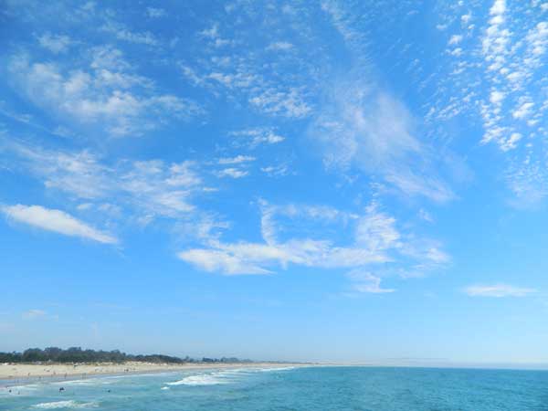
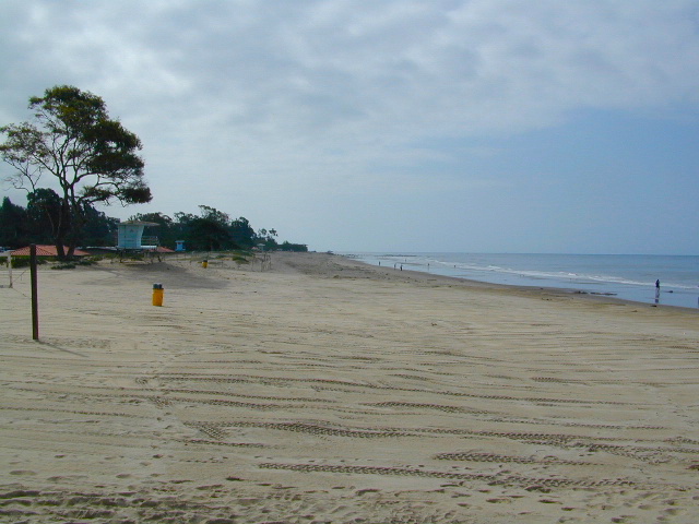
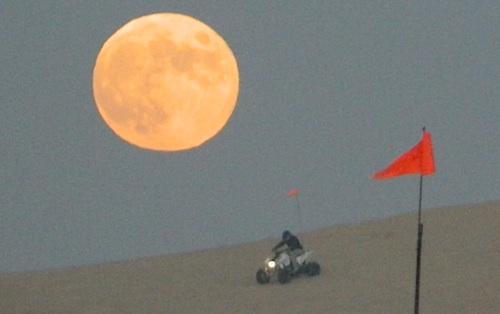
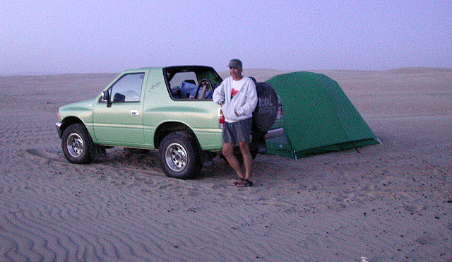
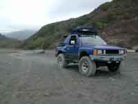
Open dispersed camping is available along Oceano Beach. Watch the high tide line and set camp well beyond that mark. A typical weekend is busy year round. Sand rails, quads, the beefy family SUV, or the ‘garage queen’ trucks. With all these motorized toys, you’re thinking either – yeah, or no way. Option B is listed below.

SAND DUNES
Off-Road playground, Oceano Park is also referred to as Pismo Dunes.

San Luis Obispo: SLO is north of Pismo a few miles. North of Avila Hot Springs. Other amazing parks include – Montana de Oro & Morro Bay.

DSCN1054

Oceano Dunes Camping open camping

Oceano State Vehicle Recreation Area has open camping on the beach, with a toilet within walking distance. No tables, no fire rings or paved anything! This is where all the big boys with the big toys like to hang out. Toy box trailers, bon fires, crowds & exhaust fumes. This crew can be seen each weekend driving Hwy 166, over to Bako.

Option B:

a large 82 site coastal campground is better suited for RVers & tourists wanting to avoid dune buggies. Horseback riding, beach, bike trails, laundry, market, shops & restaurants all close by. State Park Campground within walking distance to downtown Pismo & the Pismo pier.

Pismo State Beach State Park

Pismo State Beach Campground camp

more Pismo camp options:

Coastal Dunes RV Park RV Parks Pismo

La Sage Riviera RV Campground RV Parks Pismo
319 North Highway 1, Pismo Beach

Oceano County Campground
Oceano, CA

Pismo Coast Village RV Resort RV Parks Pismo
Pismo Beach, CA

Lake Lopez, inland
Arroyo Grande, CA

beach camps

nearby cities include:

pismo dunes

see also – Rock Front Ranch

Orange County Beach Camping

Orange County Coastal Camping

OC Beach Campgrounds

The overdeveloped Orange County coast is packed with condos, homes, parks and beaches, coastal villages, restaurants, shops and train tracks, so campgrounds in this region are few and far more popular than one might expect. Since Los Angeles has very limited beach camping options, most tourists wander further south for SoCal beach camping on the OC or San Diego coast line.

blue links lead to State Park pages with camp reservations.

State Park

Orange County Coast Campground reservations are highly recommended all year long, so make sure to plan ahead.

pierscene

Bolsa Chica State Park
Huntington Beach, CA

Crystal Cove State Park
Tent Camp & Beach Cottages
Laguna Beach, CA

Doheny State Beach
Dana Point, CA

Huntington State Beach
Huntington Beach, CA

Newport Canals

Newport Dunes RV Resort
Newport Beach Resort & Marina
Newport Beach, CA

San Clemente State Beach
San Clemente CA


DSCN0037

see more on OC towns –
Seal Beach, CA
Huntington Beach, CA
Newport Beach, CA
Laguna Beach, CA
Dana Point, CA
Capistrano Beach
San Clemente CA

Central Valley CA

happyvalleycow
Happy Valley Cow

The Great Central Valley of California – the San Joaquin Valley (on the south side) & the Sacramento Valley (on the north) together make up some of the most fertile farmland on the whole West Coast. Agriculture thrives, water flows & smog settles.

This huge valley, bordered by the Pacific Ocean on the west & the Sierra Nevada mountain range on the east side, is the one of the biggest farm land regions of the U.S. The food that feeds the world is grown right here in the Center of California. Vegetables, rice, fruits, citrus, garlic, onions, nuts, you name it.

redlettuce

Central Valley residents can easily enjoy fresh produce year round. Centrally located they can access the neighboring Central Coast, Historic Gold Country, and the Sierra Nevada mountains, plus The City (San Francisco) is not too far away either.

Since the capital city of Sacto has a “port of entry”, the California Delta & surrounding waterways, make for excellent fishing, boating & camping.

Unfortunately this low lying area is one of the worse smog basins on the west coast. The upper & lower Central Valley see the worst of it, as wind pushes the emissions right up against the mountains. Triple digit temperatures are common throughout the summer months. The super heat just magnifies the poor quality of air.

cauliflower

California Country – CA Countryside Communities

California Central Valley Map

Counties, Cities & Towns of the San Joaquin Valley:
(south to north)

Kern County
Tulare County
Kings County
Madera County
Fresno County
Merced County
Stanislaus County
San Joaquin County
Solano County
Sacramento County
Yuba County
Sutter County
Yolo County
Colusa County
Glenn County
Butte County
Tehama County
Shasta County

Reservoirs

blue links lead to more info on camp services. camp RV Camping

Central Valley Parks & points of interest:

Henry W Coe State Park
George J. Hatfield State Recreation Area
Carnegie SVRA
Dos Reis County Park, San Joaquin River
San Juan Bautista State Historical Park
Hollister Hills OHV Park
Pinnacles National Monument
Hernandez Reservoir
Los Banos Creek Reservoir
Caswell Memorial State Park
Colonel Allensworth State Historic Park
Codorniz CampgroundEastman Lake
Kern National Wildlife Reserve
Kesterson National Wildlife Reserve
San Luis National Wildlife Reserve
Merced National Wildlife Reserve
Modesto Reservoir Regional Park
Honey Run Covered Bridge
Oroville Wildlife Area
Spenceville Wildlife Management & Recreation Area
Lake Oroville State Recreation Area
Mount Diablo State Park
Auburn State Recreation Area
Sherman Island Waterfowl Management Area
Grizzly Island Waterfowl Management Area
Cache Creek
Sutter National Wildlife Reserve
Gray Lodge Wildlife Area
Colusa Sacramento River State Recreation Area
Colusa National Wildlife Reserve
Delevan National Wildlife Reserve
Sacramento National Wildlife Reserve
Mill Creek Wilderness
Ishi Wilderness
Tehama State Wildlife Area
Red Bluff Recreation Area
Shasta-Trinity NRA
Whiskeytown Reservoir NRA

California Central Valley Lakes & Reservoirs

walk in camps

for more lakes in California, check the BIG LAKES LIST

Los Angeles Beach Camping

DSCN0006

There are very few camping options along the Los Angeles coastline and what is available is geared toward RV campers and the dreaded, amusement parks. Orange County Coastline has the best camping near the Los Angeles region (without needing to smell the oil refineries). Ventura and Santa Barbara, both north of L.A. also have excellent camping beaches.

blue links lead to State Park pages with camp reservations.

State Park

SoCal Camping

Sunny and near perfect temperatures all year long, Southern California seriously pulls in the tourists. L.A. is a major metropolis city right next to the Pacific Ocean. With 22 million people residing in Southern California, and millions of visitors annually, this region is pretty busy all the time – even in winter months. Off season for camping might be November-March, when most of the precipitation falls for the year, but campground reservations are highly recommended all year long.

(located from south to north)

Orange County Beach Camping

camp

Long Beach and LA Campgrounds

queenmaryship
Queen Mary Ship @ Long Beach, CA

Bolsa Chica State Beach, Long Beach CA State Parks

Golden Shores RV Park, Long Beach CA

Redondo Beach (no campgrounds)

Hermosa Beach (no campgrounds)

Manhattan Beach (no campgrounds)

Dockweiler State Beach RV Park
Situated near LAX airport, the Chevron refinery and the main sewage treatment plant, this location can be stinky at times. Paved bike path along the beach leads north & south.

Playa del Rey (no campgrounds)

Venice Beach (no campgrounds)

Santa Monica (no campgrounds)

Malibu Campgrounds

Leo Carillo State Beach Campground State Parks

Point Mugu State Park Campgrounds State Parks

  • Sycamore Beach & Canyon Campground
  • Thornhill Broome Campground

Ventura Beach Camping

DSCN0076

DSCN0034

DSCN0090

Redwood Beach Camping

NorCal Redwood Coastal Camping

Redwood Campgrounds

Del Norte County, Northern California

redwood101

There are a few special places in California where redwood trees grow right down to the shore, but it is rare. Searching for place to pitch a tent (under the redwoods at the coast) is possible, but a bit harder to find than you might imagine. State Parks usually offer the standard paved camp site. Maybe need to drive dirt roads to find redwood seclusion.

Crescent City Camping

redwoodmap

Klamath Coast Camping

blue links lead to State Park pages with camp reservations.

State Park

Redwood Park Campgrounds State Parks

Redwood National Park National Park
Camping 

  • Demartin Campground
  • Flint Ridge Campground
  • Mill Creek Campground
  • Nickel Creek Campground (backcountry)

Eureka RV Campgrounds

redwood camping norcal

If you are seeking free or dirt cheap, primitive camping on the coast, then LOST COAST CAMPING on the Mendocino border is one option. Or head east, inland to the abundant National Forest. Dirt roads of the Six Rivers National Forest offer old logging roads, creeks, and secluded places to pitch a tent. Campfire permits are needed for dispersed camping, or ‘boondocking’ as some call it.

Dirt back roads can get muddy during the wet season, so know your vehicles capability and if you are unsure, check with the local rangers over the phone (preferably a ‘field ranger’) before venturing out. Remember that rain and mud are the norm, most of the year.

Fog is typical of the region. Enjoy the sunshine – when you can!

see more towns nearby –

Smith River
Crescent City
Klamath
Orick
Trinidad
Arcata
Eureka
Scotia
Ferndale
Petrolia
Garberville
Redway
Shelter Cove

Mendocino Beach Camping

Mendocino Coast Campgrounds

villageoncliff
Tent camping directly on a sandy beach can be found at USAL BEACH – on remote reaches of the rugged Lost Coast, via long dirt roads (not recommended for RV or camper trailers). Numerous small, cheap, forested campgrounds can be found on the Kings Range (dirt) roads. The area is also known as Honeydew or the Emerald Triangle. The “emerald” comes from the color of the main economic staple, cannabis. Heed all warnings. Private Property signs and gates mean that you need to turn arund and look for camping elsewhere. (Before you hear the gun shots.)

The remainder of camp accommodations are State Parks and State Beaches on the Mendo coast, offering developed campgrounds and most are first come, first serve. 

There are no campgrounds inside the popular, historic village of Mendocino, CA , but two state parks are within a mile to the north and south side of town: Van Damme Campground & Russian Gulch Campground. Local KOA and a few private RV parks make up the rest of the scenic coastline.

Lost Coast Camping BLM

Kings Range National Conservation Area

camp on the sand

Lost Coast Bridge

Westport Union Landing State Beach

MacKerricher State Park

  • Pinewood Campground
  • Surfwood Campground

dscn0083

Fort Bragg, California Campgrounds

Cleone Campground

Hidden Pines Camp & RV Park

Jug Handle Creek Farm & Campground

Pomo RV Park & Campground

Sportsmans RV Park

Woodside RV Park & Campground

Caspar Beach RV Park Campground

Camping Mendocino Village Area

Mendocino Coast Village

Mendocino Coast –
Albion, Pt. Arena & Gualala

camp

Manchester State Park

Manchester KOA Campground

Anchor Bay Campground @ Fish Rock Beach

Gualala River Redwood Park

Redwood forest

Mendocino Coast towns:
Albion
Caspar
Elk
Fort Bragg
Gualala
Little River
Mendocino

California Camping Maps

California Campground Maps

Maps are the key to finding your very own slice of heaven in the Wilderness. Online map sources can barely get you to your city destination correctly, much less the remote waterfall you desire. You will need a real map for your adventure. A topographical map, with all the details, dirt roads & hiking trails. If you are seeking to stay away from the touristy crowds, this is the best possible place you can be…. on this site, searching for ways to make it happen – this weekend.

BACKPACKERS BACKPACKING MAPS –

maps of California
Mount Whitney, John Muir & way beyond the High Sierra. DanaMite has all the California Wilderness maps on the new map shop. Various brands and types of maps. Most are printed on waterproof plastic now & are tear-resistant.

CAR CAMPING MAPS –

El Dorado Camping
Planning on camping outside of the developed campgrounds & finding that perfect stream side spot without the reservation & the fees? Then you will need a free fire permit (from a ranger station), plus a good map of the forests & a vehicle capable of handling the rugged the back roads. Much of California is prone to wildfires, so make sure campfires are even allowed on the backroads, before you get out there. Call the “field rangers” for back road advice and current recommendations.

CALIFORNIA OFF ROAD MAPS –

Wanna take that 4×4 vehicle somewhere really special this season? Camp well beyond the masses, way down that dirt road. We have OHV maps for SoCal, the deserts & all the National Forest maps too.

CALIF CAMPGROUND MAPS –

Start your search on the perfect campground or camp site with the destination in mind. Mountains, deserts, coastal. Parks & forests all have their own maps with all nearby camp grounds listed. We feature all the National Forest maps, as well as some State Park & National Park maps

See all California topo, hiking, camping maps

Sierra Nevada maps

coolsprings

  • California A to Z
  • California Camping
  • California Elevations
  • Camp Firewood
  • Camp Potty
  • RV camping deep in the Sierra
    RV camping at it's best in the Sierra; This rig found themselves deep in the alpine lush meadows with towering trees and a view and a very private camp site.
    Big Bend CA
    Big Bend Ranger Station, off I-80

    Redwood Hotels

    Sierra Lodges, Sequoia Cabins & California Redwood Inns

    alta sierra

    Rent a cabin in the redwood forest of the north coast of California, or get a weekend retreat in the Sequoia, deep in the Sierra Nevada. Redwood inns, cottages & yurts can be found in the Central Coast region. Big Sur redwoods & Santa Cruz redwoods. Rustic hostels, historic Sierra lodges, or mountain cabins can be found in the Sierras, from Alta Sierra near Kernville, to Yosemite National Park.

    Places to stay overnight in the Redwoods, or close by –

    If you seek big lodges made from redwood timbers, those are the historic inns, located all over California. Redwood was harvested in California since 1850, right after gold was discovered and the masses flooded in. State officials have limited harvesting of ancient redwoods in Northern California in 1988. Logging and agricultural farms have already wiped out 96% of redwood forest that once covered California.

    Northern California Redwoods

    Northern California Coast Hotels & Camps

    redwoods parks
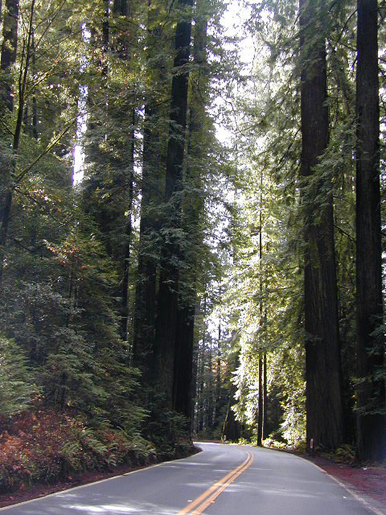
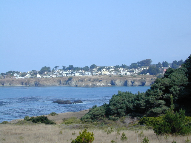
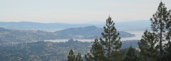
The north coast of California is dubbed the Redwood Empire, and driving north on US Hwy 101 passing the well-known wine country and communities near Clear Lake, means you’ve entered the official redwood region of Cali.

    With over 150 mile stretch between Ukiah & Crescent City, on the Oregon border, coastal redwoods thrive in this wet climate. All along US Highway 101 you can find every assortment of lodging, from standard hotels walking distance to village shops, to small secluded cottages tucked behind a winery. Sonoma & Mendocino vineyards merge on ridge lines, at the edge of oak countryside, with redwood forests & recreational rivers to the north.

    BALD HILLS ROAD: Old logging roads lead way up in elevation, behind Redwood National Park, where you can find free camping spots and firewood piles all over the clearings. A real 4×4 vehicle will be needed in wet or snowy weather conditions. AWD wagons should be cautious of deep mud and know the weather conditions ahead of time. The main gravel/dirt route traverses the Bald Hills range at 3000′ elevation and ‘epic view’ campsites are abundant. Pine Creek Road drops east into Klamath River Canyon down to Klamath Hwy 96.

    Bald Hills Rd

    USAL BEACH: In the olden days, USA Lumber Company had a prime place on the Lost Coast. Now it is a wonderful destination w/ remote beach campground hidden in the trees, next to the redwoods and creek, and the cliffs – and a big sandy beach w/ giant driftwood!

    Towns w/ Redwood Lodging in NorCal – 

    Redwood Parks in NorCal –

    (from south to north, with closest town)

    REDWOOD MAP


    Redwood Map Topo

    Topographic hiking and camping maps of the NorCal Redwood region –

    Tahoe Lake Map

    Tahoe Maps: trail maps

    lake camp, hike, mountain bike, off-road, ski, snowmobile

    Tahoe Trail Maps / Tahoe National Forest

    tahoe hiking maps

    Numerous State Parks dot the shoreline at Tahoe, while the National Forest lands and Wilderness Areas span most of the peaks above. Camping, backpacking, boating, kayaking, fishing, climbing, mountaineering, mountain biking, snow skiing, snowmobiling are all popular recreation in this Sierra region. US Highway 50 and Interstate 80 are the main western access routes to Lake Tahoe. US Hwy 395 leads to Tahoe, up from the Eastern Sierra and Southern California.

    Wanna find every waterfall or every creek to fish? This is the place that will help you find them. Easily, with good old fashion printed maps. Hard copies, some waterproof & tear resistant, most with topographical data and all roads, trails, campgrounds and parks. Whether or not you water ski or cross country ski, these maps will save your ass – when you are way back there in the boonies.

    Tahoe’s Rubicon Trail connects the historic Gold Country to the alpine lake via granite wilderness sky ways above 7000′ elevation, but a real 4×4 and overnights are required. The back roads and trails are endless in these parts of the Central Sierra Nevada mountains.tahoe maps

    keep tahoe blue

    Nearby attractions surrounding Lake Tahoe –

    Tahoe National Forest
    Tahoe Rim Trail
    Rubicon 4×4 Trail
    Lakes Basin Recreation Area
    Sierra Buttes
    Desolation Wilderness
    Grover Hot Springs
    Blue Lakes
    Hope Valley

    cabin rentals

    Sonoma Beach Camping

    Sonoma Coast Campgrounds

    Gerstle Cove @ Salt Point
    Gerstle Cove @ Salt Point SP

    tent camp RV camps

    Sonoma Coast State Park  State Park

    • Bodega Dunes Campground
    • Wrights Beach Campground

    dscn0045

    Salt Point State Park Camping State Park

    • Woodside Campground
    • Gerstle Cove Campground

    Fort Ross State Historic Park 
    (a Russian fur trading fort from 1812)

    • Reef Campground – 21 camp spots
      No RV hookups. No reservations
      [2018 CLOSED for repairs]
      707-847-3437

    coast

    Sonoma County Parks Campgrounds

    Private campgrounds @ Sonoma Coast –

    Sonoma coastal towns –

    Woodside Campground
    Woodside Campground @ Salt Point State Park

    Lake Campgrounds

    Rancheria Falls
    Rancheria Falls, Huntington Lake, CA

    California Lake Campgrounds

    Wanna Camp at the Lake?
    (you’re not the only one)

    lakes  fishing boating mountains backroad horseback trails picnic mountain bike camps hikesnight skies

    Nothing beats fresh, cold, clean water from the California mountains, in the summertime. Find time to exit the urban rat race, soon. Escape the smoggy city life and the triple-digit heat for a road trip to the higher elevations.

    View East from Davis
    Crocker Mountain @ Lake Davis, California

    Lake Campgrounds are abundant in California, where man-made reservoirs and recreation abound. Alpine lakes in pine forests are also numerous in the west, although only accessible for a portion of the year, they draw in the campers all summer long. A majority of the small lakes are located inside the California National Forests.
    USDA / USFS / NFS

    NFS State Parks

    Larger reservoirs can often be managed by California State Park system. State Parks, SRA, State Recreation Area. Suburban lake locations can be local County Parks. A few locations listed could even be desert lakes.

    Many ideal secluded lakes are only accessible with a 4WD vehicle, by foot or horseback. Super scenic, backcountry lakes are so far out – that a day hike is usually required.

    tent camp developed campground

    primitive camping primitive campsites

    RV camper trailers allowed RV campground

    hikes wilderness access

    Spicer

    No motorized boats, camping on west shoreline only, no fishing from the dam, catch & release?

    No access for trailers? Individual rules for each lake are different. Learn the basic before you get out there.

    CAMPGROUND RESERVATIONS tent camp

    Lake Campgrounds are so popular in California that many require reservations during summer. Many locations accept reservations online and we have links for those too. Other lakes are so small and remote, that only the fishermen, hikers and 4×4 gear-heads know of them.

    outdoor recreation found at or near lakes

    • backpacking
    • boating
    • camping
    • canoeing
    • creeks
    • fishing
    • floating
    • four-wheelin
    • hiking
    • horseback riding
    • house boating
    • jetski
    • kayaking
    • mountain biking
    • OHV trails
    • picnicking
    • rivers
    • river rafting
    • swimming
    • water skiing
    • waterfalls

    Silver Lake from Above

    Lake destinations listed here have some sort of campground facilities. Some may be mini resorts with boat launch, marina or bait shop/general store. RV hook-ups, maybe. Dump station, it will cost you. Usually these bigger lakes are busy centers of tourists activity with boat rentals, RV camping and certain locales are even walking distance from ‘town’.

    Fine dining is a rare find on the lakes, but some lake side restaurants (open seasonally & with limited hours) can be found. Most will require reservations, especially on the weekends.

    Other lake camps listed are literally on the edge of wilderness – with trails to the high country. The best little lakes will have one dirt road access. Below is a wide variety of lake destinations within California.

     gardisky_lake

    Floating Flyfishing Tube
    Red Lake, 4×4 access (primitive, no facilities)

    and let’s not forget the ever-popular California Lake List

    Grassy Picnic Faucherie Lake