Tag Archives: trailers

Big Meadow Sequoia

Big Meadow Kern

Big Meadow – Kern Plateau

Sherman’s Pass, Sequoia National Forest
Big Meadow borders Dome Land Wilderness
in the Southern Sierra Nevada mountains

horse camping National Forest Camps Mountain Biking Kern Hikes Trailer access camping

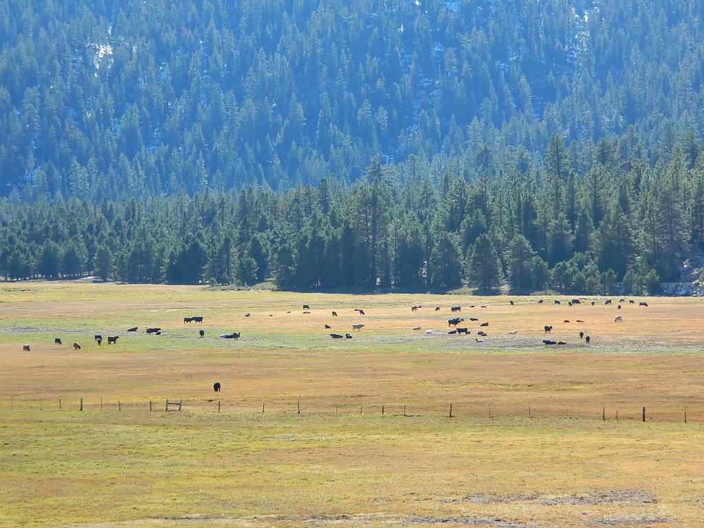
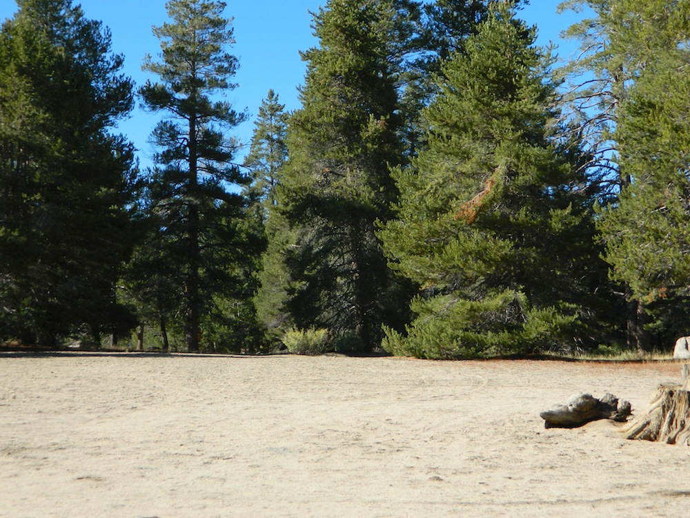
There are many large and gorgeous meadows inside Sequoia National Forest, but none compare in ‘grandeur’ to this southern Sierra public pasture. BIG MEADOW KERN

Find your way north of Kernville and the river really comes into view. Up close, right there! Stop, get out of the vehicle for a stretch break and breathe; take it all in. This is only the start of the adventure. Gorgeous Big Meadow is located up on the Kern Plateau, 3000′ above the river on the eastern ridges. Only accessible half the year due to snow, this meadow is a must see for those exploring the eastern side of the Kern River.

22s05 sherman pass

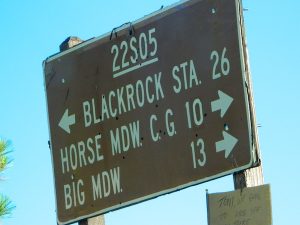
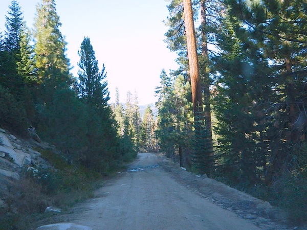
Sherman’s Pass Road #22S05 is a hard right turn after the Johnsondale Bridge. It is well signed and still easy to miss. Climb out of the dryness and into the dense forests and meadows of higher altitudes. Driving this southern Sierra-crossing route, Sherman’s Pass Rd. will require all of your concentration. Steep, curvy road without guard rails. Plus epic, scenic views (NOT to die for).

At this point – Rock slides, snow gates and road closure are typical in winter months. Check w/ rangers in Kernville about road conditions (before you head up this way).

Sequoia National Forest National Forest Camps
Kernville Ranger Station
105 Whitnet Rd
Kernville CA
760-376-3781

While traveling eastbound on Sherman’s Pass Road, the intersection to look for is

Big Meadow Road #22S12


The partially paved road will lead south a few miles, then becomes GRADED DIRT and ventures another 15+ miles – way, way out into dead-end territories. Not one road connects down to Lake Isabella!

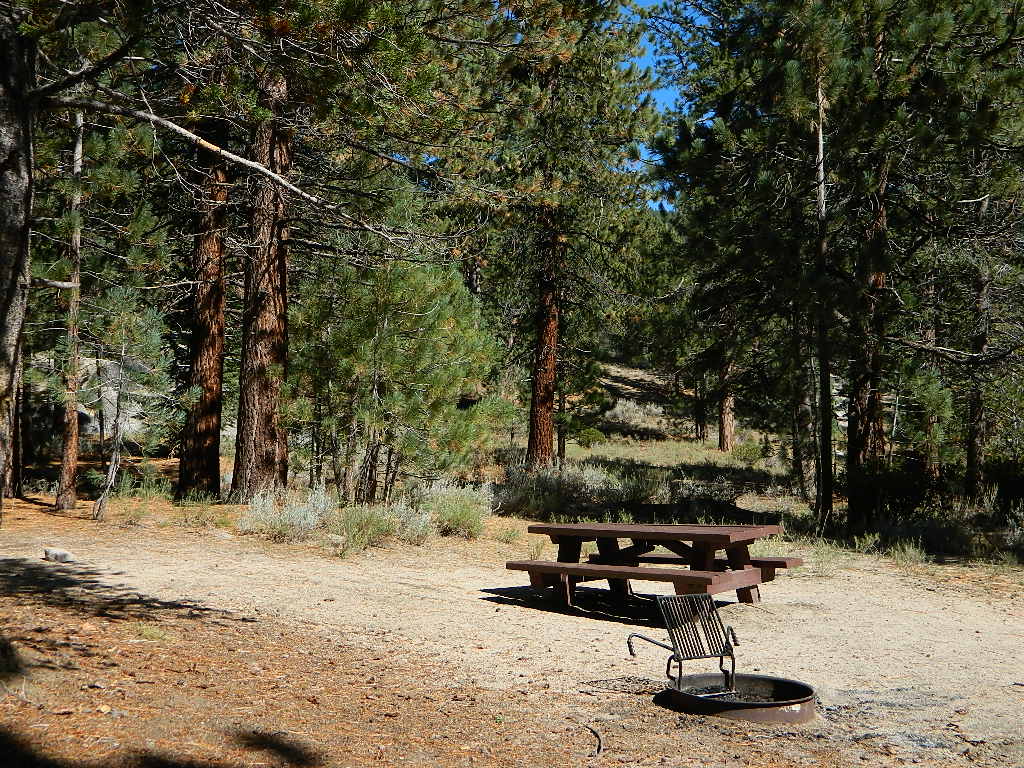
Spur roads (all one lane, dirt roads) lead out to various places like – Cherry Hill, Big Meadow, Horse Meadow Campground, Dome Land Wilderness Trailheads, Manter Meadow, Salmon Creek Falls, Cannel Meadows, dozens of trails and spurs. Plenty of primitive camping back in these forest areas. A high clearance rig may be required the further back you go. Mud and snow are quite common in spring and fall.

Camping California Back Roads
Extra Large Camp Sites

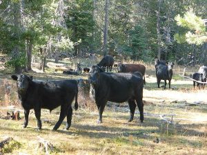
BIG MEADOW is a favorite camp area among –
backpackers (trailheads)
equestrian (horse campers)
hunters
mountain bikers
off-road campers

westsidedrive
westside drive: ample parking and camping for horse trailers

cattlecowsbeefy

no 'froading on meadows
no ‘froading on meadows

publicpasture

Big Meadow Rules

Back Loop Road
Back Loop Road, around the Big Meadow. Narrow & muddy

fencedmeadow

Or perhaps this is not the Big Meadow near Sequoia that you are seeking. National Parks The scenic, giant, public horse pasture listed above is not to be confused with #14S11 Big Meadows Road, also in National Forest land, located in between popular Sequoia National Park and Kings Canyon. (100 miles north of here)

6N06 – Stanislaus NF

graded road

Forest Rd #6N06 – County Line Road, Fence Creek, Stanislaus National Forest

Central Sierra Nevada Mountains, California
N of Hwy 108; W of Sonora Pass

On the very edge of wilderness
Stanislaus National Forest
County Line Road
Fence Creek Campground (NFS)

Graded dirt road near Clarks Fork junction @ SR 108. Dirt road travels up into forest, hiking trails and meadows; South side of the volcanic Dardanelles @ Tuolumne Co. & Alpine Co. boundary

Carson Iceberg Map

County Line Trailhead
Wheats Meadow Trailhead
Carson Iceberg Wilderness Area
The Dardanelles (9524′ elev)

Clark Fork, Middle Stanislaus River

Topo Maps of this Region:

Stanislaus National Forest Map USDA
Carson Iceberg Wilderness Map USDA
Carson, Emigrant, Mokelumne Map NatGeo
Sierra Nevada Topo Map

hiker

  • backpacker access
  • day hiking
  • horse camping
  • primitive camping
  • trailhead camping

winter road closure, annually
check with local rangers on road access and conditions.

Rd# 6N06, climbs to mountain scenery at upper elevations, well of the main highway. Route is a 2-lane wide road at times, narrower and private towards the end of roads; several dirt roads, overgrown 2 tracks w/ many camp sites to choose from. Dispersed primitive camping requires a camp fire permit.

6N06rd

OHV off-roaders will only find dead ends on dirt route 6N06. NO motorized access in nearby wilderness. Wheelers should try south of Highway 108 @ Niagra Campgrounds; Niagra Off Road #5N01 for all the noise-makers, gear heads, dirt bikes, and toy boxes. Niagra Creek, Niagra OHV, Niagra 4×4.

dirtbikes

nearest towns:

Dardanelle
Pinecrest Lake
Twain Harte

volcano mdws

San Diego Beach Camping

Coastal Cliffs San Diego

San Diego Coastal Campgrounds
Mission Bay & North County
SD Beach RV Parks & Camping

RV camps camp

San Diego’s mild climate means camping is available all year round. Winter storms can get windy and rainy, but most campgrounds are still open. From north county where the coastal cliffs overlook the ocean, to downtown bay side marinas w/ RV camping, to camping right on the sand w/ ocean crashing just feet away. Bike paths are common around downtown San Diego, so you can bring your bike or skates.

San Diego has 2 BAYS, both located along Interstate 5: The main bay downtown is called San Diego Bay (one of the deepest on the west coast) and the other a few miles north, is named Mission Bay (a man-made coastal waterway w/ green parks and paved bike trails).

Reservations are required at almost ALL coastal campgrounds, especially around holidays, any 3 day weekends, and all summer long. Tons of tourists flock to Southern California and this is a very popular coastline – with busy little cities and crowded beach towns. Beware: if you are seeking secluded camping – this would not be the place.

Best Beaches

listed from south to north

Carlsbad Cliffs

There are numerous private RV resorts, some quite large, like KOA and GoodSam parks located in and around San Diego county. Most are metro-close and not located on the beach. This list is primarily coastal camping options for the San Diego region.

camping SoCal

Seagulls at Cardiff

see also
San Diego Campground Camping

see a list of all
San Diego cities & towns

baybridge

San Diego Camping

Horse Meadow Campground

Kern Meadows Camping

Horse Meadow Campground

Salmon Creek, Kern Plateau –
Sequoia National Forest

horse camping National Forest Camps Mountain Biking Kern Hikes fish Trailer access camping
Looking to stay away from the masses camping at the Kern River?

Horse Meadow Campground can be found on the east side of the Kern River, up on the Kern Plateau. Up the infamous, steep and rugged Shermans Pass Road. How exciting!

Steep Grades

Climb the hill slowly and cautiously, no guardrails. Up the grade, Shermans eastbound – out of the dryness of the Kern canyon. Find Cherry Hill Road, that is also the Big Meadow turn off: Forest Road# 22S12, a long, narrow dirt road leads from paved Shermans Pass Road, 10 miles out to this ideal campground. Far enough off the main road, so you won’t see much of a crowd out here.

22s05 sherman pass

Hunters, horse campers and hikers really like this spot. Mountain bikers are known to frequent the region as well. Forest, meadows, trails, creeks, nature, all around. Dome Land Wilderness is close by; Waterfalls hikes, swimming holes, viewpoints. Fishing, hunting, horseback trails. Dirt roads and single track trails all over – all within the vicinity of Big Meadow.

Kern Meadows Camping

From the main Rd #22S12, the camp access road #23S08 will lead out to the NFS Campground – HORSE MEADOW. Located at higher elevation forests – 3000′ feet higher than the Kern River!

Nice forested, high country camp spots in a developed campground. The long, access road is worth it for all the scenery and seclusion. Vault toilets, piped water, maybe a small fee. Open summer into autumn, closes for winter months.

Horse Meadow Campground

• Elevation: 7600′
• Number of Sites: 41
• Vehicle Access: RV 23′ max
• Campsites Reservation: No
• Camp Fee: Yes
• Length of Stay: 14 Days
• Season: June – November
• Trailheads: Salmon Creek

33e36trailhead
Developed Campground @ Salmon Creek Trail #33E36. Hiking trailheads lead off to various destinations like, Salmon Creek Falls, Big Meadow, Cannel Meadows and Dome Lands.

Sequoia Kern Map

Sunny Campsite

SUMMERTIME: If you are coming in from Kennedy Meadows on the EAST (or the Mojave desert US 395) – first verify that the Sherman Pass is OPEN for through traffic. Ask road conditions with local rangers ahead of time. ANY amount of snow will close this whole paved route for the winter season, up until June sometimes.

Over 30 miles (one way) to the nearest general store for supplies. Pack ‘block ice’ in the cooler, instead of cubes.

nearby towns:
Fairview
Kennedy Meadows
Kernville
Lake Isabella
Mojave

Big Meadow is closeby. Check it out!

Big Meadow Kern