(before the dot com crash, before digital cameras, before GPS, before social media & way ahead of smartphones)
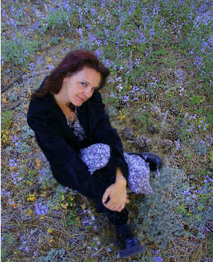
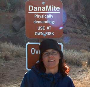
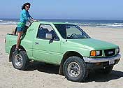
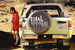
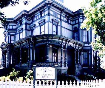
Sole creative force of Total Escape, Dana Williams left her 3D animation career to start living and working her dream job, online and off. Utilizing artistic talents, computer skills, a vast knowledge of the California landscape and a simple love of nature, to make it all come together for a killer web site called Total Escape.
27 years online means fresh content & updates every month; reworking web code every few years to keep up with various browsers, apps, maps, and wildfires.
“travel agent to the back woods”
Living close to the earth with organic gardening and rural living, DanaMite strives to offer California residents, new-comers and visitors unique, local destinations, concentrating on the outdoors – well away from overcrowded, busy, urban cities and tourist traps. Total Escape can show you how to discover the secret, hidden spots on your public lands that the gov web sites will not even dare to mention.
help keep
total escape
online
the independent source for California travel
NO CORPORATE sponsorship No venture capital No government subsidies No annoying pop-up ads
No scripts chugging bandwidth No membership needed
Decades without a television set lends plenty of time for studying terrain, topographic maps, GPS coordinates and thousands of photographs to compile more than 8000 pages on just California travel. Far from the daily grind of everyday life, DanaMite continues in educating the public about local travel, camping, family farms, organic cafes, outdoor recreation, respecting the land, responsible use of our resources & how to get more enjoyment out of weekend travels.
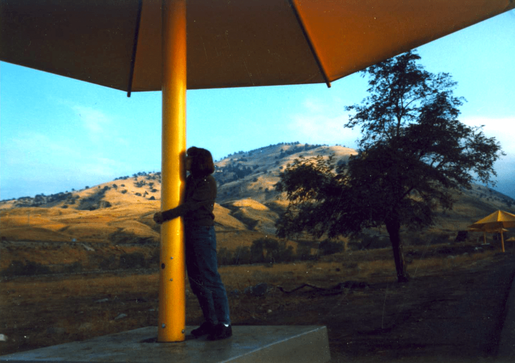
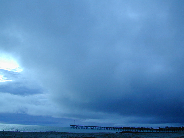
40+ years of documenting back roads of California, plus some Baja & Utah too!DanaMite loves Utah, almost as much as she loves California.Tejon Pass “Cristo’s Umbrellas” art installation 1991. Photo copyright – Kevin Robinson
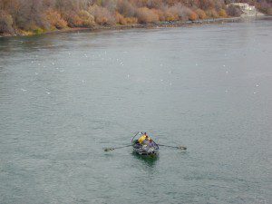
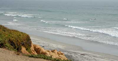
There are many gorgeous rivers in California that are perfect for camping and fishing, but none are located in Southern California. None! Yep, you read that right. If you think about it, the golden state is about half desert! The majority of our natural water in our state is coming from the north – so take this as a warning: you might need to drive a few hours to find your ideal river camp.
The easy-to-access waterways are found mostly along highways in the Sierra Nevada – or way up in NorCal. Deep granite gorges carved out by glaciers, surrounded by forested peaks is only half the appeal. High elevation lakes, waterfalls, big trees, abundant wildlife, and the alpine villages are all part of the Sierra Nevada experience. Raft, kayak, fly fish, hike, bike or just camp out next to a big, rushing, flowing river. Our selection of California maps will get you narrowed down to a specific region, so you can find that perfect river campground, or explore and discover the back roads – for the most seclusion.
KERN RIVER: The Kern River is one of the most popular of all the Sierra rivers due to its proximity to SoCal. Hurried, stressed-out, Angelinos (LA) can be at this destination in under 3 hours – which makes it a very busy place most months.
So, let it be told, that summer is not the best time to enjoy the Kern. If you do plan a summer outting, make sure you head for the Upper Kern (10+ mi N of Kernville & Lake Isabella) or the North Fork of the Kern (out in Monache Meadows) where 4×4 is often needed.
The Lower Kern River has only 2 developed campgrounds: Hobo (closed for damage 2019) andSandy Flat (open all year). Numerous primitive camp spots are available along Old Kern Canyon Rd, which parallels the Hwy 178 on the south side. None of which are located at the rivers edges. Remington Hot Springs is a popular spot for soaking. Fishing trails, mountain biking trails and hiking trails, all over. Fire danger is great in this area, so pay extra close attention to signs and fire restrictions.
Kern River above Lake Isabella and Kernville is a better choice for camping availability.
Everybody loves Yosemite! This is the most popular park in the whole state; maybe the whole nation.
The majority of campers want to stay “right on the river” when they visit Yosemite NP, but that is just plain old impossible, since reservations go fast and there is only so much room for everyone in this enclosed, narrow, precious valley.
This particular park has some major floods (1997 & 2005) that wiped out bridges, road ways; all the old wooden cabins (at Yosemite Lodge) are gone and only half of the campgrounds are still available. Yosemite has had 11 winter floods since 1916 that have caused substantial damage to property. That number is expected to increase, as winter precipitation is getting less predictable.
Reservations are taken for camping and cabins – far in advance; like one year. No joke!
3 Yosemite Campgrounds are located next to the Merced River (inside spectacular Yosemite Valley)
Way up in the Yosemite high country, which is only open a few months outta the year, the beautiful Tuolumne Meadows Campground is located next to lush meadows and the scenic Tuolumne River. All Yosemite campsites must be reserved well in advance, so visit links above – if you are serious about a Yosemite camping trip anytime soon.
MOKELUMNE RIVER: Way up the road, deep in the western Sierra, Gold Country. Small NFS campgrounds, right on the river; Access is long, narrow paved, switch-back road, not suitable for RVs or trailers.
STANISLAUS RIVER: The Sonora Pass, the fishing is very decent way back in this granite gorge. Highway 108 is only open a few months outta the year, due to deep snow & rock slides – so time is of the essence. Summer time is prime vacation weather up here. Several campgrounds are located right on the river, or on the major feeder streams. Or you can opt for secluded primitive camping on the back roads. Find Sonora camping in Stanislaus National Forest.
YUBA RIVER: The biggest play time river in the northern Gold Country, this runs along Hwy 49 near Downieville and also has a major South Fork for the best swimming holes and primitive camping in this region. Tubing, rafting, kayaking, fishing, camping, gold panning, you name it, Yuba has it. Look for more on the South Yuba Recreation Map, or the USDA issued Tahoe National Forest Map
FEATHER RIVER: Top fishing river in the Lassen to Oroville area. Chester and Lake Almanor in the upper reaches. High Bridge Campground is nice paved-camp-site camping; a forested spot where you can fish 2 rivers on the same day. A Plumas NF or Lassen NF map would be quite helpful for this region. Lower down the mountain, lower Feather Rivers which include all 4 forks which feed Lake Oroville – West Fork (Paradise, CA), North Fork, Middle Fork Feather, (Berry Creek, CA) and the South Fork (Lumpkin). Lots of waterways and creeks worth exploring in between Chico and the mountain town of Quincy.
KINGS RIVER: This one particular river is the longest in the Sierra Nevada mountain range, pulling snow melt from the upper reaches of the High Country and Mount Whitney. The river area just to the West of the National Park, over to Pine Flat Reservoir, is all prime for outdoor recreation. Several river rafting companies work this stretch of river.
The Western Divide Highway, at 6000 feet elevation, connects the Kern River Valley w/ granite peaks, dome rock, aspen groves & the Giant Sequoia trees! This is one of the southernmost Sequoia groves in the Sierra Nevada mountains. The easy hike is more of a nature trail, wheel chair accessible & approximately 1 mile long. Large Sequoia trees, picnic grounds, near campground.
SEPT 2021: Closed due to the Windy Fire
On busy weekends and holidays the rangers charge a “day use” parking fee, for those wishing to park in the paved parking lots. Avoid this fee by finding additional parking along the highway. Only a few good free parking spots along this busy 3 mile stretch of highway, and don’t forget to park all the way off the pavement.
SOUTHERN SIERRA: Great destination for camping families & sightseers traveling through the Southern Sierra Nevada mountains.
Western Divide Campgrounds
The USDA National Forest Campground across the road from the Trail of One Hundred Giants is called Redwood Meadow Campground. There is also a separate parking lot for the picnic grounds w/ a similar name.
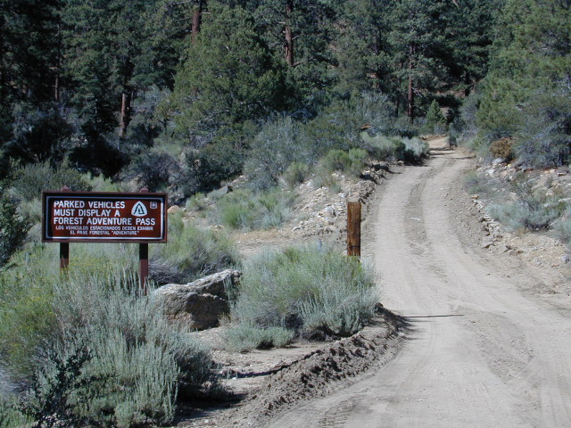
Giant Sequoia National Monument has numerous dirt back roads for free, primitive, car camping. You’ll need a good topo map to find the best ones. Some roads may be muddy, overgrown or extremely rocky, depending on recent weather. Know you vehicles limitations. There is no tow truck service available way back here in the boonies.
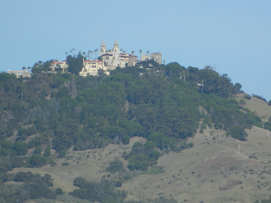
Hearst Castle
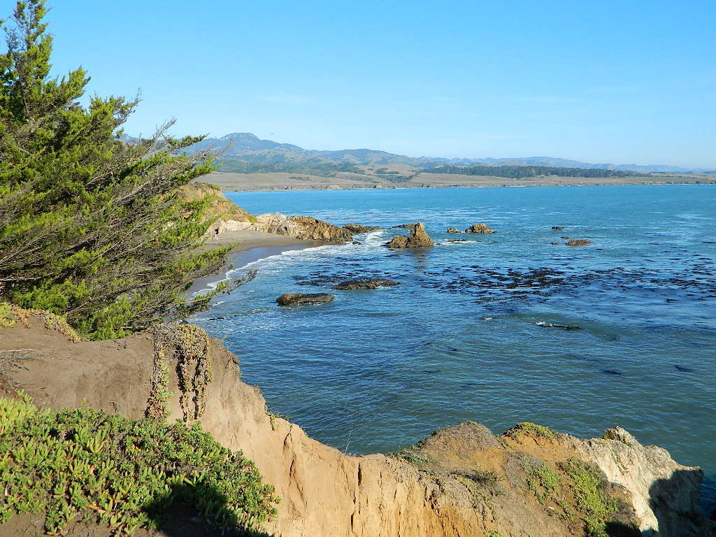
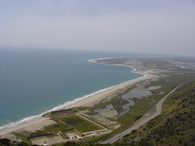
Central Coast rural and rugged coastline, south of Big Sur, California. Very touristy destination; Tickets for tours required.
San Simeon SP. Central Coast of California
Historical Re-Enactments @ Riley’s Farm A real working apple orchard near Los Angeles; offering living history programs; re-enactments of scenes from the American Revolution, Civil War & Old West. Dinner, holiday shows, restaurant & tavern.
Mountains of Northern California / NorCal Mountain
California sure has a lot of mountains. West Coast land is home to the tallest Sierra Nevada range, plus the Cascade range, which extends northwards to Canada. (Many of which have volcanic peaks.)
We break down all the mountainous regions in the north part of the state below w/ links, topo maps, lakes, rivers, wilderness, parks and forests. Small towns & cities are linked in red.
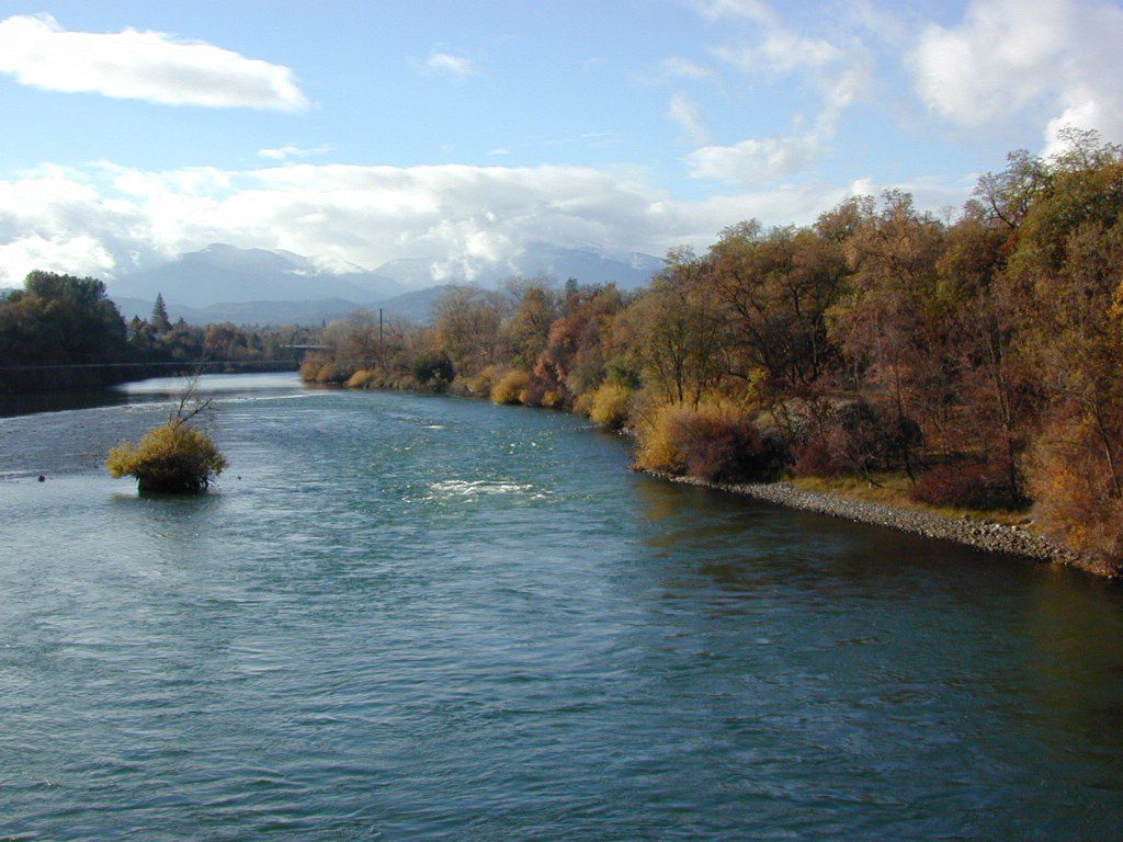
Sacramento River, above Lake Shasta
North Coast Mountains
Redwood forests and rivers are what make up most of the Northwest part of California, just below the Oregon coast. Logging and fishing are the big industries up here. Lumber mill towns and camps still exists today. Wilderness areas, dirt back roads, river kayaking, stream fishing, camping and real wild indians. Oh yeah, and Big Foot!
The landscape in more dramatic along the North Coast of California, as the steep rocky terrain tumbles into the sea w/ the San Andreas fault running parallel to the shore. Marine life, rocky shores w/ small towns. Del Norte County & Humboldt County. Wild rainy weather, at least half the year; fog and sun the other half.
The furthest north is Siskiyou County, which borders the state of Oregon. We have the Klamath River flowing south into California, with plenty of mountain peaks, forests and wilderness. Interstate 5, Highway 3 and Highway 96
Pacific Crest Trail passes through the area and backpacking is common (all year long). Notable spots – Klamath Knot and The Eddy’s. Prominent Mount Shasta is actually situated inside Siskiyou County, not Shasta.
Giant Mount Shasta is located inside Siskiyou County, and Shasta County & Trinity is everything located to the south of it. Interstate 5, Highway 3 and Highway 299. Recreational lakes, rivers and streams, and off roading trails.
Waterfalls, hot springs, mountain biking and stream fishing can be found within this region. Mining history and museums are primarily situated around Weaverville. Houseboats and boat rentals can be found on the big reservoirs. Whiskeytown was totally toasted in wildfire of 2018. Alpine lakes, granite spires, campgrounds and cavern tours, all located along the Interstate 5 corridor.
Beautiful park setting @ Lee Fong Park, in historic Weaverville, CATrinity River Camping, Douglas City, CA
Mendocino Mountains
Coastal mountains located above the Napa & Sonoma wine country. US 101 & Highway 20. Rivers, forests, wilderness and redwoods is the key terrain that make up the Mendocino County mountains.
There is a fair amount of off road trails and dirt roads located in and around Mendocino, so you can expect to see 4x4s, dirt bikes and toy haulers on the east side of the mountain range. The coastal side of the Mendo National Forest will have the rivers and redwood parks.
Northern Sierra Nevada mountains is where the granite rock of the Sierra meets to volcanic rock of Lassen Volcano. Butte County and Plumas County is the Feather River drainage, all flowing south from Mount Lassen.
Pacific Crest Trail is routed through Bucks Lake Wilderness and the Feather River Canyon, so backpacking is popular. Highway 70
Technically speaking, the Susan River is the top waterway of the Sierra Nevada mountains. Lassen County spans the distance from the Nevada state line, west to Plumas forest and the Feather Rivers (all 4 forks).
Lassen Peak is the middle of the National Park and the National Forest totally surrounds that. Numerous lakes, hiking trails, wilderness areas and dirt roads make up this huge forested area. Snow-mobiling is popular in winter months around the town of Chester.
The far northeast corner of the golden state is the remote cattle range lands of Modoc Country inside Modoc County. Drier than the rest of NorCal, the high desert sage brush meadows, a few lakes and pine forest mountains. Highway 299 & US 395
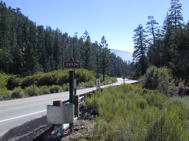
Heart Bar to Big Bear Lake, via the dirt road
San Bernardino National Forest
Big Bear Back Roads
Highway 38, East of Heart Bar @ Road #1N02
Southern California
alt big bear
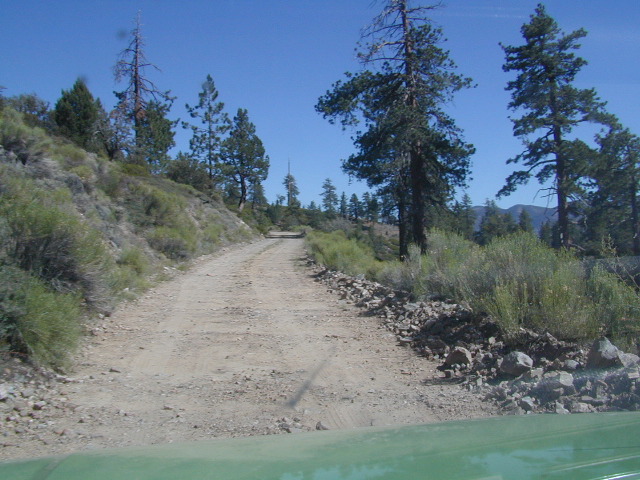
This 8 mile long forested, dirt road begins right off Hwy 38, just east of Heart Bar Campground and is an easy turn to miss. One tiny, brown sign is all that is found (on the guard rail). Driving too fast, you are bound to miss it.
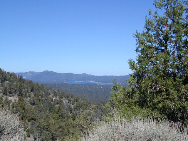
The unimproved route heads north through the National Forest, up and over and around SugarLoaf Mountain (elev 9952′), then down to the Big Bear Lake region.
Several primitive sites – yellow post camp sites – can be found way back in here, but you might NOT be able to have a campfire (depending on fire restrictions). Check w/ local rangers before you head out.
Forest roads are often closed (gated) during the winter, when snow and rain make a muddy mess of the terrain. Rock slides are also common in wetter months. Call the local rangers to inquire on road conditions or if this route is open.
The whole Big Bear Mountain area is a SoCal favorite forest destination, for weekenders and travelers alike. Mountain biking, hiking, backpacking, horseback riding, camping and 4-wheeling.
Plus the recreational lake is full of more water recreation w/ tourist shops and restaurants. Stay away from the crowds and take the back roads for adventure and recreation. Spend less money, stay outta town and camp for free.
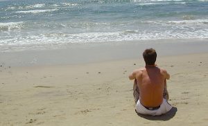
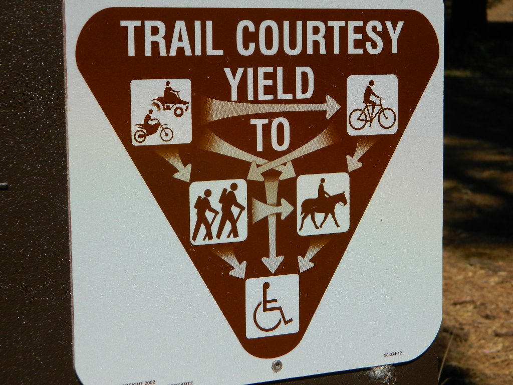
Deserts & beaches are the only places for bonfires.
kill your television
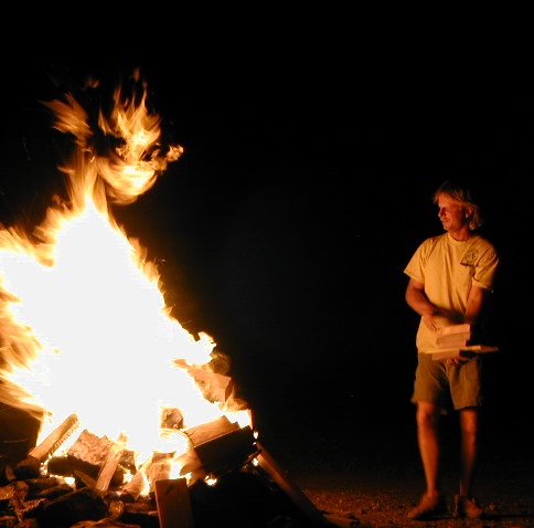
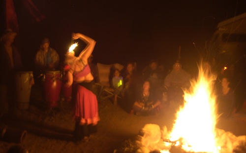
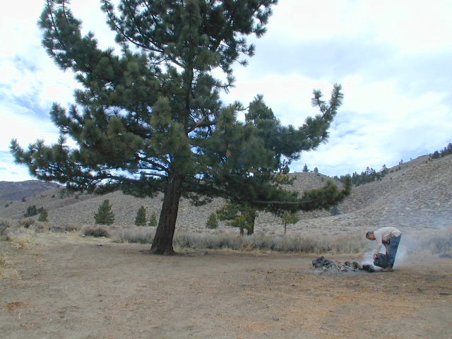
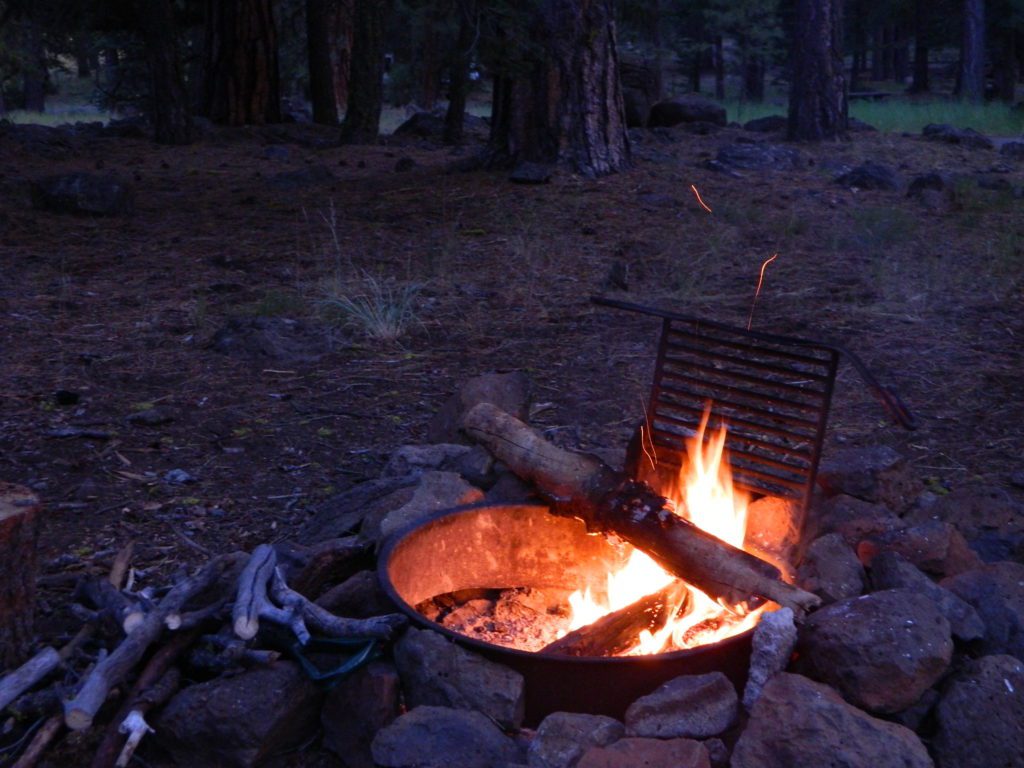
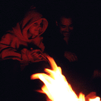
The heat source, the light source, the cook source, the sock drier, the night supplier, the outdoor LIVING ROOM. The campfire is the center stage for all entertainment, dining, drinking, music, true tales and ghost stories alike.
Since the beginning of time humans have gathered around the campfire at dark. This nightly ritual is built into us on the deepest level. We miss this today. We miss the real conversations, the community, the bonding, the stories, the soul searching. We miss the connection with nature, the fresh air and the great outdoors. The night sky filled with stars and maybe a meteor shower, a hot drink and the glow of the campfire coals. Enjoying the wilderness requires certain skills. FIRE is only ONE skill – for survival, for cooking, for warmth, for safety.
Total Escape is dedicated to those who yearn to camp, often.
photo – Charlie Sweeney 2010
Some folks cannot imagine camping without a campfire, but we better get used to it here on the West Coast. Weather patterns swing from years of super-dry drought to deluge and drenching – as we’ve seen of recent in California. Dry conditions means high wildfire dangers, tight camp stove and strict campfire restrictions.
Each California region, National Forests and State Parks have their own fire restrictions, so call ahead to rangers for current fire conditions on the place you wish to visit. Certain mountain locations will ban fires in the back country, fires on the back roads and sometimes in extreme conditions, no fires allowed even inside a developed campground.
Sagebrush could be cleared back another few feet, at least.
Campfire Restrictions
California is well known for its unforgiving drought conditions and its seasonal wildfire danger. Always know the fire conditions in the area you plan to camp. Most Southern California regions have banned ‘open campfires’ in forested areas, due to wildfire threat and population density. Call ahead to get an update on road closures and current campfire restrictions. Find California BLM offices & NFS ranger stations
Campfire Permits
If you plan on camping outside of a developed campground, you will need to get a free “camp fire permit”, which can be obtained at the local rangers office.
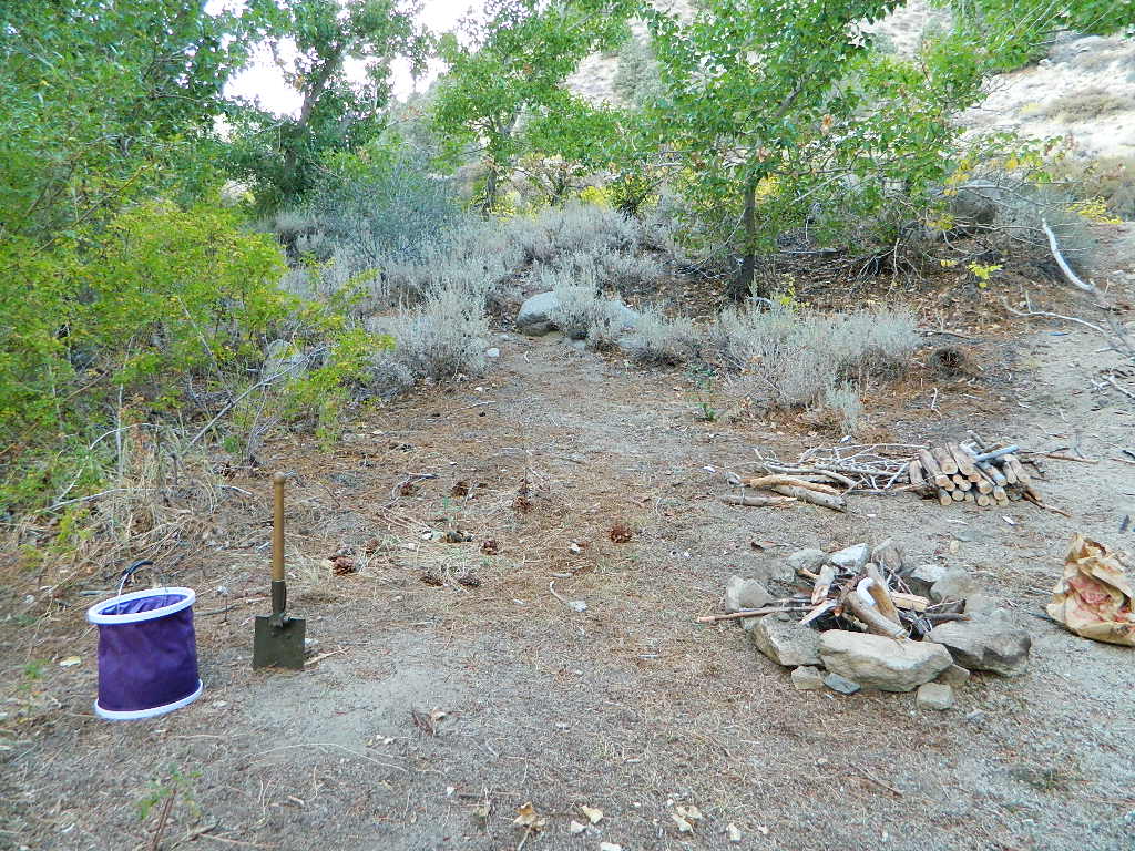
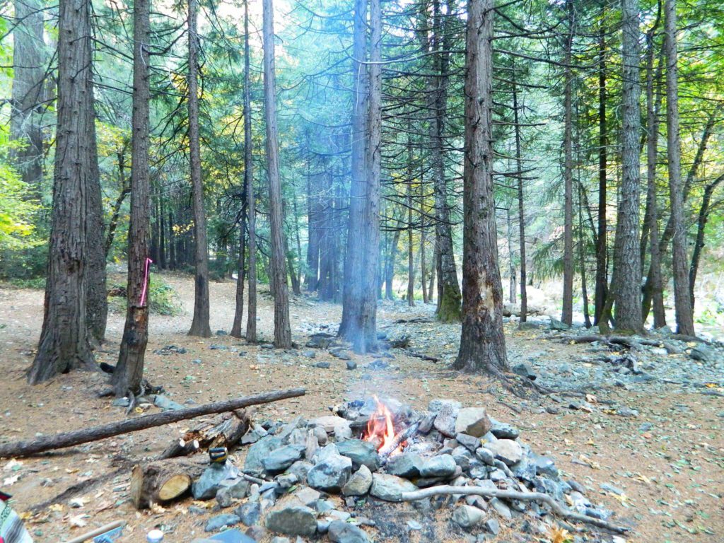
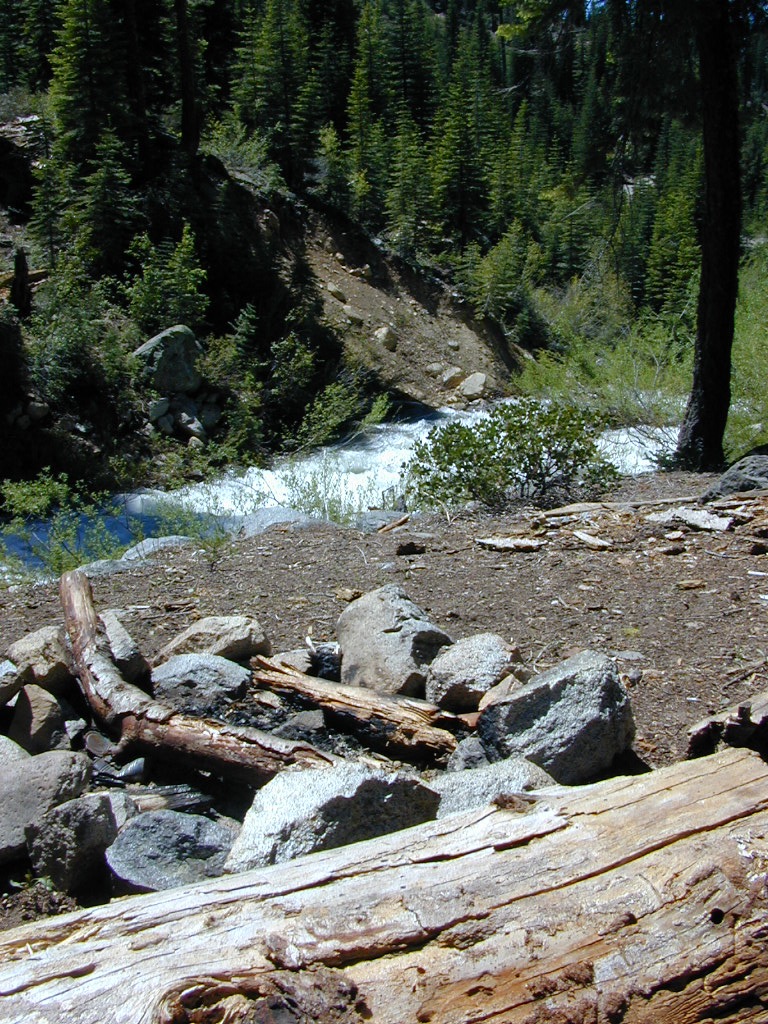
Build campfires in designated rings. Always try to use an existing ring when possible. If you must build a new rock fire ring, follow the guide on FireSafe
You will need water source & bucket, plus a decent shovel for building, maintaining and controlling a campfire. BRING enough water & tools with you to control a fire.
A ten foot clearance – all around, down to the bare dirt is the best practice. No brush close to the ring, no bushes, no leaves or pine needles. No dry over-hanging tree branches.
You might need to clean trash out of the fire pit, so bring heavy duty trash bags, or a spare old box. Shovel comes in handy here.
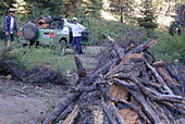
Kindling is key to getting a good fire going fast, so gather more of the small stuff. Wood gathering away from camp is usually better pickens.
Use environmentally friendly fire starters (with damp wood, if you must); not the BBQ lighter fluid or gasoline
Building fires up against a big boulder scars them w/ black soot, and although it can reflect heat back to you, it is seldom worth the unsightly damage
Bring chainsaws or hand saws for cutting your own campfire wood in the forest
Gathering wood for fuel — use only dead and down wood
A ranger issued “wood cutting permit” is required if you plan on cutting a full cord
Never burn plastics, batteries or other toxic materials in campfires
Tossing beer bottle caps into a campfire only litters site for future campers
While glass bottle smelting is a real treat among boys at night, which one is actually gonna get their hands dirty & clean up broken glass out of the campfire the following morning?
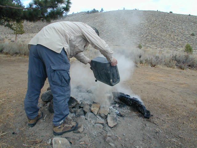
Do not leave any hot coals during the day (if you are away from camp). Winds could pick up.
Always douse campfire with water completely when breaking camp. Stir it, feel for heat, and drown it more if you hear sizzling or see bubbling.
Read more wild fire / campfire info on our FireSafe page
The Final Step of Breaking Camp
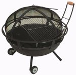
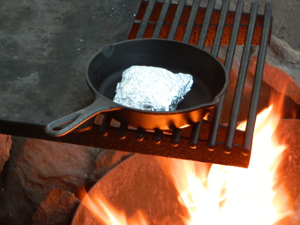
Campfire Pits & Fire Containers
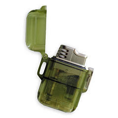
Stormproof Lighters
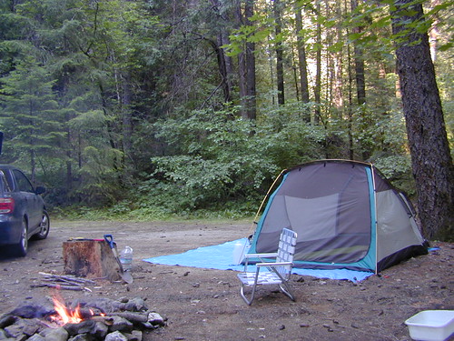
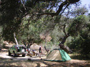
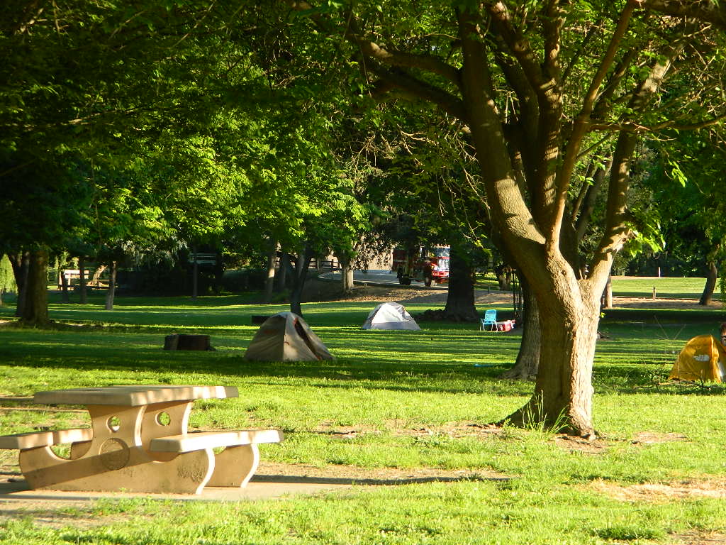
Developed Campgrounds offer sturdy, permanent, metal campfire pits. Many have adjustable grills built in.Primitive Camping is allowed in National Forests throughout California. Campfire permits are required. This style of camping is more peaceful and secluded, without neighbors, without fees and without amenities (no table, no fire ring, no toilet)
Camping is so inexpensive for the sheer entertainment factor. Reconnecting with nature can be so rewarding and good for your health. Sleeping outside doesn’t need to cost anything really. Stargazing, campfires, and listening to the wildlife are all still free.
Outdoor Gear – these purchases will be the most expensive part of your trip, but you’ll be able to use this same gear for decades of travel exploring the outdoors.
A whole weekend for under $100, seriously?
camping expense chart below for approximate cost per person for 2-day weekend
California is an outdoor recreation paradise, with near perfect weather, diverse terrain and breathtaking scenery around every corner. Many folks gravitate to the west coast specifically to be outdoors more.
Soaking in the sunshine, every day, every week. Reconnecting with nature and choosing to live a more healthy lifestyle, eat well and learning to relax often. Camping can be a real vacation – without the high cost of travel.
Summer isn’t the only time to go camping in California
Avoid crowds Try getting out there before Memorial Day or after Labor Day!
Desert camping is popular during winter months, while mountain destinations are preferred in summer. Find a secluded small campground or even try roughing it w/ primitive car camping. Motorhome campers who like to boondock, will enjoy the extensive back roads section of Total Escape. If you own a 4WD vehicle, you can reach the most secluded 4×4 camps, lookout towers and some historic cabins.
season
description
recommended
Summer
hot in deserts & country foothills,
smoggy in cities; coastlines can be foggy
mountains & coast
Autumn
great camping all around,
early winter storms in mountains
coast, deserts, country
Winter
snow in mountains & very cold,
windy on coast as seasonal storms move in
deserts (possibly)
Spring
snow melt in mountains may be late,
storms can last into late springtime
deserts & country
annual timelines to consider
summer – busiest time for traffic and travel; many travelers, families, tourists; National Parks and coastal towns are crowded; hottest in desert areas, cities and in the mountain oak foothills
autumn – meteor showers, fall colors, fishing, hunting, hiking, mountain biking; fire restrictions higher, firewood collecting, less families out and about, cuz kids are back in school
winter – prime time for desert camping, off roading, ghost towns, museums and meteor showers; coldest months w/ winter storms; snow is possible down to 1000′ elevation
spring – wildflowers, birdwatching, rainy season, lakes, rivers, creeks flowing well; rafting & kayaking; snow storms tapering off w/ snowmobiling in mountains; snow camping
Mount Pinos Fire Circle Camp SpotGold Hill Campground (which is now closed) – right next to Piru Creek.
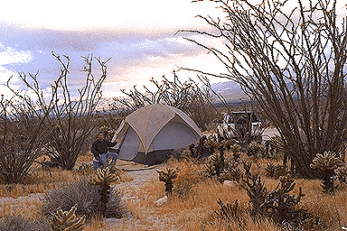
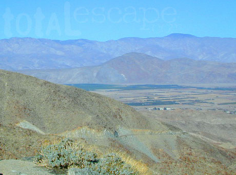
Frazier Park and neighboring towns, like freeway-close Lebec and Gorman, is where the Los Angeles hills meet the Kern County mountains. Mojave Desert meets to Coastal Range. EXIT I-5 @ Tejon Pass (elev 4144′)
Wildflower hills, seasonal creeks, forested peaks, high desert canyons. Bike trails, hike trails, off road routes. High elevation backpacking, hang gliding, mountain biking and camping in every direction.
Mountain Bikers love the trails at Mount Pinos.
High desert washes, oak creeks, pinyon pine forests, mountain meadows and numerous peaks – Frazier Peak, Reyes Peak, Alamo Mountain, Mount Pinos, Mount Abel (Cerro Noroeste) and north facing San Emigdio ridge.
Many dirt roads are gated seasonally for wet weather or snow. Call rangers to find out which routes are open before you plan your weekend. Or have a plan B and C camp site ready if route is closed. Flashfloods, thunderstorms, and erosion means you may all-of-a-sudden need to use your 4WD. This is the mountains after all. UNpredictable weather is common.
Primitive Camping in Quatal Wash, next to the OHV Route and the Chumash Wilderness
Peak-to-Peak Hike: the toughest climb you’ll do, this decade.
EB from Fresno, Hwy 168 up to Shaver, w/ another 30+ miles on paved backroads
(Dinkey Creek Rd & then McKinley Grove Rd)
Way, way back, beyond Dinkey
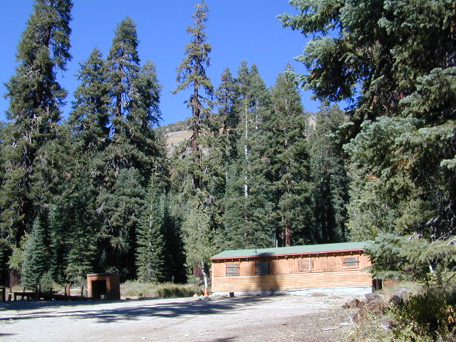
You gotta really wanna BE at places like this. Magical High Sierra mountains – California’s finest. Sheer beauty surrounds this lake w/ granite domes, granite cliffs, granite trails, forests, peaks and plenty hiking, fishing, water and boating. It does take planning (way ahead) to make it out here, cuz the area is only accessible during summer months. Typical of high altitude lakes, snow buries them annually and the roads get closed off to the public (usually NOV-MAY is winter). Some backcountry routes become snowmobiling trails during winter, and the Sierra National Forest has plenty of great snomo action (if snow is deep).
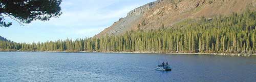
Wishon Lake, California
elevation: 6600′
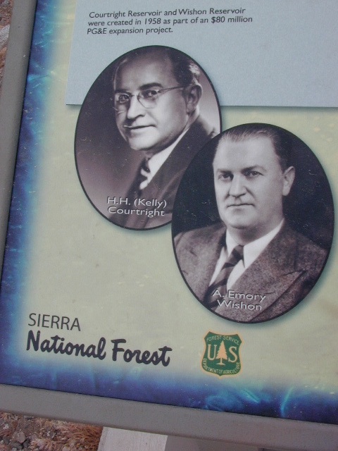
High Sierra Granite Reservoir with pines trees and rocky, granite shoreline. Not nearly as amazing as its cousin w/ the domes to the north, Courtright, Wishon has less granite & less wind, but more accessible backroads to explore, plus more car camping options. Both lakes are part of the Helms Creek hydro-electric project (dams) that make up the PG&E water infrastructure out in these parts – The Kings River Drainage System.
Backpacker trailheads, Woodchuck, Rancheria & Crown Valley all lead to dead end dirt roads – with nothing but solitude for miles & miles. Some might be passenger car accessible. Winter weather changes dirt road conditions (often).
The Kings River Geological Area is nearby, as well as both the John Muir Wilderness & Dinkey Lakes Wilderness.
Large Reservoir with 8,000-10,000′ high sierra mountain peaks surrounding. Pine forests, views, fishing, camping, hiking in every direction, secluded dirt roads. Perfect high elevation trailheads, next to John Muir Wilderness. Great for backpackers!
All boating, but no waterski or jet ski.
One public boat ramp. Fishing boat rentals available.
Wishon is a summer vacation paradise for trout fishing, hiking, backpacking and back road exploring.
CLOSED FOR WINTER: NOV-APRIL = Snow closes the road for winter. For all you hardcore campers and hikers, you must call ahead to see if roads are open. It is rural forest, well traveled, but snow storms will shut everything down out here (for many months). Although, in some mild winters you can drive as far as Dinkey Creek on pavement. Gates are locked beyond that.
Dinkey Creek Campground
Dorabelle Campground
Gigantea Campground McKinley Sequoia Grove
Sawmill Campground (dirt road)
Free, primitive or open camping abundant on the dirt backroads in Sierra National Forest. 4 wheel drive is not required for most routes, but a high clearance rig would help. Some gravel roads are graded annually and suitable for passenger cars – during summer months and only for about the first mile or two, off of the main road (pavement). Mud and snow are common on backroads!
Anza Borrego Desert State Park & Borrego Springs Campgrounds
Anza Borrego Desert is the largest of the California State Parks. Borrego Palm Canyon Campground is the official name of this popular palm oasis & developed campground located very close to Borrego Springs CA. Hike or bike to town. There is also a private RV Park named Palm Canyon Resort in town, just to confuse you.
Desert wildflowers blooms, popular hiking & biking trails, plus mud caves & slot canyons draw plenty visitors here, mostly in the winter months. Summer high temps exceed 90 degrees for months at a time.
There are hundreds of miles of dirt roads to explore, and one could easily spend every weekend for a full year, checking out all there is to see in this vast desert, where elevations range from near sea level to 5000′ peaks.
BORREGO PALM CANYON CAMPGROUND
main campground near Visitors Center, in town Borrego Springs, CA
120 camp sites for tents & RVs, flush toilets, overnight / day use fees reservations accepted
TAMARISK GROVE CAMPGROUND
27 camp sites, flush toilets, fee
on S-3 @ Highway 78 jct (closed June – Sept) reservations accepted (Oct-May)
Vern Whitaker Horse Camp
equestrian campground w/ corrals, 10 camp sites, flush toilets
elev, 960′, located N of Borrego Springs, near scenic and rugged Coyote Canyon. reservations accepted
Backcountry Campgrounds Anza
Arroyo Salado
16 miles east of Borrego Springs on County Road S-22
Blair Valley Camping Area
open car camping & RV spots, vault toilets
on SAN DIEGO County Rd S-2 near Highway 78 jct
Bow Willow Campground
elev, 950′, hwy access, 16 camp sites, pit toilets, overnight fee
near Sweeney Pass & badlands overlook; located on S-2, 9 miles N of Interstate 8
Canon Sin Nombre
off S-2 near Sweeney Pass; entrance near Badlands Overlook; slot canyon hikes
Coyote Canyon Camping
N of Borrego Springs via Di Giorgio Road
rugged backcountry dirt road, tent camping only
car camping near ocotillo gardens; 4×4 needed @ creek crossing & Sheep Canyon
Culp Valley Campgound
elev, 3400′, hwy access, 8 camp sites, pit toilets, free camp
located on S-22, atop Montezuma Grade
Culp Valley Boulders
elev, 3700′, dirt road access, primitive camp sites, free
located off S-22, 4×4 near Montezuma Grade
Fish Creek Campground
Hwy 78 near Ocotillo Wells & Split Mountain
elev, 280′, dirt road access, 8 camp sites, pit toilets, free camp
from hwy, go 12 milies south on Split Mountain Road
Yaqui Well
5 mi. south of Borrego Springs on County Road S-3 & right on Yaqui Pass Road, go 6 miles to camping area on right side
Yaqui Pass
5 mi. south of Borrego Springs on County Road S-3 & right on Yaqui Pass Road, go 4 miles to camping area on left side
Culp Valley trails, North Anza Borrego SP, SoCal Deserts
All Desert Campgrounds Nearby
AGUA CALIENTE HOT SPRINGS
(San Diego County Park)
88 camp sites for tents & RVs, flush toilets, overnight / day use fees, 760-765-1188
located on Co. Rd S-2, 22 miles N of Interstate 8 (closed June-Aug)
BOX CANYON RDMecca, CA – in between Joshua Tree NP and Anza Borrego Desert
BLM camping in Box Canyon & Mecca Hills Wilderness Park
LEAPIN LIZARD RV RANCH
(Private Campground Resort)
85 acres, 60 camp sites
located on Split Mountain Road, Ocotillo Wells, CA
OCOTILLO WELLS SVRA
(State Vehicular Recreation Area)
elev. 160′, 4×4 and off road camp sites for trailers & RVs
no water, no hook-ups, pit toilets, no fees, 760-767-5391
located on Highway 78 (closed June-Sept)
PALM CANYON RV RESORT
(Private Campground Resort)
located in town, Borrego Springs, CA
SALTON SEA SRA
(State Recreation Area & Campground)
Mecca Beach, Corvina Beach, Salt Creek Campgrounds
located on Highway 111 on east side of inland sea
SLAB CITY @ SALTON SEA
old Camp Dunlap in California desert badlands
free & open RV camping near Salton Sea
located off Highway 111 on east side of inland sea
TRUCKHAVEN HILLS
(OHV trails & camp spots)
elev. 300′, 4×4 and off road camp sites for car camping, touy hauler trailers & RVs
no water, no hook-ups, no fees,
located on S-22, East of Borrego Springs, CA
VALLECITO PARK
(San Diego County Park)
44 camp sites for tents & RVs, no hook-ups, toilets, overnight / day use fees, 760-765-1188
located on S-2, 22 miles N of Interstate 8 (closed June-Aug)
FREE CAMPING ANZA– Let us also remind you that this is the best place to camp in California for primitive car camping (camping outside of a developed campground). Open all year long – always! Super secluded, darkest skies, free and always located on the back roads. 4×4 is not required in all areas, so there are plenty of options. Blair Valley or Coyote Canyon Gardens are popular camp spots, but there are thousands of hidden canyons and washes in this giant State Park, just awaiting your tent. You’ll need a decent topographic map. For more info on free camping click here.
The main artery from the North; the Big River of California
Mighty Mount Shasta snowmelt flows south, bound to meet the giant Lake Shasta, which merges with the Pit River and numerous other major waterways, becoming the big Sacramento River. Running right down the center of the North Sacramento Valley to merge into the California Delta. Shipping channel links the State Capital city of Sacramento with the San Francisco Bay and the Pacific Ocean. Agriculture and wildlife depend on this river heavily.
Sacramento River National Wildlife Refuge
Willows, CA
~ Camping is not permitted on the Sacramento NWR. Along the Sacramento River, camping is permitted on GRAVEL BARS for up to 7 days during a 30 day period. For waterfowl hunting, overnight stay is permitted in a vehicle or RV in designated areas. Tents are prohibited. No person may build or maintain fires except in portable gas stoves.
San Diego Coastal Campgrounds
Mission Bay & North County
SD Beach RV Parks & Camping
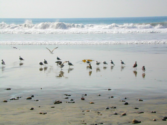
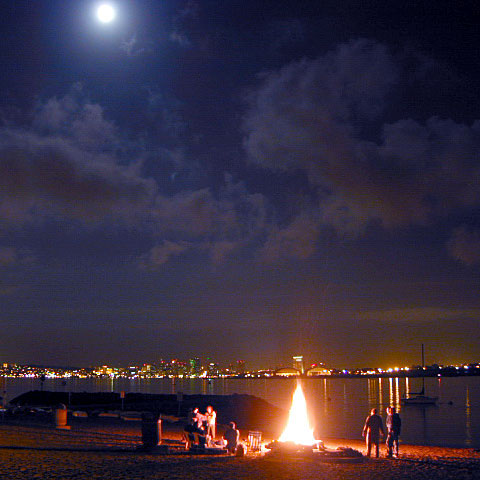
San Diego’s mild climate means camping is available all year round. Winter storms can get windy and rainy, but most campgrounds are still open. From north county where the coastal cliffs overlook the ocean, to downtown bay side marinas w/ RV camping, to camping right on the sand w/ ocean crashing just feet away. Bike paths are common around downtown San Diego, so you can bring your bike or skates.
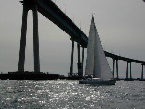
San Diego has 2 BAYS, both located along Interstate 5: The main bay downtown is called San Diego Bay (one of the deepest on the west coast) and the other a few miles north, is named Mission Bay (a man-made coastal waterway w/ green parks and paved bike trails).
Reservations are required at almost ALL coastal campgrounds, especially around holidays, any 3 day weekends, and all summer long. Tons of tourists flock to Southern California and this is a very popular coastline – with busy little cities and crowded beach towns. Beware: if you are seeking secluded camping – this would not be the place.
San Onofre State Beach Camp Pendleton or Camp Nuclear; I-5 freeway close
in between Oceanside & San Clemente, CA
There are numerous private RV resorts, some quite large, like KOA and GoodSam parks located in and around San Diego county. Most are metro-close and not located on the beach. This list is primarily coastal camping options for the San Diego region.
If you are thinking about fishing or camping the Eastern Sierra, North of Bishop & you are not up for the crowds at Mammoth or June Lakes, then try the Bridgeport area, north on Hwy 395. Rural ranch lands along main road, Bodie ghost town turn off across the highway and Virginia Creek Settlement are also nearby
Green Creek is a 11 mile long dirt road in the lush Eastern Sierra the northern portion. The wide, graded dirt road is signed and dead ends at a Toiyabe National Forest campground called Green Creek Campground. The drive up can be washboard bumpy in some parts, but that doesn’t stop the hundreds of adventurous motorhomes that make this trek annually. This place features some of the best prime Sierra back roads camping options for RVs.
Another dirt route, Dunderberg Meadow Road peels off to the left. Dunderberg departs off Green Creek a couple of miles from the highway and well maintained. This route leads to meadows, aspens, picture perfect scenery and much more seclusion. Passenger car accessible, wide graded dirt roads to wilderness edges. Two-track one lane trails lead to meadow edges and more creeks. Very impressive views of the Sierra peaks over here on this side. Meadows are sensitive areas, wonderful for picnics and you should always minimize impact.
Plain old passenger cars can easily make this route deep into the Eastern Sierra aspen canyon. Graded dirt and4x4 could be needed winter months. Backpackers can enjoy easy access to the Hoover Wilderness trailheads. There is plenty semi-primitive camping spots along the way, right on the creek, for free…. so no need to sleep in your vehicle upon arrival.
Autumn Aspen Groves: fall colors peak in October, which is usually when the first snows for the winter season start. November – usually the freeze gets them and lifeless brown leaves dangle, until the Sierra Nevada wind gust blow real good.
Green Creek Camping
DIRT ROAD CAMPING
alpine lakes
backpacking
car camping
day hikes
fishing camping
meadows
RV camping
tent camping
Dispersed, primitive camp spots along this main dirt road are on a first come basis. You’ll need a fire permit. Many flat camps are set along the creek in aspen groves, some pines, others have cubby hole privacy. Large granite valley, big creek, bird, scenery and nature everywhere. Some folks spend weeks camping out here in the warm weather months. Fishing is a big attraction.
Old Cabin in autumn leaves, up near the top of the dirt road deep in the aspen groves
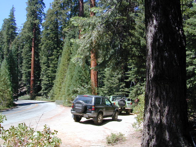
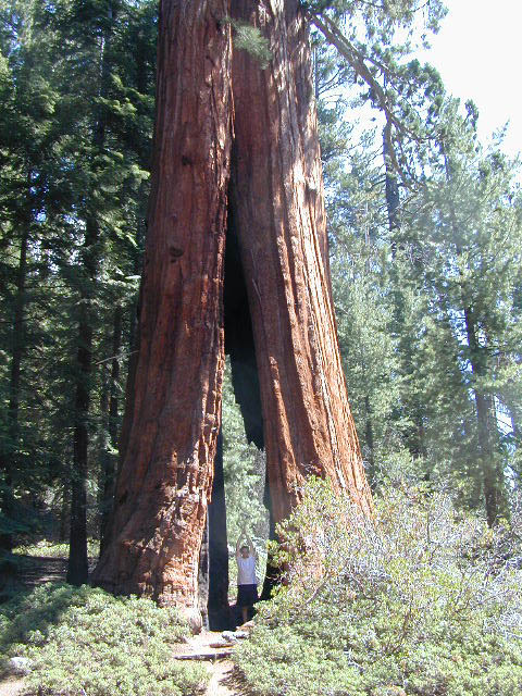
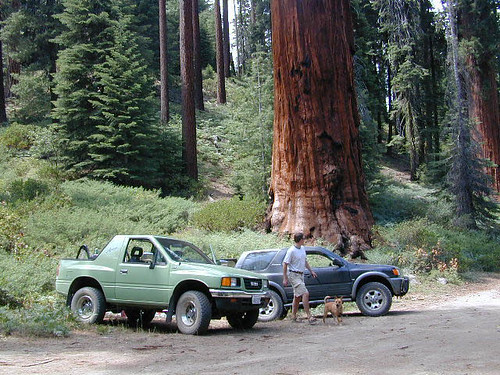
Sequoia trees naturally grow in the Sierra Nevada mountains, on the west side of the range. Several parks & forests make up what is known as “the Sequoias” – in the Southern Sierra, Sequoia National Forest; Giant Sequoia National Monument; Mountain Home State Forest; Central Sierra is home to Sequoia National Park & neighboring Kings Canyon NP; Sierra National Forest & Yosemite NP. Yep, all those areas have Sequoia groves!
If you are searching for tallest species, the Coastal Redwoods located on the shores of Northern California, then you can find them over here – NorCal Redwoods
The list below is of awesome California locations that do have off-road trails surrounding them. Some destinations listed are heavy use off-road – with OHV parks or camping nearby, while others are simply scenic dirt backroads or forest roads for easy driving. Topographic maps can be found for most areas, and should have all roads displayed, dirt and paved routes, as well as campgrounds, hiking trails and trailheads.
This California “off road towns” list was originally part of the California Off Road Maps page, but it surely deserves it’s own unique post, since it is an ever expanding list. Ongoing.


 Living close to the earth with organic gardening and rural living, DanaMite strives to offer California residents, new-comers and visitors unique, local destinations, concentrating on the outdoors – well away from overcrowded, busy, urban cities and tourist traps. Total Escape can show you how to discover the secret, hidden spots on your public lands that the gov web sites will not even dare to mention.


 Redwood forests and rivers are what make up most of the Northwest part of California, just below the Oregon coast. Logging and fishing are the big industries up here. Lumber mill towns and camps still exists today. Wilderness areas, dirt back roads, river kayaking, stream fishing, camping and real wild indians. Oh yeah, and Big Foot!
 The furthest north is


 Coastal mountains located above the Napa & Sonoma wine country. US 101 & Highway 20. Rivers, forests, wilderness and redwoods is the key terrain that make up the
 Northern Sierra Nevada mountains is where the granite rock of the Sierra meets to volcanic rock of Lassen Volcano.
 Technically speaking, the Susan River is the top waterway of the Sierra Nevada mountains.


 California is an outdoor recreation paradise, with near perfect
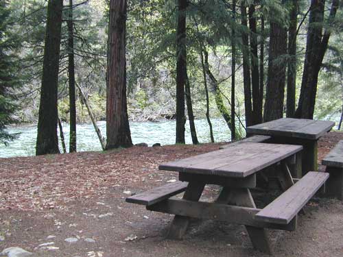


