Ukiah holds the Redwood Empire Fair every August at the Redwood Empire Fairgrounds. This one is the biggest fair in the region for summer fairs and events.
Warner Mountains
Modoc Country
Northeast California
Wide open spaces, mountains, rivers and ranch lands. The very last of the unexplored high country of California. Rural and rustic regions are full of forested mountain ranges with sage brush meadows lying below. Valleys are high elevation deserts with a base terrain sitting above 4000′; Peaks @ 8000′ above sea level.
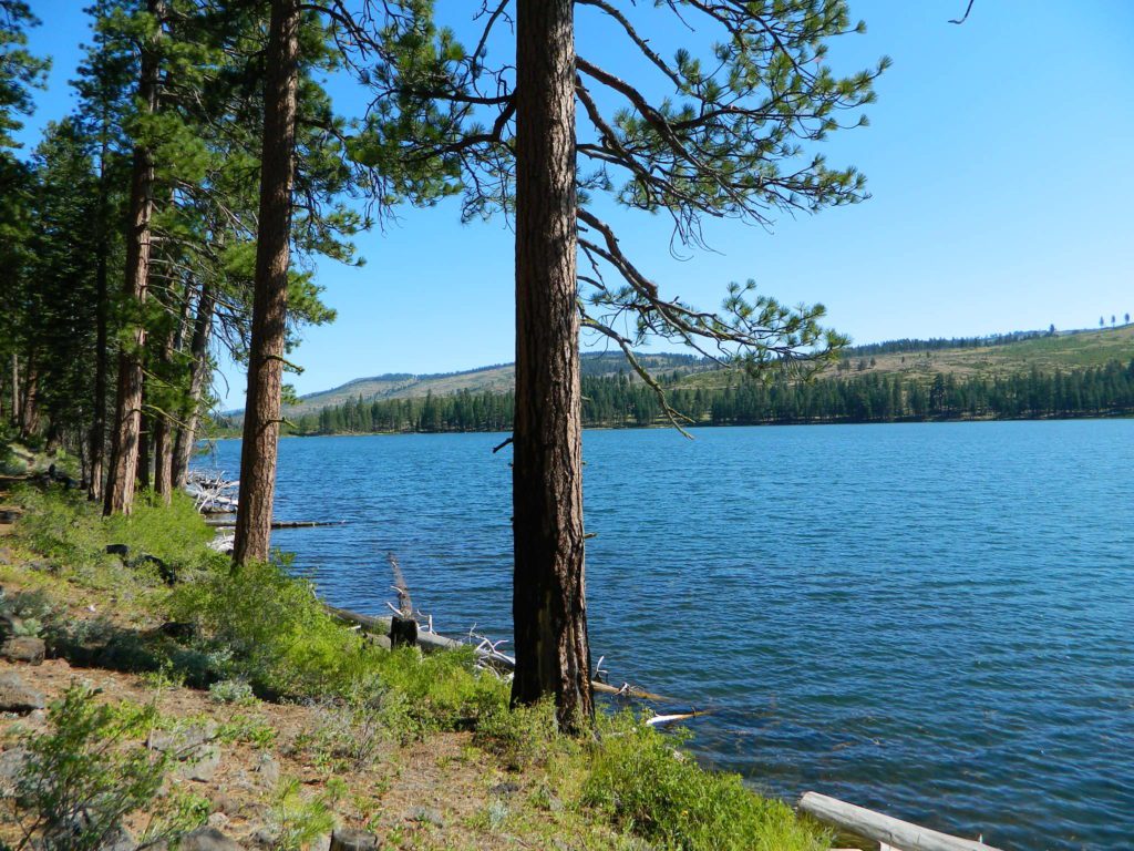
South Warner Wilderness is in the southern portion of the Warner Mountains, a north south positioned range, located in the top corner of the golden state. Surprise Valley lies to the east, bordering the Nevada state line and Alturas w/ US Hwy 395 on the west side.
California SR 299
Hwy 299, the only paved thoroughfare cuts right through the middle of the Warner Mountains. Paved Parker Creek Road #56 climbs up Parker Creek from Alturas, accessing camping, hiking, dirt back roads and wilderness trailheads. Warner Mountains State Game Refuge is north of the wilderness area.
One dirt route skirts the wilderness boundary – West Warner Road #5, which leads from Parker Creek due south to Jess Valley Rd #64. Blue Lake Road, Patterson Mill and Road #39N15 are nearest to East Creek. Winter driving tips from NFS.
All these campgrounds listed can be accessed by a vehicle, most by narrow back roads (some dirt). If you prefer to drive on paved roads only, then you’ll need to choose Blue Lake or Mill Creek Falls. Deep snow closes forest roads and campgrounds are generally only open a few months per year, from May to October.
Unbeknownst to most California tourists, the “Shasta” region encompasses most of the northern part of the state. From the majestic Trinity Alps to raging Burney Falls; the huge, snow capped peak of Mount Shasta can be seen by half of NorCal. From the high country on the north side, to the Sacramento Valley on the south side. Shasta dominates this region all around Redding and I-5.
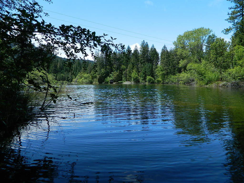
Northern California has numerous camping lakes, most of which are very RV friendly. Boating, fishing, hiking, kayaking & even houseboat rentals are available at Lake Shasta.
The Big Lake you see from Interstate 5 is named Shasta Lake, the main drain from the northern reaches of Oregon. The big reservoir in the middle of the North State.
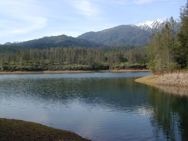
Whiskey Town Lake is west of Redding, with Trinity Lake tucked way back up in the hills – N of Weaverville.
You could spend a lifetime exploring all the lakes in the Shasta area. On foot, by bike, with a fishing pole and a pack llama. Maybe just an old funky motorhome.
Golden gems of California, a collection of alpine lakes on the north end of Historic Gold Country, North Yuba River, Northern Sierra Nevada
EAST of Downieville, CA
California’s Gold Lake and surrounding lakes; the granite spires of the Sierra Buttes and the creeks, waterfalls, headwaters of the Yuba River — total wild beauty. Steep, granite, river canyon from Downieville drive east on Highway 49 from Sierra City to Bassetts, a gasoline and market stop; they have a small hotel there too.
Take the left turn, north on to the Gold Lake Highway. The alpine and extremely scenic Lakes Basin Area consist of all small lakes in between Hwy 49 to Hwy 89, along GOLD LAKE HWY [Road S620] some maps read Road #24 or call this Gold Lake “Road” instead of highway. Snow closes in this route during winter months.
Frazier Falls Trail
Length: 1 mile RT / Directions: Trail head is located on Old Gold Lake Road, about 5 miles from the Highway 89/Gold Lake Road intersection. Take the signed, narrow paved access road 4 miles to the trail head.
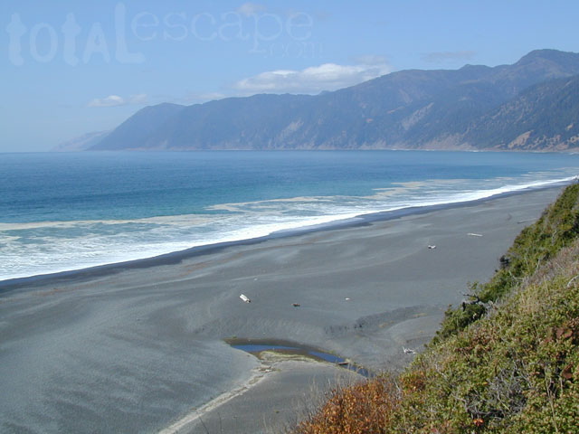
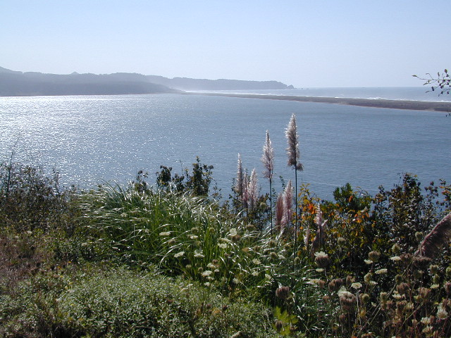
The sheer beauty of real weather, the clashing storms and ocean with the land. Cold and wet half the year (or more), Northern Cal has less people and more scenery. More nature, more land, more forests, more view points, more wild beauty – than the rest of the California coast.
Maybe more hippies too!
The fantastic coastlines of Northern California are forested, rugged, rocky and they receive a lot more rain than the rest of California. Coastal fog or deep cloud layers are common, even in warmer months.
Tall cliffs, large lagoons, rural towns, and foggy beaches. Beaches filled with small rocks. No sand? Minimal access to the coast in some areas.
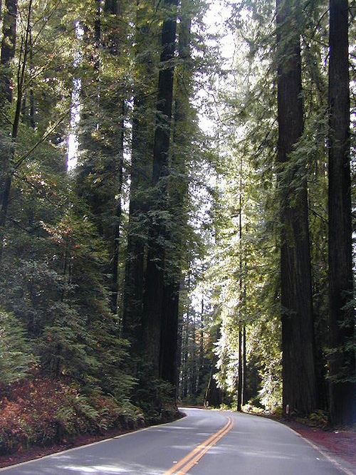
Super tall, coastal redwood trees thrive along this oceanfront wildness. They are located just a skip away from the sea. Most groves located miles inland, near US 101 highway. Close enough, but not out there on the windy beach, exposed with the elements.
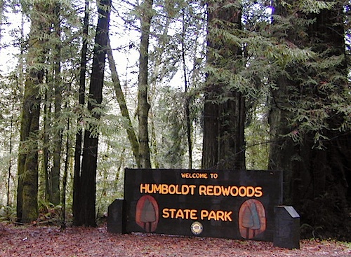
NorCal Coast Campgrounds are located generally along river ways, near redwood forests and near paved roads. Redwood Campgrounds are all over up here. Literally, everywhere. Some camps are better suited for RV campers than others. A few parks have walk-in or hike-in access to camp sites.
Several redwood parks are 20 miles from the coast, so know the exact location before you book a campsite online. Driving “over to coast for a quick day trip” is no easy task, since routes can be narrow backroads with many curves. Pavement, if you’re lucky.
listed below:
campgrounds actually located at the coastline are labeled in bold text
When the weather is warm and sunny, people – flock to the hidden coves, rugged beaches, or they float, kayak, fish or raft on the rivers, or the enjoy long day hikes.
blue links lead to State Park pages with camp reservations.
Some redwoods parks are open year round, others only in summer months. Reservations for campgrounds is common along this desired vacation region of California. River kayakers, mountain bikers, tent campers, avid hikers, road trippers and RV campers.
camps actually located at the coastline are labeled in bold text
California Redwood forests are found along the NorthCoast; coastal redwoods. And in the Sierra Nevada mountains; those big redwoods are called Sequoias.
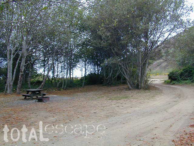
Lost Coast: Drive Dirt Roads – USAL ROAD# 431, this road is the hard left off HWY 1, just as it peels away from coast and heads into redwoods and US 101. Follow this dirt and gravel scenic wonder drive out to Usal Beach Campground, Sinkyone Wilderness and Shelter Cove. The pavement picks up again near Honeydew, a rugged 30-something miles north. Real 4×4 may be needed in wet weather.
Although the name suggests more, the number of lakes in this region is approximately seven: Eiler Lake and Box Lake are the 2 largest lakes within the Wilderness boundary. Logan Lake and North Battle Creek Reservoir are on the outskirts. Trout fishing is a popular recreation sport all around Lassen. Thousand Lakes Wilderness is part of the Cascade Range in northern California. 16,335 acres and 21 miles of trails, all managed by Lassen National Forest. The area lies midway between the mountain town of Burney and Lassen Volcanic National Park.
Volcanic activity and glaciers have combined to create the Lassen topography. Dominated by Crater Peak 8677′, which is the highest point in Lassen National Forest, this area is a reminder of the glacial action that eroded the original, much larger Thousand Lakes Volcano and created the many small lakes and ponds scattered throughout the region. Wildlife includes black-tailed deer, black bear, pika, pine marten, northern goshawk, spotted owl, pileated woodpecker, and Clark’s nutcracker. Even elk have been known to visit occasionally.
Roads and trailheads surrounding Thousand Lakes Wilderness and the Wild Woods
Lassen Forest Road #16 – Ashpan Winter Recreation Area @ Hwy 44, leads to hikes on the west side of the Wilderness. Bunchgrass trailhead and Magee trailhead. LaTour State Forest, Ashpan Butte, Huckleberry Mountain, Fredonyer Peak, Crater Peak, and Whittington Butte. Lassen Route 16 is a graded dirt road that connects to Tamarack Road #4M001 at Burney Creek, near the north side of the Wilderness.
Road #32N17 – access to North Battle Creek Reservoir Road #32N16 Road #32N24
Road #32N31 – access to North Battle Creek Reservoir
Road #32N18 leads to PG&E North Battle Creek Reservoir
North Battle Creek Campground: elevation 5600? / 15 camp sites / open Apr-Oct
Road #26 on the north side of the Wilderness, connects Hwy 89 @ Hat Creek, west to Road #32N22. Cypress trailhead is located on a side route nearby.
Road #32N23 is up on Burney Mountain elev. 7863′, another hang glider launch site.
Road #33N25 leads to the Tamarack trailhead Road #34N78 off Hwy 44, near Logan Lake and route leads to McElroy Flat
Road #32N35 behind Burney connects to Hat Creek (the back way).


 Whiskey Town Lake is west of


 Lost Coast Camping BLM