Celebrate Freedom and Independence Day lakeside under giant shady oaks with three great musical acts on an afternoon of music, food & drinks! General Admission is free to the music festival. If you want to be closer to the music there is a reserved VIP area and VIP Plus to get into the front row. ?Don’t forget to bring your low back chair or blanket.
July 4th @ 4 to 8 pm
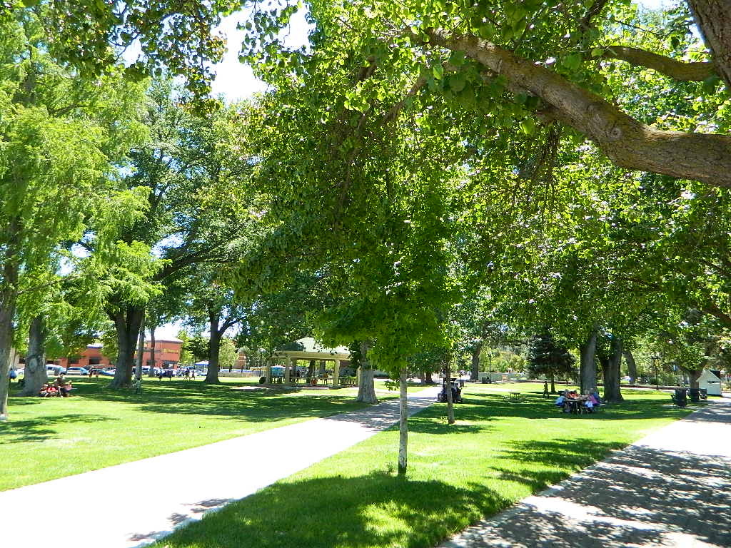
Atascadero Lake Park
Annual event: July
One day event, always held on Fourth of July
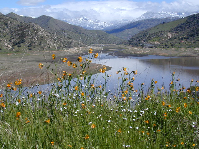
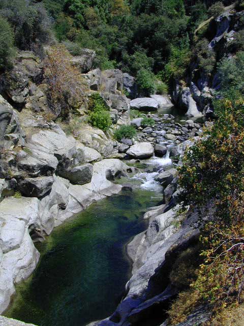
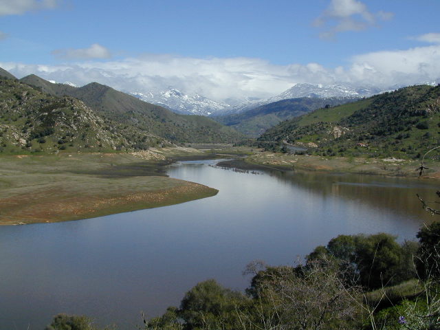
Sequoia Foothills Reservoir, CA SR 198 Kaweah Lake
Southern Sierra lake located on Kaweah River, near the mouth of Mineral King Canyon. In between the western Sierra foothills and the agricultural San Joaquin Valley. West of Sequoia NP, east of Visalia, California.
Crystal Cave
Mineral King
Sequoia National Park
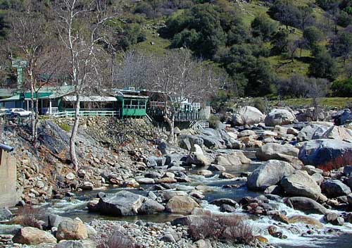
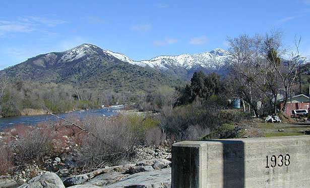
Three Rivers
Visalia
The small town of Three Rivers is just up the road from this small reservoir & their slogan is the ‘southern gateway’ to the Sequoia National Park.
There are several recreational reservoirs that are situated at the base of the Sierras, along the western slopes. The Kaweah River transports snowmelt deep from the Sierra Nevada mountains, down to the San Joaquin Valley (Central Valley), for human consumption, households, and agriculture.
Kaweah Marina has patio boats, fishing boats, and paddle boards available for rent. Reservations are needed in summer for weekends and holidays. 559-597-2526
Kaweah Houseboats
Privately owned house-boats can be seen on this lake, although none are available at the marina for rent. Some can usually be found for sale on visalia.craigslist.org
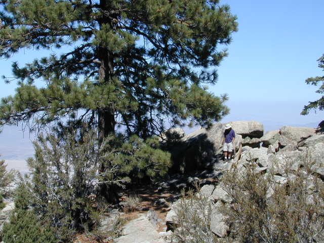
Sequoia Highway 198 has many side routes worth exploring: Mineral King Road will get you to amazing scenery, but there ARE NOT ANY Sequoia groves up that way; Crystal Cave, open for tours is located near the south entrance of the National Park; and a lesser known campground in this area is called South Fork, off on a residential side route canyon – South Fork Drive (Road #348); Located on the quiet South Fork of the Kaweah River.
Sequoia Atlas Three Rivers is small town, located along the Kaweah River, near south entrance to Sequoia National Park
North Fork Drive: North Fork of the Kaweah River is a seldom traveled dirt back road that leads from the east side of the lake @ Hwy 198, northbound (along the North Fork of Kaweah River), straight into the backdoor of Sequoia National Park’s ridge line highway @ Dorst Campground. The original town of Kaweah (elev 960′) is along this route. Many small dirt roads to explore up this way and a good topo map is advised.
Eshom Campground(on western border of Sequoia NP), a small slice of Giant Sequoia National Monument land, Redwood Creek and a trailhead called Redwood Saddle are all back up in here.
Have a few good maps to cross-reference while traveling back roads and trails.
This major dirt route is often closed and gated by the rangers during wet, winter months.
5 years running on the Central Coast. Held in downtown Paso Robles City Park, in north San Luis Obispo County.
Producers from all over California, Olive Oil Tasting, Culinary Row, Wine & Beer Tasting and now with lavender!
Now this event has been combined with the Lavender Festival (and moved to July)
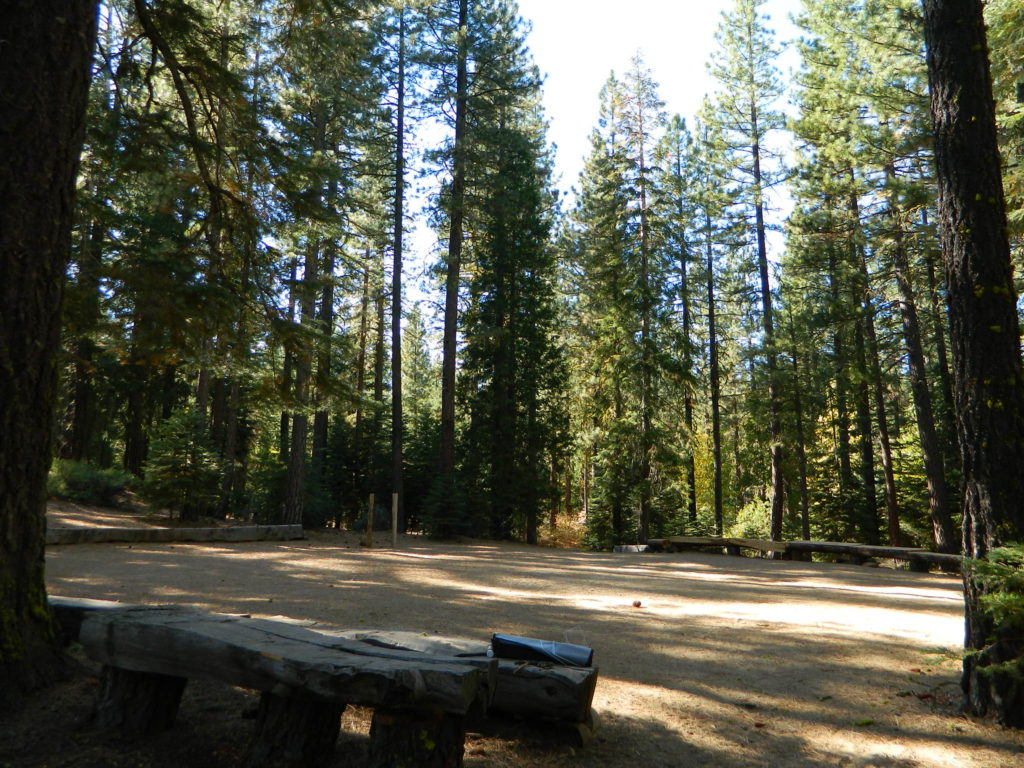
This pine forest is home to the developed NFS campground – which has been named after the tribal elder. The camp location is a sacred spot to the local native tribes. Just above Susanville, CA on the west side, south of the highway; forested w/ creeks and aspen groves. Autumn colors can be found in the creek beds.
Dirt roads all over the place, leading to far away destinations like Diamond Mountain, Antelope Lake and Taylorsville. The backcountry region was recently damaged by wildfires: 2020 Sheep Fire and now the Dixie Fire
FREE CAMPING – W Susanville, CA en route camp
Less than 3 miles of dirt road #29N03 driving will get you back off the highway and into this forest, Hwy 36 W of Susanville. Bring the mountain bike for abundant usage and a week of exploring.
Only 13 miles to downtown Susanville, via the back road. Chaney Creek Road is a main dirt road near Highway 36, which parallels the river, the red rock bluff and the road, downhill into town.
This FREE campground is popular with the hipcampers and pediums – and gets rave reviews; small RV campers do like to use this camp spot, if they don’t mind a little dirt road driving; they’ll need to park in the dirt parking lot, 40+ feet away (not adjacent to the picnic tables or fire rings).
camping
ceremony
drum circle
fishing
hiking
horseback trails
hunting
mountain bike
off road trails
Bear Dance Circle @ Roxie
walk in campground, and close to town
Walk-In Campsites @ Roxie
AUG 2021 – CLOSED due to the Dixie Fire
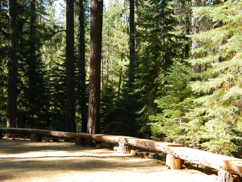
Roxie P Campground
Susanville, CA – Lassen NF
• Elevation: 4,800′
• Number of Sites: 10 (walk-in only)
• Vehicle Accessibility: any
• Campsites Reservation: No
• Campsite Fee: No
• Length of Stay: 14 Days
• Season: open all year
• Trailheads: Diamond Peak
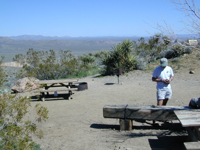
Flat forest and easy to walk. Shade and pine needles, picnic tables and group fire pits. All facilities are encompassed with a sturdy wooden, fence line. No RV or trailer access to camp sites. Mountain bikers like this spot and so do horseback riders. Travelers passing through eastern California will welcome the convenient location, plus the ease of dirt road.
The Roxie Camp is situated near Willard Creek on the south side of the Highway 36, close to Susanville. Willard is a feeder stream into the Susan River, which flows into town. Quiet camp, most of the time. If a big family is camping here w/ children, or there is a tribal gathering, it could get loud.
PLAN B – head over to Goumaz Campground NFS, due north. Located in between, near the junction of Hwy 38 & 44. Near the railroad tracks and the Susan River. Smaller camp near the NRT (National Recreation Trail), the Biz Johnson Trail (BLM). 2021, this camp is CLOSED!
so find someplace else: PLAN C
(make sure any camp is open by calling rangers before traveling).
OHV activity may be passing the developed campground, but are discouraged – due to the layout of camp. Plenty spots for ‘froaders further out – at the end of the road. Way back there!
Jeeps, 4×4 trucks, quads, dirt bikes, anglers and hunters travel these dirt back roads, as well as rangers, campers, horses, mountain bikes, and big logging trucks. 25 mph slow is always best. Daytime headlights help you get seen in the shadows. Forest is dense and road conditions are ever changing.
Forest Road #29N03 is Gold Run Road, the bumpy dirt road – that skirts around Diamond Mountain on the south side. Lots of one single track or one-lane dirt roads, which will require a National Forest map or a decent topo map to navigate properly.
OHV is common in these areas, but not so busy at this camp. If you seek peace and quiet and solitude, know how to read a map and where the noise is expected to be. Avoid the OHV areas, if you want to nap in the hammock and read a book.
Wild red necks with guns live in NorCal, so pay close attention to property lines and trespassing signs.
USFS Ranger Station is located on the west side, just outside of town, on the wide downhill grade on the highway @ the Eagle Lake turnoff. Cal Fire station is also located along this stretch of road.
Lassen National Forest
Ranger Station USFS
CA-36 @ Eagle Lake Rd
Susanville, CA 96130
530-257-4188
Cal Fire Station
697 CA-36, Susanville, CA 96130
530-257-4171
Plumas Road #24N29, off Bucks Lake Road
East of Bucks Lake, California.
a six mile, one lane, dirt road is the only vehicle access into this high elevation, dammed reservoir, tucked back against the wilderness. Secluded lake campsites await, you’ll just need to get a little dusty first. The turn off, at a small brown sign reading “Silver Lake”, one which is very easy to miss – due to the amount of homes, cabins, fencing and driveways in the vicinity.
No swimming allowed at this Silver Lake, as it serves as a drinking water source for the neighborhoods below. Canoe & kayaking are allowed. Fishing is also popular at this location. Hiking trailheads at Silver Lake lead to the PCT (Pacific Crest Trail), Mount Pleasant, Spanish Peak and a small gem of a swimming hole, we call mini Gold Lake.
This small campground is actually set downhill from the rock earthen dam, which is something to ponder before/during a big earthquake. With sites 1-5 in a shady forest area and the others a bit closer to the lake, no campsite is too close to another. These are all well-spaced-out sites, providing decent privacy and minimal noise from neighboring campers. No campsites are located at the lake edge, as the rocky dam is a long structure and quite complex with water control measures.
All the campsites have new bear boxes for food storage, cuz ‘wilderness’ usually means black bears are roaming about. Deer tend to frequent campsites 1 & 2.
2020 update: overnight camping fees now charged at this campground
Silver Lake Campground NFS
• Elevation: 5800′
• Number of Sites: 9
• Vehicle Accessibility: RV 22′
• Campsite Reservations: No
• Camp Fee: Yes
• Toilet: Vault
• Water: No piped/potable
• Length of Stay: 14 Days
• Season: May – October
• Trailheads: PCT, Gold Lake, Rock Lake, Granite Gap, Bucks Lake Wilderness
As with most of the high elevation lakes in California, winter months can mean deep snow and dirt road closures. This campground is usually open through the end of October, but call head to the local rangers if in doubt.
Plumas National Forest
Mt. Hough Ranger District
39696 State Highway 70
Quincy, CA 95971
530-283-0555
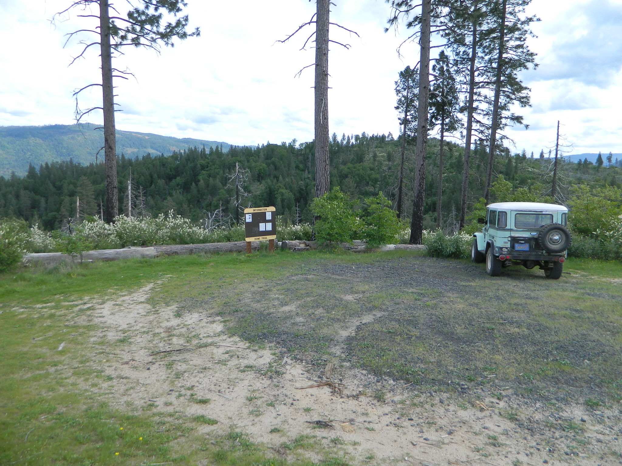
On paved Bald Rock Road a rusted metal sign reads “Dome Trail 3” which is where the fun begins, on the dirt.
3 mile drive to trailhead from pavement
4.6 miles RT hike
w/ a 2000 feet elevation drop to the river
Plumas Forest Rd #21N51Y is located in the forested community of Berry Creek – opposite from Upper Zink Road. Road 21N51Y becomes Bean Creek Rd #21N36: The forested route passes a few private properties and gates, the dirt road leads 3 miles down to an old wildfire (2008) burn area and eventually dead-ends at the Dome trailhead. The hiking trail descends down while overlooking the Bald Rock Canyon with the Middle Fork of the Feather River.
Rated as a moderately difficult hike: Steep hillsides, plenty switchbacks, downed trees across trail, boulder hopping, cliff edges, extreme heights and rock slides. Delighted by dozens of wildflowers, the old metal staircase still in use, steel pipe railings and the minimal fencing and of course, the big river deep inside an impressive rock canyon. Sierra Nevada spectacular!
Indian Creek spills down into Curtain Falls up the canyon, sometimes within view. Secluded Milsap Bar Campground is also up the river from here. The stretch of the whitewater river is popular with rafters and kayaks. Rock climbers gravitate to the big walls above. Bring a picnic lunch and water filter for this amazing all day hike.
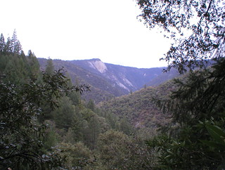
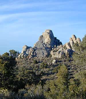
Granite Domes & Bald Rocks
There are numerous granite domes and bald rocks within the Plumas National Forest, most located near the big river canyons. This particular granite dome is situated overlooking the Middle Fork of the Feather River, and it is called Bald Rock Dome w/ 3509′ elevation.
Not to be confused with another shorter hike nearby on Bald Rock Road at a well marked trailhead for Bald Rock, which over looks the forest and valley to the west side. The official peak is named “Big Bald Rock” as listed on most maps.
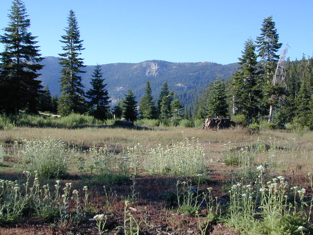
California meadow is a common term people search for when dreaming of their mountain retreat vacation or upcoming weekend camping trip.
Meadows are places in the forest where cool air collects and settles. Deer among other wildlife, can often be found here grazing around dawn and dusk. Alpine meadows are usually surrounded by trees with lush green grasses, located at higher altitudes above 6000′ – the ‘highcountry’ as most like to say.
Find meadows on National Forest lands from 3000-10,000′ elevation, and it is not uncommon to see cattle grazing in these same regions. California National Parks have some of the most protected meadows in the golden state!
MT SAGE – mountain sage meadows
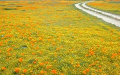
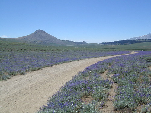
High desert mountains have drier landscapes, with large sage brush meadows surrounded by sparse pinon pine and/or juniper forest. The Mojave desert’s sagebrush reaches out westward to the peaks of West Kern County. High deserts and mountain meadows can both have significant wildflower blooms. The deserts start to show color in March & April, while the highest elevations of the Sierra Nevada can bloom as late as July & August. All California Wildflowers depend on autumn seasonal rains & snow melt.
Kennedy Meadows from Bald Mountain Fire Lookout
Wilderness Meadows
The best places to find secluded wildflower meadows is on the high country trails of various mountains – Mount Pinos, Sierra Nevada, Shasta, Trinity & Lassen – all have marvelous meadows, some have easy access w/ parking nearby and others are hike-in only. Locate hiking trailheads for meadows and possibly find camp nearby.
Excellent near Meadows:
Stargazing, Wildflowers, Wildlife Viewing, Horse Camping
Explore dirt back roads of California to find your very own meadow. If you would like to explore at this level, a good topo map is highly advised. The Sierra Nevada mountains have the most beautiful meadows in the state (by far). Their scenery w/ granite outcroppings and wild flowers, surpasses all else. Although on rare occasions, even the Antelope Valley can look amazing — with poppies.
Mountain Meadows are sacred spaces: Do not disturb the lush, grassy landscape, as wildlife rely on these areas for survival.
No driving on meadows. No camping on meadows; No Campfires; Camp next to (or nearby), but not on top of the meadow. Picnicking should be kept on the sidelines.
Stay on designated dirt roads: No tires across the meadow; No mountain biking, No dirt bikes, No off roading. You’re not spreading the seeds, you’re destroying a fragile ecosystem.
Ranch FENCING w/ barbed-wire is quite common around meadows, to keep cattle out of certain problem areas. Fences also help keep the wandering public out of private lands or sensitive areas.
When hiking – stay out of the muddy spots and know that if you choose to hike directly across meadow, you may encounter water and deep, sinking mud. HINT: There is usually a shallow creek running through most meadows, during all times of the year.
Winter snow usually blankets these fragile areas in winter, and when deep enough – making this terrain prime destinations for snowmobilers.
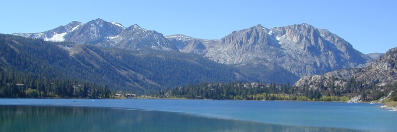
Large, granite, alpine lake in the Central Sierra Nevada Mountains. Abundant trout fishing, swimming, camping, boating, hiking, floating, kayaking, picnic sites, and high altitude backpacking trailheads. Shoreline fishing is just as good as by boat. Fishing boats can be rented at Kit Carson Lodge.
The high altitude location makes this a winter wonderland half the year w/ snow ski resorts nearby! It is an awesome summertime family vacation destination as well. Fishing is excellent through Autumn months. Campgrounds close up shop in October, generally when the snow starts. High Sierra – Deep snow pack means they will not reopen until May (at the earliest).
Carson is major Sierra Pass highway, but it closes for big snows, so always check CalTrans before you make the drive up the mountain. Carson Pass is California State Route 88, which connects the Gold Country (on the western slopes) to the South Lake Tahoe region (on the eastern border), near Nevada.
Check Current Highway Conditions for HWY 88 roads.dot.ca.gov
Cal Trans 800-427-7623
Silver Lake Day Use Areas
These areas listed below are operated by El Dorado Irrigation District and they do charge a day-use fee for many of the amenities provided. Boat Launch fee? Yep. Parking fee? Maybe. Picnic stop! How much? Eat fast!
Ferguson Point is located on the north shore of Silver Lake: 10 picnic tables & vault toilets.
Sandy Cove is on NW shore of Silver Lake: Wheel-chair access to lake edge, 5 picnic tables, piped water & vault toilets.
Oyster Creek Rest Area, up along Highway 88, 1 mile NE of Silver Lake: 10 picnic tables & vault toilets.
Historic Memories: Camp Minkalo, Camp Silverado & Kays Silver Lake Resort are all closed now.
Many small businesses come and go in the rural mountains of California. Throughout the decades, some do survive, but many change hands, change names, or have a difficult time ‘making it all work’ in the off-season. Always call ahead (real phone w/ real person) before you make a big drive to a remote location.
National Forest Campgrounds in this lake vicinity:
East Silver Lake Campground – 62 sites
West Silver Lake Campground – 42 sites Kirkwood Lake Campground – 12 sites
Silver Lake Campground NFS
• Elevation: 7200′
• Number of Sites: 62
• Vehicle Accessibility: RV 30′
• Campsite Reservations: Yes
• Camp Fee: Yes
• Toilet: Vault
• Length of Stay: 14 Days
• Season: June – October
• Trailheads: Hidden Lake, Sandy Cove
El Dorado National Forest
Amador Ranger District
26820 Silver Drive
Pioneer, CA 95666
209-295-4251
Older lodges, resorts, camps and cabins at Silver Lake were mainly built in the 1920s, while the oldest resort dates back to the mid 1800s. Wow, how cool is that! Much history in this mountain region w/ Kit Carson Emigrant Trail, all stories totally worth exploring.
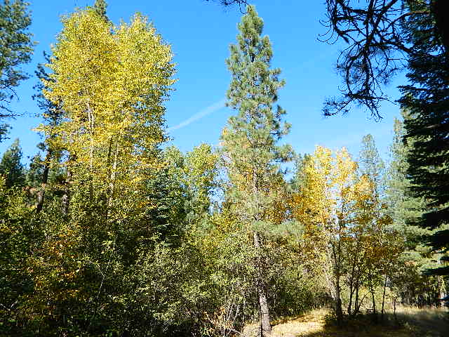
Rock Creek is a top destination for Autumn Colors in OCTOBER
NFS Campgrounds on Rock Creek Road listed below:
12 NFS Campgrounds are located around Eastern Sierra Rock Creek Canyon. Elevations range from 7000′ at the highway, to over 10,000′ at a trailhead parking lot at the road’s end. Most of these developed campgrounds listed are only open a few months outta the year, due to winter snow closures (NOV-APRIL). On occasion, snow can still be on the roads until MAY.
Mosquito Flat Walk-In Campground (trailhead camp) Some maps may have this one listed as Little Lakes Campground, but that is just the official trailhead name.
Backpackers and horseback riders frequent this Eastern Sierra canyon a lot of the year. Many high country trails lead out to Sierra peaks, alpine lakes and sheer wilderness. Download PDF Map of this canyons hiking trails.
Rock Creek Loop Road – Dinkey
Sierra Forest Road #9S09, off of paved Dinkey Creek Road. Excellent primitive camping along creek; 4×4 trailheads, as well as hiking & horseback trails. Small RVs okay. Dispersed camp sites, no facilities. Fire permits are required. Near Shaver Lake, CA inside the Sierra National Forest
Similarly named –
ROCK LAKE is located inside Lakes Basin Recreation Area, northern Gold Country @ Yuba River headwaters. Hike-in access only.
And if you want some Central Coast wheelin – 4×4 camping and trails, see the ROCK FRONT RANCH on California Hwy 166, on the way to New Cuyama, CA
Lower Rock Creek Road, off US hwy 395
We will continue to add any more Rock Creeks to this page (as we find and photograph them). Stay tuned for more of the very best camping in California.
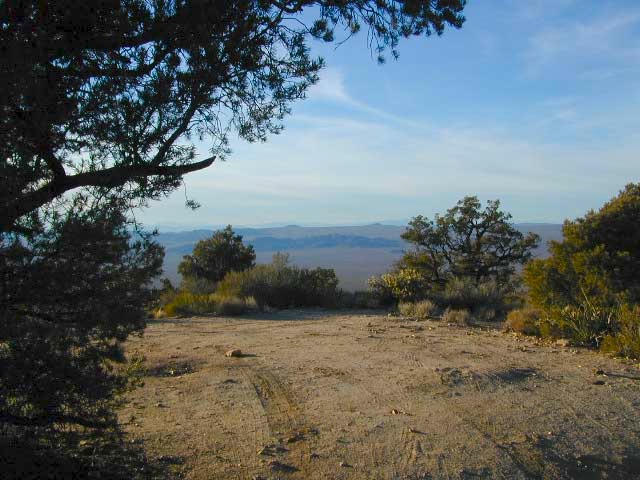
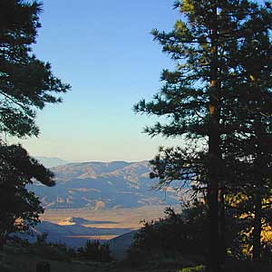
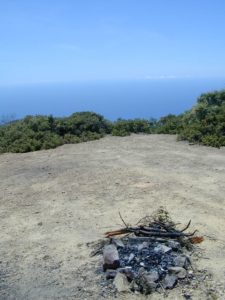
This camp list is comprised of primitive camp sites and developed campgrounds with good views overlooking a large area (valley, town, canyon, desert, river, ocean). Many ideal spots may require dirt road driving, and a few might need a 4-wheel drive vehicle to reach.
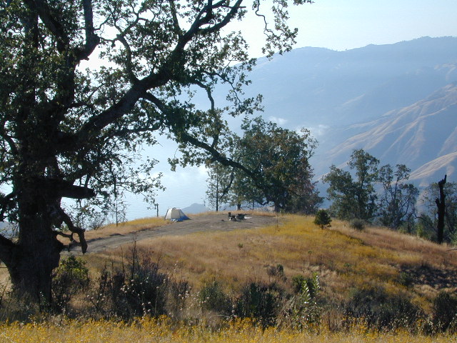
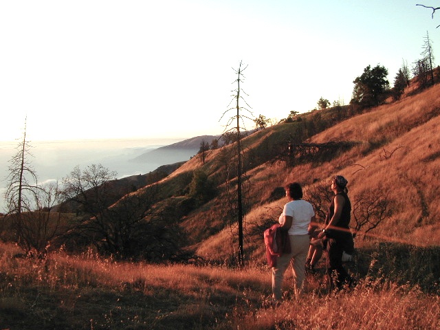
We were suggesting this very spot way back in 1999, well before anyone else was ‘blogging’ about it. This area is by far the best, free coastal camping on the Central Coastline of Big Sur. Dirt roads traverse 10 miles out to vacant ridges overlooking the Pacific, with steep hills down to the highway. Camp above the fog layer and above the crowds. Explore the beaches during the day, and camp above the traffic & crowds at night.
Dry brush is abundant on the mountains of Los Padres National Forest. Camp fire restrictions should be of utmost concern in this area, since wildfires burn here often. Camp fire permits are required for camping on the back roads, and much of the time camp fires are banned in this region. Call ahead to the rangers to find out the current conditions.
Two prime walk-in camp sites, on a shady point, high above a beach cove w/ scenic waterfall.
Called “environmental camps” these highly desirable spots need advanced reservations w/ fees many months in advance. Tables, fire rings and a vault toilet. Bare bones basics, but the ideal location is worth it. A forested cliff on the edge of the ocean, high above a secluded cove. This location a can get windy if a storm moves in (generally October – March).
There are several primitive campsites off of M10 with views of chaparral and canyons. Just above Stonyford, CA, on the way up to Fouts Springs. Unfortunately Mendocino National Forest is may be closed for 2019 due Ranch Fire (wildfire 2018) w/ Snow Mountain Wilderness completely 100% burnt.
Planning more scouting of this region summer 2019. Stay tuned.
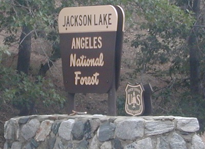
Angeles National Forest
Mount Pacifico Campground
Angeles Forest Highway
Lightning Point Group Campground
near Jackson Lake @ Hwy 2
San Berdu has more than a few trail camps for 4×4 enthusiasts. Weekends can be busy all year long. Snow usually closes some routes. Pine forest in southern California means very tight campfire restrictions. All yellow post camp sites include table and a fire ring. Campfire permits are required.
East ridge line, rocky, dusty, 4WD-only route, the John Bull Trail (near Holcomb Valley) has ONE real awesome view camp spot with great spans over the Mojave desert w/ smog and city lights @ night.
Culp Valley – boulders, primitive camps on dirt roads; better views off-road. Vault toilet. Few tables, no signs. Small campground at the highway is easy to find. Boulders and bouldering. Mountain biking and hiking. Wildflowers in spring.
Interstate 15 & I-40 Mojave Desert
Providence Mountains SRA @ Mitchell Cavern. Campground is perched on rocky hill overlooking desert.
Boulder Outcroppings w/ primitive camp spots, tucked back on one lane dirt roads, behind Mid Hills Campground. Mojave National Preserve
Coyote Flat @ Pinyon Boulders – 4×4 required, one primitive camp w/ great views overlooking the Owens Valley & peaks to the east. Coyote Flat has views toward the Sierra
Oh! Ridge Campground Off the main highway 158, June Lake Loop
(148 sites @ 7600′ elev.) near June Lake, CA
Golden gems of California, a collection of alpine lakes on the north end of Historic Gold Country, North Yuba River, Northern Sierra Nevada
EAST of Downieville, CA
California’s Gold Lake and surrounding lakes; the granite spires of the Sierra Buttes and the creeks, waterfalls, headwaters of the Yuba River — total wild beauty. Steep, granite, river canyon from Downieville drive east on Highway 49 from Sierra City to Bassetts, a gasoline and market stop; they have a small hotel there too.
Take the left turn, north on to the Gold Lake Highway. The alpine and extremely scenic Lakes Basin Area consist of all small lakes in between Hwy 49 to Hwy 89, along GOLD LAKE HWY [Road S620] some maps read Road #24 or call this Gold Lake “Road” instead of highway. Snow closes in this route during winter months.
Frazier Falls Trail
Length: 1 mile RT / Directions: Trail head is located on Old Gold Lake Road, about 5 miles from the Highway 89/Gold Lake Road intersection. Take the signed, narrow paved access road 4 miles to the trail head.
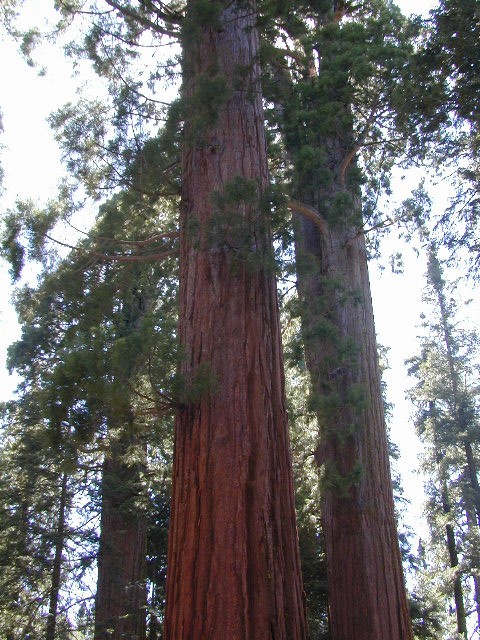
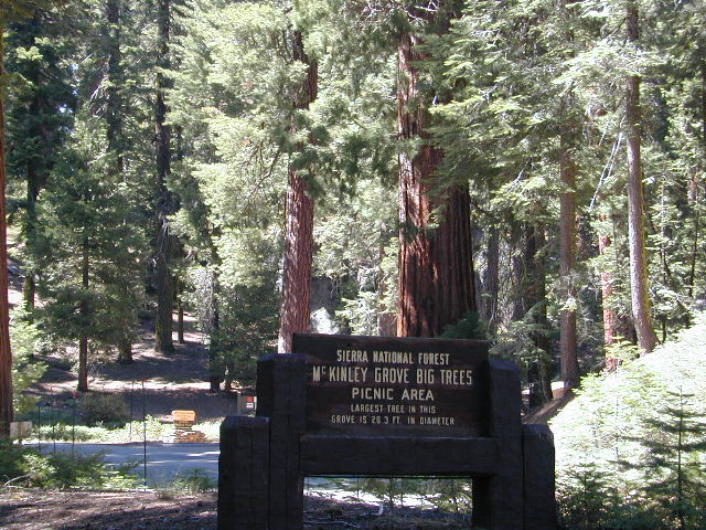
Mc Kinley Grove is a small grouping of Sequoia trees in the Central Sierra Nevada; Located off Hwy 168 & way down Dinkey Creek Road (Sierra Rd #40). deep inside Sierra National Forest, past the Dinkey Creek Campground turn off. It’s a good stretch break and picnic stop on your way to Wishon & Courtright Reservoirs.
Ancient volcanic peaks mix with Sierra Nevada granite rock, pine forests and fresh, clear, clean mountain water! California, of course.
Stanislaus Forest Road #7N01 leads down from Highway 4 to this popular series of alpine lakes and reservoirs. Camping, fishing, hiking and mountain biking. Sailing, canoeing, kayaking, swimming, floating and fishing are also popular water activities.
Rules of the Reservoir:
10 mph speed limit on Western Arm.
No motorized boating in Eastern Arm.
Camp only in developed Campgrounds.
2 NFS Campgrounds at west end of lake:
Spicer Campground (60 sites)
Spicer Group Camp (75 people max)
Campgrounds only open June-September. Some campsites at the campground are wheelchair accessible.
Additionally, Stanislaus River Campground w/ only 8 sites, is located just off the main access road #7N01, right near the river.
Numerous smaller lakes in the region make this a hot spot for summer vacations. Union and Utica Reservoirs (both with dirt road access) are good for kayaking and canoes, while power or sail boats prefer the larger Spicer Lake. Summit Lake and Elephant Rock Lake are perfect for quite picnics and day hikes. Trails (many unmarked) connect the lakes to each other. Area gets buried with snow in winter, so these roads are generally only open half the year.
Often called fly fishing lakes, or backpacking lakes, these are usually located in the mountainous parts of California. Remote lakes that are ‘hard to reach’ come in 2 varieties:
hike-in lakes
Backpacking Lakes, found in the Sierra Nevada Wilderness or Northern California Wilderness Areas.
These are often many miles down a dirt road or narrow paved route (neither which is recommended with a big trailer or large motorhome). Matter of fact, some of these lake destinations require 4 wheel drive to access them. You will need a good vehicle, maps, possibly more than one. You will need time to enjoy these. They require a fair amount of work to get to, but the rewards are immense.
Sequoia trees naturally grow in the Sierra Nevada mountains, on the west side of the range. Several parks & forests make up what is known as “the Sequoias” – in the Southern Sierra, Sequoia National Forest; Giant Sequoia National Monument; Mountain Home State Forest; Central Sierra is home to Sequoia National Park & neighboring Kings Canyon NP; Sierra National Forest & Yosemite NP. Yep, all those areas have Sequoia groves!
If you are searching for tallest species, the Coastal Redwoods located on the shores of Northern California, then you can find them over here – NorCal Redwoods


 Stay on designated dirt roads: No tires across the meadow; No mountain biking, No dirt bikes, No off roading. You’re not spreading the seeds, you’re destroying a fragile ecosystem.


 Mitchell Cavern. Campground is perched on rocky hill overlooking desert.