Tag Archives: Big Bear

Big Bear Renaissance Faire

Big Bear Ren Faire

Big Bear Lake’s Renaissance Faire

Three weekends of fun, music and merriment. An authentic re-creation of an English Summer Faire. Visit an exciting, vibrant village where you can experience a joust, strolling entertainers, stage performances, beautiful handcrafts, delicious food and drink, children’s area and the spirit of the days of William Shakespeare and the Renaissance.

Meadow Park
41276 Park Ave.
Big Bear Lake, CA 92315

Annual event; August
909-237-0448

BIG BEAR, CA

bigbearrenfaire.org

Apple Butter Festival

Loving this Apple Butter from Los Rios in Oak Glen CA - Happy Apple Month!

Oak Glen Apple Butter Festival

Yucaipa’s hidden secret – rural area of OAK GLEN, is a apple orchard canyon near the Inland Empire.

After the harvest is finished and the apples have all been picked from the trees – celebrate the coming winter with a historic festival that traces its roots back to the 16th century.

  • Public Apple Butter Making
  • Harvest Dinner and Dance
  • Historic Crafts
  • Children’s Games
  • Live Music
  • Wagon Rides
  • Merchant Vendors
  • Water Color Painting Class

Los Rios Ranch holds the annual Apple Butter Festival & Apple Butter Hoedown on Thanksgiving weekend.

Annual event: November

losriosrancho.com

San Jacinto Camping

jacinto campground

Mt San Jacinto State Park & Idyllwild Campgrounds

San Jacinto State Park Headquarters
25905 Highway 243
Idyllwild, CA 92549

Rangers & Wilderness Permits
951-659-2607

Mount San Jacinto State Park is surrounded by Wilderness area, the village of Idyllwild & the Palm Springs Tram station. Tahquitz Peak close to Idyllwild, is a rock climbing favorite.

Stone Creek Campground is located in the forest, along Highway 243. Elevation 5900′ w/ 50 camp sites & max RV = 24′

Idyllwild Campground is walking distance from town. North end of Idyllwild, CA. 33 camp sites & max RV = 24′

San Jacinto State Park
takes campground reservations!

For more Idylwild Camping options see –

San Bernardino Campgrounds & Yellow Post Sites

Topo trail maps, wilderness hiking maps –

nearby towns:

Yellow Post Campsites

yellowpost


Yellow Post Camping

Yellow Stake Camp Sites / Back Roads Camping NFS
near Cajon Pass, Big Bear & Idyllwild CA

YELLOW POST CAMPS are dispersed camping sites on the back roads in Southern California, where fire danger is greatest. Forest authorities have designated certain spots as ‘fire safe’ for remote, open camping options around Big Bear Lake, Fawnskin and the Idyllwild mountain area.

If you prefer to stay out of the developed campgrounds, you will be the minority. But you must know how to read a map well to reach these beauties.

Map Big Bear

camping

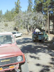
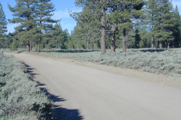
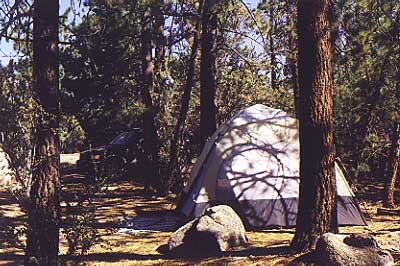
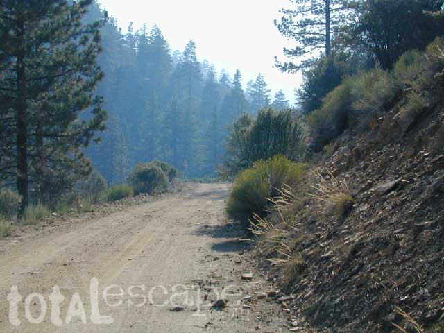
SoCal camping doesn’t have to mean crowded campgrounds. Seek your seclusion on the dirt back roads, where there are no fees, minimal noises & a private site waiting just for you. These are usually on a first come, first serve basis. A high clearance vehicle (SUV, truck or 4×4) may be needed to reach some of the premium camp spots, but there are also sites accessible by passenger cars. And, of course, a fire permit is required.

HeartBar14

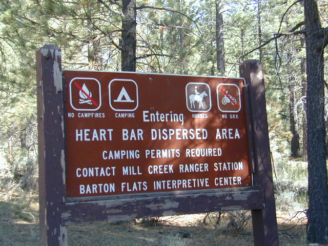
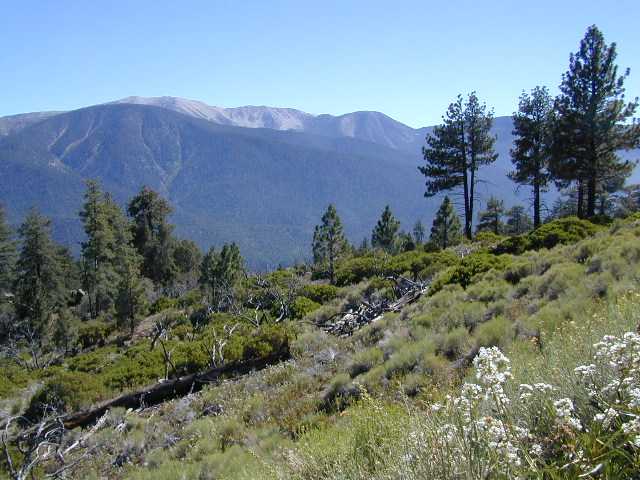
In the San Bernardino National Forest there are several back woods ‘fire safe’ camping spots, that are noted with a single yellow post & some may require reservations in busy summer months. You can find out more on reserving from the Big Bear Discovery Center, 909-382-2790

campfires bannedExtra caution should be used when winds are high, camp fires are often banned due to wildfire danger. Check with local rangers for up to date conditions and always get your campfire permit.

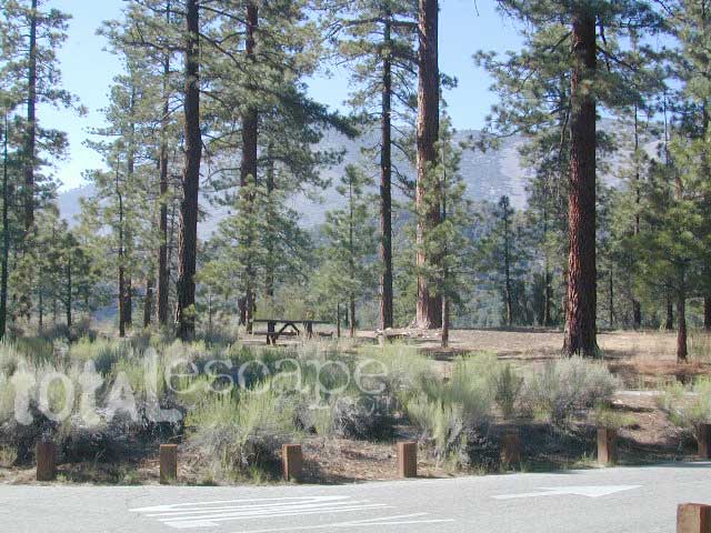
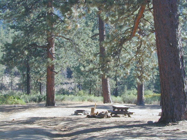
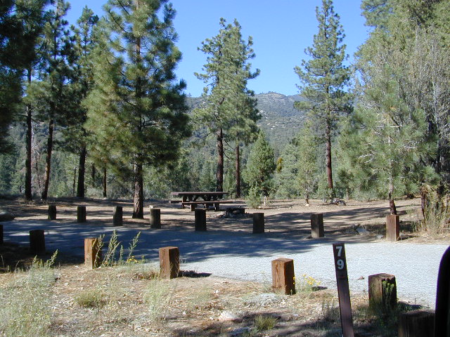
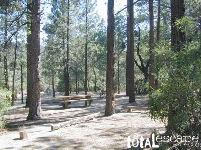
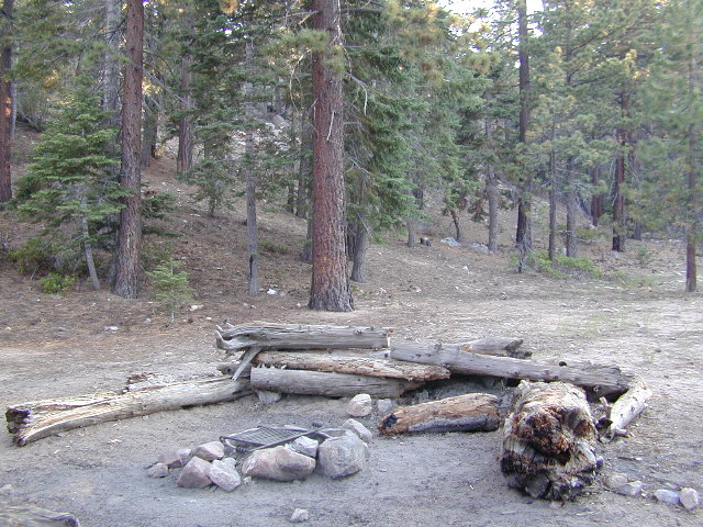
No restrooms, no water, no facilities. Just a dirt road, a fire ring & a single picnic table. Hopefully your table will not be shot up, by the local rednecks who ‘get off’ doing stupid stuff like this. Pick up any litter & leave the place better than your found it.

Yellow Post Camps

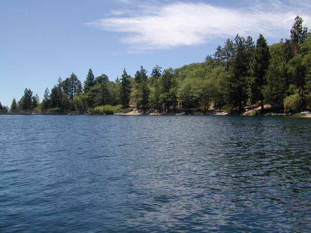
These backroad camps are perfect for the 4×4 group, stressed out social club, church group w/ rugged van, or the city SUVer who wants to get away from the crowds. The most sought after camp spots are nearest to the lake or a site accessible by RVs and horse trailers, but there are many more excellent camp sites to be discovered. USDA Forest Service Map is highly advised to reach these remote, dirt road camp areas. Rugged, steep, one lane dirt roads that lead to some of these spots. A passenger car is sometimes not suitable for all dirt roads. Rutted and steep means turn around. Wet weather changes dirt roads. Often routes close for winter w/ locked gates.

Big Bear Back Roads Camping

download PDF maps
on Big Bear Yellow Post Sites

Campsite7

Big Lots

Cajon Pass Camping near I-15

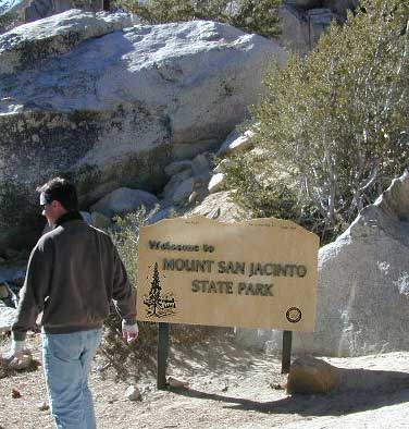
Idyllwild Dispersed Camping

thomas camp
Topo maps, Wilderness hiking maps, Equestrian trails, OHV maps –

Holcomb Valley

holcomb valley

On the eastern mountain slopes of Big Bear Lake, Holcomb Creek creates a forested sage valley – called Holcomb Valley, located only a few miles away from the big lake. A graded dirt road leads out to this pine forest & a prime campground area. Perfect location for picnics and sightseeing.

Holcomb Valley Campground
@ Big Bear Lake

campground  elev.
spots
 veg toilet water comment
Holcomb
Valley
7400′ 19 pines vault no Road 3N16,
open year round

National Forest Campground in San Bernardino NF, located at higher elevations.

Although the developed campground is open all year long, please take into consideration that SNOW and mud is the norm for winter months.

Nice shady sites to beat the summer heat. Camp spots spaced out fairly well. Hikers parking lot is located at one end of the campground. Bears are well known in the region, so please lock all food in the provided metal bear lockers.

  • backpacking
  • bouldering (rock climbing)
  • camping
  • cross country snow skiing
  • hiking
  • mountain biking
  • off roading
  • stargazing
  • water recreation @ lake
holcombcamp
CLICK TO ENLARGE

The epic Pacific Crest Trail runs right through the Holcomb Valley. Doble Trail Camp is out this way for PCT parking, next to Holcomb Valley Road #3N16 which encircles this whole forested area inside San Bernardino National Forest.pct

cabin holcomb
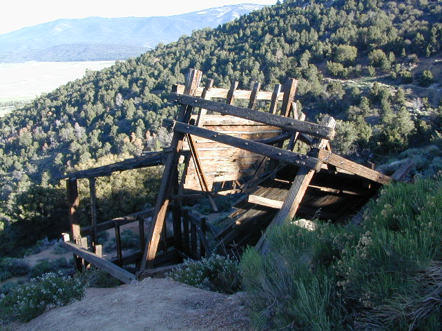
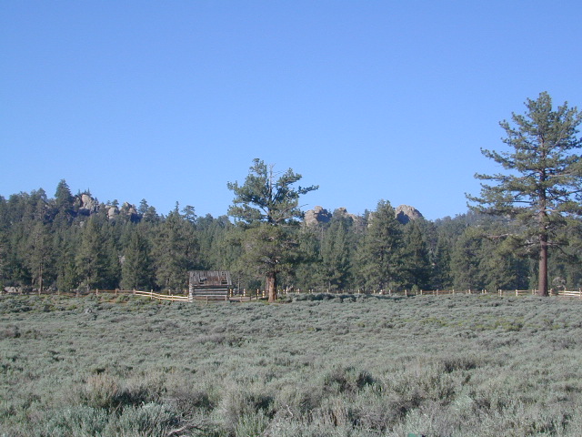
Holcomb Valley has a historic cabin to see. Numerous old mines exist around this area. Nearby Gold Mountain is a popular 4WD route.
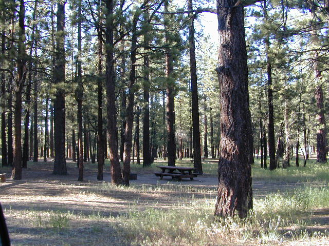
The dirt back road leads east down to the high desert @ Highway 162. Down to Pioneertown and Yucca Valley, and eventually Joshua Tree National Park.

holcomb campsites

towns nearby

mine shaft
Old mine shaft back behind Holcomb Valley

Campground San Bernardino

whitecliffs

Big Bear – San Bernardino National Forest Camping & Campgrounds

areas include:
Big Bear Lake, Fawnskin, San Gorgonio, Lake Arrowhead, Forest Falls, Green Valley Lake & Idyllwild

Listed below are all the San Bernardino National Forest campgrounds, public lands for outdoor recreation. SoCal campground reservations can be booked online with the linked campsites below.

Big Bear Campgrounds near Big Bear Lake & Fawnskin area

campground elev spots veg toilet water notes
Applewhite Campground 6800′ 42 pines vault piped disabled access, RV 30′
Barton Flats Campground 6300′ 52 pines vault shwrs disabled access, RV 45′
Big Pine Flats Horse Camp 6800′ 17 pines vault piped Way back 3N14, year round
Cold Brook Campground 7000′ 36 pines vault piped RV max 25′
Crab Flats Campground 6200′ 29 pines vault piped 3N16, Green Valley Lk
Dogwood Campground 7000′ 90 pines vault piped disabled access, RV 22′
Green Valley Campground 7000′ 37 pines vault piped Green Valley Lake
Hanna Flat Campground 7000′ 88 pines vault RV max 25′
Heart Bar Campground 6900′ 94 pines vault seasonal Hwy 38, equestrian
Holcomb Valley Campgr 7400′ 19 pines vault no Rd 3N16, year round
Horse Springs Campgr 5800′ 17 pines vault no Rd 3N17, year round
North Shore Arrowhead 5100′ 27 vault piped disabled access
Pineknot Campground 6400′ 48 vault piped disabled access, RV 45′
San Gorgonio Campground 7000′ 54 pines vault shwrs Hwy 38, disabled, RV 43′
South Fork Campground 6400′ 24 pines vault piped Hwy 38, RV max 30′

site12

San Jacinto Campgrounds near Idyllwild area

campground elev spots veg toilet water notes
Black Mountain Group 6000′ 16 pines pit piped group site
Boulder Basin Campground 7300′ 34 pines pit piped CLOSED
Dark Canyon 5800′ 22 pines pit piped CLOSED
Fern Basin Campground 6000′ 22 pines vault piped Rd# 4S02
Marion Mountain Campground 6400′ 24 pines vault piped Rd# 4S02
Pinyon Flat Campground 4000′ 18 pinyon vault piped bighorn sheep, year round
Santa Rosa Springs Camp 7000′ 3 pines pit no no RVs, Toro Peak
Thomas Mountain Camp 6800′ 6 mixed vault no no RVs, Rd 6S13; Lk Hemet
Tool Box Spring Campground 6500′ 6 mixed vault piped no RVs, above Lake Hemet
Toro Campground 7800′ 5 pines pit no Santa Rosa Wilderness

Southern California Camping see also –

Topo maps, wilderness hiking maps, Equestrian trails, OHV maps –

SoCal mountain communities include:

Big Bear Campsites

Heart Bar Campground

Heartbar

San Bernardino National Forest: Heart Bar Campground
National Forest Service

At Hwy 38 & Forest Road #1N02 is a huge, pine forested valley, right next to San Gorgonio Wilderness. Heartbar Campground, Heart Bar Horse Camps, RV Dispersed Sites. Highway 38 – SE of Big Bear Lake, California; Mountain Bike, Hiking & Equestrian Trails with ridges of 10,000′ elevation. SAN GORGONIO peak nearby. Best high elevation scenery for SoCal by far.

  • backpacking
  • camping
  • fishing
  • hiking
  • mountain biking
  • mountain peaks
  • waterfalls
yellows
Primitive Camps on the Back Road #1N02

Heart Bar Campground

Big Bear Forest –  HEART BAR

This gorgeous valley is a developed recreation area w/ 89 camp sites, plus big equestrian area. Picnic, hiking, mountain biking, horseback trails, plenty RV spots, even a creek. (Oooops I meant the Santa Ana River) Highway 38 is kinda the long way into Big Bear Lake, up thru Angelus Oaks. Locals call this stretch of the highway Barton Flats.

spot79

horse camp
Bring the Horses & RVs

Group Campground facilities
Barton Flats – San Gorgonio Recreation Area

out back

Leading out the back way of HeartBar, past the horse camp – is a nice one lane dirt road, narrow in spots, with random, primitive camp sites along the roadway. Authorities refer to these spots as yellow post camp sites.

This backcountry route is marked as Forest Service Rd #1N02 – graded dirt road that leads back to Coon Creek Cabin.

Coon Cabin
Coon Cabin Backside

Big Bear Discovery Center
at Big Bear Lake
909-382-2790

ranger

Southern California forest 

San Bernardino maps:

nearby mountain communities:

ForestFalls
Forest Falls, late afternoon

Forest Falls is well worth a stop for a quick picnic or hike – and head dunk. Weekends can be busy and crowded. Since this location is close to Southern California and the population centers, expect weekends to be busy in the Big Bear mountains. Plan a trip for week days to experience less people, and more nature.


1N02 – San Berdu NF

Heart Bar Camps

Heart Bar Camp: Forest Road #1N02 – San Bernardino National Forest

Heartbar Campground, Heart Bar Horse Camps, RV Dispersed Sites, Coon Creek Cabin. SE of Big Bear Lake; Hiking & Equestrian Trails

horse camp hikes primitive camp sites

Hwy 38 , the long way into Big Bear Lake, up thru Angelus Oaks CA. Heartbar Campground is a developed recreation area, right up front. 94 camp sites, plus the recreation all around. Big equestrian area.

HART BAR: Heart Bar is large pine valley w/ alpine meadows, great camping, San Gorgonio looms overhead with ridges of 10,000′ elevation.

Heart bar campsites

yellow post camps

free, dispersed, primitive camping
in Southern Cal

HEART BAR DISPERSED AREA

Forest Service Rd #1N02 – the dirt road is graded & maintained, about half the year. Primitive camp sites require permits; see local rangers. Many forest roads can close due to heavy snow, big rain or rock slides. Best traveled in the warmer months. Winter can be questionable with open gates and road access.

bigsign

site14

Large open sites, with tables & moderately level dirt access. Seen RV campers way back here. RV’s beyond 30′ are not recommended. At end of this 5 mile dirt route is a hiking trail to Big Morongo Canyon & a really neat historic place called the Coon Creek Cabin.

Coon Creek Cabin

Totally worth a visit, if you plan on driving to the end of the road – just for the heck of it. Cabin area can be reserved for small group camping in summer months.

COON CREEK CABIN reservations
909-794-4861

San Bernardino forest maps:

nearby mountain communities:

nearby cities:

  • Mentone, CA
  • Redlands, CA

site12


Crab Flats Campground

Crabflats

San Berdu National Forest: Crab Flats Campground National Forest Service

SOUTHERN CALIFORNIA MTS:
Big Bear Area Camping; Crabflats is on dirt road – Road# 3N16
elevation
North of Green Valley Lake, off Hwy 18. Between Big Bear Lake & Lake Arrowhead, California.

OHV trails abundant in this region, so expect some 4x4s, dirt bikes and engine noise. Looking for peaceful camp, try Heart Bar Camp.

Crab Flats Campground

• Elevation: 6,200′
• Number of Sites: 28
• Camping Reservations: Yes
• Sites Available: 3 first come
• Vehicle Accessibility: RV 15′ max
• Length of Stay: 14 Days
• Water: No Piped; seasonal creek iffy
• Toilet: Vault
• Season: Open APR-NOV
• Fee: YesNFSlogo
• Operated By: National Forest Service
• Closest Town: Lake Arrowhead, CA

San Bernardino National Forest
Big Bear Discovery Center
Big Bear Lake, CA
909-382-2790

Topo maps, wilderness hiking maps, Equestrian trails, OHV maps –

nearby mountain communities:

Green Valley Lake

Los Angeles Mountains

LA forest / Los Angeles Mountain / LA National Forest

wrightwood

Los Angeles forest & parks –

San Bernardino National Forest
Angeles National Forest
Los Padres National Forest

Santa Monica Mountains NRA
Malibu Creek State Park
Verdugo Mountains Park
Mount San Jacinto State Park

+ numerous Wilderness Areas

Los Angeles Mountains
Maps & Hiking Trails –

Los Angeles mountain towns –
Big Bear, Angelus Oaks, Arrowhead, Forest Falls, Green Valley Lake, Idyllwild, Wrightwood

Tunnel thru Rock

Angeles Crest Highway
Angeles Crest Highway 2

SoCal Map

cali maps

Southern California is a culture unto itself. The SoCal region spans from the coast of San Diego to the inland deserts of Imperial. Upward to included most of Mojave desert and over to the Santa Barbara coast, with he coastal mountains in Los Padres National Forest as the backdrop. If you seek a mountain bike trail in Big Bear, a picnic spot on the Malibu coast, a camp site in Anza Borrego Desert or an 4×4 route near Gorman, we will have you covered with our large selection of topos and trail maps.

hike, bike, camp, off road and explore

SoCal Map Set

A handy map set that includes all 4 Southern California National Forests

SoCal More Maps for 4×4 trails, ATV, dirt bikes, quads, rally, 4WD routes

Hiking Maps of SoCal
Wilderness and recreation maps of the Southern California region

Agua Tibia Wilderness Map
Channel Islands Map
Cucamonga Wilderness Map
Cuyamaca Rancho State Park
Death Valley National Park Map
Dick Smith Wilderness Map
Joshua Tree National Park Map
Malibu Creek Map
Mojave Desert Map
Mount Wilson Map
Mount Baldy Map
PCT Trail Maps
Pine Creek / Hauser
Point Mugu State Park
Anza Borrego Desert Map
San Diego Backcountry Map
San Gorgonio Map
San Jacinto Map
Santa Monica Mountains Map
Sespe Wilderness Map
Topanga Canyon
Verdugo Trail Map
Zuma Canyon Map

California Hikes

San Gorgonio Wilderness

sangorgonioview
Old Greyback, San Gorgonio Mountain – as seen from forest road #2N93

Southern California /San Gorgonio Wilderness Area / San Gorgonio Mountain Peak Hikes / Backpack Gorgonio

The tallest mountain peak in Southern California towers over the often smoggy basin of the Inland Empire, Riverside & San Bernardino. Coachella Valley lies to the southeast. Joshua Tree National Park lies due east.

Old Greyback is a fitting nickname for the peak. The massive, bald, decomposed granite gravel paves the whole top layer, above treeline (altitude nearing 12,000 feet above sea level) and this impressive peak can be seen from most of the Los Angeles basin and the Palm Springs desert. The expanding view of the Pacific Ocean can be seen 70 miles to the west, but only if the skies are clear. Windy, winter days are excellent conditions for viewing, but plan your hike accordingly as this peak could be covered in deep snow during winter or springtime.

This is a very popular backpacking weekend trip to escape from the big urban populations. San Diegans and Angelinos can easily access this location in a few hours from home, via Interstate 10 and some mountain driving on a 2 lane highway.

tallest peak

94,702 acres

San Gorgonio Peak – 11,503′ elevation

San Bernardino National Forest


Forest & Hiking Maps –

San Gorgonio Topo Maps

  • San Gorgonio Wilderness Map (USDA)
  • San Gorgonio Trail Map (Tom Harrison)
  • San Bernardino National Forest (USDA)

Gorgonio trailheads –peak hiking

  • Hwy 38 @ Angeles Oaks
  • Hwy 38 @ Barton Flats – Jenks Lake
  • Hwy 38 @ Heartbar – Fish Creek & Mission Springs
  • Hwy 38 @ Fossil Falls – Momyer & Big Falls
  • I-10 @ Millard Canyon – East Branch & Middle Branch
  • Interstate 10 @ Cottonwood Canyon – PCT access

nearby campgrounds –

Heartbar Campground (Hwy 38)

Mission Springs Trailhead Camp

Dry Lake Campground

nearby communities & towns –

ANGELES OAKS
BIG BEAR CITY
BIG BEAR LAKE
FOREST FALLS

surrounding wilderness and forest lands –

San Bernardino National Forest
Pipes Canyon Pioneertown Preserve
San Jacinto Wilderness

National Forest & Wilderness Permits –

USDA San Bernardino NF

more San Gorgonio info & links –

summitpost.org/san-gorgonio-wilderness
San Gorgonio Wilderness Wiki
Trails of the San Gorgonio

Gorgonio Trailhead

Equestrian Trails
MIssion Springs camp & corrals at trailhead. Dirt road above Heart Bar.

Deep Creek Hot Springs

Deep Creek Hike-in Hot Springs

Deep Creek Canyon

Several hot spring pools line this desert canyon on the SW side of Deep Creek. There are smaller hot tubs, as well a large warm tub that is big enough to swim in. The vegetation around the springs and main creek is fairly lush for this desert terrain. A variety of trees, including willows, plus small meadows and grasslands add to the visual balance of this land. Deep Creek is one of the popular Southern California hot springs due to its proximity to the big, urban areas.

East of Lake Arrowhead; South West of I-15 @ Hesperia & Victorville

Deep Creek Hot Springs is a hike in only site.

San Bernardino National Forest
Big Bear Map

option A: Bowen Ranch, 2 mile hike
Bowen Ranch parking area, pay a fee to the crazy man and have the shortest hike to springs. The word ‘ranch” is used to describe a small shack with some junker cars. No entry after 10PM and the man at this private property is not a friendly ranger, nor is he a pleasant person to deal with (which is why we list 2 other parking options).

Interstate 15, exit Bear Valley in Victorville. Go East on Bear Valley 10 miles to Central. Turn right on Central. Just beyond the top of the hill turn left on Ocotillo, which becomes a dirt road. Turn right on Bowen Ranch Road and continue until you get to Bowen Ranch. National Forest Trail #3W02 the Goat Trail (aka Bowen trail) is 2 miles, the steepest and shortest route into the desert creek canyon.

Bowen Ranch Trail, as seen from opposite side of canyon

option B: PCT Trail Route, 6 mile hike
Interstate 15, exit Hesperia & take Main St. @ Y veer left- Rock Springs Rd., right on Deep Creek Road and follow it up to Mojave River at the Saddle Dike Embankment. Park near the dam; Look for Pacific Crest Trail sign for hike up canyon to the hot springs.

option C: Bradford Ridge, 3 mile hike
Lake Arrowhead hike-in way via the Bradford Ridge Path. Take Highway 173 East, which becomes a wide graded dirt road heading toward the desert. From the shooting (rifle) range where the pavement ends, clock your trip meter on your vehicle 3 miles further down the road. Park at small pull out on the left side. Near the sign that says ‘Narrow Bridge’, where a gated old fire is directly across. Trail head was not marked. If you are into hiking, this option is for you. Narrow sandy ridge trails, single track. Bring flashlights for a successful hike out at night.


View Larger Map


DeepCreek

Deep Creek Forum – deepcreekhotsprings.net
Deep Creek Volunteers – deepcreekvolunteers.com
NFS link – http://www.fs.usda.gov/recarea/sbnf/recarea/?recid=34152